Tobatheornottobathe sought out the Olav Duun Festival on the island Jøa in Namsos municipality in the north of Trøndelag. We wanted to get to know Olav Duun, his writing and the island where he grew up – and we were also pretty sure that 3 days as islanders would provide opportunities for great swimming experiences.
Tractor eggs with a view towards the Dun village.
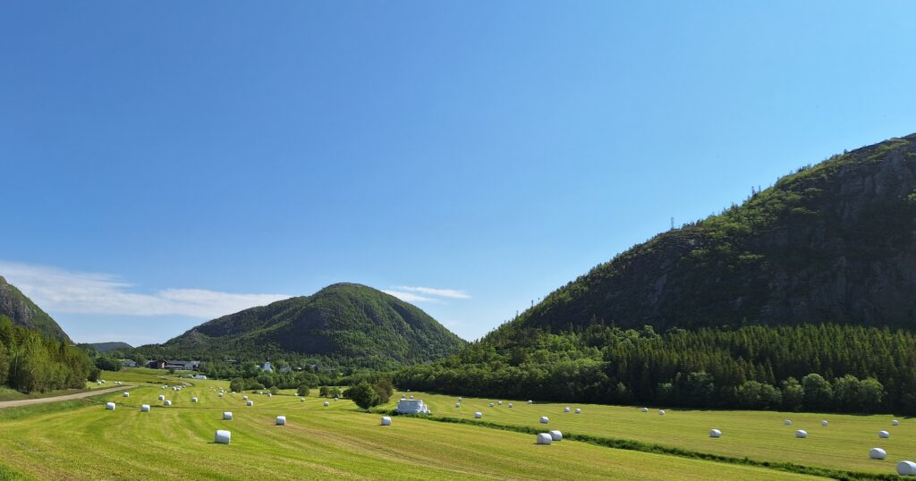
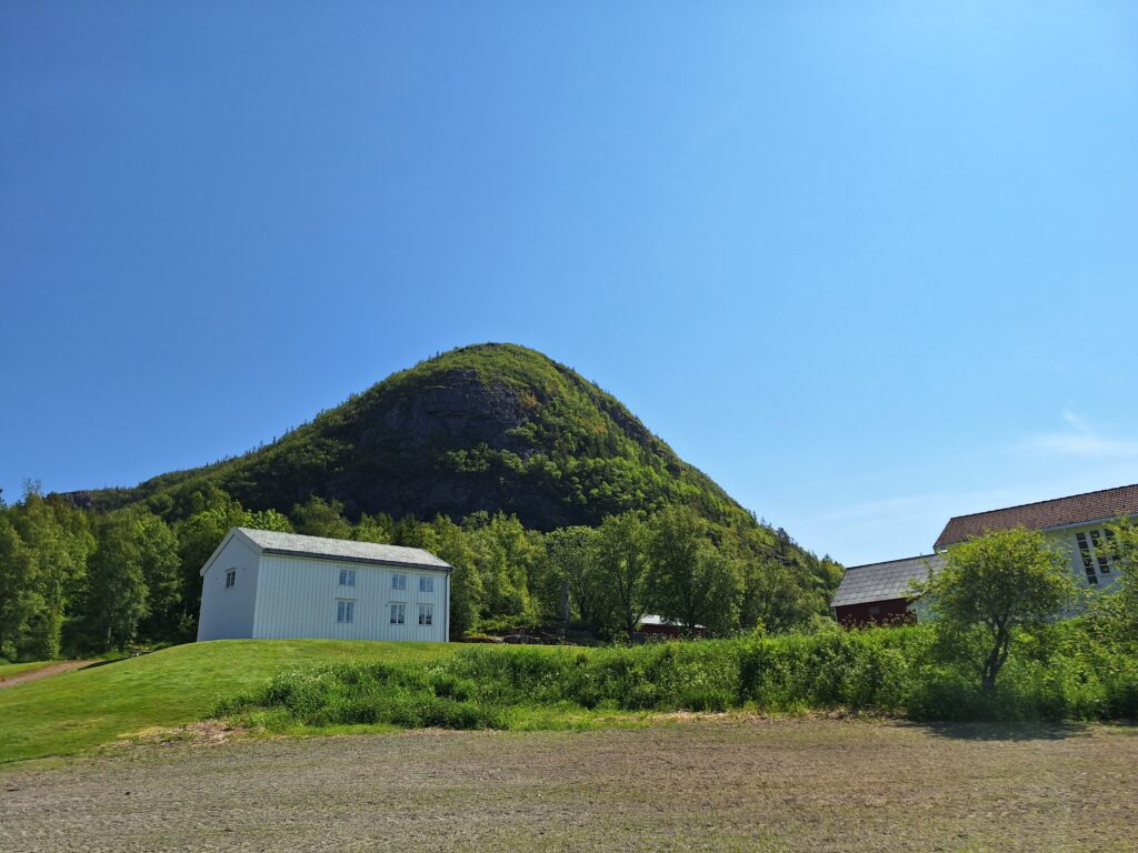
The Dun farms are located approximately in the middle of Jøa, characterized by a beautiful agricultural landscape surrounded by charming crags. On one of this there was an old fortress. In Gaelic, fortresses are called dún (such as Dún Aonghasa, which we have written about in another post). Some historians have other theories about the source of the name Dun, but we found this theory very likely, wether the Irish borrowed the name from the Vikings or vice versa. Here in Dun, Ole Julius Raabye grew up. When young, he was a fisherman for many years, before moving to Levanger in 1901 to study teaching. At that occasion Ole changed his name to Olav Duun.
Olav Duun’s childhood home. Earlier placed where the building on the right is now.
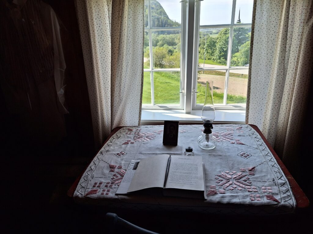
Olav Duun worked hard. In addition to his job as a teacher, he published 31 books in as many years. The sixth volume of his masterpiece ‘Juvikfolke‘ was finished in 1923, so 2023 was the 100 years celebration. He wrote with a non-standard grammar, almost writing in dialect. Which might be the reason many Norwegians from other parts of the country find him hard to read. Duun was nominated for the Nobel Prize in Literature several times, but never received it. In 1925 he lost it to Georg Bernhard Shaw by one vote. The ‘Aftenposten‘ newspaper in Oslo was so sure that Duun would win, that they published a paper on the day the award was to be announced with the headline ‘Today Olav Duun will win the Nobel Prize‘, only to withdraw the statement in the evening news. There has been “Fake News” before!
View from the writing room in the childhood home of Olav Duun.
From a nice tour in the Duun house, we went quickly over to Jøa’s cultural house ‘Fyret‘ (The Lighthouse) and a presentation of ‘Juvikfolke‘ as a 3 hour monologue by Hildegunn Eggen.
The Jøa community center has emphasized the name ‘Fyret‘ by erecting a lighthouse directly in front of it. It is borrowed from Kystverket (Coastal department) and previously was used somewhere along the Møre coastline.
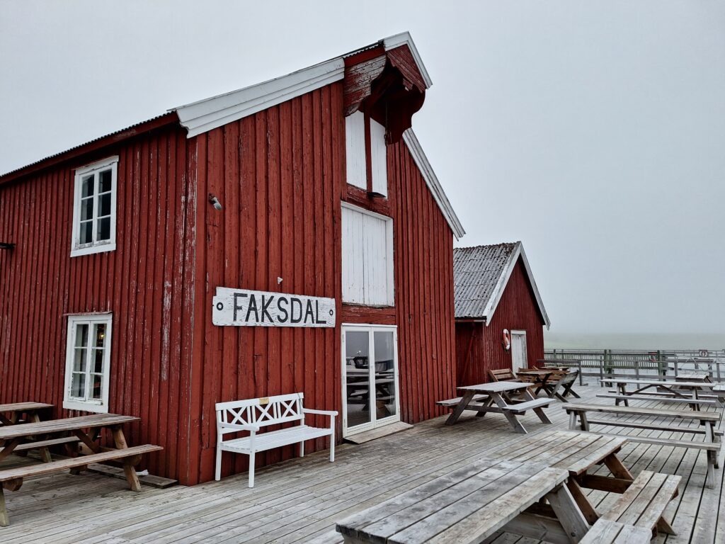
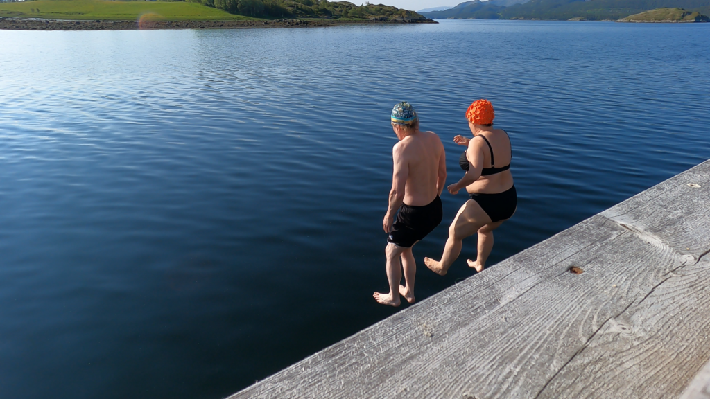
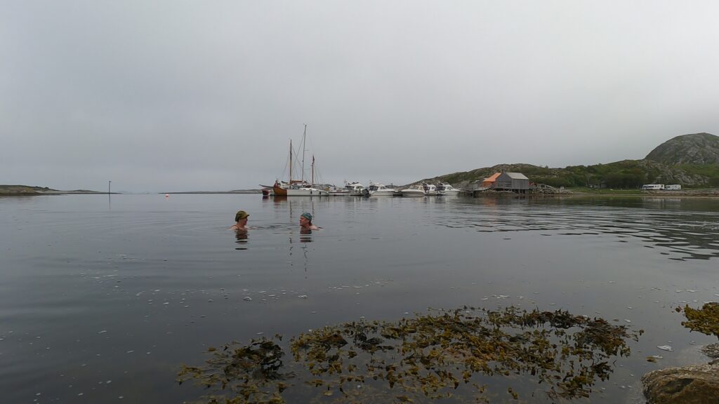
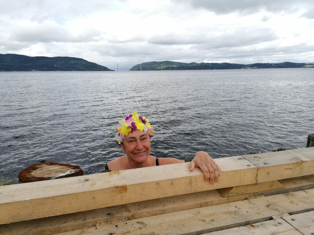
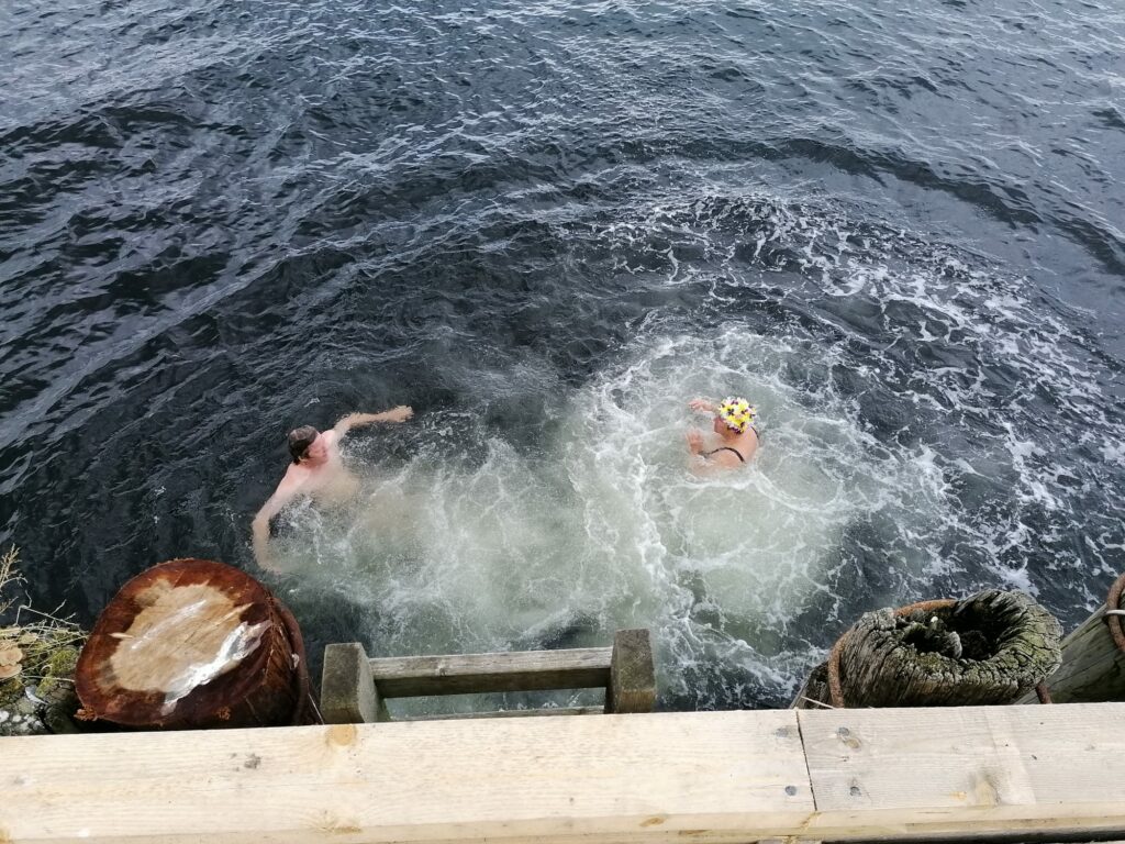
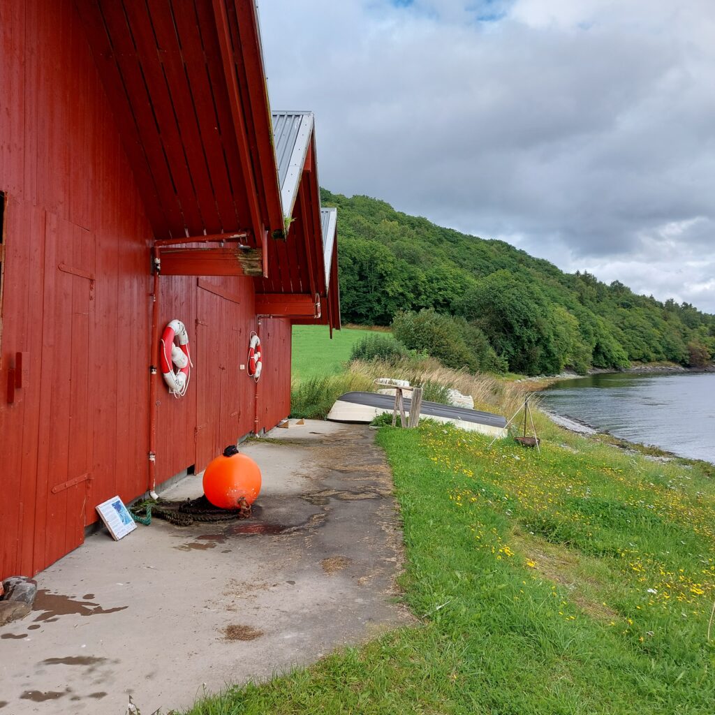
Jøa is perfect for cycling. From Fyret, it’s only a few minutes trip down to Faksdal, where the old quai provides a good atmosphere, good food and good drink.
Faksdal brygge.
What’s more – at Faksdal Brygge it feels just right to jump off the quay!
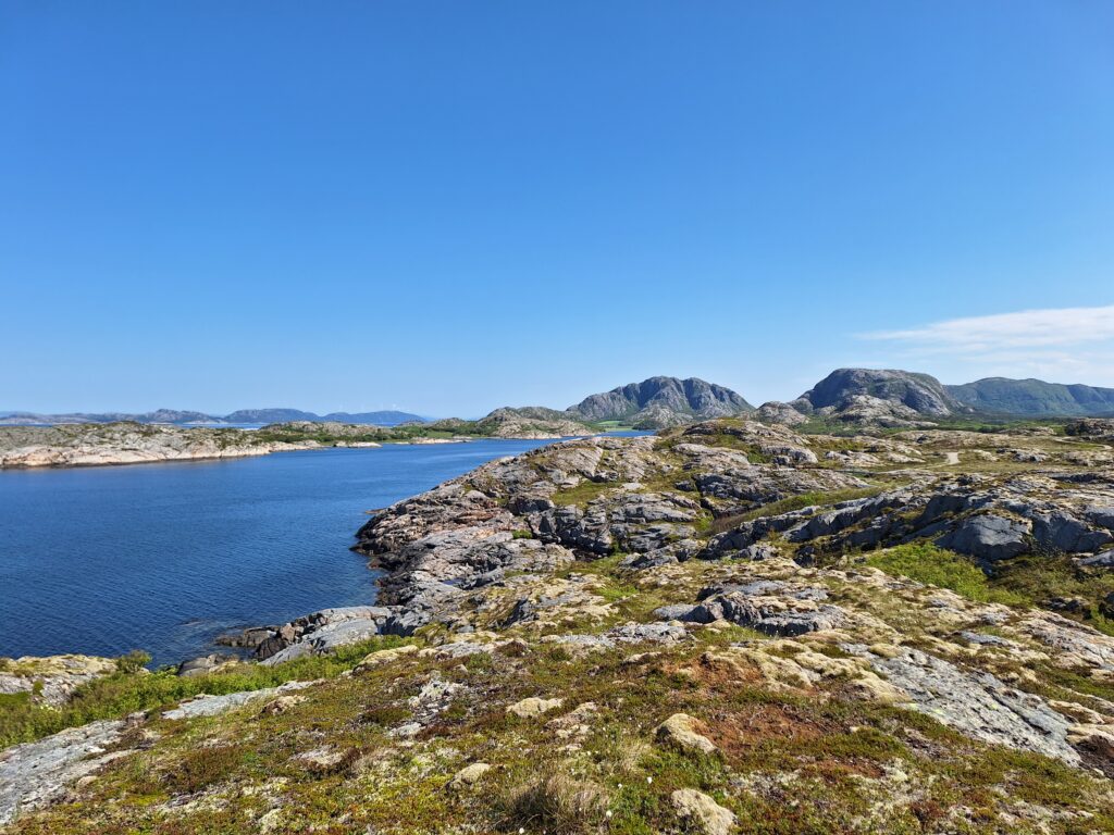
North-west of Namsos municipality is the island of Jøa. About 400 wonderful people live here spread over 55 km². The island is shaped like a triangle with charming crags in the northern and central parts, and a flatter, more marshy landscape in the southeast. The name comes from Norse ‘jóð‘ = ‘that which is separated from‘.
The north side of Jøa.
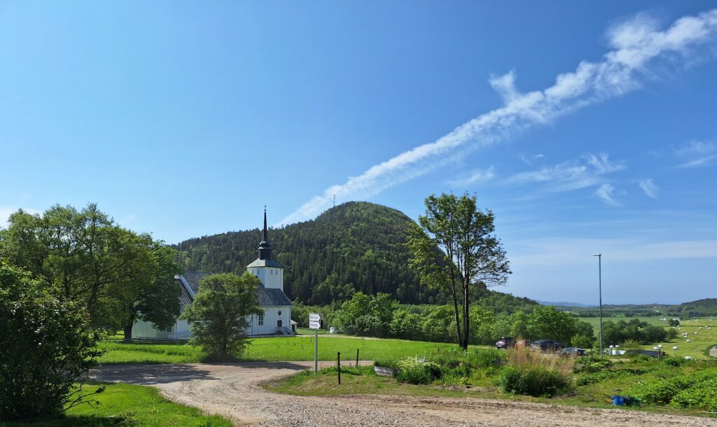
The Norwegian author Olav Duun grew up on Jøa, and although he lived for many years in Holmestrand (southern Norway), all his books were set on this island. More about him in another post.
‘Dun’ church with a view north towards Brakstad on the right.
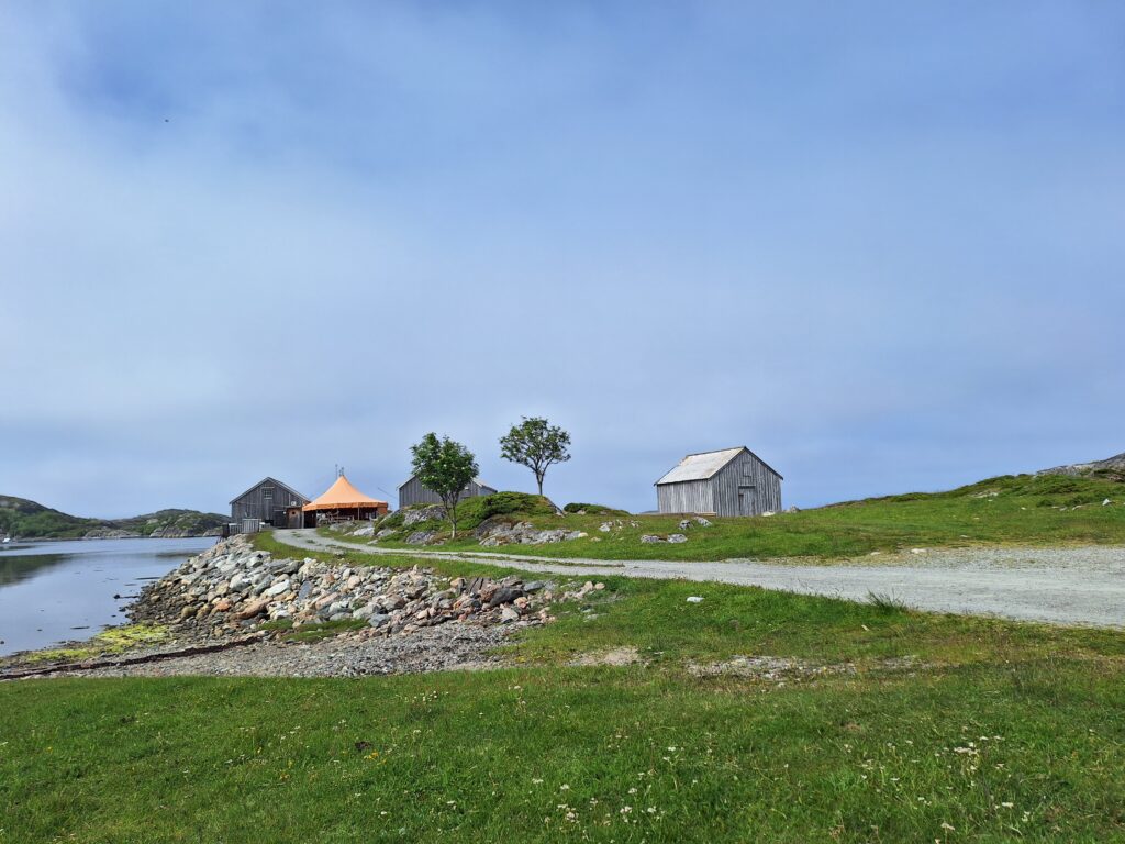
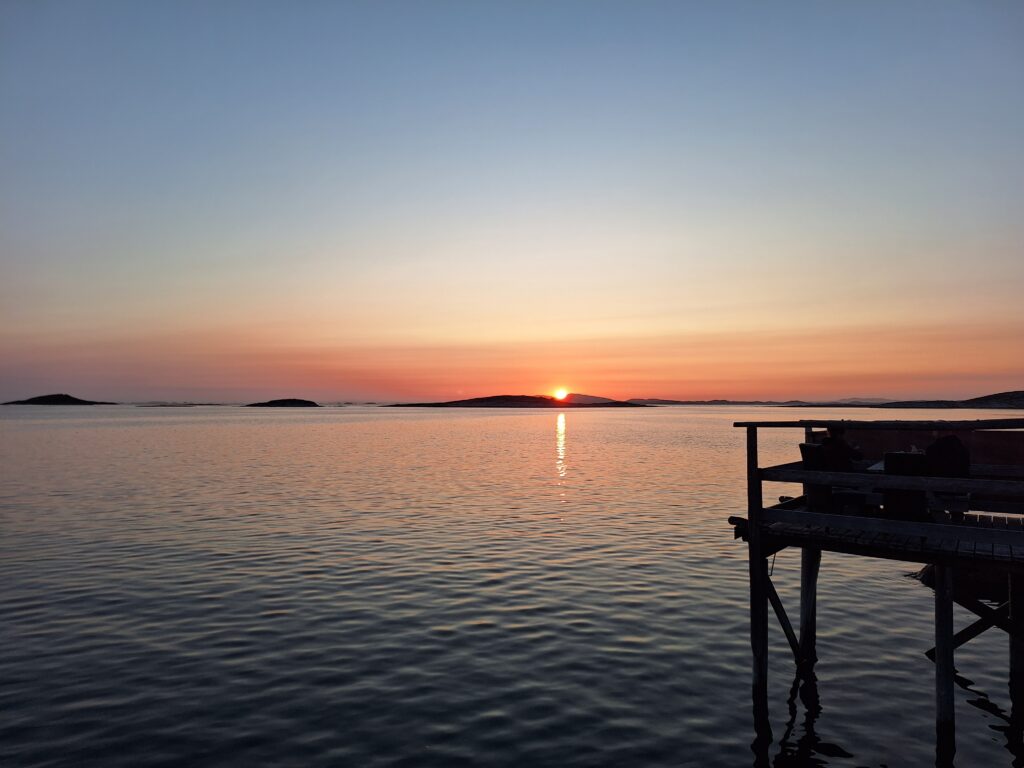
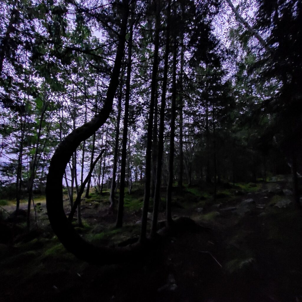
The legacy of Duun is well maintained on Jøa, and every two years they make a ‘Duun Festival‘ in June. We wanted to go there! Tobatheornottobathe had missed Hildegunn Eggen’s farewell performance at Trøndelag Teater, the monologue ‘Juvikfolket’. A play that in 3 hours brings out the essence of Olav Duun’s masterpiece in 6 volumes. So when we heard that there would be an absolutely last chance at the Olav Duun Festival 2023, it was easy to decide to go. It takes some hours to drive to Jøa from Trondheim, but it was well worth it, and Friday after work we went straight to the ‘book bath‘ (a moderated talk with book writers) at Brakstad, by the northwestern coast of the island.
The orange tent at Brakstad. Some partying here as well, although it is a little different from the Roskilde festival in Denmark.
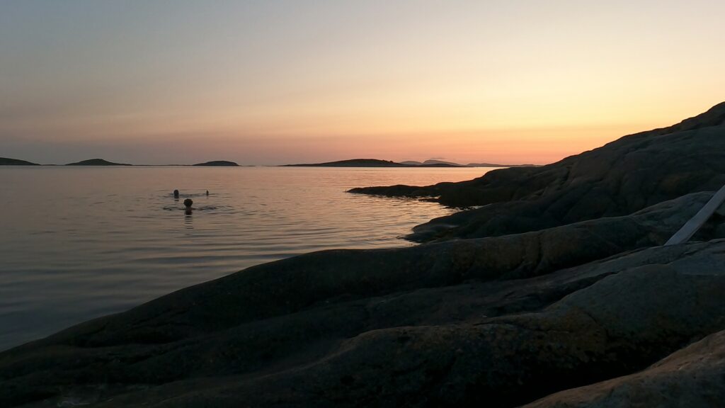
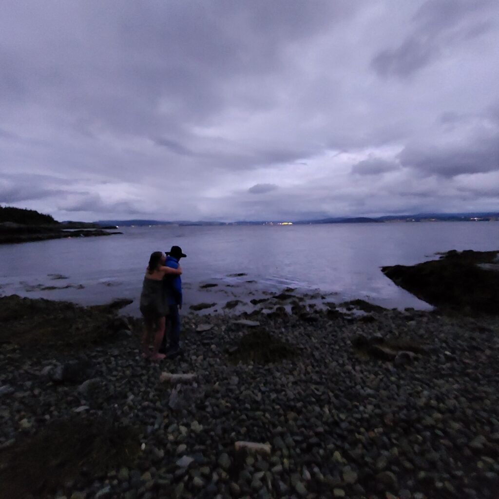
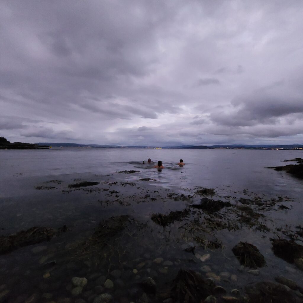
We didn’t just do book bathing, of course. At Brakstad, nature is so fantastic, with sea and islands and islets and sun up and down, that we had to swim several times. And humming a little to DDE’s summer song ‘Lange Late Daga‘ (Long Lazy Days), which actually mentions Pøbben (The Pub) in Brakstad. Pøbben has this motto: ‘When good people serve, good people can drink‘. However, the DDE text is a bit illogical, so Knut forced himself to switch to Ulf Lundell’s ‘Öppna landskap‘ (Open Landscapes) after a while, another song that feels just right at Brakstadsundet.
You will have to search hard to find a sunset more stunning than Brakstad in June!
Pøbben at Brakstad often serve shrimps, which are fished in the sea you can see from there. And although they were not so big, the taste was really great! To have an excuse to order some ‘Gammel Dansk‘ at the bar, we had to take a night bath first.
Pure joy!
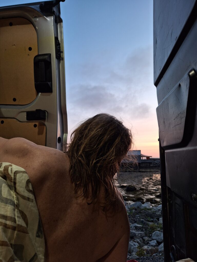
We had rented a Transit from ‘Bilkollektivet‘, which we were going to use as a mobile home. It was unfortunately a bit demanding, with cool dew at night and strong heat in the morning as soon as the sun rised.
All the more tempting with a fresh morning bath, as we in Tobatheornottobathe like to see it!
Knut is considering the possibility for a morning bath…
…but the decision was in practice already taken!
A book bath or any type of bath is just right at Brakstad Hamn!
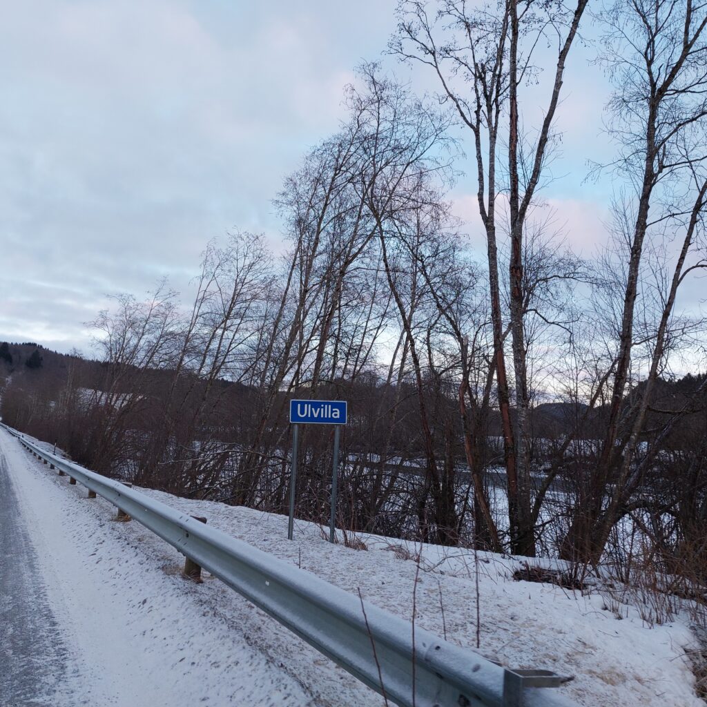
Verdalselva is quiet and calm and got its name from that fact. But you don’t have to go very much further up the valley before there are bigger heights and waterfalls. We wanted more fun, and drove up Helgådalen (the Holy River Valley) in search of a suitable waterfall or two. Then suddenly we saw this:
The river Ulvilla is a tributary to Helgåa river.
… and that took us back to the heavy duty parties at the Trøndelag countryside in the 80’s, when the song ‘Ulvillavisa‘ was often in the repertoire: ‘Får æ’tj ei pøls, så hoppe æ i ælva, i Ølvilla.‘ (“If I don’t get a sausage, I’ll jump into the river, into Ulvilla!”) Funny! Maybe we could even bathe in Ulvilla, as the song suggests?
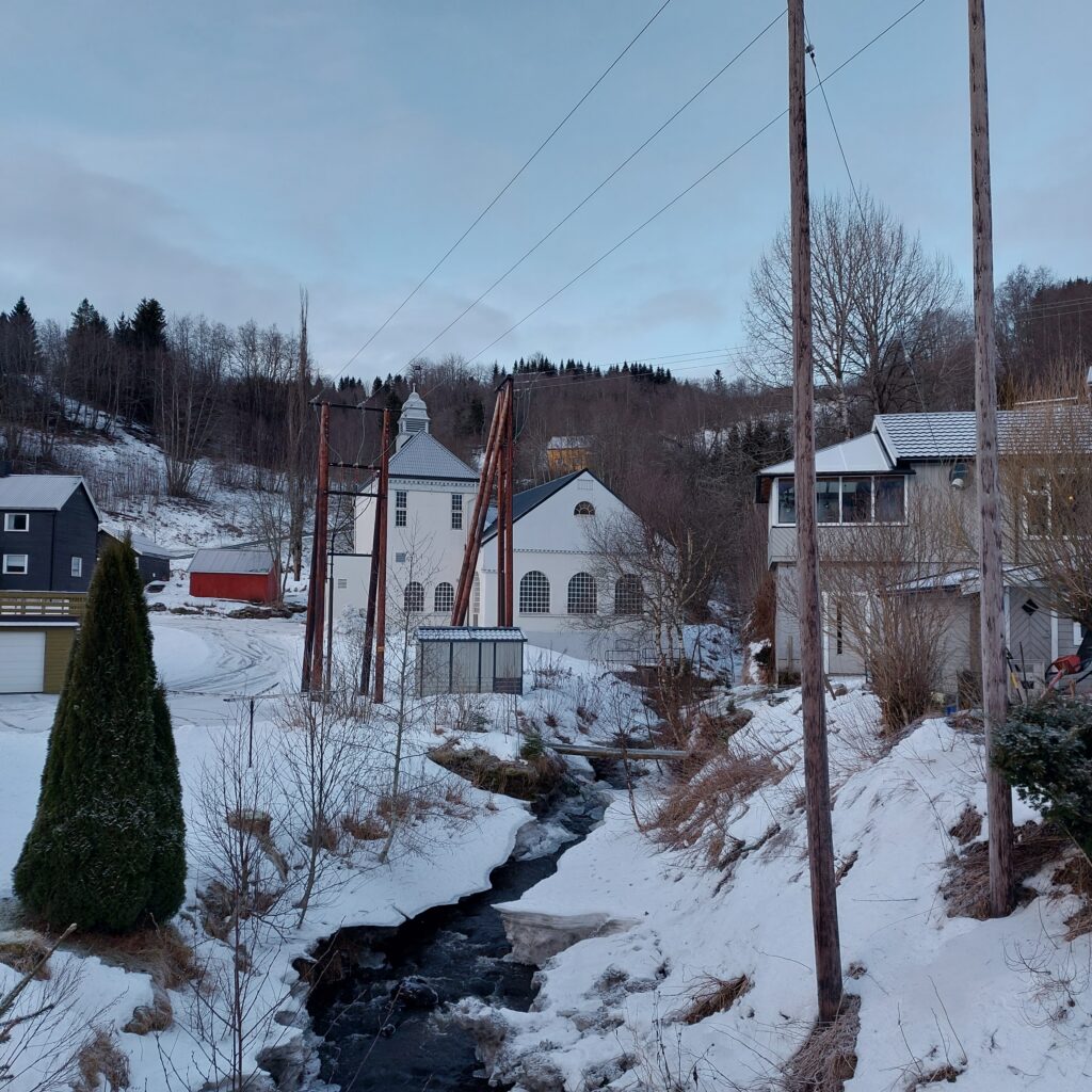
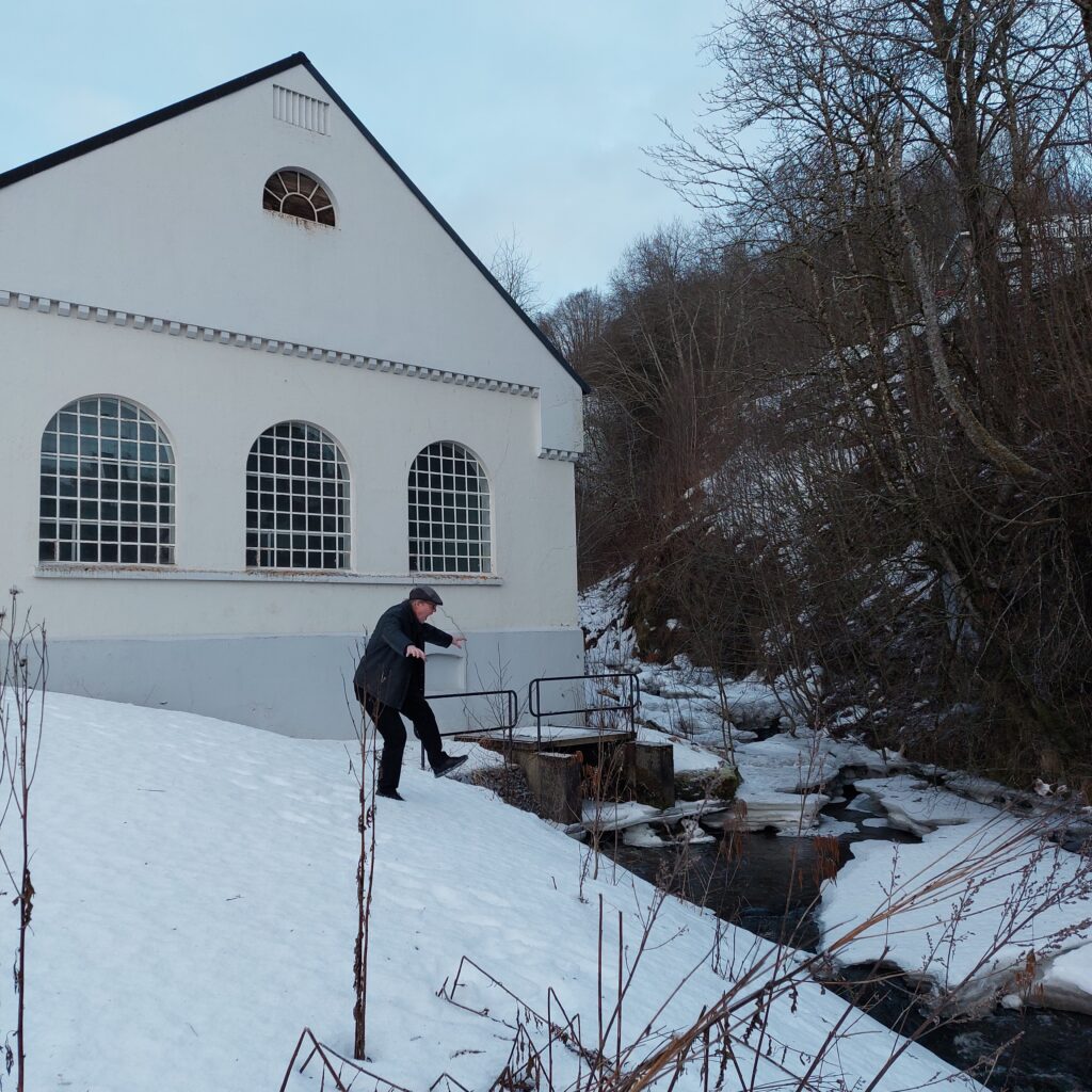
Ulvilla power plant. Constructed back in the days (1917), when the power plants were as beautiful as any church.
It remained a thought. The lower part of Ulvilla was just not very tempting, so we dropped the bath. But not without protests.
Knut would – almost – like to jump in.
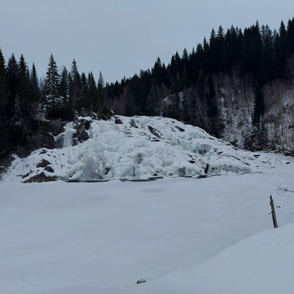
And it’s certainly not a crisis if you skip a bathing place or two in Verdalen. There are plenty to choose from, not least a large number of waterfalls in the rivers Inna, Helgåa and Skjævra. Our next attempt was Granfossen in Helgåa, but it was a bit difficult to access the waterfall with the footwear we had, so we went on to Skjækerfossen.
Skjækerfossen.
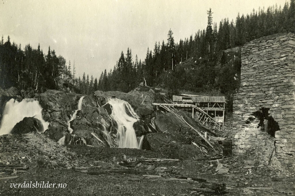
What a place! The waterfall is 22.5 m high, wide and beautiful. And this is historical ground. There used to be furnaces for nickel ore from the Dyråa mines in Skjækerdalen: ‘Værdalens Nikkel og Kobberværk’. The ore was transported to Skjækerfossen by horse in winter, since Dyråa river doesn’t have enough slope to run the smelter cabin’s bellows. The sulfur was removed by burning charcoal, resulting in emissions causing forest death in a 50 m wide area every year. Dead trees were cut to firewood for the smelting process. The nickel was transported by horse carriages to the fjord (at Skånes), a transport that was more expensive than the Skånes-England transport, and therefore greatly contributed to the Verdal nickel industry lasting only 10 years.
Skjækerfossen anno 1917. To the right you can see remains after a mill, sawmill and a smelting furnace. Photo: Gunnar Holmsen/Verdalsbilder.no
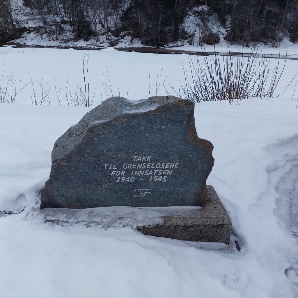
There is also a memorial by the waterfall, honoring the border refugee guides, who saved many lives during WWII. It is estimated that 7-800 people fled to Sweden through Helgådalen during the 5 years of war. None of these routes were ever revealed. The stone was unveiled in 2006.
The border refugee guide memorial.
A tent camp was set up at Skjækerfossen in the spring of 1945, as they were looking for 25 members of the Rinnan gang, who tried to flee to Sweden after the peace treaty. Magne Solheim from Målselv arrested Henry Oliver Rinnan at Flyvollen farm on the 14/5-1945. Rinnan was convicted and executed by a firing squad at the Festningen Fortress in Trondheim 1/2-47. Rinnan assisted in the torture of at least 1,000 people, the murder of more than 80, and he was convicted of murdering 13 people.
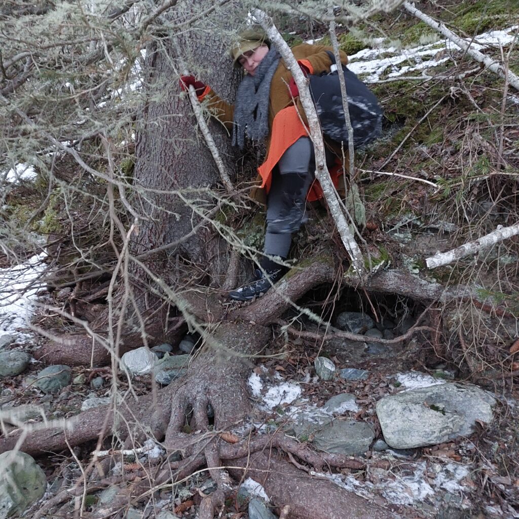
There was a bit of climbing to Skjækerfossen.
However, we didn’t need a tent – to get a bath. On the other hand, there was a bit of climbing in rough terrain, and as usual we laughed at the idiocy of carrying swimwear in bags instead of backpacks.
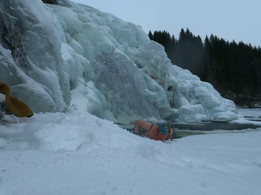
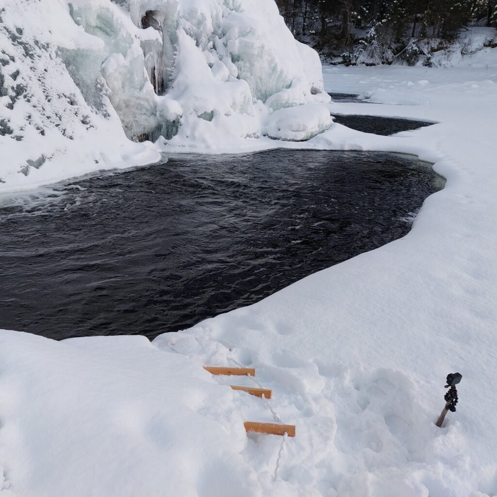
Skjækerfossen was wearing winter clothes in the form of an ice curtain.
But swimming in Skjækerfossen? No, it was too scary for Idun. The waterfall is deep, and Idun was afraid she wouldn’t be able to drag herself back onto the ice. It was therefore only Knut who bathed.
Getting up was a little cumbersome.
… with subsequent intense discussions about how to solve this problem. What we needed was a ladder, but it is not particularly practical to bring a ladder into the car. The solution: Laider, of course. And we actually had one at home, in Trondheim, which the children got from grandpa and once used in a tree in the garden.
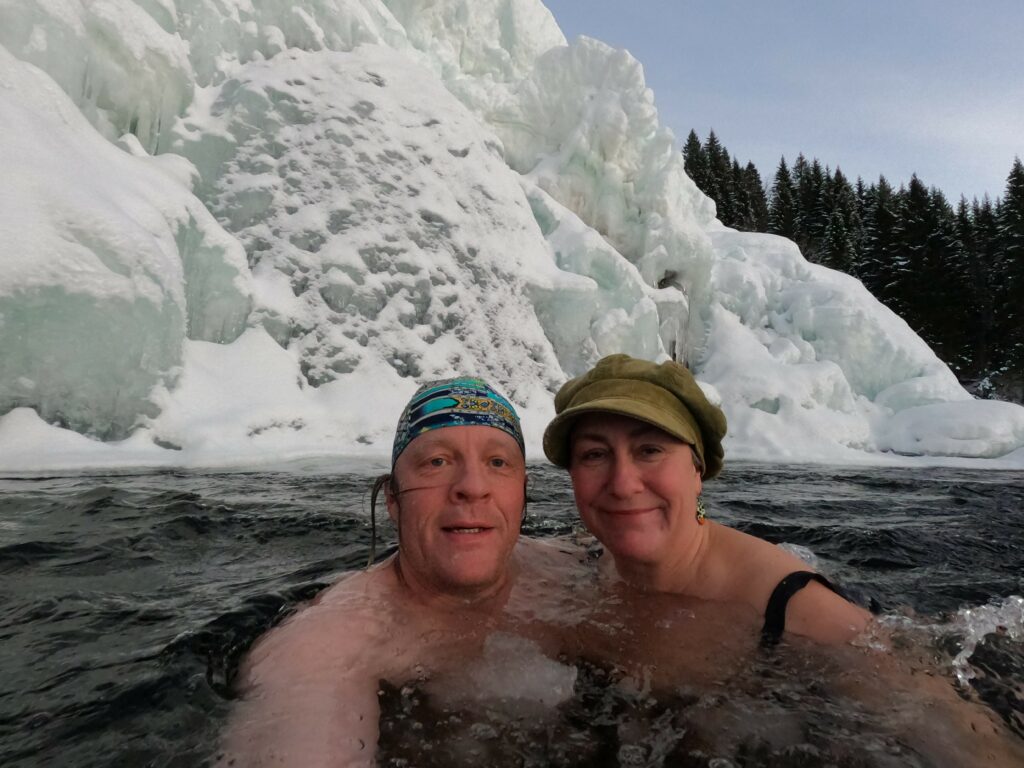
Ready for Skjækerfossen 2.0.
It was great! An absolutely splendid bath. No dangerous incidents of the type of ice falling down (we didn’t swim tight up to the waterfall).
The second Skjækerfoss bath.
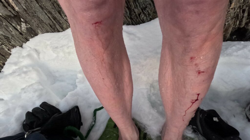
However, the ice is sharp, so a little blood on the knees must be expected. Otherwise, like the Icelanders, we say: ‘Everything was just fine!‘
A somewhat bloody affair.
It is quite fabulous to have a bath in Skjækerfossen. Also mid-winter! But of course; the water flow is most likely more impressive in spring and summer.
North in Trøndelag, shaped like a triangle, between the inner Trondheimsfjord and the Swedish border, is Verdal municipality located. Here, ‘the border between municipalities’ was set a very long time ago, and there have been only 3 changes in historical time (!). The first change occurred when the border river against Levanger (Rinnelva) changed its way, while the second occurred shortly after The Black Death, when the farms at Leksdalsvannet were abandoned. The third boundary change came in 1917, when a new school was needed in Feren, Meråker municipality. And, actually, Verdal did get away with no changes in the much debated municipal reform in 2020.
Verdal has 15,000 inhabitants, of which more than half live in the administrative center Verdalsøra. Humans have lived here for a long time! There are a number of ancient monuments in the municipality, especially many burial mounds, but otherwise Verdal is perhaps best known for the site Stiklestad Battlefield (called “Stekstad” by the locals).
Viking helmet at Verdalsøra.
15 km upwards from the fjord, the two rivers Helgåa and Inna run together to form Verdalselva. The name comes from the old word ‘Ver’, which means quiet, calm. This sounded perfect for a swimming adventure. We wanted to swim there!
The Old Bridge. Verdalselva is beautiful, quiet and calm.
But this January evening was very dark. We became aware that ‘how to climb into the river’ was not very clear. And Knut had that bad prolapse back. Actually, this bath turned into a ‘not’.
… at first attempt, that is. The next day, in daylight, we went a little further upstream. And just downstream ‘Nybrua’ (the New Bridge), we found Bjarnebukta (Bjarne Bay). This seemed to be a great place to swim!
Bjarne Bay at low tide.
The water was still and beautiful. And the ducks swam to meet us. Bjarne, however, we didn’t see. Is it Bjarne who owns the place? Or has there been a bear (“Bjørn” in Norwegian) here a long, long time ago? Please notify us if you know!
The equipment for ‘Øras dager’ is ready by Nybrua (the New Bridge).
Well… The bath itself was nice, but the swimwear didn’t quite have any deliciuos scent afterwards. Perhaps Verdalselva will not be our favorite bathing place after all? It seems that Verdal municipality never takes any quality check of bathing spots. So bathing is at your own risk.
It was almost right to swim in Bjarnebukta January 2023.
After a bath in Verdal, it is a good idea to go to the theatre. Verdal Teaterlag is a very active institution, while we are optimistic and chose the musical ‘Otpimist’ with music by Jahn Teigen.
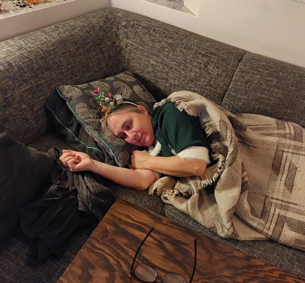
Hurray! Finally Christmas! The children were home again and Christmas holidays had almost started. THEN corona revision 2 struck, and Idun fell to the ground, voiceless. Or, no, it’s not called ‘the ground’ but ‘the sofa’.
Idun tried to lift the mood with an ugly christmas dress, but it didn’t help much. Photo: Une Hunstad Løwø
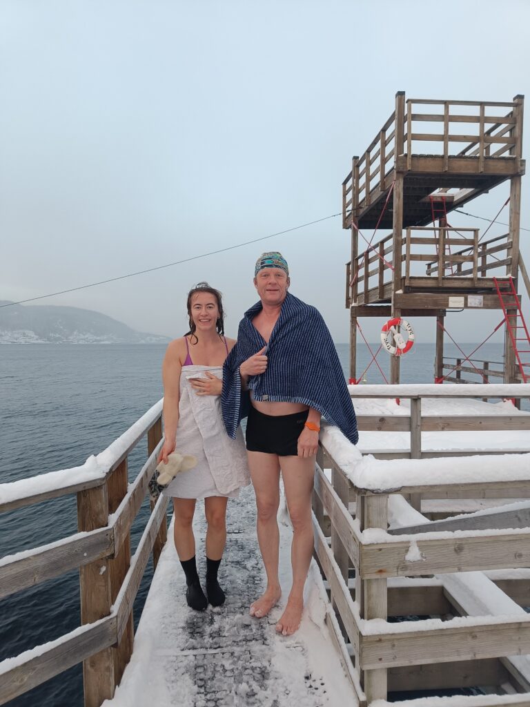
Christmas Bath 2022 became a split session, where the corona patient and the French delegation dropped any cold baths. U1 and Knut, on the other hand, went to Sjøbadet to swim at the great facilities there.
Tobatheornottobathe-standin
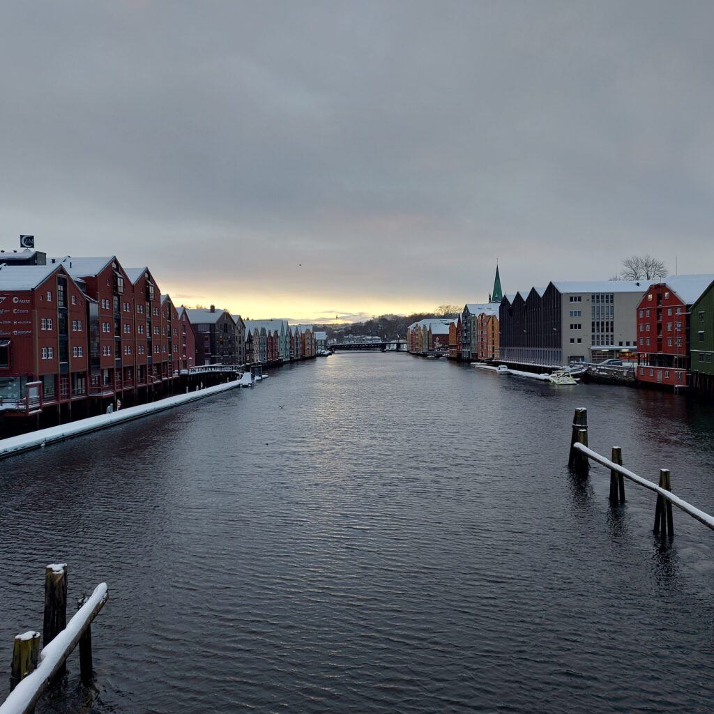
But no sauna, we missed that because of the tradition of Cinderella movie watching. And the 24th of December was a fabulous day to take a walk in Trondheim.
Splendid view in Trondheim.
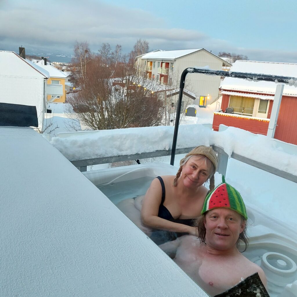
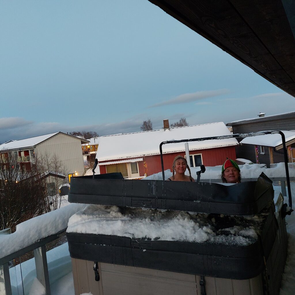
Once at home, Knut just had to get bathing again. CovIdun also wanted a Christmas bath!
Hot Tobatheornottobathe Bath 2022.
Merry Christmas and Happy New Year from Tobatheornottobathe!
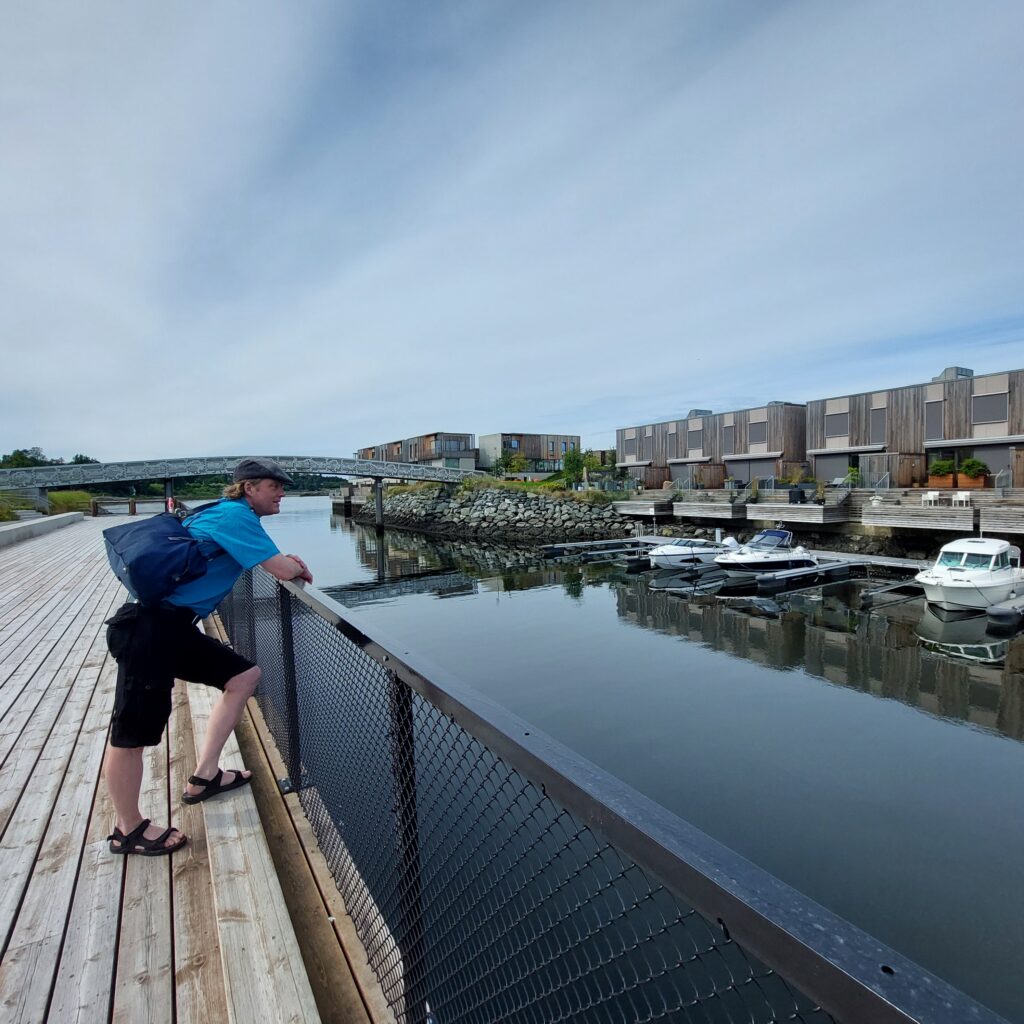
East of central Trondheim, between Nedre Charlottenlund and Ranheim, is Grilstad. Originally this was only a farm belonging to the Archbishop of Nidaros, named after an old river name: Grýtla. The name comes from ‘gruvla’ which means to dig or mess up. A sausage factory, Grilstad factories, was built on the farm in 1957, which is still in full operation. Below Grilstad farm there was a fine shore which has been planned to be developed since the 1960’s. However, the plans were put on hold due to high costs and a lack of filling material.
Grilstadbekken (Grilstad river) has an outlet at Grilstad coast. Photo: WikiStrinda
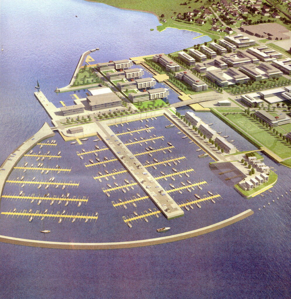
The construction finally started in 2005, with filling material from the Strindheim tunnel project. Grilstad Park is planned with 1,000 residential units, 110,000 m2 commercial buildings, and in addition Grilstad Marina, a harbor/pier with 800 boat berths.
Grilstad Marina, the prospect. Photo: WikiStrinda
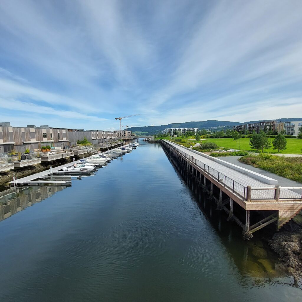
This must be like paradise, you are probably thinking, with a beautiful and peaceful sea panorama. A quay has been built close to the filled-in islands. On the land side there is a sand volleyball court, barbecue grills, benches, lawn and plantings. Great!
Indre Kanal (the Inner Channel) with the quay.
Oh no, it’s not that simple. The bathing area has become too popular. Young people come there to have a bath. They make noise. They jump into the water from the bridge. Ugh! That’s not how we like it!
Knut is inspecting a popular, but oh, so noisy, bathing place.
We visited Grilstad in July, and there were no young people there. None! Had they all gone on vacation? Or did it really work to mount a 100 meter long fence along the quayside to prevent bathing in the canal? The matter has, following complaints from the residents, been up for debate in the City Council repeatedly. The argument for a bathing ban has been the safety of bathers. Of course, you have to bring up safety, you can’t argue against that. Or can you? The debate concerns 100-150 meters where there could be a conflict between boats and bathers. There are about 20 boats that have their parking place there. What speed do you need to drive your yacht this distance?
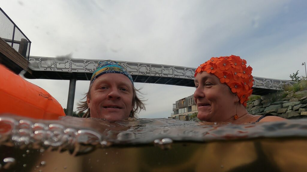
We took a test bath. There was no fuzz, but we didn’t make much noise either. The water was nice and crystal clear, but it was low tide, we couldn’t see the bottom, and we didn’t jump. A great bath!
No, don’t laugh, it’s too noisy!
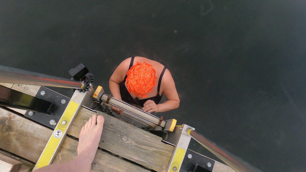
Swimming in Grilstad Marina is perfect, even though the ladder down from the quay was a little wobbly at the bottom.
Wobble, wobble
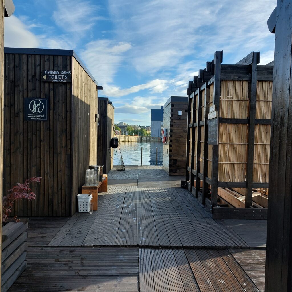
After a bath, food is always right. We ate at Flipper Kafe, on Fullriggerøya (Sailboat island). The sandwiches aren’t the cheapest, but that’s no wonder, because the portions are huge. And after the meal, to play shuffle board might be just right. That can be quite fun, at least for some of us.
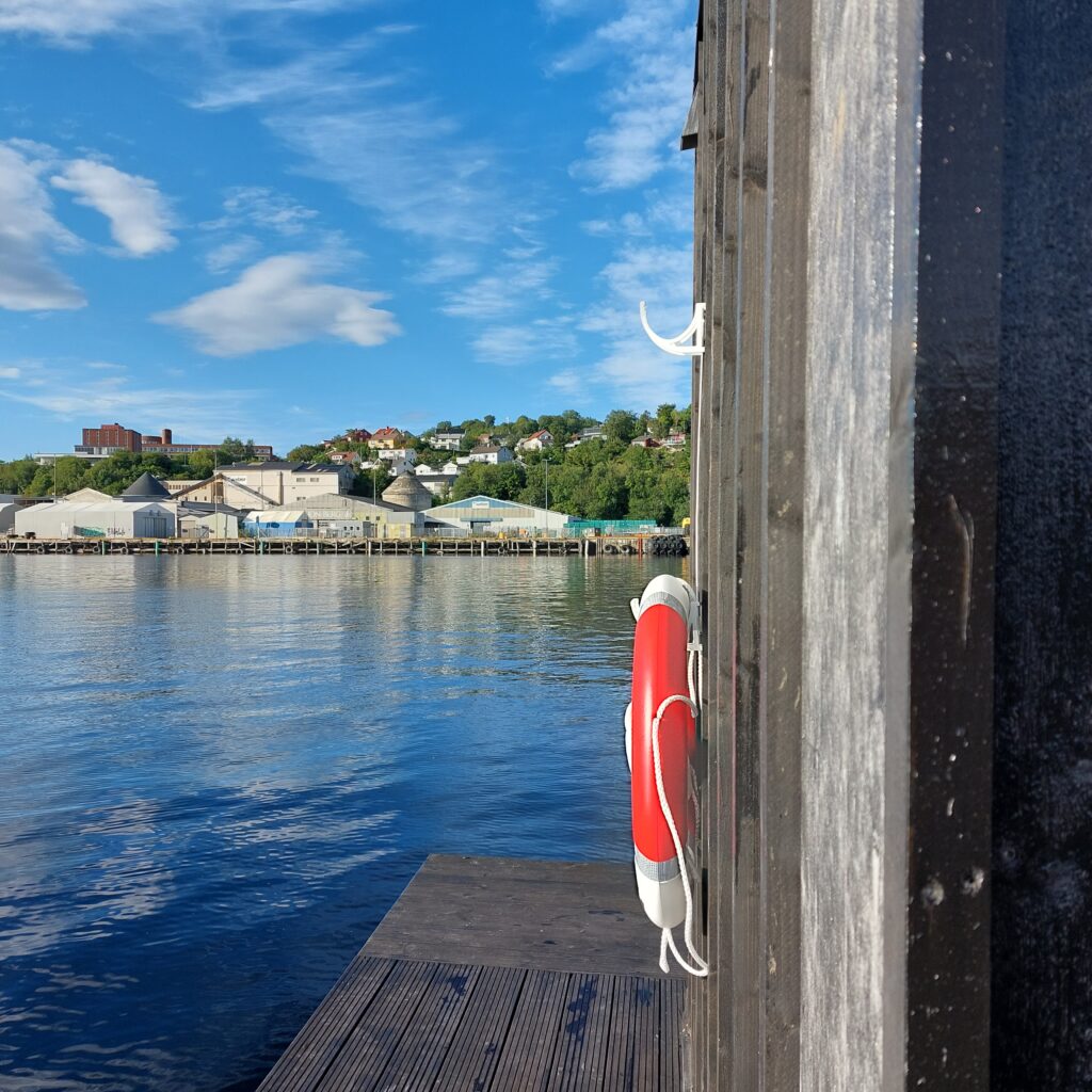
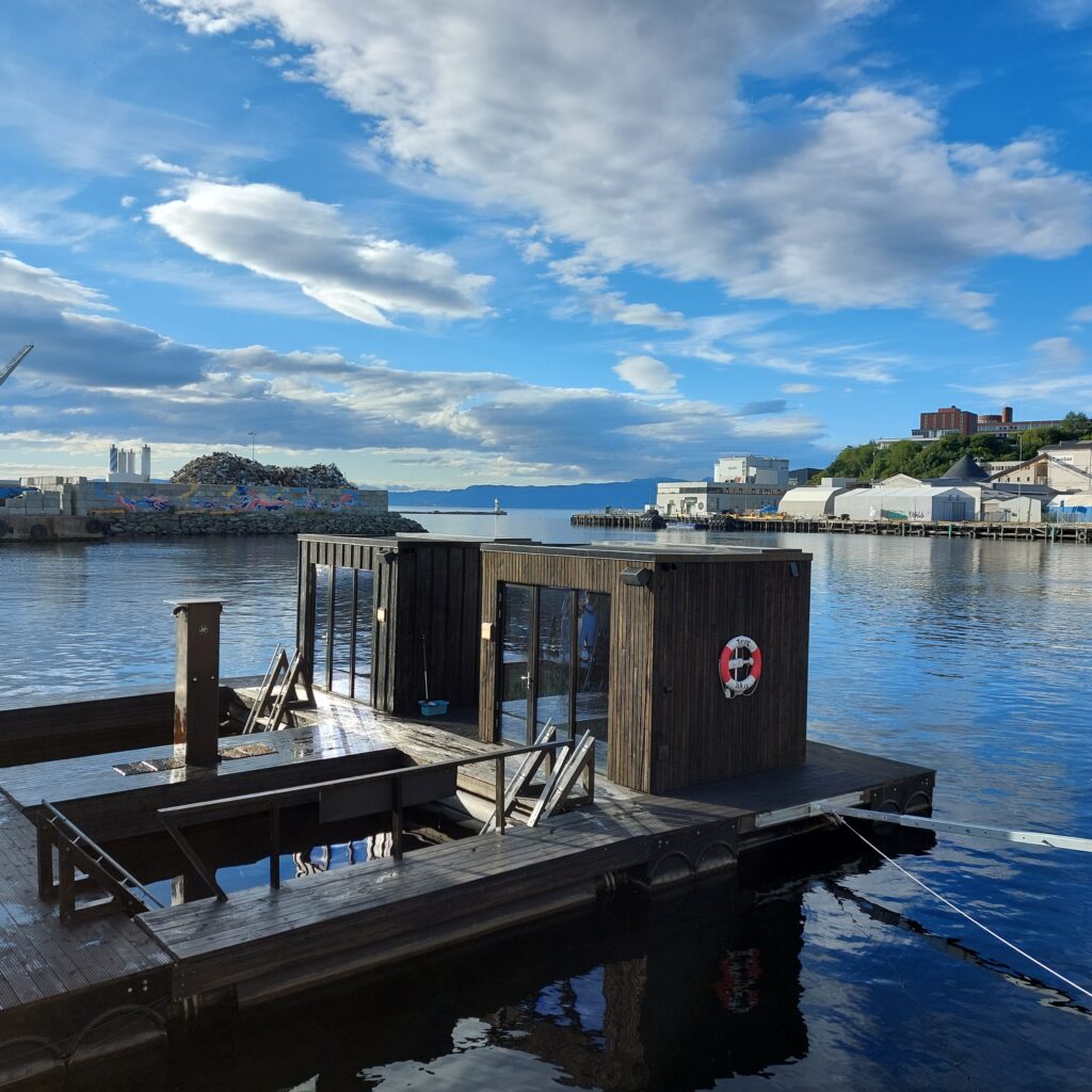
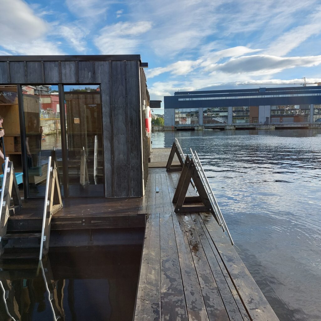
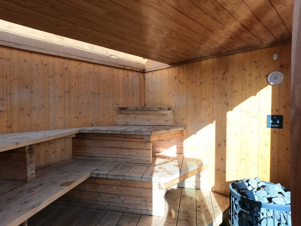
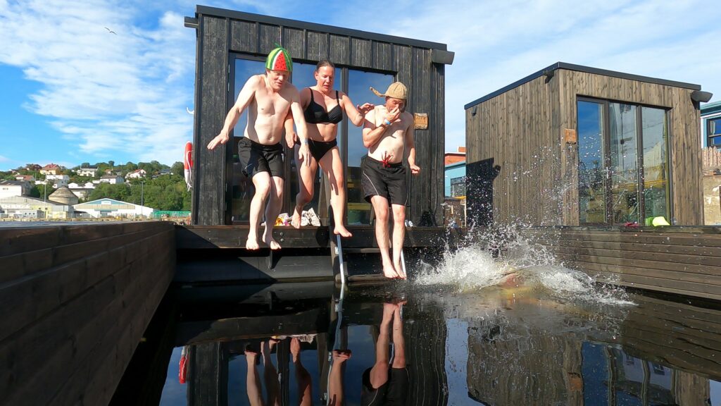
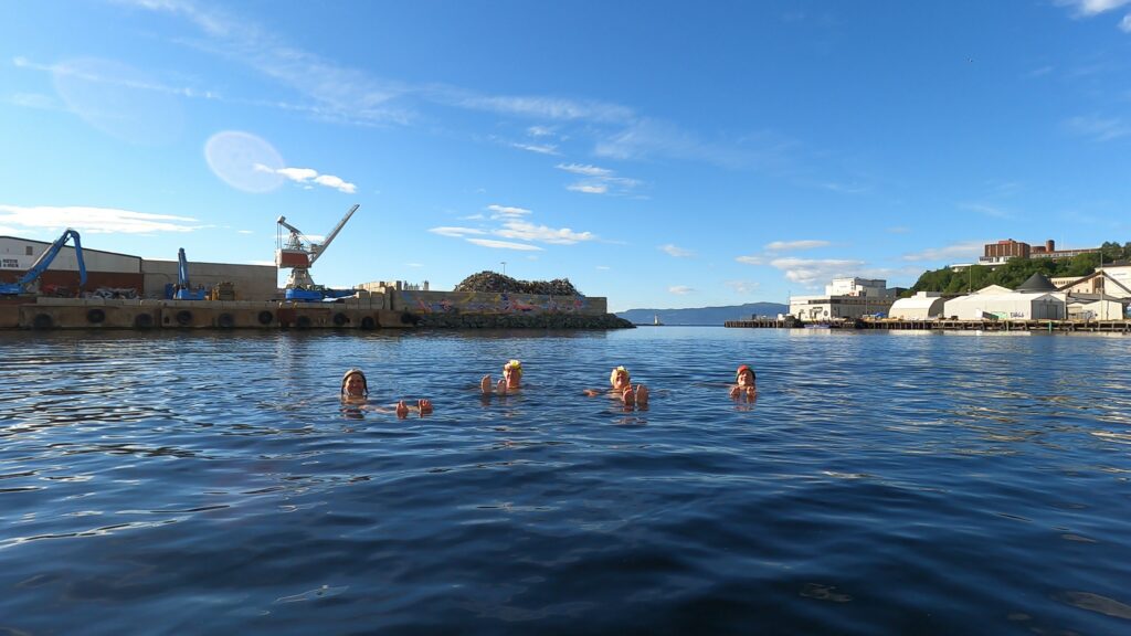
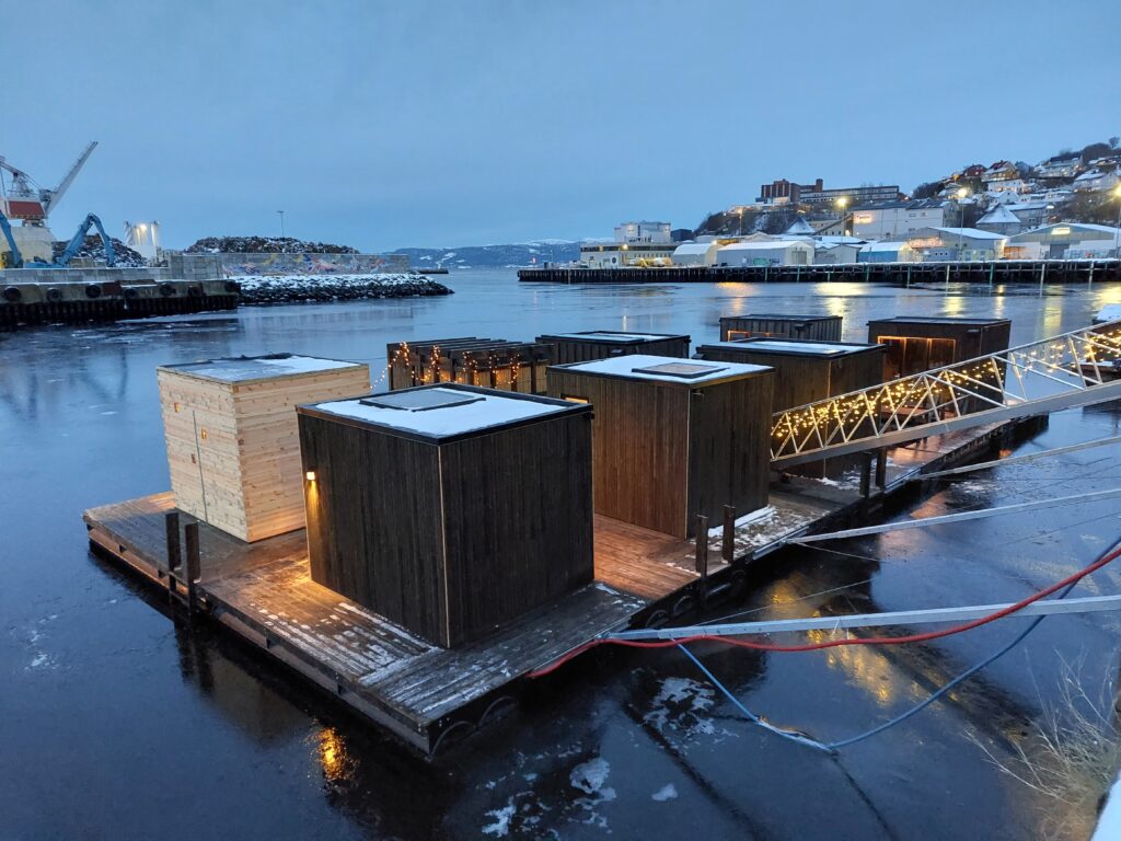
Nyhavna (the new harbour) in Trondheim has for a long time been ready for urban renewal. The industry is retreating, and the municipality wants to make Nyhavna a brand new district. Here, a mixture of offices, apartments, culture and artistic arenas is planned. One of the most positive things that has happened so far in this transformation is ‘Havet’ (The Sea). Just a short cycle ride from the center you have a varied offer for sauna bathing and swimming in the Trondheimsfjord.
There are many saunas at ‘Havet’.
The location is such that you have a varied view:
… towards the industry at Ladehammeren in the east.… towards the scrap dude (metal recycling) in the north.… towards Dora 1 (submarine bunker from WWII) in the west.
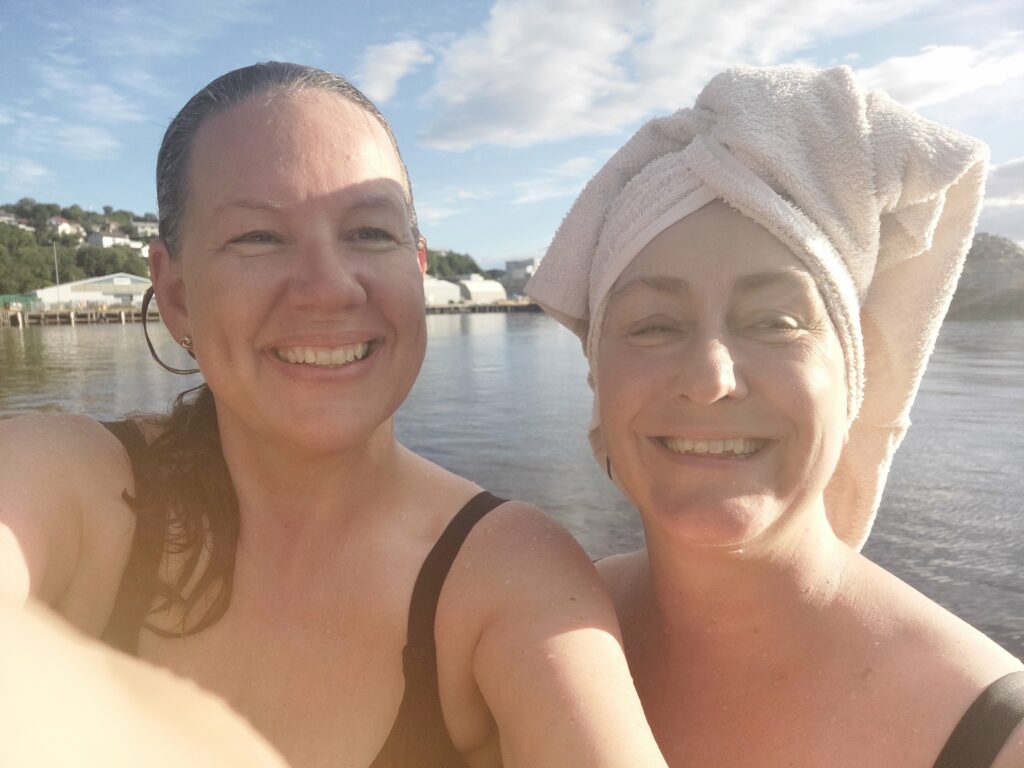
Alternatively, you can of course be the view yourself:
Kjerstin and Idun as ‘Bellaview, bellaview, bella ciao ciao ciao‘. Photo: Kjerstin Moseid Bryhni
At Havet, you can book single hours or whole saunas for 2 hours. Try it! This is splendid! The furnishings (benches) are spread out in different levels and odd angles, you don’t have to sit in a row if you don’t want to.
Many different angles in the saunas.
Cold baths are carried out in the openings between the saunas.
Yes! We are all really looking forward to this!
Some of us where missing some steps up to the roof, to be able to jump from there, as we have seen on other floating saunas.
A couple of hundred meters away, the municipality has built a diving tower in collaboration with Havet. There you can jump and swim for free. But it is just a little too far from the saunas to function as a common facility.
During ‘Kulturnatt Trondheim’ (Cultural Evening Trondheim) in 2017, there was a competition ‘What is your dream for Nyhavna?’ Our bathing friend Taru won, with the answer: Sauna. But she won by a lottery draw, the idea in itself was considered undoable both by the municipality and the consult bureau arranging the contest. But now they are here, a lot of saunas!
Thank you so much, Taru, for an absolutely brilliant idea! For once, it happened in Trondheim that all this came into place quite suddenly, without a long-term localization debate and a lot of back and forth.
Nice to float on the outside too.
Our sauna had a ceiling partly made of glass. Imagine sitting here and enjoying the stars in the sky and maybe the aurora borealis in winter time?
Havet is nice in winter too.
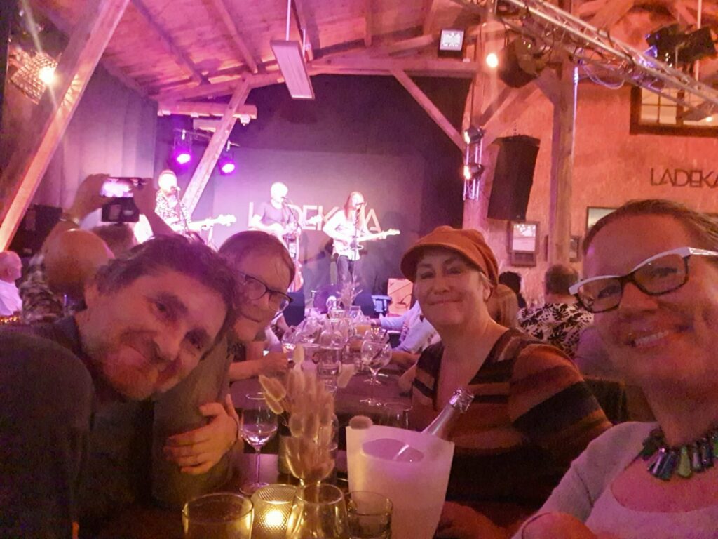
In not too long time, the sauna concert concept at Havet will probably start up again, and then you can experience a sauna and a concert – at the same time! However, we had do to the concert part another place and ended the evening at Ladekaia, watching Vømmøl.
Bathing and a concert the same evening is just right! Photo: Kjerstin Moseid Bryhni
From the beautiful wooden town of Levanger there goes a ferry to Hokstad on Ytterøya. Bring your bike and discover this pearl in the inner Trondheimsfjord!
A bike from Levanger that didn’t follow us to Ytterøya.
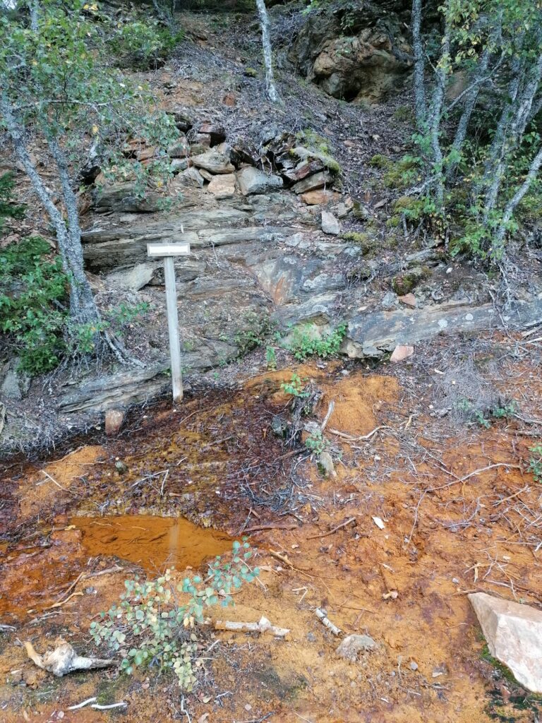
Just east of the ferry quay at Hokstad, there are remains of Ytterøy Kopperverk. Mining on Ytterøya started as early as 1630, as one of Norway’s earliest mines. 5-600 people worked in the mine around 1870. The copper works were sold to an English company and renamed “Ytterøy Mining Company”. The English owners settled on the island, and the mine had the largest production in the country. The peak year was 1867, when 35,000 tonnes of ore were shipped out (95 tonnes per day). This corresponded to 25% of the world’s needs. The ore reserves were largely exhausted by 1880, and activity declined accordingly. Operations were closed down in the interwar period. It can be dangerous to explore the mining area, please do follow the paths! In the spring of 1870, there was a large mudslide by the mines. 7 people died, including 3 children.
In the 1840s/50s, the Ytterøen mines were set up to extract pyrite. This was to be used for the production of sulfuric acid at the Leren Kromfabrikk in Trondheim, but that project failed.
Remains from the mining, east of Hokstad on Ytterøya. Photo: Yvonne Thuv
We lived in Skolbakken (the School Hill) east of the mines when we were on Ytterøya this summer. It’s nice here! Our hosts, Yvonne and Jens, needed help salvaging their submarine, but we spent so much time sightseeing, swimming and time together, that no help came out of it.
The hosts’ submarine was a little too much into its perfect element.
The road through the forest became a fascinating affair. Here is a viking ship of a very special type:
The viking ship ‘Yttereyar’.
The bathing took place in Kabelvika, where the power cable to Ytterøya was landed earlier. Here there are a lot of pebbles! Our recommendation is to use wet socks or preferably swimming shoes in such cases, but of course we didn’t remember to bring them. For our evening bath, there were 4 of us, each with their own solution to the problem:
Idun wore her sandals all the way down to the water front.
Knut stepped over the pebble field without caring much about it.
Jens didn’t bathe.
Yvonne committed to the the Finnish national sport of wife-carrying.
Successful wife carrying.
Apart from the pebble problem it was a really nice bath at dusk. From Ytterøya’s south side, you can see a lot of lights from Levanger and Fiborgtangen. Wife carrying baths on Ytterøya is just right!
Nice twilight bath on Ytterøya. Photo: Jens Vigen
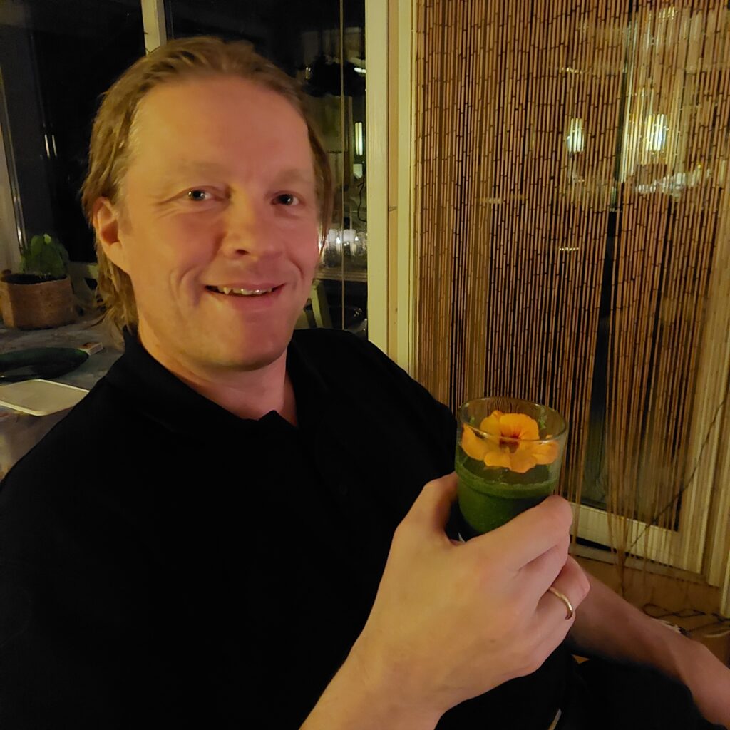
After a bath, time is perfect for going on a visit. It was Hauke’s birthday, so we went home to Randi and Hauke. He wanted a visit of the Norwegian King and Queen for his birthday, but since he had forgotten to send the invitation, Hauke had to be satisfied by a couple of neighbours, as well as a couple of Trondhjemmers with accordions. Good enough, right? On a birthday visit, time is perfect for a taste of ‘Grønn Glede’ (Green Happiness). It was very, very green, but you survived, Knut? Extremely healthy this is!
‘The very first steamship to enter the Trondheimsfjord was the English Georg Canning, in 1837. During a stay in Trondhjem, the ship was rented out for a pleasure trip to Steinkjer. Everywhere, the steamship caused great excitement and sometimes horror. In Mosvik, the men resolutely refused to row out to the ‘Smoke boat’ (“Røykbåten”), which could go against both wind and current.‘ (From the information board at Jørstad)
15 years later, a fixed route network was established at Innherred, served by steamships. On Ytterøya, Jørstad was listed as a port of call from 1850.
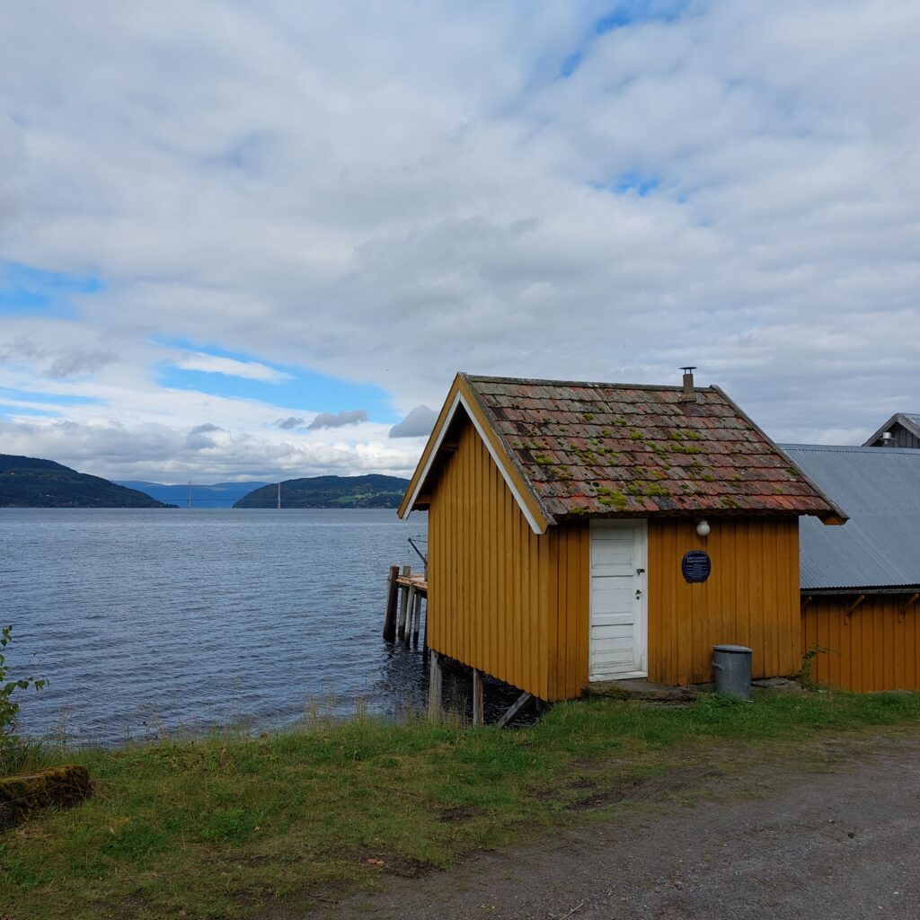
Jørstad, on the north side of Ytterøya, with a view towards the Skarnsund bridge.
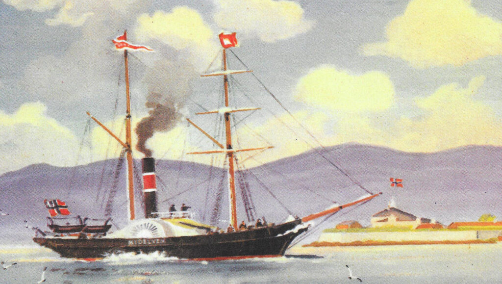
‘D/S “Nidelven” was built in Trondhjem and was the first passenger steamship to be made in Norway. The hull was built at Trondhjem’s shipyard, it was made of pine, copper bolts and skin. The boiler and machine were built and installed by the Factory at Nidelven (now Trondhjern’s Mech. Verksted).’ Today the factory contains apartments, where we lived ourselves in the 1990’s. Coal consumption was 3 barrels per hour. The first trip was made on Trondhjemsfjorden on 24th of November 1850, including singing, music and great festivities.
Ordinary people did not immediately become familiar with ‘Nidelven’. The farmers simply called it ‘Røykbaaten’ (the Smoke Boat). Photo: WikiStrinda
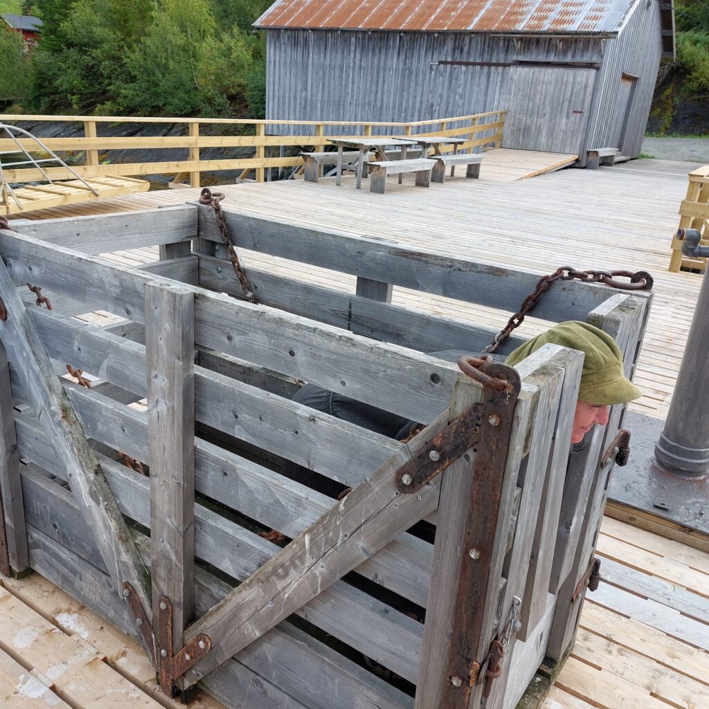
In the first years there was no quay at Jørstad, people and goods were rowed out to the steamship. Indherred’s Aktie-Dampskibsselskab built the quay and the ‘Litjpakkuset’ (the Little Warehouse) at Jørstadsjøen in 1930. Now the goods could be hoisted directly on board. For easy lifting of horses and cattle, the steamship had its own cattle box. A cattle box copy can be found on the quay, and Idun just had to try it.
Idun practices becoming a cow.
D/S Nidelven’s route at Innherred was a big disappointment, as the traffic in no way covered the expenses. Travel by steamship was considered luxury. People from Innherred traveled to Trondheim mostly by small boats. This took time, but then they could also spend the nights in the boat while they were in town, and a city trip usually took a week or two. The ‘Nidelven’ was later put into different coastal routes, but that was not a success either. She was too large for fjord shipping and too small for coastal shipping, and was scrapped on 18 October 1895 after many years out of circulation.
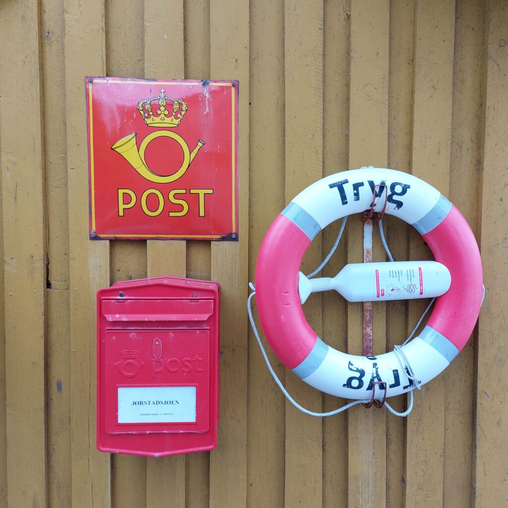
A mailbox, but no service at Jørstad.
We took a commemorative bath for the steamship traffic from the beautifully restored quay. It was ‘Stiftelsen Ytterøy Bygdetun’ who started work on the quay in 2005.
It’s nice at Jørstad! Photo: Yvonne Thuv
Then it was just a matter of jumping in!
A bath from Jørstad Dampskibskai is just right. Photo: Yvonne Thuv
The last boat that went between Trondheim and Steinkjer was the motor ship “Steinkjer”. The boat was purchased by Indherreds Aktie-Dampsibsselskab in 1968, and put into service in December the same year. On 12 September 1974, “Steinkjer” made its last passenger and freight trip between Trondheim and Steinkjer. After 118 years, there was definitely put an end to the continuous passenger traffic by boats to and from Steinkjer. However, the story does not quite end here. If you’re lucky, say in early August, a steamship may still appear.
Maybe the sail steam ship Hansteen will come? Knut, Yvonne and Jens are waiting anxiously.
Sources: WikiStrinda, ‘Gamle Dampen’ by Olaf T. Engvig and Jørstad info board.
Far, far away, in the inner part of the 126 km long Trondheimsfjord lies a pearl: Ytterøya (the Outer Island). You might find this slightly unlogical, but the name is logical enough, since Ytterøya lies outside Inderøy (the Inner Island) (which is actually not an island but a peninsula). The ferry to Ytterøya leaves from Levanger in the southeast, which is twice as far away from the island as Mosvik in the northwest, but somehow that is probably logical too. The island is small enough for you to leave the car at the mainland and take the bicycle instead. Once up from the ferry quay, turn left and cycle around the largest (western) section first. It is beautiful at Ytterøya!
By the church, with a view north-west towards the Skarnsund bridge.
The island is 13.5 km long and 4.3 km wide at its widest, with a varied and sometimes rather hilly landscape. The soil is rich on nutrients, and together with marine deposits, this provides a rich flora. Ytterøya has been inhabited for more than 5,000 years. In earlier times, the island was divided in two (near the church), but land rising has made them connected. Both petroglyphs and burial mounds have been found on Ytterøya.
The inland on Ytterøya, also called the Prairie.
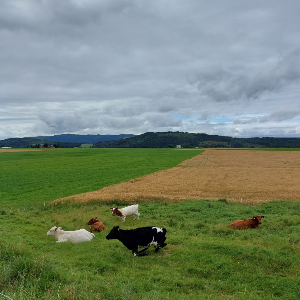
There are about 50 farms on the island, which has around 500 inhabitants. It is good to live here – also for the animals!
Happy atmosphere for people (?) and cattle on Ytterøya.
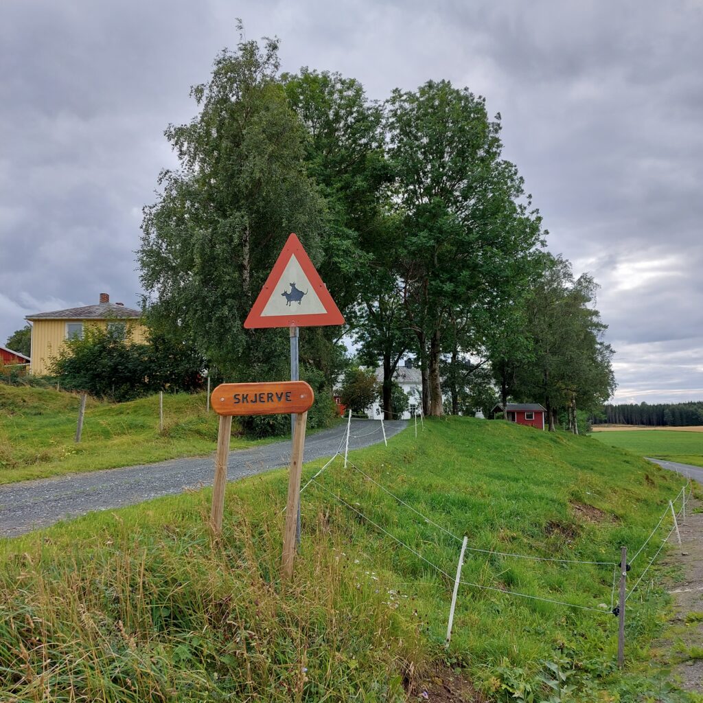
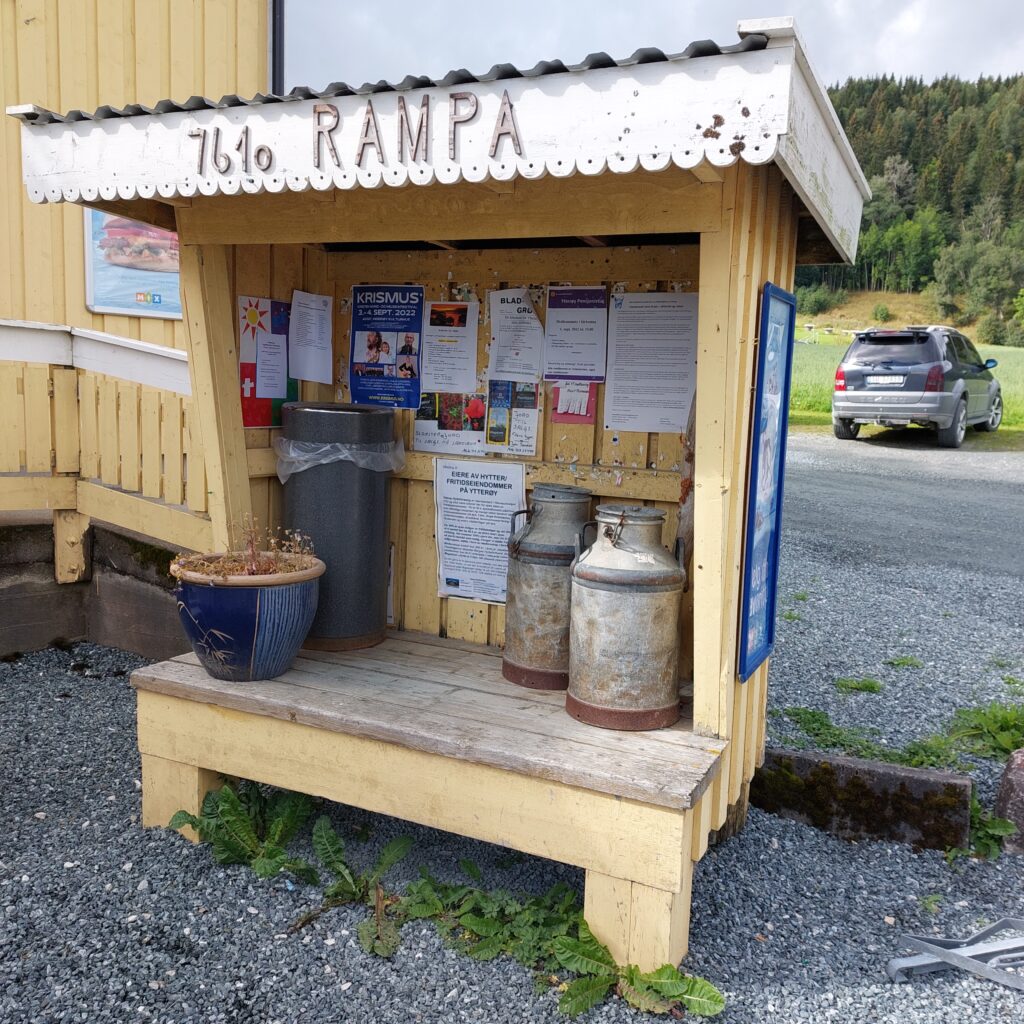
However, the groundwater has been sinking steadily in recent years, and the large chicken slaughterhouse has been decided moved, which gives some concerns about the future. Melkerampa (the Milk Ramp) in Midtbygda (the Village in the Middle) has grown a bit out of the old ways, so there you will find both a shop and a bar and quite a bit in between those two.
The Milk Ramp in Midtbygda.
There are many beautiful bays to visit for a bath at Ytterøya, but the sandy beaches are somewhat absent. Therefore, you’d better bring your swimming shoes if you don’t like walking on pebbles.
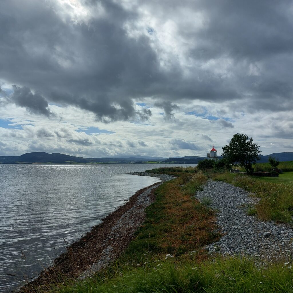
The Lighthouse at Ytterøya.
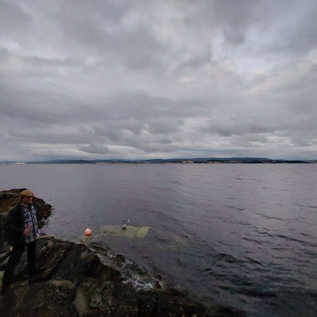
We went to the lighthouse to swim, it’s a beautiful place on the south side of the island, but perhaps a bit private.
Idyllic scene at Sørnesset, by the lighthouse. The black lump on the buoy is Knut’s swimming trunks (underwear, since he had forgotten his swimwear). The panties were almost forgotten here too.