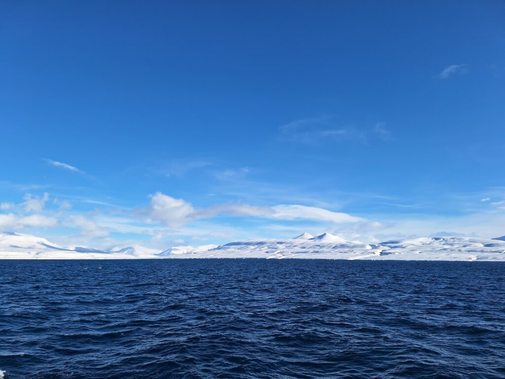
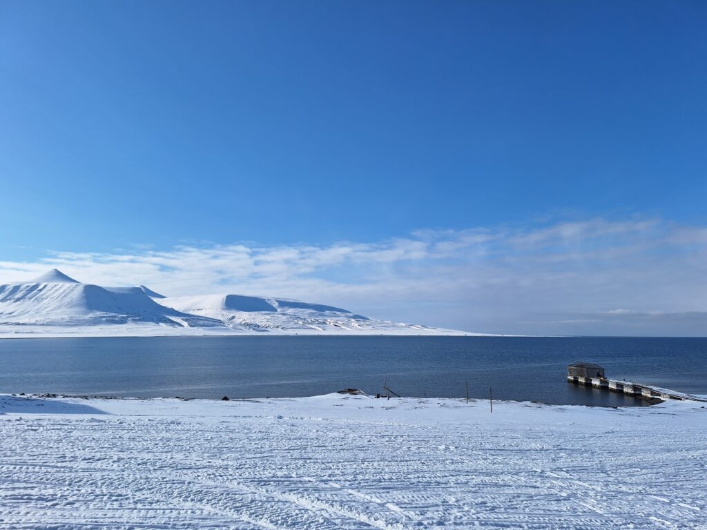
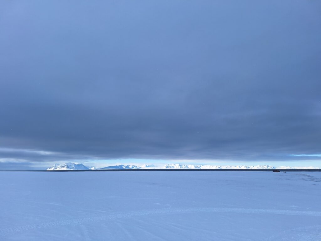
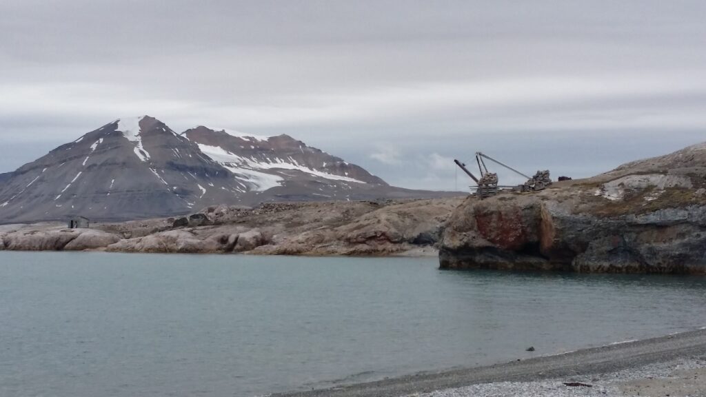
On the south side of Isfjorden, between Longyearbyen and Barentsburg, lies a large and wide bay called Coles Bay (Colesbukta).
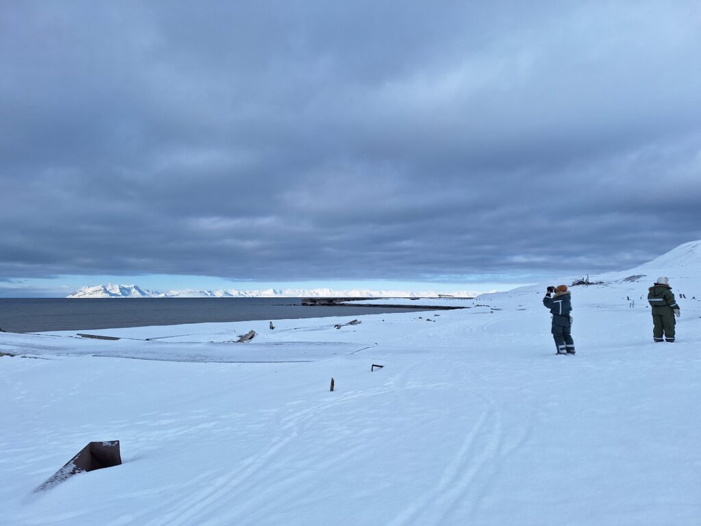
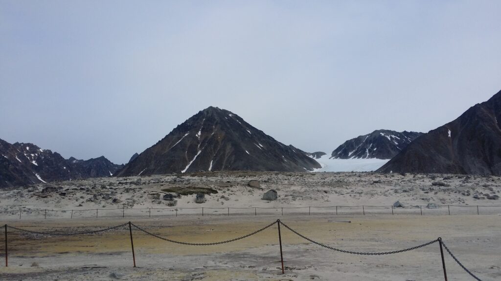
Coles Bay is more than 4 km wide. View southwards. Coles Bay shipping port to the left (east) and Cape Laila to the right. The mountain peaks in the middle are called Vesuvius and Little Vesuvius.
The bay was named as early as 1630, when an (English?) explorer reported that this was a good place for hunting reindeer. Coles Bay is named after Cole Park in Wiltshire, England. Later, when coal mining started up in Isfjorden, the name was misinterpreted as Coal Bay.
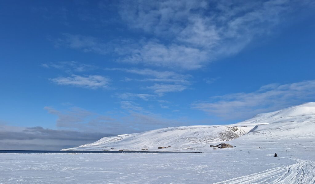
Coles Bay 2025. Most of the houses are either falling into disrepair or demolished, but occasionally the place is still inhabited – by Russian scientists.
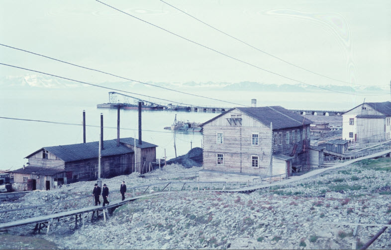
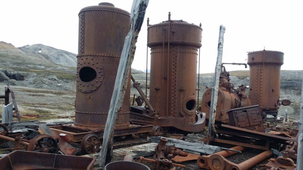
The Russian coal mining town of Grumant, located between Coles Bay and Longyearbyen, was bombed during World War II. Due to difficult port conditions, it was decided to build a new coal shipping port in Coles Bay when reconstruction began after the war.
Coles Bay shipping port, July 1960 (one year before decommissioning). Photo: Carl A. Wendt / DigitaltMuseum
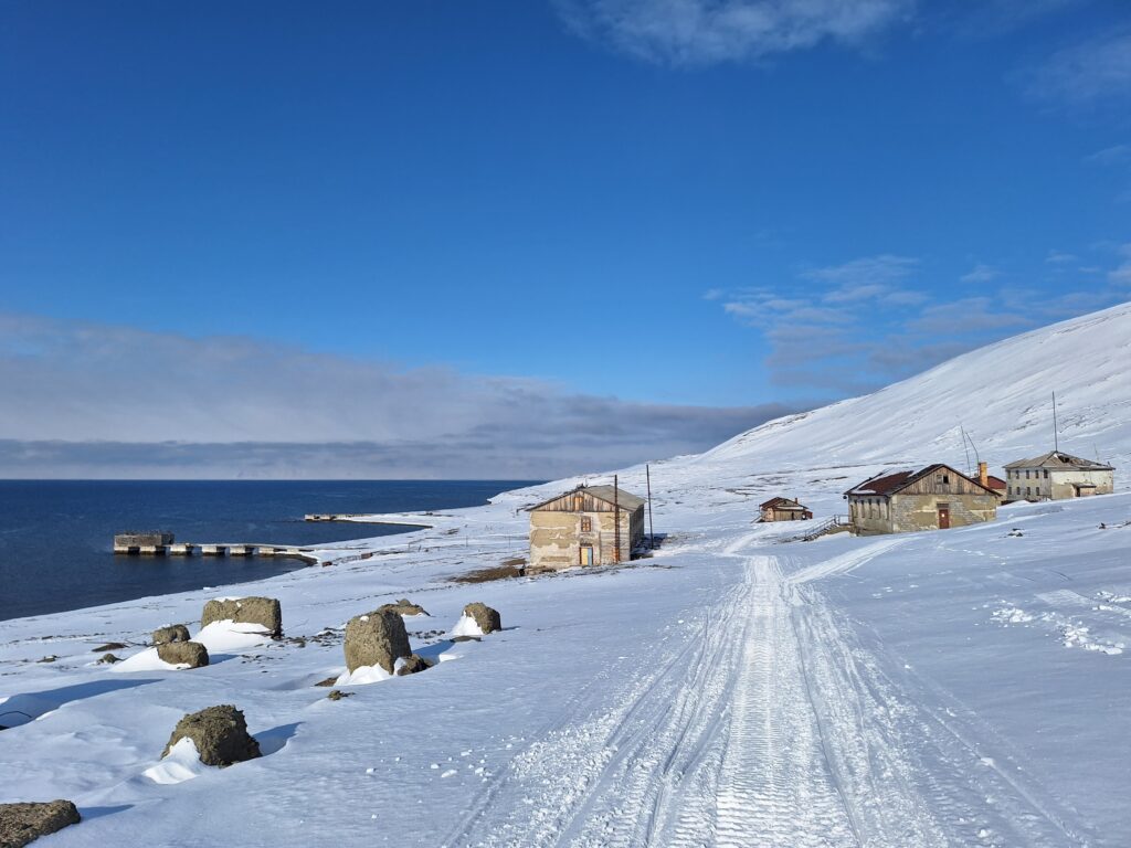
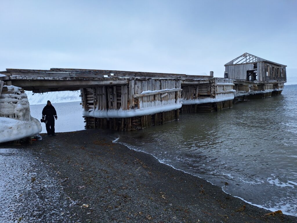
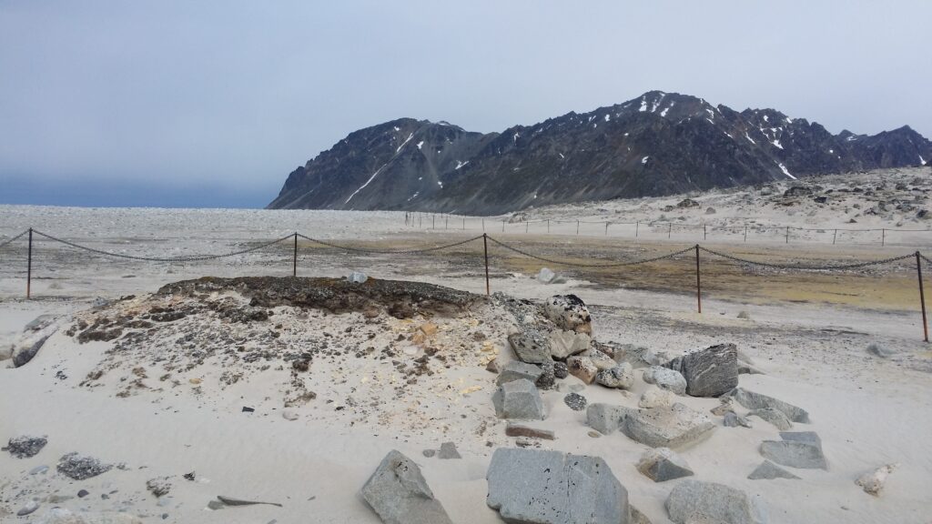
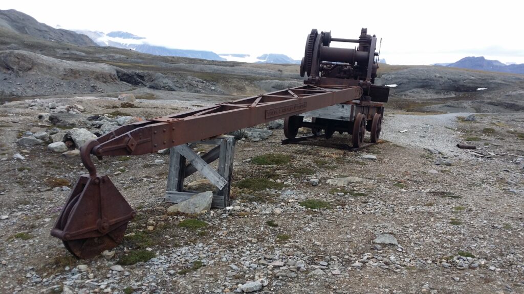
A 40 cm wide (narrow gauge) and 10 km long railway was built between Grumant and Coles Bay for coal transportation. The railway was partly tunnelled and otherwise built-in. The wharves are made of timber, and parts of them are still standing, some 60 years later.
The timber wharves in Coles Bay 2025.
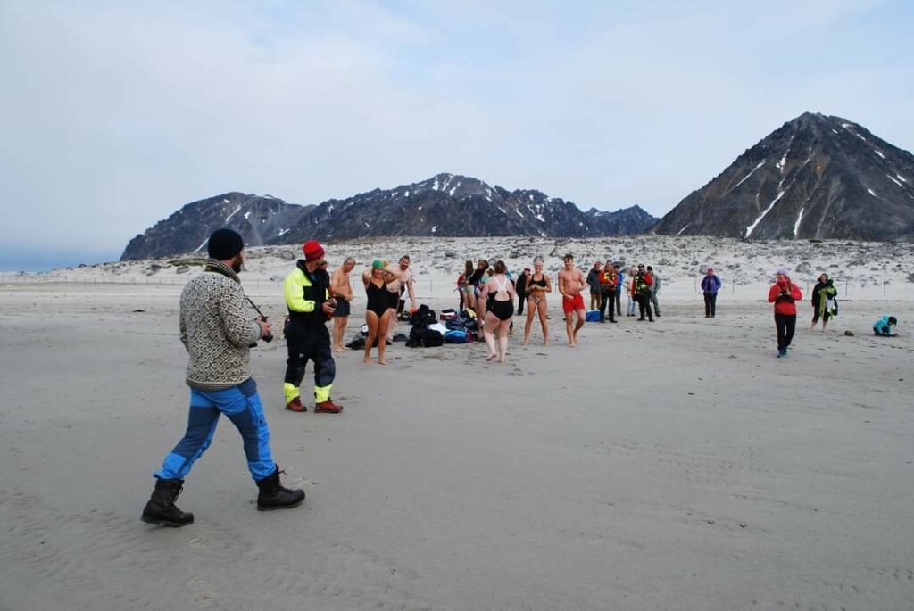
We wanted to go swimming in Coles Bay! Luckily, we were assisted by Jorunn and Nina, who helped us as photographers and polar bear guards.
The bathing assistants at work. In the background: Alkhornet mountain in bright sunshine.
Then we just had to get started, we even had a wardrobe.
Knut inspects the locker room in Coles Bay.
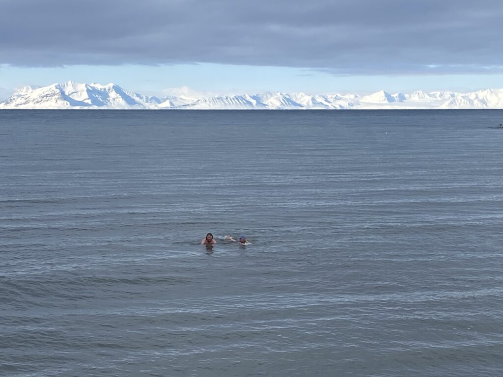
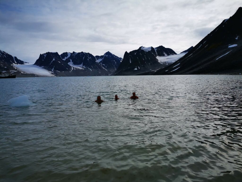
It was a really nice swim. Quays like this are not built in shallow waters, and we didn’t have to go far before we could swim. There were no hints of slush this time, water temperature about 0 degrees Celsius, and minus 15 degrees in the air. The beach, like all the Svalbard beaches we have tested so far, consisted of fine-grained gravel (or possibly coarse-grained sand), which means you don’t have to worry about sand getting inside all your clothes. Three black guillemots swam around right next to us, and a reindeer grazed nearby. Add to that the splendid view, and you have our recommendation: A swim in Coles Bay can be fabulous!
NB! There were no Russians in Coles Bay during our visit, and we didn’t disturb anyone.
The most splendid bathing view ever? Photo: Nina Hestø
The events in the Løwø family are endless, and in 2025 there were two confirmations in Longyearbyen, at Palm Sunday. We like that! And a visit to Svalbard also includes a trip to the family cabin at Cape Laila. Thank you very much for the invitation, Jorunn!
Coles Bay, looking westwards. Lailadalen (The Laila Valley) to the left and Cape Laila to the right. The mountains Vesuvius and Little Vesuvius in the background.
The names Lailadalen and Cape Laila come from the name of one of the motor cutters (Laila of Tromsø) used on Gunnar Isachsen’s Svalbard expedition in 1910. Isachsen was a topographer (topographic maps describe the terrain in the area), and as the expedition leader you can come up with names for unknown places, right?
Cape Laila. View north towards Alkhornet. It can’t get more beautiful than that!
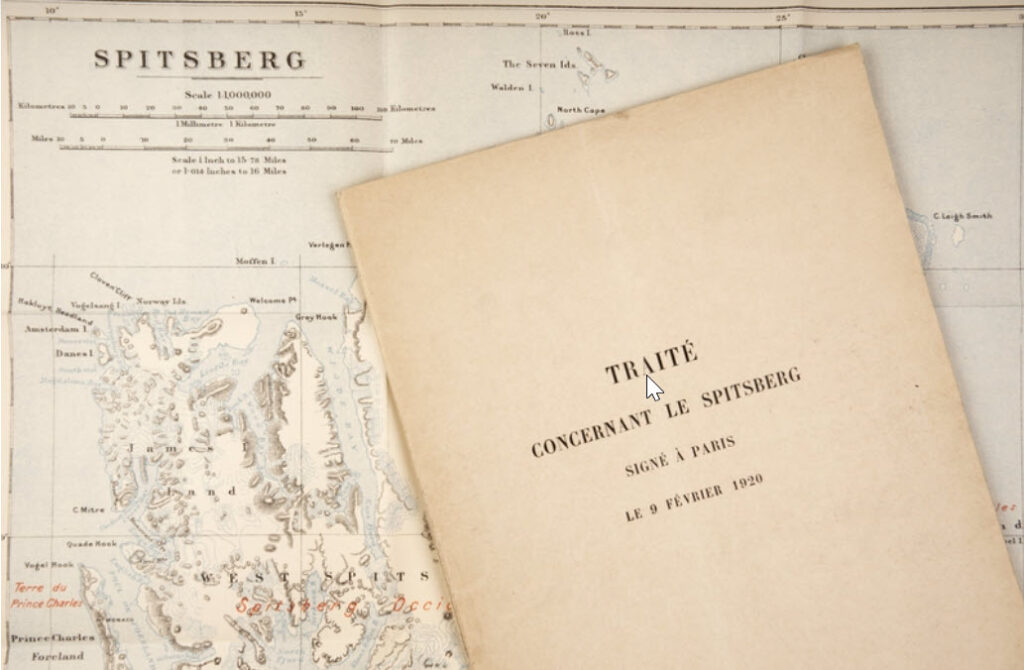
Sweden invested heavily in Arctic exploration towards the end of the 19th century, primarily driven by Adolf Erik Nordenskiöld, who proposed that Svalbard should belong to Norway. After Nansen’s successful expeditions, interest also increased in Norway, and after we left the union with Sweden there were no problems with funding any more. ‘Stortinget‘ (The Norwegian Parliament) allocated money for the ‘Spitsbergen Expedition‘, for exploration of Svalbard’s topography, geology and hydrography for many years. However, the work of finding a solution to the ‘No Man’s Land Problem‘ (Svalbard was called Terra Nullius) was completed as a result of the legal settlement after the First World War, in the form of the ‘Svalbard Treaty‘.
Isachsen’s personal copy of the Svalbard Treaty from 1920. Photo: Beate Kjørslevik / Norwegian Maritime Museum
Signed in Paris, 1920, the Svalbard Treaty gives Norway sovereignty over Svalbard, Hopen, Jan Mayen and Bjørnøya. The treaty came into force in 1925. All countries that have signed the treaty have equal rights to the resources, but it is Norway’s laws that apply. Military activity is prohibited on or near the islands, (Germany didn’t really care about that during World War II), which Russia has used as an argument when they have protested that Norwegian coast guard ships patrol Svalbard. Russia signed the agreement in 1935 (they first had to end a civil war and regroup themselves to the Soviet Union). China signed the Svalbard Treaty already in 1925 (according to Wikipedia), so that can’t be why Chinese people are not allowed to drive snowmobiles in Longyearbyen. Anyone who knows?
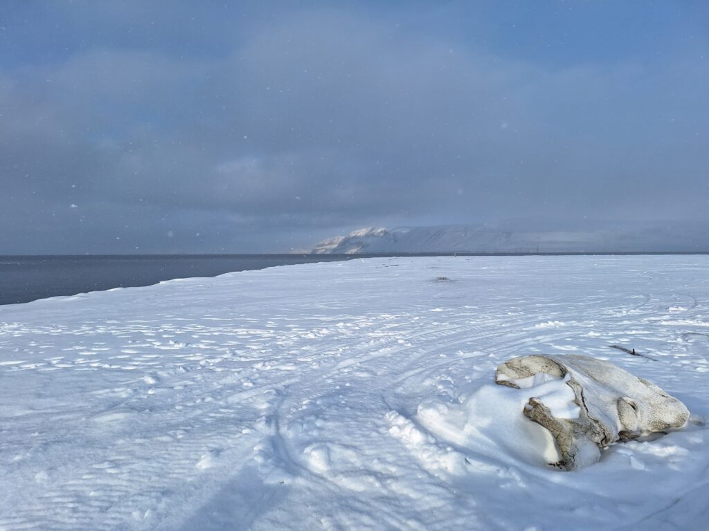
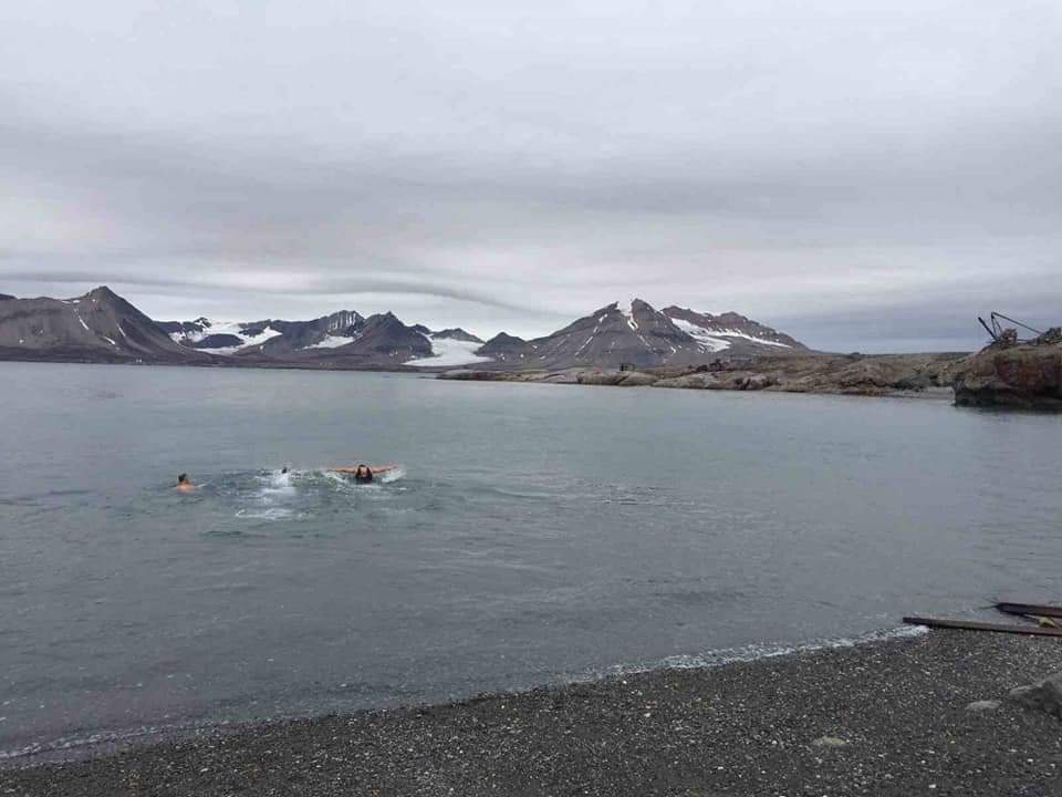
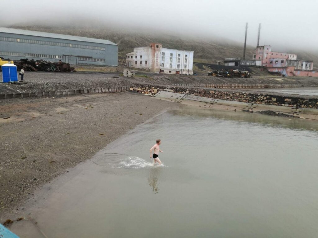
For the 100 years anniversary of the Svalbard Treaty, Tobatheornottobathe thought that a bath at Kapp Laila could be a good idea. We have tried to swim there before (Kapp Laila), but that doesn’t stop us at all! If it’s terribly shallow in the lagoon, then you can swim a little further away from Løwøhytta, right? We chose ‘The whale bone‘ as our starting point, it is located west of the neighboring cabin ‘Bikkjebu‘ (The Dog’s Cabin).
The whalebone. There is not much left of the whale skeleton at Cape Laila, but one vertebra is clearly visible.
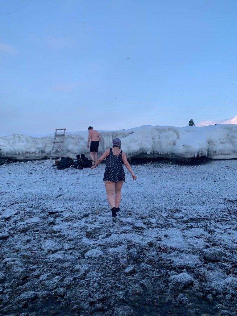
What could possible go wrong at Kapp Laila in winter? Well, first of all, ‘Landkallen‘ means trouble. Above the high tide boarder on Svalbard’s beaches, there is an ice edge during winter time, and it often grows to 1-2 meters height. It’s not easy to climb up there with frozen fingers after swimming. ‘Better bring a ladder!‘, we thought.
Well-equipped with a ladder, bath photographers and polar bear guards, there was little stress with a Lailabath in winter. Photo: Une Hunstad Løwø
But then there was this thing with the tides. Again. We had inspected the place earlier the same day, at high tide. When we went there to swim, it was low tide, and we had a long way to walk before it was deep enough to swim. Conclusion for the second time: Cape Laila is not the best swimming spot, it is actually pretty bad at low tide, despite the crystal clear water.
Bathing at Kapp Laila, 17th of April 2025. Photo: Une Hunstad Løwø
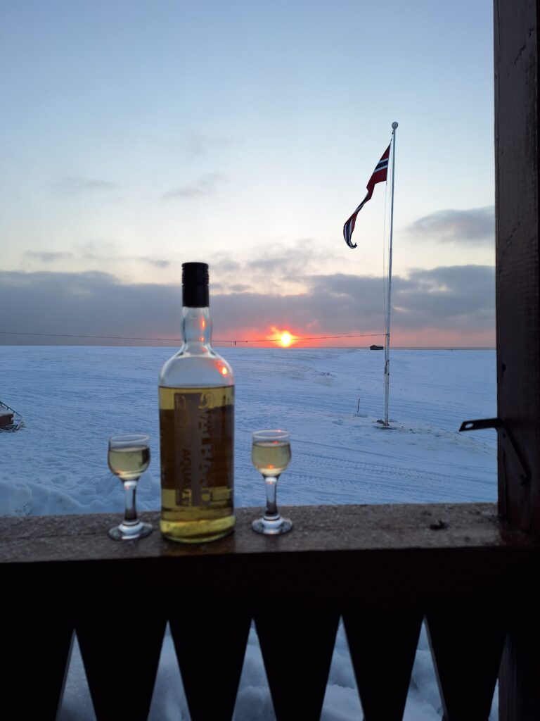
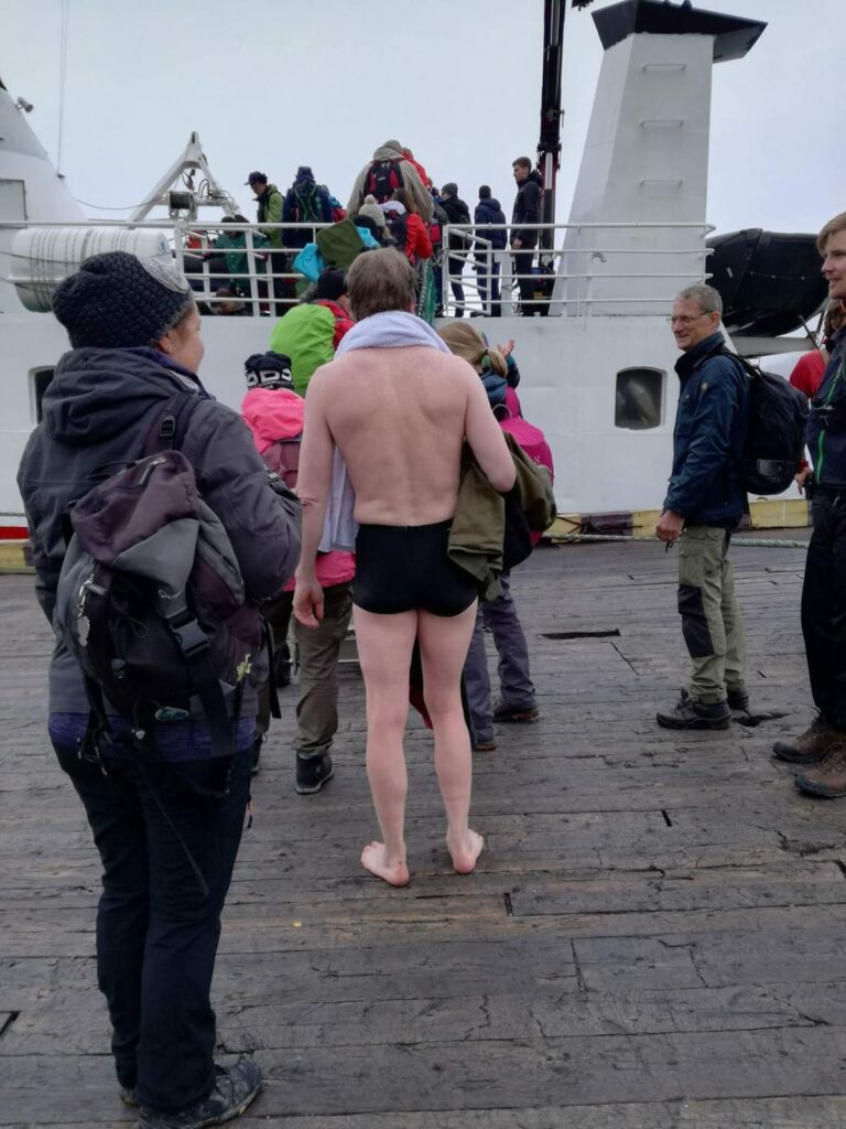
Minus 13 degrees celcius, clear and beautiful ‘slush water’ (which means approximately minus 2 degrees in the water), a veeery shallow beach, but we absolutely did not regret it! We had the world’s most beautiful view of Isfjorden, a bath is always energizing, and after the bath Idun’s sister Jorunn and her husband Berner treated us with a sip of the ‘Svalbard Aquavit‘. Thank you!
Celebrating the 100th anniversary of the Svalbard Treaty with lots of snow, aquavit and the midnight sun. Congratulations!
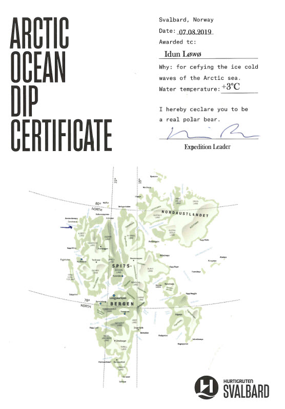
In the summer of 2019, Idun’s older sister Jorunn had another big birthday to celebrate. The celebration was a cruise with ‘Hurtigruten‘ to Svalbard, from Longyearbyen to the island of Moffen, 80 degrees north.
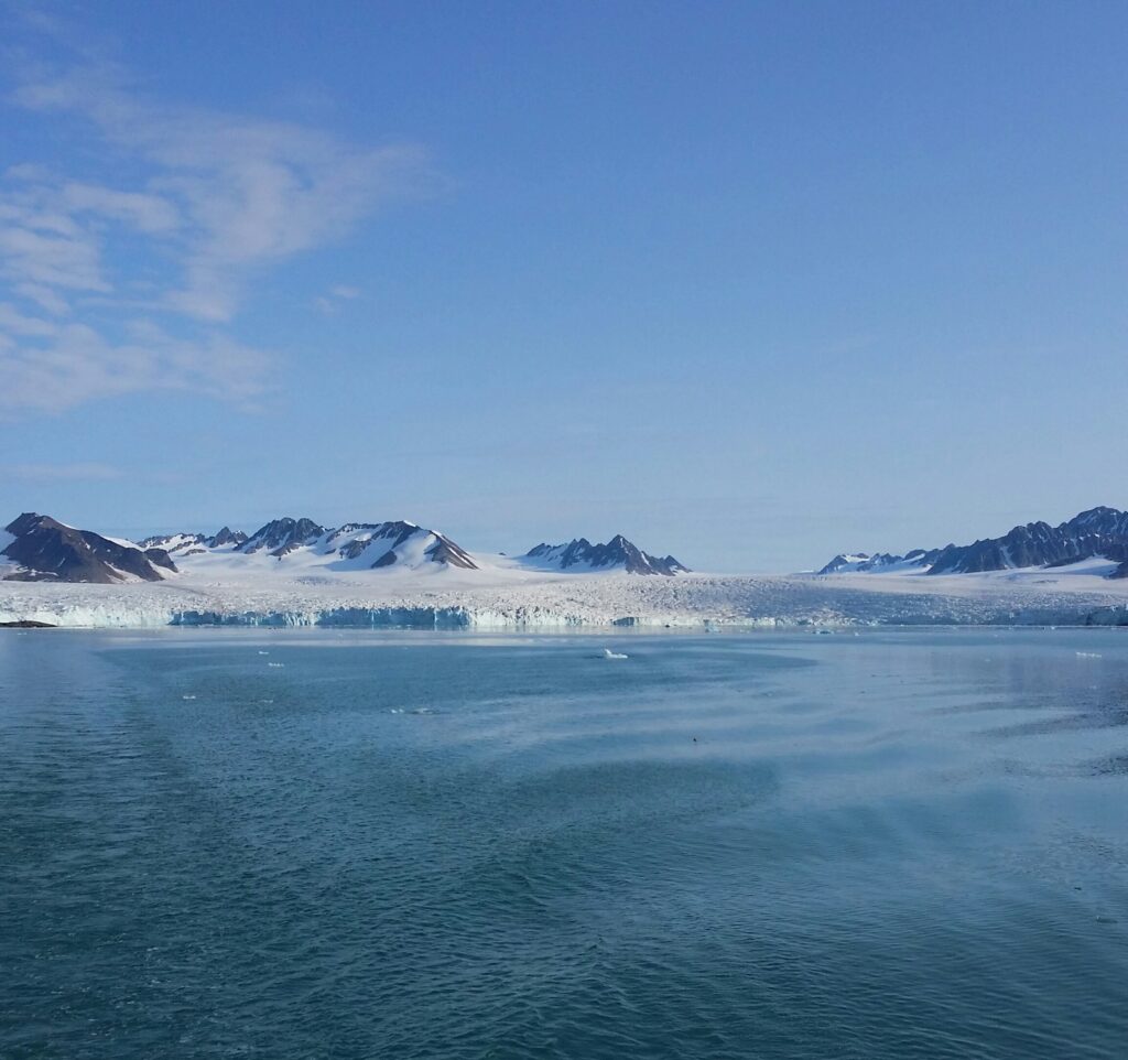
The Lønnech glacier seen from the ship ‘Nordstjernen’ (the North Star).
On day 2 of the cruise, we entered the Magdalene fjord north of Ny-Ålesund. Here it is wild and beautiful, and you can admire glaciers surrounded by pointed mountains.
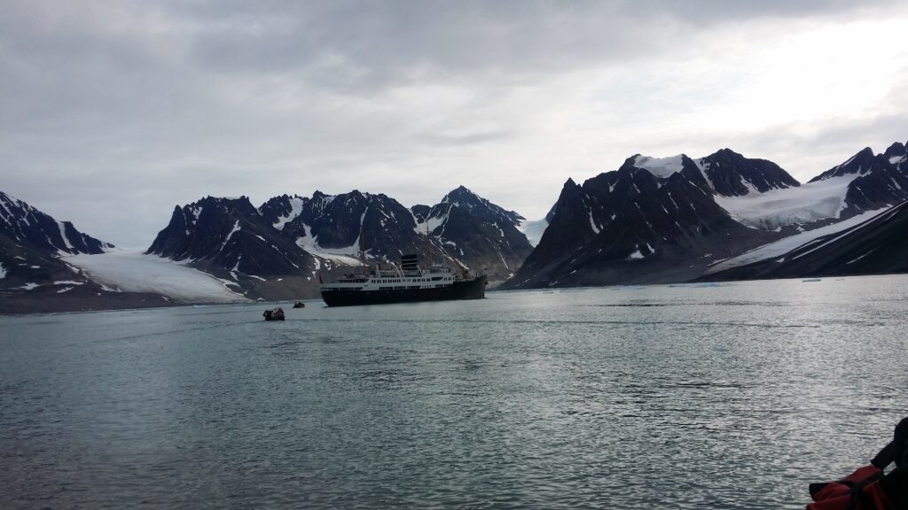
Nordstjernen in the Magdalene fjord.
Presumably this is where the name ‘Spitsbergen’ comes from. The fjord’s name is from the 18th century, named after the biblical Mary Magdalene.
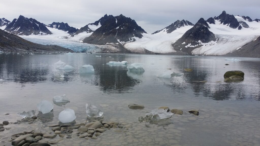
Gully bay. Can nature be more beautiful than this?
On the south side of the Magdalene fjord is a headland with a fine sandy beach, one of the few places in the area where it is possible to a) disembark b) bury corpses c) have a bath
An English whaling station was built here in the 17th century.
One of four blubber oven foundations at Magdalenefjorden.
During 200 years of whaling, many people were buried here, and the place is today called Gravneset (the Grave Headland) with Gravnesodden at the end. 130 graves have been found, many of them long after the whale station itself had closed down. The sailors preferred to bury the dead here, where it was possible to dig holes for bodies, instead of throwing the corpses into the sea. The graves are English, Dutch, but also many Basques are buried at Gravneset, they were skilled whalers. In the 1970s, you could still find bone remains in the area, dug up by foxes, polar bears and souvenir-chasing tourists. Today, Gravneset is protected, and large parts are fenced off to avoid wear and tear of the cultural heritage.
Gravneset by the Magdalene fjord.
The guides had insisted for two days, that it was compulsory to have a bath at Gravnesodden, imaging that maybe 2-3 people would take the bait and actually have a dip. But that was a severe underestimation of the Løwø family. We ended up with 17 bathers from the ‘Birthday group‘ – a new record!
This is how it looks like when 17 people go swimming at 79°33′ north. Photo: Berner Hestø
And the bath itself? Absolutely gorgeous! A white sandy beach, crystal clear water decorated by ice cubes – and 3 degrees celsius.
Swimming in the Magdalena Fjord, perhaps the most beautiful fjord in the world. Photo: Karina Løwø.
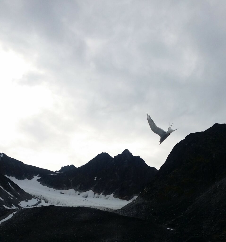
In addition to the buried people, there was also an arctic tern (Sterna paradisaea) who wanted to see us leave Gravneset:
Get the heck out of here!
… so then we did. And as ice bathers on a cruise, this time we got physical proof of the bathing madness:
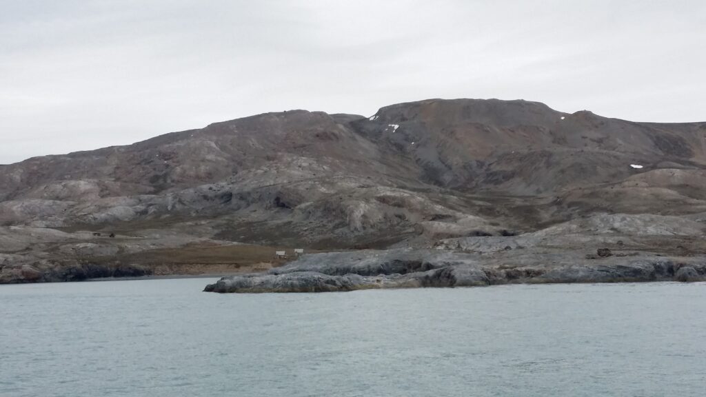
The Kings Bay (Kongsfjord) in the northwestern part of Spitsbergen is one of the most beautiful fjords in Svalbard. On the south side of the fjord you will find the researcher town Ny-Ålesund with the previous coal producing ‘Kings Bay Kull Company’, and on the north side you find ‘Ny-London’, a disused marble mining village.
Blomstrandøya. ‘Nothing less than an island made of pure marble’ (quote: Ernest Mansfield).
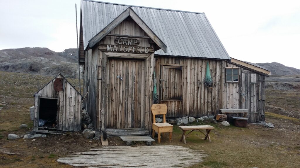
The marble deposits on Blomstrandøya were discovered in 1906. Development of the site began in 1911 and was carried out by the English company ‘Northern Exploration Company Ltd’. The head of the project was Ernest Mansfield. Of the buildings that were erected here (they were supposed to house 70 men), some have been moved to Ny-Ålesund where they are still in use. But some houses remain, partly deserted and partly in use as cabins for the researchers in Ny-Ålesund.
New London in Kongsfjorden, also called Camp Mansfield.
The appetite for investments in the early 20th century was sky high. The best of the technical devices of the time were installed, including railways, steam engines, marble cutting machines and cranes.
Nicely riveted processing plant from the early 20th century.Mobile crane manufactured by Taylor & Hubbard, Leicester.
The appetite for investments was continuously increasing throughout the First World War, and the share capital rose to over a million pounds. There were many people who made good money during WWI, and they needed something to spend their money on. The adventure in New London ended in the world’s first stock market bubble, which burst in 1920. Large amounts of money had been invested – without anybody knowing what the marble was actually worth.
Yes, marble can be very valuable, as blocks. But as gravel?
When the first small cargo of marble arrived in England, 1912, it turned out that the large, beautiful marble blocks had been transformed into marble gravel due to frost bursting. There was no value whatsoever in the marble from Kongsfjorden. However, this did not stop the investments! Expectations of quick returns overshadowed common sense. Mansfield was fired, and the growth continued. The value was NOK 18 million in 1919. The following year it was 0, and the plant was abandoned.
After so much history teaching, time was just right for a bath, and in New London the bathing conditions are chilly, but excellent!
Our bathing beach east of the old unloading facility, 78°58′ north.
Here we found just the perfect type of sand, and not too shallow, either.
Nice drive south towards Ny Ålesund! Arne and Kjerstin were tobatheornottobathe standins for Knut on this trip.
If we swam far? No, we did not swim across Kongsfjorden.
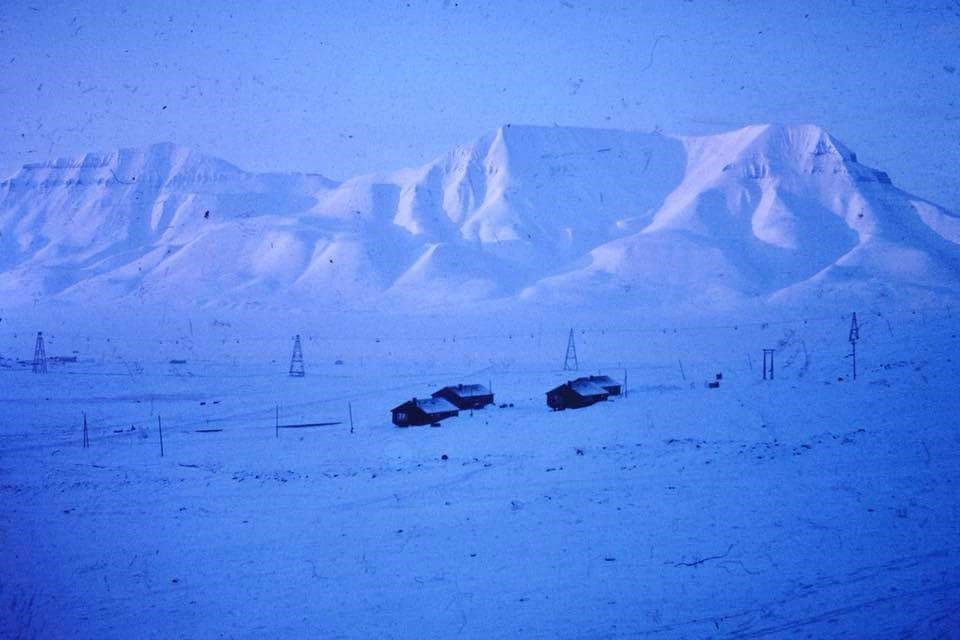
In the summer of 2017, we traveled to Svalbard. The purpose of the trip was for Knut’s mother to experience her daughter-in-law Idun’s place of upbringing.
The ‘Million City’ in Lia circa 1968. Idun grew up in house number two from the left. Photographer: Unknown.
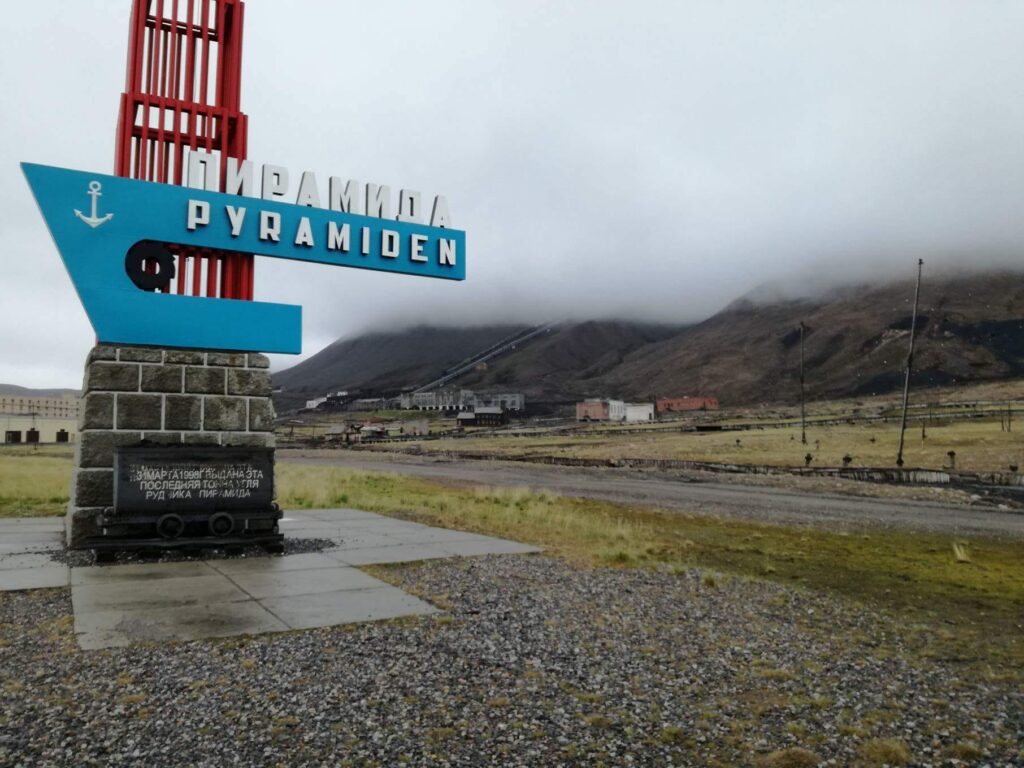
After a few days in Longyearbyen, we booked a boat trip to the Russian ghost town of Pyramiden, which is located by Billefjorden, a fjord branch in the innermost part of the bigger Isfjorden.
The Pyramid Mountain, not at it’s most splendid.
The Pyramid City is named after the pyramid-shaped mountain of the same name. The town was founded by Sweden in 1910. Test drilling revealed coal deposits, but also difficult conditions due to faults in the bedrock. The Swedes therefore chose to concentrate on the Svea mine, and Pyramiden City was sold to the Soviet Union in 1927.
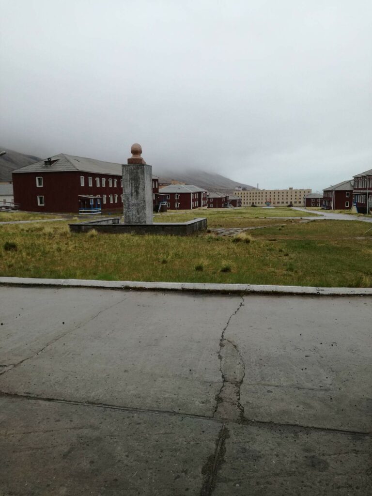
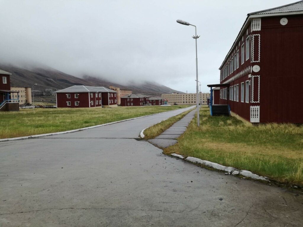
Welcome to Pyramid City.
During the Soviet era, the town was developed into a model community with most facilities: Cultural center, swimming pool, library, school, kindergarten and cinema. Pyramiden also had both barns and greenhouses. At the most, some 1,000 people lived here.
Lenin looks down the model city.
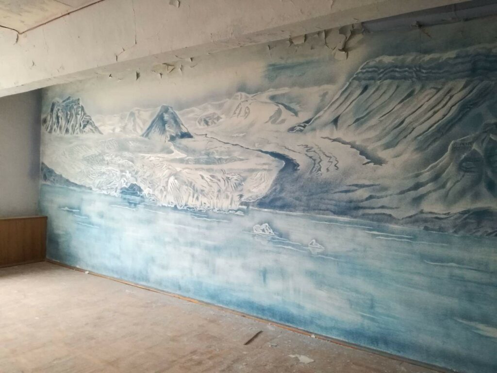
The houses in Pyramiden were built with a desire for good aesthetics. The buildings (both wooden and brick houses) have nice details both outside and inside.
The common areas were decorated.Idun thinks that she has probably played solo accordion on a cultural exchange trip to Pyramiden around 1980. But for sure? … no.
Pyramiden was suddenly abandoned in 1998. This happened during a period of economic downturn in Russia. But it was also connected to the aftermath of the plane crash in Mount Opera near Longyearbyen in 1996, where 141 people died. Many of these were Ukrainian miners working in Pyramiden.
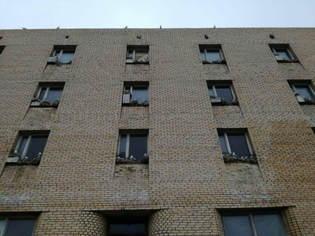
The seagulls have taken over Pyramiden.
Today, Pyramiden again has a permanent settlement, but the population is slightly reduced – to around 10 people. Hotel Tulipan started up in 2015, and guided tours are organized from Longyearbyen by boat in the summer and snowmobile during winter time.
And the bath? Knut grabbed the chance to do his northernmost bath to date: 78°39′ north. In order not to stress the guide unnecessarily, it was a dip in the harbour. When Pyramiden was built, a distinction was made between the technical installations and the housing. The bath in the harbor therefore did not take place in an idyllic Soviet living- and bathing area.
Cold and blurry, but certainly refreshing water!
And after the bath? Then it was just a matter of standing in line to enter the gangway.
Knut in classic sightseeing outfit 78°39′ north.
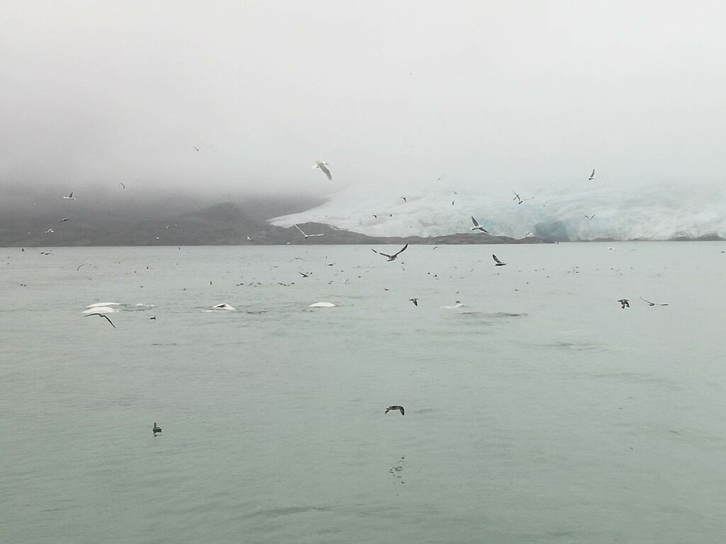
The highlight of the return trip was the visit in front of the Nordenskiöld glacier, and the many beluga whales that were swimming in the foreground.
Belugas in front of the Nordenskiöld glacier.
With this sight, it doesn’t matter if the weather is foggy!
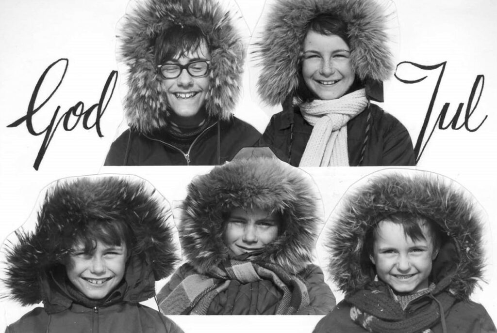
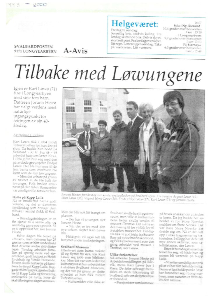
In 1999, Idun’s older sister Jorunn celebrated her birthday at Spitsbergen, where the 5 ‘Løwø Children’ grew up.
The Løwø Children anno 1970.
The first part of the program was a guided bus tour in Longyearbyen, where the guides were ‘The Løwø children’ themselves.
The Løwø Children anno 1999. Photo: Svalbardposten
The birthday dinner took place at ‘Huset’, and the following day we went to the cabin at Kapp Laila. For many years our mum Kari and dad Fridtjof had a cabin in Adventdalen (below Operafjellet), but it was inaccessible all summer because of the big rivers. In 1982, they took over a working barrack from Birger Pedersen, and this was to become the new cabin – at Kapp Laila, midway between Longyearbyen and Barentsburg. The cabin was therefore ok. But how to move it from Longyearbyen to Kapp Laila?
Cabin on the move in ‘Isfjorden’, 1982. Photographer: Unknown.
The answer was: On a raft! After all, they had a 16-foot boat called ‘Hårek’ with a 50-horsepower engine in the back. No problem, right? Extra muscle power was hired via their youngest son, Frode. However, he was tired after working double shift in mine 3, and needed rest. And he got that – on the coach in the cabin while it was on tour. The towing took 24 hours. Conveniently enough, there was a wood stove in the cabin, so they could even make coffee on the way.
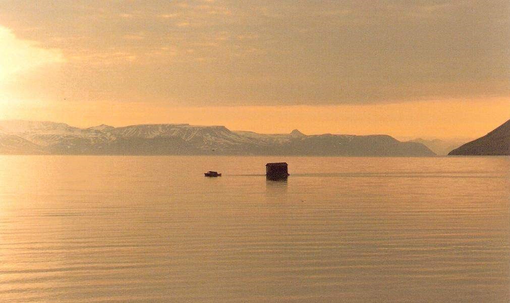
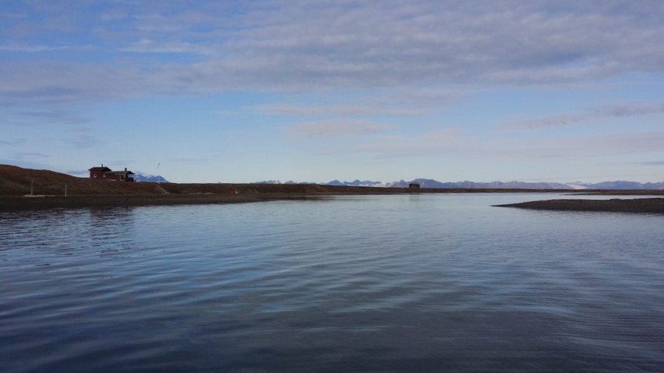
Kapp Laila is accessible both summer and winter, but there is a ‘but’ during summer season. The cabin is located by a lagoon, which is so shallow that you have to plan arrival and departure times according to the tides.
The Kapp Laila lagoon at high tide. The dog club’s cabin in the background.
We stayed and celebrated our sister at Kapp Laila for a whole week, and it was splendid weather every single day. So we rigged some driftwood as benches, and barbecued by the sea every afternoon. Fabulous! The first night we were so many guests that there wasn’t room for everyone indoors (Jorunn had also rented two neighboring cabins). Idun and Knut therefore slept in tents outside, as Idun’s eldest brother Asgaut also did. ‘What about the polar bear risk?‘ Knut asked. ‘There’s no risk‘, Idun replied: ‘The Løwø family never sees any polar bear‘. And with some red wine in the body, it was easy to fall asleep in the midnight sun… and just as suddenly wake up the next morning to outside noises. Idun jumped up and picked up the rifle that was hidden under the sleeping bag. Was it actually a polar bear? The zipper in the tent was carefully pulled down, and Idun looked out: ‘What’s going on?‘ It was Asgaut who had crawled out of his tent: ‘I don’t know if I’m most afraid of polar bears or lying on top of a gun – there will be no more sleep anyway!‘ The next night we moved into ‘Bikkjebu’, the dog club’s cabin , and felt safe there.
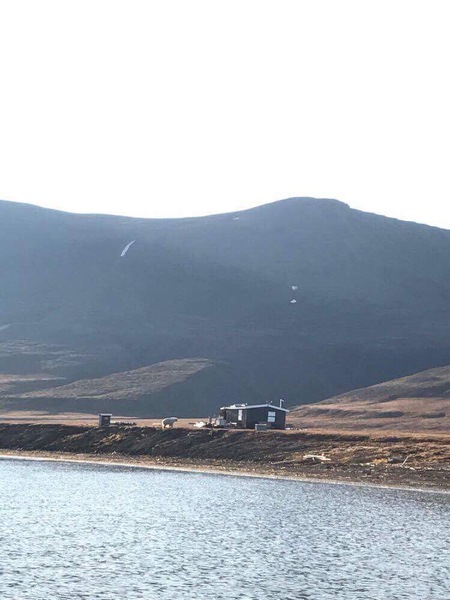
Polar bear visit by the Kapp Laila neighbours 2021. Photographer: Svenn Are Johansen
One night after playing ‘Mattis’ (card game) for hours (in traditional student way, the looser (‘Mattis’) from the previous round had to wear a funny headgear, read: a sleeping bag cover), we found out that time was just right to swim in the lagoon. It was a wonderful midnight sun night. What could go wrong? Well, the tide could obviously be of the wrong type… This night water was definitely low, and we realized that at low tide the lagoon consisted of equal parts (15 cm / 15 cm) water and mud. We had a dip, but this bath is not really recommended by ‘Tobatheornottobathe’. But sunbathing in the midnight sun? Yes, that is something we will recommend! Doesn’t do much for the tan, though…
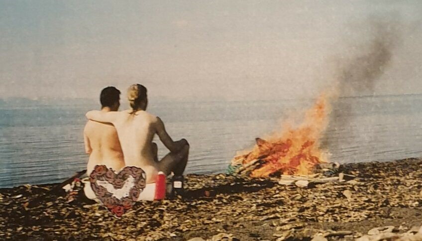
Midnightsunbath at Kapp Laila 1999.
And the polar bear? A bear mother with two cubs attacked the fridge (= a tub with food under the balcony at the north wall) one week later. Tobatheornottobathe had left Svalbard by then, but those relatives remaining are still talking about the incident.
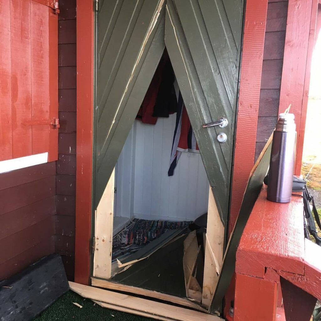
Bear flap made by the polar bear itself (but not in 1999). Photo: Svenn Are Johansen
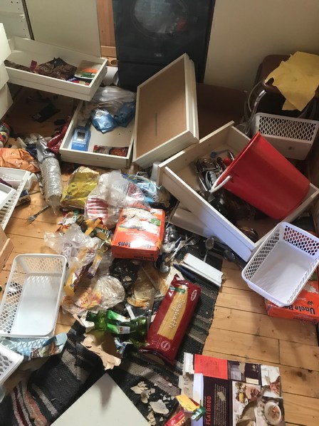
Depending on the mood, it doesn’t need a door either, the polar bear can just as well punch itself through the wall. And why does it do that? In search of food, of course. The polar bears are very fond of chocolate, but not all kinds of food are appreciated, as you can see in the next photo (also from the cabin at Kapp Laila, but not in 1999).
Uncooked rice or pasta isn’t the first choise for polar bears. Photo: Svenn Are Johansen
In 1999 the three bears broke into cabin after cabin, but were shot as they arrived Barentsburg. The Russians don’t let the bears rule their lives.
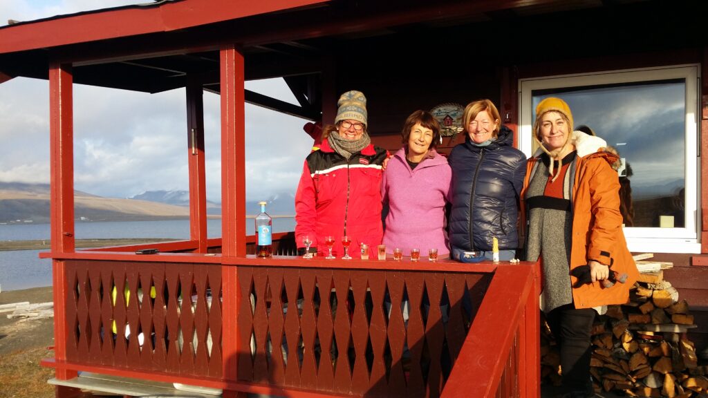
Jorunn’s birthday celebration some 20 years later. The lagoon in the back left.