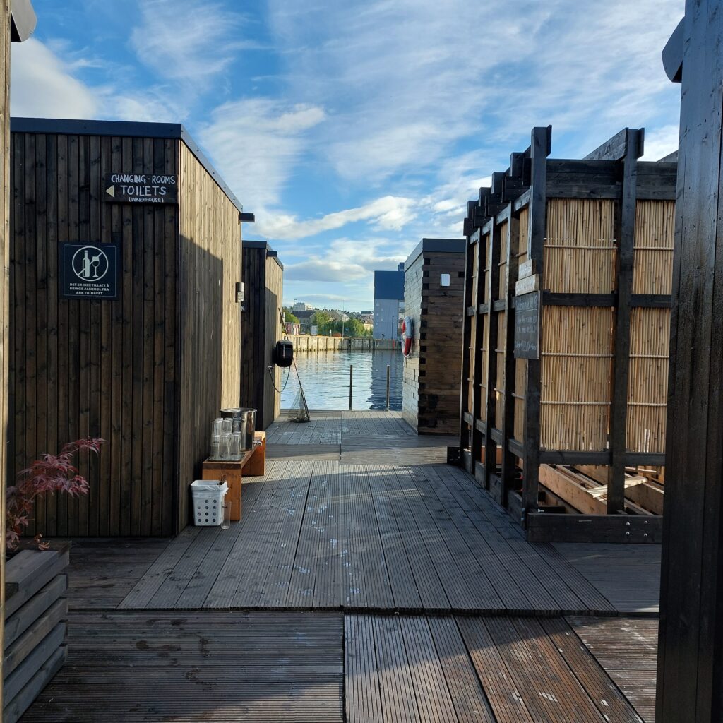
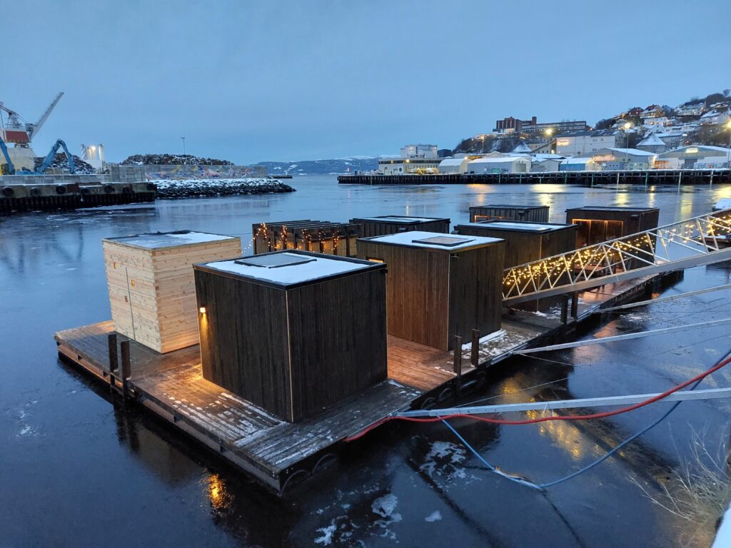
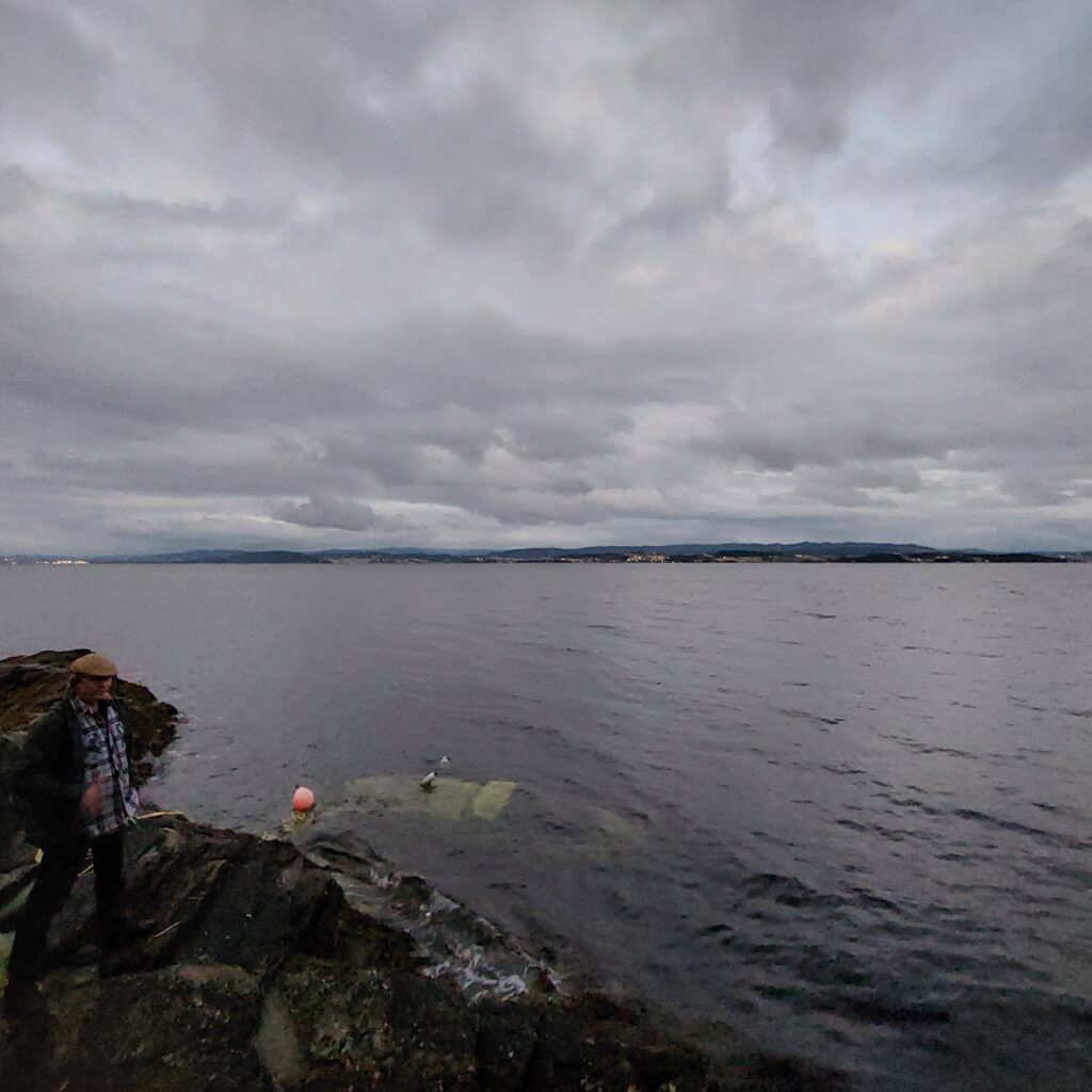
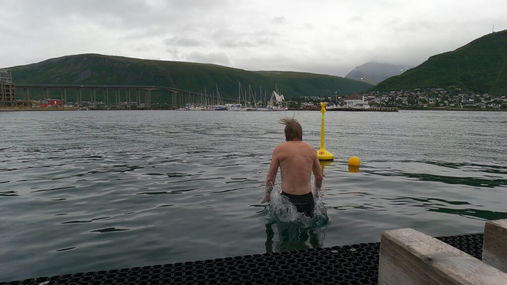
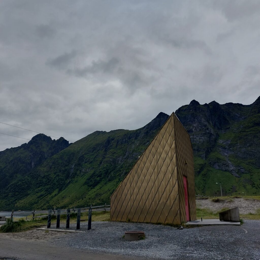
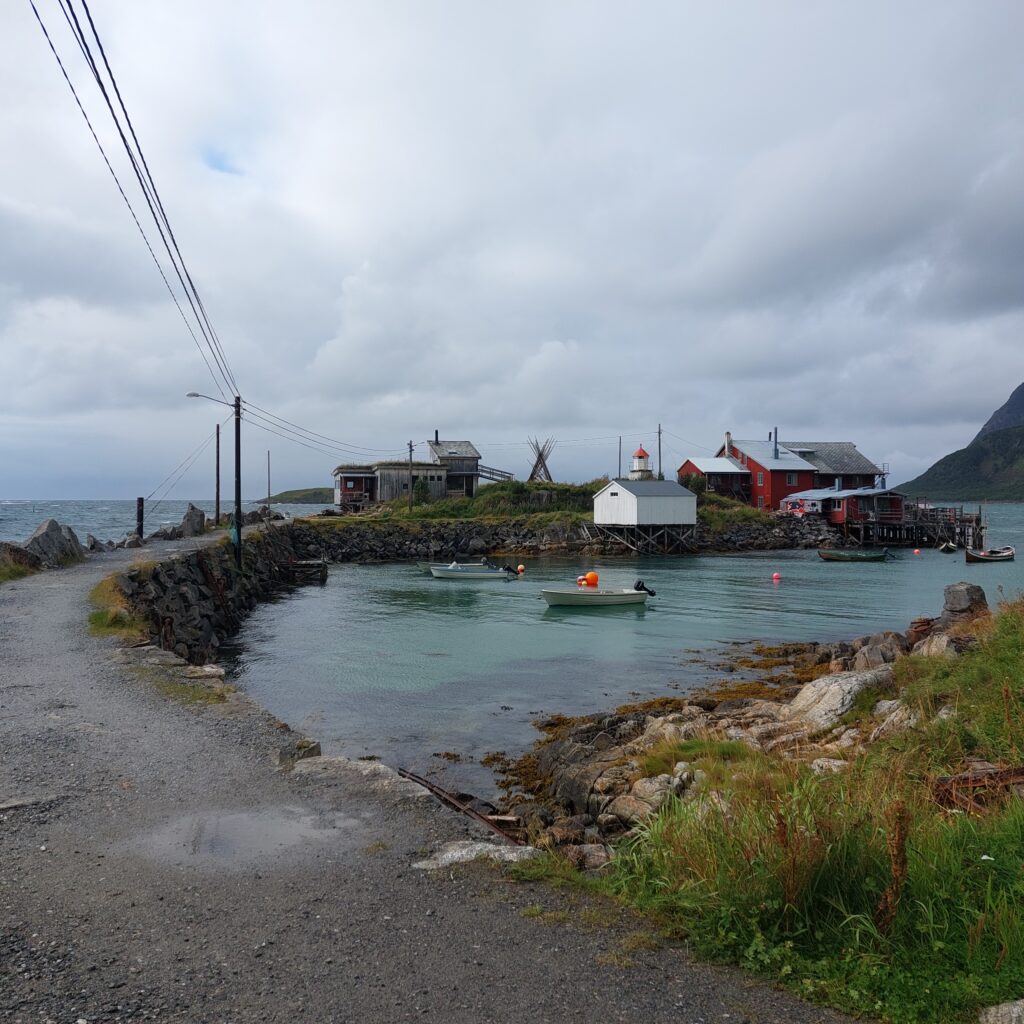
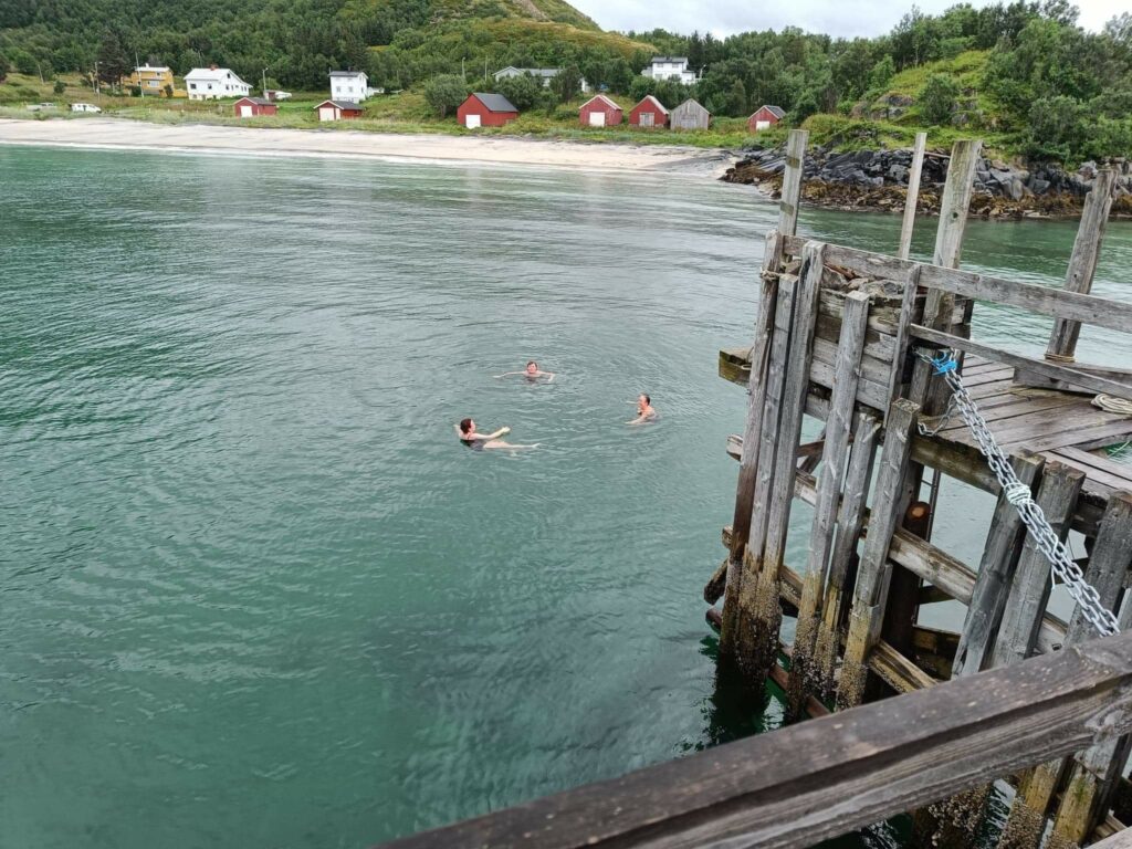
Nyhavna (the new harbour) in Trondheim has for a long time been ready for urban renewal. The industry is retreating, and the municipality wants to make Nyhavna a brand new district. Here, a mixture of offices, apartments, culture and artistic arenas is planned. One of the most positive things that has happened so far in this transformation is ‘Havet’ (The Sea). Just a short cycle ride from the center you have a varied offer for sauna bathing and swimming in the Trondheimsfjord.
There are many saunas at ‘Havet’.
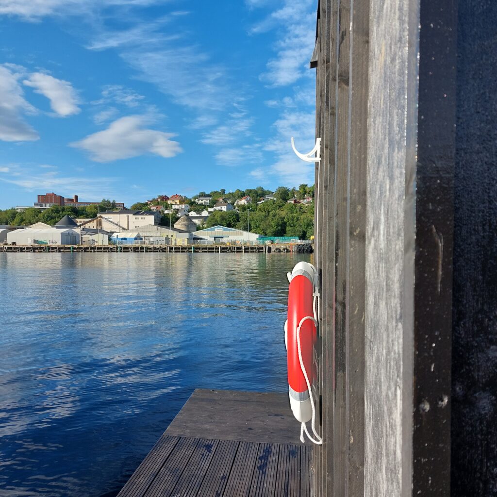
The location is such that you have a varied view:
… towards the industry at Ladehammeren in the east.… towards the scrap dude (metal recycling) in the north.… towards Dora 1 (submarine bunker from WWII) in the west.
Alternatively, you can of course be the view yourself:
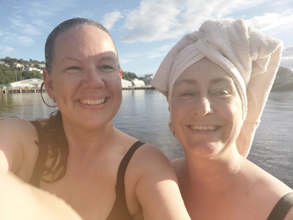
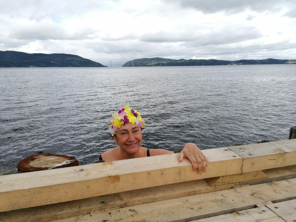
Kjerstin and Idun as ‘Bellaview, bellaview, bella ciao ciao ciao‘. Photo: Kjerstin Moseid Bryhni
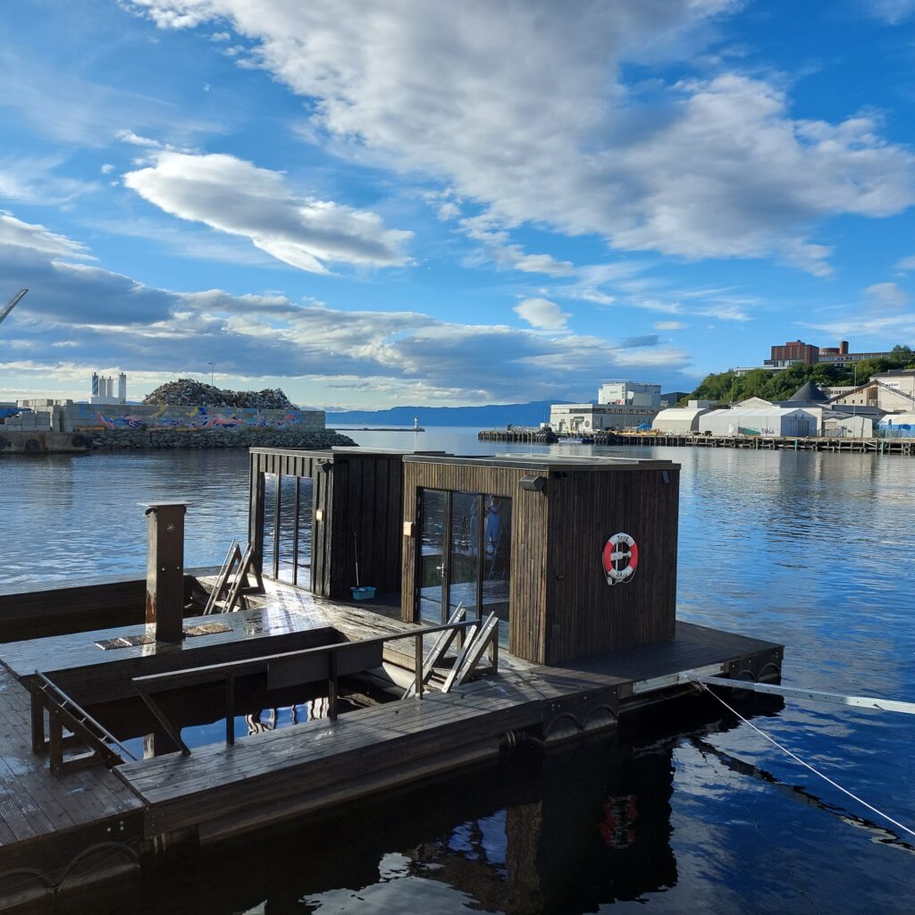
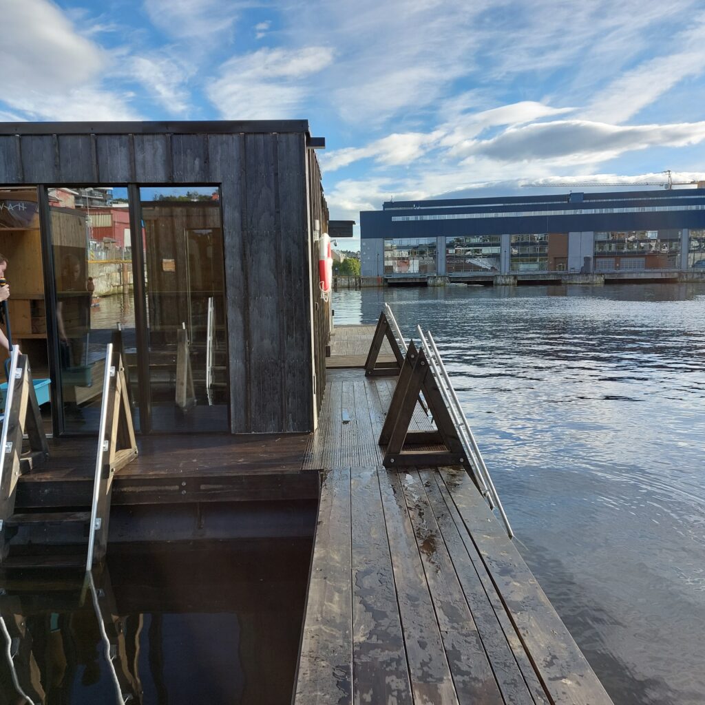
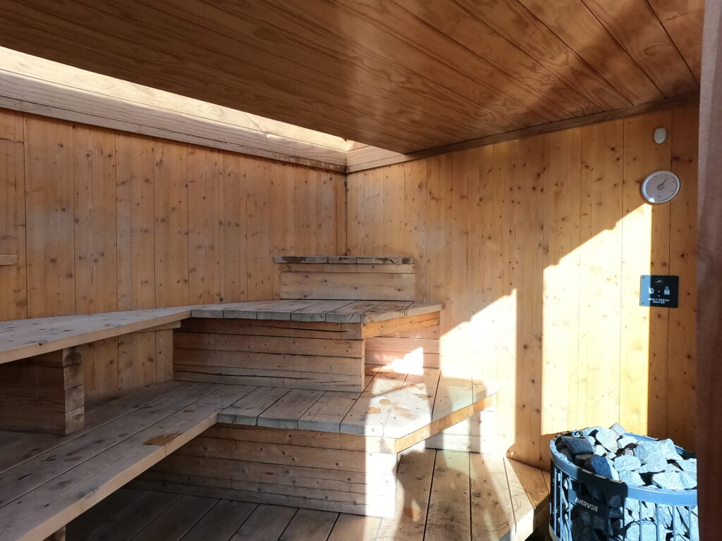
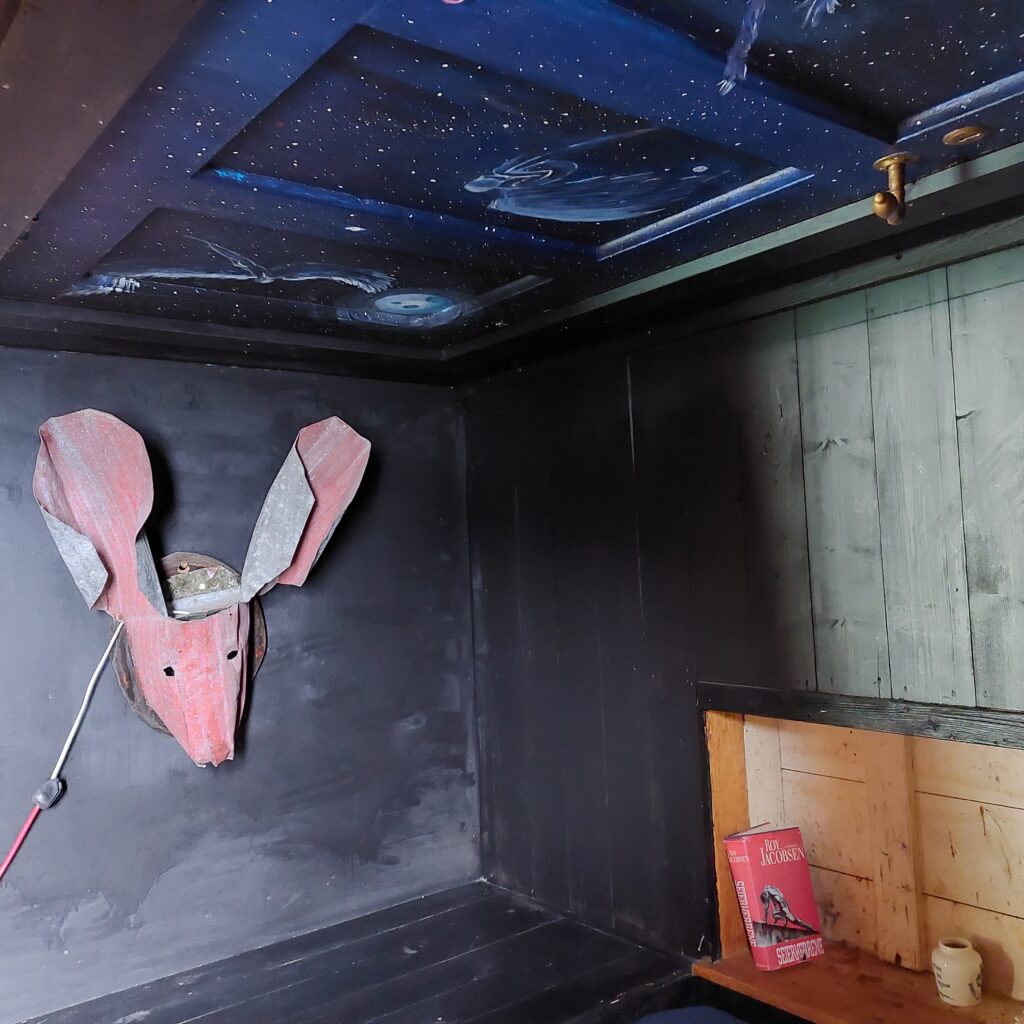
At Havet, you can book single hours or whole saunas for 2 hours. Try it! This is splendid! The furnishings (benches) are spread out in different levels and odd angles, you don’t have to sit in a row if you don’t want to.
Many different angles in the saunas.
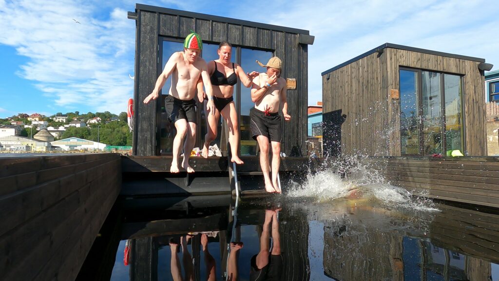
Cold baths are carried out in the openings between the saunas.
Yes! We are all really looking forward to this!
Some of us where missing some steps up to the roof, to be able to jump from there, as we have seen on other floating saunas.
A couple of hundred meters away, the municipality has built a diving tower in collaboration with Havet. There you can jump and swim for free. But it is just a little too far from the saunas to function as a common facility.
During ‘Kulturnatt Trondheim’ (Cultural Evening Trondheim) in 2017, there was a competition ‘What is your dream for Nyhavna?’ Our bathing friend Taru won, with the answer: Sauna. But she won by a lottery draw, the idea in itself was considered undoable both by the municipality and the consult bureau arranging the contest. But now they are here, a lot of saunas!
Thank you so much, Taru, for an absolutely brilliant idea! For once, it happened in Trondheim that all this came into place quite suddenly, without a long-term localization debate and a lot of back and forth.
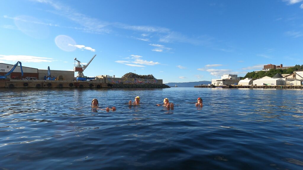
Nice to float on the outside too.
Our sauna had a ceiling partly made of glass. Imagine sitting here and enjoying the stars in the sky and maybe the aurora borealis in winter time?
Havet is nice in winter too.
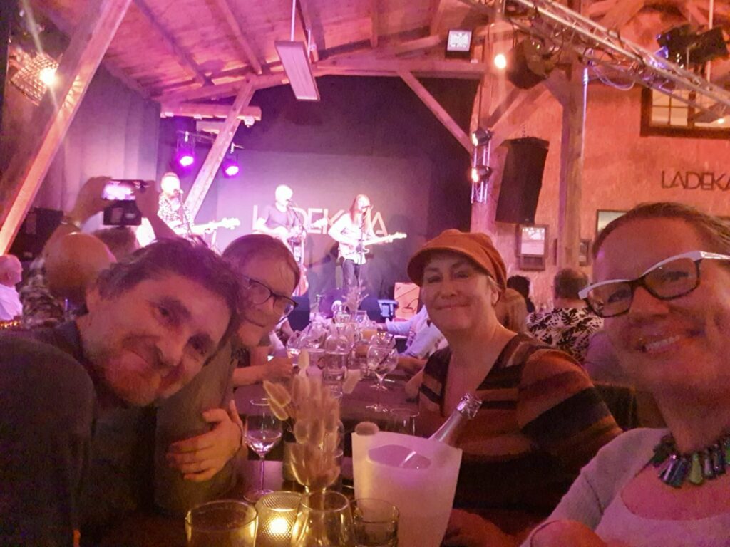
In not too long time, the sauna concert concept at Havet will probably start up again, and then you can experience a sauna and a concert – at the same time! However, we had do to the concert part another place and ended the evening at Ladekaia, watching Vømmøl.
Bathing and a concert the same evening is just right! Photo: Kjerstin Moseid Bryhni
From the beautiful wooden town of Levanger there goes a ferry to Hokstad on Ytterøya. Bring your bike and discover this pearl in the inner Trondheimsfjord!
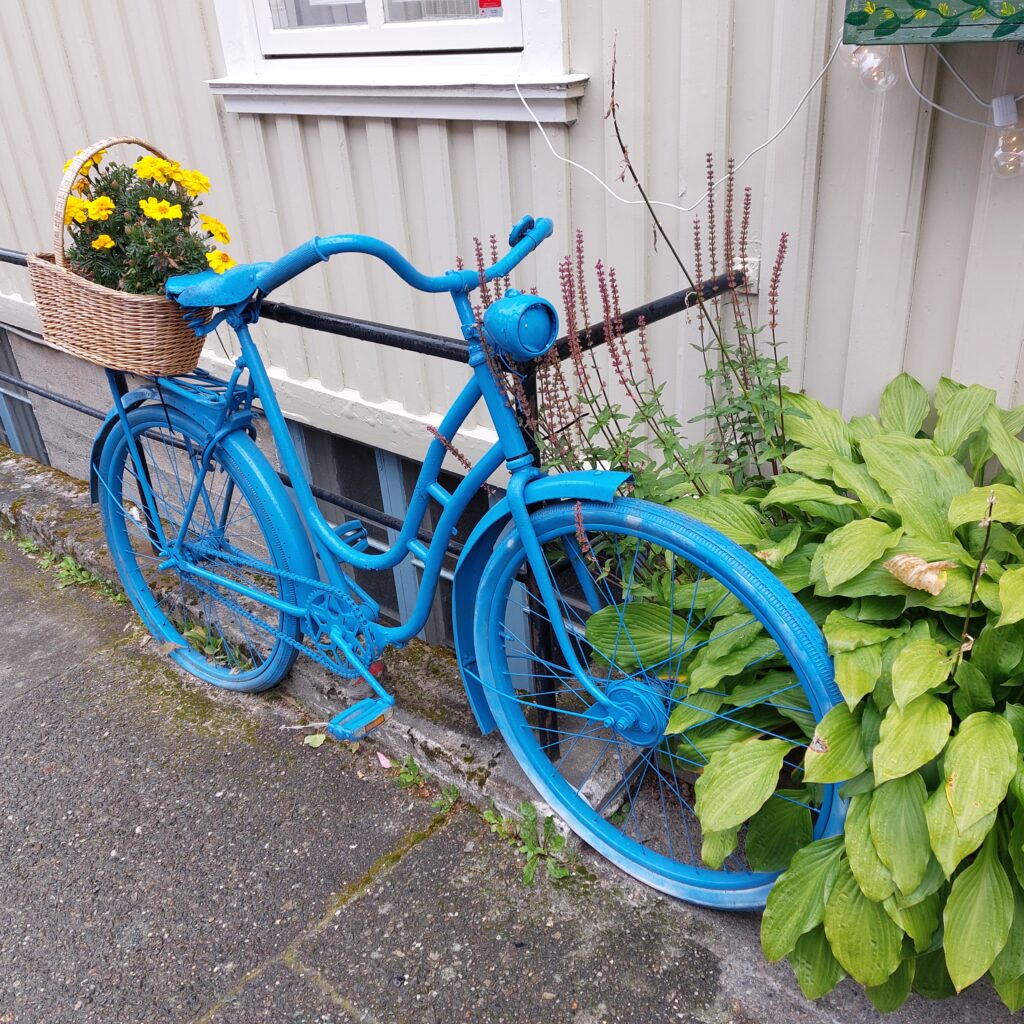
A bike from Levanger that didn’t follow us to Ytterøya.
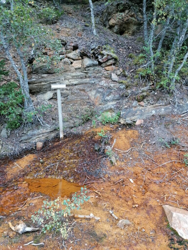
Just east of the ferry quay at Hokstad, there are remains of Ytterøy Kopperverk. Mining on Ytterøya started as early as 1630, as one of Norway’s earliest mines. 5-600 people worked in the mine around 1870. The copper works were sold to an English company and renamed “Ytterøy Mining Company”. The English owners settled on the island, and the mine had the largest production in the country. The peak year was 1867, when 35,000 tonnes of ore were shipped out (95 tonnes per day). This corresponded to 25% of the world’s needs. The ore reserves were largely exhausted by 1880, and activity declined accordingly. Operations were closed down in the interwar period. It can be dangerous to explore the mining area, please do follow the paths! In the spring of 1870, there was a large mudslide by the mines. 7 people died, including 3 children.
In the 1840s/50s, the Ytterøen mines were set up to extract pyrite. This was to be used for the production of sulfuric acid at the Leren Kromfabrikk in Trondheim, but that project failed.
Remains from the mining, east of Hokstad on Ytterøya. Photo: Yvonne Thuv
We lived in Skolbakken (the School Hill) east of the mines when we were on Ytterøya this summer. It’s nice here! Our hosts, Yvonne and Jens, needed help salvaging their submarine, but we spent so much time sightseeing, swimming and time together, that no help came out of it.
The hosts’ submarine was a little too much into its perfect element.
The road through the forest became a fascinating affair. Here is a viking ship of a very special type:
The viking ship ‘Yttereyar’.
The bathing took place in Kabelvika, where the power cable to Ytterøya was landed earlier. Here there are a lot of pebbles! Our recommendation is to use wet socks or preferably swimming shoes in such cases, but of course we didn’t remember to bring them. For our evening bath, there were 4 of us, each with their own solution to the problem:
Idun wore her sandals all the way down to the water front.
Knut stepped over the pebble field without caring much about it.
Jens didn’t bathe.
Yvonne committed to the the Finnish national sport of wife-carrying.
Successful wife carrying.
Apart from the pebble problem it was a really nice bath at dusk. From Ytterøya’s south side, you can see a lot of lights from Levanger and Fiborgtangen. Wife carrying baths on Ytterøya is just right!
Nice twilight bath on Ytterøya. Photo: Jens Vigen
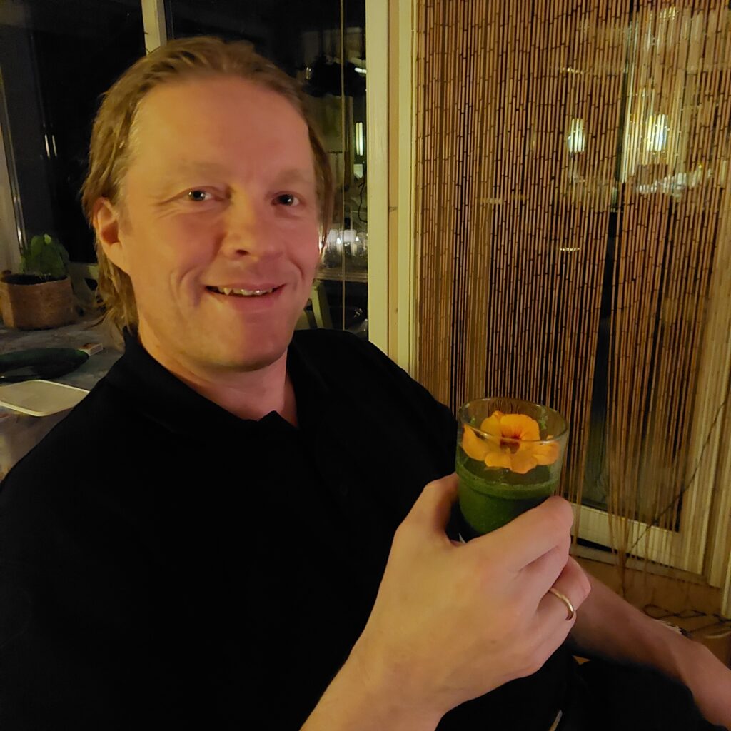
After a bath, time is perfect for going on a visit. It was Hauke’s birthday, so we went home to Randi and Hauke. He wanted a visit of the Norwegian King and Queen for his birthday, but since he had forgotten to send the invitation, Hauke had to be satisfied by a couple of neighbours, as well as a couple of Trondhjemmers with accordions. Good enough, right? On a birthday visit, time is perfect for a taste of ‘Grønn Glede’ (Green Happiness). It was very, very green, but you survived, Knut? Extremely healthy this is!
‘The very first steamship to enter the Trondheimsfjord was the English Georg Canning, in 1837. During a stay in Trondhjem, the ship was rented out for a pleasure trip to Steinkjer. Everywhere, the steamship caused great excitement and sometimes horror. In Mosvik, the men resolutely refused to row out to the ‘Smoke boat’ (“Røykbåten”), which could go against both wind and current.‘ (From the information board at Jørstad)
15 years later, a fixed route network was established at Innherred, served by steamships. On Ytterøya, Jørstad was listed as a port of call from 1850.
Jørstad, on the north side of Ytterøya, with a view towards the Skarnsund bridge.
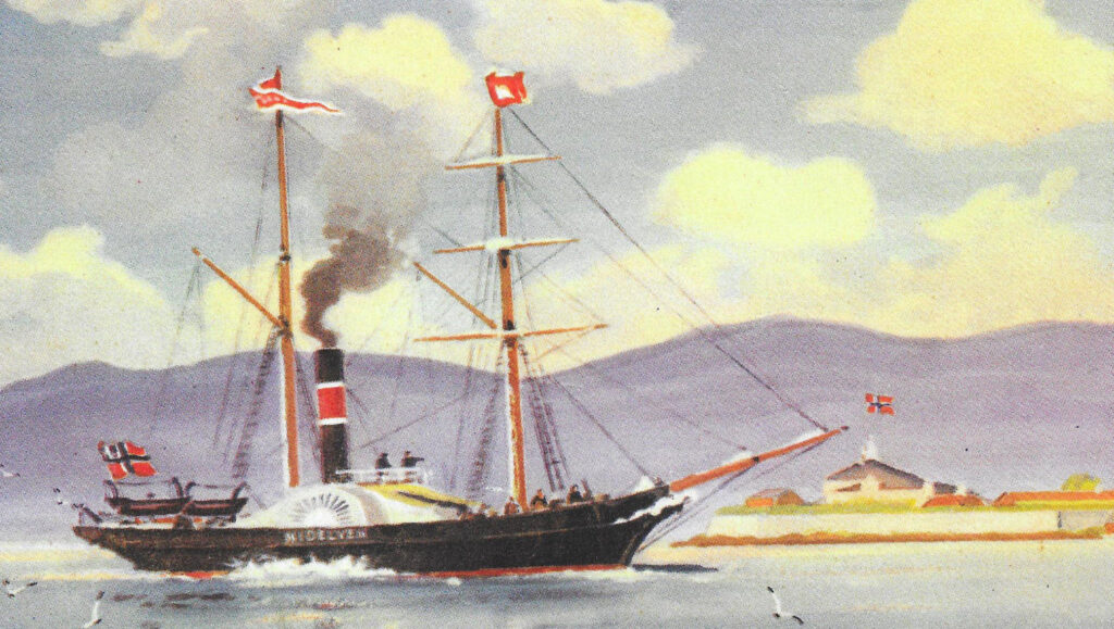
‘D/S “Nidelven” was built in Trondhjem and was the first passenger steamship to be made in Norway. The hull was built at Trondhjem’s shipyard, it was made of pine, copper bolts and skin. The boiler and machine were built and installed by the Factory at Nidelven (now Trondhjern’s Mech. Verksted).’ Today the factory contains apartments, where we lived ourselves in the 1990’s. Coal consumption was 3 barrels per hour. The first trip was made on Trondhjemsfjorden on 24th of November 1850, including singing, music and great festivities.
Ordinary people did not immediately become familiar with ‘Nidelven’. The farmers simply called it ‘Røykbaaten’ (the Smoke Boat). Photo: WikiStrinda
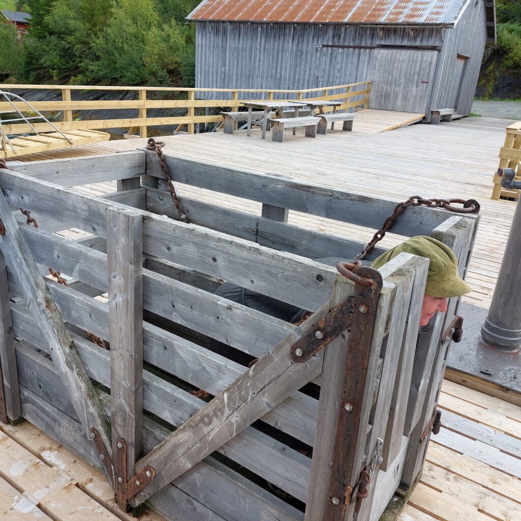
In the first years there was no quay at Jørstad, people and goods were rowed out to the steamship. Indherred’s Aktie-Dampskibsselskab built the quay and the ‘Litjpakkuset’ (the Little Warehouse) at Jørstadsjøen in 1930. Now the goods could be hoisted directly on board. For easy lifting of horses and cattle, the steamship had its own cattle box. A cattle box copy can be found on the quay, and Idun just had to try it.
Idun practices becoming a cow.
D/S Nidelven’s route at Innherred was a big disappointment, as the traffic in no way covered the expenses. Travel by steamship was considered luxury. People from Innherred traveled to Trondheim mostly by small boats. This took time, but then they could also spend the nights in the boat while they were in town, and a city trip usually took a week or two. The ‘Nidelven’ was later put into different coastal routes, but that was not a success either. She was too large for fjord shipping and too small for coastal shipping, and was scrapped on 18 October 1895 after many years out of circulation.
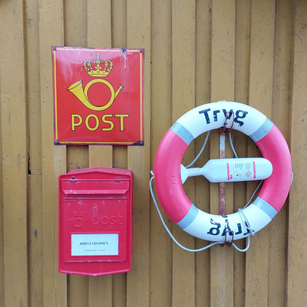
A mailbox, but no service at Jørstad.
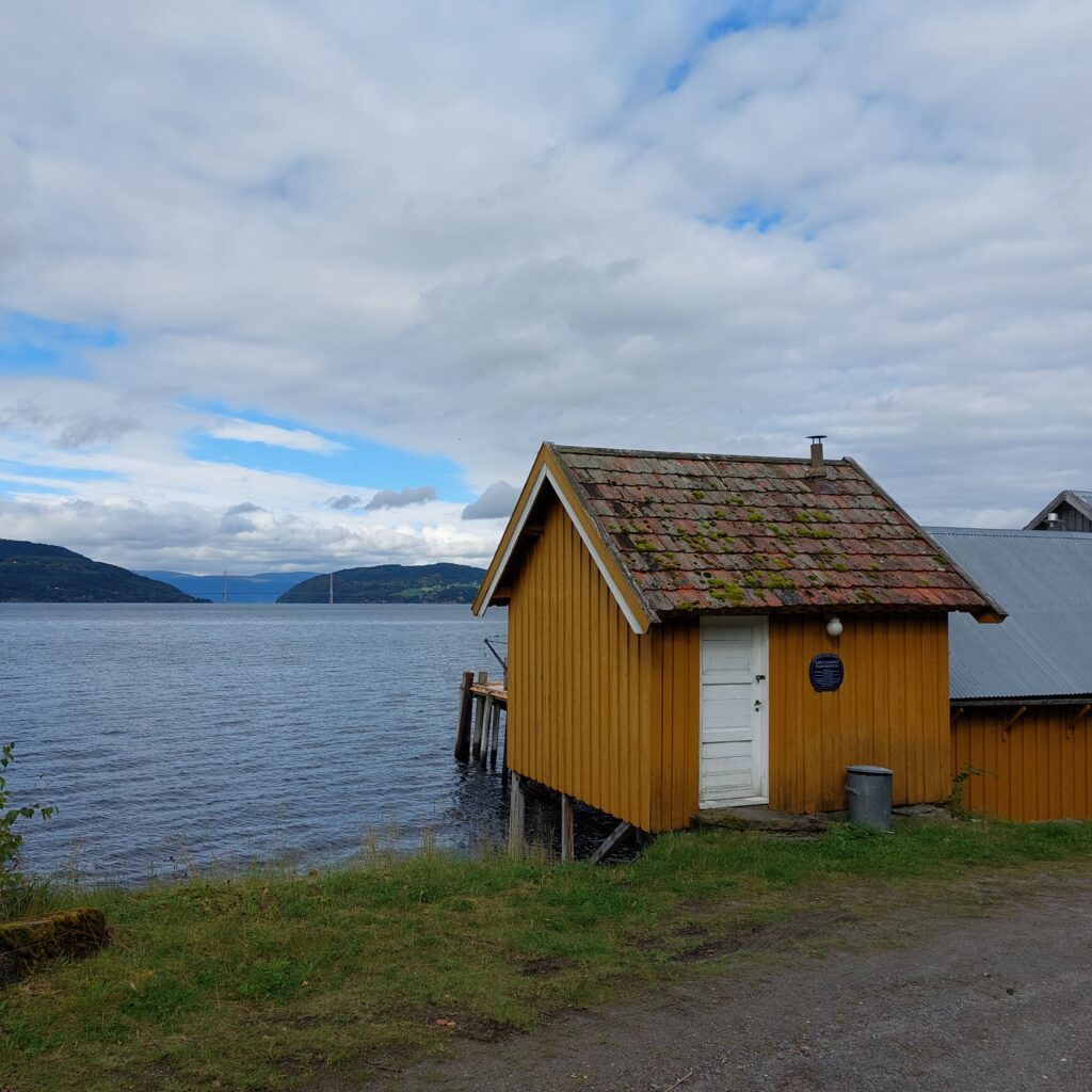
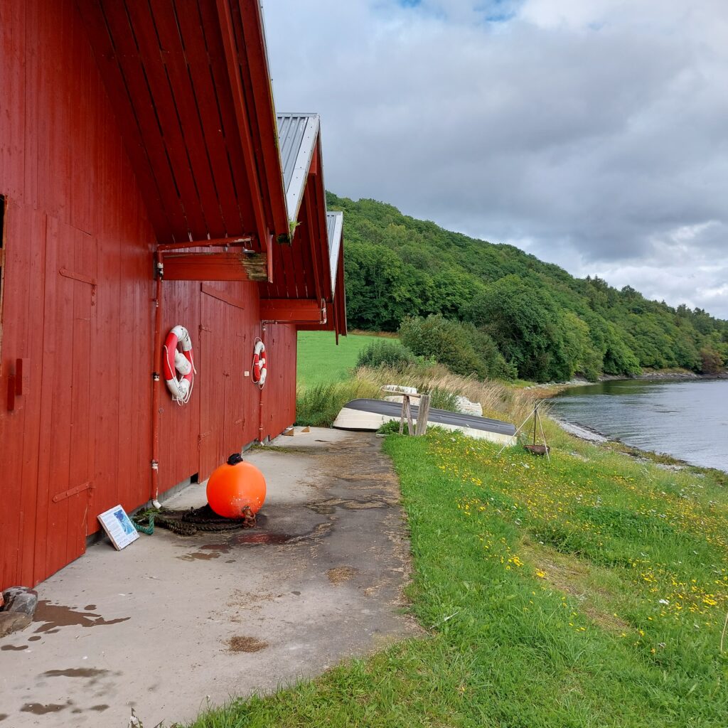
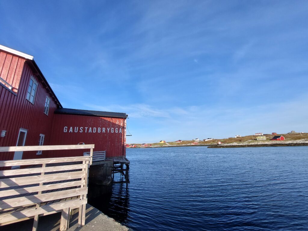
We took a commemorative bath for the steamship traffic from the beautifully restored quay. It was ‘Stiftelsen Ytterøy Bygdetun’ who started work on the quay in 2005.
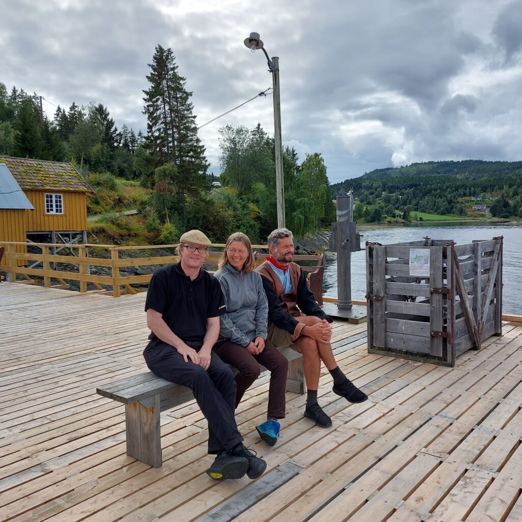
It’s nice at Jørstad! Photo: Yvonne Thuv
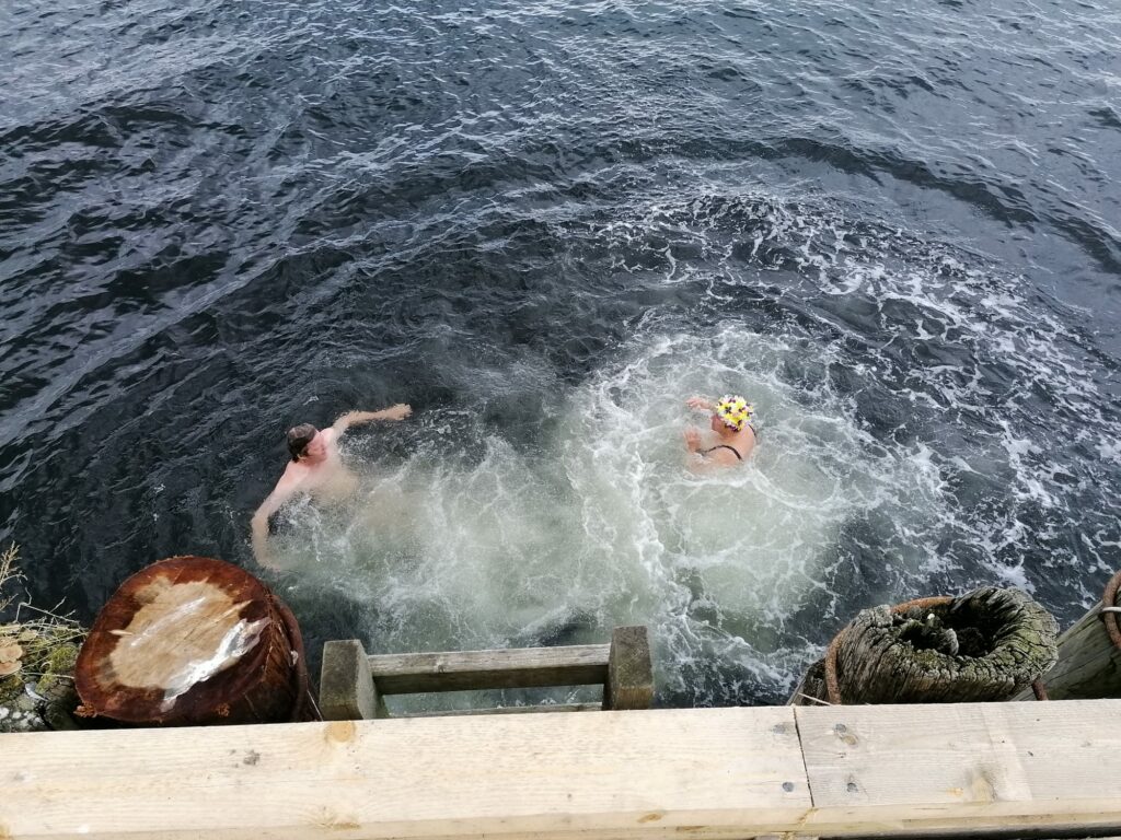
Then it was just a matter of jumping in!
A bath from Jørstad Dampskibskai is just right. Photo: Yvonne Thuv
The last boat that went between Trondheim and Steinkjer was the motor ship “Steinkjer”. The boat was purchased by Indherreds Aktie-Dampsibsselskab in 1968, and put into service in December the same year. On 12 September 1974, “Steinkjer” made its last passenger and freight trip between Trondheim and Steinkjer. After 118 years, there was definitely put an end to the continuous passenger traffic by boats to and from Steinkjer. However, the story does not quite end here. If you’re lucky, say in early August, a steamship may still appear.
Maybe the sail steam ship Hansteen will come? Knut, Yvonne and Jens are waiting anxiously.
Sources: WikiStrinda, ‘Gamle Dampen’ by Olaf T. Engvig and Jørstad info board.
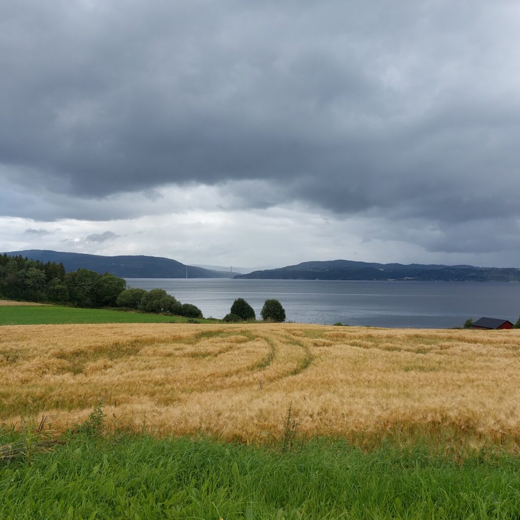
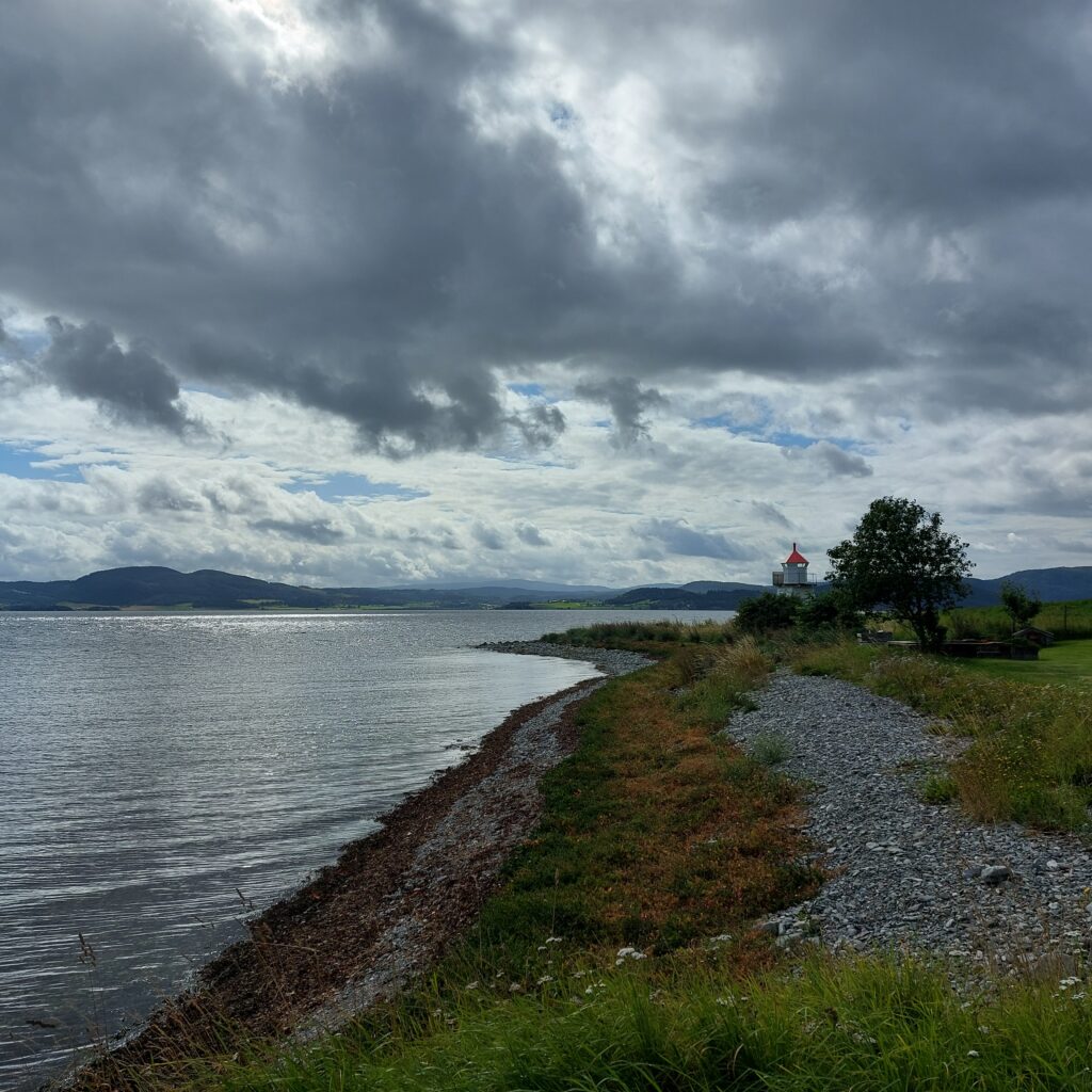
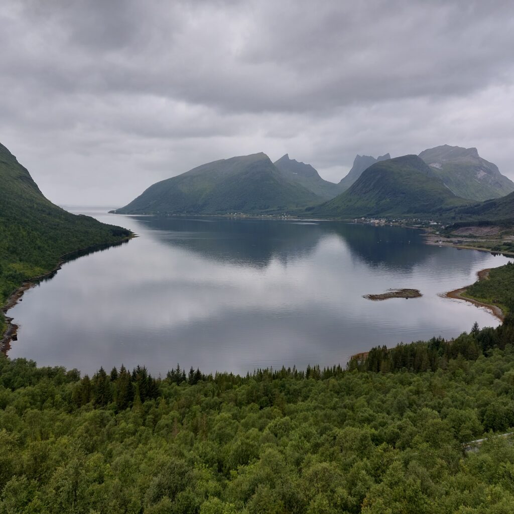
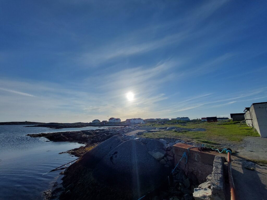
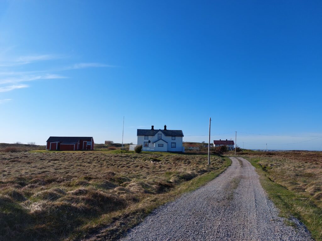
Far, far away, in the inner part of the 126 km long Trondheimsfjord lies a pearl: Ytterøya (the Outer Island). You might find this slightly unlogical, but the name is logical enough, since Ytterøya lies outside Inderøy (the Inner Island) (which is actually not an island but a peninsula). The ferry to Ytterøya leaves from Levanger in the southeast, which is twice as far away from the island as Mosvik in the northwest, but somehow that is probably logical too. The island is small enough for you to leave the car at the mainland and take the bicycle instead. Once up from the ferry quay, turn left and cycle around the largest (western) section first. It is beautiful at Ytterøya!
By the church, with a view north-west towards the Skarnsund bridge.
The island is 13.5 km long and 4.3 km wide at its widest, with a varied and sometimes rather hilly landscape. The soil is rich on nutrients, and together with marine deposits, this provides a rich flora. Ytterøya has been inhabited for more than 5,000 years. In earlier times, the island was divided in two (near the church), but land rising has made them connected. Both petroglyphs and burial mounds have been found on Ytterøya.
The inland on Ytterøya, also called the Prairie.
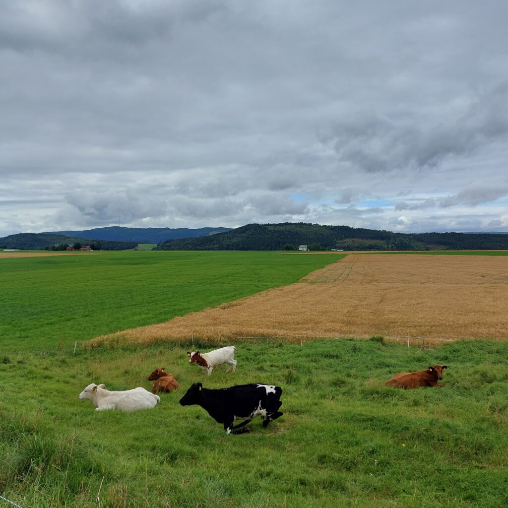
There are about 50 farms on the island, which has around 500 inhabitants. It is good to live here – also for the animals!
Happy atmosphere for people (?) and cattle on Ytterøya.
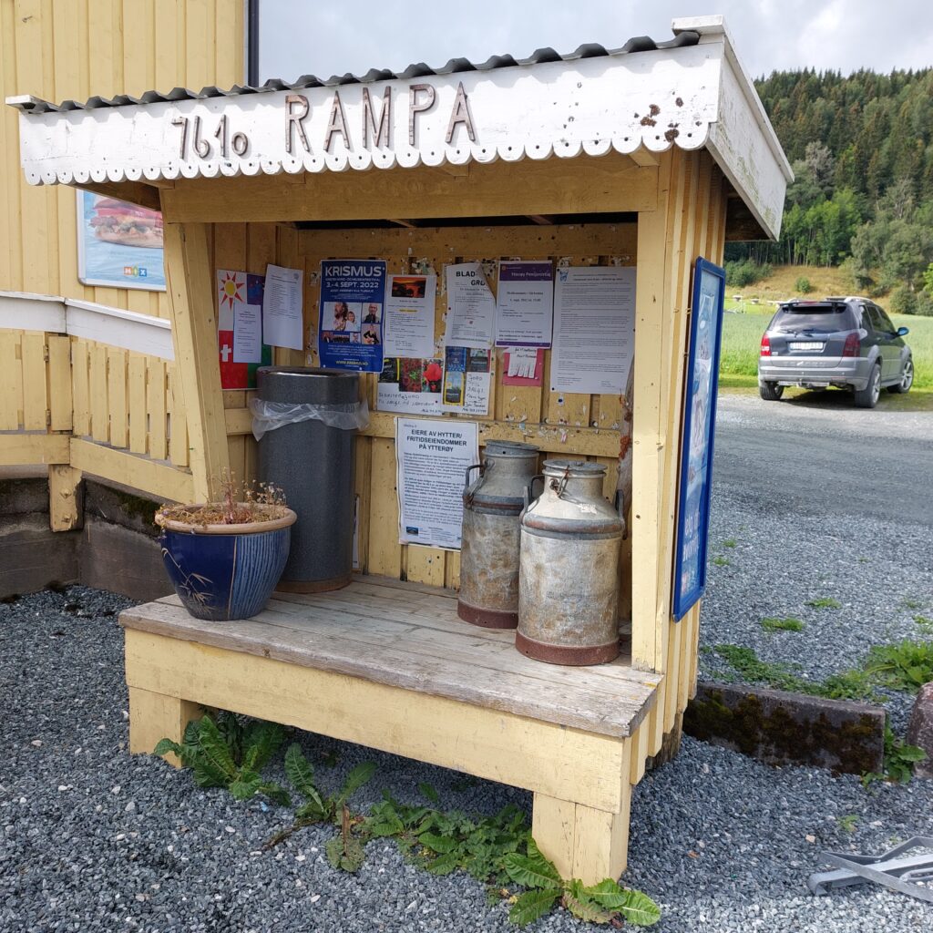
However, the groundwater has been sinking steadily in recent years, and the large chicken slaughterhouse has been decided moved, which gives some concerns about the future. Melkerampa (the Milk Ramp) in Midtbygda (the Village in the Middle) has grown a bit out of the old ways, so there you will find both a shop and a bar and quite a bit in between those two.
The Milk Ramp in Midtbygda.
There are many beautiful bays to visit for a bath at Ytterøya, but the sandy beaches are somewhat absent. Therefore, you’d better bring your swimming shoes if you don’t like walking on pebbles.
The Lighthouse at Ytterøya.
We went to the lighthouse to swim, it’s a beautiful place on the south side of the island, but perhaps a bit private.
Idyllic scene at Sørnesset, by the lighthouse. The black lump on the buoy is Knut’s swimming trunks (underwear, since he had forgotten his swimwear). The panties were almost forgotten here too.
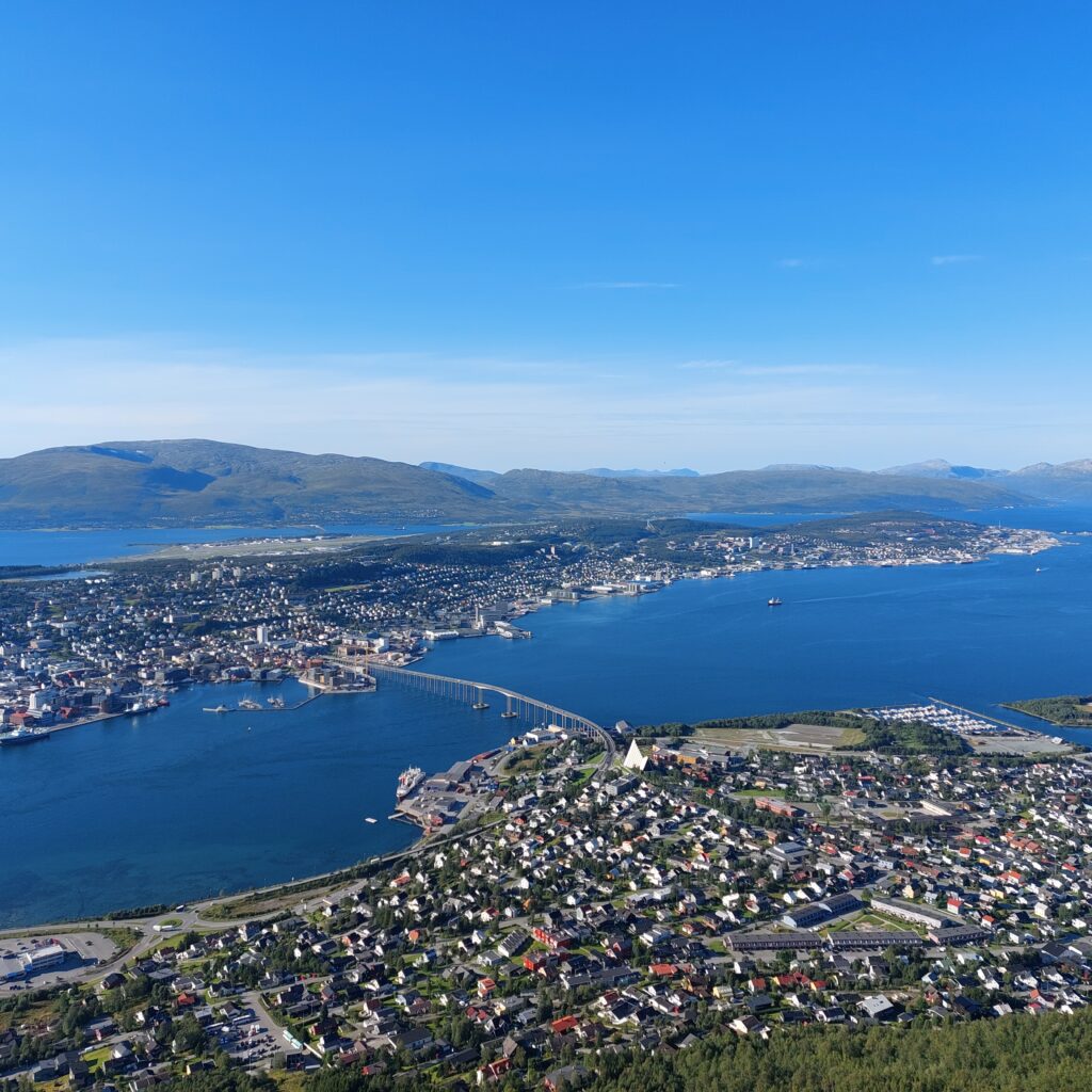
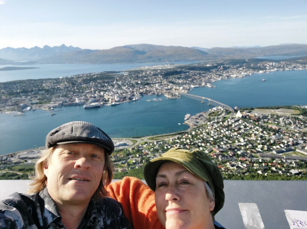
The name Tromsø comes from the Indo-European ‘straumr’ = to flow (the water in the strait). In earlier times, Tromsø was a kind of border to unknown territory. Tromsøya became ice-free 10,000 years ago, and there are traces of humans dating back 11,000 years. The church site of Tromsø is mentioned in written sources for the first time in Håkon Håkonsson’s saga: “He had the Christ Church built in Trum’s and made a christian parish there.” The cathedral in Tromsø is located at Tromsøya (Troms island), while the beautiful ‘Arctic Cathedral’ is located on the mainland, in the district of Tromsdalen (Troms valley), on the other side of the 1016 m long Tromsø Bridge.
Tromsø seen from the mountain lift. The white ‘Arctic Cathedral’ to the right of the bridge.
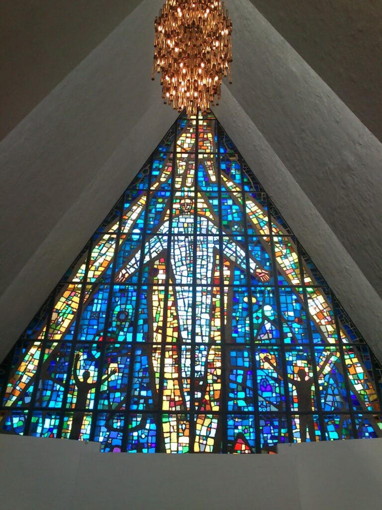
If you have a few hours free in Tromsø, we recommend a bus trip to Tromsdalen. Tromsdalen is a valley that leads from Tromsdalstinden (mountain) down to Tromsøysundet and Tromsøya (Tromsø). Arthur Arntzen made his debut with Oluf in Tromsdalen. Get off at Tromsdalen church (the official name for the Arctic Cathedral) and go inside. The Arctic Cathedral was inaugurated in 1965 and it is just beautiful! The shape gives associations to icebergs, and the glass fields between the ‘blocks of ice’ let light through both inwards and outwards. The church was designed by Jan Inge Hovig (he was married to Ingrid Espelid Hovig a whole week before he died of a heart attack). The entire eastern wall is decorated with stained glass.
The Arctic Cathedral is also beautiful seen from the inside.
From the Arctic Cathedral there are only 10 minutes to go to the mountain lift. Here you will find a splendid view towards Tromsø and the dramatic landscape that surrounds the town!
Tromsø seen from Fjellheisen (the Mountain lift).
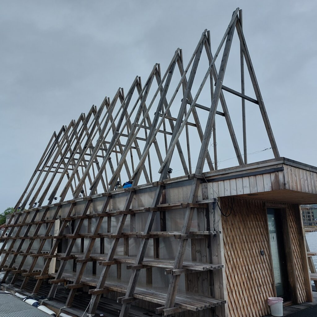
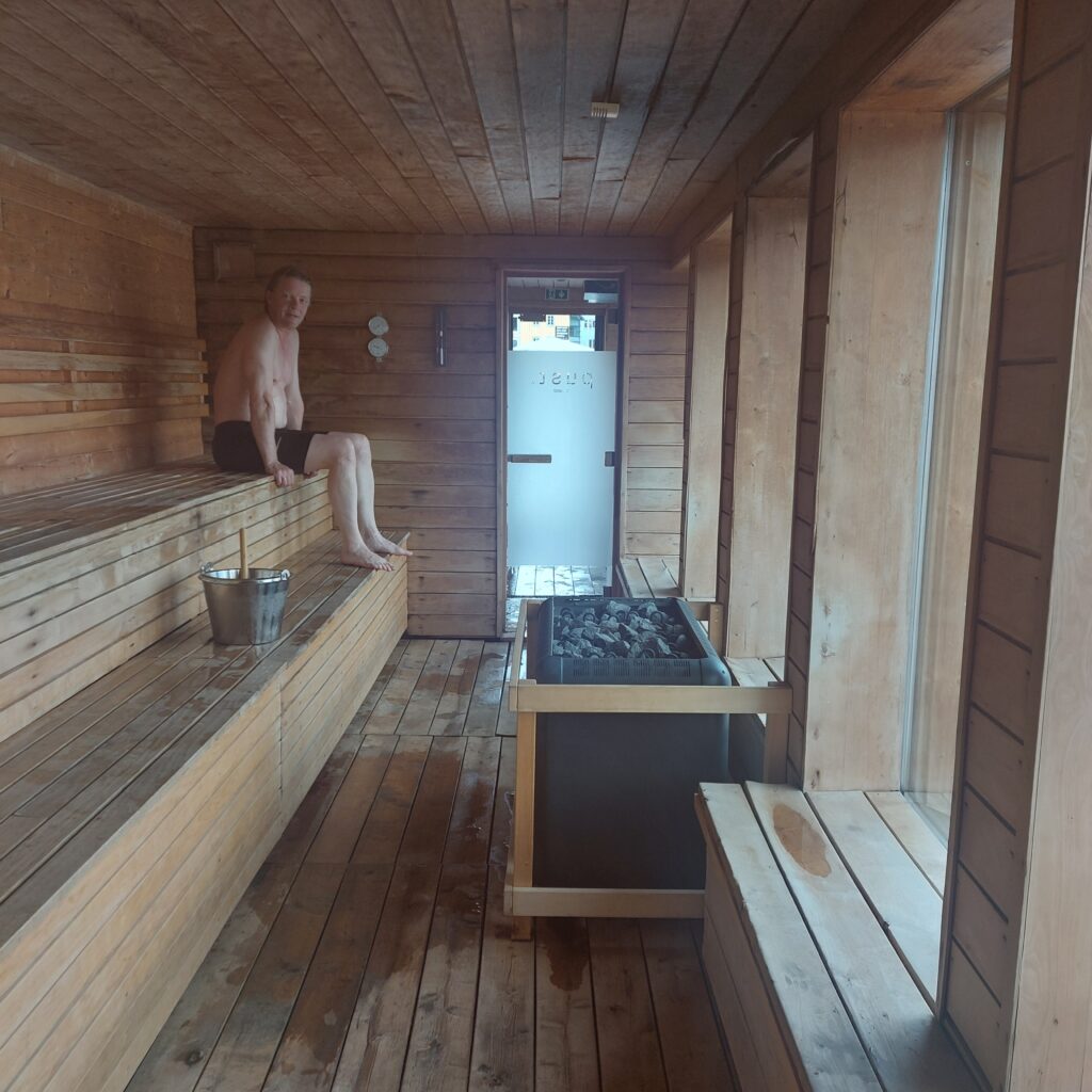
We defied the hints from Trip Advisor and planned a dinner with a view. It turned out as warned: 3 out of 5 dishes on the menu were sold out, so we had a burger dinner with a view. The burger’s fried mushrooms were very good. Nothing more to say about the food, really. After the view and food, a hot sauna and a cold dip is just right. Take the bus back and go to ‘Pust’ (Breathe).
Breathe here!
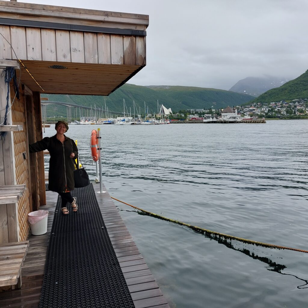
Pust is a floating sauna located in the middle of the marina in Tromsø. Highly recommended! The house functions as a human mountain. We observed several pairs of people climbing up and eating their lunch on the roof of ‘Pust’.
Mountain for humans?
Women and men have changing rooms on opposite sides, to meet in the sauna in the middle, with a brilliant view of Tromsdalen, the Arctic Cathedral and Fjellheisen.
From Pust there is a fabulous view towards Tromsdalen and the Arctic Cathedral.
The best thing of a sauna is that you hardly notice that the water is cold. Even in mid-August it was only 9 degrees. Is it cold water from the depths that is pushed up in Tromsundet?
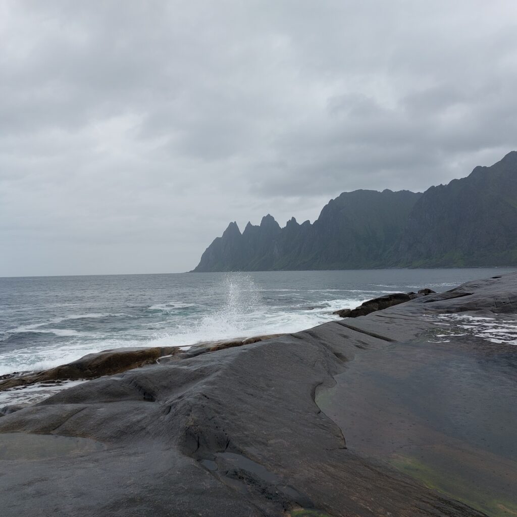
Senja is Norway’s second largest island, with an area of 1,586 km2 and around 8,000 inhabitants.
Bergsfjorden at Senja.
The island has a varied landscape, and has been called ‘a Norway in miniature’. Southern Senja is mountainous with an archipelago, rocky cliffs and pine forests. The inner/eastern parts consist of a friendly lowland with fertile hills and birch forests, while the outer and northern parts are wild with deep fjords and high mountains that run straight down into the sea.
Tungeneset (Cape Tounge) with the Ersfjord and Okshornan (Ox Horn Mountains) in the background.
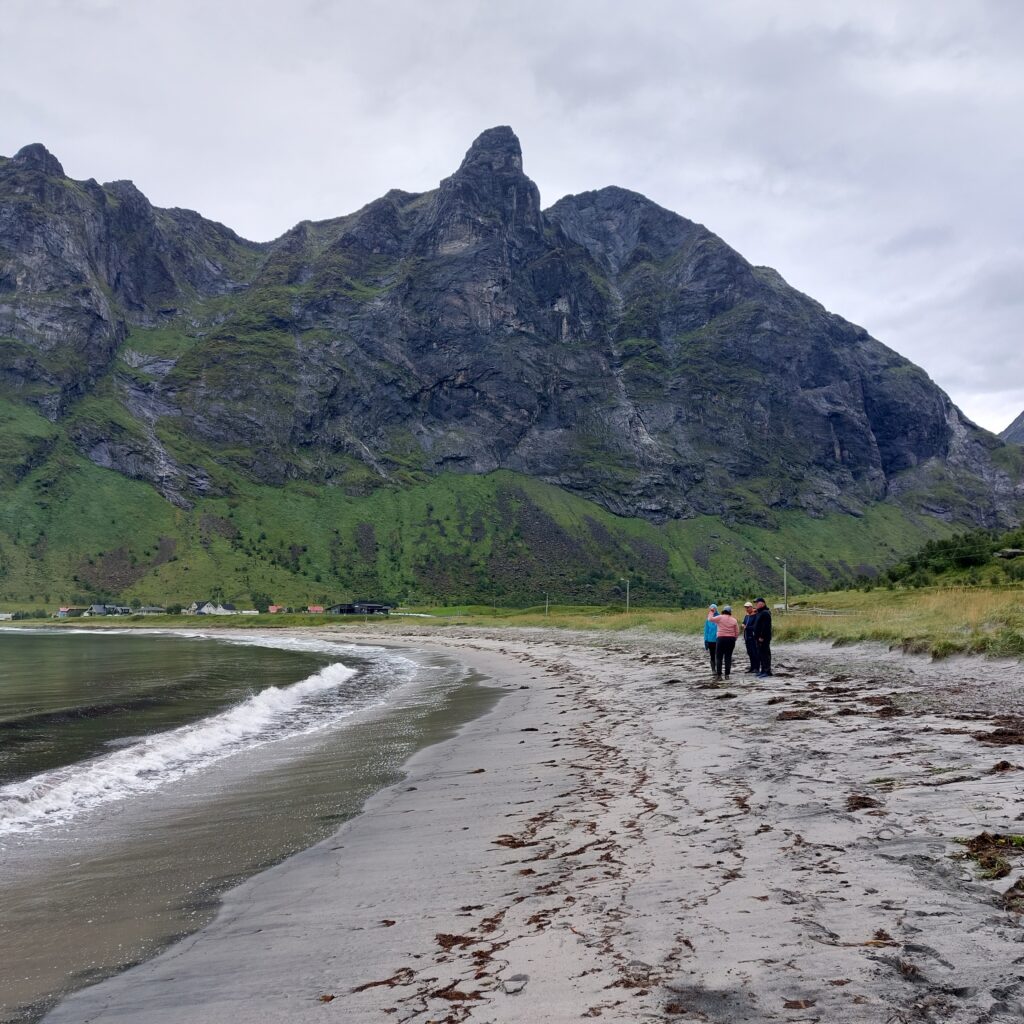
Sometimes, the row of mountains are broken by the uttermost beautiful, white beaches. The most splendid of them all is perhaps the beach in the Erik’s fjord, or Ersfjorden as it is also called.
Ersfjordstranda (the Ersfjord beach) – a Copacabana of northern Norway?
We have bathed here many times. It is basically a ‘must’ to go here and swim every time we visit Idun’s older brother Frode in Sørreisa.
U2 in Ersfjorden, May 2010.
This time, however, there were far more people watching than bathing. Strange…
An incredible number of people who didn’t want to have a bath!
Their loss, ‘Tobatheornottobathe’ think. We had a great bath!
And who took the best choice?The spectacular view feels even better when you’re in it.
The 40 inhabitants in Ersfjord have experienced a big change when the Geitskar tunnel opened in 2004. Previously, it was a 115 km drive to Senjahopen (the nearest village, with 300 inhabitants). Now it is 3 km. This has led to much more tourism, as it became possible to drive around Senja. What else is there to do in the Ersfjord? Visit Gulldassen (the Golden Toilet), of course! They are quite good at spectacular toilets at Senja. Square meter price for this one: NOK 300,000! Quite a price. But nice? Oh yes, it is.
The Golden Toilet in Ersfjord. Price: NOK 3.75 million.
A little ironic, though, that the architect had put in a window in the roof, to enable seeing the northern lights while contemplating and doing your business. But currently the toilet is closed both at night and in wintertime…
Bathing and rest room visits are just right in Ersfjorden!
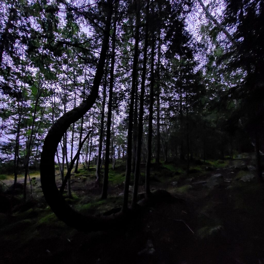
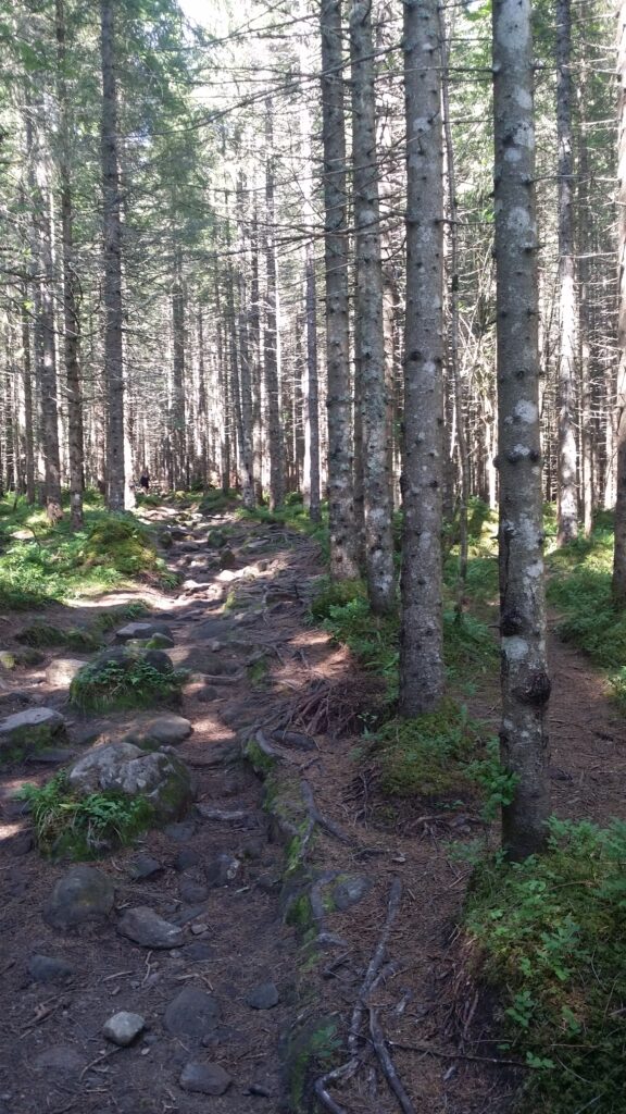
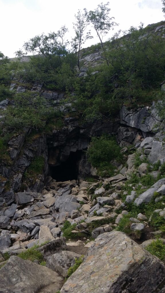
In anticipation of a somewhat more cooperative winter weather, we will recommend a fabulous bathing trip from the summer of 2021: Trollkyrkja (the Troll Church) in Hustadvika municipality (formerly Fræna), Møre og Romsdal. The kids were inspired by the James Bond movie ‘No Time to Die’ and booked a trip along ‘Atlanterhavsveien’ (the Atlantic Road), and from there Trollkyrkja is an excellent detour, located in the heart of Trolldalen, by national road 64 between the fjords Frænfjorden and Kornstadfjorden.
From the parking lot there is a nice path through the forest before the ascent begins.
Magical atmosphere on the way to the Troll valley.
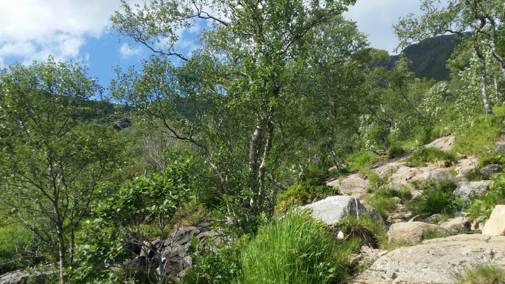
Don’t worry, this is not a hard climb. It’s fine! After a while the forest opens up and you can see the mountains behind Trollkyrkja cave.
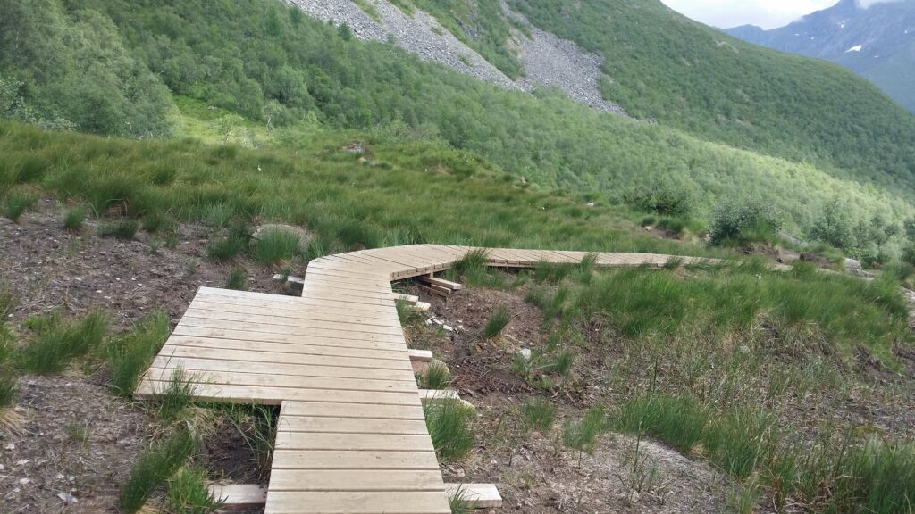
The ‘Molde and Romsdal Tourist Association’ made Trollkyrkja known, secured and passable as early as 1890. And the trip still is well arranged with a marked trail, small bridges and wooden walkways where needed.
Walkway equipped with a meeting place.
It takes about 90 minutes to walk up to Trollkyrkja. Originally there were 4 caves, but one has collapsed.
Troll Church Portal.
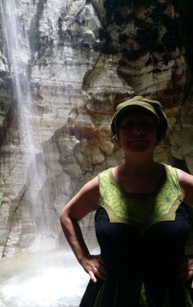
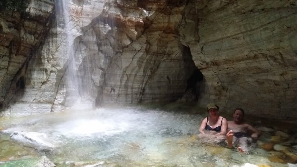
Yes! This is a great place! We think the name is more than modest enough (completely logical for relaxed people from Central Norway): It could just as easily have been named the ‘Troll Cathedral’. The caves are washed out of a large limestone vein, and in the lower one the water falls 14 meters into a white marble pool. Absolutely gorgeous!
Fantastic!
And the bath? Amazingly cold! Even at a nice and warm day in July, you experienced ‘frost smoke’ as you entered the cave, and the kids said it was very cold to wait for the crazy old bathaholics.
A little too shallow for swimming, but it was absolutely worth a small dip.
The return trip? Was great, except for ‘the guard of cows’ that would not let us pass on the trail.
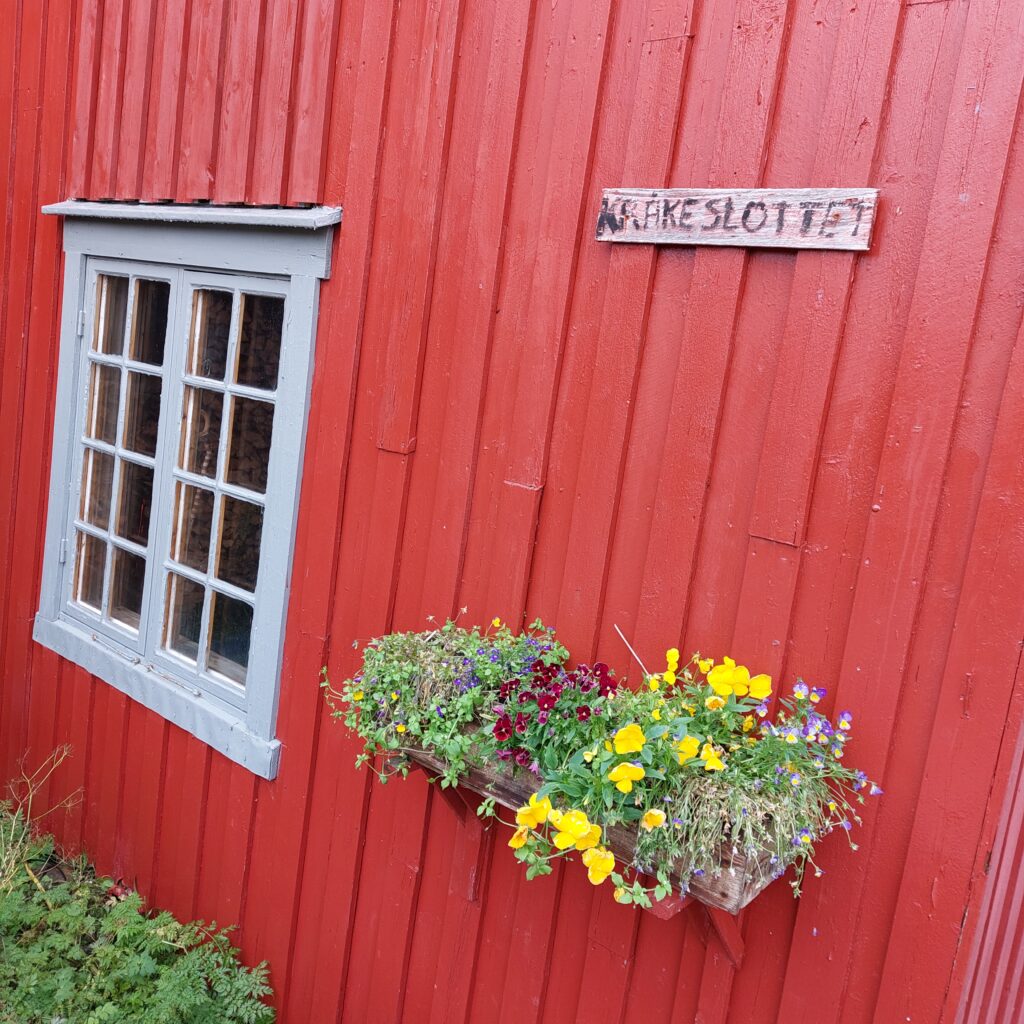
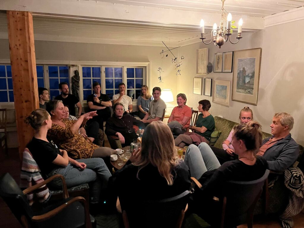
West, on the outer side of the island Senja, in Bøvær, is the Crow Castle. This place is a pearl! We were celebrating a number of covid-postponed milestones in the family of Idun’s older brother Frode. As the family is quite big, we needed some space to meet. And both space and atmosphere you can find in the Crow Castle. There are several living rooms:
A Løwø family’s party at Kråkeslottet. Photo: Anette Løwø
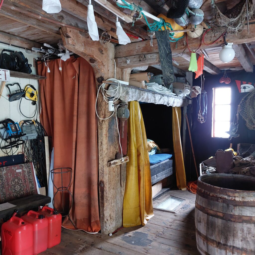
… and bedrooms. Many bedrooms. Or, in fact, some of the bedrooms are probably what you could call sleeping places. Check out this favorite:
Bedroom or bedplace?
Yes, you can actually sleep here. With a beautiful ceiling made from an old door:
Artistic ceiling and artistic lamp.
… and when you put down your foot in the morning, there is a direct view into the sea.
A panorama view or just looking down?
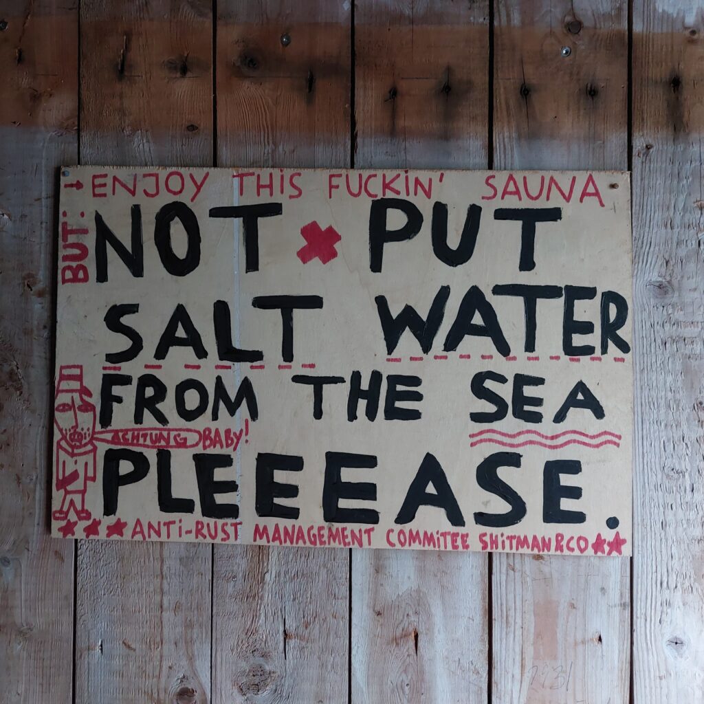
Bøvær is a tiny community. The population has decreased from 17 in the year 2000 to only 8 people in 2015. The fish house is no longer used for unloading fish, it is used for art, concerts, cafè, events and celebrations. And swimming! Here, it is easy peasy to bathe – just jump into the beautiful sea from the quay. For those of you who are afraid of cold water – there is a sauna at Kråkeslottet. With a small hint concerning where the disperse water for the sauna oven should NOT be collected:
NB! The sauna water is to be taken from the shower.
Another poster made it very clear that shouting in or by the water after 9 pm is not very popular among the neighbours. There are plenty of them, as you already know.
Night in Bøvær.
We were at Kråkeslottet for a whole weekend, and did bathe both night and day. Without shouting! It should be possible to enter 13 degree celcius water without yelling, right?
Morning bath at Bøvær. No need to shout, just enjoy. Photo: Egil Hestnes
Some did more advanced diving than others: (Ulvhild salto)
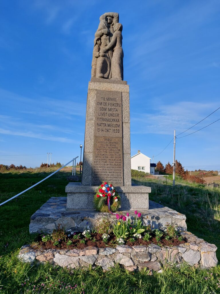
On October 13th 1899, the port of Titran was full of fishing boats. Lots of herring had arrived, and fishermen from all of Mid-Norway hoped to make good money. This was at a turning point between the old and the new times. There were many traditional fishing boats built for sails and oars, but also some larger ships with steam engines.
Titran anno 2022. No fishing boats in sight.
Many were those who had a bad feeling before they left for sea. Friday the 13th made them feel insecure, in addition to a falling barometer pressure. But the desire for profit, how to handle that? Nobody wanted to stay ashore and watch the other fishermen go to sea and collect boatloads of the ‘silver of the sea’. By six o’clock in the afternoon, most of the fishing teams had placed the nets in the sea. Years later quite a lot of the survivors said that they had seen a warning, a ‘Merman’ who got up from the sea and looked towards them, but they did not take notice of it.
Titran. Here you could cross the bay on foot in the old days, when herring fishing was at its peak.
At about two o’clock after midnight, the fishing fleet was attacked by a storm. A survivor, from one of the steamships, later told that he was thrown out of bed, because the wind came so suddenly. The sky cracked with icy rain, hail and gusts of wind that tore sails and rudder to pieces. The smaller boats tried to find their way back to Titran, but it was impossible. The night was dark, no visibility in such rain and wind. 31 boats went down, and 140 fishermen lost their lives. Of those who survived, many were aboard the larger ships that stayed at ocean all night in the storm, instead of trying to find a harbor. During the whole night they were waiting for the wind to reduce and the sun to rise. This is how they avoided the dangerous waters off Frøya in the gloom and darkness of the night.
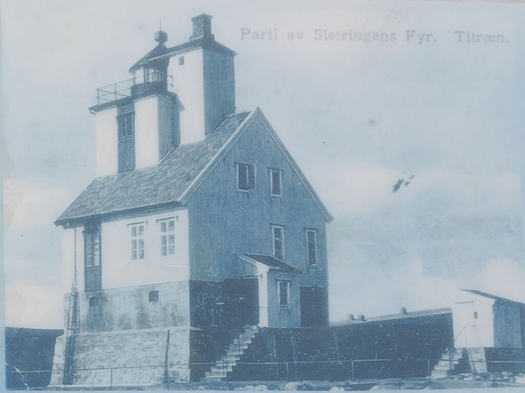
Old Sletringen Lighthouse. From the Information board by Høynesveien, Titran.
After the accident, a nationwide fundraising campaign was launched for the bereaved. There were many widows who were left alone, crying with their flock of children. The collection was very successful, it raised over a million NOK. Idun’s grandfather, Emil Herje, interviewed survivors and widows, and has written about the Titran Accident. These are strong stories. In many families, all the adult men disappeared that very night. Fathers, sons and brothers often fished from the same boat. According to tradition, many men took care of the money in the family and kept it with them at all times. Therefore all the family savings disappeared into the sea together with the man.
‘When will he return?’ Memorial to the Titran Accident, by Kristoffer Leirdal. Unveiled at the 50th anniversary in 1949.
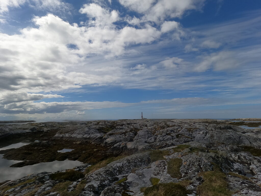
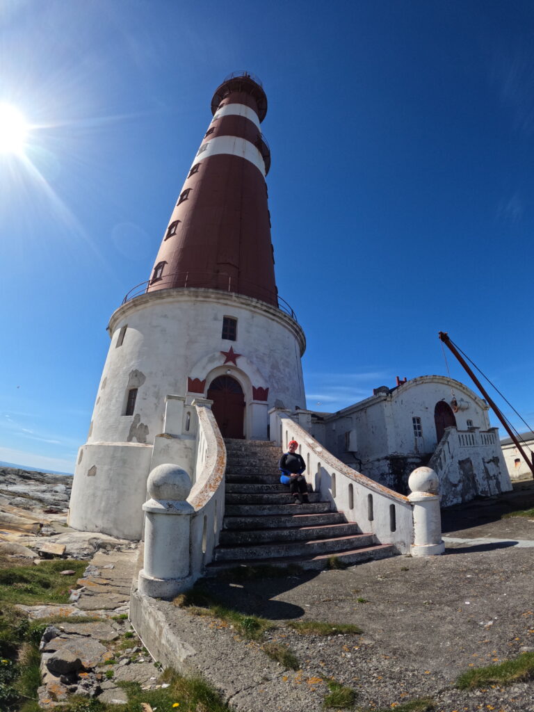
When the accident occurred, Sletringen lighthouse outside Titran was brand new. This led to a lot of criticism. The lighthouse, with its 20 m was too low, and the light did not go far enough. It was decided to build a new and taller lighthouse, and the result was a new cast iron lighthouse which, with it’s 46 meters is Norway’s tallest lighthouse. The name comes from the island where it is placed, which is ‘slett’ (plain). The old timber house was moved to Sandstad by Hitra island, where it still makes use as a lighthouse (Terningen).
Sletringen lighthouse is now the landmark it was supposed to be.
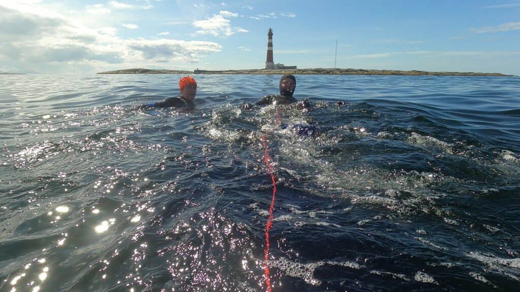
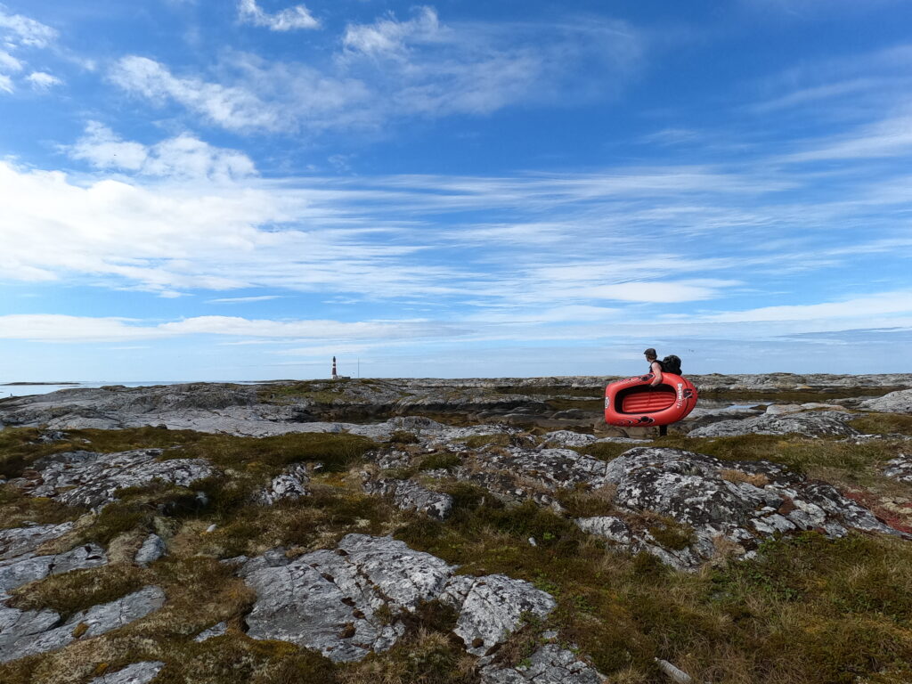
Between Titran and Sletringen there is an infinity of islets and reefs. Could it be a good idea to swim to Sletringen? After some study of maps, we came to the conclusion that we had to do a variation of the sport known as ‘Swim-Run’, if the Tobatheornottobathe-people were to reach Sletringen without motorized help. The speed of some of the participants is not very impressive, so it is tempting to translate Swim-Run to ‘Walk-Swim’ in this case. For the occasion, we dragged with us a not insignificant amount of luggage, including an inflatable boat. We did not stress the time schedule, the most important thing was to come home without any accidents.
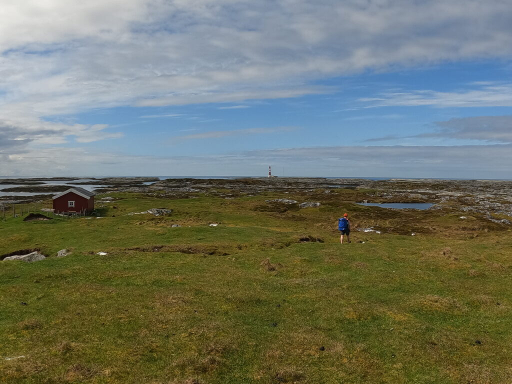
Walking towards Sletringen Lighthouse.
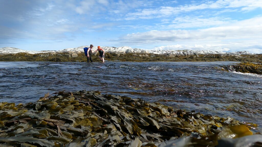
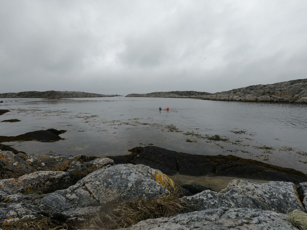
From Høynesvegen we went northwest as far as we could, and then started swimming. We wore wet suits, gloves, wet socks and fins. We crossed three narrow ‘channels’ on the way outwards. At first we changed from regular shoes to wet socks/fins and back again, but after a few times we got tired of it. Knut managed well, he had also a pair of wet shoes in his luggage, but Idun’s wet socks did not survive the trip. In advance, we had thought a bit about this thing with high or low tide, but on closer thought, it was not very important. Actually, we could spend a whole day on the trip if necessary. And the tour turned out quite exciting (but not dangerous!). Especially when crossing a small channel, where the current was so strong that it felt like crossing a flooded river instead of the ocean.
Crossing a river or crossing a channel?
After passing three channels and as many islands, we were ready for ‘The big crossing’ over to the lighthouse. It is about 250 meters open water to Sletringen. The weather was fantastic, no wind or waves. But still – the swells really broke against the shears on each side of the lighthouse. Idun was very thoughtful. “I reserve the right to turn back as soon as I notice there is too much current!” Idun said. And then we set off. There was no current! Not scary at all, this absolutely beautiful day. Once there, it was a bit awkward to get up on the rock. The swells pull you down as soon as you think you are ashore. You have to grab the rocks while the sea recedes, waiting for the next wave to push you ashore. It went well!
In good flow towards Sletringen.
However, Idun had to admit that the new, beautiful bathing cap she had received as a Christmas present was too cold for this type of expedition, so on the way back she switched to a warmer hood. But what a marvelous place Sletringen island is! A fantastic landscape! A beautiful lighthouse! Though, it must have been harsch to live out here in the stormy winters. Sletringen is not a big island. In bad weather, the waves cross it all. The lighthouse was vacated in 1999. Frøya municipality has started a project to make the lighthouse accessible to the public. We really hope this will actually happen. Imagine spending the night at Sletringen lighthouse!
Sletringen lighthouse is tall and beautiful.
The return was just as nice as the way out. This time the sea was ‘flooding’, and we felt that we were pulled inwards. We swam past the first island – but with the tide the islands had become more numerous, so we ended up with 4 crossings back as well. All in all, a brilliant day. It’s great to swim and walk to Sletringen lighthouse! But we want to point out that good wetsuits, exceptionally calm weather and sufficient experience / adaptation to cold water is needed if this kind of expedition shall be successful. You are hereby warned!
A trip to Sletringen is just right!
Sources: ‘Titranulykka’, Edited by Hans A Grønskag ISBN: 82-993698-1-9 ‘Stormhav’, Leo Oterhals, ISBN: 82-90757-1-23
When reading about how countries/cities/towns should make things easy for movie makers, there is much talk about all the tourists who would come to the places where a movie is shot. In that way, the location should earn money, even if the movie is sponsored for selecting that particular location. If this really happens, is debatable. Especially when e.g. the Norwegian “Prekestolen” (close to Stavanger) in “Mission Impossible” is presented as being in India!
Few might have thought that the movie “Everyone hates Johan”, shot in Titran on the island Frøya, would bring any tourists. But we can confirm it now has happened! Knut was an extra in the movie and was one day on Frøya recording a while ago. When the movie finally came to the movie theaters, he didn’t see himself until his name was in the credits. That’s what can happen when you are an extra!
No matter, we liked the movie very much and suspect it is closer to the truth of how it is to live on Titran than the natives would care to admit. So we just had to take a bath in Johan’s foot steps.
What we had planned, was a bath in the sound right below Johan’s house, where his parents lost their lives. This is right west of Titran and is called Svalbalen beach (originally Svalbar, from “Sval”, meaning chilly). What we hadn’t considered, was the tide. We arrived Titran friday evening and went straight to the beach, but quickly realized that at low tide it looks quite different than in the movie. So we went back the next day on high tide instead and then it looked just right.
A bath in honor of Johan’s parents
The houses of Johan and his childhood sweetheart Solvor, whom he happened to blow up a little, are close to the beach, just as the movie depicts it.
Johan’s house to the right, Solvor’s in the middle.
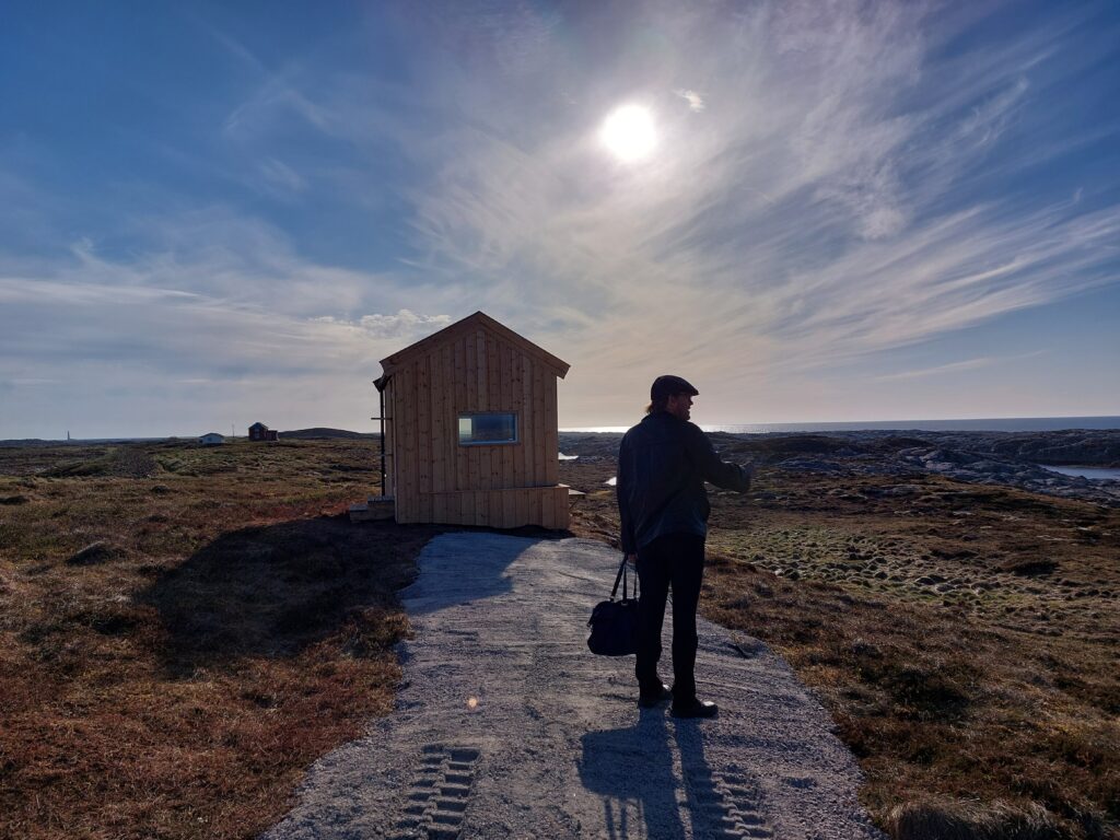
At the beach there is now a house for bird watching. Very nice and very new, but maybe a little too far from the beach for misusing it to change before bathing.
You can watch birds outside the house as well, but many days the indoor option might be preferrable.
Without knowing for sure, we suspect that this house has a direct correlation to the movie, since it was brand new. Maybe financed by money someone got for renting out their house for filming? Actually it was so new that we were the first to sign in the guest book! Which was a first for us.
One thing we hadn’t thought about, is that there are other central elements in the movie to see around! E.g. these bars where Johan showed his strength.
No chance for Knut to beat Johan in this game…
Also Sletringen lighthouse was in the movie, but that’s another story. Our conclusion is that a bath in “Johan’s bay” is just right.