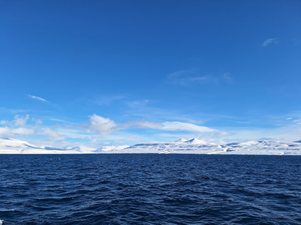
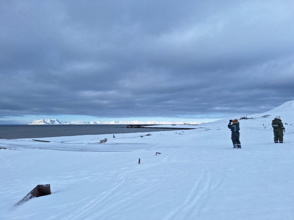
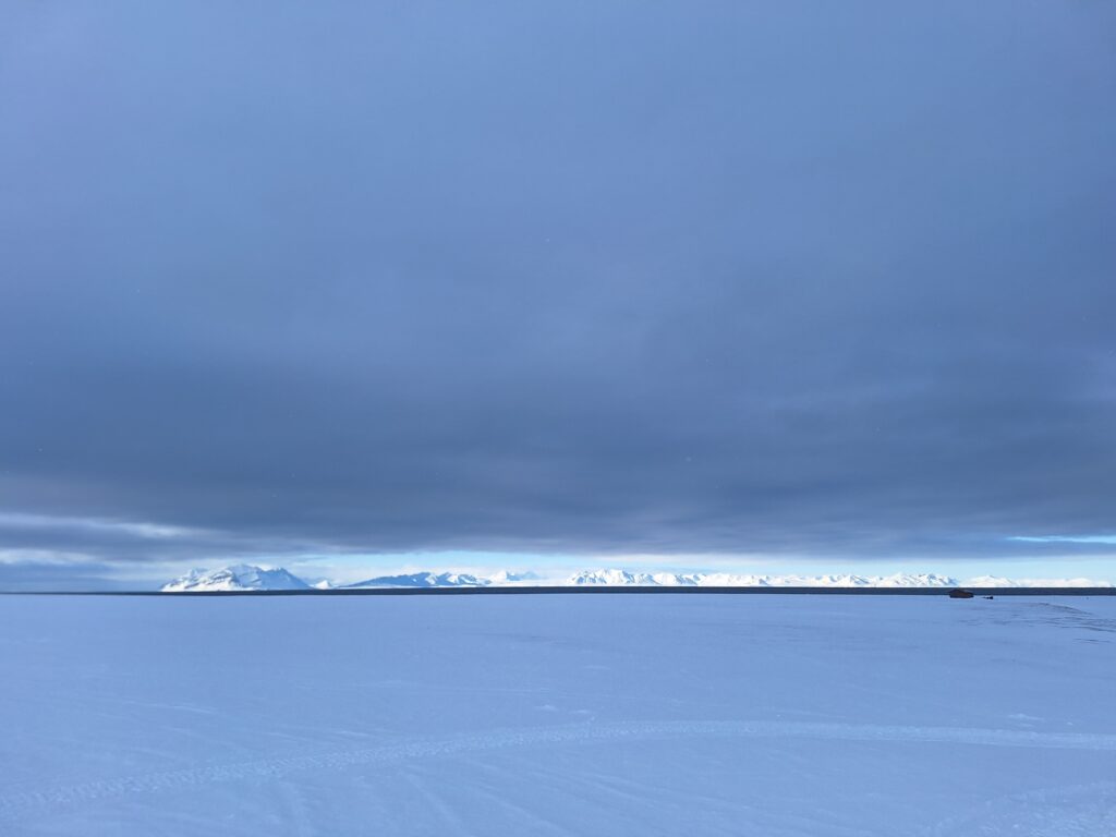
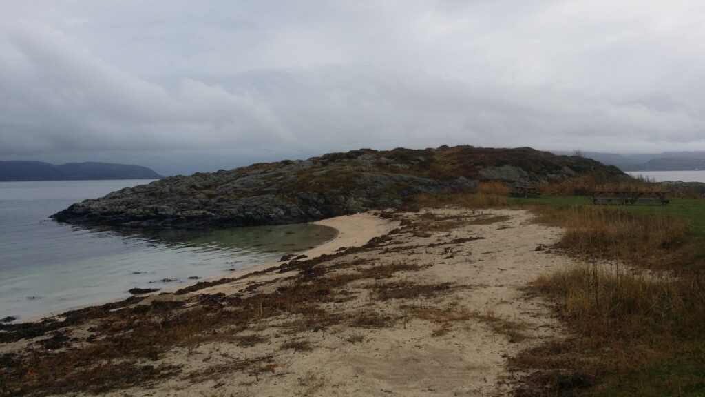
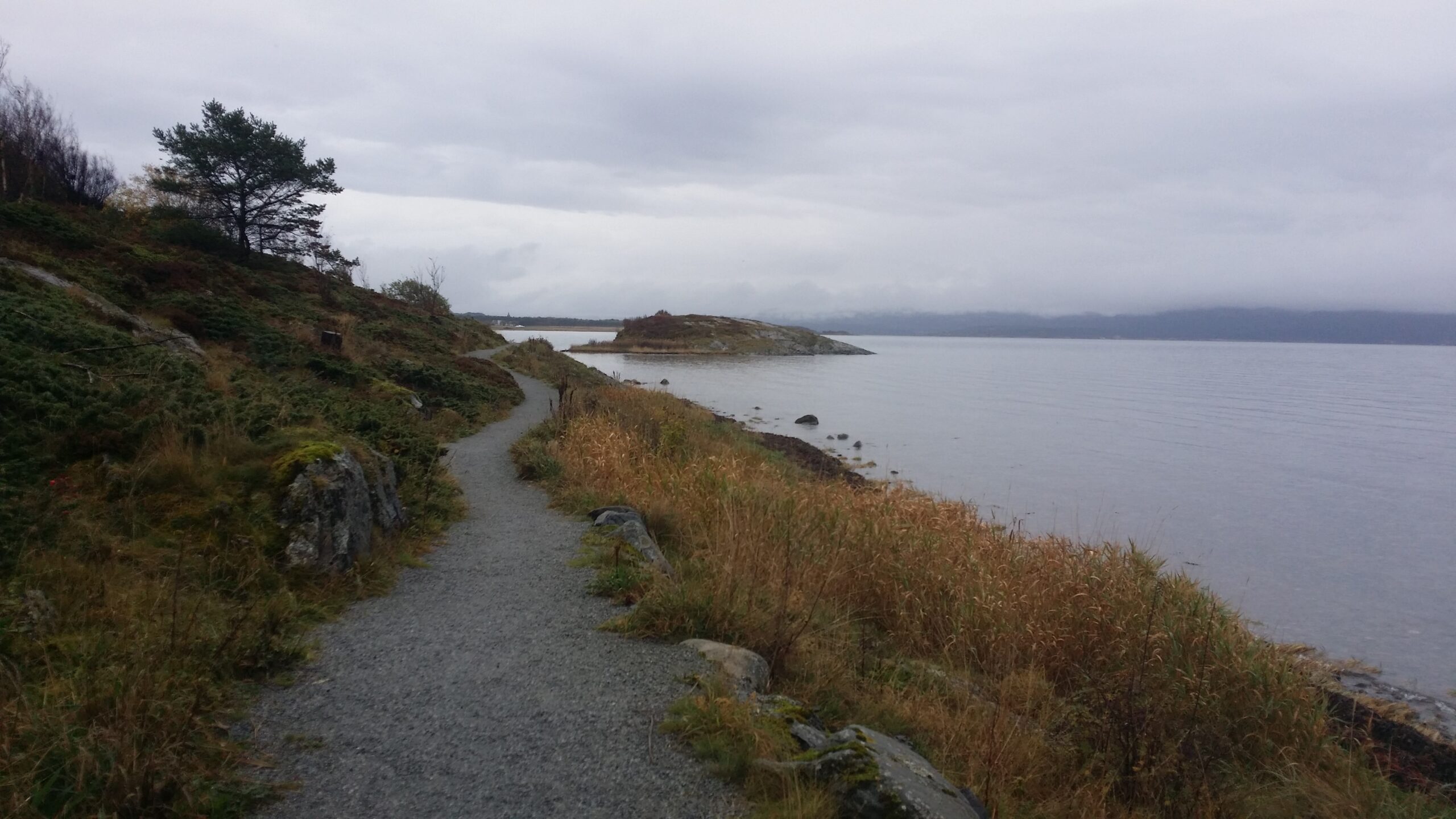
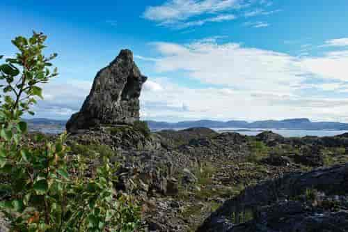
On the south side of Isfjorden, between Longyearbyen and Barentsburg, lies a large and wide bay called Coles Bay (Colesbukta).
Coles Bay is more than 4 km wide. View southwards. Coles Bay shipping port to the left (east) and Cape Laila to the right. The mountain peaks in the middle are called Vesuvius and Little Vesuvius.
The bay was named as early as 1630, when an (English?) explorer reported that this was a good place for hunting reindeer. Coles Bay is named after Cole Park in Wiltshire, England. Later, when coal mining started up in Isfjorden, the name was misinterpreted as Coal Bay.
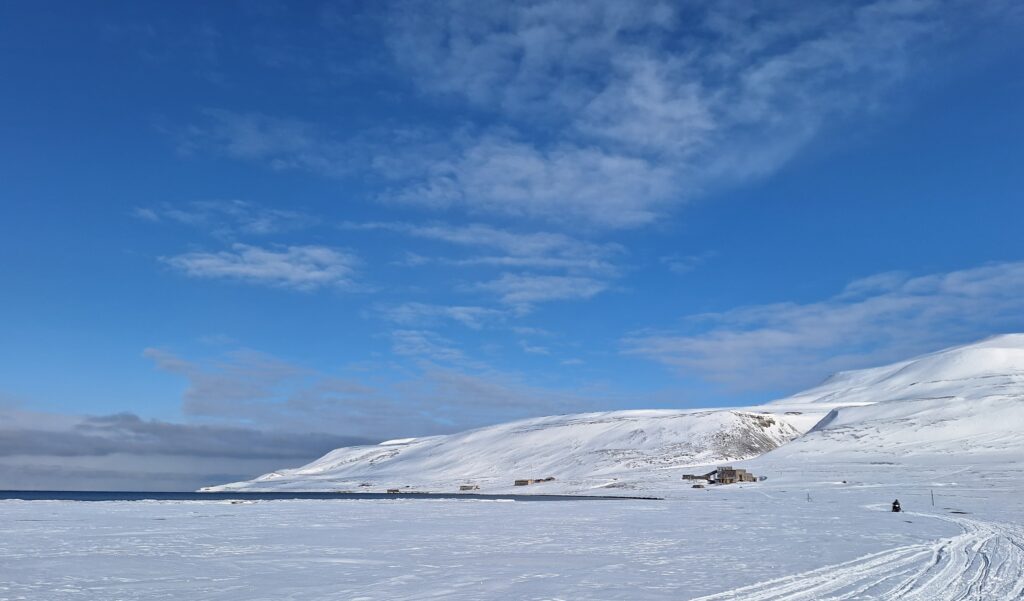
Coles Bay 2025. Most of the houses are either falling into disrepair or demolished, but occasionally the place is still inhabited – by Russian scientists.
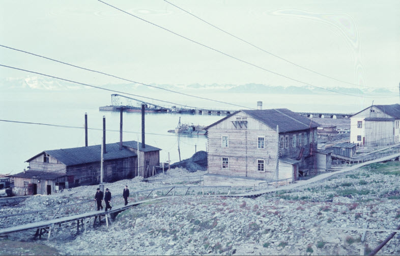
The Russian coal mining town of Grumant, located between Coles Bay and Longyearbyen, was bombed during World War II. Due to difficult port conditions, it was decided to build a new coal shipping port in Coles Bay when reconstruction began after the war.
Coles Bay shipping port, July 1960 (one year before decommissioning). Photo: Carl A. Wendt / DigitaltMuseum
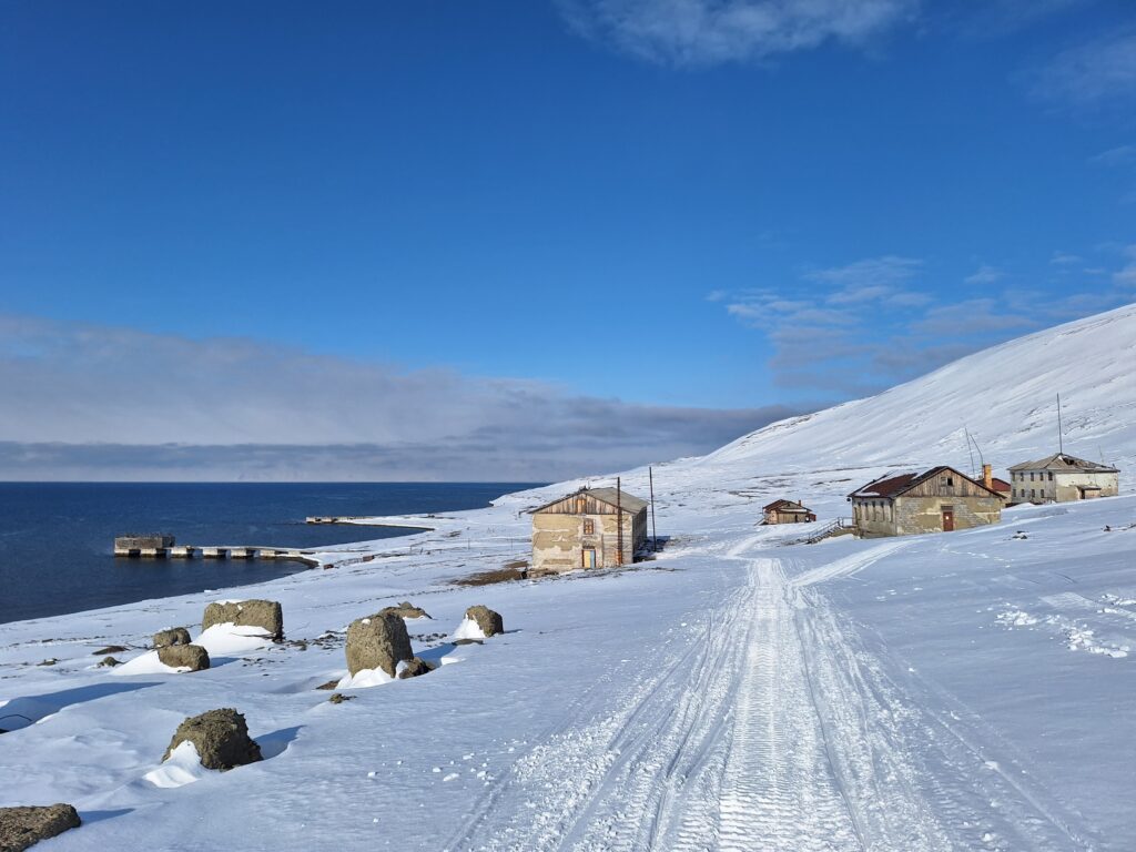
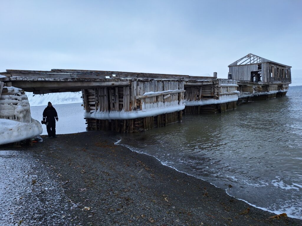
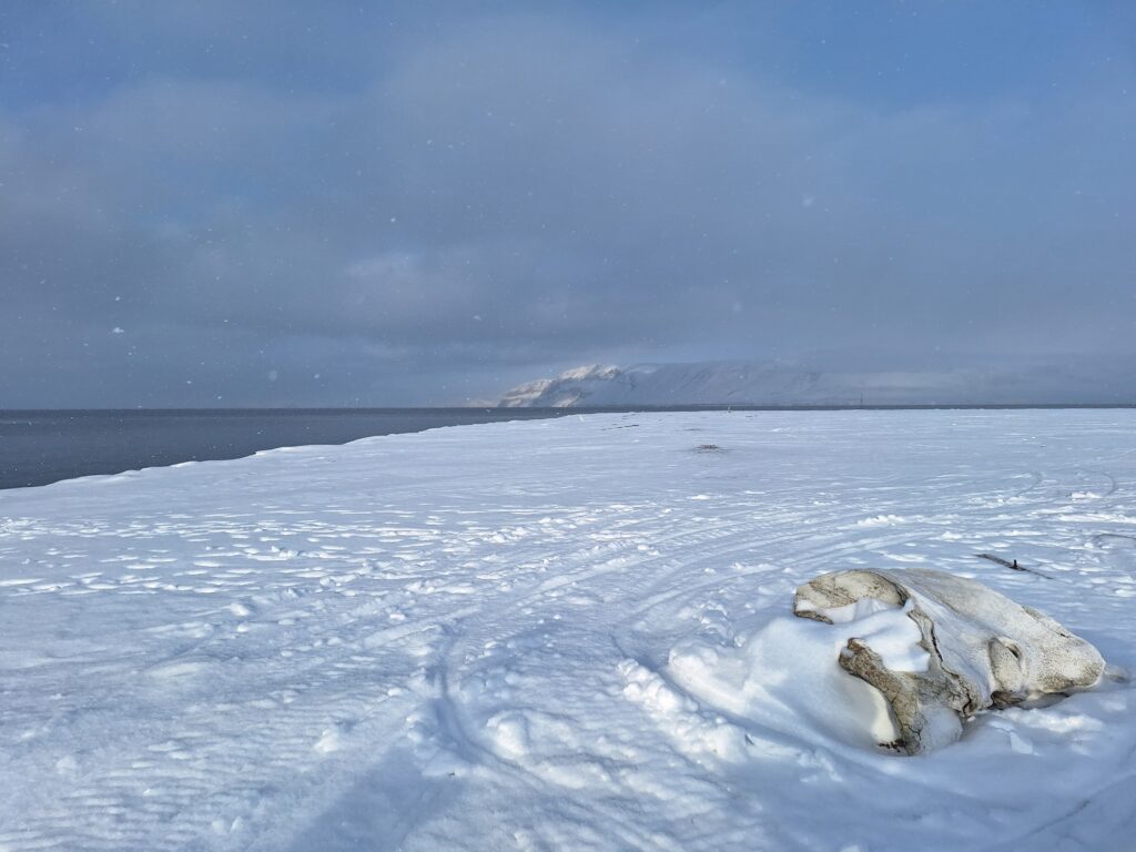
A 40 cm wide (narrow gauge) and 10 km long railway was built between Grumant and Coles Bay for coal transportation. The railway was partly tunnelled and otherwise built-in. The wharves are made of timber, and parts of them are still standing, some 60 years later.
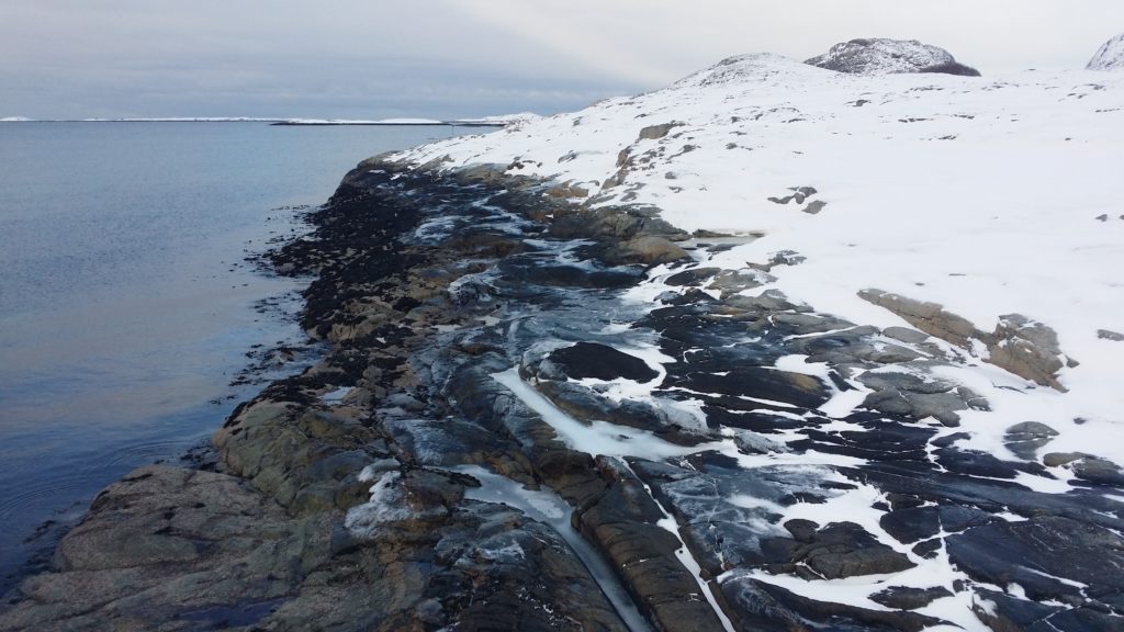
The timber wharves in Coles Bay 2025.
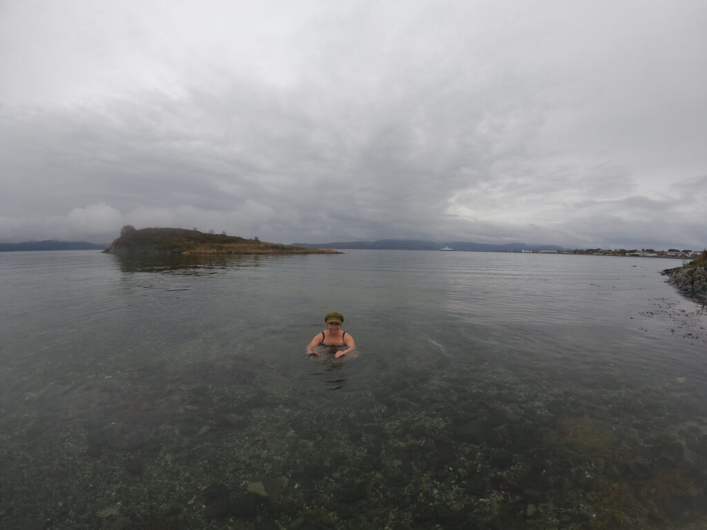
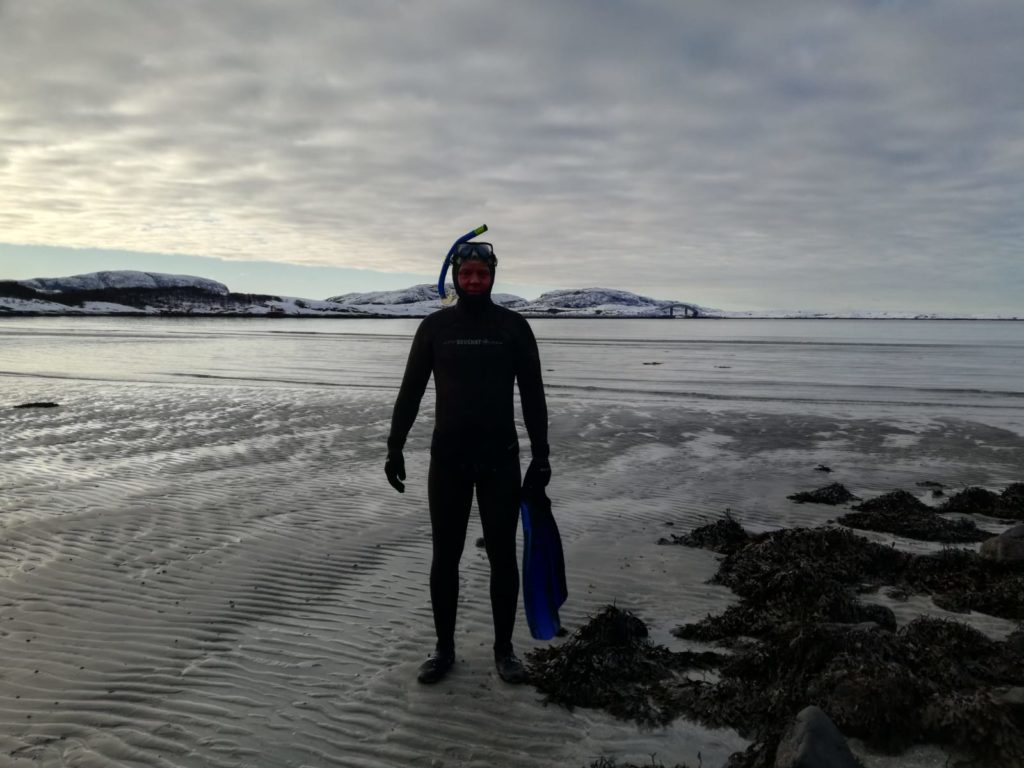
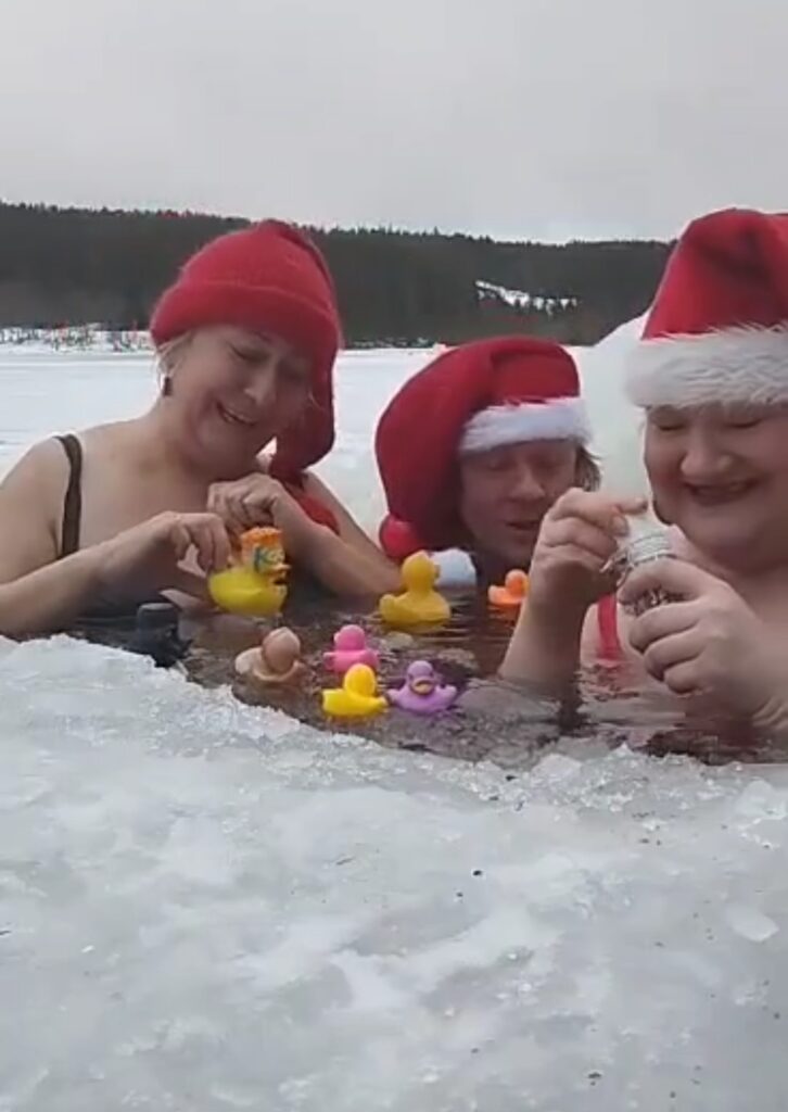
We wanted to go swimming in Coles Bay! Luckily, we were assisted by Jorunn and Nina, who helped us as photographers and polar bear guards.
The bathing assistants at work. In the background: Alkhornet mountain in bright sunshine.
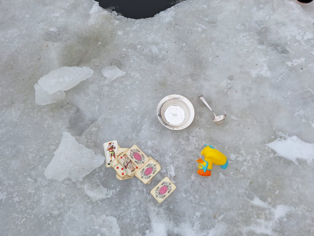
Then we just had to get started, we even had a wardrobe.
Knut inspects the locker room in Coles Bay.
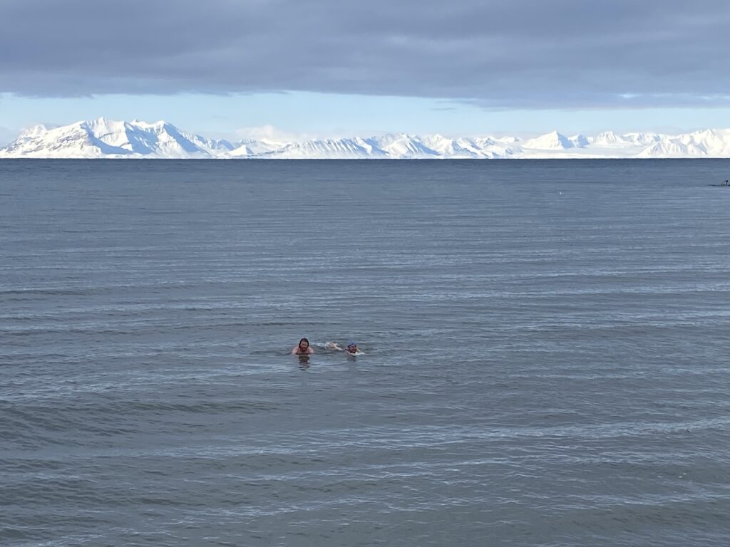
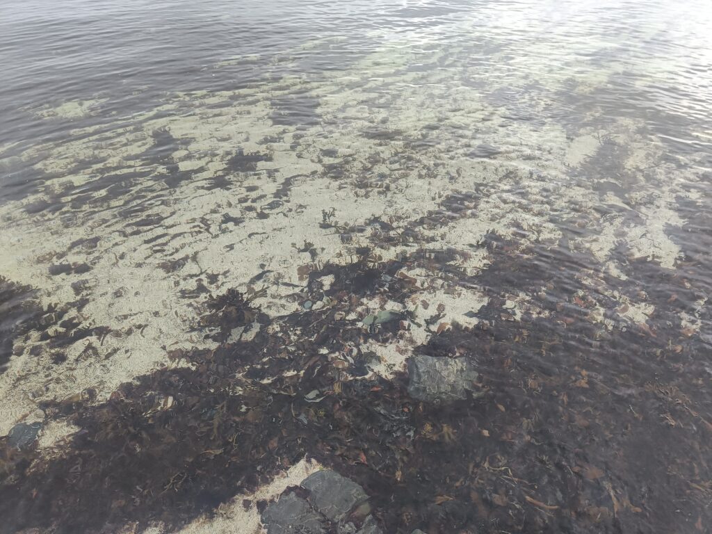
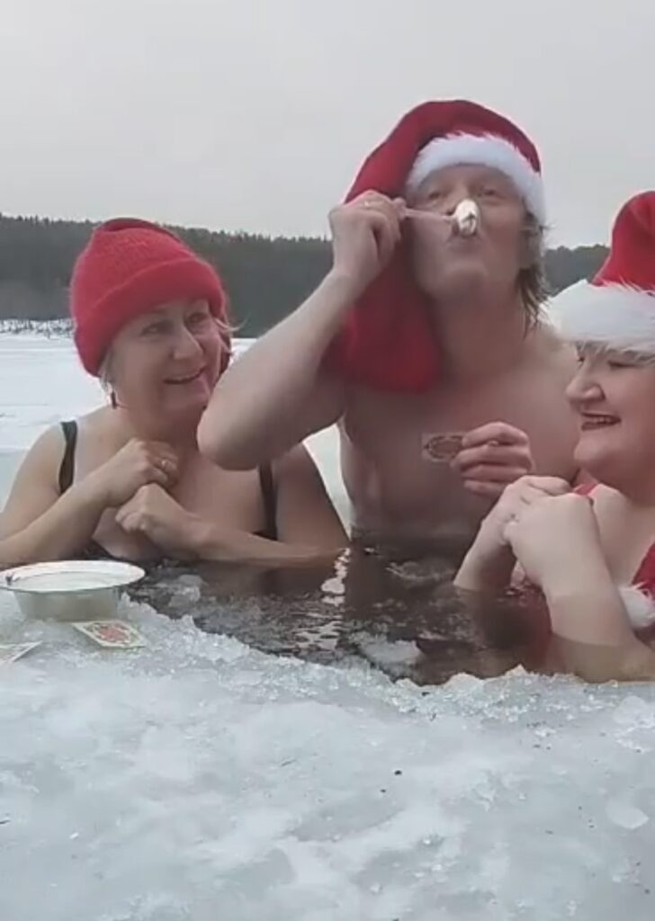
It was a really nice swim. Quays like this are not built in shallow waters, and we didn’t have to go far before we could swim. There were no hints of slush this time, water temperature about 0 degrees Celsius, and minus 15 degrees in the air. The beach, like all the Svalbard beaches we have tested so far, consisted of fine-grained gravel (or possibly coarse-grained sand), which means you don’t have to worry about sand getting inside all your clothes. Three black guillemots swam around right next to us, and a reindeer grazed nearby. Add to that the splendid view, and you have our recommendation: A swim in Coles Bay can be fabulous!
NB! There were no Russians in Coles Bay during our visit, and we didn’t disturb anyone.
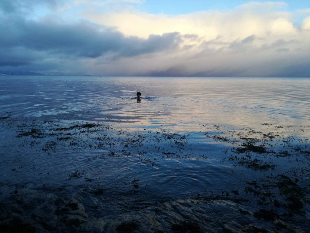
The most splendid bathing view ever? Photo: Nina Hestø
The events in the Løwø family are endless, and in 2025 there were two confirmations in Longyearbyen, at Palm Sunday. We like that! And a visit to Svalbard also includes a trip to the family cabin at Cape Laila. Thank you very much for the invitation, Jorunn!
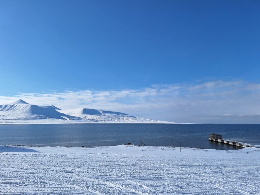
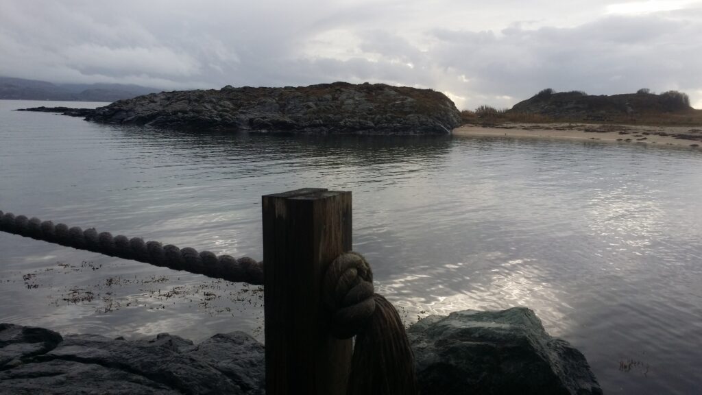
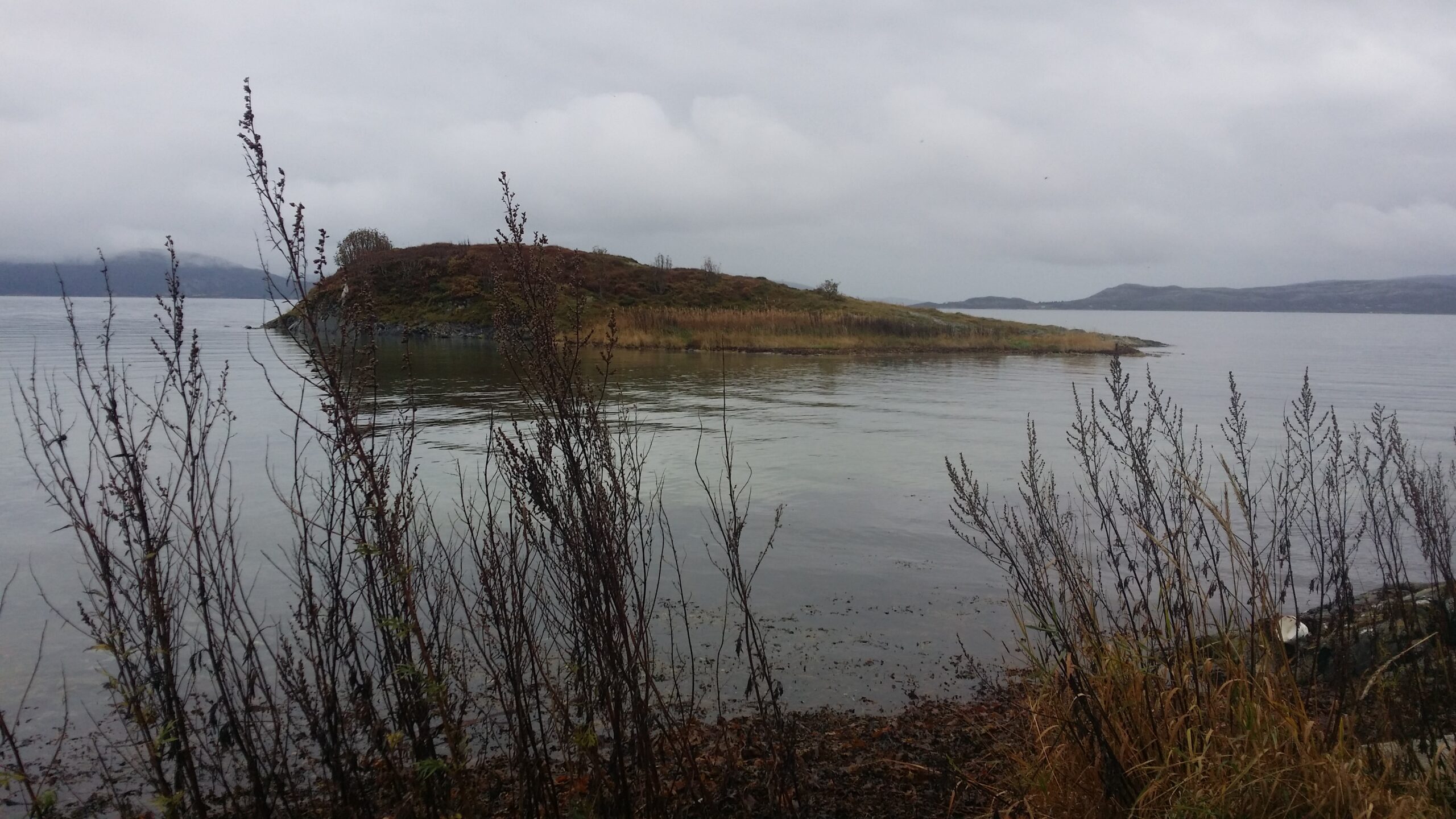
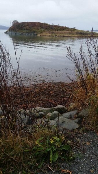
Coles Bay, looking westwards. Lailadalen (The Laila Valley) to the left and Cape Laila to the right. The mountains Vesuvius and Little Vesuvius in the background.
The names Lailadalen and Cape Laila come from the name of one of the motor cutters (Laila of Tromsø) used on Gunnar Isachsen’s Svalbard expedition in 1910. Isachsen was a topographer (topographic maps describe the terrain in the area), and as the expedition leader you can come up with names for unknown places, right?
Cape Laila. View north towards Alkhornet. It can’t get more beautiful than that!
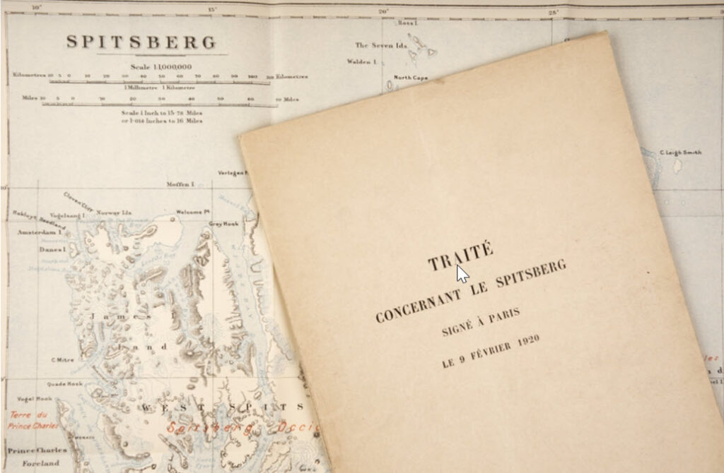
Sweden invested heavily in Arctic exploration towards the end of the 19th century, primarily driven by Adolf Erik Nordenskiöld, who proposed that Svalbard should belong to Norway. After Nansen’s successful expeditions, interest also increased in Norway, and after we left the union with Sweden there were no problems with funding any more. ‘Stortinget‘ (The Norwegian Parliament) allocated money for the ‘Spitsbergen Expedition‘, for exploration of Svalbard’s topography, geology and hydrography for many years. However, the work of finding a solution to the ‘No Man’s Land Problem‘ (Svalbard was called Terra Nullius) was completed as a result of the legal settlement after the First World War, in the form of the ‘Svalbard Treaty‘.
Isachsen’s personal copy of the Svalbard Treaty from 1920. Photo: Beate Kjørslevik / Norwegian Maritime Museum
Signed in Paris, 1920, the Svalbard Treaty gives Norway sovereignty over Svalbard, Hopen, Jan Mayen and Bjørnøya. The treaty came into force in 1925. All countries that have signed the treaty have equal rights to the resources, but it is Norway’s laws that apply. Military activity is prohibited on or near the islands, (Germany didn’t really care about that during World War II), which Russia has used as an argument when they have protested that Norwegian coast guard ships patrol Svalbard. Russia signed the agreement in 1935 (they first had to end a civil war and regroup themselves to the Soviet Union). China signed the Svalbard Treaty already in 1925 (according to Wikipedia), so that can’t be why Chinese people are not allowed to drive snowmobiles in Longyearbyen. Anyone who knows?
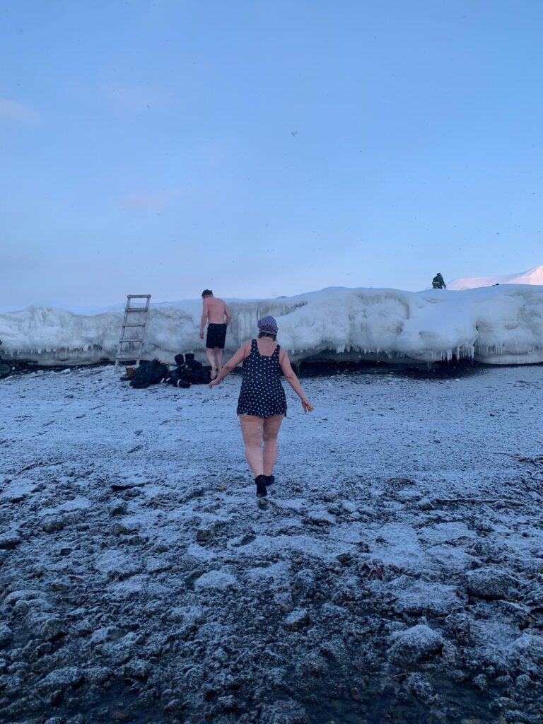
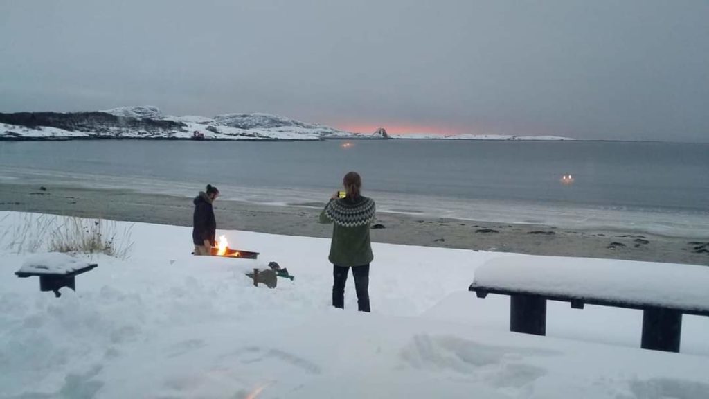
For the 100 years anniversary of the Svalbard Treaty, Tobatheornottobathe thought that a bath at Kapp Laila could be a good idea. We have tried to swim there before (Kapp Laila), but that doesn’t stop us at all! If it’s terribly shallow in the lagoon, then you can swim a little further away from Løwøhytta, right? We chose ‘The whale bone‘ as our starting point, it is located west of the neighboring cabin ‘Bikkjebu‘ (The Dog’s Cabin).
The whalebone. There is not much left of the whale skeleton at Cape Laila, but one vertebra is clearly visible.
What could possible go wrong at Kapp Laila in winter? Well, first of all, ‘Landkallen‘ means trouble. Above the high tide boarder on Svalbard’s beaches, there is an ice edge during winter time, and it often grows to 1-2 meters height. It’s not easy to climb up there with frozen fingers after swimming. ‘Better bring a ladder!‘, we thought.
Well-equipped with a ladder, bath photographers and polar bear guards, there was little stress with a Lailabath in winter. Photo: Une Hunstad Løwø
But then there was this thing with the tides. Again. We had inspected the place earlier the same day, at high tide. When we went there to swim, it was low tide, and we had a long way to walk before it was deep enough to swim. Conclusion for the second time: Cape Laila is not the best swimming spot, it is actually pretty bad at low tide, despite the crystal clear water.
Bathing at Kapp Laila, 17th of April 2025. Photo: Une Hunstad Løwø
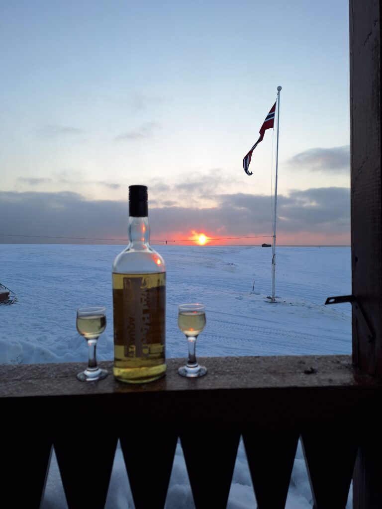
Minus 13 degrees celcius, clear and beautiful ‘slush water’ (which means approximately minus 2 degrees in the water), a veeery shallow beach, but we absolutely did not regret it! We had the world’s most beautiful view of Isfjorden, a bath is always energizing, and after the bath Idun’s sister Jorunn and her husband Berner treated us with a sip of the ‘Svalbard Aquavit‘. Thank you!
Celebrating the 100th anniversary of the Svalbard Treaty with lots of snow, aquavit and the midnight sun. Congratulations!
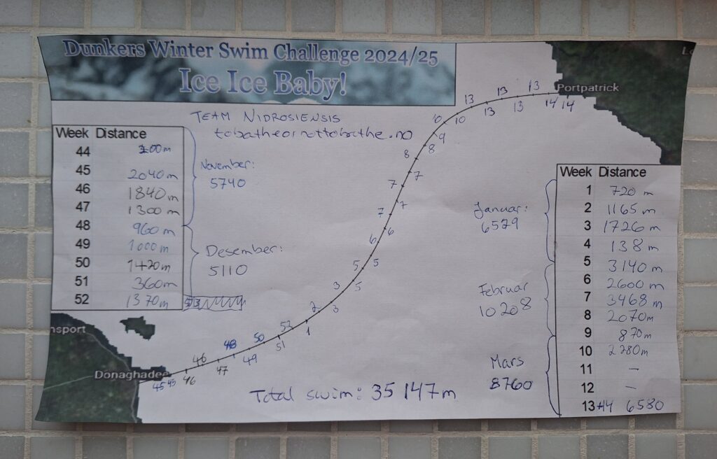
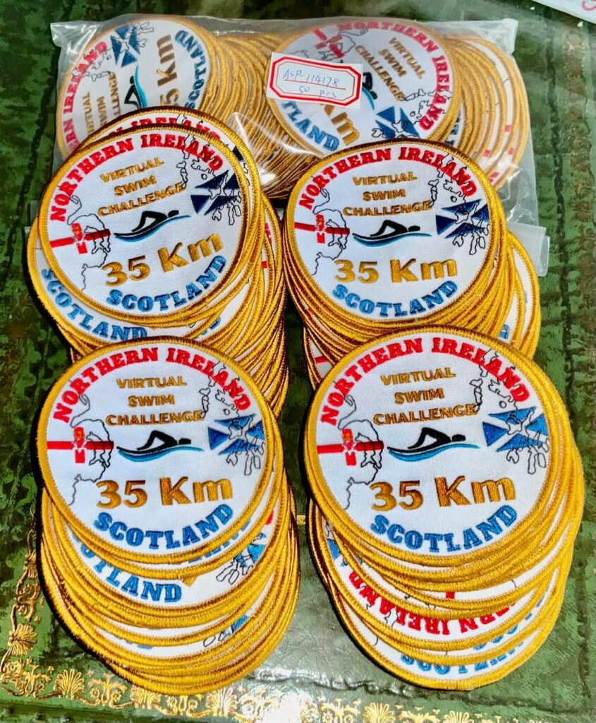
On November 1st, 2024, the Donaghadee Chunky Dunkers (DCD) Winter Challenge 2024/25 began: To swim alone, or as a team, a total of 35 km in open water, without a wetsuit or other aids by March 31st, 2025. We never doubted that we could do this!
35 km is the distance between Donaghadee in Northern Ireland and Portpatrick in Scotland. How hard could it be? Picture slightly manipulated by HI (Human Intelligence), since AI failed to do the job.
It turned out to be a challenge, indeed. The first week there was a storm, and we only swam 50 (!) meters at a time. When the weather calmed down, we managed a little longer trip, but when we swam 435 m in 7 degree celsius water on the 8th of November, it was really nail-biting, and Idun turned somewhat hesitant about whether this was a joyful hobby in the long run.
Progress reporting is an important motivator! We struggled in both November and December, but at the end of January things loosened up a bit, and we were able to swim 500 m without the nails biting too bad.
Research has confirmed that the human body adapts to the stresses of repeated cold swimming, including by converting some fat into so-called brown fat, which can easily be converted into heat when needed. After 3 months of effort, we began to feel that we tolerated the cold better, and now we swim nearly 600 meters without much trouble. But we get shaky! It’s not easy to talk after these swims!
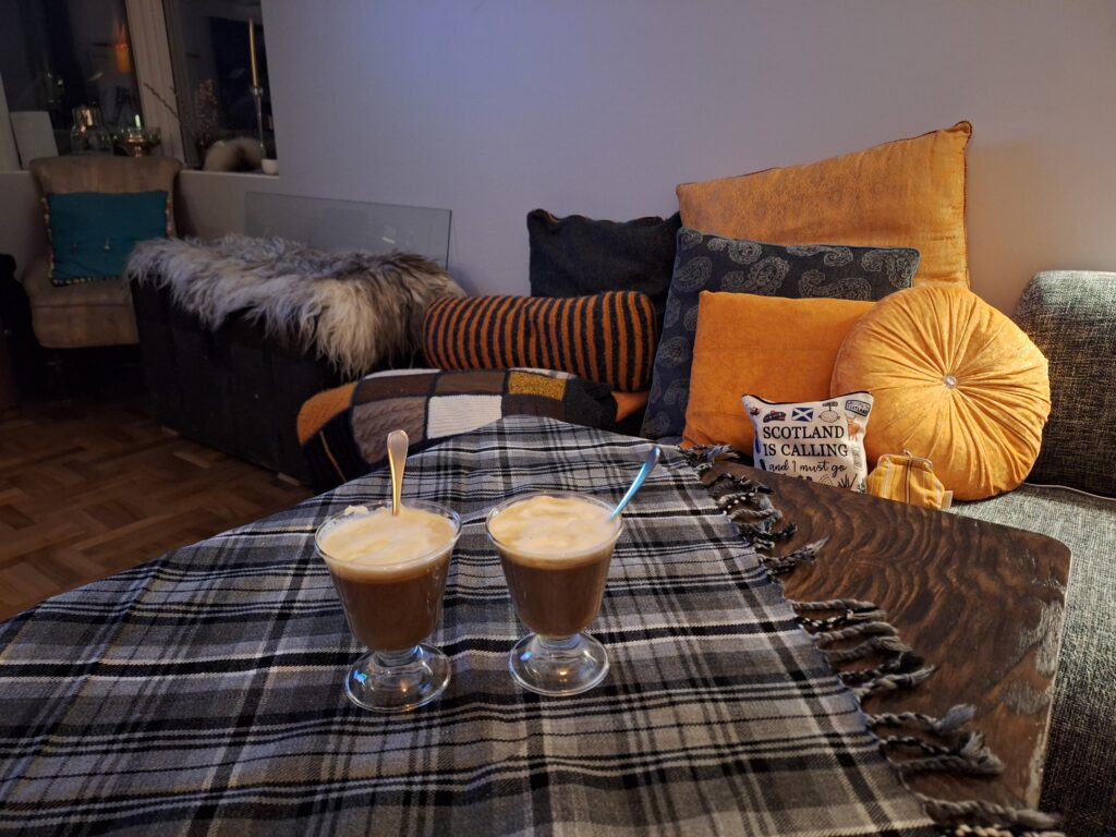
After the last swim we thought an Irish whiskey made with Scotch whiskey would be just right. Tartan: Hamilton Grey.
We did it! It turned out to become a rather tough run-in. Knut was unwell for a week, and Idun was in Mumbai the week after (yes, she swam at Yuhu Beach, but fully clothed like they do it there, and DCD runs channel rules: Skin Only, i.e. only a swimming cap, swimsuit/pants and swimming goggles). In a couple of weeks we expect 2 badges to arrive by mail. The entry fee was 10 pounds per person, and we are happy to pay. The profit goes, as mentioned in a previous post, to charity. In total, there were 140 people registered from all over the world for this challenge. Maybe we drew a shorter straw than those who swam in Australia during the same period, but still.
DCD’s badge for 2024/25. We can’t wait to sew them on our beach bags! Photo: Martin Strain
Overall a great challenge, even though we almost gave up along the way. It took a lot of time to fulfill! But we haven’t regretted it, maybe with the exception of that one worst nail-biting swim. But now that we did it – no no, no regrets at all!
The best thing about outdoor swimming is to be in the nature! We have swum in rain and slush water, fog, wind, moonlight, sun and sunsets. Absolutely splendid!
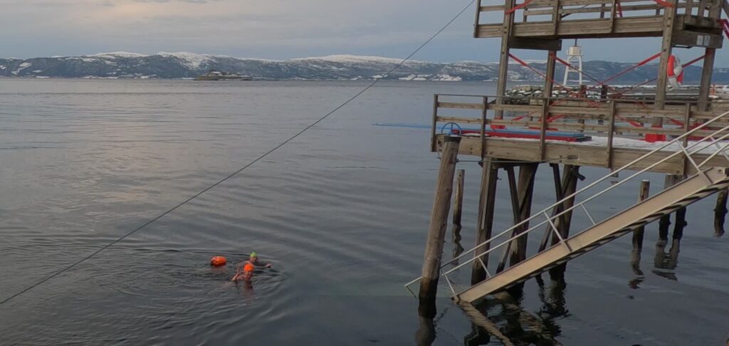
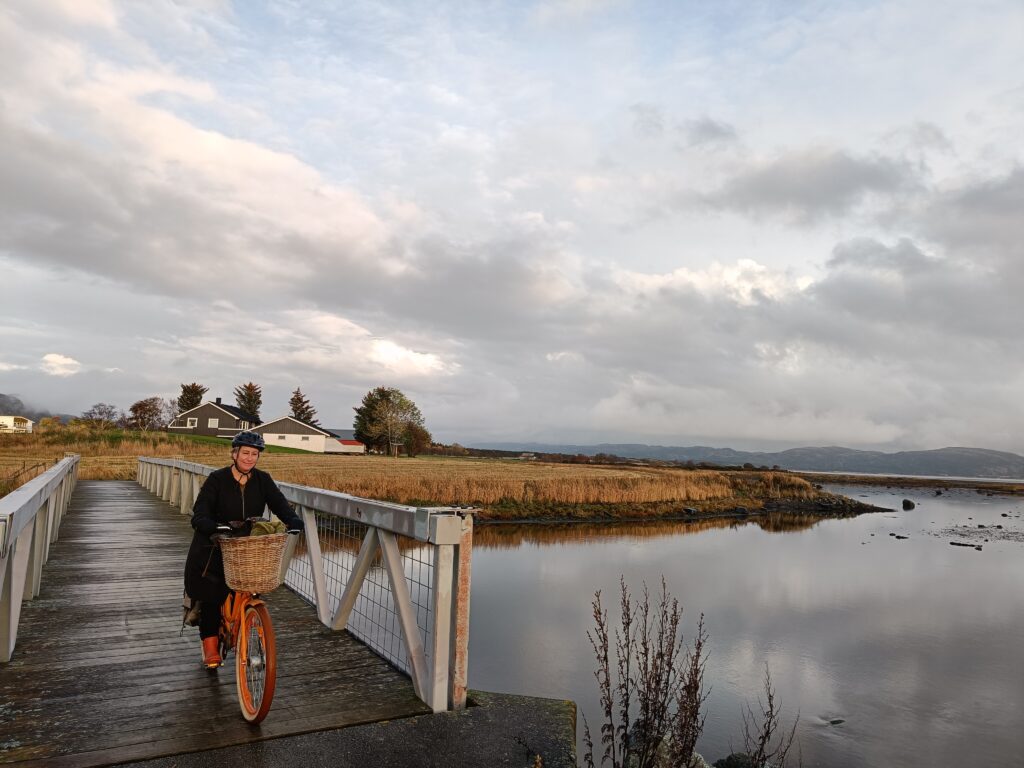
We brought our bikes on the local boat, and this is a Sunday trip we can really recommend:
Take the boat from Trondheim at noon, cycle to Austråttborgen (with a swim around Bruholmen, as we wrote about in the previous blog post), swim in Jektvika on the way back and visit the Hannah Ryggen exhibition before the boat returns a little before seven in the evening. Definitely, this would have been a slightly better plan in the summer – when the sites are open…
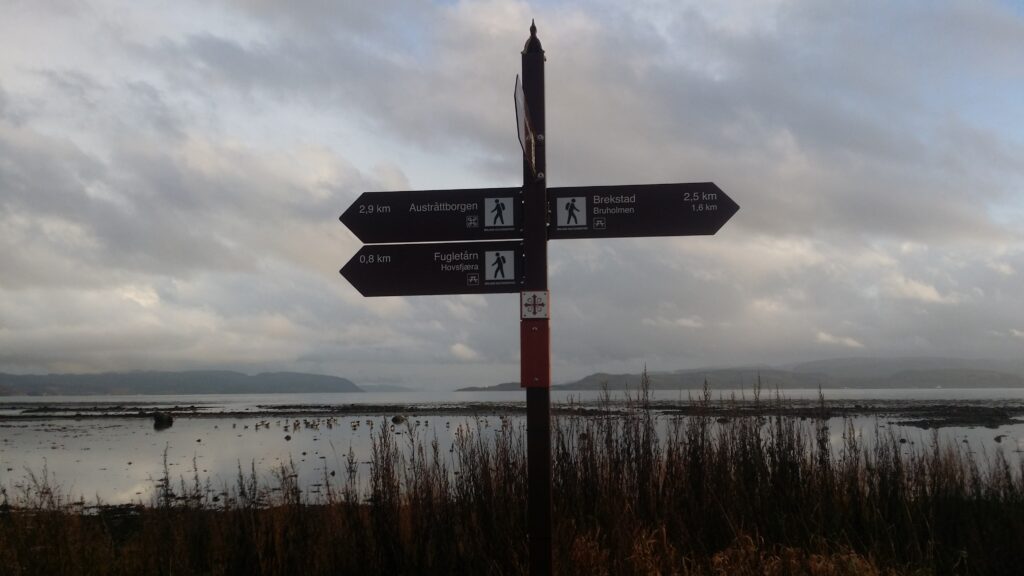
Anyway, the bike trail is really great. And you will always know where you’re going – the tower profile of Austråttborgen is visible on the signposts!
Bicycle path sign with historical significance.
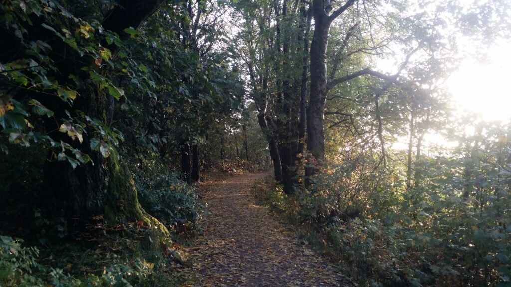
You ride along the fjord and wetlands, and partly inside a forest with lichen covered trees.
Atmospheric cycle path at Ørlandet.
On the way you will pass 3 bridges, and there are benches and birdwatching sheds along the way.
1000 years ago, Finn Arnesson (a liegeman for Olav Haraldsson) owned Austrått. Finn fought side by side with Olav the (soon to be) Saint in the battle of Stiklestad. His brother, Kalv, however, was on the opposite side, in the peasant army, and Kalv even became one of the saint Olav’s executioners. I wonder how interesting the family reunions at Austrått were in ancient times!
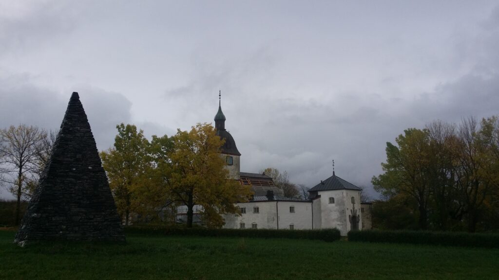
The most famous owner of Austrått is probably Ingerd Ottesdatter (Mrs. Inger of Austrått). She was a large landowner and held several regions in the mid-northern part of Norway. Mrs. Inger was in a long-standing feud with the last Archbishop of Nidaros: Olav Engelbrektsson. It was Mrs. Inger’s great-great-grandson Ove Bjelke who built the castle as we see it today. You can see the castle tower from the center of Brekstad, a fairytale castle!
Austrått, from Old Norse “aust” = east and ‘ätt’ = “direction” or perhaps property, was a center of power already in the Viking Age.
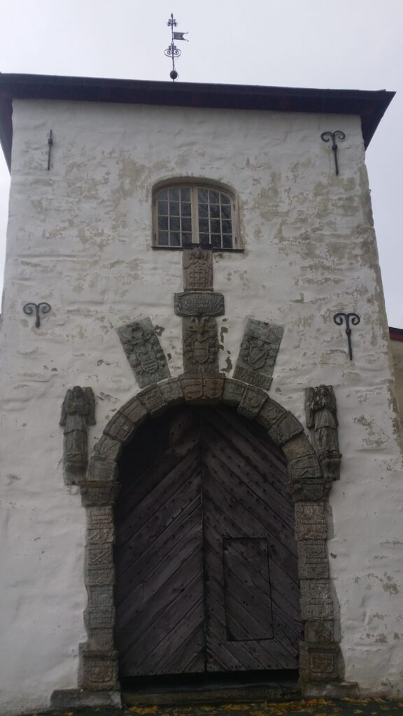
Around 1200, a private chapel was built at Austrått. This church had a large, strong tower. The church with tower was part of the castle complex that Ove Bjelke had built between 1654 and 1656. In the main building’s portal you can see the names and family coats of arms of the previous owners carved in soapstone.
Austråttborgen is magnificent!
When we visited the facility in October 2021, it was closed for the winter, and also under renovation (they were replacing the roof). We therefore do not mention here the arcades inside the courtyard with their caryatids (columns sculpted as female figures – named after the basket-shaped headdresses worn by women from the city of Karyai in Laconia). And definitely not that the caryatids at Austrått depict the story of the wise and the foolish virgins, who respectively had and did not have enough oil for their lamps.
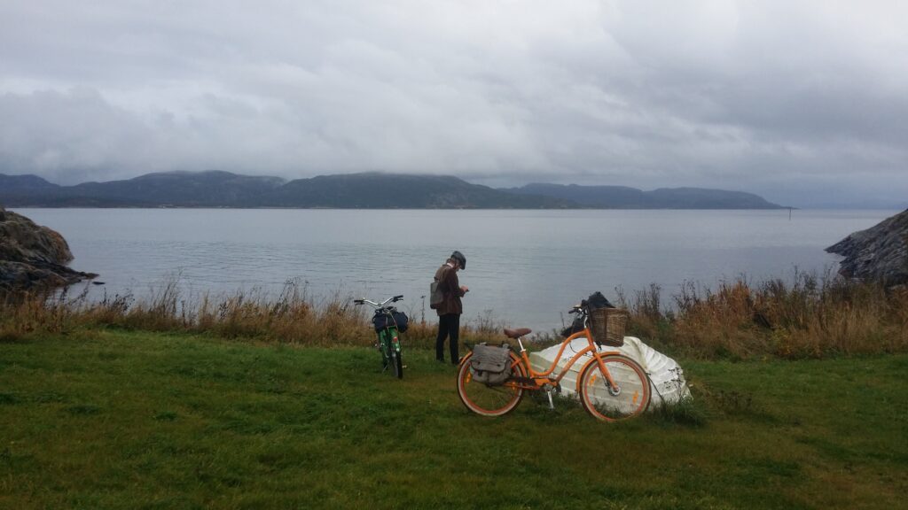
No, instead we let history be history and get ready for swimming. At Austrått it is incredibly right to swim in Jektvika, as we had heard, a pearl of a beach, which Ørland Municipality has upgraded with white shell sand. But where was this beach? We cycled to Austrått harbour and found a bay by the campsite, yes, we did. But it wasn’t that fantastic. Knut asked Google for help:
Don’t always settle for the first and best bay. Maybe it’s not the best at all.
Aha! There is a bay, Jektvika, a little further west. And yes – it is a very beautiful place!
Fine, white sand in Jektvika.
There is a sand volleyball court and benches at the site, too. Add crystal clear water:
… then there’s not much more to say (other than that a grill would be nice). And in October: Not a hint of a queue on the beach. Actually, completely empty. Strange thing, this wet, gray Sunday.
Another weird thing was the access platform on the east side of the bay. What is that? Balconies for theater performances in the water? Fishing spots? We definitely don’t recommend diving from here, it way too shallow:
Does anyone know what these devices are for? Not diving boards, apparently. Stage maybe?
But swimming in Jektvika? Yes indeed!
Turning home at dusk. Surely, we made it back to the boat in time.
We tried to escape the rain in Trondheim this Sunday in October. And by going to Ørlandet we did – almost. Ørland municipality is a short boat ride from Trondheim – just north of the mouth of the Trondheimsfjord. Bjugn and Ørland were merged in 2020 and the municipal center is divided between the Bjugn village and the town of Brekstad. The population is just over 10,000 – the fluctuations follow the activity at Ørland airport. From Brekstad you can take a ferry to the south side of the Trondheimsfjord (Agdenes).
The ferry to Agdenes seen from ‘the Field of Gravel’. Yes, it’s flat on Ørlandet.
The name Ørland comes from Norse ‘yrjar’ = gravel. The municipality consists of a peninsula with large gravel plains and otherwise a slightly hilly landscape with many islands, islets and skerries. Most of the Ørlandet peninsula is lowland, and will struggle hard if/when the sea rises. It is windy here! So much so that the ‘Ørlanders‘ are often referred to as leaning forward – it takes a lot to stand up against the wind.
On our way through the city center, we came across ‘Meieriparken‘ = the dairy playground. There is a lot of funny stuff in the old dairy, including this challenge: How to get through the barn without stepping on the floor?
This is fun for both children and adults!
Knut couldn’t resist and had to try. Here he is swinging, elegant as always. Idun had a sore back at the time, and didn’t join the game.
Splendid bike trail in Ørlandet.
Following a tip from Idun’s colleague Anita, we brought bicycles on the express boat. From Brekstad city center, there is a great bike path northeast towards Austrått. Try it!
One kilometer from Brekstad harbor lies Bruholmen (the Bridge islet). It floats freely at high tide, but is landlocked at low tide (is it called Bruholmen because there is a “bridge” out there at low tide?):
Bruholmen at high tide.
We arrived at Bruholmen at high tide and decided to swim around it. The seaweed soup was kind of awful:
Seaweed soup is not among our favorites.
But the water further out was crystal clear (12 degrees). Absolutely beautiful! We could even see the rocks on the bottom.
Clear as crystal.
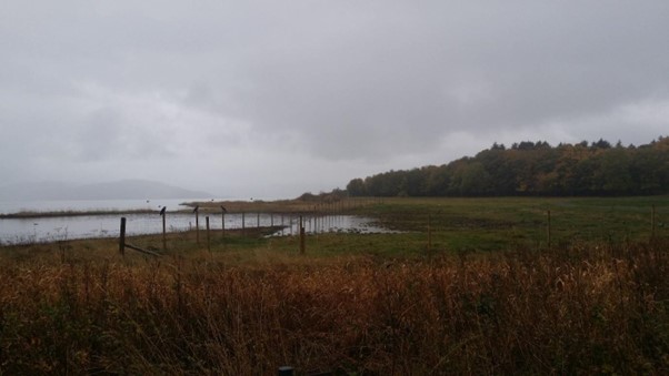
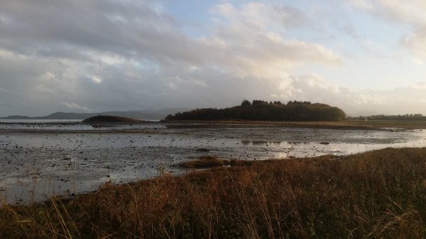
Beyond Bruholmen there are wetlands all the way, a bird paradise! The area is a Ramsar site. This means that Norway has signed an agreement in the city of Ramsar (in Iran) that this wetland is protected.
We saw hundreds of geese ready to depart south. And a flock of crows: as the text does not say in the norwegian children crow song: ‘There were 10 crows sitting on the fence crowing’.
Crows crowing on the fence.
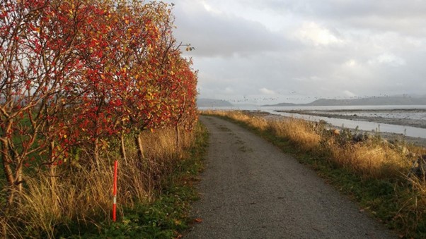
We were in doubt when we saw the use of road sticks by the trail. What is the point here (normally they are meant to tell the snow plowers at winter time where the road is)? Do they tell us that the trail does not go through the bushes? If there is a concern about ending up in the wetland, perhaps the sticks should have been placed on the other side of the trail? Does anyone know? The band of black dots in the photo below are geese.
No bicycling through the bushes!
We continued later to Austrått of course and had another swim, but we’ll save that for the next blog post.
On the way back we took a picture of Bruholmen at low tide:
Perfect Ramsar land!
On the way back we took the opportunity to pick sea buckthorn close to the trail. Sea buckthorn is a pioneer plant, which thrives in sand by rivers and coasts. The berries are orange, so beautiful colored that Idun just had to swing her bike in front of them.
Orange is the best color!
In addition to the splendid color, the berries are full of antioxidants and they taste good. So now we have sea buckthorn liqueur aging for Christmas. Although not in very large quantities (50 g of berries to be exact – it was more important to reach the boat back, they are not so easy to pick).
Stokkøya is a 17 km2 island in Åfjord municipality in Trøndelag, with 300 inspired inhabitants. The island was connected to land in the year 2000 via the 525 m long Stokksund bridge over the log-straight Stokksundet (stokk means log). At Stokkøya, facing west, lies the magnificent, 400 m long beach Hosnasand.
The pier goes west to Linesøya. In the background Hosnavika and Hosnasand beach.
At Hosnasand you will find Stokkøya Sjøsenter with its very special SUB architecture. Partially buried in the sand, with a dedicated use of color. Constructed by so much concrete it might have felt cold and unappealing, but it was surprisingly cozy. Well worth a visit!
Sea buckthorn (Hippophae) and SUB.
There were also vibrant colors indoors. Orange from hippophae and turquoise color from the sea?
SUB cabin (Sleep-Under-the-Ground) in vibrant colors.
As expected, we went to sea the same evening we arrived. A faboulous bath! The sky was wide, dark and infinitely more stars than we can see in Trondheim. The beach is both long and shallow, so we recommend wet socks to avoid freezing toes.
The next day we went out towards the Linesøy pier to find more suitable water depth. However, the coastline had no easy access this winter day.
Not easy to take a bath from here, obviously.
…but finally we found water.
Plenty of sky and sea on Stokkøya.
Sunday was snorkeling day.
Idun ready for snorkeling.Knut ready for snorkeling.
It took a while to pass the beach, but the water was fantastic; clear and beautiful.
For lunch it was time for a barbecue (the food at Strandbaren is really good). As you can see, we’re not the only ones who take ease on both barbecue and swimming seasons! We think both are equally naturally all year round.
Classic barbecue season at Stokkøya Strandbar.
The “aliens” in the water are just reflections from the window. The lazy photographer stood inside and took a picture of the other photographer…
Before returning home on sunday we took the obligatory little walk via Hosnastrand to Stokkøya Bakeri. On the way we found this special art, sadly enough made by trash from the sea:
Trash art.
And Stokkøya Bakeri? It’s run by a couple of very nice Italians!
Gli italiani si trovano a Stokkøya Bakeri.
At Stokkøya time is always right for cookies and wheat buns! And a bath…
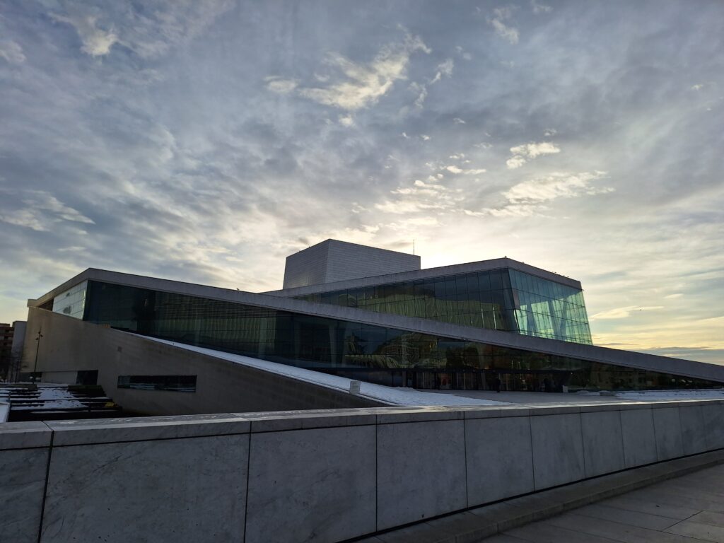
A stone’s throw from Oslo Central Station you’ll find the Norwegian Opera and Ballet. Designed by ‘Snøhetta‘ architects, it has become a landmark and place of pilgrimage for all who visit Oslo.
It was not too popular that Carrera marble was chosen for the facade of the Norwegian Opera House, instead of domestic stone. But it is understandable that pink Fauske marble would not have given the same references to the Arctic Ocean or icebergs.
The decision to build a completely new opera house started a long lasting debate at the time, not least the price tag of over 4 billion NOK. As expected, attendance at the opera has increased significantly since the new building opened in 2008, and all shows are normally sold out before the season starts. When you also consider that the ingenious design, including public access on the roof, makes it accessible to everyone regardless of musical preferences, this project can only be labeled a great success.
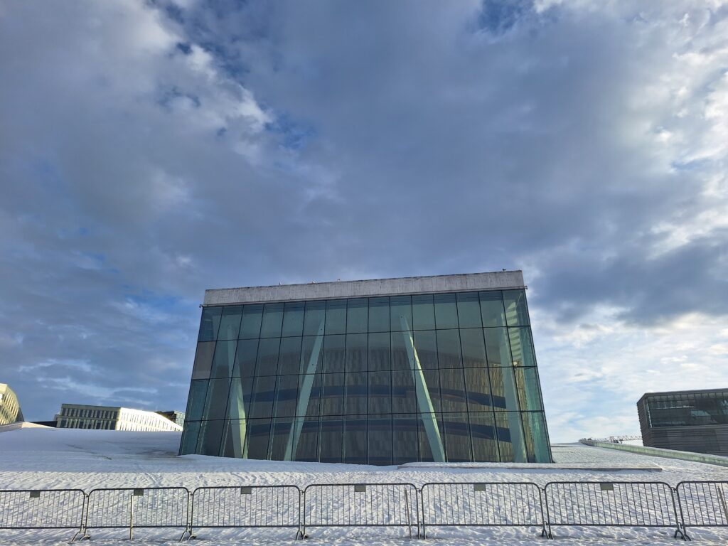
The opera roof is unattainable in winter conditions. The non-integrated fencing solution is not very stylish, though.
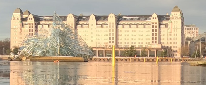
For Tobatheornottobathe, the lack of roof summit climbing was not a big disappointment, as we are always on a bathing tour as well. Just outside the Opera House, you can admire the floating sculpture ‘She Lies’. Her design interacts neatly with the Opera House, constantly turning and moving with the current and wind. Awesome! We wanted to swim there!
It’s been called trash, but Tobatheornottobathe thinks Monica Bonvicini’s ‘She Lies’ is just beautiful. And a great goal to swim to.
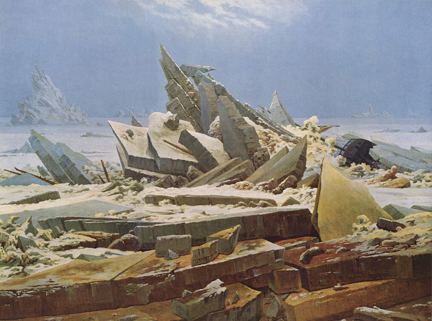
‘She Lies‘ is a three-dimensional interpretation in steel and glass of Caspar David Friedrich’s painting ‘Das Eismeer‘ (The Ice Sea) from 1823.
Friedrich didn’t visit the Arctic Ocean himself, but the Arctic was getting popular like never before in the 1820’s. Humanity (the wreck) looses aganst nature (God).
Caspar David Friedrich was born German in Greifswald (Swedish Pomerania) in 1774. He is considered one of the most important painters of the Romantic period. Why did he paint the Arctic Ocean? Art patron Johann Gottlob von Quandt wanted polar images in his private collection as a counterpart to motifs from the lush south, so in this sense it may have been a commissioned work. But it has also been interpreted as an elaboration of a childhood trauma from the age of 12, when he and his brother Christoffer went skating and Friedrich fell through the ice into water. The brother, one year younger, managed to save Friedrich, but drowned himself. The brownish color of the ice might come from domestic rather than arctic ice. Friedrich made many sketches while living in Dresden during the winter 1821, when the river Elbe was completely covered in ice.
‘Eisfie‘. For sure, she’s lying in the water crust. But is she lying too?
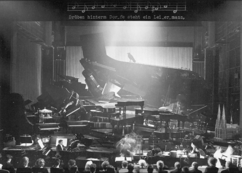
As a picture of the feeling when you throw yourself into water below 4 degrees Celsius, ‘She Lies’ is an excellent illustration. Tobatheornottobathe do not combine sauna with ice bathing at the moment, so every bath is cold-cold-cold and not warm-cold-warm (the motive is to become even better accustomed to cold water). She Lies’ location might be a lie, since icebergs do not usually drift into the Oslo fjord. But ice on the fjord is not at all unusual, as the day we enjoyed our swim. Bonvicini is an Italian artist based in Berlin, who likes to use humor in her works. Here, the most striking issue is the tension between the romantic style of Das Eismeer and the pointed, modern style of She Lies, which could perhaps be seen as a kind of lie? However, there are other, more extreme variations on Das Eismeer, the scenography at Theater Basel being the most special? The opera ‘Aus Deutchland‘ was performed in and on real pianos stacked like the ice in the painting.
‘Das Pianomeer‘, Basel 1997.
Our swimming was definitely neither lying down nor lying, in winter it’s all about efficiency! It was a rift in the ice from Operastranda (the Opera Beach) to our destination. Luckily! It would have been too much fuzz if we actually did change clothes and jumped into the water directly from the Opera roof. The Opera Beach is constructed by the use of local stone and sand from the Drammen fjord. It’s lovely! While we changed, a couple of Italians were standing just by, talking loudly on their mobile phones. ‘This is Oslo, we can see the Opera, we can see the Munch Museum, etc.‘. ‘Wow! This will turn out loud when we start swimming!‘, we thought. But the narrator continued in exactly the same voice… There’s clearly nothing special about swimming in the innermost part of the Oslofjord in winter, even not for italians.
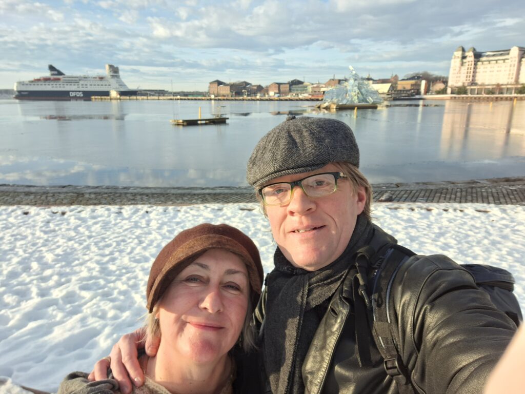
A sunny swim in front of the Opera House in January is just right. ‘Havnelageret’ (the port storage) in the background. Tobatheornottobathe in place right in front of She Lies.
After an opera bath, what should we do – except visiting the Opera? If all the performances actually are sold out, mulled wine (gløgg), or ‘vin brûlé‘ as they might call it further south, could be an option. To our disappointment, we had to realize that pub owners in The Tiger City make gløgg only in December, and that is very hard to understand. As we see it, gløgg is a part of winter – and winter just doesn’t end in December!
About 10 km from the center of Trondheim lies Lian (from the Old Norse ‘hlið‘ = sloping hill or mountain side), as part of Bymarka. There was little activity here until the idea of a tram line emerged, probably inspired by the ‘Holmenkollbanen‘ in Kristiania (Oslo). Construction work started in 1922, but the rails did not reach Lian until 1933. And then things started to happen. The place quickly was taken into the heart of Trondheim’s residents. In the summer, this is a splendid area for swimming, fishing and camping. However, the fishing has been poor for a number of years, after rotenone treatment to remove fish parasites in 2017, but now (2024) it’s said to be good again (trout). What about winter activities, one might ask. Is there anything going on during winter time?
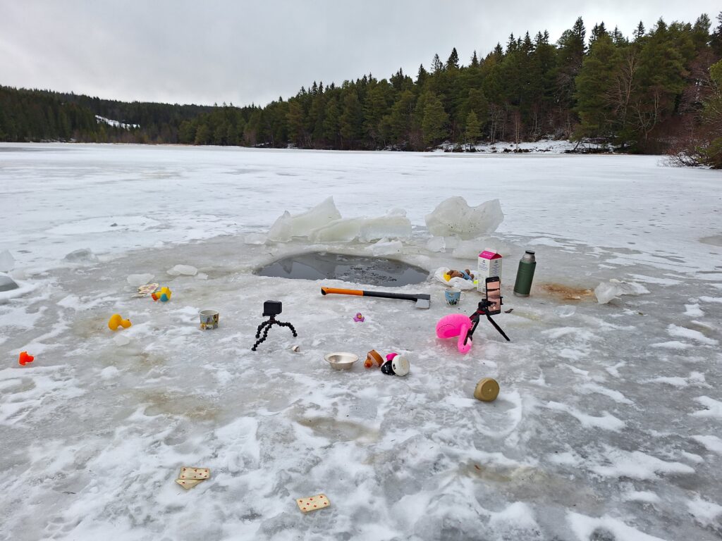
Preparing a bathing hole in 2024. You better switch sawing duty, so everyone gets warmed up. In the background, you can see Lian Restaurant, currently closed.
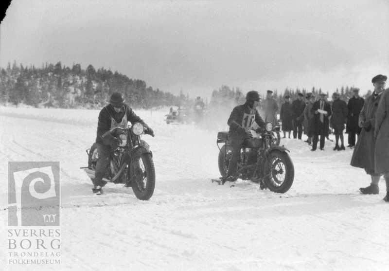
In the 1930’s, it wasn’t just skiing or ice skating on Lianvatnet (Lake Lian), there were also motorcycle and horse races on the ice. However, we haven’t heard any stories about ice bathing from ancient times. Has anyone heard about that? We want to know!
Motorcycle race on Lianvatnet in the 1930’s.
On a wet and grey December day in 2024, there was little else going on at Lianvatnet other than bathing in our bathing friend Taru’s swimming hole. Taru posts a video clip from her bathtub every day in Advent, like a ‘bath-vent‘ calendar. Tobatheornottobathe really wanted to be a part of that!
Peaceful atmosphere between Finnish and Norwegian bathers/ducks. Photo: Taru Uusinoka
Parts of Lianvannet are very shallow. Both Idun and Knut have partied and bathed in/by Helgelandshytta, and there it’s almost too shallow to swim. For Taru, who often bathes alone in her bathing hole, it is good to be in contact with the bottom, to be sure to get safely up again (good HSSE). That way, no bathing ladder is needed either.
‘There is a Rose at play)’. In Advent. At Lian. Photo: Taru Uusinoka
But as in Finnish television theaters on Norwegian TV in the 1970’s, the bathing couldn’t be all peaceful. One could hear both ‘fu*@‘ and ‘per&%#%‘, and in the end the axe was brought forward.
Finnish television theater in the 1970’s always ended with an ax. Photo: Taru Uusinoka
To reassure worried readers: Everyone came home safely!
…Little Boy, did you play Rose all by yourself? No good!
With its 600 inhabitants, Leka is one of Norway’s smallest municipalities, but that does not prevent an immense commitment to theater. Herlaugsgildet theater group was established in 1977, and they have set up the play ‘Herlaugsspelet’ for many years. But in 2024 it was ‘The saga about the Helgeland mountains’ that was the theme. We wanted to see that!
The path to Lekamøya (The Leka Virgin Mountain) starts from Solsem.
Tobatheornottobathe’s short version of the saga goes like this: King Sulis in Sulitjelma and King Vågakallen in Lofoten argued about who had the biggest kingdom. But there was one thing they agreed on, namely that the youths were difficult to manage. Vågakallen had given up his unruly son, Hestmannen (The Horse Man), and King Sulis had sent his 7 daughters to Landegode close to Bodø, so that they would be brought up by the wise and beautiful Lekamøya.
Lekamøya mountain looks like a woman with stretched arms and a shawl. Photo: Ole Hamnes, license: CC BY NC SA 4.0.
It didn’t work out very well, because the seven sisters just wanted to play and bathe, preferably with the Horseman. But his eyes had fallen on Lekamøya, and there was a lot of back and forth before he shot his arrow after her. The arrow went through Trollhatten which still has a hole through it, and at the same time the sun rised and everyone turned to stone. The color on the west side of Leka island is explained by the fact that Lekamøya dropped the bucket of mysost (whey cheese) in the same moment, and the stones were colored red.
On the way to theater in Frøvik. The mysost bucket on this milk ramp won’t blow away anytime soon.
The play ‘Lekamøya and Hestmannen‘ was quite well set up, with several references to Herlaugspelet. The outdoor stage is absolutely beautiful, located on a headland with water visible on both sides. The play had many scenes mentioning bathing, certainly a show to Tobatheornottobathe’s taste!
The seven sisters, here are 5 of them, appreciated bathing and all sorts of fun, especially if the Horseman was around.
This theater day in 2024, the weather was brilliant, almost too much for Tobatheornottobathe. Sunny and 27 degrees celcius… It all went as it had to go – there was a swim in the break!
At Leka, a bath is perfect when the theater has a break.