In Eyafjörður, a little north of Akureyri, there are some very special formations that ‘grow’ up from the seabed: Strýtur = pouts or vents. These are geothermal ‘chimneys’ (Hydrothermal vents) made of silicates (not biological structures). Ystuvikurstrýtur is the highest, standing 60 meters above the seabed. The water inside is measured to be 72 degrees Celsius. 100 liters of water come out of Ysturvikurstrýtur per second. Arnarnessstrýtur is wider, but shorter, shallower and has an internal temperature of 78 degrees. The vents are over 10,000 years old, they were formed just after the last ice age. The Strýturs were discovered some 100 years ago, but they disappeared from the map again because no one noticed them anymore. But then, in 1997, the pouts in Eyafjörður were rediscovered by Erlendur Bogason and Árni Halldórsson. See the episode “The Moth and the Flame” from the BBC-series “Forces of Nature” for the story of how they rediscovered them.
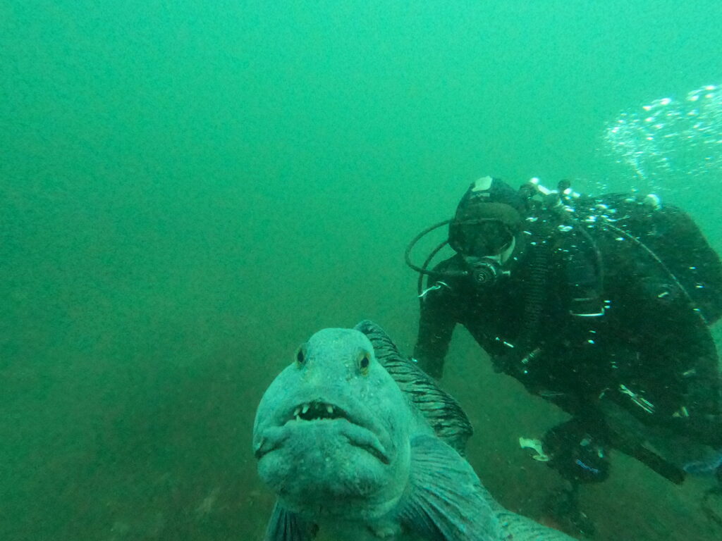
A pat under the chin and a broken mussel, and ‘Its all fine’, as they say in Iceland (Allt fint!).
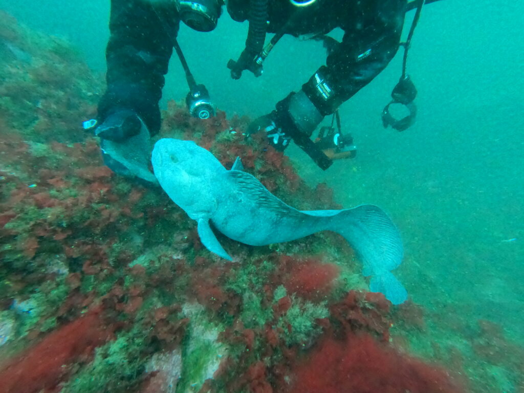
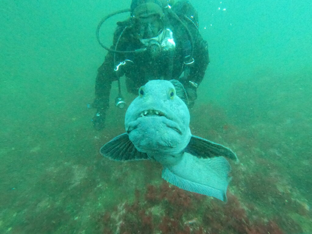
Some experts believe that life on Earth originated in shallow thermal structures in the ocean, like here. The Eyafjörður therminal vents are the only ones in the world that can be reached with regular scuba diving equipment, the others are located at depths of several thousand meters. They typically occur in the spreading zones between continental plates, such as in Iceland, where there’s a short distance to high temperatures from the Earth’s interior. Erlendur Bogason has developed a diving center around the vents existence. A diving trip here includes a visit to both Ystuvikurstrýtur and Arnarnessstrýtur. You can see the water coming out, and lots and lots of fish surround them. A very special experience! AND – you get to say hello to Erlendur’s two friends: The tame catfish!
Yummy, yummy!
Erlendur feeds them mussels – and if he doesn’t, they look back and forth between him and the food with saddened eyes, until he breaks them and offers the catfish a well-prepared meal.
A diving trip to Strýtur is just perfect, at least for Knut, who has a diving certificate.
P.S.: Always learn to know your photo equipment before going on a special dive! Due to not being aquainted with the new GoPro, we don’t have any pictures of the Stryturs themselves. But you can easily find that by a little internet search.
Eyjafjörður is one of Iceland’s longest fjords, 60 km long and 25 km wide at its widest. The fjord is located in the middle of northern Iceland. Compared to the rest of Iceland, the Eyjafjörður area, with its 25,000 inhabitants, is densely populated, the second highest population density after the Capital Region.
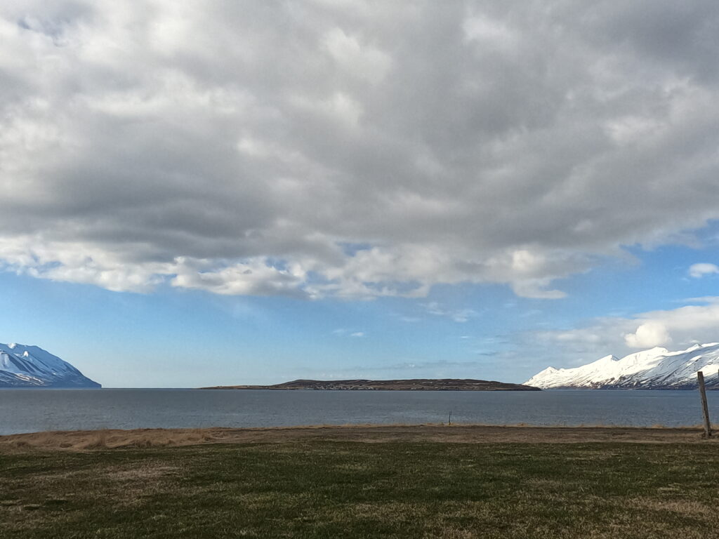
Eyjafjörður and Hrisey.
Northwest in Eyjafjörður (the fjord is named after the island of Hrisey), lies Hauganes (in the former municipality Árskógströnd). This small place with about 100 inhabitants does some tourism, including a campsite and whale watching. As expected, there are also opportunities for hot baths here, and Hauganes Hot Pot is a little gem! A simple arrangement, yes, the showers don’t always work, but the price is just right – you actually don’t need to buy a ticket to use the facility! However, there is a payment box where you are asked to donate an appropriate amount of money. Do this right away – in case the landlord suddenly appears, because he does! – and make your conscience feel good.
Hauganes Hot Pots.
The facility consists of 4 plastic tubs with different temperatures, one is made for children and is shaped like a boat, it is actually a small boat. Everything is located on a beautiful, black beach, where you can refresh yourself in the not very warm fjord. Expect crystal clear water! Maybe some hikers in warm jackets will appear while you swim in the sea… In short, an absolutely splendid place, and nice people too! Hauganes Hot Pot is co-located with the campsite, and there is a charming restaurant nearby, with good food – Baccalá Bar.
Both hot and cold baths are just right at Hauganes.
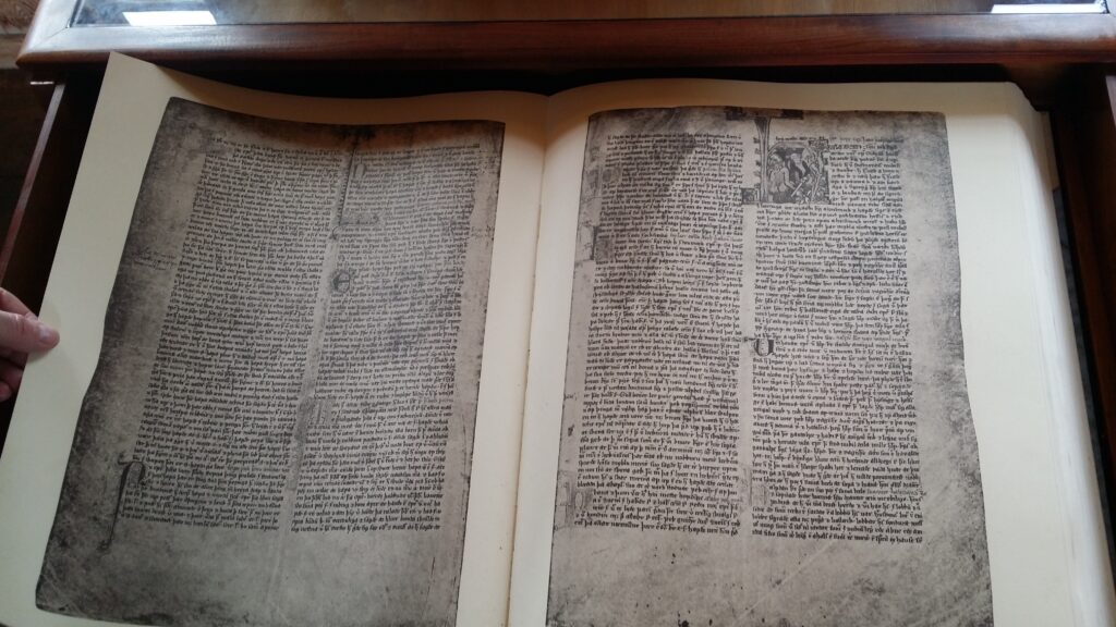
From the bath you can see the mountain Kátlufjall, where the hideous woman Þorkatla is buried (Kátluhóll), but we will not cover her story here. Below the mountain, north of Hauganes, there is a place called Kálfskinni. Here, the Norwegian King Rørek of Hedmark was buried (in Icelandic called Hrærekur), the only Norwegian king buried in Iceland. Rørek fought against King Olav Haraldsson (later to become Saint Olav), when Olav in the year 1021 fought 5 kings before breakfast, ref Flatøybok volume 3:
The kings had no guards to resist, they were all captured and brought before the king. Rørek was a far-sighted man and hard-hearted. King Olav thought he could not be trusted, even though he made peace with him. He had Rørek blinded in both eyes and took him with him, for he feared his wisdom if he was unharmed, but still did not want to kill him for the sake of his brother, Øymund. Øymund was Olav’s foster brother.
The Oppland Kings. Illustration from Flatøybok, volume 3.
This was the King Olav Trondheim choose to name it’s major hospital after! But of course: if people go around mutilating others, the hospital gets more customers, so maybe there is a logic here…
King Olav kept Rørek with him after this, and during the high mass on Ascension Day, the blind Rørek attacked the king:
And when the mass was in progress, the king stood up with raised hands and bowed to the altar. Then Rørek jumped up, quickly and violently. He stabbed King Olav with a kind of scissor knife they call a ‘ryting’. The stab hit the overcoat in the folds he had let fall. The clothes were cut into many pieces, but the king was not wounded.
In the library at Flatey in Breidafjörður there is a facsimile of Flatøybok.
The king then asked Torarin Nevjolvsson to take Rørek with him and give him to Leif Eiriksson in Greenland. The wind was poor during the trip, and he did not get further than Iceland, where Rørek lived for three winters before dying by sickness. Rørek was known for his unhappiness, but when you have lost your kingship, your kingdom, your sight and your country, it is okay to be a little irritated. In the end, there seems to have been a kind of reconciliation with his life situation:
Then Gudmund (from Mödruvellir) gave him lodging at a small farm called Kalvskinn (in Árskógströnd). There Rørek spent his third winter. There were few servants. Rørek said that since he had lost his kingdom, he had not liked any place as much as there. Here he was highly regarded by all the people.
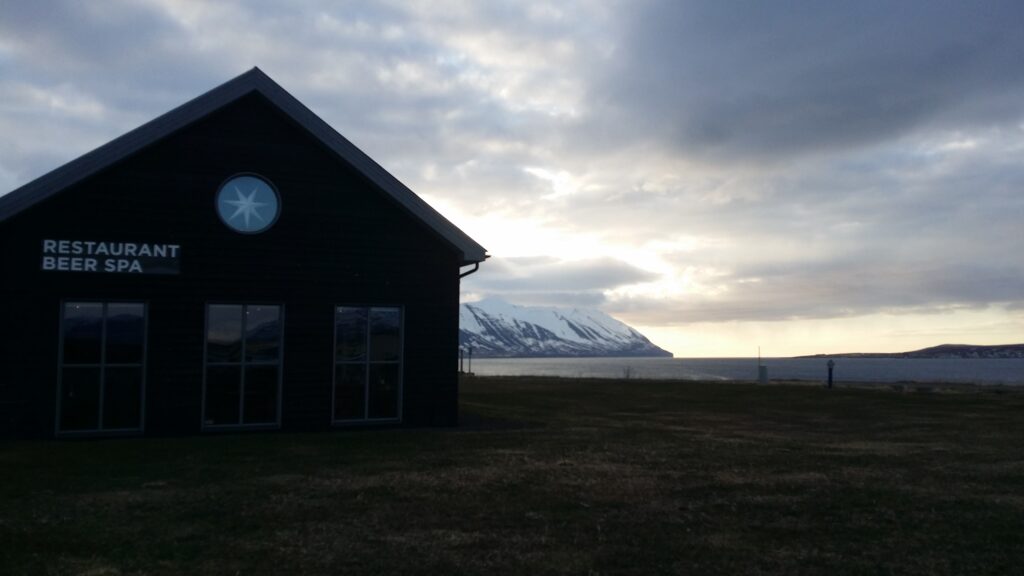
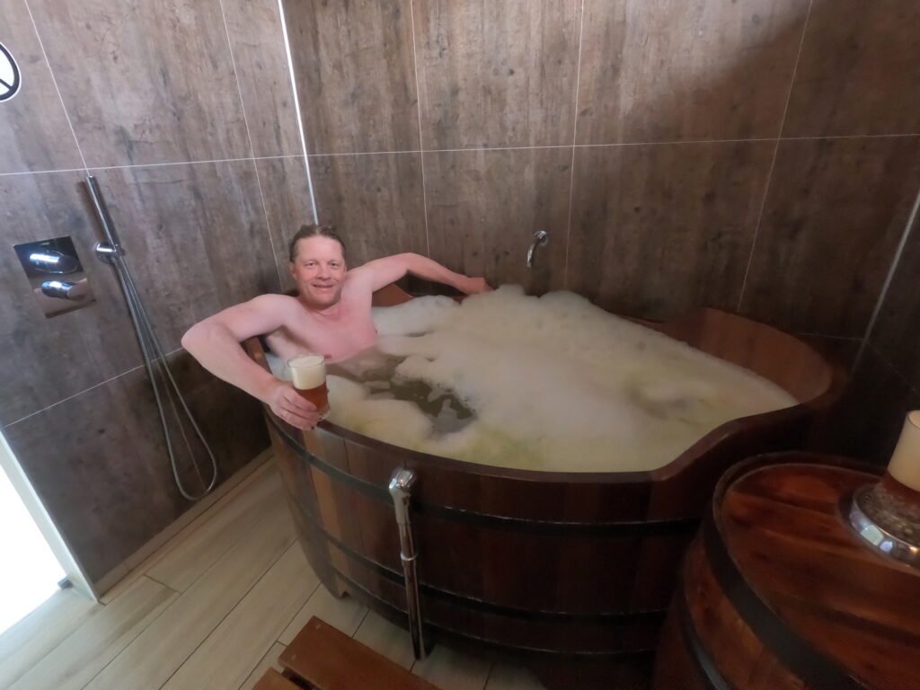
Northeast of Akureyri, you can indulge yourself decadently in warm beer! The place is called Bjórböðin (The Beer Baths) and opened in 2017. The facility is located close to the sea with a fabulous view. There is a fjord, there are mountains and in the middle is Hrisey (Bush Island). It can’t get any more beautiful than that!
Hrisey in Eyjafjörður (it is the island that gave the name to the fjord).
From Akureyri to Bjórböðin it is a 35 km drive. If you for obvious reasons don’t want to drive there, you can sign up for a minibus transport there and back, which we did – and it worked very well, you quickly get to know each other on the road. We hadn’t talked for long before the people in front of us turned around and asked if we were Norwegians. When this was confirmed, they continued: ‘Norway is so exotic to us, you really live a rich man’s life there, it’s not like that in Iceland.’ (they were referring to the Norwegian TV series Exit…). But a fun travel companion we had, that’s for sure!
Sunset in Eyjafjörður. Hrisey to the right.
We had some time to wait for our turn when we arrived, and were encouraged to take a bath in one of their two hot tubs. It was incredibly beautiful! Outside, a little above the sea, with the sun on the snow-capped mountains. A nice warm-up before the actual beer bath.
A splendid evening at Beer spa.
The beer bath took place indoors, in a separate small pool made from half a beer barrel filled with warm, fresh, newly fermented beer. It smelled good and foamed a lot – and tasted like grass. Next to it was a tap – you could drink as much beer as you wanted for the half hour that was allotted to you. But we are talking about only half an hour.
Beer theme in Bjórböðin.
After the beer bath you are led up a white plush staircase to the attic. There you are wrapped in blankets and can lie down and relax. Knut thought it was a waste of time, because he was in party mood. The alternative is to return to the hot tubs outside or to go to the restaurant. We went to the restaurant first. The fried cheese is delicious.
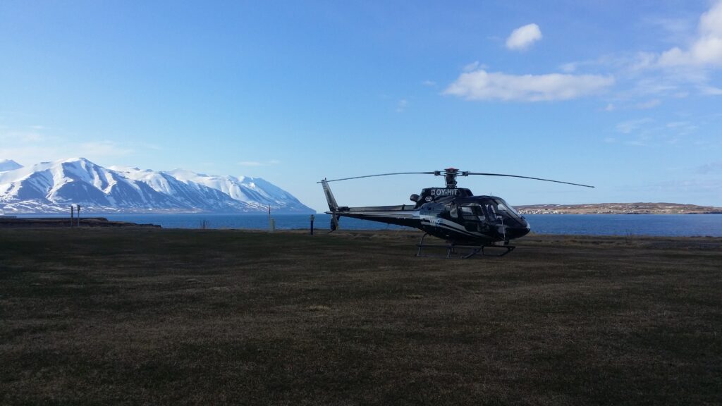
We felt decadent, but others took it even further as they were transported by helicopter. A bath or three in Bjórböðin is a good idea, even for those of us who don’t otherwise live the Exit life.
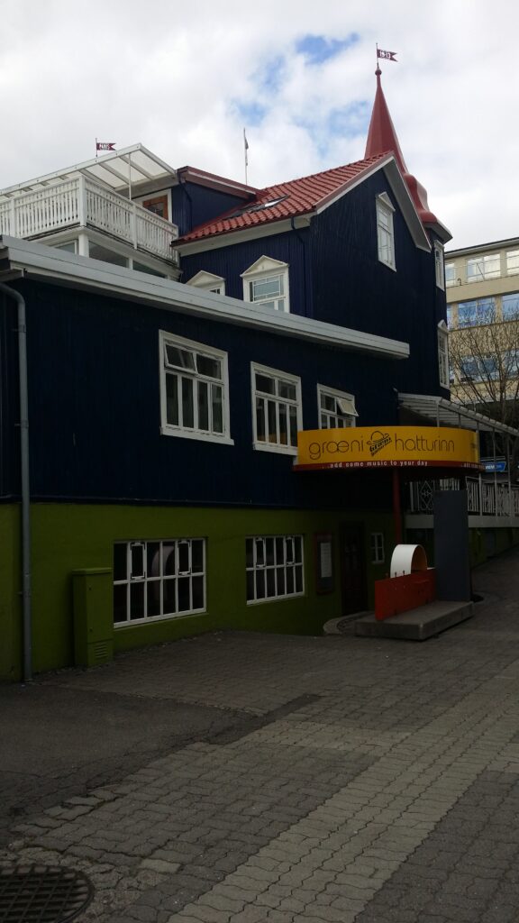
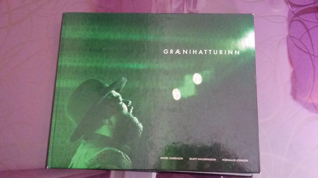
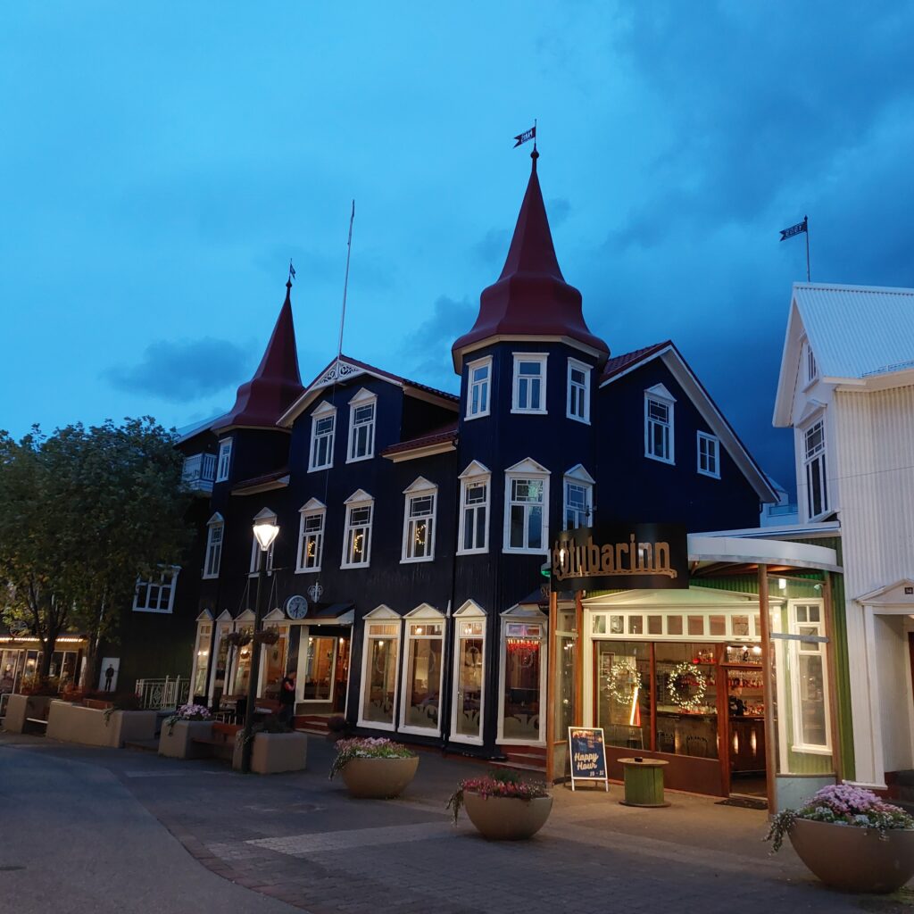
One of the coziest cafes in Akureyri is ‘Bláa Kannan’ (the Blue Tea Pot), with its two frequently photographed towers. Under that Blue Tea Pot there are Green Hats! Græni Hatturinn (the Green Hats) is the concert venue in Akureyri, which actually stayed partially open during the corona period. This is a very nice place, with a good selection of various bjór (pronounced bjaor), i.e. beer, but you probably already knew that.
Græni Hatturinn below the Bláa Kannan Cafe.
Here we can recommend a concert with, for example, the band ‘Hjálmar‘, who plays a nice mix of raggie and folk music (we do often plan the Iceland trip according to the program at Græni Hatturinn). Or maybe you’d rather be amused by the white idiots: ‘Ljótu hárvívitarning‘? In Icelandic! This is reminiscent of Prima Vera, listen to this song as an example: ‘Ég fer á traktornum‘. Or, perhaps, an alternative might be to check out ‘Papar‘, Irish music in Icelandic. However, the titles are somewhat strange: ‘Og þá stundi Mundi‘ = ‘The Wild Rover‘…
Anniversary book for ‘Græni Hatturinn’.
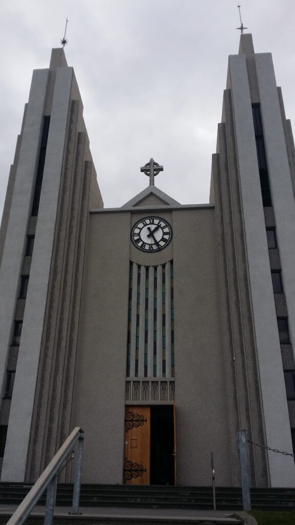
Before the concert, swimming training is a good idea. Straight up the hill and past Akureyrikirkja, you will find Sundlaug Akureyri, Akureyri’s public pool.
Akureyri church from 1940 was designed by Guðjón Samúelsson. The architecture is inspired by basalt columns. Here you can see a representation of goða Þorgeir Þorkelsson throwing his pagan idols into Goðafoss.
This is a slightly larger swimming facility than usual, with 2 outdoor swimming pools, many different hot tubs and a sauna. Akureyri Sundlaug is a bathing paradise for children with several children’s pools, a long slide and 2 jumping castles. After the swim, when you are clean and ready to party, just put on your green hat and go.
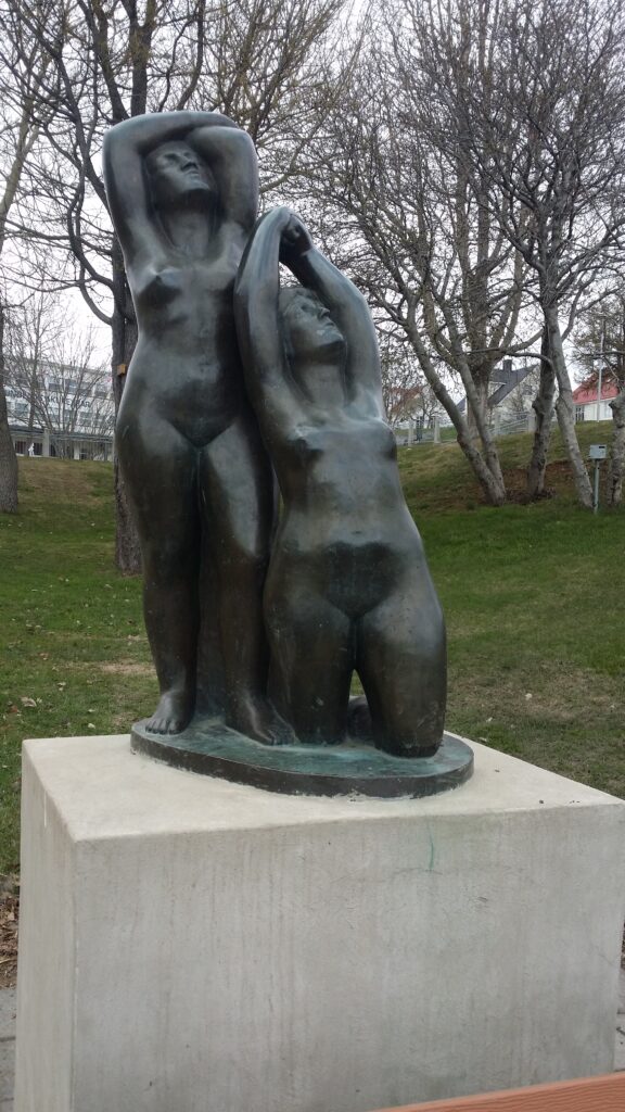
The sculpture ‘Systrurnar’ (The Sisters) below Akureyri Sundlaug is modeled by Ásmund Sveinsson.A bath and a green hat, and Idun is ready for party. Illustration photo (we usually don’t take photos in public swimming pools).
Akureyri was originally two settlements: The houses on the ‘øra’ where Gleráverfi is located today, and in the south, Old Akureyri, where you will find the Minjasafnið á Akureyri (Akureyri Museum). Today’s city center is basically situated between these. From the 17th century, trade was conducted here in the summer months, as there are good harbor conditions. However, the Danes did not stay at winter time until well into the 18th century. At Gleráverfi, in the 20th century, there were a number of ramps out into the sea during the herring fishing, and a lot of activity.
Gleráverfi, with a view towards old Akureyri. Here the herring boats were parked side by side in the 20th century.
Akureyri Museum exhibits a number of old maps and also has a section on the topic Icelandic popular music. The museum is interesting, even if the selected subjects have little to do with each other.
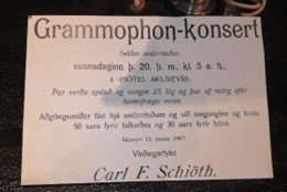
Gramophone concert, announced at Minjasafnið á Akureyri.
There is an exhibition in the basement that emphasizes the Icelanders’ struggle to free themselves from the Danish trade monopoly. Iceland joined Norway into the Kalmar Union in 1397, and the Danes got a monopoly on all trade. The problem was that there were no duties attached to the trade rights. Although the need for imported goods was critical for the population, one could never be sure that Danish ships actually arrived on Iceland every year. At the same time, vessels from other countries, or the Icelanders themselves, risked large fines for trading – regardless of whether Danish ships actually traded or not. In short, a moving story, well told and definitely worth a visit!
Art in old Akureyri.
After a visit to the museum, a swim is a good idea. Take the car and drive further into the fjord ending, to the forest Vaðlaskógur. The forest is named after the mountain Vaðlaheiði on the east side of Eyjafjörður (the fjord with an island). Before 1985, the road from Akureyri to Húsavík was both steep and winding over Vaðlaheiði and through a small canyon called Steinsskarð. Here one might be able to see the remains of a small shed, which some believe inspired the construction of Iceland’s longest word ever:
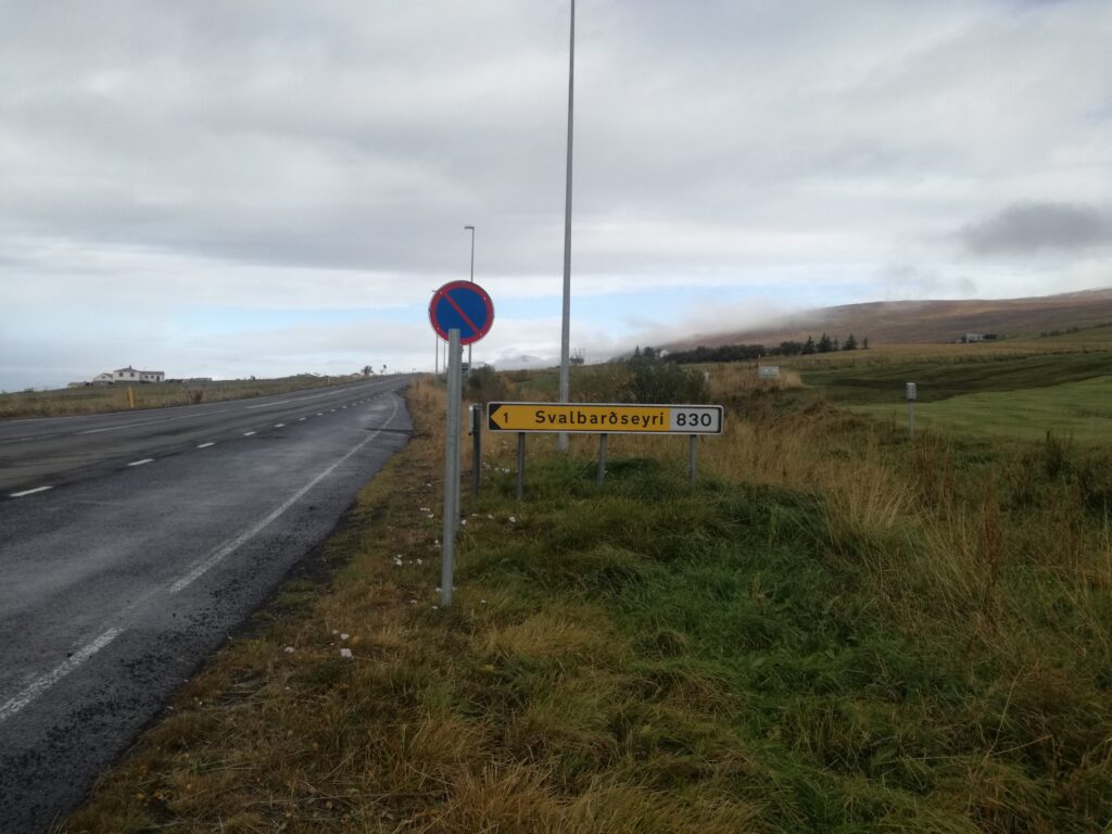
Today there is a tunnel under Vaðlaheiði, called Vaðlaheiðargöng. At Eyafjörður, the tunnel opening is close to the village of Svalbarðseyri, that immediately gave Idun the good, homely feeling, even though it is otherwise not very similar to Longyearbyen, Svalbard, where she grew up.
Vaðlaheiðargöng opened in 2018, which shortened the route between Akureyri and Húsavík by 16 km. NB! You have 48 hours to pay the toll if you haven’t done so in advance. Tobatheornottobathe finds is hard to remember those kinds of deadlines and recommend paying in advance!
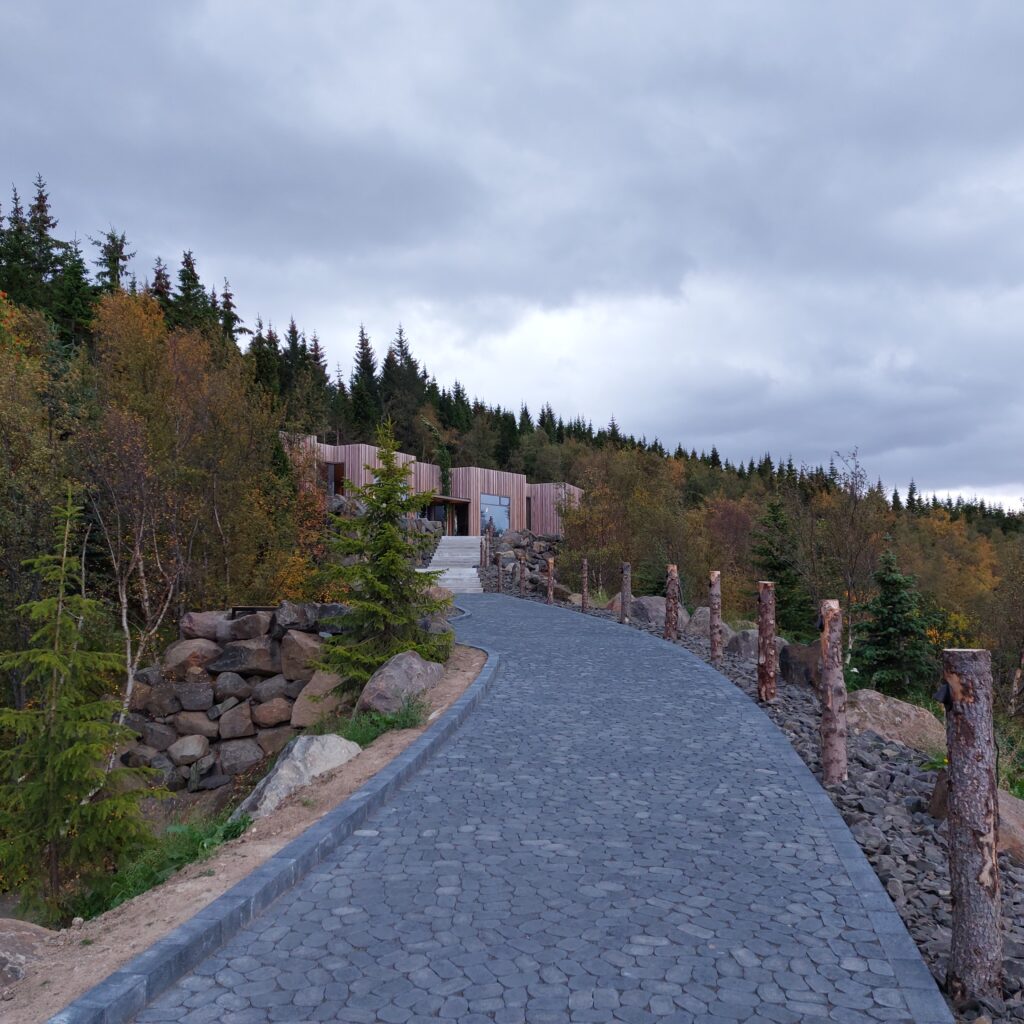
Forest Lagoon opened in 2022 and is located – actually! – in a forest.
During the construction of the Vaðlaheiðargöng in 2014, there were problems with water seepage. But the misfortune turned to luck, as the water turned out to be a geothermal source! That, in turn, inspired the couple Sigríður Hammer and Finnur Aðalbjörnsson to build the Forest Lagoon.
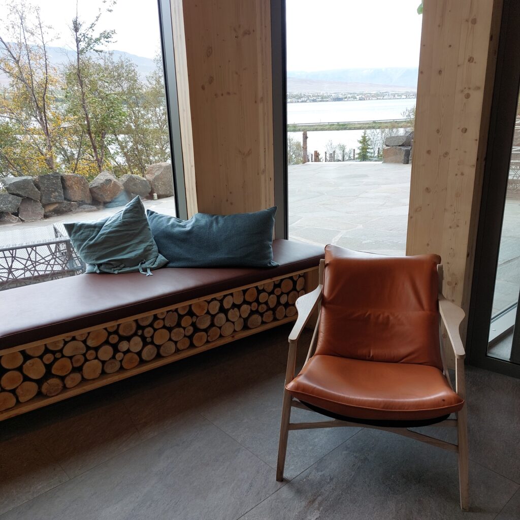
Wood is a recurring element in Forest Lagoons interior. Akureyri can be seen in the background.
Eyafarðar skogbruksforening got a contract with the land owner in 1936 to plant a forest on their marshes, at the inner end of Eyafjörður. The tree planting was completed in 1970, and today it is a strange feeling to enter an Icelandic forest here up in the north region, where there are no wild trees at all. The spa is very beautiful and has everything you could ever dream of: hot and cold baths, saunas, a restaurant, all with inspiration from the forest and rocky hill behind. Absolutely recommended!
Akureyri (the acre in the delta) – the capital of Norðurlands Eystri (North Eastern Region), is a university town with all facilities and a bustling public life even though the population is only 20,000.
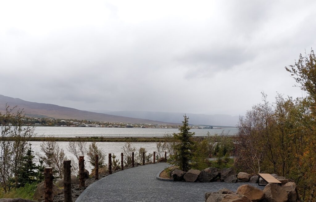
Not very colorful Akureyri town, seen from the fjord Eyjafjörður’s inner end.
According to Landnámabók (the conquest book), the settlement of Eyjafjörður started with Helgi Magri sometime in the 9th century. His father, Eivind, was originally Swedish, and moved westwards via Norway. Helge was born in Ireland, but left for fostering in the Suðrøyene (Hebrides, west of Scotland) as an infant. When his parents picked him up 2 years later, he had become so thin that they hardly recognized him, hence the nickname ‘magri’ = ‘the skinny one’. Fostering children was a form of alliance building in the Viking Age, and foster children had the same rights as their own children. But one wonders how good the relationships were after this… And let’s hope that the foster family didn’t also have daughters! In the book ‘Auðr’, Kim Hjardar writes that in the Viking Age 7% of men and 37% of women were malnourished as children. Helgi married Torunn, who was the daughter of Kjetil Flatnose and sister of Aud the Deep-Thinking (the same Auðr mentioned above), and they had many children. Their settlement was the largest in Iceland, larger than the settlement of Ingólfur Arnarson. Helgi was a Christian, but when it really came down to life or death (for example in stormy weather at sea), he invoked the thunder god Þor instead.
Akureyri’s most characteristic building, with Bláa Kannan café on the 1st floor.
The first time Akureyri is mentioned by name in written sources is in a judgment from 1562, when a woman was convicted of having slept with a man without being married. But don’t let this put a damper on your mood! Akureyri is a place with a good spirit, several cozy cafes and an abundant number of restaurants and bars.
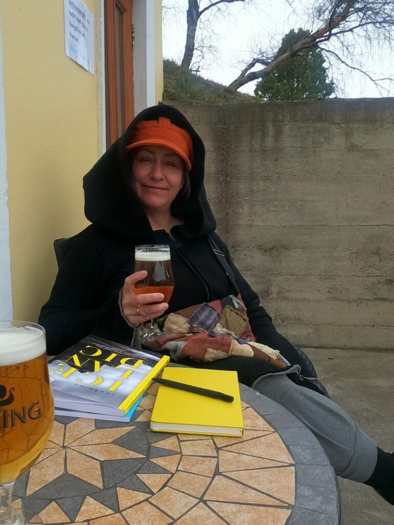
Idun enjoys life at Kafe Limur. Trying to learn Icelandic, but that’s quite a challenge.
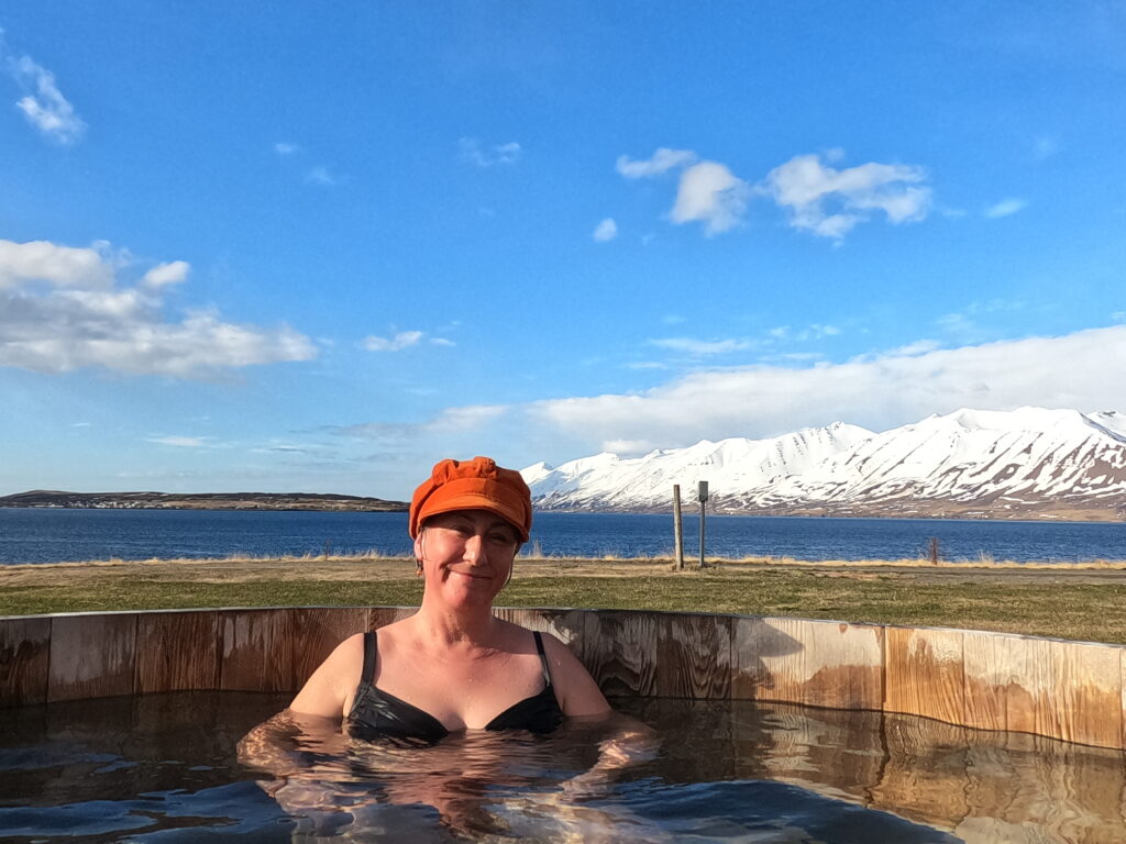
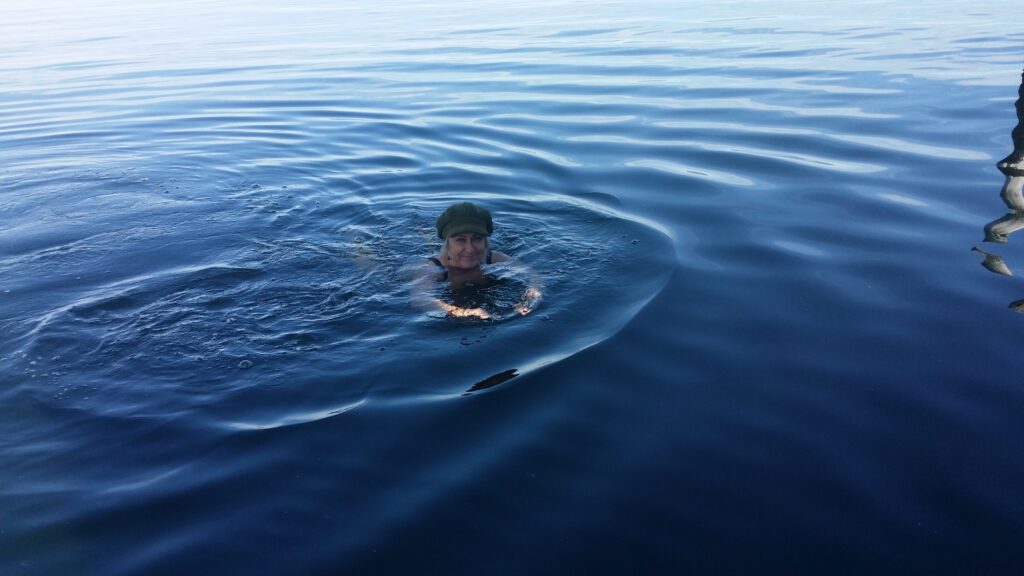
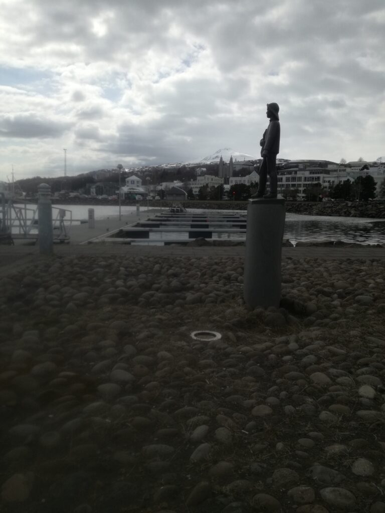
Before you go out to party, taking a bath is just right. This time, we recommend a morning dip! We made it incredibly easy by changing at the hotel, crossing Drotningarbraut (Queen’s Road), climbing over the boulders and swim there. Clear and beautiful water, lots of birds and clean water even though it’s close by an active harbor.
A bath in Eyjafjörður is just right!
Ref: ‘Auðr-Kvinneliv i vikingtid‘, Kim Hjardar, ISBN 978-82-430-1209-7
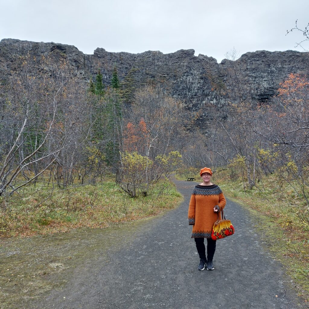
An hour’s drive east of Húsavík is the norse god castle Ásbyrgi. What a place! A field surrounded on three sides by 100 m high cliffs, with a rocky island in between. The rock in the middle is called Eyjan (the Island). Seen from above, it all resembles a giant imprint of a horse’s hoof. Clearly this must be a track made by Odin’s horse Sleipner!
Sleipner’s footprint?
However, science interprets the Ásbyrgi geology somewhat differently. The lava rocks are formed by a volcanic eruption from Stóravíti some 10,000 years ago. The canyon was excavated later. 3,000 years ago, there were 3 active volcanoes under the glacier Vatnajökull, which created dramatic floods of meltwater northwards, and hence the Ásbyrgi cliffs.
At Ásbyrgi you will find nice hiking trails, and in the summer, guided tours are also organized in the area. Spend some time here!
The information sign. Ásbyrgi is 3.5 km long and 1.1 km wide. How big must the horse Sleipner have been to make such an imprint?
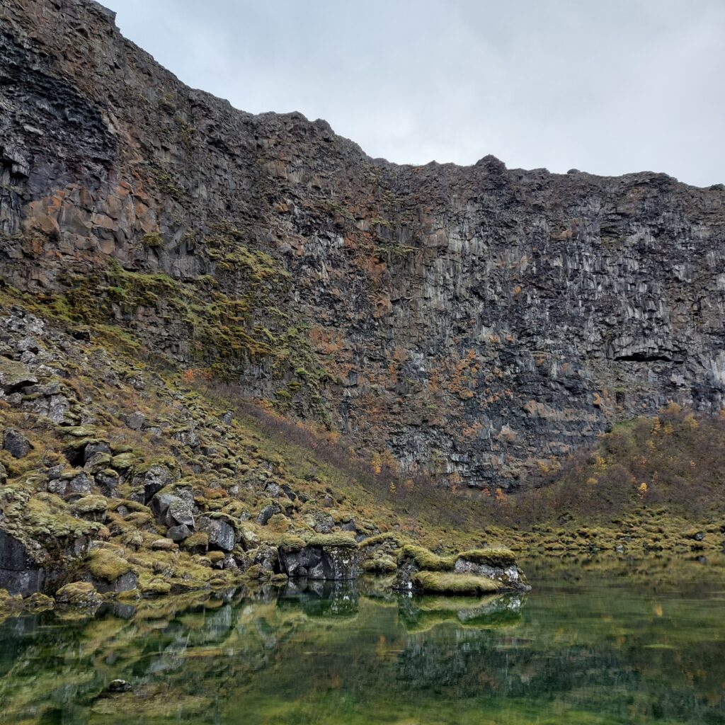
Those who can see elves (and in Iceland a lot of people do), have said that inside these cliffs there are many elf homes, public elf houses and even an elf concert hall. There are several elf stories connected to the place, including the impossible love between the poor boy Huginn and Heiðbláina, who was the daughter of the landlord in Ásbyrgi. Because of the difference in status, they were not allowed to marry, and they were very sad. One night an elf came to them in a dream. She was very unhappy, because her beloved had been bewitched into a water monster. Now he lived in lake Botnstjörn, Ásbyrgi, and could only come up when the midnight sun shone on the cliffs. The elf said that Heiðbláina could break the spell if she confronted the Nixie and threw her most valuable things into its gap. So the girl did, the curse was broken and the elf woman paid back by arranging for Huginn and Heiðbláina to get married after all. It always pays back to help an elf!
Idun didn’t hear any elves crying, and was looking forward to a bath in Botnstjörn.
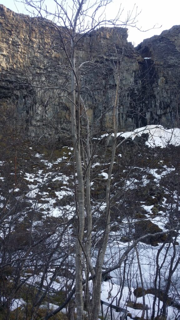
If you hear crying in the elf’s home, it might be the elf Bjartmar mourning for the orphan Una, but that’s a long story that we won’t cover here. None of the Tobatheornottobathers have the ability to see or hear elves, so surely a bath in Botnstjörn could be a good idea? We have been to Ásbyrgi twice. The first time it was winter (April), and what could go wrong?
Elf Homes and the lake Botnstjörn in Ásbyrgi, winter.
Well, it was this thing with ice on the water… We couldn’t swim in April. So then we just had to try again, in September. What could possibly go wrong in autumn?
Botnstjörn in September.
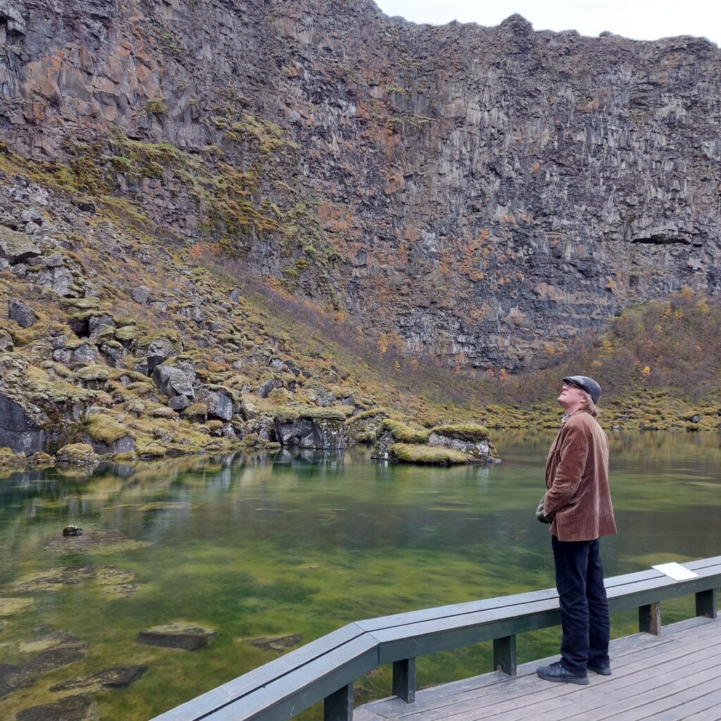
When it comes to bathing, there is actually quite a lot that can go wrong. One classic problem: The water isn’t deep enough. Do you really want to have a bath when it will only be a small dip? No, a bath without getting your back wet is too stupid, so this bath became a ‘no‘. AND – by closer inspection: It is not allowed to go outside the path, so we had to conclude that swimming in Botnstjörn is in fact prohibited. Just as well Botnstjörn was too shallow, so we could let go of that temptation.
Knut is considering the Botnstjörn bathing area for the second time.
On the road between Húsavík and Ásbyrgi there is a small museum on a farm by the sea: Minjasafnið á Mánárbakka. It is well worth a visit! Here, among other things, they have found a pearl in the soil, a so-called ‘pearl of the eye‘. The pearl was professionally assessed in Norway, and we saw a letter from the Tromsø museum, which says that such eye pearls date from the late Viking Age (9th century), with a place of origin in Turkmenistan (!). In Norway, 55 eye pearls have been found, including Lofoten and in Troms (Kvaløya).
Charming turf houses at Mánárbakka. Please remember to bring some cash for the tickets, as they don’t accept credit cards at Mánárbakka.
A visit to the Mánárbakka museum is just right on the way to or from Ásbyrgi. Even without cash to pay, we got a tour of the museum. The farm has belonged to the same family in an unbroken line since the Conquest period. As far as we can understand from the ‘Landnåmsboken’, this means that today’s residents are descendants of Bodolv, who emigrated from Agder, Norway, in the 7th century.
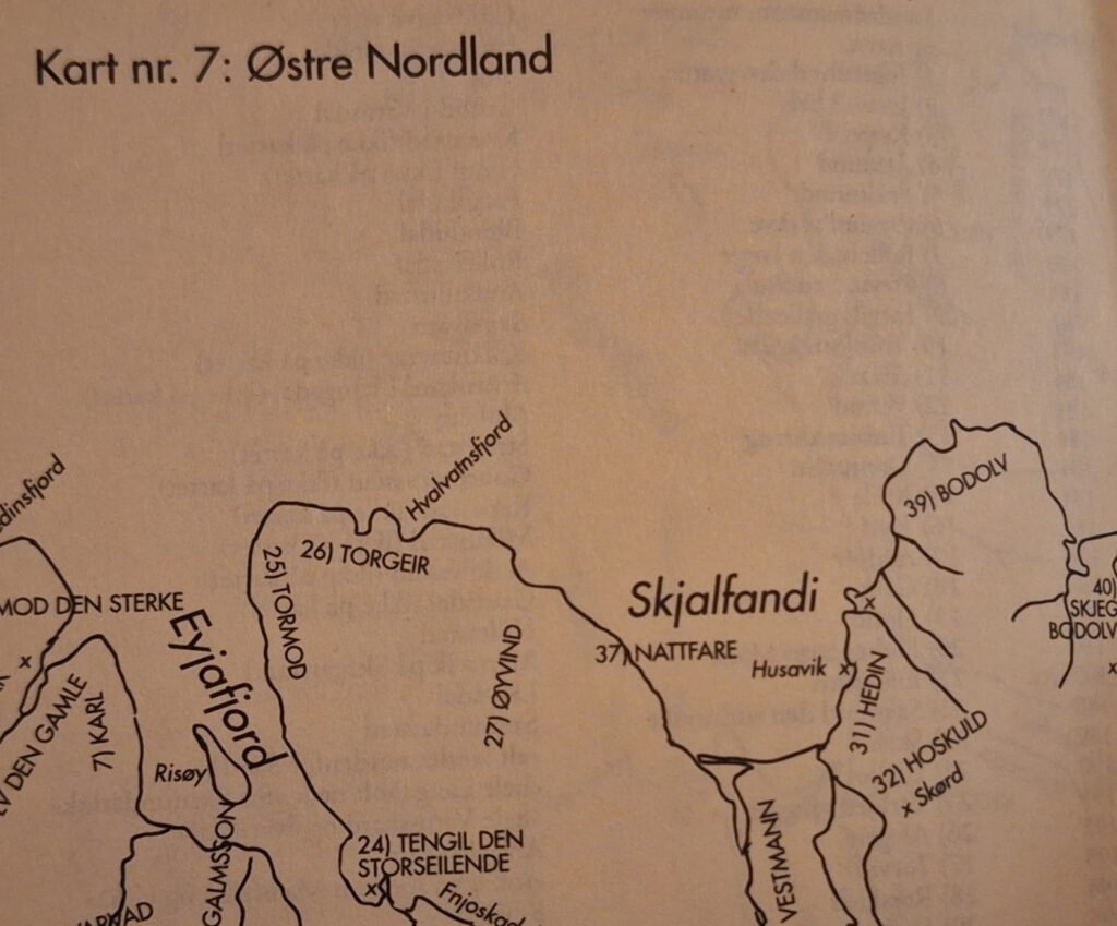
Conquest no. 39 in Norðurland Eystra, Tjörnes, was taken by Bodolv. From ‘Landnåmsboken’.
‘A man named Bodolv was the son of Grim Grimolvsson from Agder (Norway) and brother of Bodmond. He was married to Torunn, daughter of Torolv frode, and their son was Skjegge. They all went to Iceland, but their ship was wrecked at Tjörnes, and they were at Audolvsstad the first winter. Bodolv took all of Tjörnes between Tunguá and Os. He was then married to Torbjørg holmesol, daughter of Helgi magri. Their daughter was Torgerd, who was married to Åsmund Ondottsson.‘ Ref Landnåmsboken
Mánárbakka. In the absence of a (Christmas) tree, the solution could be a glittering iron tree.
P.S.: On our next Island trip, we sent cash to Mánárbakka, so we have settled our score!
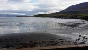
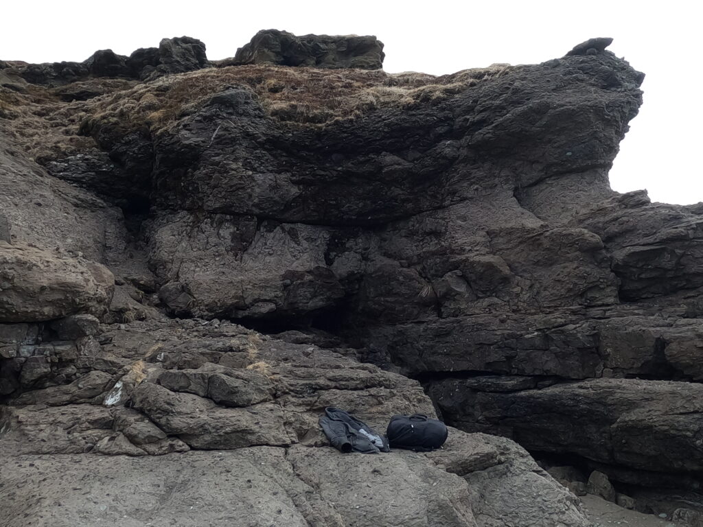
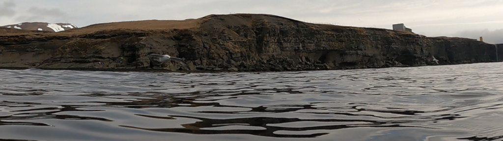
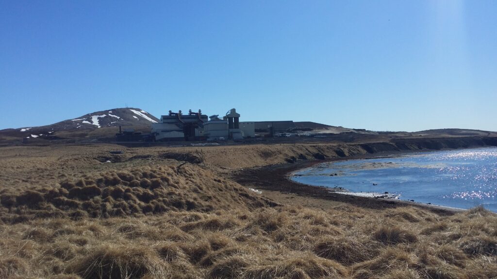
While we were staying in Húsavík, we had a wish for a bath in the fjord – perhaps we could actually see puffins or other interesting elements of Iceland’s fauna. So we took a stroll northwards along the sea, past a dead end by the local motorcycle club, past the GeoSea spa and towards the silicon factory outside the city. We had to walk across old fences and such, but eventually we found a way down to the shore – before we reached PCC BakkiSilicon.
A perfect wardrobe, north of Húsavík.
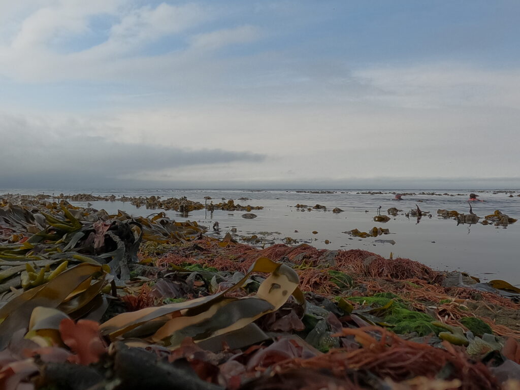
This day we brought wetsuits, the idea was to swim a bit and not just dip for a few minutes. It was very low tide when we arrived. All the seaweed was dry, and the kelp forest was sticking up everywhere.
Low-low tide at Skjálfandi Bay.
There was a bit of a struggle to pass the kelp, and while we were working on it, an air raid started – by fulmars! Suddenly, a steady stream of birds swooped straight above our heads, we could almost grab them. The fulmars released their torpedoes, but the target hits were poor, and fortunately we got away without poo on our heads. A splendid experience!
Fulmar incoming!
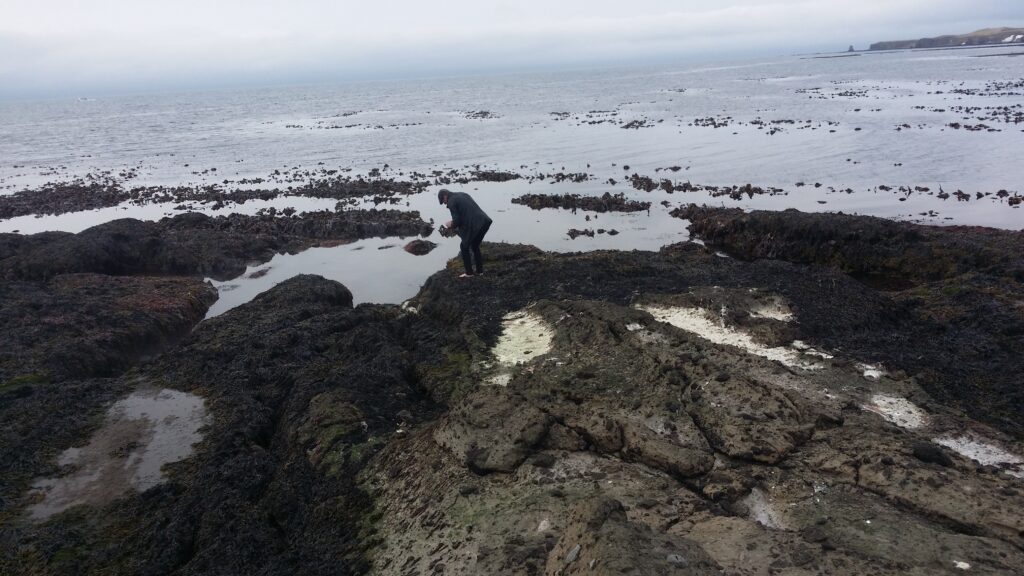
Back on land, we observed steam on the shore. Steam? Here? Why? Knut went over and checked. Yes, it was a hot spring! On the shore, completely anonymous, surrounded by snow-covered mountains and a big, cold fjord. An absolutely perfect place for cold water swimming – as you can easily warm your toes afterwards. Iceland Niceland – what a country!
Smoke on the water. Not so easy to photograph, so this time the photographer became the subject.
Húsavík is a community with both great patriotism and great optimism. After the city became known through the ESC film ‘The Story of Fire Saga‘, they have invested heavily in an ESC boom.
A fake bus stop was constructed for the Fire Saga movie, and was taken down afterwards. But now it is rebuilt as a sightseeing spot (the buses don’t pass here).
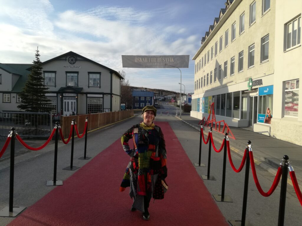
Now it is possible to book a ‘Fire Saga Guided Tour‘, a ‘Ja Ja Ding Dong Pub‘ has opened, and when the song ‘My Hometown‘ (Húsavík) was nominated for an Oscar as the best soundtrack in 2020, it really escalated. Several funny commercials with the theme ‘Oscar for Húsavík‘ were posted, and when the award evening approached, they even painted 50 meters of the main street red – to have the red carpet ready for Oscar.
Idun on the red carpet in Húsavík.
Icelandic TV followed up and filmed a version of the song at Húsavík harbour, with the church in the background. Girls from Húsavík school were backing vocals, each of them wearing a beautiful Icelandic ‘Peysa‘ (knitted sweater). The song was broadcasted again and again during the Oscar’s commercial breaks.
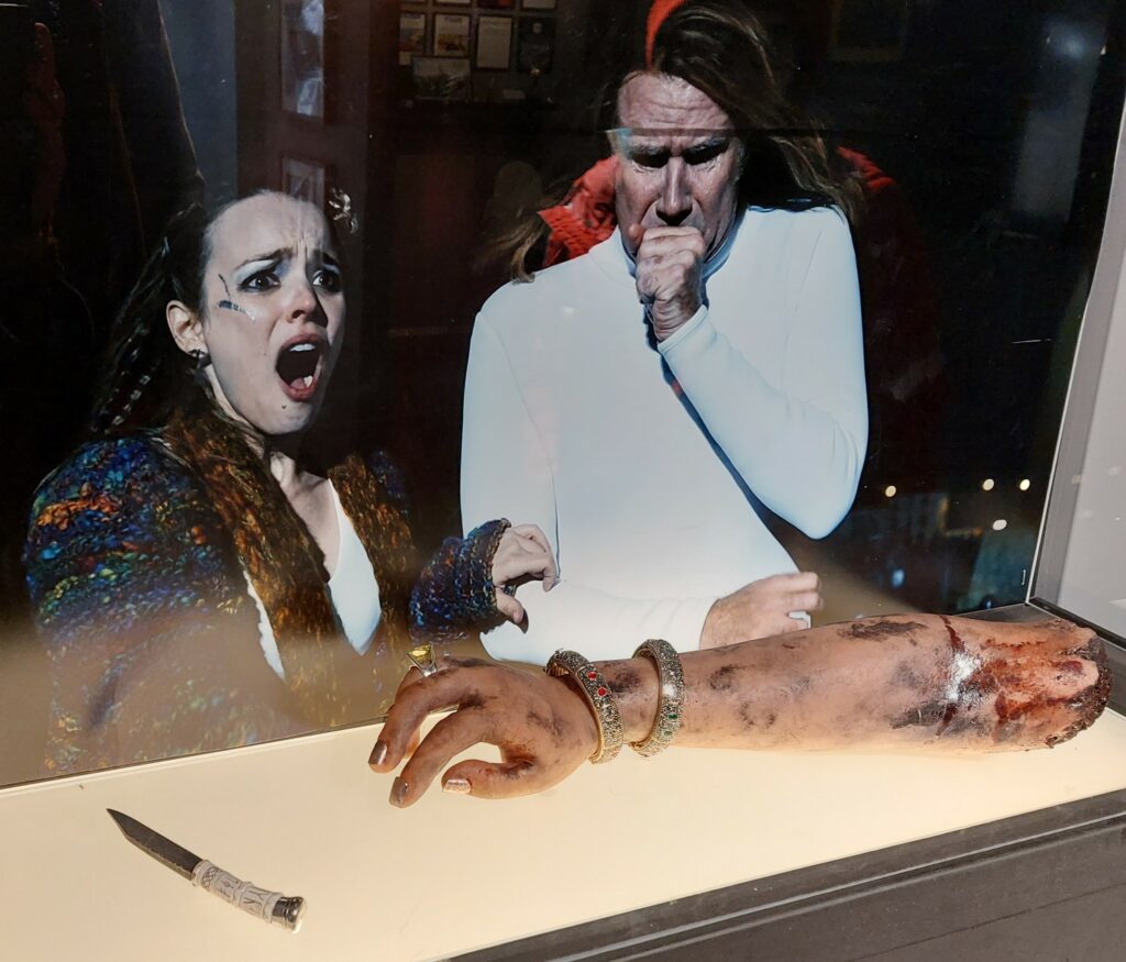
From the ESC exhibition in Húsavík Höfði Hótel.
There was no Oscar for Húsavík. But the Húsavík children were given a public holiday the next day – everyone knew that they would be awake on this dramatic night anyway.
PCC BakkiSilicon.
After a Fire Saga Guided Tour, a refreshing bath is just right. Drive north to the PCC BakkiSilicon factory, then towards the shore and park below the site.
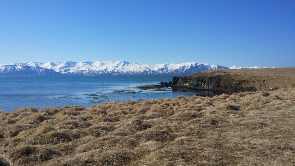
Skjálfandi Bay – incredibly beautiful.
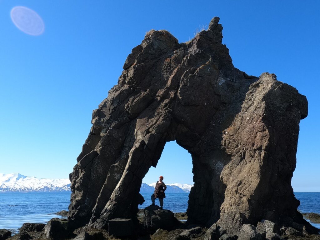
Walk towards the sea but not right down to the shore, stay on the grass. Follow the coast, and you will find an unknown gem at the very edge: The Húsavík’s mammoth!
Bakkastakkur/Gatanöf, Húsavík’s mammoth.
If you want to stand under the mammoth’s belly – choose low tide. If you want to swim between its legs – choose high tide. The mammoth is just as beautiful as Hvítserkur – and almost completely unknown. If low tide (as at both our visits), there will be no swimming under the mammoth. A good alternative would then be Sundlaugin á Húsavík. An unpretentious, classic public Icelandic bathing facility with a couple of hot tubs and everything you possibly need. One of us went there while the other stayed at home with a cold. But we don’t have pictures, grown up single men with cameras at a pool aren’t always very popular, so the camera also stayed home.
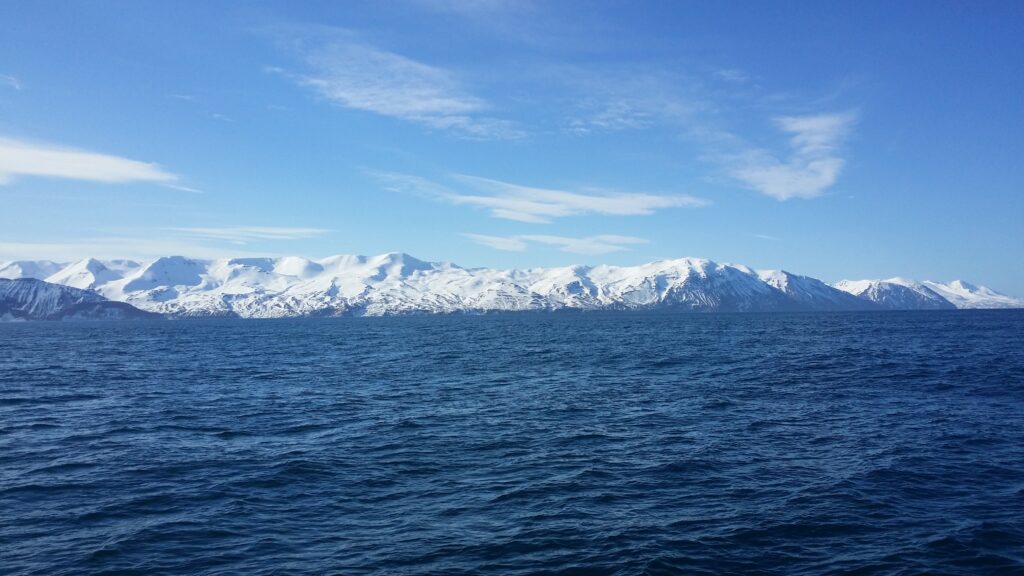
Húsavík is a beautiful place! A rounded mountain behind the town (Húsavíkurfjall) is not so exciting, you might think, but on the other side of the bay of Skjálfandi you can enjoy a spectacular row of mountains starting with Kinnarfjöll, which likes to express itself in winter clothing, all year round. Skjálfandi means trembling and comes from the many earthquakes in the area.
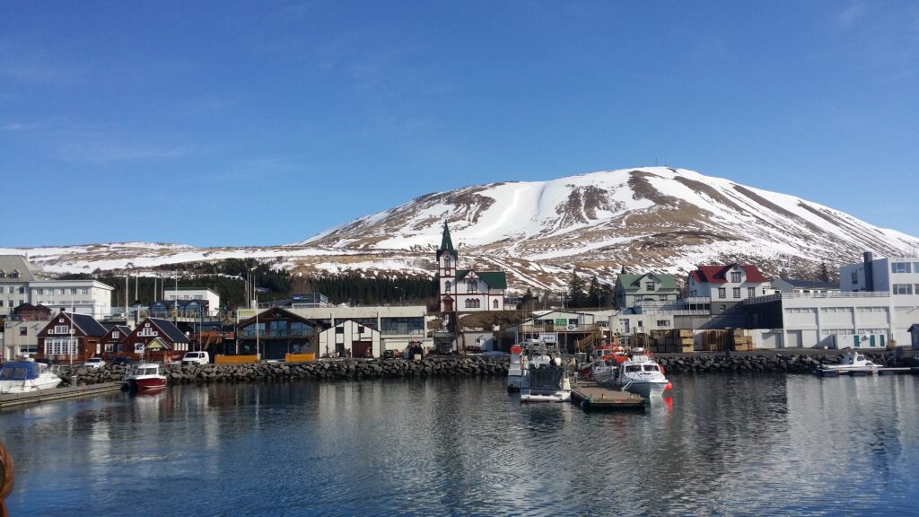
Húsavík harbour, with the characteristic church and the mountain in the background.
The conquest period in Iceland started with a Swede – Garðar Svavarsson, who built a farm in Húsavík. He had heard about the land in the west from the Norwegian Naddoð, who had found it but not wintered there. Garðar left Iceland after only one winter, after having completed an entire round trip and thus being able to establish that Iceland is an island. To honor himself, he named it Garðarshólmur. When Garðar left, one of his men, Náttfari, stayed behind with a slave and a maid. They moved to Reykjadal, where they took up land and lived for many years. Later, a man called Eyvindr appeared in Reykjadal, and gave Náttfari the annoying choice: That he should have Náttfaravík, or no land at all. Náttfari saw no other option, and moved from Reykjadalur. Náttfaravík lies vis a vis Húsavík, in a very hostile environment.
The west side of Skjálfandi is not a warm and friendly place to live.
Finally, in the summer of 1970, Náttfari got his restoration, when they celebrated his conquest 1100 years earlier. This event happend in Húsavík, 4 years before the rest of Iceland honored Ingólfur Arnarson’s conquest.
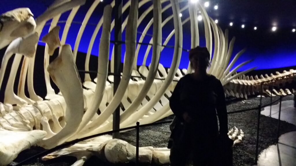
Check out the blue whale sceleton in the Húsavík whale museum!
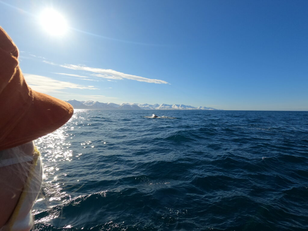
Husavik got it’s income from trade, fishing and whaling for many years. Today (2021), Húsavík has switched from whaling to whale watching, and it works very well! There are different whale watching concepts, including by sailboat, where the focus is silence. Before the cruise: Take a trip to the whale museum, where you will find, among other things, an entire skeleton of a blue whale. Yes! That’s impressive stuff! We did a standard whale watching tour, during winter time, although that is not the best time to see whales. The name of the boat? ‘Náttfari‘, of course. Skjálfandi is a large bay, more like a fjord, and we cruised around for over an hour before we saw anything. But finally, a sperm whale (physeter) did appear – to the guide’s great surprise. You don’t come across sperm whales very often, because their dives are deep and long lasting. Our boat crossed behind and to the side of the whale, and we saw it breathe quite closely a few times before it disappeared into the deep. Then we stopped for a while, hoping to see the whale again. And indeed, it did reappear. A great experience!
Sun, mountains and whales – a splendid day!
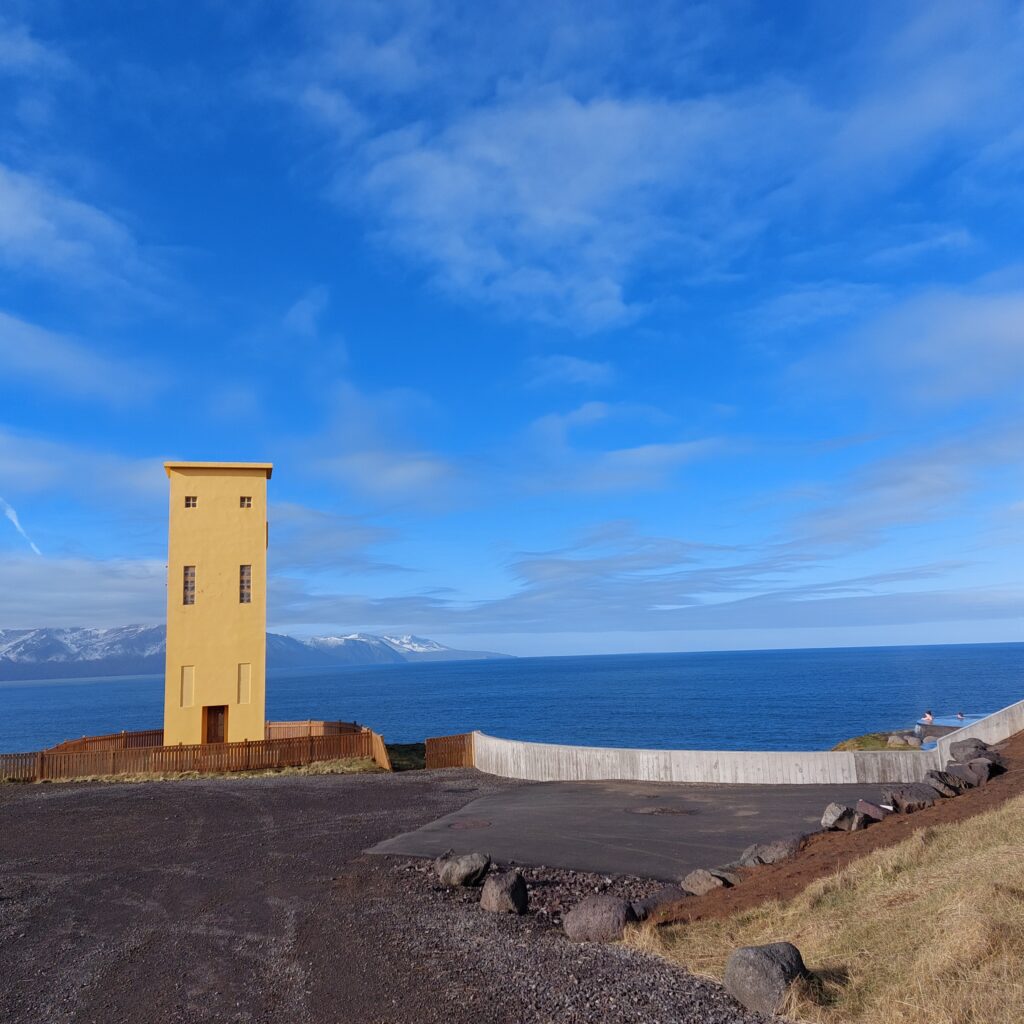
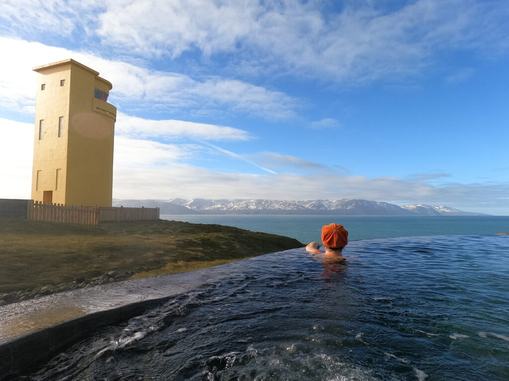
After an ice cold whale watching trip, a warm bath is the perfect thing to do. In Húsavík there is a wonderful spa, GeoSea, located on the cliffs just north of the town.
Close neighbours: Húsavík lighthouse and GeoSea spa.
Here you will find beautiful design both outside and inside. The site is partially submerged in the terrain. When you arrive, you can see straight through the building and out to the sea. An absolutely fantastic view from the spa (when there is no fog). Lovely!