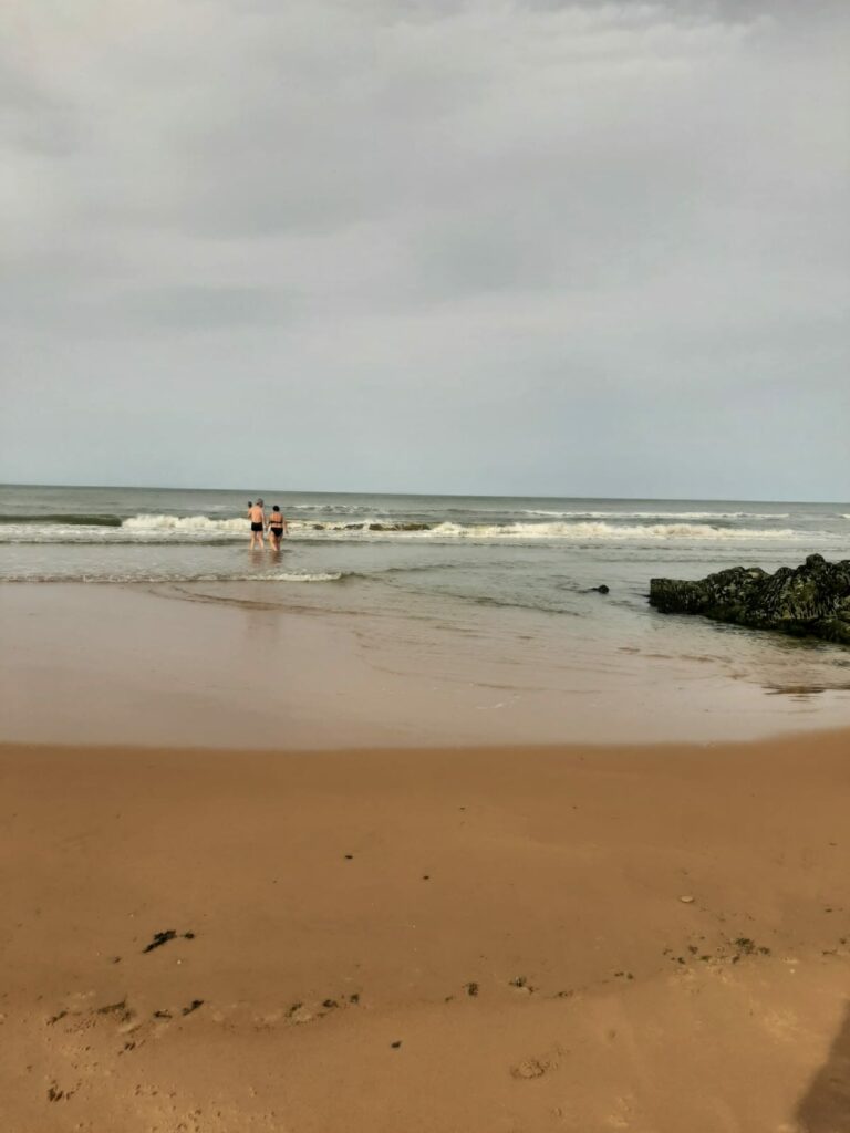
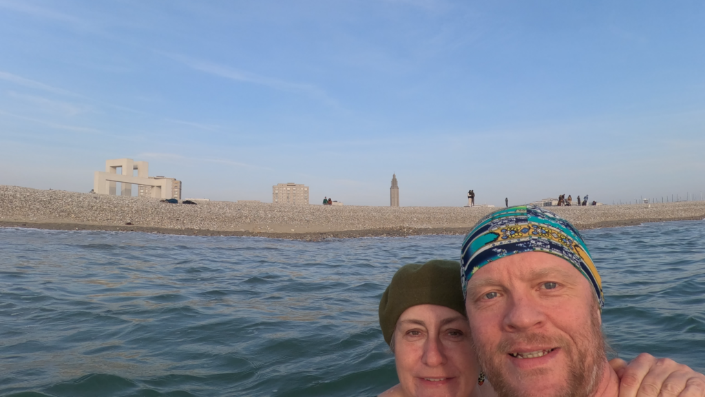
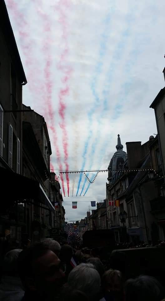
In fresh seas and lovely waves, Tobatheornottobath wishes you a Merry Christmas from Ouistreham, Normandy.
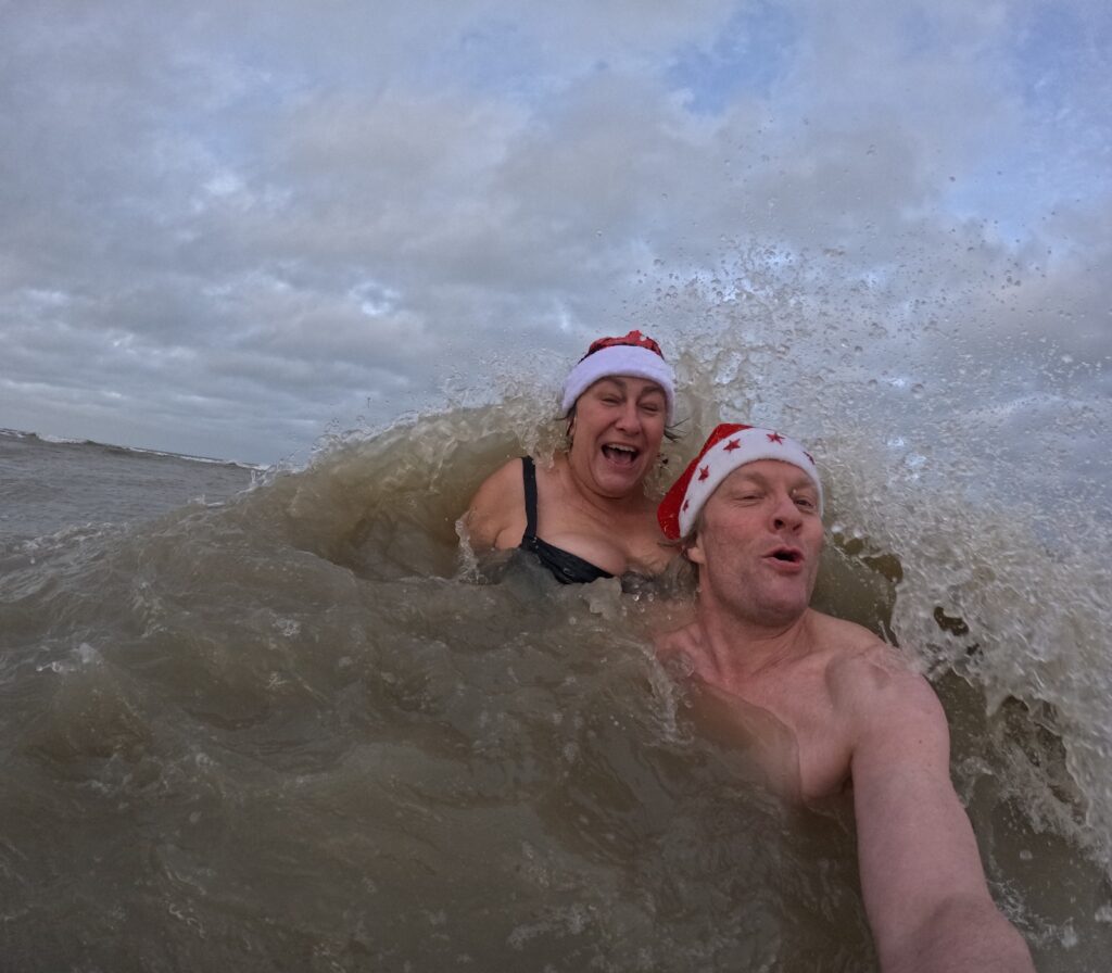
Right now is always a good time for a bath!
In fresh seas and lovely waves, Tobatheornottobath wishes you a Merry Christmas from Ouistreham, Normandy.
The origin of the name Étretat has been widely studied and debated. From ancient times, people have tried to find explanations from Celtic and Latin/Old French, but without complete success. Later derivations from Norse have emerged as more plausible, including Torstad, Stútrstakkr (upright, high rock) and Styrrstaðr = ‘helmsman’s town’. But one thing is certain, the Vikings were here!
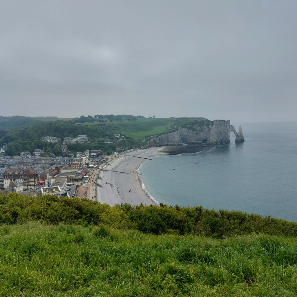
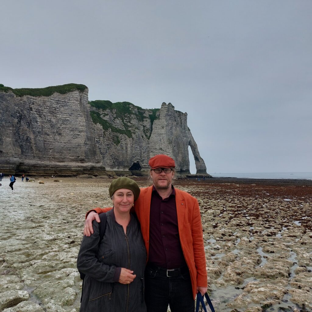
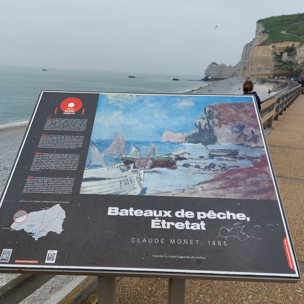
This village north of Le Havre is famous for the three arches that lie in a row by the English Channel. Farthest north (to the right when looking towards the sea) is the Porte d’Amont (Upstream Gate).
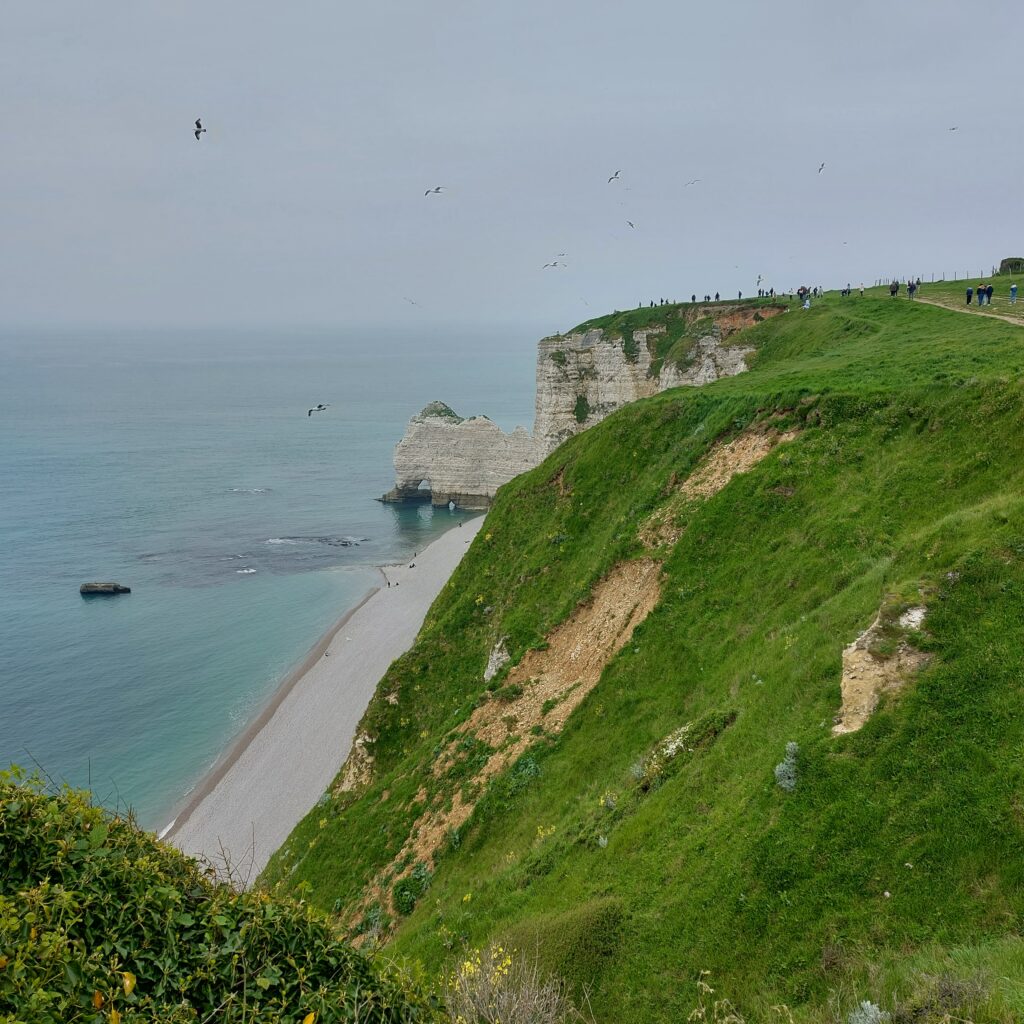
To the left of the beach you can see the beautiful Porte d’Aval (Downstream Gate) with a broken arch, l’Aiguille (The Needle) next to it, and further south and invisible from the city: Manneporte (big enough for a sailing ship with all sails up).
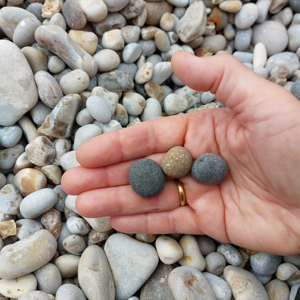
The light color of the cliffs has given the area it’s name ‘The Alabast Coast‘ = ‘The bright coast‘ (ref ‘The White cliffs of Dover‘ on the opposite side of the channel). Parallel to the coast, at Étretat, an underground river flows into the sea, and the arches have been eroded by this river. In older photos, women can be seen washing clothes on the beach at low tide (in fresh water). The beautiful arches are thus created by continental erosion and not by the sea. The limestone contains, among other things, flint, which is left behind as pebbles on the beach when the limestone is dissolved.
The place’s existence is linked to the sea, and in the 18th century oysters were grown and processed here. Baskets of shells were transported to Versailles overnight so that Marie-Antoinette could enjoy fresh oysters in the morning.
In the 19th century, tourists began to flock the site, and by the end of the 20th century, fishing was completely replaced by tourism as a means of living. No wonder, this place is stunning! So beautiful, that the place is used a lot both in literature and paintings. The creator of Arsène Lupin, Maurice Leblanc, lived in the area and his home is now a museum (Le Clos Arsène Lupin, Maison Maurice Leblanc). The last episode of the Netflix series Lupin was filmed in Étretat. But perhaps most famous are Claude Monet’s paintings of the beach and the arches.
The pebble beach at Étretat is somewhat demanding as a bathing spot. It is actually very good exercise to wade in pebbles on a steep beach. For us, a reminiscent of the movie ‘Rocky‘, who exercised hard by running in the snow. One step forward and half a step back… But it will be good for you (it was for us), and the water is clear and fresh, so beach life by Étretat is highly recommended.
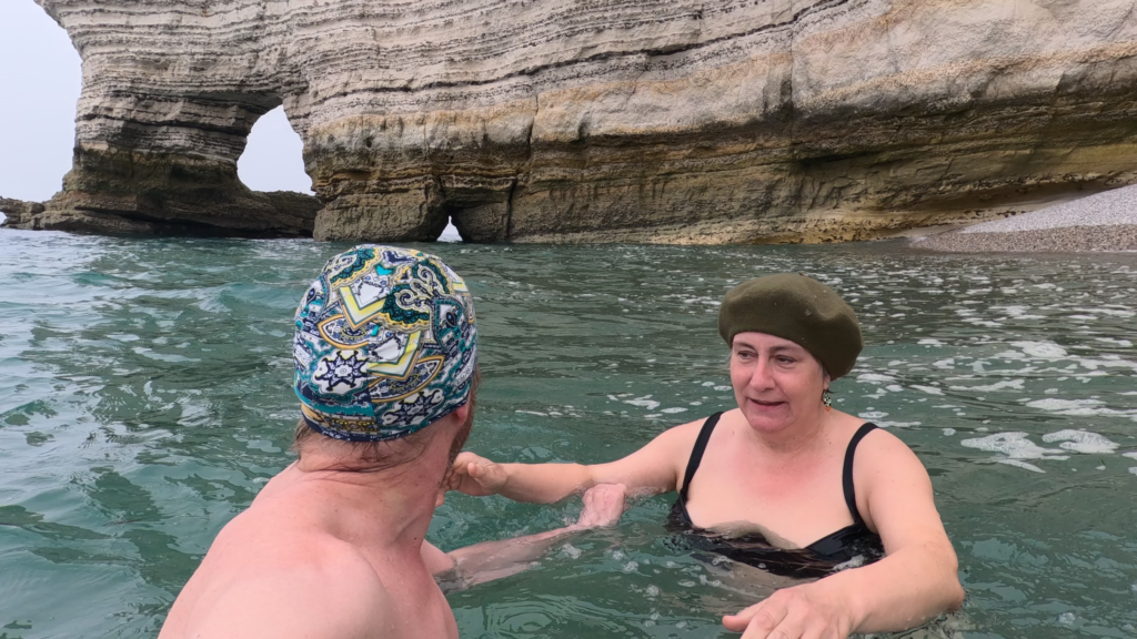
At Porte d’Amont, there were no prohibiting signs against swimming, only for walking too close to the cliffs. Into the water we went. Currents? Oh yes! The tide was coming in, and when we lifted the legs up from the bottom we were pulled away northwards. The water level here changes 10-15 meter according to the tides… Terrifying, at least without an accompanying boat! Tobatheornottobathe didn’t swim under one single arch, but remained with ground contact…
The estuary of the Seine has at all times been an important hub between the inland and the sea, and this time we mean literally ‘all times’. Human activity goes back a full 400,000 years, to prehistoric times. This was also Asterix-land (Gallic-Roman), with activities linked to the Seine traffic. The city of Francispolis was formally founded in 1517 by King François I (for fear of English invasion), but by then the city was already established. For many years it was called Le Havre-de-Grâce (Harbour of Grace), and after the Revolution just Le Havre (The Harbour).
In 1914, Le Havre had around 150,000 inhabitants. During the First World War, 7,500 of them died (mostly sailors and soldiers). However, the city escaped the bombardment because the front was much further north. Still, World War II was a disaster for the city. Le Havre was occupied by the Germans, 5,000 people were killed and 12,000 homes destroyed (both devastation by the retreating Nazis, but also by massive Allied bombing). The result was a large exodus, and the population in 1945 was down to around 100,000. Today, Le Havre has again 150,000 inhabitants but this is currently declining.
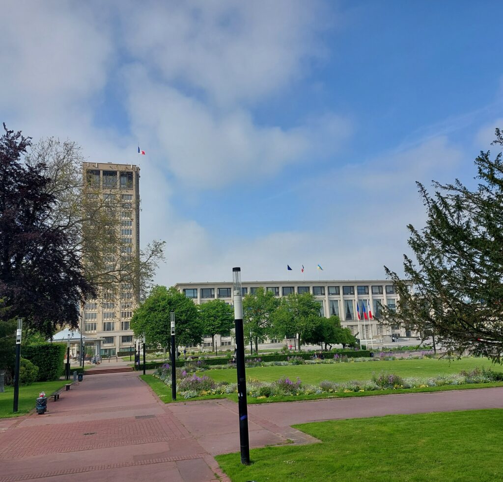
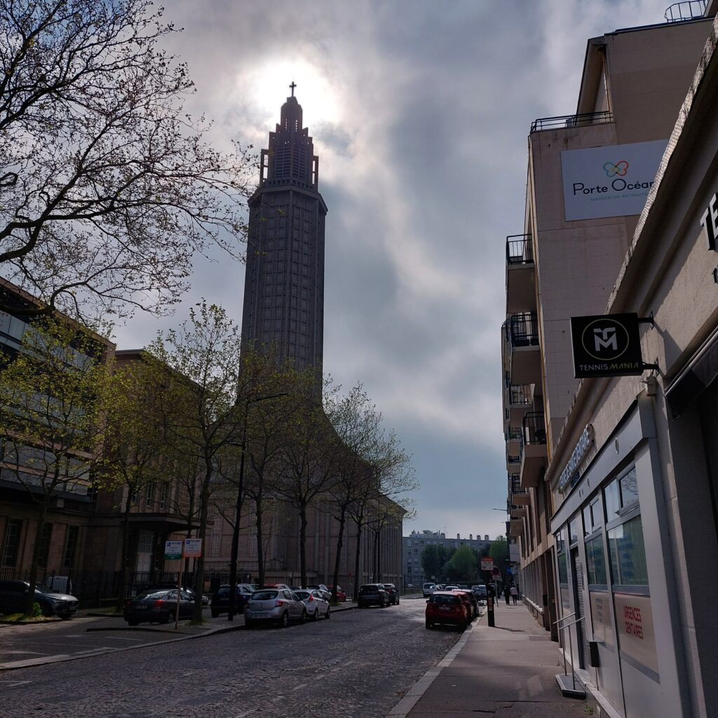
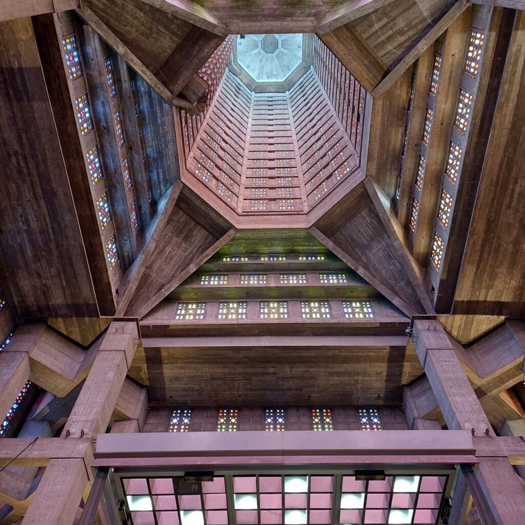
After the war, it was decided to build up the city as quickly as possible, without copying what was there before. The architect Auguste Perret designed a completely new center in reinforced concrete, and this unique city center was placed on the UNESCO World Heritage List in 2005. The construction took place using prefabricated elements, where each module unit was 6.24 m. The restoration was finished with the consecration of the Saint Joseph church in 1964.
Perret’s use of concrete in a modernist style was not immediately praised, and further development of the style in Eastern Europe has given rise to terms such as ‘Stalin architecture‘ about it. And yes, it does feel overwhelming.
We visited Le Havre on an ordinary Sunday, and the city appeared cold, boring and empty of people. When there’s nothing to do, a bath is just right, you might think, and yes, it was. The area around Le Havre is full of water and swamps (it is, after all, the Seine’s delta), but to the north-west of the city there is a wonderful, long, pebble beach.
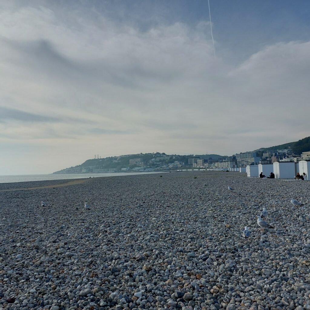
There were people at the beach! And there were seagulls. And in the north, parts of the old city were also preserved.
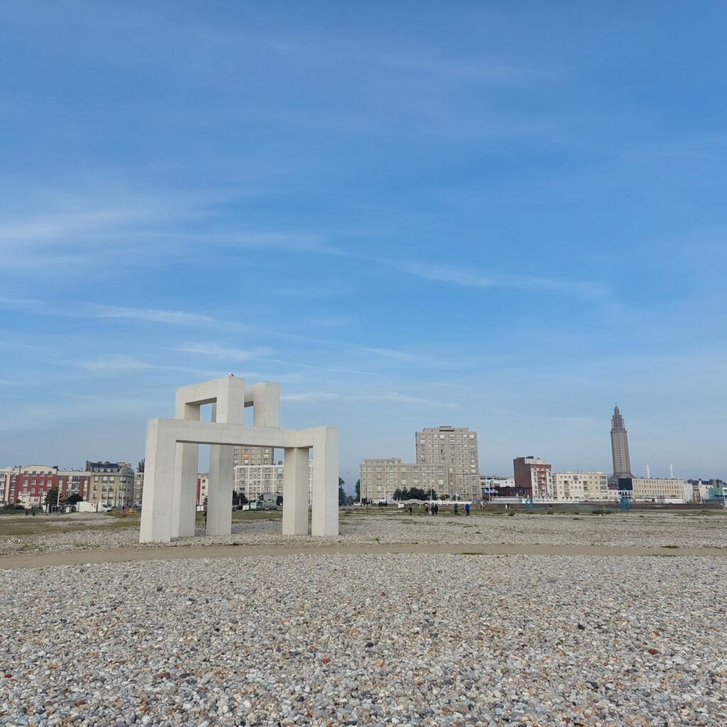
In the project ‘Un Eté au Havre‘ (A summer in Le Havre) in 2017, the port and the city’s 500th anniversary were celebrated. Several of the artworks have since become permanent elements in the city, including UP #3 by Sabina Lang and Daniel Baumann.
We had a nice swim by the Beach, surrounded by seagulls and sort-of exhausted young people. But we think that massive bombing of ‘The Harbour of Grace‘ was not just right.
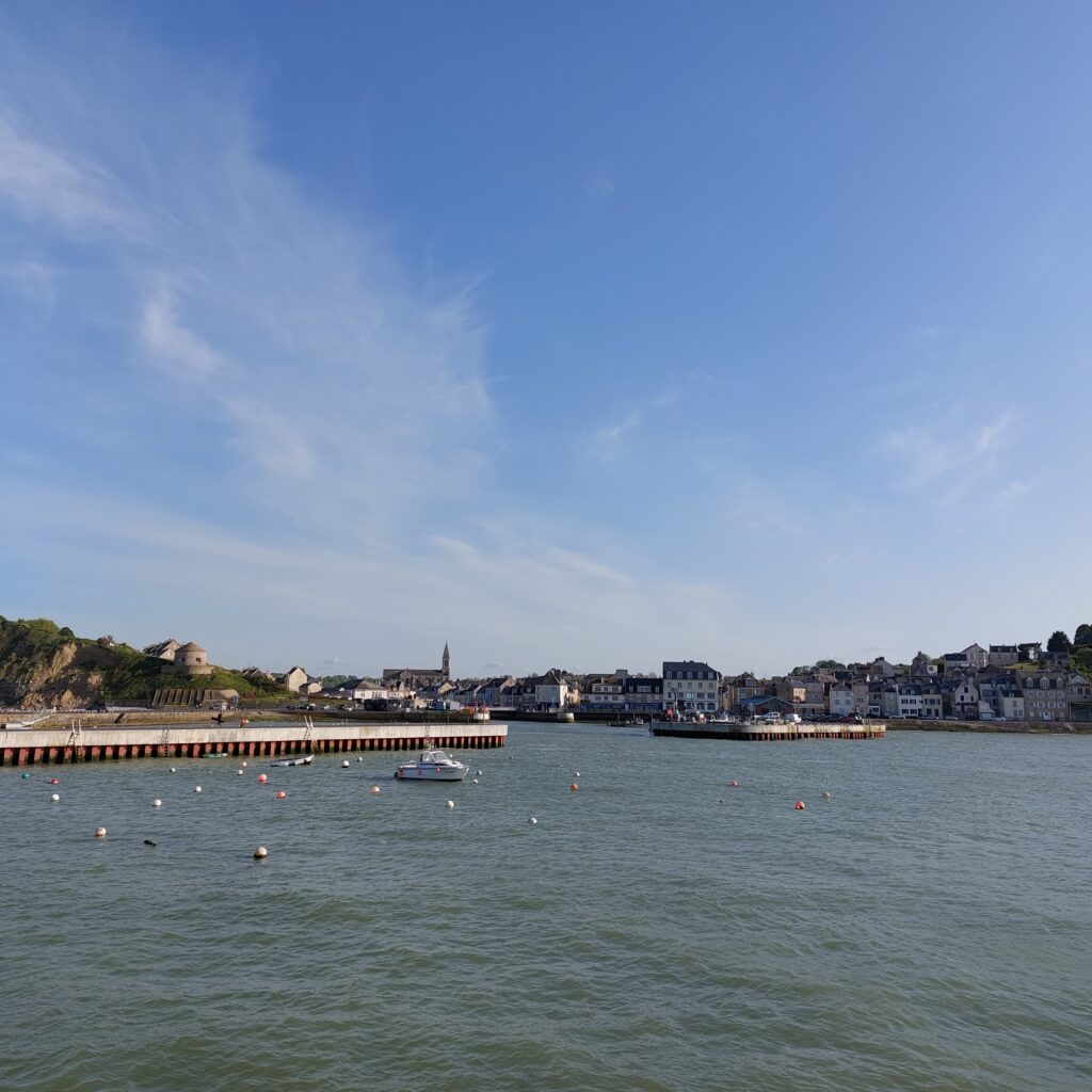
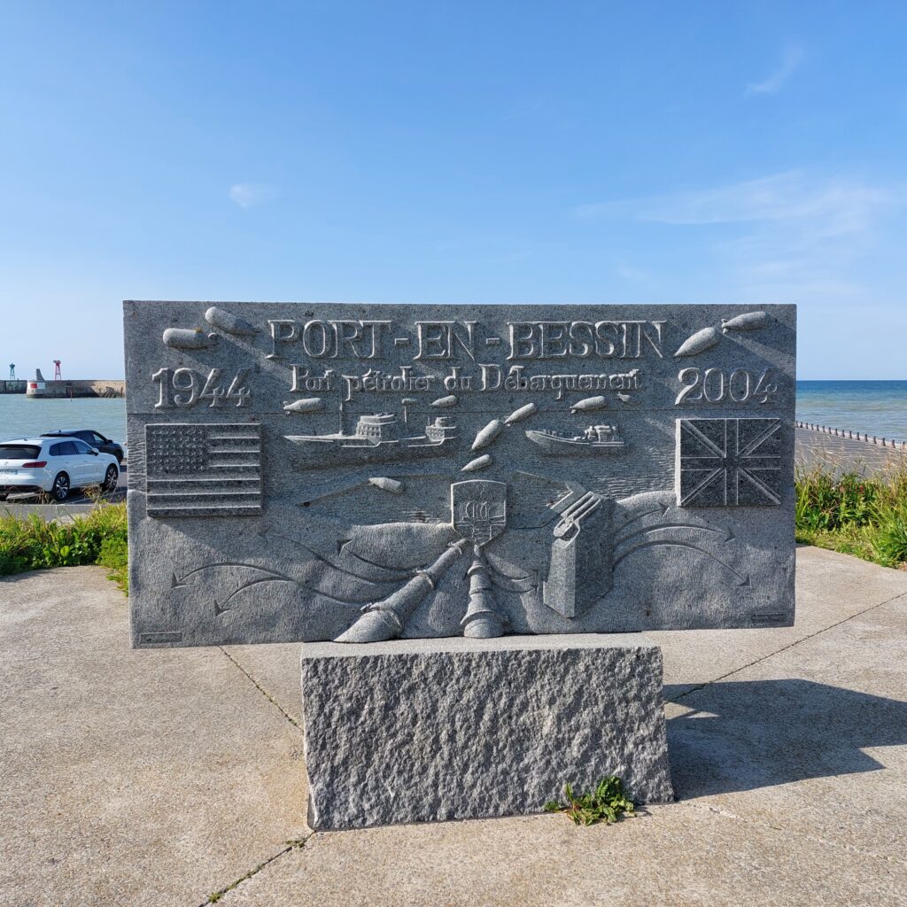
Port-en-Bessin-Huppain is a commune in Calvados, Normandy. Here, people have lived since the Bronze Age. The town of Port-en-Bessin was founded by Vikings, and it’s destiny has always been linked to the sea, which is also evident from the motto ‘Res Nostra Mare‘ = The sea is our law. It is situated in a small valley (fault) between high cliffs, about 10 km from Bayeux.
In 1972 it merged with the neighboring village of Huppain (from Norwegian/Norse: Oppheim). After 1096, Port-en-Bessin was called ‘Port des Évêques de Bayeux‘ (The ‘Bishop’s Harbour in Bayeux), and it was Bishop Louis de Harcourt who initiated the excavation of a deeper harbor basin in 1475.
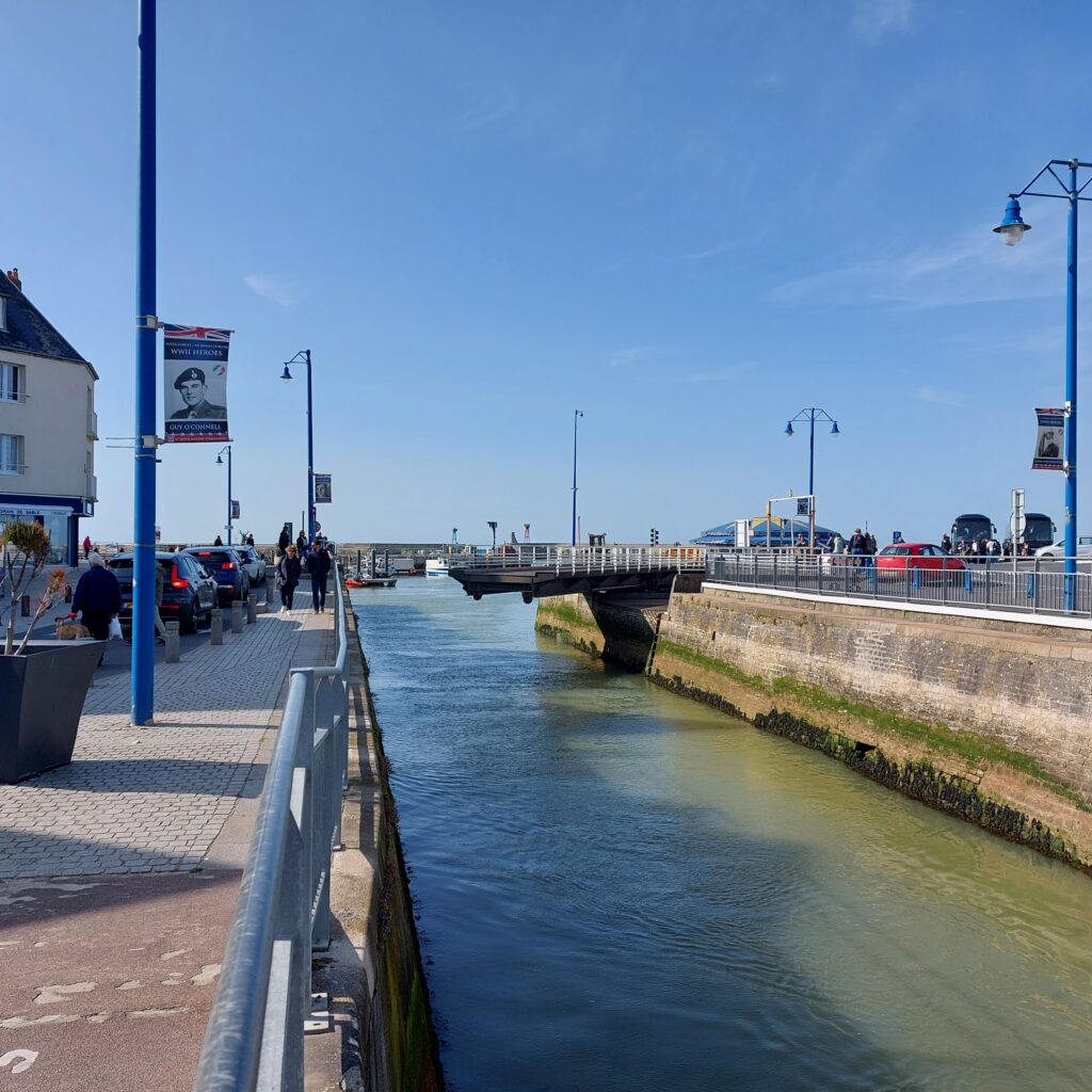
This first, outer, harbor was destroyed in a storm in 1622, and that led to recession in the area. It wasn’t until 1866 that the harbor was fully reconstructed, and in the 1870’s and 80’s, first a smaller and later a larger inner basin were excavated.
Port-en-Bessin has always been connected to the sea and fisheries, but during the Allied landings in 1944, the village took on a very special role. To keep the war machine going, there was a great need for fuel. At the start of ‘Operation Overlord‘, this was solved in the somewhat cumbersome way: Transport by the use of cans. However, two offshore oil terminals were built in a hurry, and one (outside Sainte-Honorine-des Pertes) was connected to Port-en-Bessin with a pipeline. This was a very successful project, and already from June 14th, 100 tonnes of fuel passed through this small town every day.
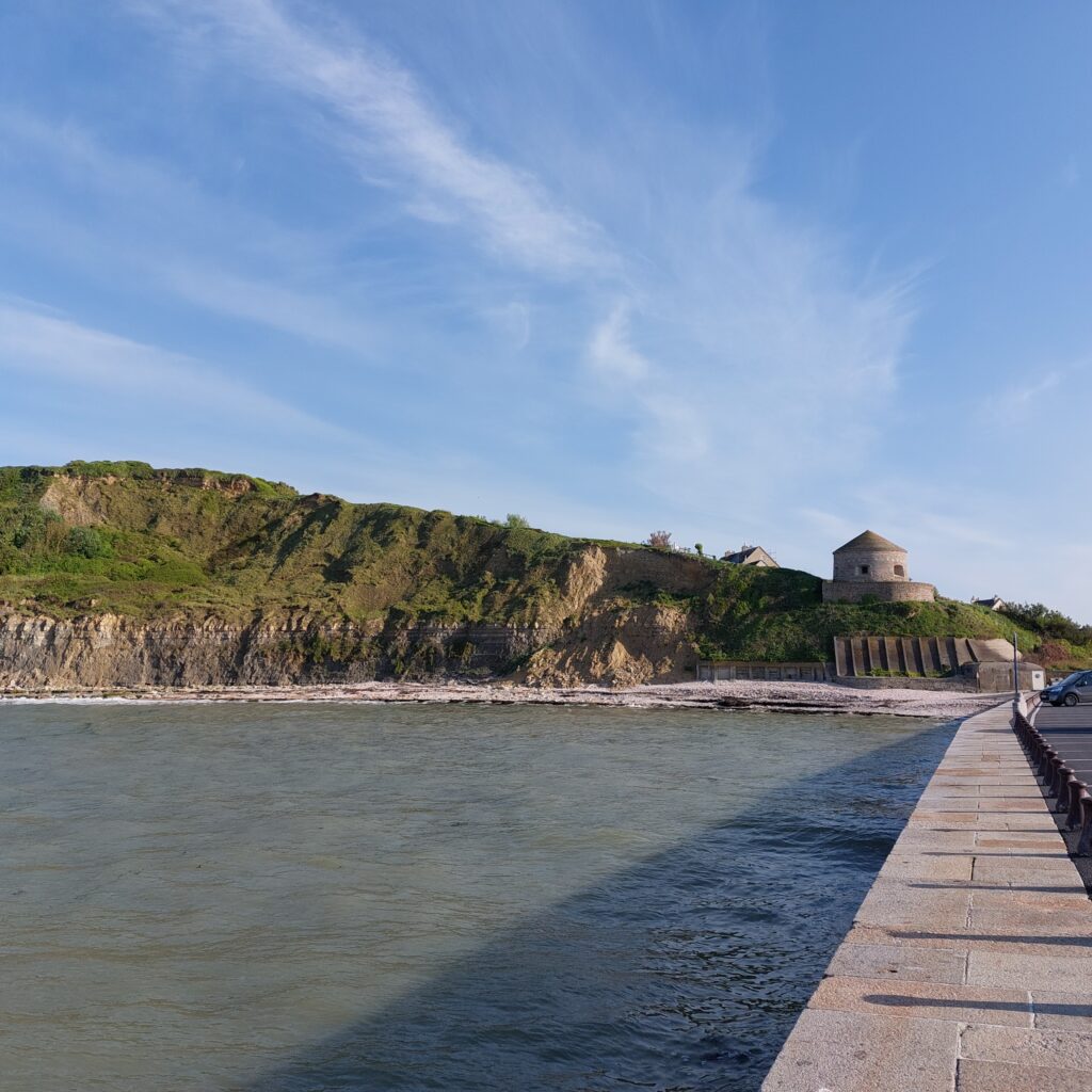
The memorial stands by the outer harbour, and then a bath would be just right, wouldn’t it? We walked down to the beach just below the 1694 Vauban Tower, which was built to prevent English invasion. There used to be a similar tower on the hill above, but this was bombed by the Allies 6-8. June 1944, at the start of the landing.
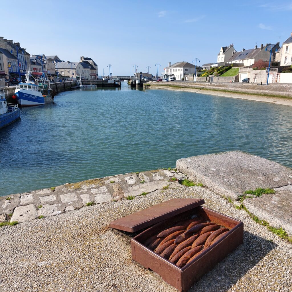
The beach below the tower turned out to be a bit special. As a memorial to the local tradition of scallop fishing, you can wade in layers upon layers of shells. They seem to have dumped scallops here for decades!
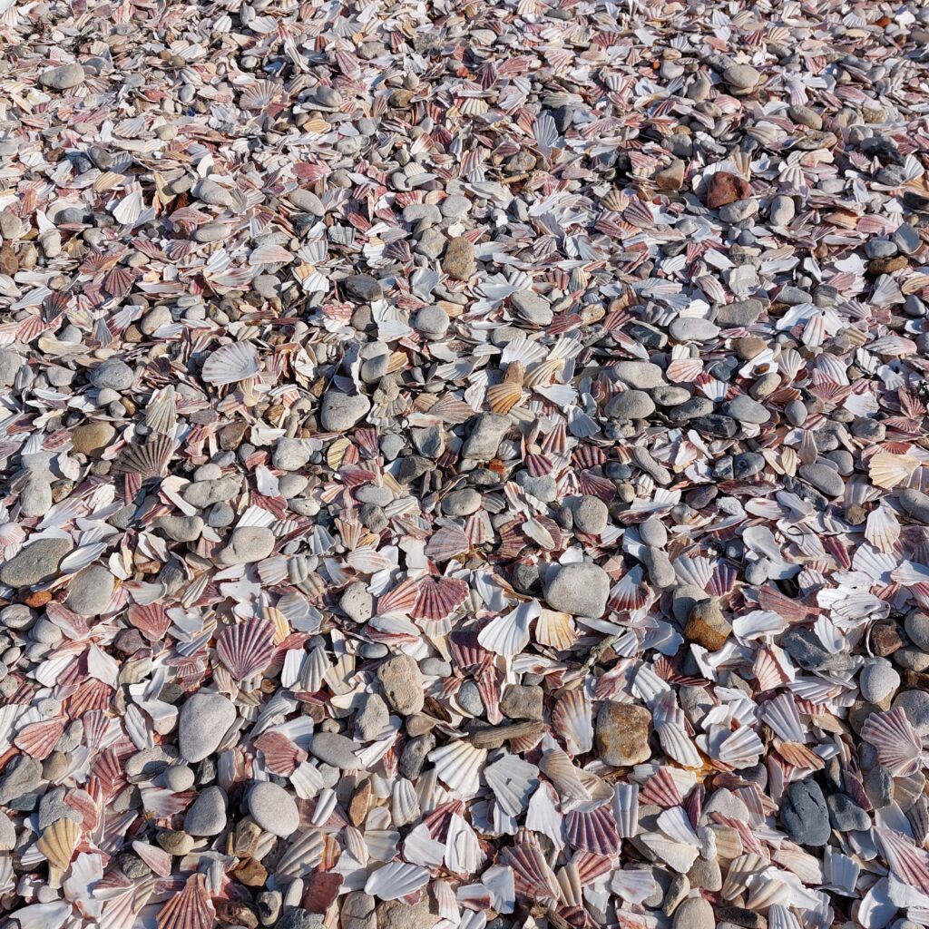
However, the shells were well-rounded and not at all painful to step on – may we call them ‘Pebble scallops‘?
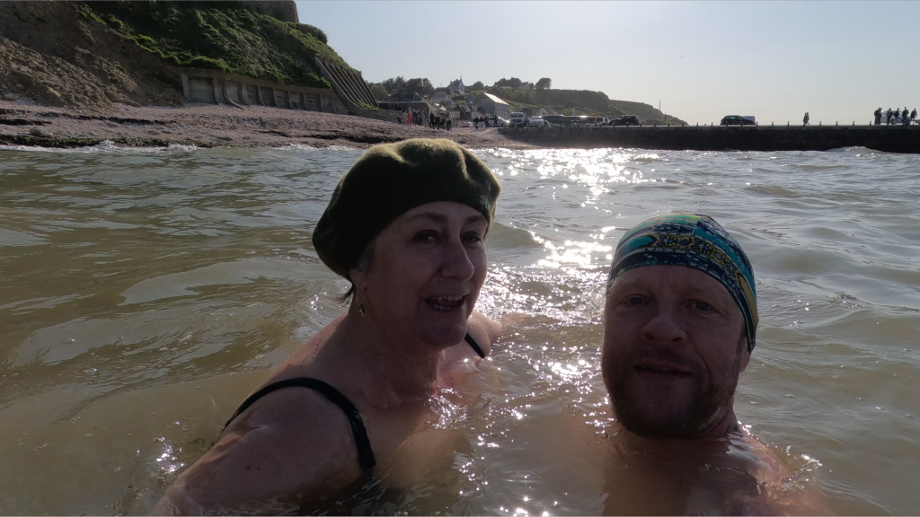
Anyway, then it was just a matter of jumping into the sea? Well… Yes, the sea was fresh and nice – a little way out. But we experienced quite a lot of wind this day, and large swells, which swirled up sand, hence brown water close to the land. And also quite a lot of seaweed to step over, which we normally wouldn’t give a thought. However, as you wade outwards, the sand is very quickly replaced by big stones (which explains the piles of seaweed on the beach), and combined with the waves, the bath turned out to be a little bloody. But apart from that – a nice bath by a very cozy little town.
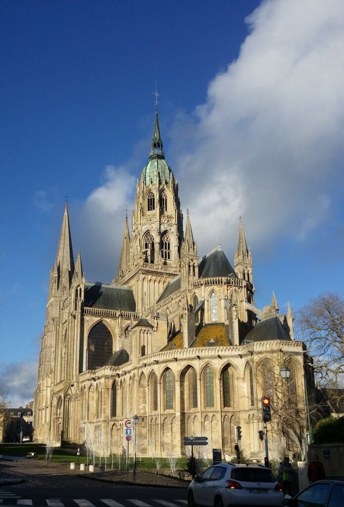
And after the bath? If you are interested in scrap from World War 2, don’t miss ‘Le Musée des épaves sous-marines du débarquement‘ (D-Day Underwater Wreck Museum), which exhibits all kinds of artefacts and vehicles found on the seabed after D-Day. However, we missed this museum, and we would therefore instead recommend a trip to the episcopal city of Bayeux. There you can (and should!) visit ‘Le Musée de la Tapisserie de Bayeux‘, to see the Bayeux Tapestry.
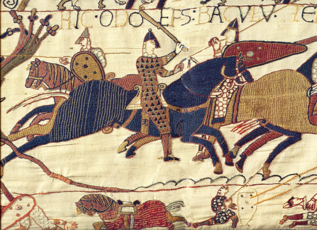
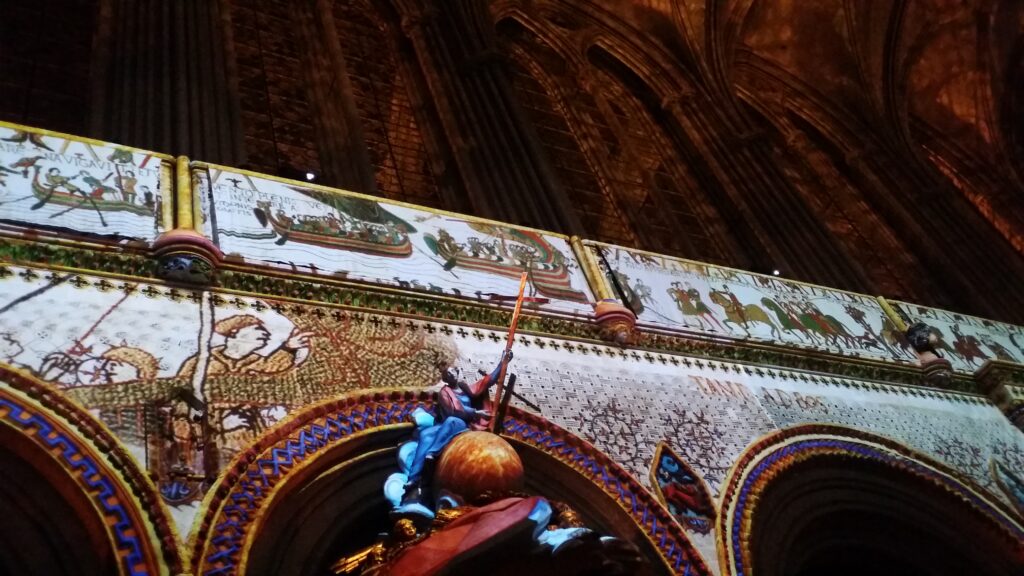
The carpet depicts King William the Conqueror’s invasion of England, as well as the Battle of Hastings in 1066 in 72 detailed scenes. Queen Mathilde’s role in the production has been very much debated, but anyway, the tapestry is absolutely marvellous, and the audio guide is also very good. Quote Audioguide: ‘They are approaching land. Everyone is happy. Even the horses are happy!‘. Here, retailers can really dive deep into the fashion, weapons, equipment and horse’s mood of that time.
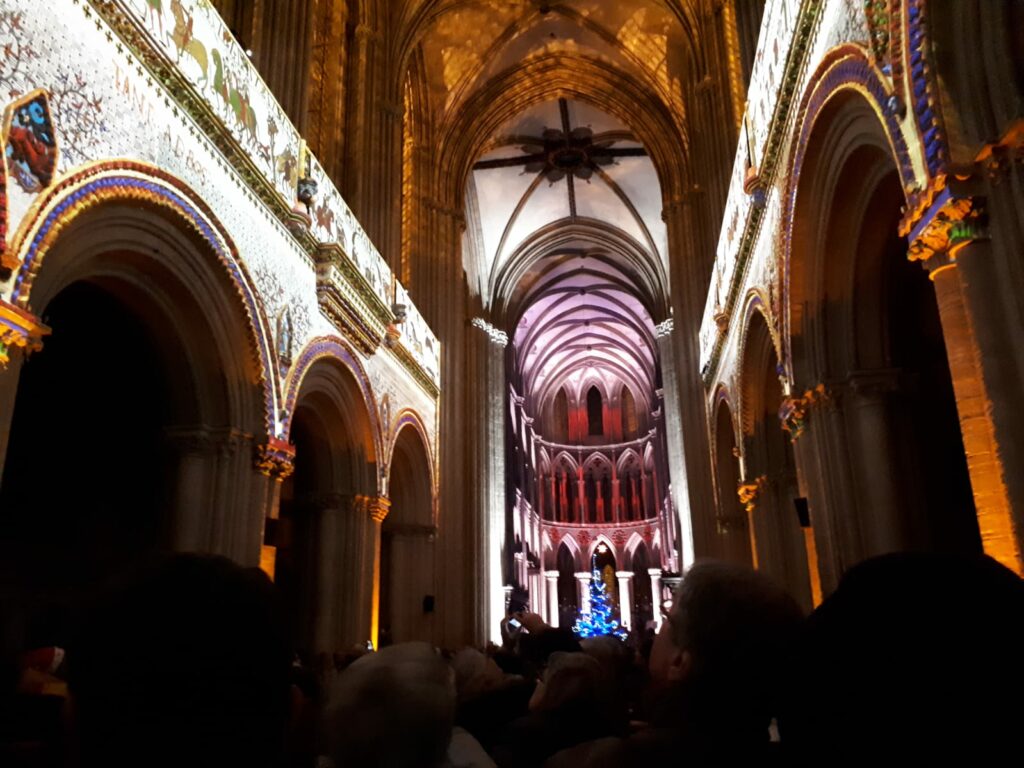
The tapestry is 70 (!) meters long and 0.5 meters high. That was a very strange size, you might think. But this is carefully planned – to fit under the triforium in the huge nave of the Bayeux Cathedral. In this way, everyone could ‘read’ the cartoon about William’s exploits: Beating two armies, and thus conquering an entire kingdom, England.
A cathedral visit in France is always just right!
After more than a year of preparations, Allied forces landed on the coast of Normandy on the morning of June 6, 1944. Germany expected an invasion and was well prepared. Field Marshal Erwin Rommel had fortified the coast with bunkers and physical obstacles. The actual landing, however, was expected to take place at Calais, where the English Channel is at its narrowest, and the fortifications therefore were strongest there. Even long after D-Day, Hitler believed that the landing was a decoy maneuver. Consequently, no massive reinforcements were sent immediately. The landing was given the name Operation Neptune and it was part of the larger Operation Overlord, whose goal was the liberation of France.
The landing is the largest amphibious operation ever, and lasted until June 30, 1944, when Allied forces liberated Cherbourg in western Normandy. About 7,000 ships transported 156,000 infantry troops to the five D-Day beaches: Sword, Juno, Gold, Omaha and Utah.
One village that was liberated in the morning hours of June 6th, was Saint-Marie-du-Mont, which changed hands several times during the day. The village was occupied by 60 German soldiers, who used the church tower as an observation post. On a clear day you can see all the way to the sea from the church tower.
In the hours before the actual landing, paratroopers were released within the D-Day beaches, to prepare for the thousands of soldiers and vehicles that were to be landed. However, dense fog and heavy flak, led to only 1/3 of the paratroopers actually being released, and many ended up in the wrong place. The two German soldiers who were on duty at the bell tower fired at paratroopers before they suddenly disappeared.

When the priest came for the morning mass on D-Day, he found the two soldiers in the church, and they asked to be locked into the sacristy. “We promise not to touch anything!”, the soldiers said. ‘Not even the altar wine?’, the priest replied, before turning his back on them. The Allied paratroopers wanted to occupy the bell tower, and there were battles inside the church. Later, bullet holes and blood were found in front of the confessional. On the evening of June 6th, when everything had calmed down, the sexton went into the church and started the clean-up. Sweeping up the rubble in the church nave, dust swirled up. Suddenly he heard a sneeze, and he found two German soldiers who had been hiding inside the confessional.
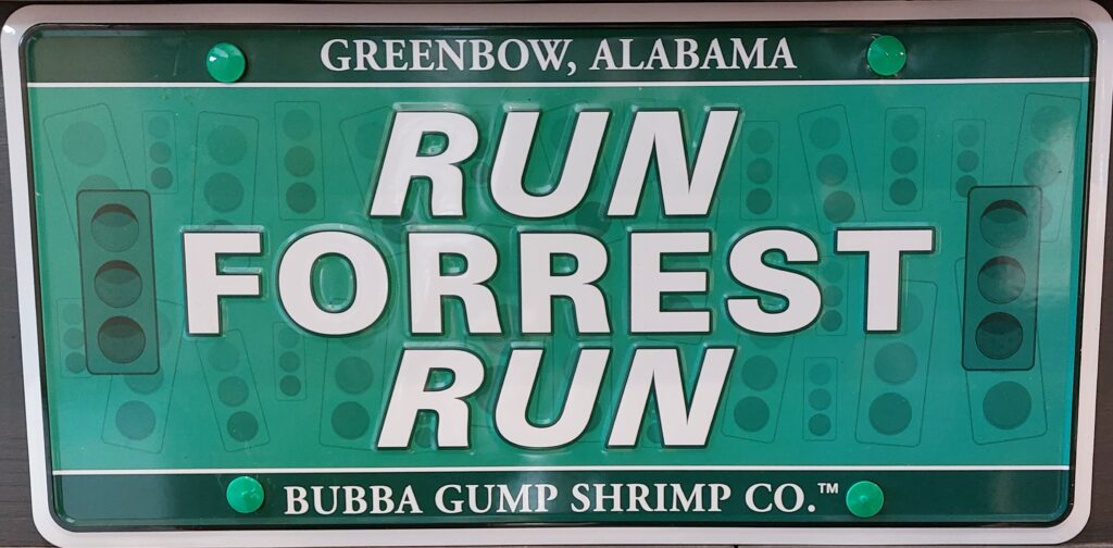
In Sainte-Marie-du-Mont, as many other places in Normandy, there is a shop that exclusively sells goods from the war universe. Here you can, among other things, buy this charming little sign:
4 miles from Sainte-Marie-du-Mont lies Utah Beach, the westernmost of the D-Day beaches. Here you can find a memorial in honor of Andrew Jackson Higgins, who designed the American LCVPs (Landing Craft Vehicle, Personnel) used during Operation Neptune. According to D.D. Eisenhower (who led the entire operation): ‘The man who won the war for us’.
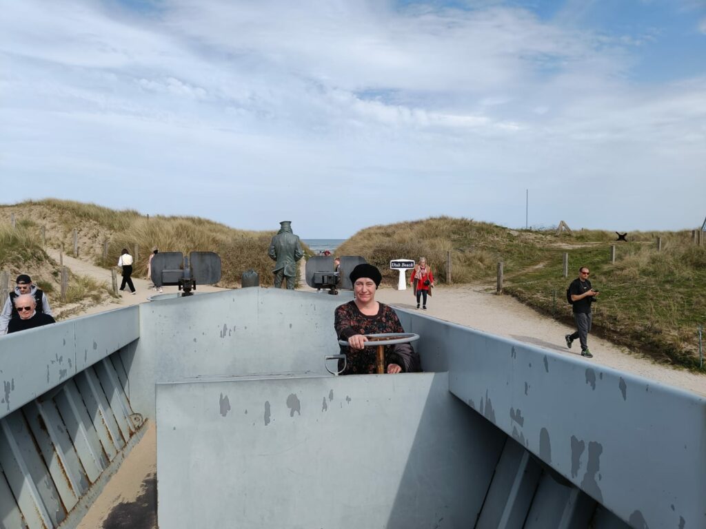
Utah Beach was worth a bath. The water was fresh and clear with fun waves to jump through. And here we could not see any signs warning of strong currents.
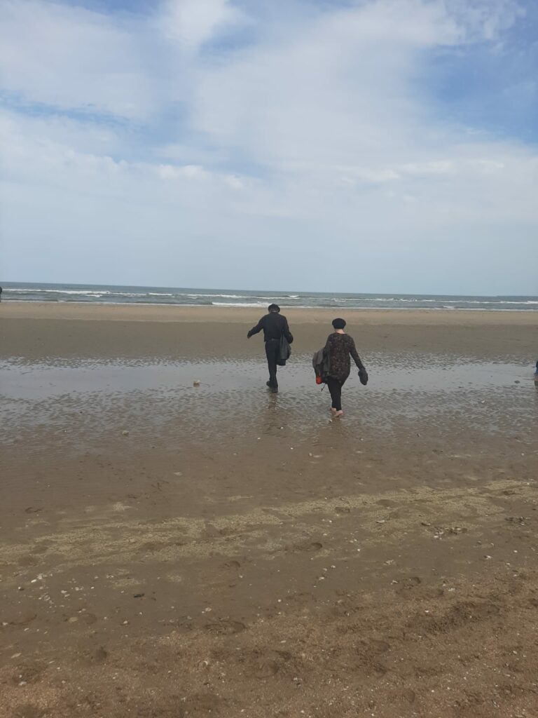
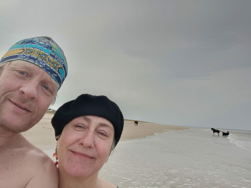
There are fewer people here than on Omaha Beach, but they had horses on the beach.
A bath at Utah Beach was just right!
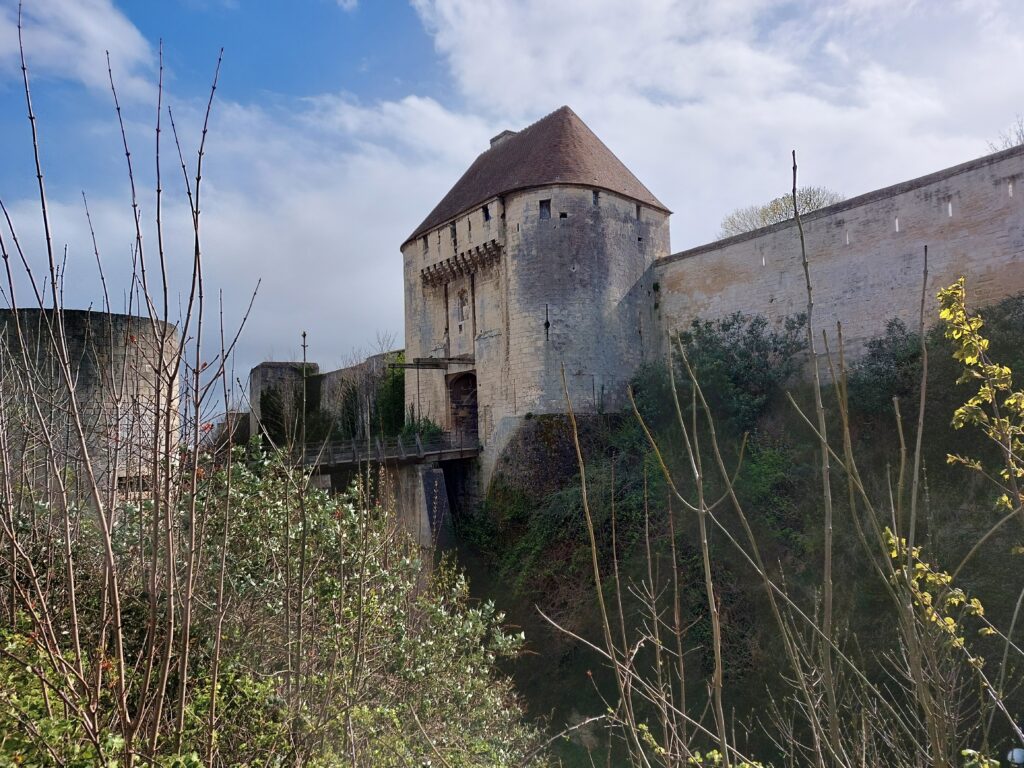
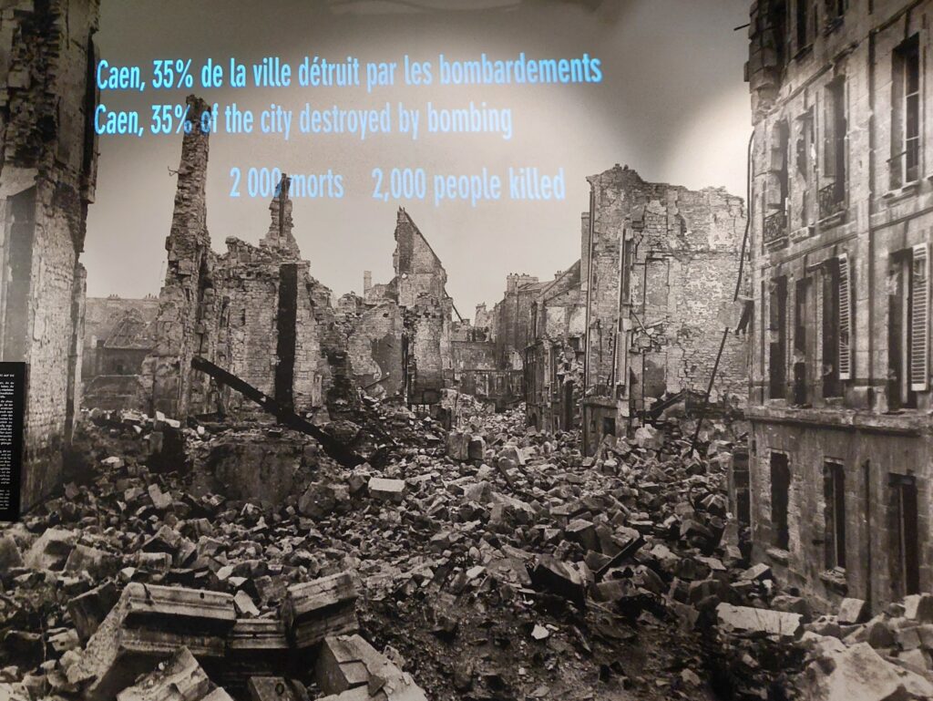
Normandy is named after the Vikings (Danish and Norwegian). The Norwegian Viking Gange-Rolv was according to tradition appointed Duke Rollo of Normandy in 911, to end the Norse looting. A descendant of Rollo, Wilhelm the Conqueror, started the construction of a large castle in the city of Caen in 1060. The city experienced an economic rise based on Wilhelm’s invasion of England in 1066. The castle is still large in extent, but not so high anymore, partly due to the bombings during World War II.
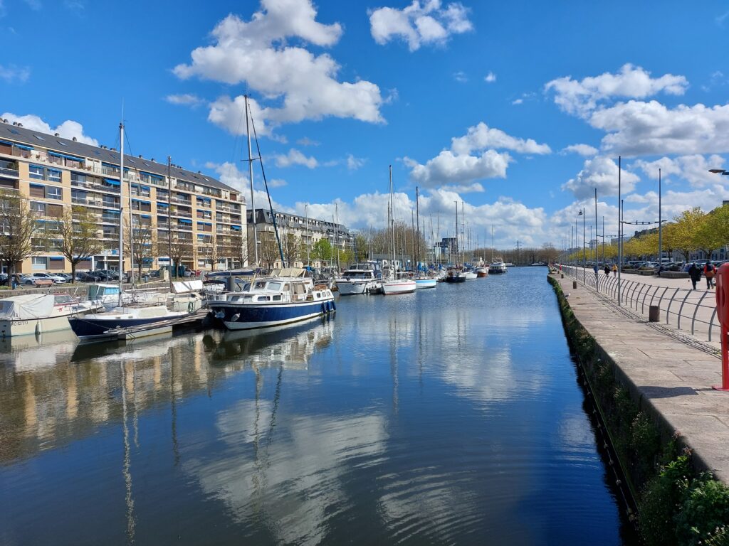
We spent the Easter holiday 2022 in Caen to visit our youngest daughter, Une, who is studying there. Could there be swimming opportunities in Caen? The town is about 20 km from shore, but the river Orne is navigable all the way up, so it was worth a try. Wearing French bérets, we went to the old port – La Quai – but no, that water was too unappetizing, even for bathoholics like us. But the water photo turned out to be quite nice!
Other possible activities in Caen are church visits – there are several beautiful churches here, in a mixed Romanesque-Gothic style. And if the congregation grows out of the church, just build a new church nave in parallel with the old one, in a new and different style.
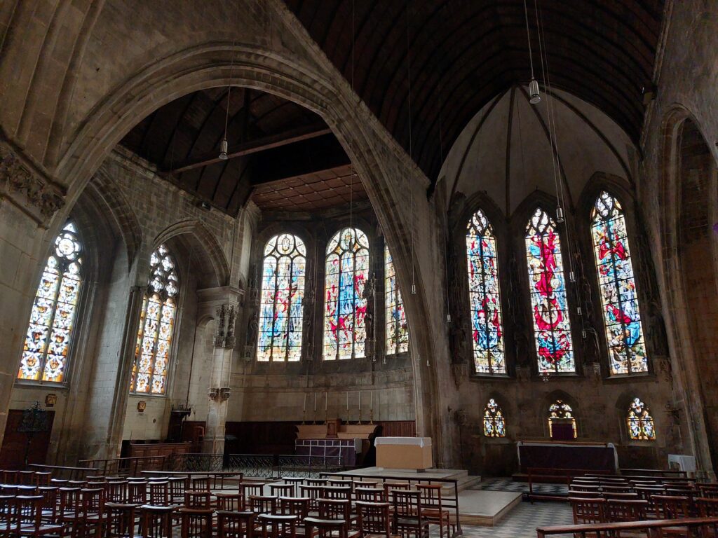
Anyway – what to do in Caen is to memorise the World War II. Many of the churches in Normandy, for example, lack a few floors, if you look closely. It became too strenuous to rebuild them to their original height after the war, so they put a roof over the lower floor instead and let it be.
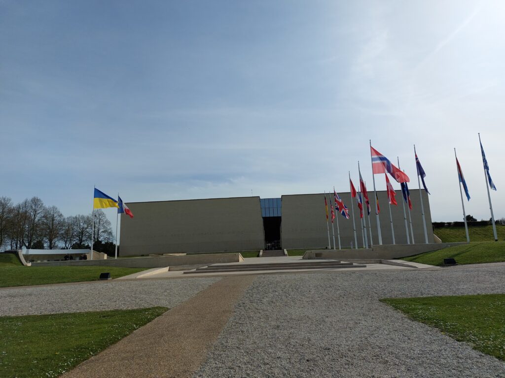
And if you are (by chance) looking for a food tour, you will find excursions out of Caen with World War II as the theme. Caen itself has basically very few excursions for itself. So then you just have to go into the world of war. With the war in Ukraine simultaneously unfolding in the theater of reality, this became rather gloomy. A bus ride out of the city center you can find the Mémorial de Caen, which covers most aspects of World War II.
The center of Caen was bombed several times during the war, but the Allied bombing during Operation Neptune (D-day) was probably the worst.
With World War II as a backdrop, however, there are up to several bathing opportunities in Normandy, namely the D-Day beaches of Juno, Gold, Sword, Omaha and Utah, where the Allies carried out the largest landing operation in world history on June 6, 1944. In France, this is not just a memorial day of the losses, it’s about liberation from Nazism, and this is a real celebration.
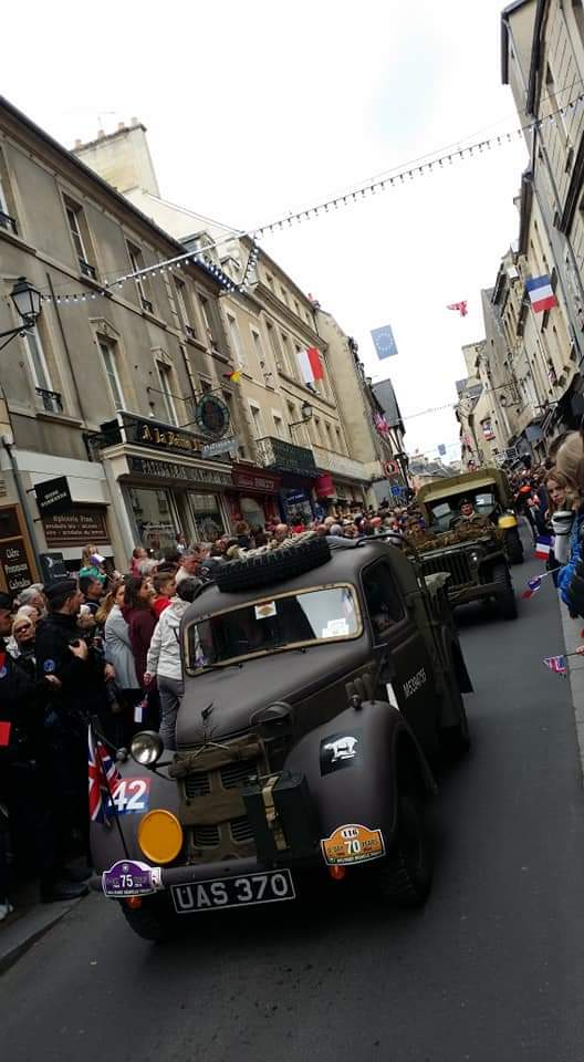
During the D-Day festivities, the atmosphere is rather tense at the beaches, with many tourists, especially Americans, who are there to remember the fallen soldiers. At the beginning of June we would not really recommend these as bathing spots, but the rest of the year it is fine.
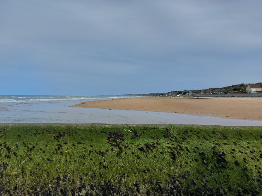
Omaha Beach is 8 miles long, with the finest golden sand. It was here that the landing forces experienced the greatest losses. In the course of one day, about 1,000 American soldiers died here, most of them during the morning hours, and they were on the verge of ending this landing. The first 20 minutes of the movie ‘Saving Private Ryan’ describe these scenes as well (horribly) as can be done.
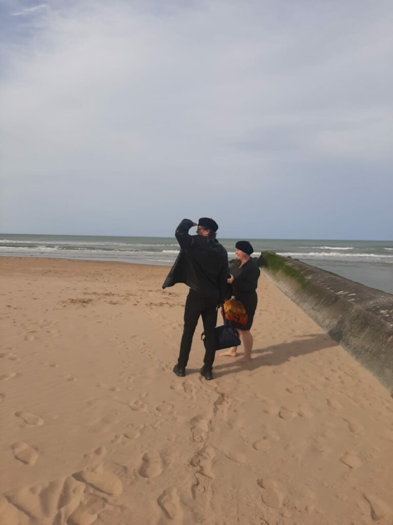
We concluded that ‘yes’ we can have a bathe here. But be careful! We saw a sign warning of strong currents, so do not swim too far out!
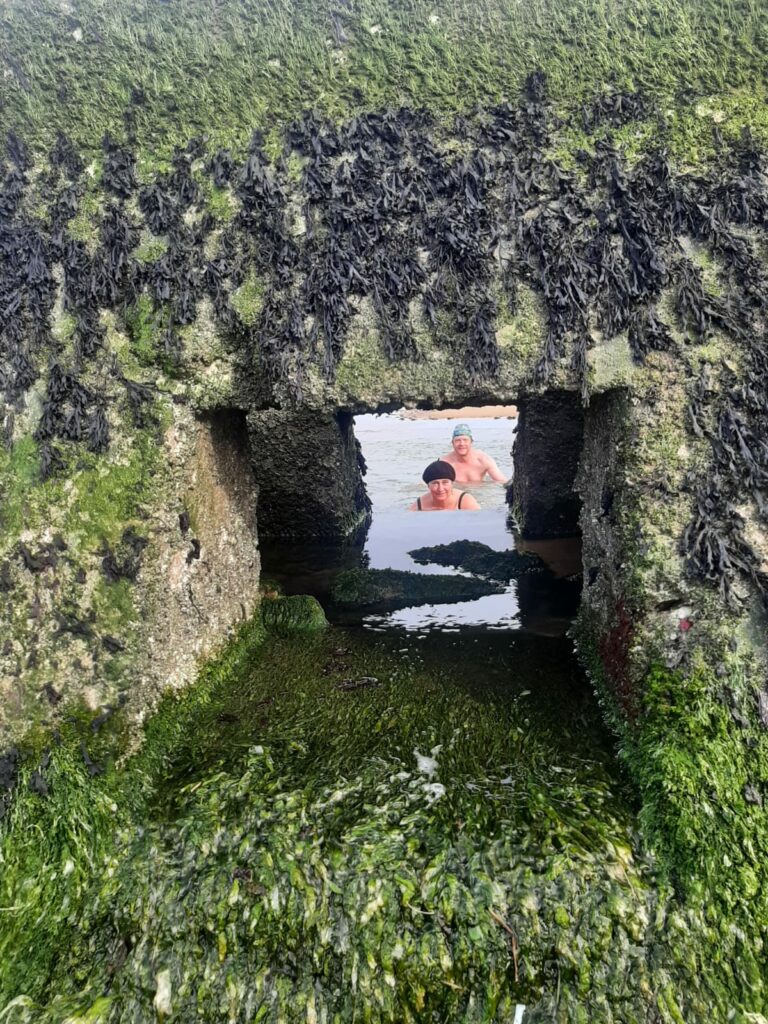
And yes, this was a great bath. Fresh and nice water, big and fun waves on the way out. A bath on Omaha Beach is just right – when there is no D-Day celebration!