The Basin City

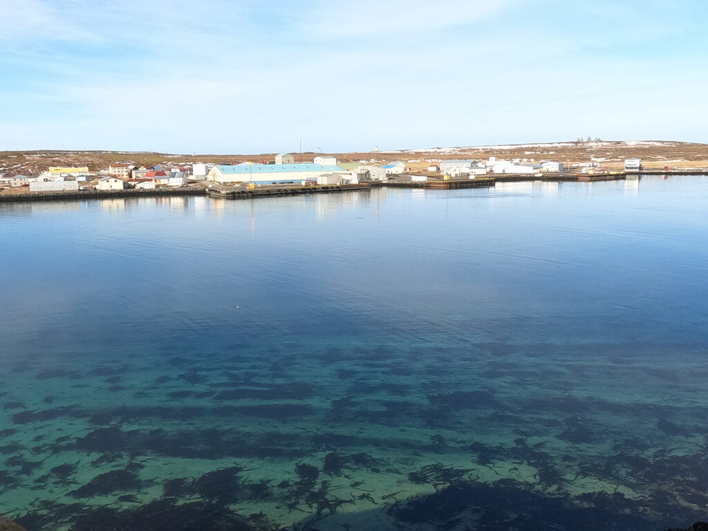
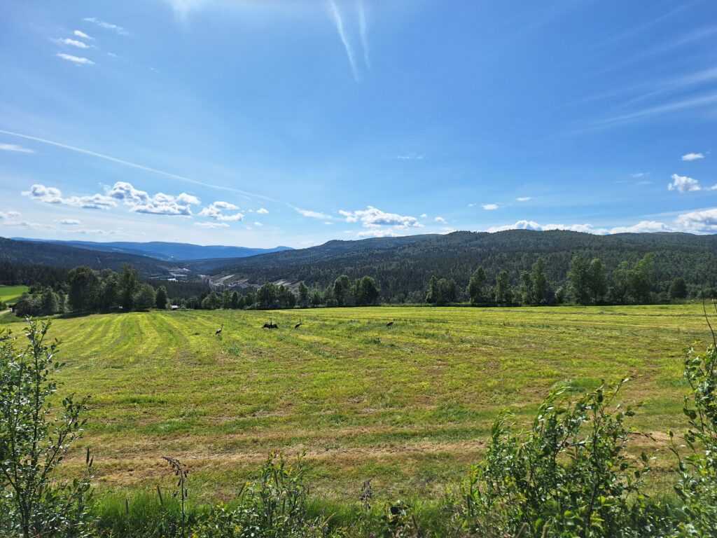
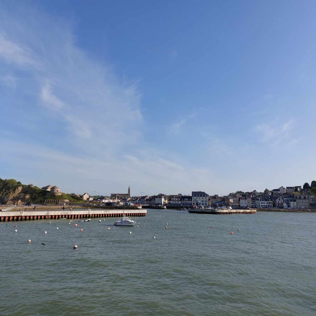
Port-en-Bessin-Huppain is a commune in Calvados, Normandy. Here, people have lived since the Bronze Age. The town of Port-en-Bessin was founded by Vikings, and it’s destiny has always been linked to the sea, which is also evident from the motto ‘Res Nostra Mare‘ = The sea is our law. It is situated in a small valley (fault) between high cliffs, about 10 km from Bayeux.

Outer harbour, Port-en-Bessin.

In 1972 it merged with the neighboring village of Huppain (from Norwegian/Norse: Oppheim). After 1096, Port-en-Bessin was called ‘Port des Évêques de Bayeux‘ (The ‘Bishop’s Harbour in Bayeux), and it was Bishop Louis de Harcourt who initiated the excavation of a deeper harbor basin in 1475.

The swing bridge from 1880 between the outer and inner basin was bombed in 1944, and replaced with a new one in 1975.

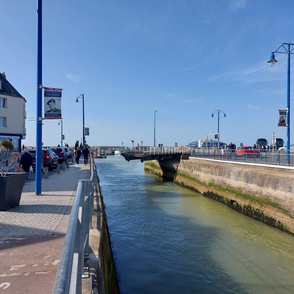
This first, outer, harbor was destroyed in a storm in 1622, and that led to recession in the area. It wasn’t until 1866 that the harbor was fully reconstructed, and in the 1870’s and 80’s, first a smaller and later a larger inner basin were excavated.

From the split between the two inner basins. We face the sea towards the lock of the outer harbour. The lock is only open 2 hours before and after high tide, so it is best to plan your fishing trips closely here.

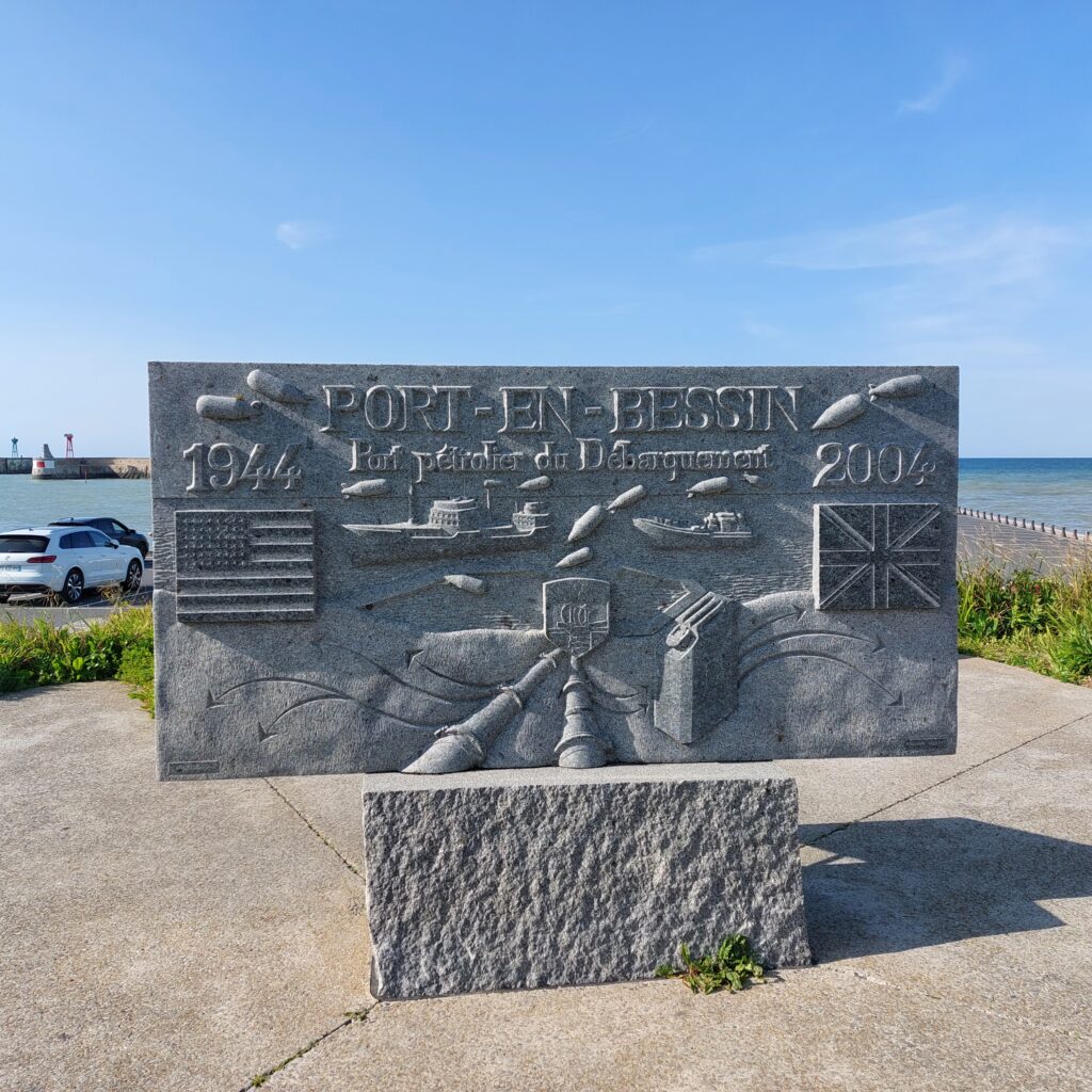
Port-en-Bessin has always been connected to the sea and fisheries, but during the Allied landings in 1944, the village took on a very special role. To keep the war machine going, there was a great need for fuel. At the start of ‘Operation Overlord‘, this was solved in the somewhat cumbersome way: Transport by the use of cans. However, two offshore oil terminals were built in a hurry, and one (outside Sainte-Honorine-des Pertes) was connected to Port-en-Bessin with a pipeline. This was a very successful project, and already from June 14th, 100 tonnes of fuel passed through this small town every day.

Jerry cans versus pipelines, 1944.

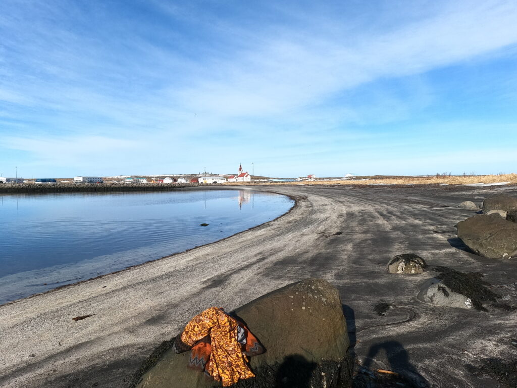
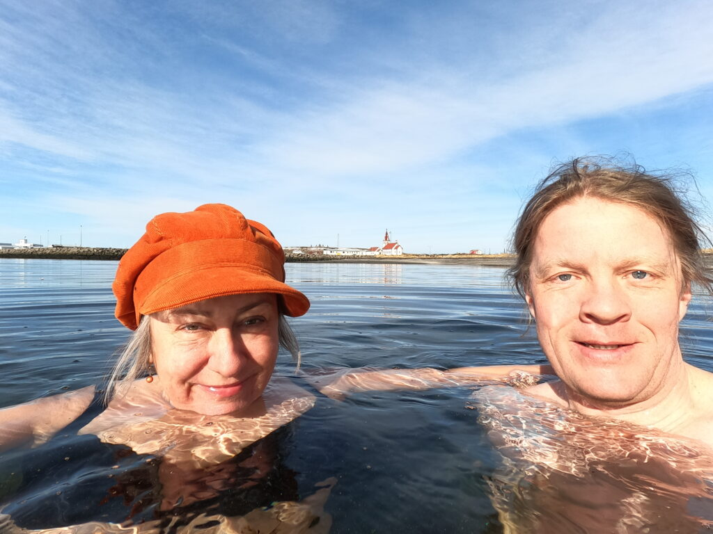
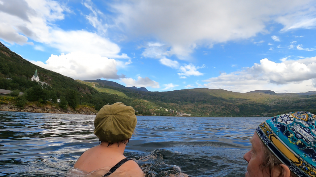
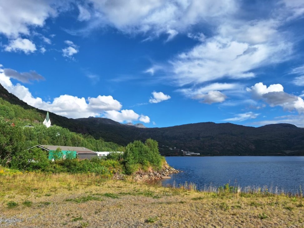
The memorial stands by the outer harbour, and then a bath would be just right, wouldn’t it? We walked down to the beach just below the 1694 Vauban Tower, which was built to prevent English invasion. There used to be a similar tower on the hill above, but this was bombed by the Allies 6-8. June 1944, at the start of the landing.

The Vauban Tower and the beach.

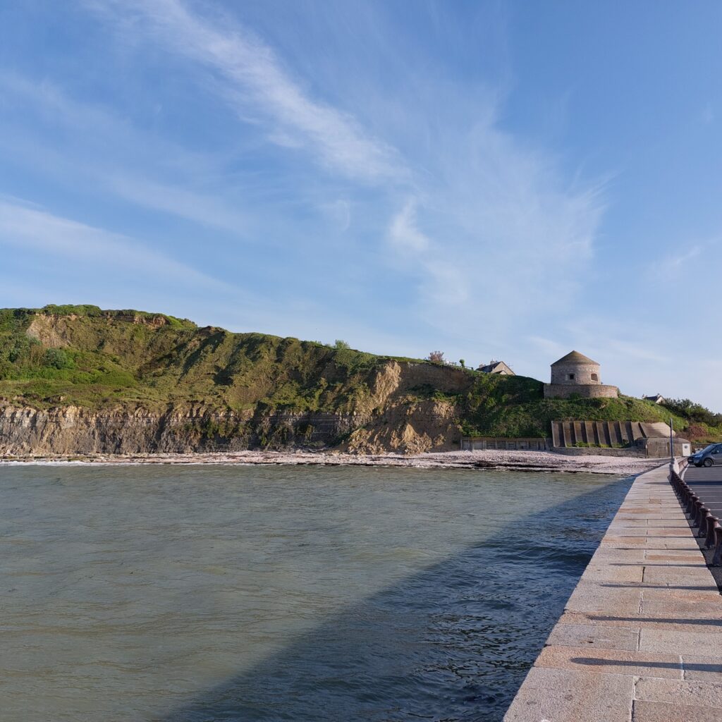
The beach below the tower turned out to be a bit special. As a memorial to the local tradition of scallop fishing, you can wade in layers upon layers of shells. They seem to have dumped scallops here for decades!

Heaps of scallops, Port-en-Bessin.

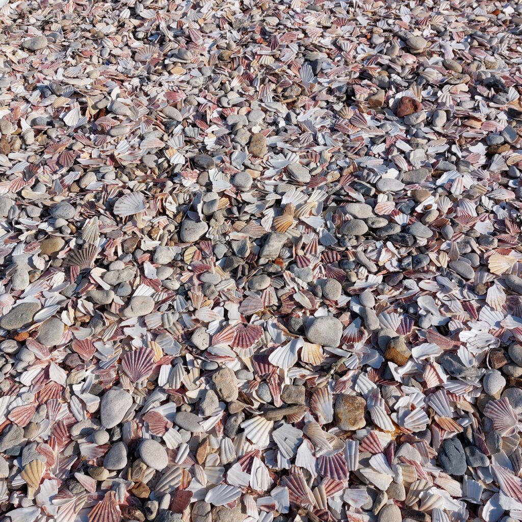
However, the shells were well-rounded and not at all painful to step on – may we call them ‘Pebble scallops‘?

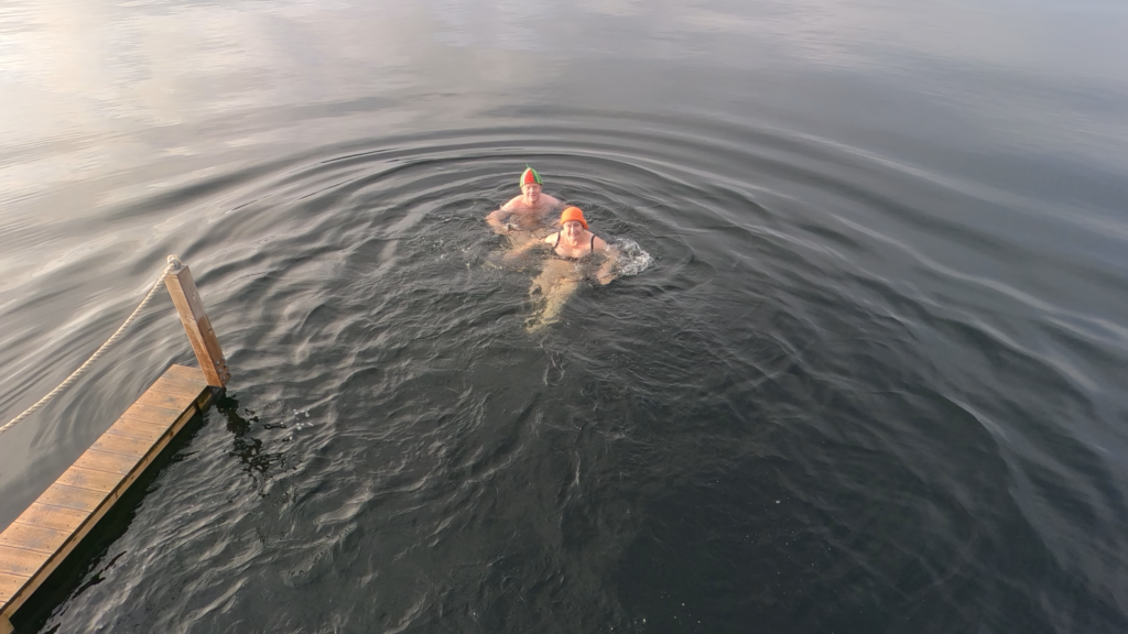
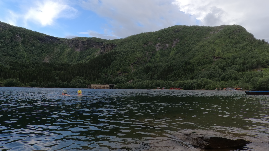
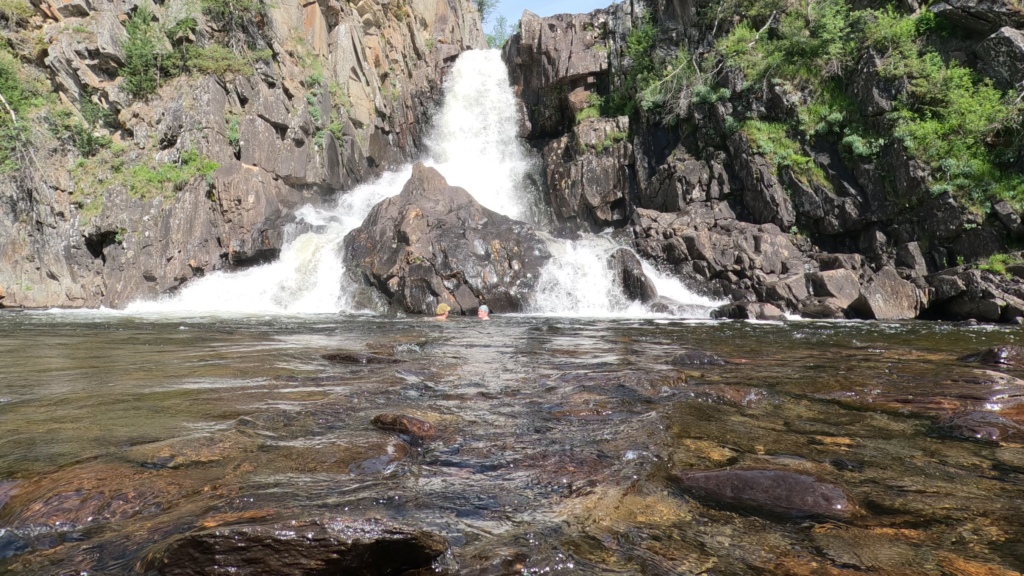
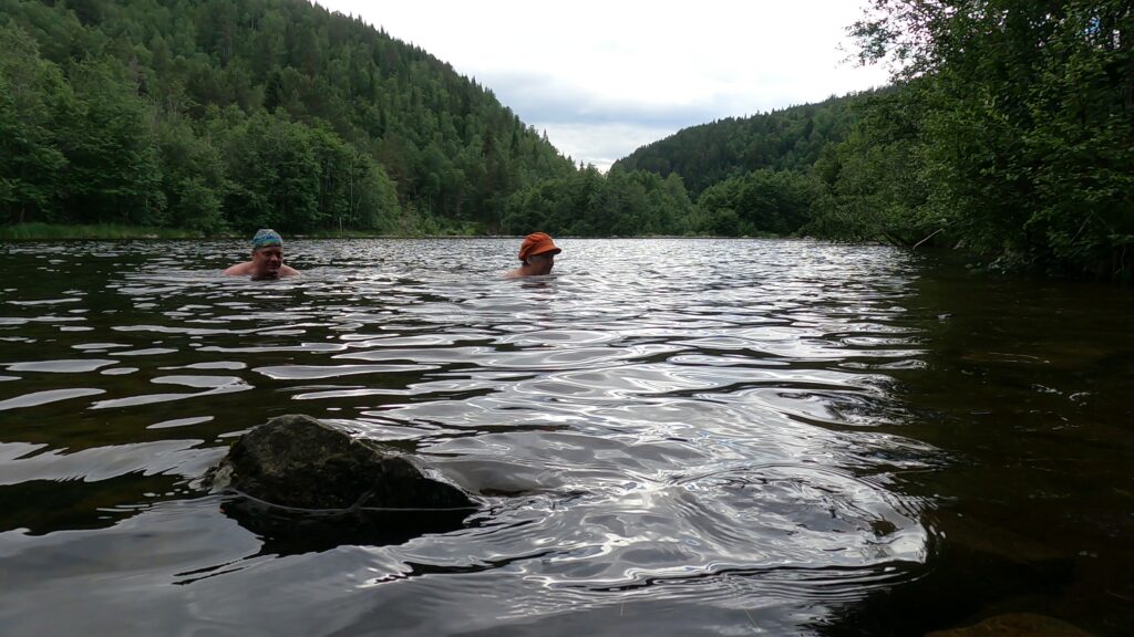
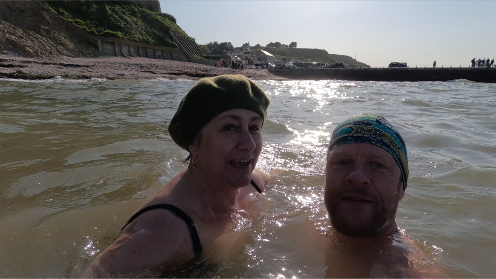
Anyway, then it was just a matter of jumping into the sea? Well… Yes, the sea was fresh and nice – a little way out. But we experienced quite a lot of wind this day, and large swells, which swirled up sand, hence brown water close to the land. And also quite a lot of seaweed to step over, which we normally wouldn’t give a thought. However, as you wade outwards, the sand is very quickly replaced by big stones (which explains the piles of seaweed on the beach), and combined with the waves, the bath turned out to be a little bloody. But apart from that – a nice bath by a very cozy little town.

And after the bath? If you are interested in scrap from World War 2, don’t miss ‘Le Musée des épaves sous-marines du débarquement‘ (D-Day Underwater Wreck Museum), which exhibits all kinds of artefacts and vehicles found on the seabed after D-Day. However, we missed this museum, and we would therefore instead recommend a trip to the episcopal city of Bayeux. There you can (and should!) visit ‘Le Musée de la Tapisserie de Bayeux‘, to see the Bayeux Tapestry.

Wool embrodery on linen is just as beautiful 950 years later. Photo: Public Domain

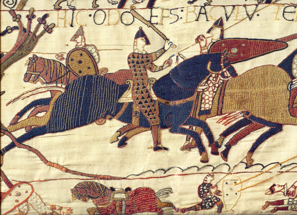
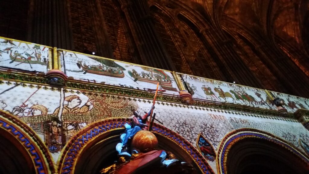
The carpet depicts King William the Conqueror’s invasion of England, as well as the Battle of Hastings in 1066 in 72 detailed scenes. Queen Mathilde’s role in the production has been very much debated, but anyway, the tapestry is absolutely marvellous, and the audio guide is also very good. Quote Audioguide: ‘They are approaching land. Everyone is happy. Even the horses are happy!‘. Here, retailers can really dive deep into the fashion, weapons, equipment and horse’s mood of that time.

The Cathedral of Our Lady of Bayeux (La cathédrale Notre-Dame de Bayeux) was consecrated in 1077.

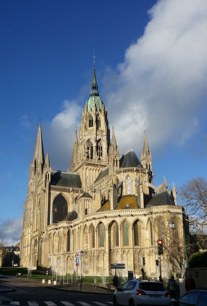
The tapestry is 70 (!) meters long and 0.5 meters high. That was a very strange size, you might think. But this is carefully planned – to fit under the triforium in the huge nave of the Bayeux Cathedral. In this way, everyone could ‘read’ the cartoon about William’s exploits: Beating two armies, and thus conquering an entire kingdom, England.

Projection of the Bayeux Tapestry over the arcades in the Bayeux Cathedral, December 2017. This is how the tapestry was returned to its original location – by the use of modern technology. Photo: Une Hunstad Løwø

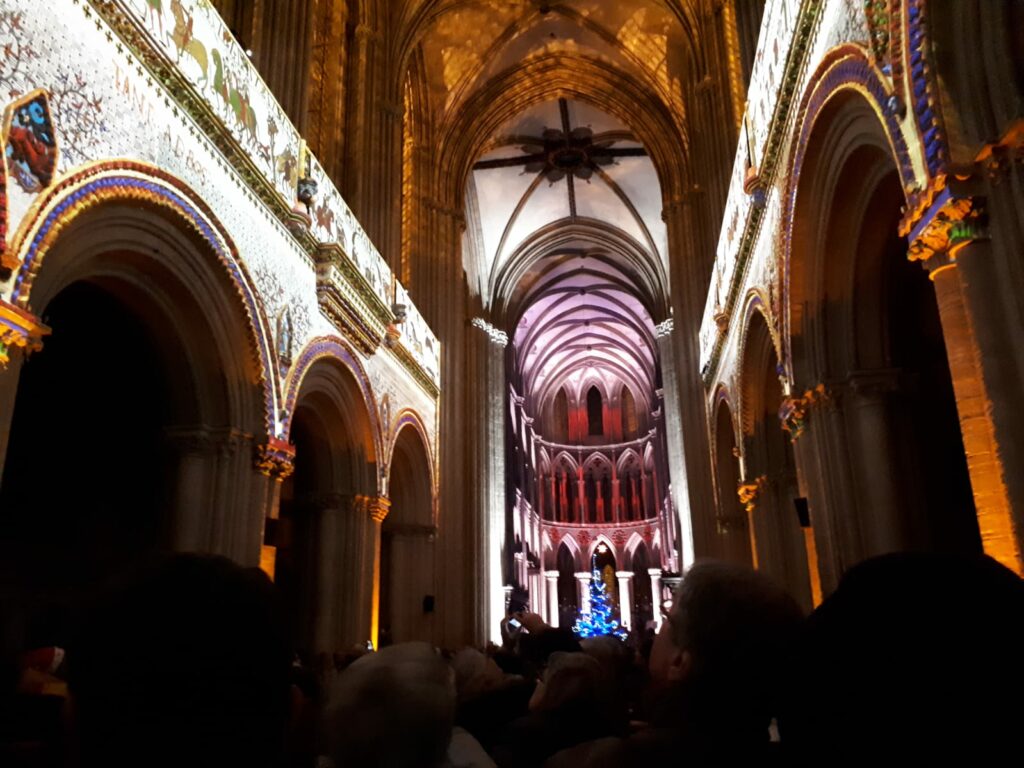
A cathedral visit in France is always just right!

World Swim Hat Day 2023

Nice and hatty octoberbath!

If you wonder what this is, see: https://tobatheornottobathe.no/2022/10/31/world-swim-hat-day/

What kind of a henge is that?

Raufarhöfn (Rauf means a long fissure, höfn means port) is the northernmost village on the island Iceland, with a population of less than 200. A charming place – but you have to put up with some wind. Due to the good harbor conditions, this has been a popular meeting spot and place of trade ever since the colonial era.

Raufarhöfn has a well protected, natural harbor.

Anyway, there was almost no increase in the population until herring fishing started around 1960. For a period, Raufarhöfn was Iceland’s largest herring town, with up to 11 salting stations in operation at the same time. About 10 % of the country’s income came from herring work at Raufarhöfn, and the population of six hundred could increase to four thousand people during the fishery. But then, in 1967, the herring disappeared, and Raufarhöfn became more or less a ghost town. Today, the village is categorized as an endangered settlement.

You will have to search hard to find clearer water than in northern Iceland. The sculpture park in the background to the right.

Despite (or perhaps because of?) the limited amount of people, the construction of a very ambitious sculpture park in Raufarhöfn has surprisingly been started: Heimskautsgerðið (The Arctic Henge). The work is inspired by norse literature: ‘Voluspå‘ and Snorre Sturlasson’s ‘Edda‘. It is made by a collaboration between Erling Torodssen and Haukur Halldórsson. By now, this is a futuristic Stonehenge.

The Arctic Henge.

When finished (if it ever is, they lack financing right now), it will look like a small Colosseum, with a stone wall around it all. But even now (2021): as an unfinished work, this is both beautiful and fascinating. And huge! We are talking about a diameter of 50 m and up to 10 m high columns. The arches are positioned so that the sun can be seen through them at the winter and summer solstice. Eventually, in the Heimskautsgerðið, you will find the yearly calendar personified by 72 dwarfs, where each dwarf spans over 5 days. Be impressed!

Heimskautsgerðið.

From the majestic sculpture park, it’s a nice little walk down to the harbor in Raufarhöfn. Here you will find a beautiful beach with a mix of light and dark sand, and large wardrobe rocks.

Raufarhöfn beach – the wardrobe.

A bath in Raufarhöfn is just right!

What, no hat?

Sjønstå

In the innermost part of Øvervatnet (the Upper Lake), approximately midway between Fauske and Sulitjelma, by the estuary of the river Sjønståa, lies an old settlement. A farm (actually 2) with such a beautiful (skjønn-) name must be absolutely splendid, you might think, and yes, this is as being in a fairytale; with a meandering river, steep mountain sides and beautiful old buildings. The name is not explained with full certainty, but may come from ‘skinstøde-å’, i.e. the river at a place where the cows seek shelter from insects in the summer heat. No beauty explanation, actually.

Sjønstå. The ‘Øvergården’ yard: Stove house from the 17th century, stables with room for one horse, barn in the background and sheep barn to the back right.

Sjønstå is mentioned for the first time in a tax census from 1665, under the name Süinstad. Øvervatnet is directly connected to the sea via Hermogsundet (Nervatnet) and Finneidstraumen, to Skjerstadfjorden. Fishing was therefore an important supplementary income to agriculture. The tax to be paid in 1666 was 9 kg dry fish in military tax (leidang), 3/4 barrel of grain and 4 kg of cheese to the church, and also 18 kg of dry fish in land debt.

More of Øvergården’s yard: The barn to the left is from around 1780, built in the norse ‘sjelter‘ technique.

The farms at Sjønstå had little opportunity for expansion, since the place is surrounded by steep mountains. At the census in 1865, there were 21 people living in Sjønstå, divided into three households.

Nergården. Øvervatnet in the background.

With the establishment of the Sulitjelma mines, Sjønstå became a hub in the transportation between Sulitjelma and Finneid/Fauske. Transport of ore from the mines took place by boat on Langvatnet. From Langvatnet to Sjønstå, they initially went by horse and sledge 10 km over the mountain. This was a slow and expensive transport, and construction of the railway started almost immediately, opening in 1892. Transshipment took place on the east side of the river, and in 1920 a bridge was built across it so that the farm’s people could easily get to the steamship quay and railway station. Between 1890 and 1956, Sjønstå had 300 inhabitants.

The bridge over the Sjønstå river, newly restored and chique (2023).

Transport of ore from the mines only took place in the summer, when the waters were ice-free. There was a strong desire for a railway all the way from Sulitjelma to Finneid, and finally, in 1956, the line was complete from Fagerli to Finneid, including 3 long tunnels. The last stretch of the Sulitjelma Railway was opened by King Olav V in 1956, and closed down again in 1972, when the track was turned into a road within just 3 weeks (county road 830). This was the end of Sjønstå’s function as a transport hub. The place was quickly vacated, except the old farm, which continued until the bachelor Andor Karolius Hansen died in 1973 (Øvergården).

Øvervatnet. The old storage hall for ore can be seen in the background.

At Sjønstå there are good swimming opportunities from the beach on the east side of the river. You just have to throw yourself into it!

Idyllic!

After a refreshing swim at Sjønstå, time is just right to get new energy into the body. Today, almost all newer houses (from the 20th century) have been demolished, but on Sundays there is a cafe in ‘Folkets hus‘ in Sjønstå. ‘Møsbrømlefse‘ is made by heating a thin ‘lefse‘ filled with ‘duppe‘ (brown cheese sauce). This is a signature dish from the Salten region in Nordland, which we will strongly recommend. Buon appetite!

Møssbrømlefse. If it is too far for you to go to Sjønstå, there is an option in Oslo, at the cafè ‘Spor av Nord‘. Møssbrømlefse is heavy stuff, but very good.

Langvatnet

The Swede Nils Persson founded Sulitjelma Aktiebolag 10/2-1891, after 4 years of trial operations. Sulitjelma had a permanent settlement of 50 in 1880, which increased to almost 3,000 within 30 years. The immigrants came from all over the northern hemisphere, and the community became a conglomerate of Sami, Kven, Norwegians, Swedes, Finns, Germans and Russians. Here you could make money, but the work was hard and the living conditions miserable, especially in the early days.

The Mining Company ‘Sulitjelma Gruber’ consisted of 18 different mines.

Sulitjelma’s nickname for many years was ‘The Hell of Lapland‘, which says something about the poor conditions. The term was first used by the agitator Kata Dalström, the writer August Strindberg’s niece. It was strictly forbidden to agitate for trade unions. All agitators were chased from the village as soon as they were discovered. As was said in Sulis: ‘Norway’s laws stop at Finneid‘. A female agitator who managed to speak in the Sulitjelma mines before the spies discovered her, was Helene Ugland from Froland near Arendal:

Aren’t you worth as much as the foremen and leaders? No, you are worth more. Do you understand that? It is you and your dirty, powerful fists that have value to the exploiters. You are the ones who raise money for the foremen, the managers, the clerks or whatever they are called, the ones who squander it. And what do you get in return? Pay for the work… yes, but you get something else, too. You get mocked and fired if the managers don’t like you.

Old Sulis. A large flow of water in the Giken river. The lake ‘Langvatnet’ in the background, with two cable cars.

Like many other mining communities, there was a clear distinction of class in Sulis. Clerks and engineers had good living conditions, high wages and access to hunting and fishing. Workers who tried to do some hunting, however, were dismissed. In the beginning, only the mining company had a shop (sometimes very poor products), so they got the money back from the workers. For a long time they also had their own money system in Sulitjelma. Hence, the Company could save all salaries in the bank, and earn interest on it.

Christmas lights on a new home (2023) at Charlotta in Sulitjelma.

A strategic ploy to keep wages down was to sell work assignments at auction once a month, a kind of auction called ‘lisitation‘. To get the job, the worker teams had to underbid each other, and the result was mistrust between the teams. The ‘Mining Act‘ of 1848 gave the mining companies the burden of support for the personnel when they had lived on the mine’s premises for two consecutive years. According to the law, sick or injured workers were therefore supposed to receive support from the Company, but this could be avoided by dismissing workers after 23 months of service at the latest. In this way, the Company could evict workers who were injured or fired, and also the families of workers who died. Later, the same (living) worker could easily get a new job – at Sulitjelma Gruber. Martin Tranmæl has said that Sulitjelma was “a small tsardom, where the capitalists ruled unrestrained“.

Langvatnet (the Long Lake). View inwards, Sandnes and Fagerli in the background.

Towards the end of 1906, the management got an idea to introduce use of something they called ‘control marks‘. The point was to know exactly how many hours the individual miner worked. This was to happen by each worker being handed a lead chip in the morning. The chip was ment to be worn at the chest, and when the mark was returned at the end of the day, the working hours were clear. The chips were immediately named the ‘Sulis Medal‘, or the ‘Slave Mark‘, and were deeply hated. The scheme with the control marks was first introduced in the Charlotta mine, which the management knew had the largest proportion of workers with family responsibilities. It was thought that this would go under the radar in the other mines , but that did not happen.

The slave marks. “We are not slaves!“, the miners shouted, knocking over the chip box. The following night, the marks disappeared after a break-in at the mining office.

At the Hanken and Charlotta mines, 200 men were dismissed when they refused to wear control marks, and a rebellion, the ‘Mark War‘, spread from mine to mine. The workers wanted to start a trade union, but how was that to happen when the Company had banned all kinds of meeting activities? The Company owned all houses, roads and all the land in the valley. They also had a private police force. Where could they meet? The solution was lake ‘Langvatnet’. Nobody owns the water, and the 13th of January 1907; 1,300 people met on the ice at Langvatnet. Ole Kristoffer Sundt spoke standing on a margarine box: ‘Everyone who wants to join the trade union goes to the left!‘ No one stepped to the right. This happened during church time, and the comment from the priest was as follows: ‘The old Sulitjelma is falling now!

The Hanken miners represented by computer-worker Knut.

After the meeting at Langvatnet, 13 trade unions were established: 7 for miners and 6 workers’ unions. Sulitjelma had scattered settlements and difficult transport conditions, therefore this many departments.

The film ‘Sulis 1907‘ was directed by Nils Gaup and presents some of the prelude to the miners’ uprising. Knut (to the right) was a featured extra in the movie. Here in Olavsgruva at Røros.

After living with the Sulis movie for many weeks in 2022, Tobatheornottobathe just had to take the trip to Sulitjelma and experience the place for ourselves. We wanted to have a bath in lake Langvatnet! Ideally it should have been done through a hole in the ice, but as the premiere was set to October, this was relatively impossible. And where to swim? Langvatnet (Spoiler alert!) is actually quite long, almost 11 km (under a kilometer wide), so the possibilities are many. We chose the new housing estate Charlotta, built on the slag heap of the Charlotta mine.

A bit difficult to walk on the water this time.

A bath here was fine for us, but as previously mentioned: The locals hesitate, because of polluted water!

Ref:
– Frifagbevelse.no – https://frifagbevegelse.no/magasinet-for-fagorganiserte/slavemerket-som-reiste-arbeiderkampen-pa-norges-nest-storste-arbeidsplass-6.469.821411.e4bf5b2fa7
– Eyvind Viken: ‘Pioner og agitator – et portrett av Helene Ugland‘, Falken Forlag, 1991
– Wikipedia: Sulitjelma Gruber

Sulitjelma

Sulis was for many years Norway’s most polluted place, but now (in 2023) the forest has returned.

In Sulitjelma (nickname Sulis), human activity has been traced 1,000 years back in time, but then we are talking about nomadic Sami people. Permanent settlement began with the Norwegian Anders Larsen in 1848. The name Sulitjelma comes from Pitesami language, but is not explained with absolute certainty. Suggestions for translations are ‘The Eyes’ Threshold‘ or ‘The Sun’s Eye‘.

Not all that glimmers is gold, but pyrite (“Fool’s gold”) certainly looks very much like it.

In 1858, the Sami Mons Petter found a stone that he thought was gold. Disappointingly, he did not become rich, as it turned out that he had found pyrite. However, the industrialist Nils Persson realized what it was, and that this could be useful in his factory at Hälsingborg, Sweden. He started test mining operations at Langvatnet southwest of Fauske, in 1887. This became an industrial adventure that was to last for over 100 years.

Outside the Mining Museum, Fagerli.

Sulitjelma Aktiebolag was founded on 10/2-1891. The population in Sulis increased dramatically from 50 around 1880 to 2,750 in 1910 (today less than 400 people). A total of 18 mines were opened in the area, and Sulitjelma Aktiebolag was for many years Norway’s second largest employer. With the mines came the need for cable cars, a laundry, an ore crusher, a power station, a wharf and eventually also a railway. The transport was demanding and expensive, with several reloadings along the way, to and from rail and boat.

In Sulis, a visit to both the mining museum and the visitor mine is just right. Photo: Unknown other visitor

The Sulitjelma mining industry closed in 1991. During 100 years of operation, 6 million tons of metal and sulfur were produced. Most of it was sulfur. The rest were: 470,000 tons of copper, 215 tons of zinc, 282 tons of silver, and 3.7 tons of gold. The visitor mine is located at +59 m (above Langvatnet). The mine shafts (which are now mostly filled with water) go all the way down to -396 m (ie approx. 250 m below sea level). The length of the shafts corresponds to a journey of 1240 km (Sulitjelma – Drammen).

The passenger lift down into the depths had an incline of 45 degrees. In the visitor’s mine, you can ride the mine train 1.6 km into the mine, but you cannot take the lift into water filled tunnels.

After a mine visit and the corresponding mining museum, a bath must be just right, we thought. However, after several testimonies from the locals, the conclusion was that ‘You don’t swim in Sulitjelma, it’s polluted here!‘ Too bad, we thought. Or? Maybe we could have a bath anyway? It felt really, really disappointing not to bathe, as tobatheornottobathe see it.

Look at this marvellous waterfall in the Giken river!

What if we did the bathing thing with our mouths closed? If the problem is heavy metals, then surely they won’t jump into our bodies during a short bath? And we thought this waterfall in the Giken River was so extreme in its colours, that we just had to bathe it.

The Giken River, heavy polluted.

Most of the pollution in the Sulitjelma waterways comes from the Giken River. After the mine was closed (1991 to 2013), NIVA has estimated the amount of heavy metals coming out of Lake Langvatnet to approximately 25 tons of copper, 30 tons of zinc, 80 kg of cadmium and 4,500 tons of sulphate – each year. Today, the pollution mostly comes from runoff from the mines. Attempts have been made to stop this by filling the mine tunnels with water. The fish in Langvatnet, though, actually do not contain heavy metals above the recommended values, but the people in Sulis still do not want to eat it (or to swim in the water).

Swimming in the Giken River is basically not something we recommend, even if the colors are spectacular.

Tynset

In the north end of Østerdalen lies Tynset, 493 m above sea level. This is so high that you cannot expect matured grain every year. Agriculture is therefore dominated by cattle and sheep, with forests in addition. The name comes from the river Tunna = ‘the one that swirls‘. Of the municipality’s 5,500 inhabitants, more than half live in the Tynset village.

Tynset bridge over the river Glomma. The Tunna river, from which the municipality takes its name, flows into the Glomma southwest of the settlement.

A number of beautiful rivers flow through Tynset municipality, so Tobatheornottobathe was hopeful for some waterfall bathing possibilities here. And yes, from highway 3 there is a good view of the beautiful Magnillfossen. But who was Magnill? Or was it a Magne that originated the name ‘Magnill waterfall‘? Comments are gratefully received. However, the first attempt at Magnillfossen ended with a visit to Tunnfossen instead.

Tunnfossen under Highway 3. Should we really pass this before turning right? We never found out what the description meant!

On a general basis, we at Tobatheornottobathe would like to thank Tynset Municipality so much for taking the trouble to list bathing places on their website. If only all Norwegian municipalities did the same! BUT – there was the small practical inconvenience that we didn’t understand how to get to Magnillfossen, despite the waterfall being on the list. The description was extremely simplified, and we didn’t get any help from the natives either, when we asked. We conclude that waterfall trips are not common here. It is described that you should drive past the waterfall on your way to Trondheim, and then turn right. But then you pass Tunnfossen first – and it was not mentioned even though it is both large and beautiful (but not really accessible for bathing, unfortunately).

Cranes above Magnillfossen.

Our next attempt at Magnillfossen was therefore in the opposite direction of the description. We arrived high up in the valley. Here there’s a nice cultural landscape with horses – and cranes. We parked above the waterfall and began the descent along a field. Pretty soon we ended up in a magical, old pine forest – much to Idun’s frustration. In this warm, south-facing hillside, the whole ground was alive – with ants. They crawled up over the sandals – and bit. Every attempt to brush them off ended up with even more crawling up the legs, you shouldn’t make any stop here! It wasn’t long before the waterfall trip was interrupted, and we made a new attempt below the waterfall.

High pine forest in Magnilldalen. An unbelievable large number of ants effectively shot down the excitement.

The third attempt was better. We parked at ‘Midteng’ below the waterfall, there is a bridge over the Tunna. But Idun was still a little stressed. This time not so much by ants, but by necrophilic flies, intensely concerned with the scab on Idun’s ancle after a bicycle fall a couple of weeks earlier.

Easy to get over the fence here.

From Midtenget it is about one kilometer to Magnillfossen. The path is obviously not much in use, but it worked well, and we had a varied walk by meadow, river and forest.

Magnillfossen is a beautiful waterfall with a deep pool. Here you can jump in when there is high water flow, and the pool functions as a fabulous counter-current pool. Highly recommended!

Magnillfossen delivers, well worth the trip!

After a swim in Magnilla, it’s a good idea to visit Tynset. Here you can climb the world’s (unofficially) biggest ‘spark‘ (kicksled/kicker). The kicksled is placed in front of the municipality building ‘Brunosten‘ (the Brown cheese), in 2010 winner of the award ‘Norway’s ugliest town hall‘. The first magnum kicksled (4 times larger than a normal one) came into place in connection with ‘Sparkens dag‘ (Kicksled’s Day) at Tynset in 1994. Both Sandefjord and Farsund have since constructed larger kicksleds, but today’s kicksled at Tynset (6 times larger than normal) is said to be the world’s largest (2023).

Knut and the kicksled. The giant kicksled weighs 2 tonnes and is almost 12 meters high.

As always, it’s not just about climbing, there has to be music too.

If you come to Tynset, you will enjoy yourself! (the municipality slogan).

As always, a kick bath in Tynset is just right!

Cat’s Eye and Opera in the Highlands

When the glaciers disappeared after the Ice Age, large blocks of ice remained here and there. Some of these were covered by sand or gravel, and therefore melted down quite slowly. The result was so-called dead ice pits, or pot hole formations, which filled with water became more or less circular lakes or ponds, connected to each other via the groundwater. Kattjønna (The Cat Lake) south of Kvikne was formed in this way.

Knut in full speed across Kattjønna. The pond is circular like a cat’s eye.

Kattjønna has neither inlet nor outlet, the water level depends on the groundwater. But charming, yes indeed! This lake is 4-5 meters deep, it does not freeze 100 % in winter and it is really generously filled with trout. We had a very pleasant stop at Uncle Jon’s in Kvikne, with prawn dinner, quiz and swimming. Kvikne is nice!

Lovely morning bath in Kattjønna with cousin Kristine.

A lot of work with the blog!‘ said Kristine, when we asked for a few more photos before the end of the bath.

The goal for the trip was Svarthammerlia and ‘Opera di Sætra 2023‘. The first performance at this mountain farm in Tylldal was in 2010, and it is something we would really recommend. Adventurous experiences in wonderland. This year’s show was based on people and stories from the comic newspaper “Pinchcliff Times’ (‘Flåklypa Tidende‘). What could possibly be better than playing on an old farm?

Everything’s just right at Opera di Sætra.

We had booked seats on the bus from Tynset, and it was great fun. The party was ongoing already as we arrived on the bus for the first time, and we were lucky enough to end up in the middle of a bunch of happy ‘Østerdøler’, who kindly guided us during the trip.

On the way up: ‘Here I shot my first moose!‘.
On the way down: ‘Here I shot my first moose!‘.
Comment from the sideline: ‘Here too?

It was a great show. Everyone, including singers and musicians, were really good. A splendid atmosphere with lots of humour. Especially the guys making ‘moonshine’ were a hit.

Good feelings on set. The guys with the ‘Moonshine’ had their own party on the right flank.

What about swimming, you think? Well, yes, the Svarthammerlitjønna is just right for a bath, but then you actually have to drive yourself. Since we went by bus, we didn’t have time to swim neither before nor after the show. We just had to be satisfied with the breakfast bath at Kvikne. Next time!

Lots of inspiring details at Sætra di Tylldal.

Kvikne

Kvikne is located in the watershed between Østerdalen (where the Tunna river flows south towards Glomma) and Trøndelag (Orkla’s source).

Vollan farm, Kvikne. National Park Center for Forollhogna National Park.

The first metal ore discovery at Kvikne was reported to the king in 1629 (extraction of copper probably took place much earlier). King Christian IV is said to have been so excited by this that he created a ‘Day of thanksgiving for the upcoming mining industry‘. He also ordered the creation of a mining town (Bergstad), but this did not happen. Instead, the miners were allowed to build their own farms at site.

When Christian IV visited Kvikne in 1635, he ordered the construction of a new church, since the old stave church had fallen into neglect.

Kvikne church from 1652. The panel is fixed with wooden plugs.

Bjørnstjerne Bjørnson was baptized here in 1833, while his father Peder Bjørnson was a priest in Kvikne.

About 10 km south of Kvikne are the remains of the Eidsfossen dam from 1917. The dam was built to provide electricity to the Røstvangen mines on Kvikne mountain, which produced copper-bearing pyrite.

Eidsfossen dam.

The dam had a balance hatch of the ‘Clapet Equilibré‘ type. Equilibrium was obtained by a concrete sinker in water. The purpose was to maintain a fixed water level in the reservoir, regardless of the water flow. The hatch was designed by engineer John Kinck, but was not a great success. Already during the first winter, the entire hatch froze, and an attempt to loosen the ice using explosives was really not a good solution.

For Tobatheornottobathe, this turned out to be a bathing pool’s paradise!

Great rapids in Orkla. A little caution is a must.

This part of Orkla river consists of a long series of rapids, with charming pools everywhere. Recommended! And actually, we were not the only bathers by Eidsfossen this beautiful summer day.

Slighty skeptical.

Knut wanted to get up to the hole he saw in the rock on the other side, but was a little skeptical about crossing the river. A quick security review was approved, however, and crossing wasn’t really very difficult or dangerous. Or at least it worked this time! It sure will vary with the amount of water in the river. Always make your own judgments!

Peek a boo!
The view hole from the other side.

You will find lots of interesting geology here, including large and small caves in all directions. And yes, Idun bathed too. We both had a few rounds of stream baths. Great fun!

Maybe not very elegant, but very fun!

A bath or three in Orkla’s rapids is just right – if you are careful. Wet shoes can be practical, and a wet suit as well (for buoyancy, not against the cold in such a hot summer day). Maybe even a helmet? But we think the most important thing is to be two or more together and to show caution all along the way.

The woman against the stream.

“The woman against the stream” is an old Norwegian fairytale. It tells about a woman who was so stubborn that when she drowned, her husband told them to search upwards the river, and that’s where they found her! Any similarity to actual persons depicted here is most likely not by coincidence!

Orkla

We have bathed in Orkla before, at the outlet in Orkanger. There, Orkla is flowing peacefully (actually overflowing when we were there, after the storm Gyda’s ravages). Now we wanted to see if the river had other qualities for bathing pleasures. Orkla is Norway’s 11th longest river, 172 km from Orkelsjøen in Oppdal municipality to the Trondheimsfjord. There are 5 power plants in Orkla. Tobatheornottobathe has developed a fascination for waterfall bathing, and before we go for a trip we always check if there are any places on the road with ‘foss’ (waterfall) in their name. And yes, there are waterfalls in Orkla, with scenic names such as Storfossen and Litjfossen (the Big and Small Waterfall).

Storfossdammen.

We stopped by Litjfossen, but it was a bit confusing, all the while the dam there was called Storfossdammen. Big or small waterfall? Where are they, these two? Anyway, this was obviously not a good bathing place for Tobatheornottobathe. Even the salmon must have trouble here, as there wasn’t a drop of water in the salmon ladder. At Nåvårdalen, however!

Unbelievable? This is actually the Orkla river!

It was a both refreshing and relaxing bath in Orkla. Not much reminiscent of the name meaning ‘the digging river‘. Instead it was tempting to call this gem ‘the Little Orkel Sea’.

Nåvårdalen. Swimming shoes may be an idea in Orkla, as the stones are quite sharp.

In Nåvårdalen you will find the beautiful remains of Nåvårdalen’s smeltery, which came into operation in 1653. This was the only smeltery of the Kvikne copper mine that was in operation after the ‘Storofsen‘ flooding in 1789. The purpose of the smeltery was to remove as much sulfur as possible from the copper ore.

Nåvårdalen smeltery. Kvikne Kobberverk started up in 1630 as one of the first, larger copper mines in Norway. The oven in the picture is from the 19th century.

King Christian IV strongly encouraged mining, but for the local farmers it was not necessarily an advantage to report the finding of new ores. Mining meant compulsory labor for the local population, and they could earn more by digging and farming on their own. It is said about the copper ore at Kvikne, that it was discovered by ‘Old Nils’, but that he later forgot where it was…

Remains after Nåvårdalen’s smeltery.

On the other side of Rv 3 we saw a truly beautiful waterfall. Nameless on Google Maps, so we choose to call it Nåvårdalsfossen. We wanted to have a bath there!

Knut inspects the waterfalls’ pools.

But no. The pools were just not deep enough, and a bath just wasn’t right. After all, we run a blog called ‘To bathe or not to bathe’, and not ‘To dip or not to dip’!