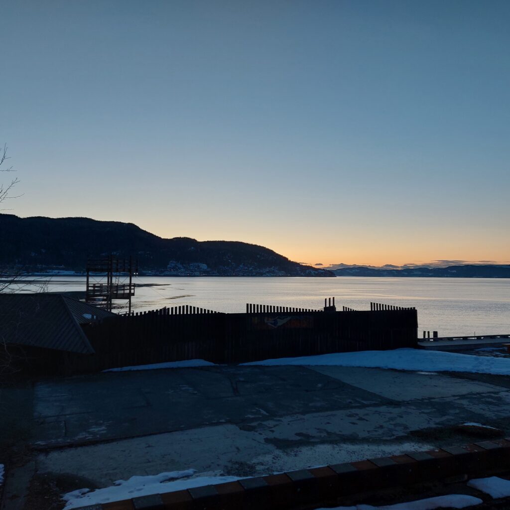
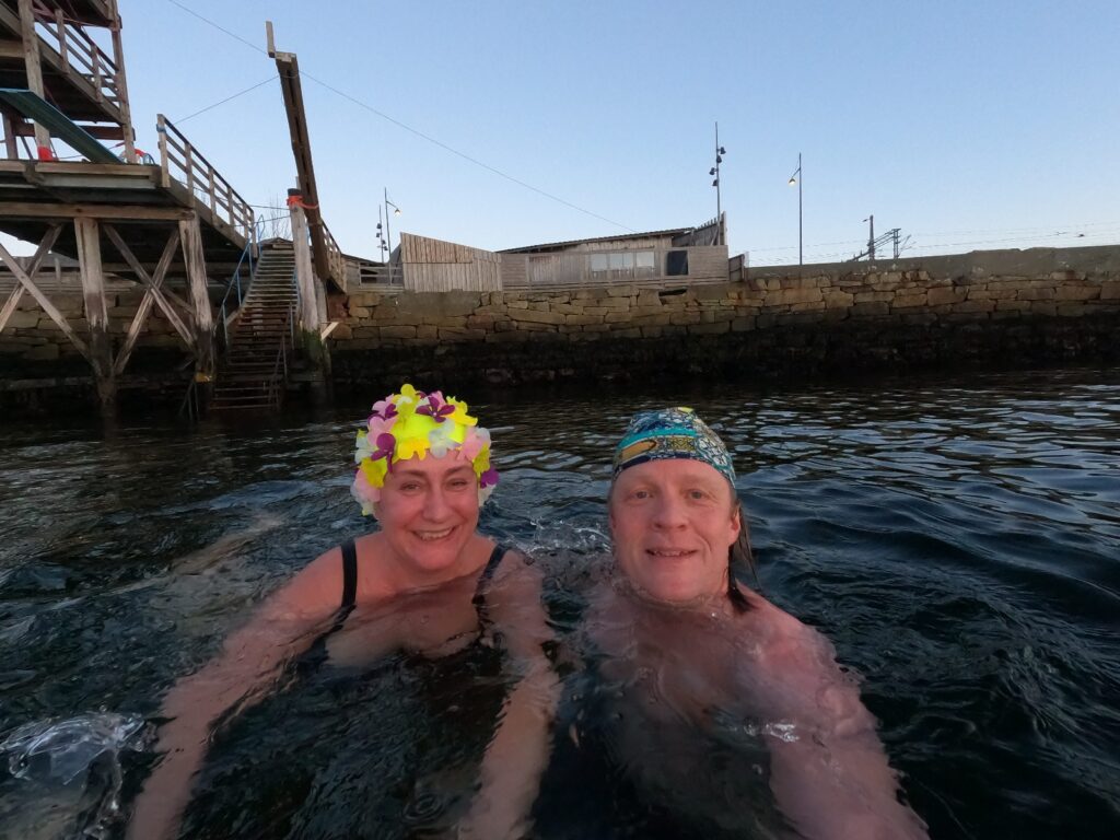
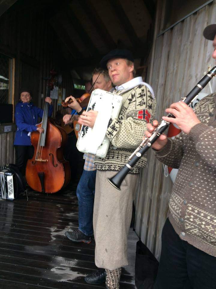
Beautiful winter atmosphere at ‘Sjøbadet’ in Trondheim.
Sjøbadet (The Sea Bathing House) in Trondheim is one of the oldest associations in the city, founded in 1858 with a formal/physical opening on May 1st 1860. The bath was initially a joint-stock company called ‘Søbadedindretningen i Trondhjem’. The first bath was placed in the inner canal (by Ravnkloa).
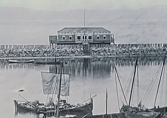
The ‘sea bath device’ in Trondheim, 1860.
Due to unhealthy water, the bath was moved to St. Olav’s pier in 1880, thanks to the bath’s patron, City Engineer Dahl.
New location at St. Olav’s pier.
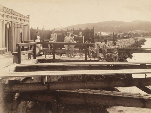
At the start, Sjøbadet was for men only. Eventually, the ladies were given access a few hours a day, but it was not until 1927 that a separate women’s department was added. The annual report from 1879 says that the ladies stopped going into the sea because they were disturbed by the dock workers.
The sea bath has long been a splendid place to hang out.
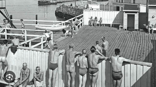
Tone Hoff became the bath master in 1968, and noticed men standing for a loooong time in the diving tower, staring down into the ladies’ sunbathing area. So she shouted to them: ‘Stop glancing!‘, whereupon some jumped into the water and others climbed ashamed back down the gully.
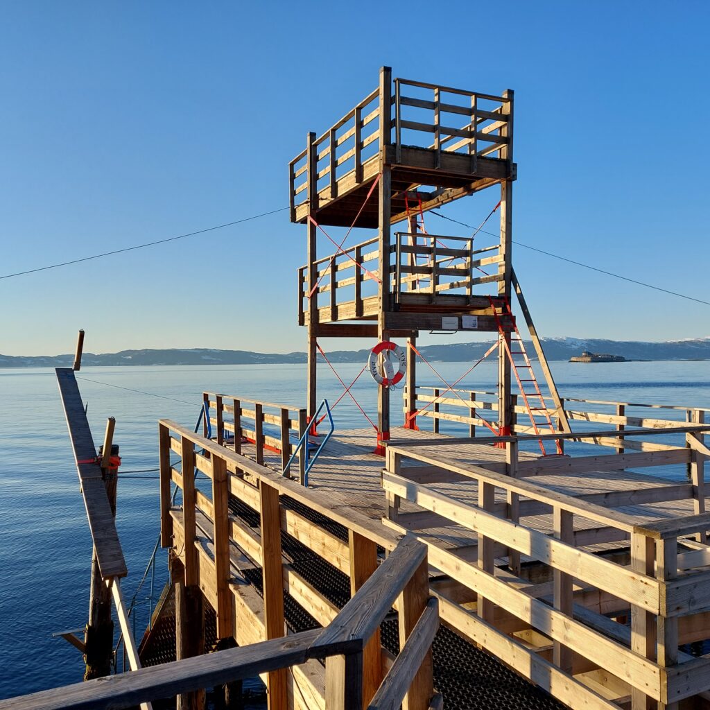
The diving tower, 2023.
Rasmus Rohde has made a nice song about this: ‘Sjøbadet‘. Check it out on YouTube! (However, with a somewhat exaggerated description of the bathing temperature. As you might know, the Trondheimsfjord is very deep, and the water never really gets warm).
Tobatheornottobathe recommends Sjøbadet at its warmest (and coldest…)!
In 2011, the Sjøbadet was moved 1 (!) meter to make room for ‘Nordre Avlastningsvei’, and the bath was rebuilt. For many years, members dreamed of building a sauna. More and more people took into ice bathing in winter, and it was quite certain that a sauna would increase both the use of the bath and the number of members dramatically. Still, there was a lot back and forth, the uncertainty of the finances of the sauna project was big, and the years went by. But finally, on 9/8-2018, after many hours of voluntary work, sauna manager Taru could say ‘Tervetuloa‘ to the first sauna experience at Sjøbadet. The number of members exploded, and for a period a waiting list existed, to get onto the waiting list for membership.
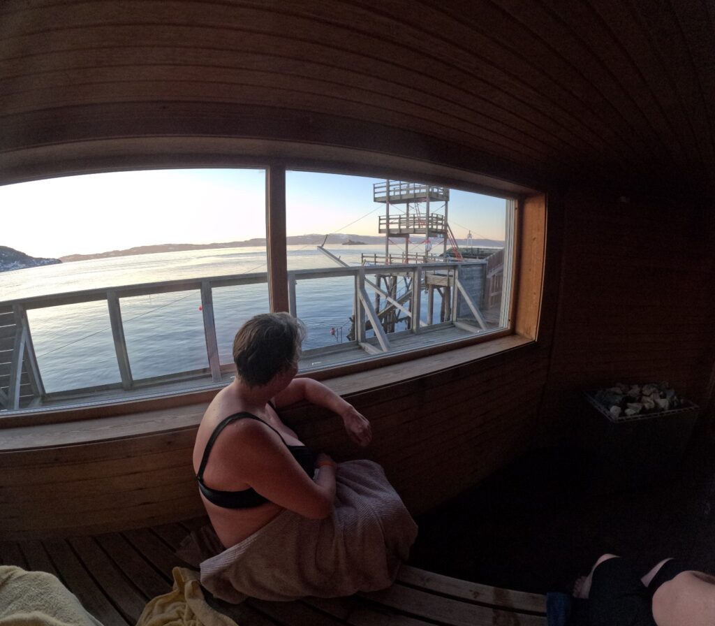
The sauna at Sjøbadet indeed has a panoramic view. Sauna master this winter day in 2023 was Taru Uusinoka.
Tobatheornottobathe highly appreciate both Sjøbadet and its sauna. A better location is hard to find! Various sauna rituals with and without ethereal oils, aufguss, Finnish traditions etc. are carried out here. All members are sent a sauna program every week, so it is easy to choose what suits you the best. If you do not have a membership, it is still possible to visit the Sjøbadet in summertime, for a reasonable amount of money. In summer, there’s a paid lifeguard, who also serves coffee, waffles and sausages between 12 am and 6 pm (2024). When the ‘Trønder summer’ occasionally strikes with wet and cold weather, sometimes the sauna is heated in summer as well. Check FB if this is tempting! In winter, a monthly ‘Folkebadstue‘ (People’s Baths) is organized (2024), where non-members can try both the sauna and ice bathing. Hereby strongly recommended!
Sjøbadet is still going strong. Not bad after 166 years (2024).
In addition to bathing and sauna rituals, there are also other happenings at Sjøbadet, both in terms of performances and concerts. On Midsummer’s Eve 2017, you could dance norwegian folk dances all the way into the dressing rooms, to music by Gammel-Snaustrinda/The Dirty Old Band.
A cold and wet Midsummer eve in 2017. Gammel-Snaustrinda plays to raise income for the sauna construction. Photo: Berit Rusten
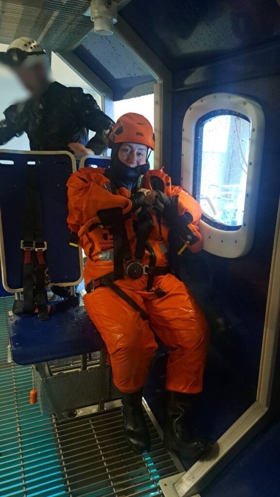
Why do you have to take a several-day safety course to work offshore? Where does that idea come from? Most people probably don’t think much about this, but when it’s your turn to join a course, that’s when you start wondering.
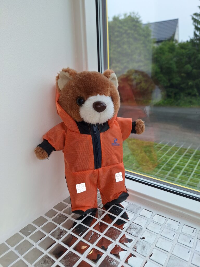
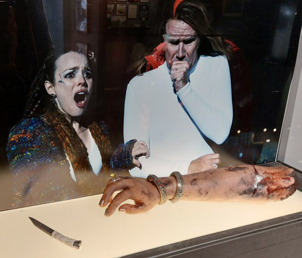
Teddy bear ‘Kristin‘ is ready to go offshore. There has been much debate about the use of hoods in the helicopter. The rescue suit is much more effective with the hood on, but it is not very comfortable in a normal transport situation. The compromise is that everyone must put on the hood before take-off and landing, while during cruising it’s optional. Teddy bear ‘Troll‘ has lost his suit and was not allowed to join the photo.
When drilling off the coast of Norway started in the 1960’s, it was with completely blank sheets. We had many mines in Norway, and we were big in shipping, but no expertise in drilling and producing oil and gas at sea. It was necessary to lean on American companies, which had both expertise and capital. The first drilling on the Norwegian shelf was done by Esso in 1966, they had experience from offshore fields, including in the Gulf of Mexico. In the 1950’s, the personnel were transported out to the rigs by boat – a method that had its drawbacks. One thing was the use of time. The most important argument against was seasickness. There was a risk that the workers were ill and in bad shape when they started work offshore. The very first helicopter to be certified for civil aviation was the Bell 47B in 1946. Throughout the 1950’s, helicopter types with room for more passengers appeared, and it was decided from the beginning to use helicopters for all passenger transport to and from the Norwegian continental shelf. The authorities wanted a Norwegian supplier to handle the helicopter traffic, and the contract went to Helikopter Service A/S. Two Sikorsky S-61 machines were purchased, they made four trips per week. With this activity, the income was far from sufficient, and Esso sponsored Helikopter Service A/S with approximately 60,000 dollars per month at the beginning. It was Phillips who found the first viable (huge) oil discovery ‘Ekofisk‘ on Christmas Eve 1969. The first decades were characterized by a certain ‘Cowboy mentality’. The focus was on efficiency and production, unions were banned, and safety was often so-so. Rescue suits, for example, were not used.
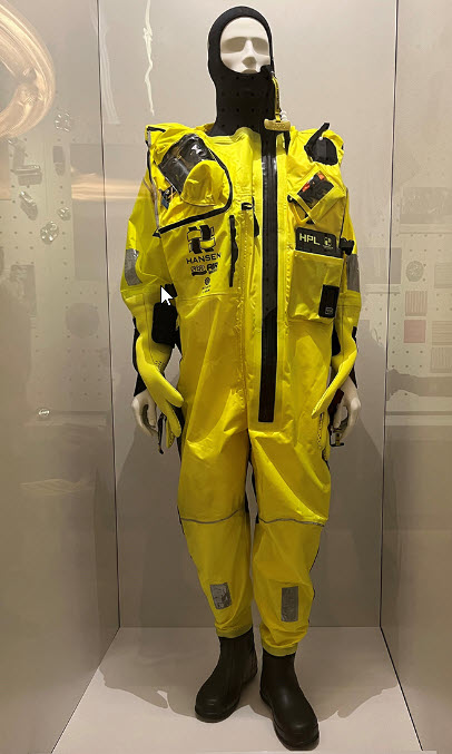
Survival suit with breathing lung (hose and valve can be seen at the doll’s right shoulder). The suit helps you to be rescued, but since survival cannot be guaranteed, it is recommended to use the term rescue suit instead. Photo: The Norwegian Oil Museum in Stavanger
It soon proved impossible for the authorities to have control over everything that happened in the petroleum industry. The development sometimes went so quickly that the regulations were constantly lagging behind, and control offshore was difficult and time-consuming in terms of logistics. The development of safety systems was pushed forward by accidents. If you look at Ekofisk, this development alone resulted in 45 deaths, of which 1/3 were linked to helicopter accidents. The head of the Norwegian Petroleum Directorate’s security department, Arne Flikke, resigned in the summer of 1974 due to a lack of resources to exercise control. The solution was internal control. The Norwegian Petroleum Directorate was supposed to check that the systems were in order, but they were not supposed to go into detailed checks on each individual installation. The companies that did not put in place a functioning internal control risked being ‘punished’ at the next license award. In 1978 there was an investigation (the Leiro committee) which recommended a 3-week safety course for offshore employees. However, this had not been implemented when Aleksander Kielland tipped on the 27th of March 1980. In this disaster, 123 people died. Of the 212 on board, only 76 persons had undergone safety training. The safety courses are therefore a consequence of the Aleksander Kielland accident. Rescue suits were not required by the offshore contractor companies, and almost everyone who died in the Kielland accident were employed by contractors. Therefore, the Norwegian Maritime Directorate decided in the autumn of 1980 that all offshore employees should be equipped with rescue suits.
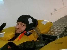
Knut is testing a rescue suit. The Diving Group at NTNU has for many years sent members to these tests, where you stay in cold water for a couple of hours, with temperature sensors literally everywhere. Photo: Lars Lyse Moen
The most important functions of the suit are insulation (retaining heat) and buoyancy. When evacuating in water, the use of a rescue suit will increase the probability of survival considerably.
An offshore security course (2024) consists of a 4-day basic course, which must be refreshed with a 2-day repetition course every 4 years. One of the main elements is training in the use of rescue suits including breathing lung and helicopter underwater evacuation (HUET). The breathing lung is a waterproof bag that is mounted in the collar of the suit. A hose, valve and a nozzle are fitted to the bag. In an emergency situation, air is blown into the bag and the valve is closed before coming into contact with water. Then you have some air to breathe in until you get up to the water surface. The rescue suit has a lot of buoyancy, so when you first get out of the helicopter, you don’t need to swim to reach the surface. Having said that, this course, or a rescue suit for that matter, will not help the slightest if the gearbox breaks (as in the Turøy 2016 accident).
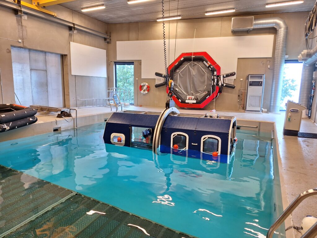
Idun is very ready for HUET (Helicopter Underwater Escape Training) at RelyOnNutec. The center of gravity of a helicopter is high up. In the event of an emergency landing on water, you must be prepared for the helicopter to tip over so that the rotor faces down. Photo: RelyOnNutec
Before you get as far as the helicopter, you have to go through a number of introductory exercises to get used to the breathing lung. Idun was so out of practice that she breathed into the hose without closing the valve first (while we were still on land checking the equipment). It was 3 years since the last offshore trip and 4 years since the last course. Repetition is indeed necessary! The exercises in water went better. First, we had to lay face down in the water and breath into the lungs for 20-50 seconds. Then pull ourself along the edge of the pool by a rope, lying face down. The last exercise before the helicopter was to hang upside down on the edge of the pool, with your foot around the pool ladder and your head down. Not at all complicated for someone who likes to swim. If you are unfamiliar with water, the situation is of course completely different.
The rotatable helicopter is a piece of pipe with a grating floor, seats with seat belts and windows that can be pushed out.
The heart rate rises considerably entering the helicopter. During the helicopter exercises, everyone has an instructor who only looks after you. Fastening the seat belt (4-point) properly is practiced, which is the first thing to do if you hear the pilot say: ‘Brace, brace‘. There are various stories about things that have gone wrong on the courses, and a classic failure is turning the seat belt knot inwards. The opening mechanism is easy to trigger, but a colleague of Idun had once turned it so that it faced his stomach, with consequent stress, he lost his grip on his reference point (the window), and ended up on the roof (floor) of the helicopter when it turned upside down under water. Then it’s ok to have instructor help!
The instructor’s inquisitive look at Idun turned to laughter when she realized that ‘Wow, you actually like this!‘ After 4 evacuations from helicopter under water, the conclusion is that it’s quite fun when ‘Toworkornottowork‘ turns into ‘Tobatheornottobathe‘!
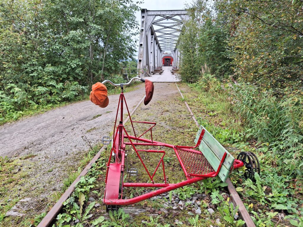
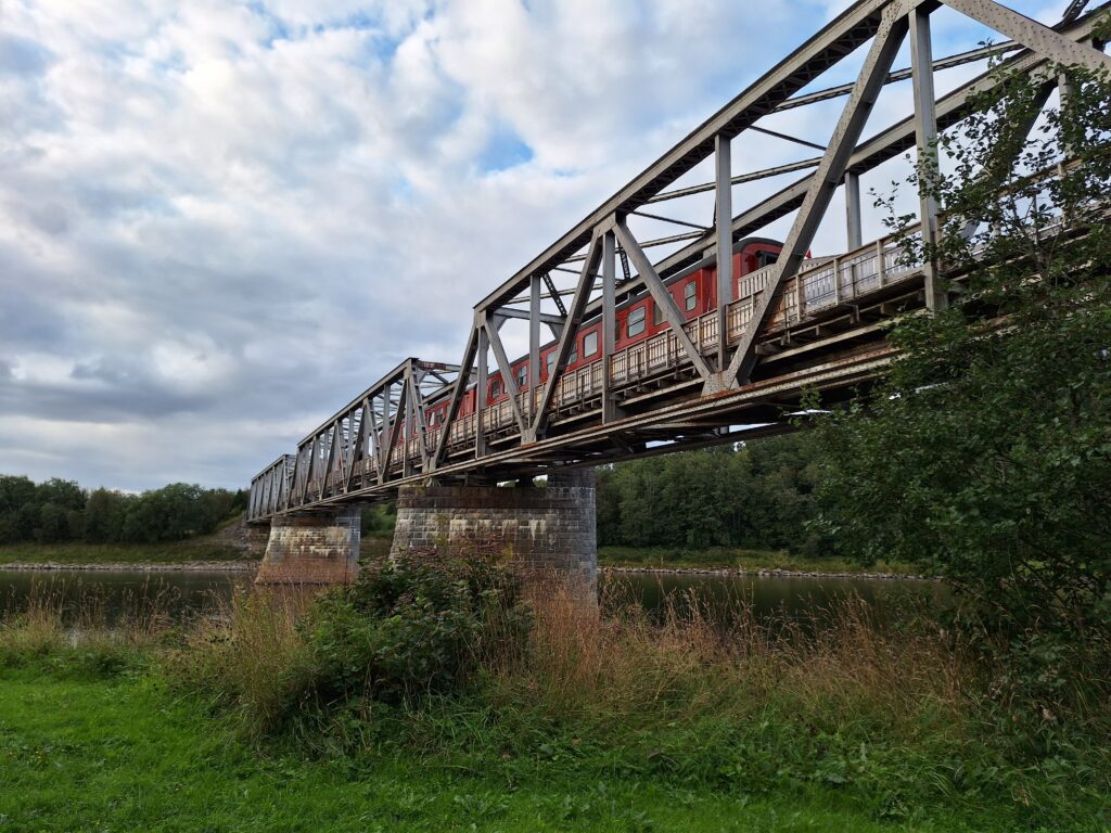
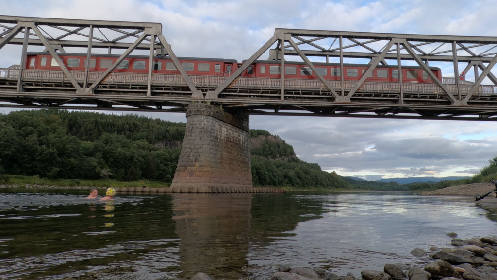
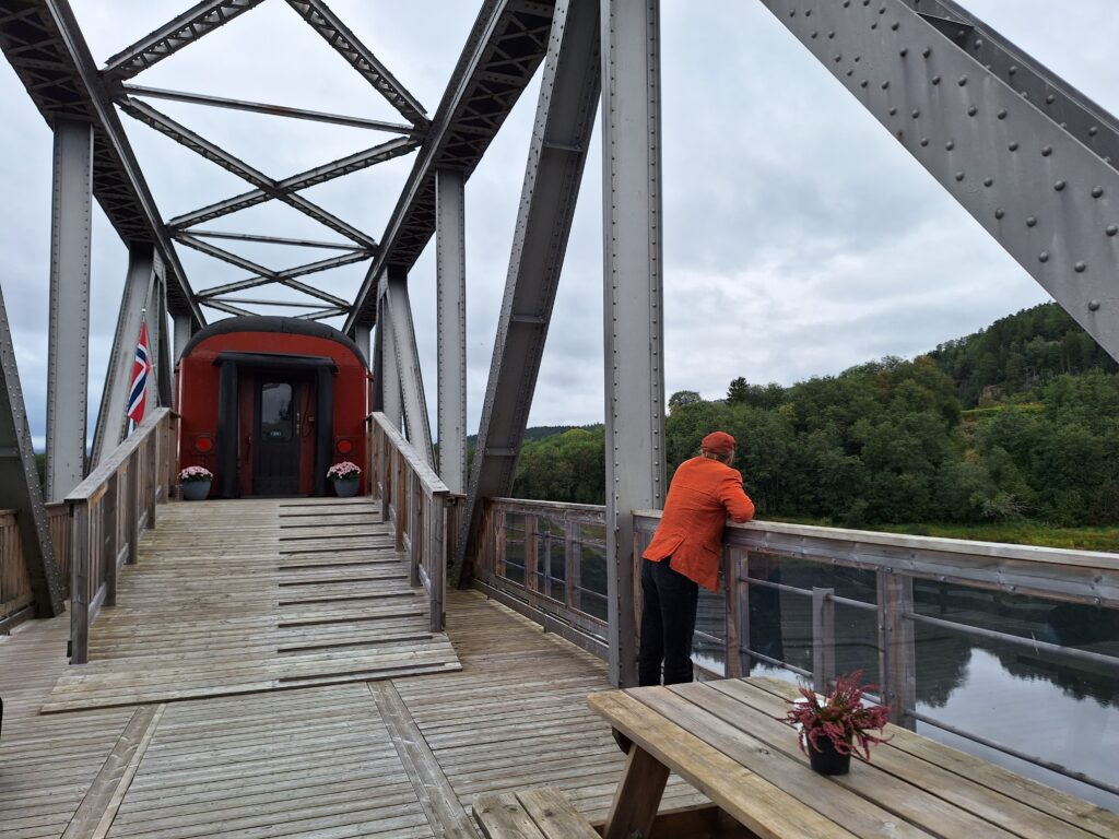
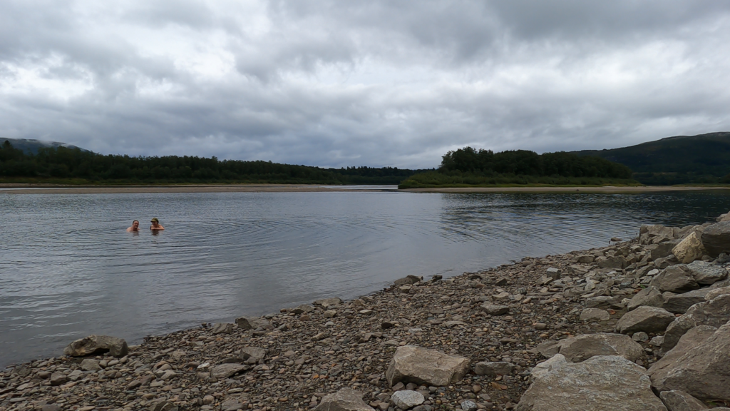
Bertnem bridge in Overhalla municipality, Trøndelag.
What on earth can bridges be used for on an abandoned track? This is a question most people find no reason to ask. But when a railway bridge crosses your part of a salmon river – then it’s an interesting problem to discuss during the late late hours of the night. The solution for Bertnem bridge over Namsen River was: Place some train wagons on the bridge and use it as a hotel!
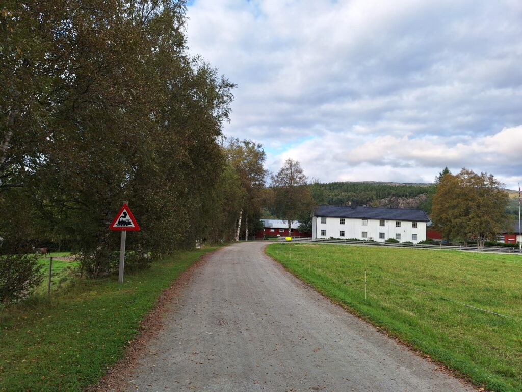
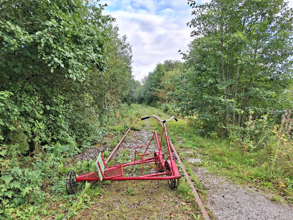
Be aware of trains at Øysletta. However, this train is not moving.
The 52 km long Namsos Railway between Grong and Namsos opened the 1st of November 1934, after a construction period of 12 years. Passenger traffic was shut down in 1978, while freight transport of grain took place until 2005. Today, you can cycle with a dressin on parts of the stretch, both by Namsos town and by Bertnem Bridge in Overhalla municipality.
The Namsos Railway. Formally closed in 2021.
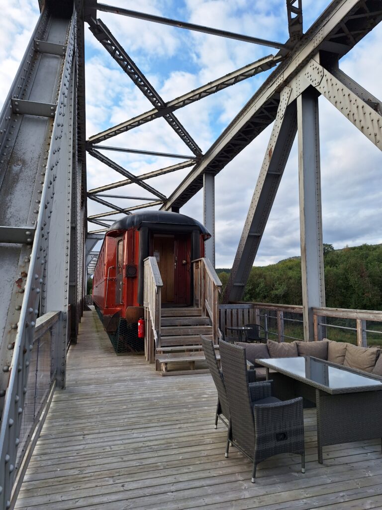
In order to actually be allowed to put four carriages on a railway bridge, a good portion of ‘Trønderly‘ optimism and stubbornness is required. It took Torger Haugen 5 years to get the permit, but the result is well worth the effort. The stunt costs NOK 55,000 per year in bridge rent, but since that includes bridge maintenance it may not be extravagant. And the ‘Namsen Salmon and Train Experience‘, has really become something special!
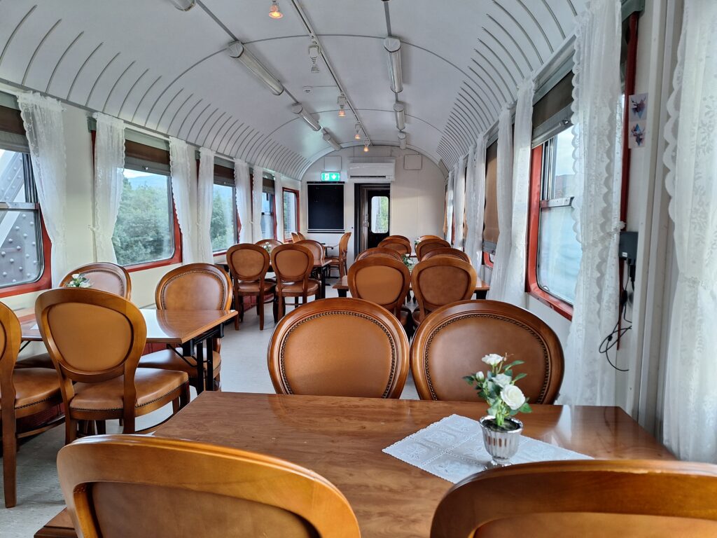
This is what it looks like when four railway carriages and a railway bridge are transformed into a hotel. The hosts (2023) are Elizabeth Hamsund and Torger Haugen.
The Bertnem Bridge is barely two hundred meters long and crosses the Namsen – one of Norway’s best salmon rivers. Here you can fish from the railway bridge! Price per kilo of salmon from this salmon adventure is not low, but if you put in a little extra, you can be rowed in the river by your own salmon guide, with an almost guaranteed catch. However, we started our ‘Salmon Experience‘ the day after the end of the 2023 salmon season, and our salmon experience therefore consisted of dinner made from wild salmon, which was both tasty and enjoyable.
The restaurant wagon at Bertnem bridge.
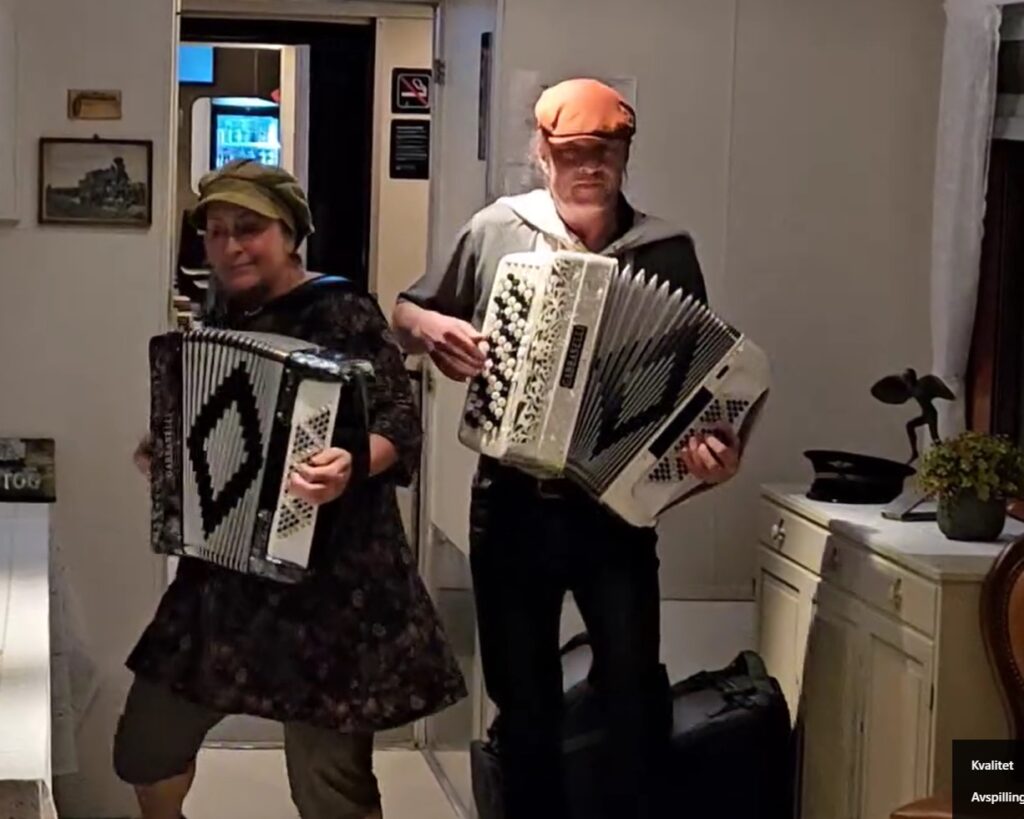
Among the 6 guests this evening were representatives from the former rock band Prudence, the Pe-Torsa revue and of course Tobatheornottobathe’s own band. Culture was therefore very much in place at the train, and the evening turned out both long and pleasant.
Before eating wild salmon above Namsen, a bath in Namsen is highly recommended. Below the Bertnem Bridge you will find easy access to the river. The water is clear and nice (and drinkable, according to the host – if wanted). A pleasant bath, not at all cold this first day of September. But be aware that there is a camera on the train sending a livestream of this bathing area!
A ‘Train and Bathing Experience‘ in Namsen is just right!
After the bath you can relax in or between the train carriages, where nice outdoor areas have been created on the railway bridge.
Namsen Salmon and Train Experience.
And if it gets too boring as the train is standing still, a QR code resulting in train sound is displayed outside the sleeping compartments. That was very confusing indeed! Sitting there, on folding seats from the 60’s, with train sounds from your mobile, while you enjoyed the view of Namsen, the brain didn’t like the fact that the sound indicated that the train was moving forward (as it usually does), while the eyes saw that the movement was going across. Of course, Namsen River runs perpendicular to, and not along the bridge.
Knut enjoys the view of Namsen – ‘Queen of the Rivers‘.
A bath-train-salmon adventure at Namsen can be both fun and strange.
P.S.: For the season 2024 all salmon fishing is prohibited. We really hope that’s not the end of this train adventure!
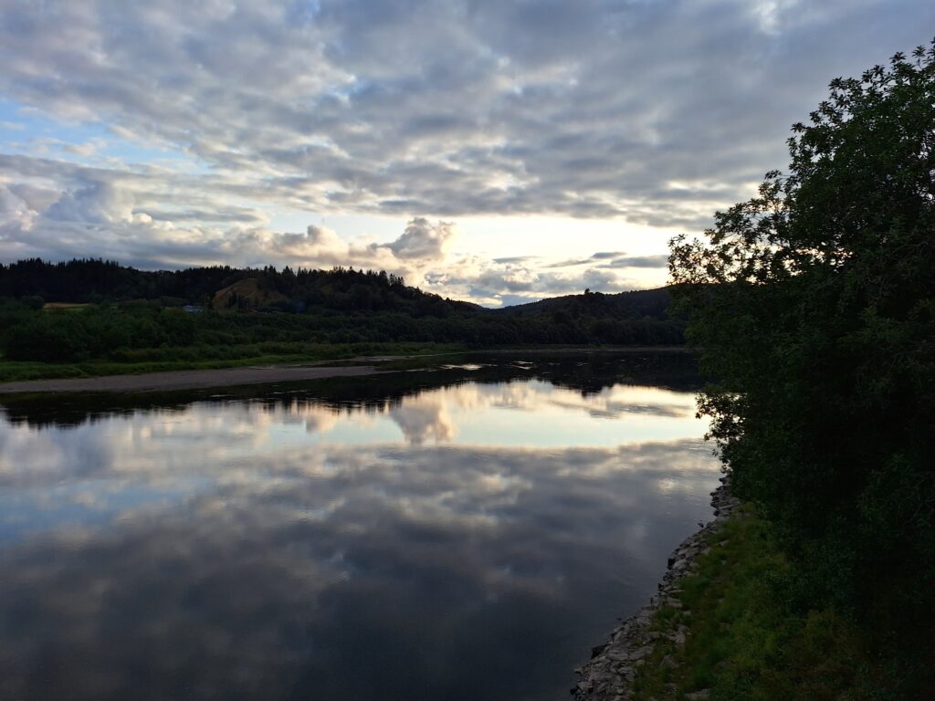
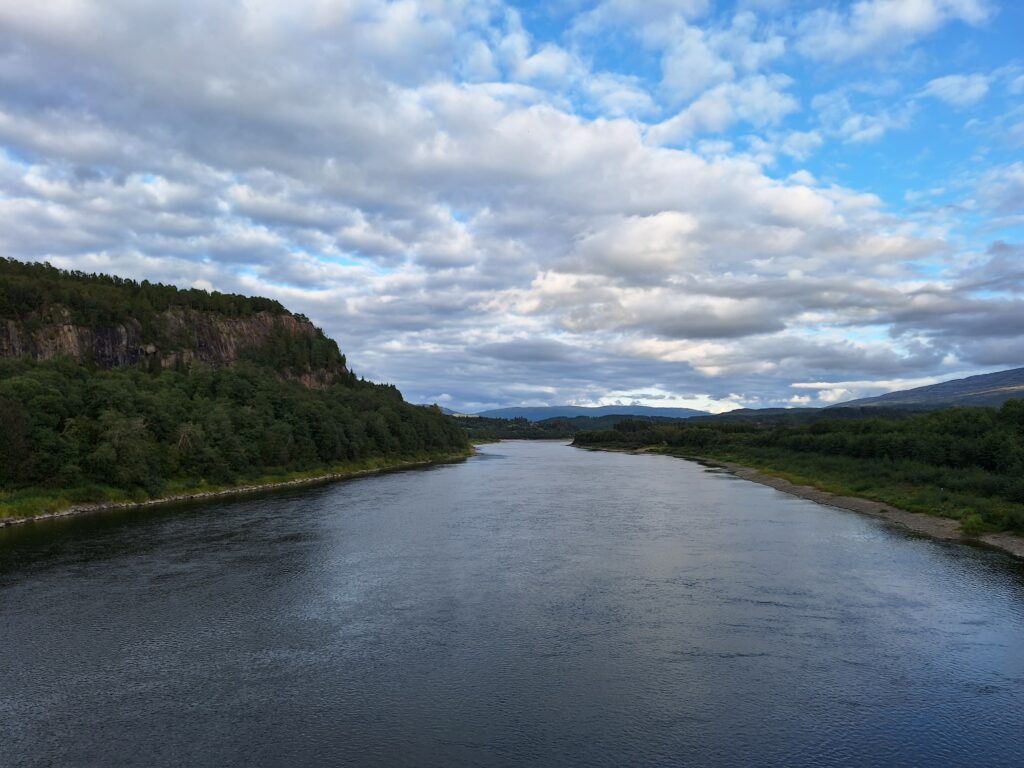
The Namsen is Central Norway’s largest river and defines large parts of Northern Trøndelag, we are talking about the Namdalen region. The river is over 200 km long, with an average water flow of 285 m3 per second. From the source in Børgefjell (southeast in Nordland), the water goes via nine power stations before it joins the sea at Namsos.
Namsen downstream Bertnem bridge.
The name was from old Nauma, hence Naumdalen/Namdalen valley. It is uncertainly explained, but may come either from ‘naust‘ = boat house or ‘navis‘ = boat. The ending -sen comes from Norse ‘sær‘ = sea/lake, i.e. the river from Naumsjøen.
Namsen, Queen of the Rivers.
Namsen has long been known as one of Norway’s best salmon rivers. In 2020, 28 tonnes of salmon were caught in Namsen. In addition to the anadromous strain (salmon that spawn in the river but otherwise live their lives at sea), there is also an indigenous species that never goes out to sea: Namsblank. The Namsblank is genetically very different from other salmon species. It is much smaller, and spends its entire life in the upper part of the Namsen river.
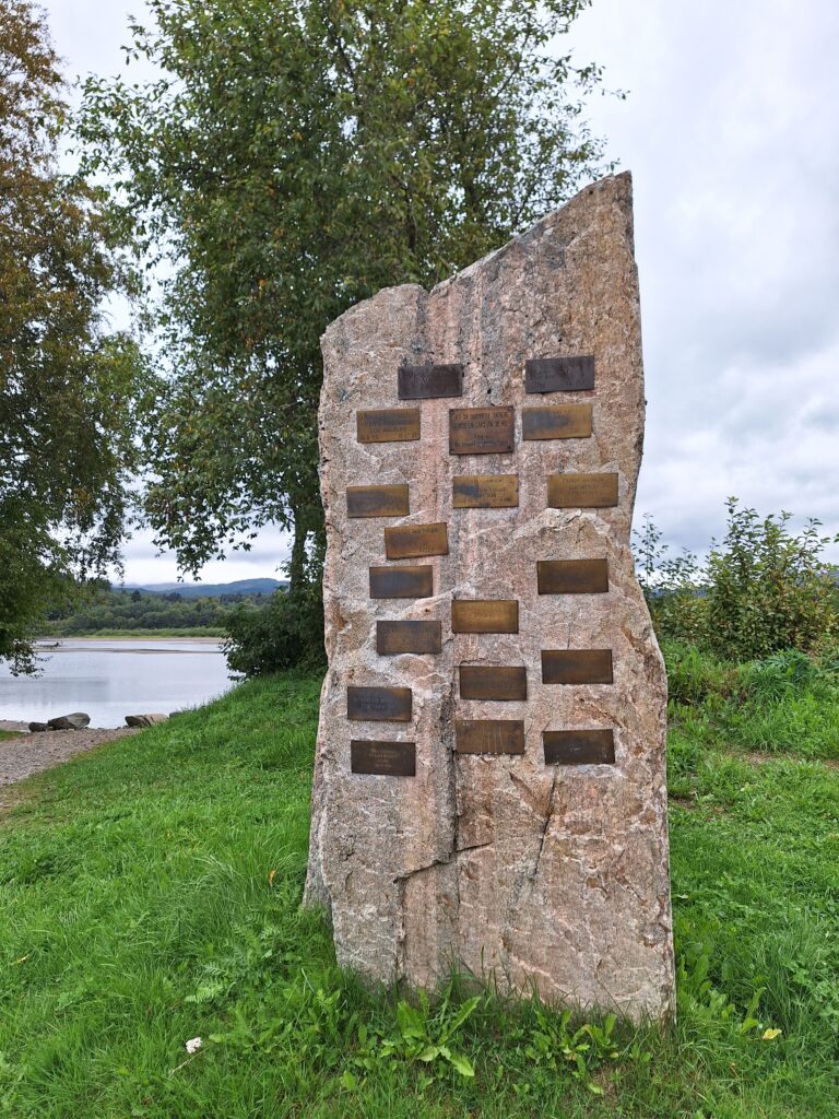
Unfortunately, the stone below will get no new marks in 2024, since the salmon fishing has been shut down!
Salmon memorial for catches over 20 kg at Grande Canari. No Namsblank here.
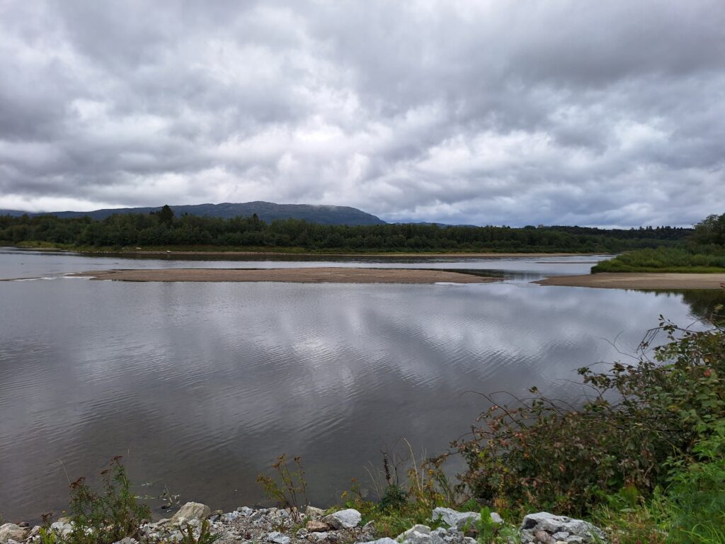
Grande farm, with its 862 acres, is the fourth largest farm in Trøndelag (third if you ignore the area owned by the Norwegian Defence Authorities). After 300 years as a priest’s farm, it changed to a new era in the 19th century as a salmon farm. This adventure was started by English ‘salmon lords‘. By Grande farm, Namsen is wide, quiet and shallow. There are several ponds and islets here, and a rich bird life. What can you call such a nice area? Grande Canari, of course!
Grande Canari. River bathing doesn’t always have to be scary.
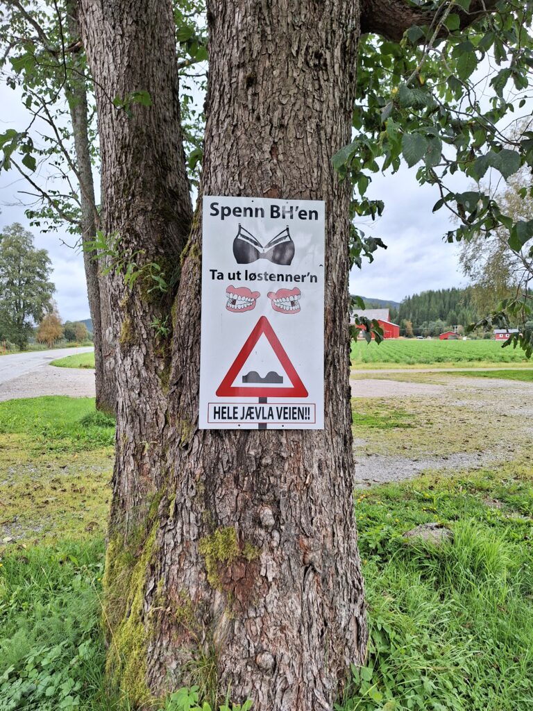
We wanted to go swimming at Grande Canari! It is super easy, just drive past the golf club and you’re there. However, you have to accept that the road standard is sometimes not always at its best.
Tighten your bra, take out your dentures…along the whole bloody way!
A bath at Grandi Canari can be just right – even if the water is shallow.
Overhalla municipality in Namdalen, with almost 4,000 inhabitants, is one of the larger Namdal municipalities in terms of population. It was a special name for a municipality, you might be thinking, which ‘hall‘ are we talking about? But the name has a completely natural explanation. After the national assembly, Namdalen was divided into two parts, and the upper half of Naumdølafylke was called ‘œfri halfa‘ (“Upper half”) in Norse: Overhalla simple as that.
It is lush in Overhalla, with a lot of agricultural and timber production.
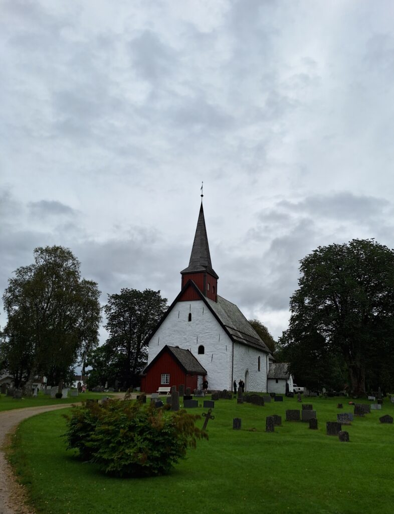
Overhalla was populated a long time ago. In the municipality, archaeologists have excavated remains of settlements from 1000 BC, a number of burial mounds, burial stones and other finds, including the Hunna sword. Of old stuff, however, Ranem church from 1187 is the most eye-catching. The church burned in 1899, but has been beautifully rebuilt with a wooden roof and tower.
Ranem church in the Romanesque style is built of local stone, both quarry stone and marble.
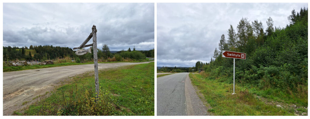
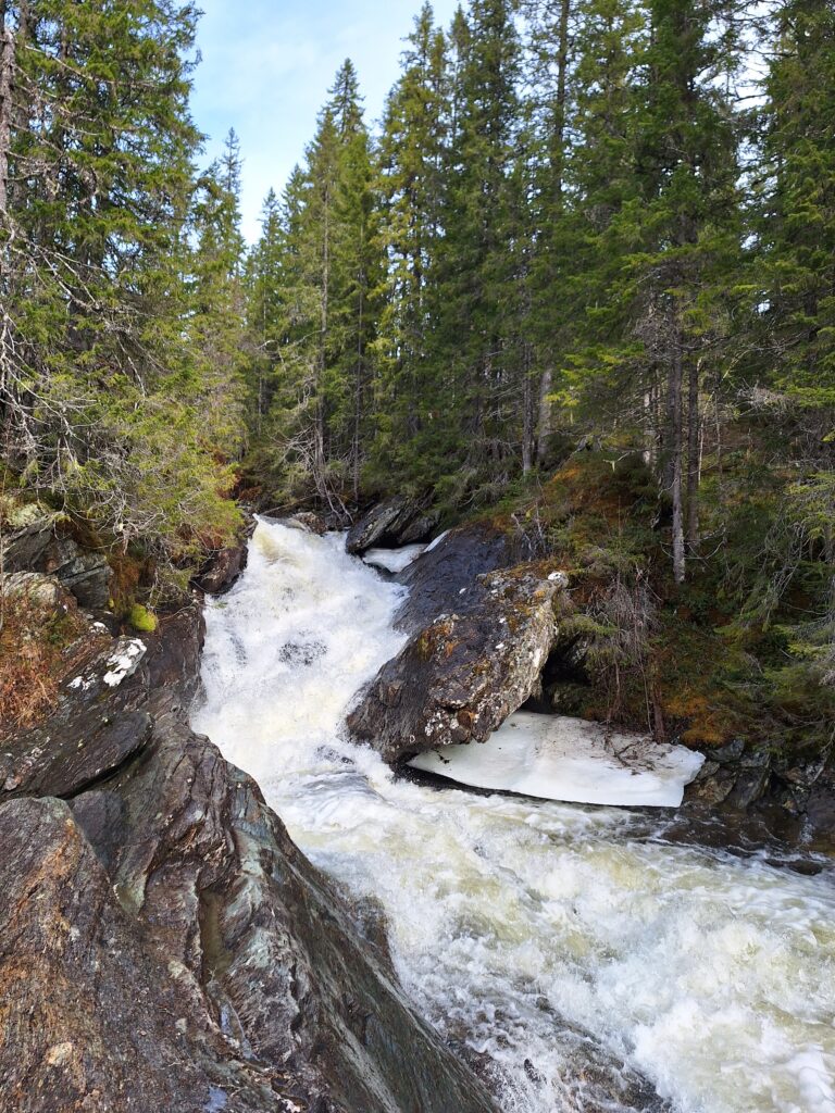
Tobatheornottobathe has become very interested in waterfall bathing, but it is not always easy to find suitable pools below them. And especially in Namsen, as it floats quietly and nicely mile after mile. We really wondered if the ‘Queen of the Rivers‘ herself had a bathing secret or two for us. The question was: Are there any fun swimming spots here? We got a tip about ‘Sælkhylla‘ or ‘Sellægshylla‘, about 10 km from Ranemsletta, on the south side of the river.
We don’t know what the name means, but this bathing post is at least well signposted.
Sælkhylla is a great place! Here you can swim carefully in the small bay within the rapids, or you can go onto the rocks.
Careful does it. Step by step.
The height of water determines how far out you reach, but we made it to the nearest reefs at least.
Sælkhylla. Certainly not a waterfall, but rapids can be fun, too.
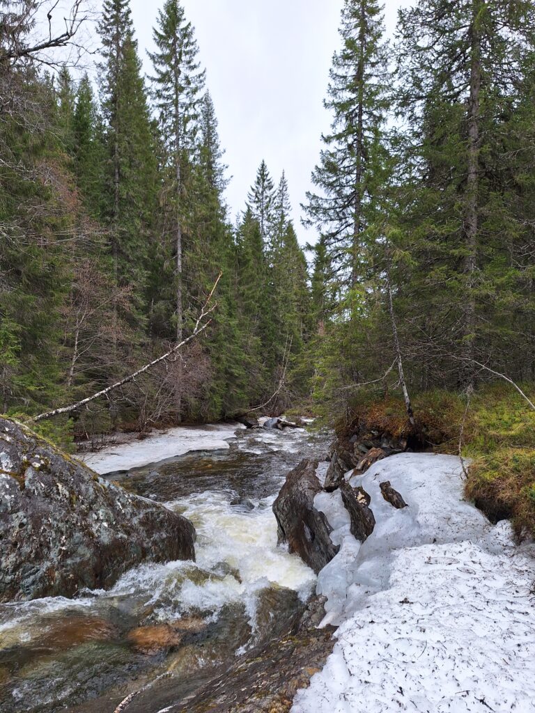
Then there were discussions. We didn’t have any wetsuits with us, and the conclusion was that we shouldn’t try to float through the current.
To float or not to float…
But – we found a nice jacuzzi, perfect for a bubble bath!
Sælkhylla – a funny place: jacuzzi with a built-in shower.
However, some caution should be taken. It is said that a girl drowned here a long time ago, and the body was found in Namsos 3 weeks later. Be careful!
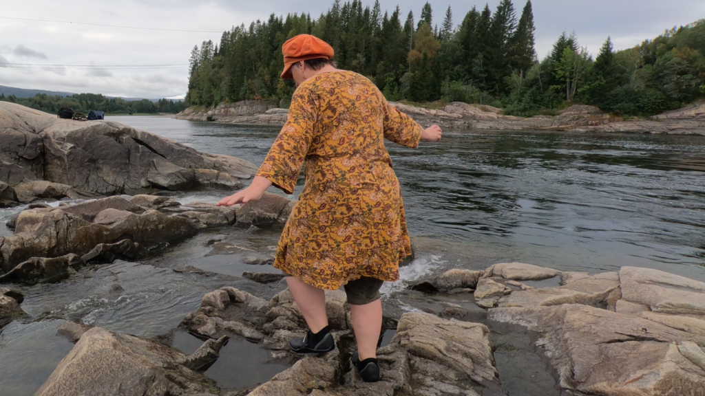
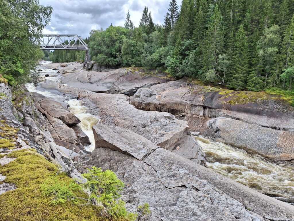
We have gradually learned (it is possible that we are a little slow), that when a large river flows down a valley, it is not necessarily easy to find great waterfalls to explore. The river Namsen, for example, flows steadily down the Namdalen for miles without producing waterfalls. Of course, there are large quantities of water (and salmon), but kind of tedious, to be honest. The tributaries, however!
Of the tributaries to Namsen, Sanddøla delivers very well on the waterfall front.
Sanddøla is a tributary of Namsen, having its source in Lierne, close to the Swedish border. The river is 64 km long and joins the Namsen by Grong church. Sanddøla holds salmon up to Tømmeråsfossen waterfall, and unlike Namsen, it is protected from power development.
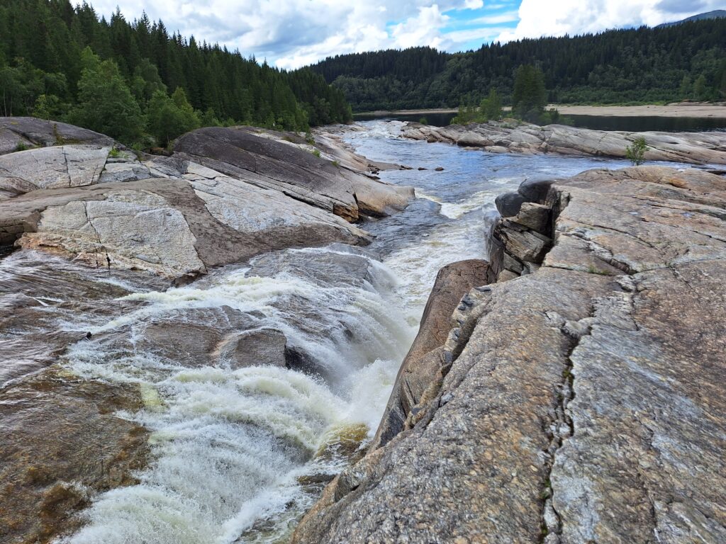
Exciting bathing opportunities in Tømmeråsfossen.
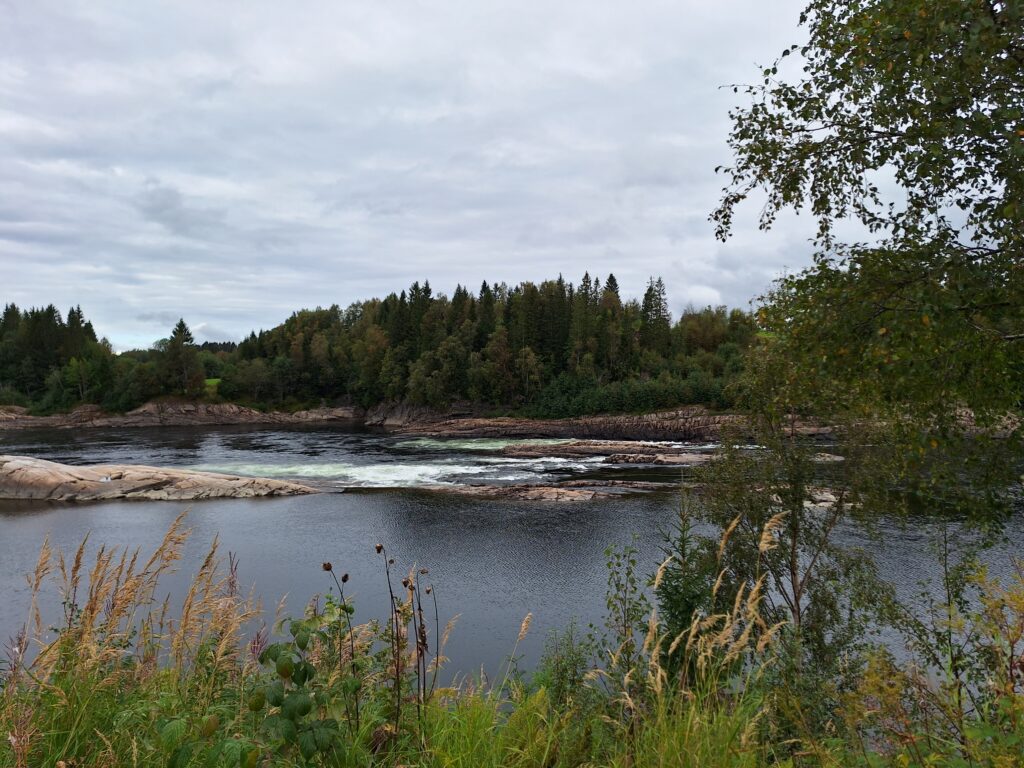
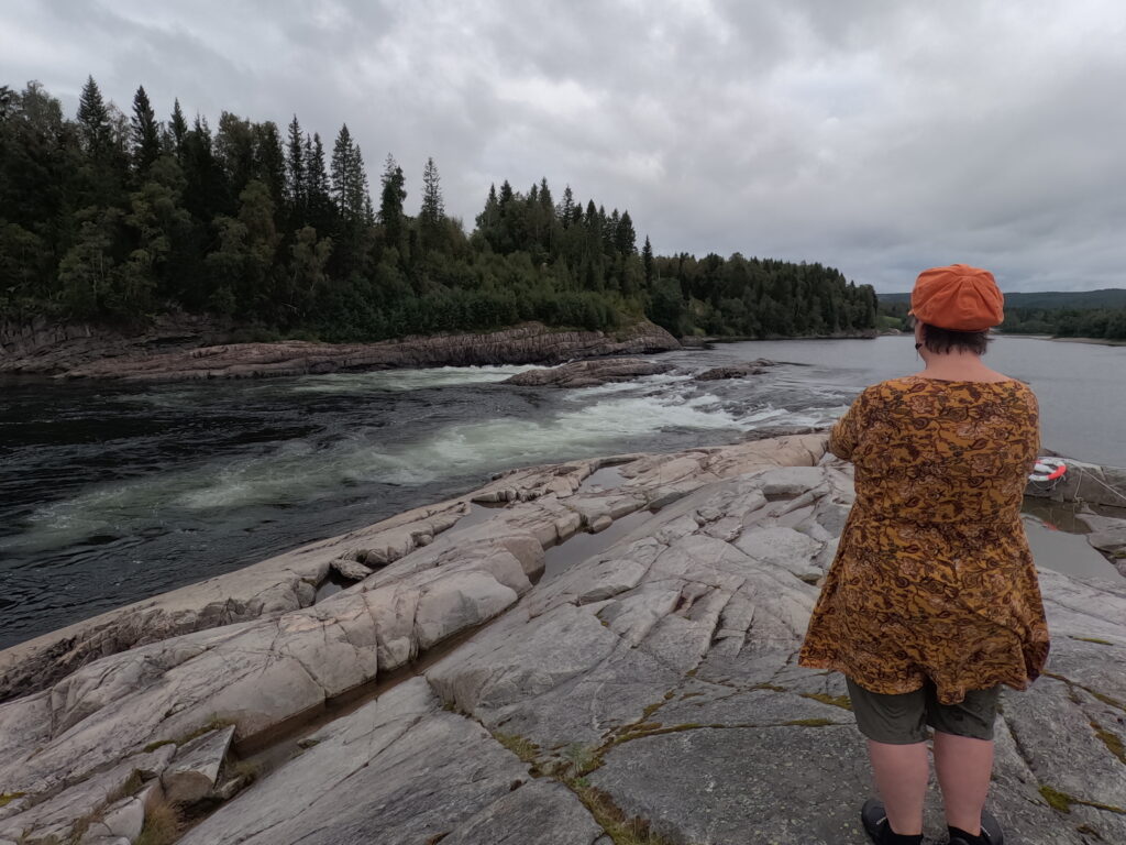
Namsen and its tributaries for many years had an important role in forestry, as a basis for timber floating. All timber from ‘Indre Namdalen’ was sent via Grong on it’s way to Namsos (and the sea). Tømmeråsfossen, together with Fiskumfoss and Formofoss, are Grong municipality’s millennium sites. There was a mill here until 1948. The name Grong comes from Norse ‘Granungar’, meaning spruce. Three green triangles in the Grong municipal’s coat of arms also symbolize the importance of spruce and forestry in the region.
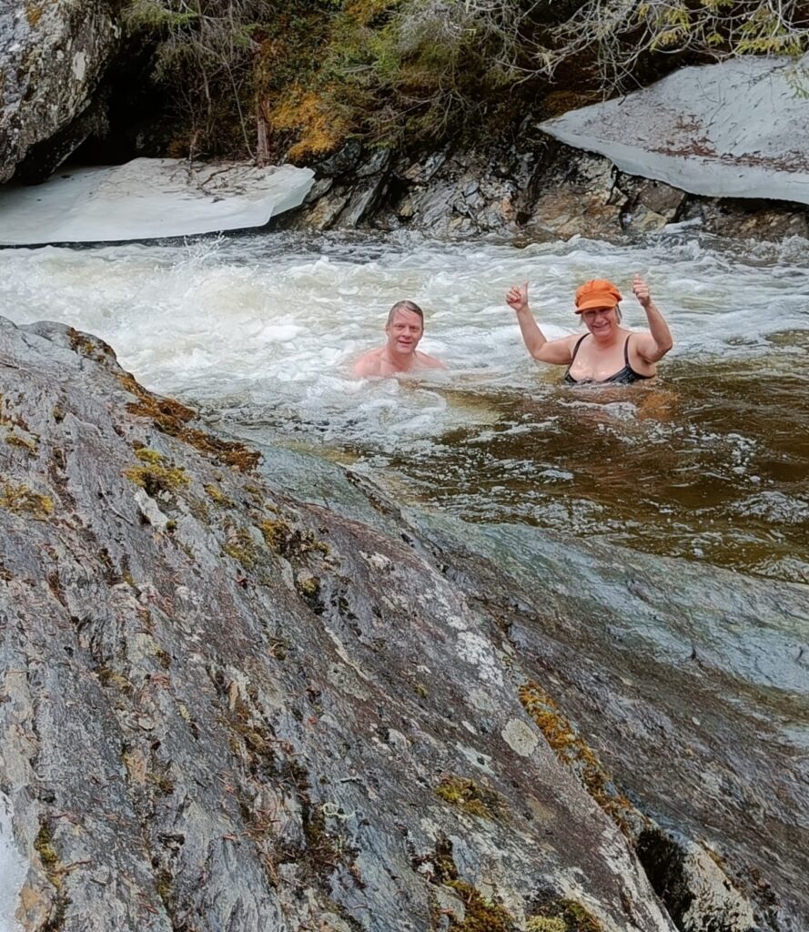
The ancestor of all bathing pools.
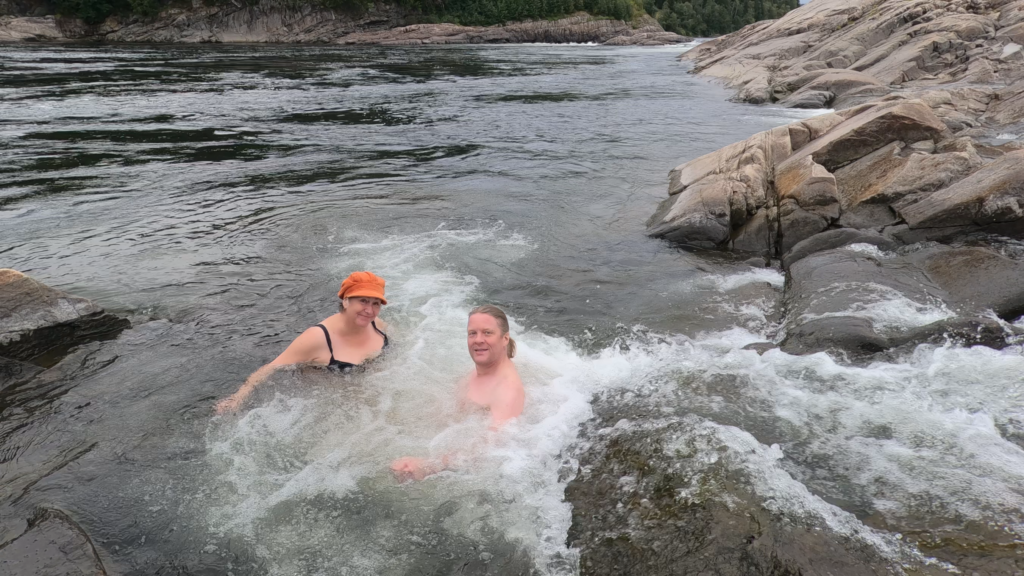
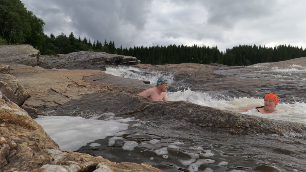
The pool below Tømmeråsfossen is fabulously large and beautiful, it is almost like an inland sea, and has a reputation for being one of Norway’s most exotic bathing spots. Badebadadede agrees. It’s just great to have a bath at Tømmeråsfossen!
Idun forgot to watch her feet on the way down the last rapid stream, and hit a rock. But fun anyway!
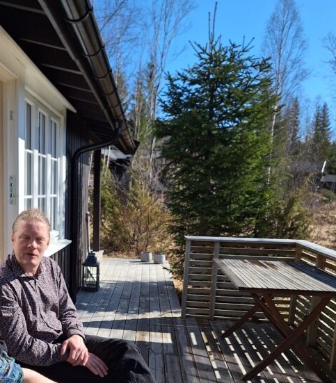
‘Why do you actually run this blog?‘, Trine asked. We were at a cabin in Fagerlia, Meråker, where we have been a lot. How to answer that? We did always had a bath here and there, didn’t we? But, of course. intensive bathing started with all the trips to Iceland during Corona pandemi. We had decided to have a bath every day, and since each trip started with a 5-day quarantine, there had to be cold outdoor baths every day the first week. ‘Bathing forces us out for new adventures! Through the bathing blog, we get many great experiences, and we visit places we would otherwise never get to see. It’s hard to believe, but there are still regions in Trøndelag none of us have ever visited. Not in 50 years!‘
Sunny morning in Meråker on a day with exceptionally changeable weather, even for Trøndelag. If you see the sun, you just have to run outside immediately! Brush your teeth first? No, then you must be prepared for rain before you reach the door.
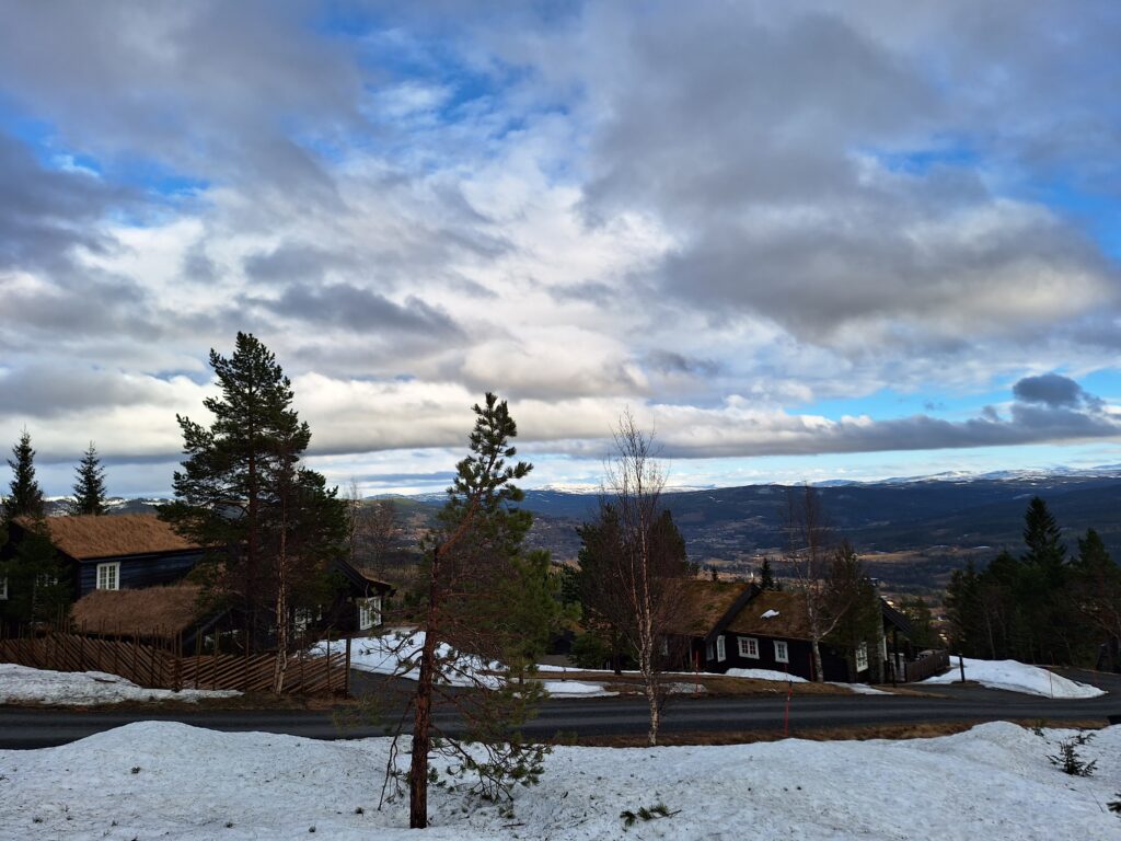
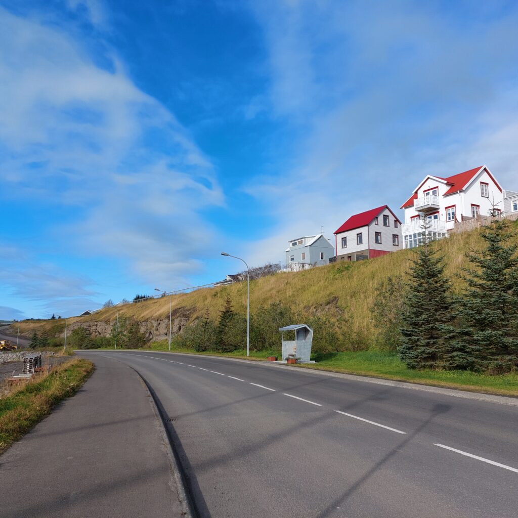
Meråker was separated from Øvre Stjørdal municipality in 1874 and consists of the upper Stjørdalen with surrounding forests and mountains. The name is a farm name, from ‘Merr’ = female horse and ‘åker’ = field. Meråker has only one village, Midtbygda, with a common primary school for the entire municipality. Here, however, the advantages of the area in terms of nature and climate have been taken into account, with the focus on sports subjects, especially skiing, at Meråker upper secondary school. In collaboration with NORD University, you can also take higher education in Meråker.
Fagerlia. View eastwards from Kjørkbyfjellet (The Church Village Mountain) with Sylan and Sweden far, far away.
There are many cabins in Meråker, the ratio between the number of inhabitants and the number of cottages is 2:1. For Trine and Knut, cottage life in Fagerlia has lasted for over 40 years. Idun, on the other hand, is in this context a pure novice, with only 32 years’ experience at the cabin (2024). In particular, the many years of the ‘Hut Years Eve‘ were legendary. The sledge competitions are high on the list of funny traditions, not to mention the clothes-changings. Funny, though, that it was always funniest for the boys.
A typical clothes changing situation at New Years Eve.
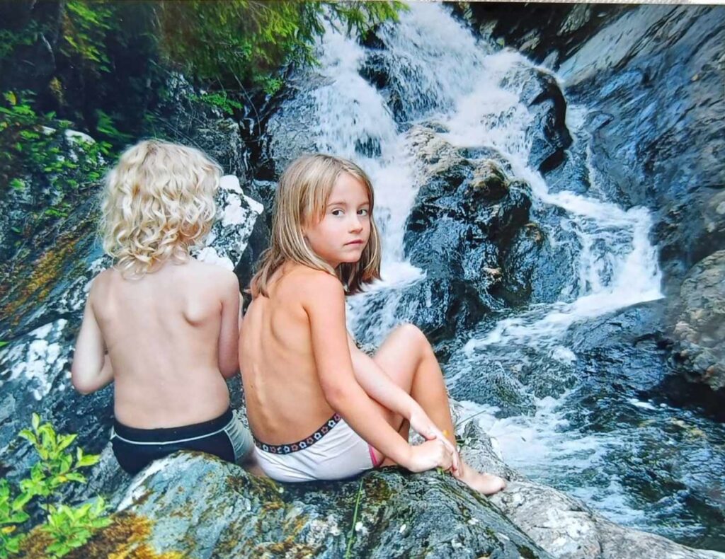
In summer, swimming was also sometimes out of the question, as the previously mentioned stable unstable weather in Trøndelag was not always in line with the practical challenges of getting the kids packed and ready for bathing on a nice sunny day – before the rain started. But sometimes things happened smoothly, and Trine has at least once managed to get four children into the river all by herself.
Benjamin and Ulvhild at Kråkstadåa around 2010. Photo: Trine Vollan
Bathing in Fagerlia had to take place by old paths by Kråkstadåa river. Old, you said? Neither Idun nor Knut can remember that we have ever visited Kråkstadåa. However, Trine is convinced that, ‘Yes, you must have been there before!‘. As said, so done, and this confirms the claim that we experience more blogging Tobatheornottobathe than we otherwise would. This morning bath would not have happened without the blog!
Children’s swimming paradise, you said? This looked really dangerous!
We are talking April 2024, full spring in addition to the already mentioned weather, alternating between sun and rain. Kråkstadåa in the spring is not at all a suitable place to throw the children into the water, and Idun was very skeptical about entering the river.
The consequences of letting the current take you…
After some debate, we were ready for bathing, and even though the current was strong, it wasn’t scary, since you could touch the bottom of the river all the time. Fun!
A spring bath in Krogstadåa was fun! But don’t throw the kids into the river! Photo: Trine Vollan
After a bath in the adult’s bath tub, time is just right to have both food and a quiz at Kirkebyfjellet pub, right next to the skiing tracks. ‘Fagerlia’s fagreste (beautiful)’ quiz team is not on the top 3 in this spring’s tournament, but despite the few members in the group (for now), we are not at all in a bad position either. Start the Quiz!
P.S.: Rumours in the Fagerlia area say that bathing in Kråkstadåa is not allowed, because it is drinking water for the cabins. We checked this and were told by someone at Meråker municipality that there are no such restrictions.
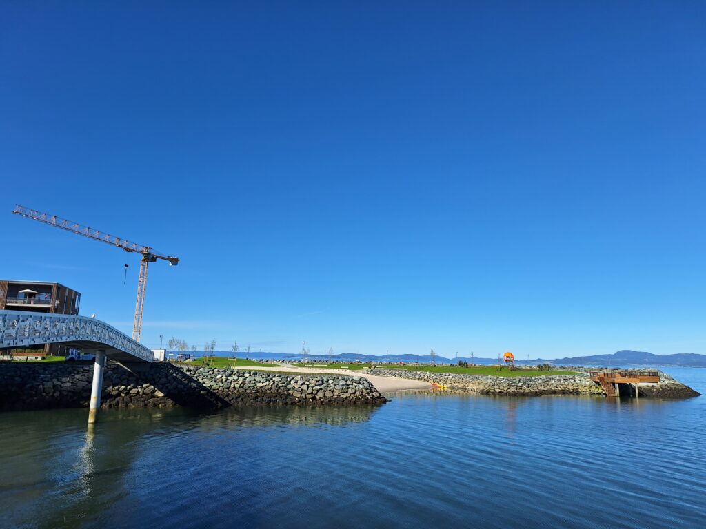
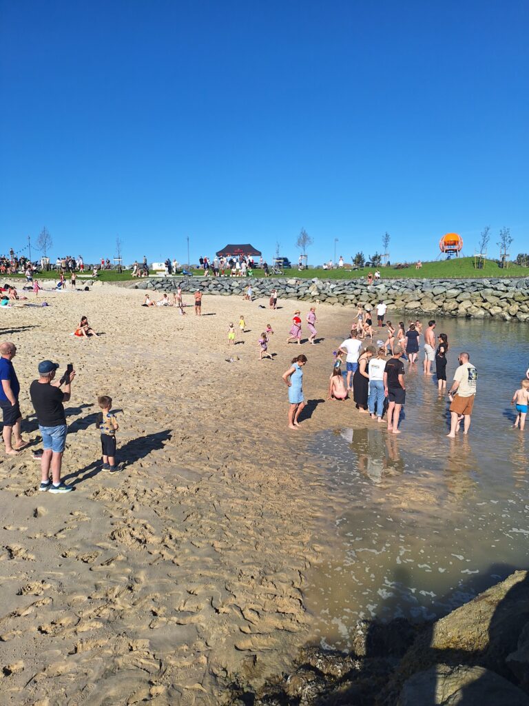
A brand new bathing beach in Trondheim, imagine that!
The new beach at Grilstad Marina is located on the east side of the artificial ‘Fullriggerøya‘ .
After 12 years of construction, Grilstad Marina is approaching completion (2024). The entire project consists of approximately 800 apartments, 110,000 m2 of commercial space, a marina and recreational areas, all made possible by the stone masses from the road tunnels between Stjørdal and Trondheim. There are swimming opportunities here! So much so, that the residents for a long time have complained about happy, load, youths jumping from piers and bridges, ref our bath ‘Grilstad Marina‘. But this time, the new Fullriggerøya (The Sailship’s Island) was to be visited.
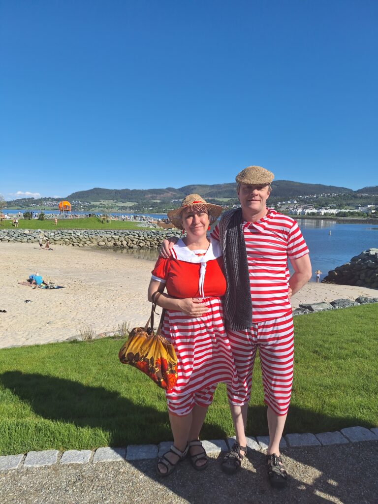
Tobatheornottobathe visited the Sailship’s Beach in new, (old) bathing inspired attire. Photo: Une Hunstad Løwø
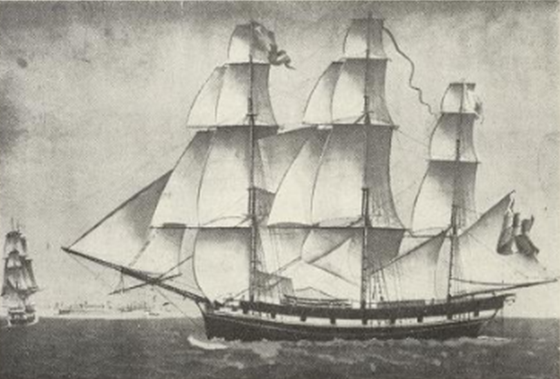
The cross-rigged sailing ships must be considered to be the summit of the sailing ship era. These were large, beautiful ships with square sails on all masts, which required a large crew. They did best on long-distance sailing, where speed was crucial, and in the navy. Competition in the merchant fleet was fierce, those who arrived first were paid better for the goods. Tobatheornottobathe has not found the name of any fully square rigged ships built in Trøndelag, but we would like to attach a drawing of one of H.J. Sommer’s beautiful ships, cleared from Trondhjem in 1915.
Mathilde Henriette, cross-rigged in 3 masts. Photo from ‘Norske Seilskuter‘, 6th volume, National Library of Norway.
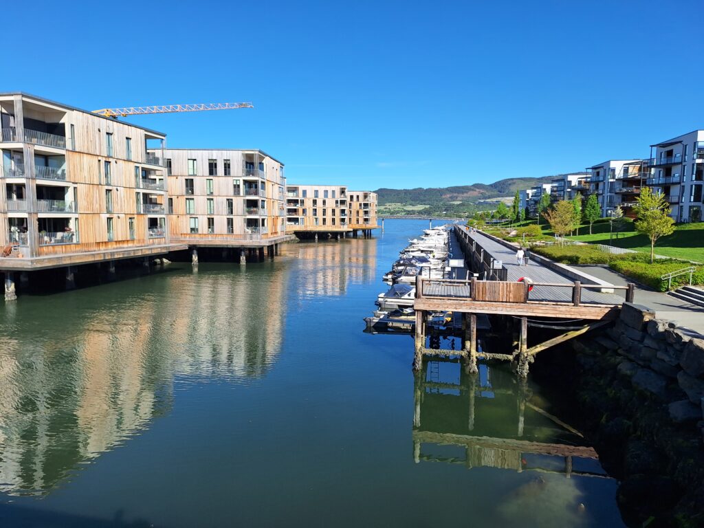
It is actually a good idea to call the new, artificial, island Fullriggerøya. Why not, when the whole project is built at sea? Apart from the canals, however, there is not much of a maritime feeling in the new buildings at Grilstad. These are apartment buildings, with sometimes large terraces, but they do not resemble piers. And the titles? Bryggetun, what is it? And pier villas? A villa is a house with a garden for one or a few families, inspired by the country estates that the Roman upper class built 2000 years ago, for example by Lake Albano (ref our bath ‘Lago di Albano‘). The villas at Grilstad do not have gardens, and there are 10-15 apartments in each apartment building. A completely wrong use of words! We understand that some estate agents want to ’embellish’ the concepts, but with the architects’ acceptance? We simply do not understand it.
The ‘pier villas’ on Fullriggerøya (left) look neither like piers nor villas.
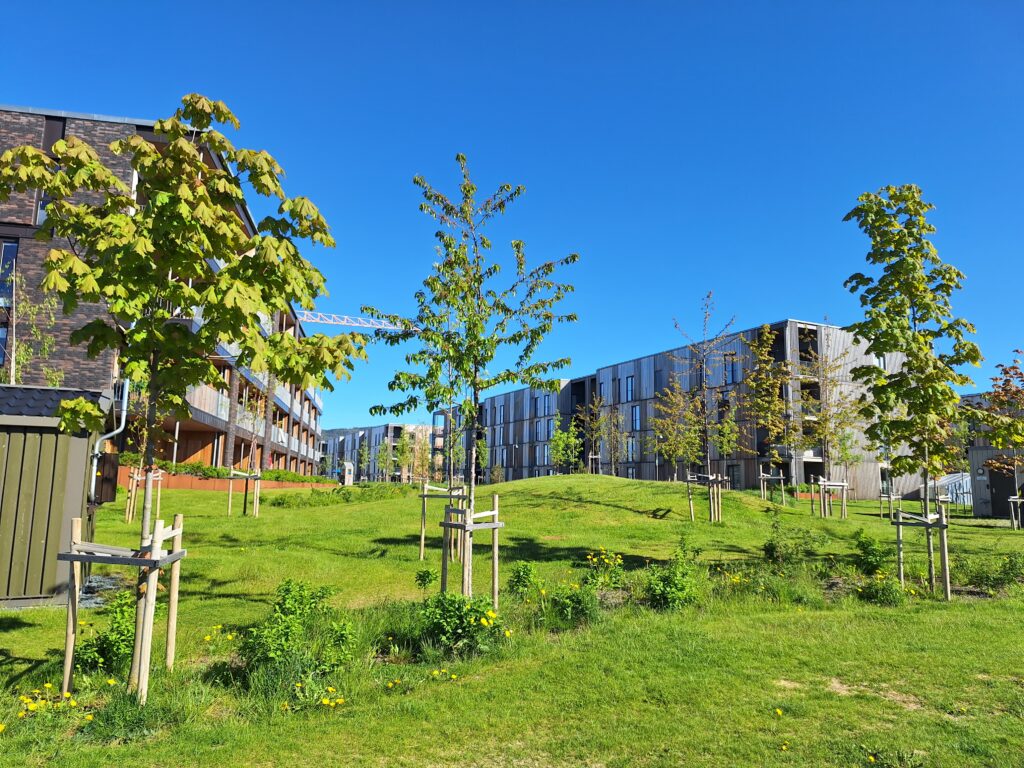
Interestingly enough, a forest has also been developed on the island, by the name Fullriggerskogen (forest). And yes, 20-30 trees have been planted between the houses, in between childrens playgrounds, paths and lawns. Why not call it all a park? Isn’t a parc good enough?
Very nice parc-to-be at Fullriggerøya. But it’s not a forest!
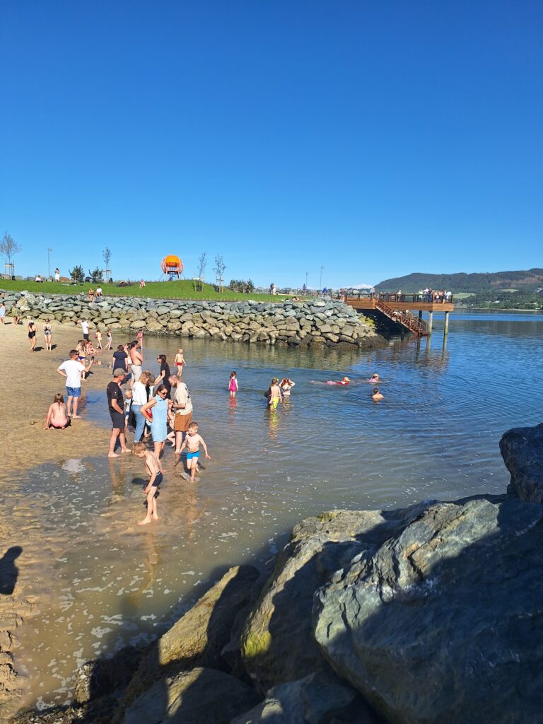
What we really like about this project is of course the swimming facilities! From the first floor you can throw yourself into the water, but there will be some climbing back up. For us, a dream scenario for retirement, apart from the fact that most of the apartments with direct bathing actually have no view of the fjord other than the canal. But the beach is nice!
Mayor Kent Ranum opened the beach – and Tobatheornottobathe opened the swimming. Photo from Grilstadmarina Instagram.
The Grilstad Beach is the first beach in Trondheim that faces south. Trondheim struggles with having its back facing the sun. 75 lorry loads of fine white sand have been brought here from Denmark, and the beach is relatively steep so that you don’t have to wade very long to swim. However, we were a little surprised by the stone embankment 10 meters from the water’s edge, where it was very shallow, before entering the fjord. We do assume that the stones are supposed to hold the sand in place, and that is fine, just a little surprising during this first bath.
Tobatheornottobathe rushing towards a new bath. Photo: Une Hunstad Løwø
The new beach gets top score from Tobatheornottobathe! A special plus for the sauna (we hope to visit it sometime), along with benches and children’s playground. So now we hope that the beach will reduce the jumping from the canal bridges, so that the poor, irritated residents can have peace on their terraces.
Thank you for the beach!
A new beach is hereby inaugurated. Photo: Une Hunstad Løwø
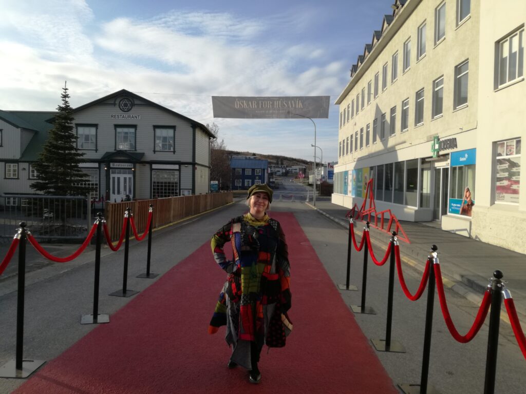
Húsavík is a community with both great patriotism and great optimism. After the city became known through the ESC film ‘The Story of Fire Saga‘, they have invested heavily in an ESC boom.
A fake bus stop was constructed for the Fire Saga movie, and was taken down afterwards. But now it is rebuilt as a sightseeing spot (the buses don’t pass here).
Now it is possible to book a ‘Fire Saga Guided Tour‘, a ‘Ja Ja Ding Dong Pub‘ has opened, and when the song ‘My Hometown‘ (Húsavík) was nominated for an Oscar as the best soundtrack in 2020, it really escalated. Several funny commercials with the theme ‘Oscar for Húsavík‘ were posted, and when the award evening approached, they even painted 50 meters of the main street red – to have the red carpet ready for Oscar.
Idun on the red carpet in Húsavík.
Icelandic TV followed up and filmed a version of the song at Húsavík harbour, with the church in the background. Girls from Húsavík school were backing vocals, each of them wearing a beautiful Icelandic ‘Peysa‘ (knitted sweater). The song was broadcasted again and again during the Oscar’s commercial breaks.
From the ESC exhibition in Húsavík Höfði Hótel.
There was no Oscar for Húsavík. But the Húsavík children were given a public holiday the next day – everyone knew that they would be awake on this dramatic night anyway.
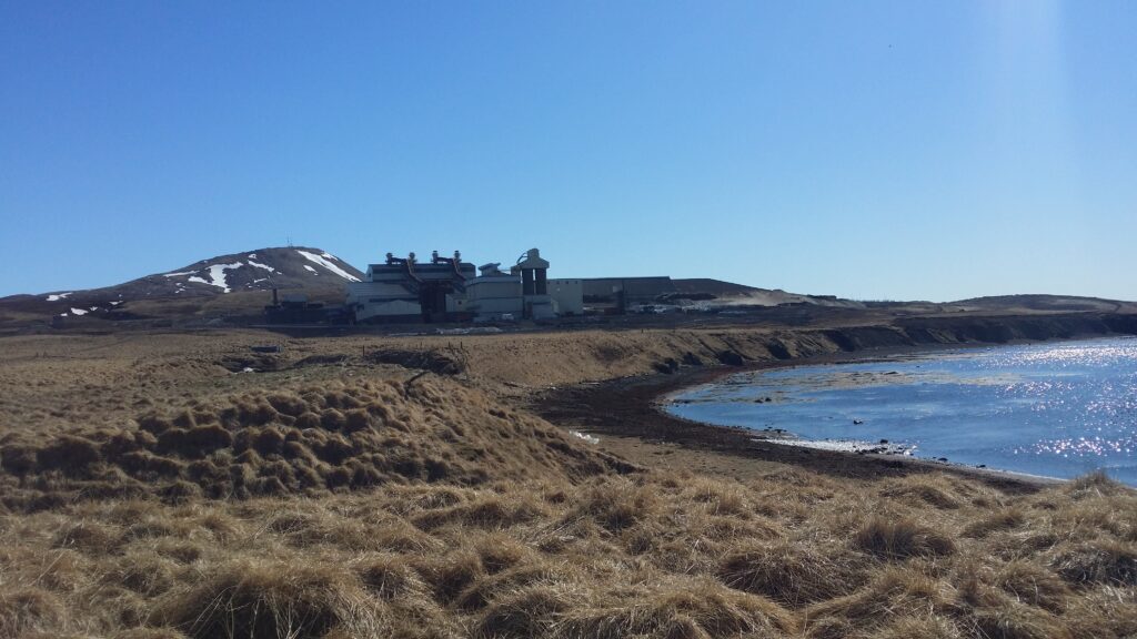
PCC BakkiSilicon.
After a Fire Saga Guided Tour, a refreshing bath is just right. Drive north to the PCC BakkiSilicon factory, then towards the shore and park below the site.
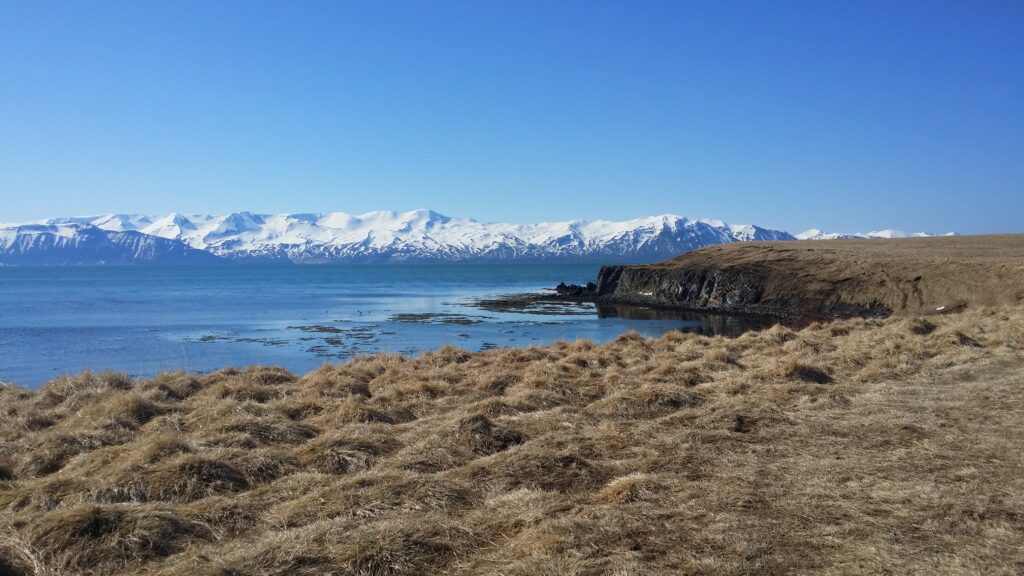
Skjálfandi Bay – incredibly beautiful.
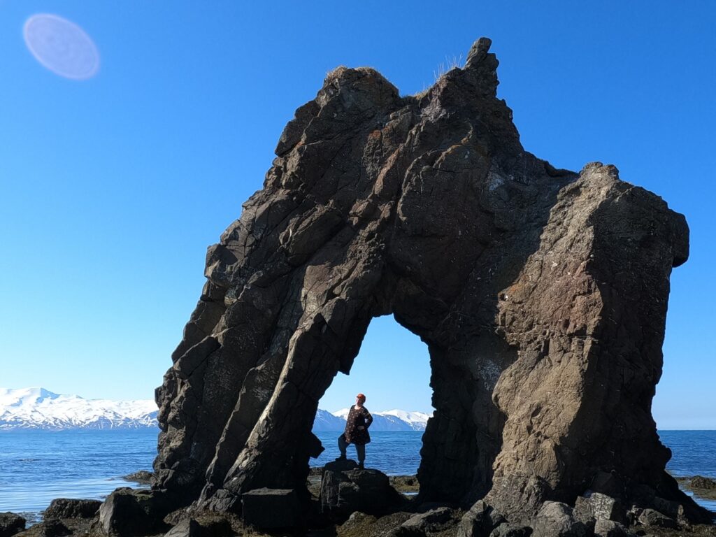
Walk towards the sea but not right down to the shore, stay on the grass. Follow the coast, and you will find an unknown gem at the very edge: The Húsavík’s mammoth!
Bakkastakkur/Gatanöf, Húsavík’s mammoth.
If you want to stand under the mammoth’s belly – choose low tide. If you want to swim between its legs – choose high tide. The mammoth is just as beautiful as Hvítserkur – and almost completely unknown. If low tide (as at both our visits), there will be no swimming under the mammoth. A good alternative would then be Sundlaugin á Húsavík. An unpretentious, classic public Icelandic bathing facility with a couple of hot tubs and everything you possibly need. One of us went there while the other stayed at home with a cold. But we don’t have pictures, grown up single men with cameras at a pool aren’t always very popular, so the camera also stayed home.
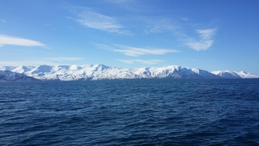
Húsavík is a beautiful place! A rounded mountain behind the town (Húsavíkurfjall) is not so exciting, you might think, but on the other side of the bay of Skjálfandi you can enjoy a spectacular row of mountains starting with Kinnarfjöll, which likes to express itself in winter clothing, all year round. Skjálfandi means trembling and comes from the many earthquakes in the area.
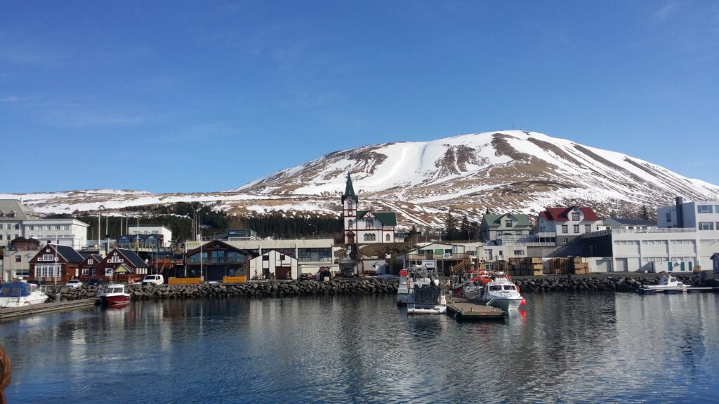
Húsavík harbour, with the characteristic church and the mountain in the background.
The conquest period in Iceland started with a Swede – Garðar Svavarsson, who built a farm in Húsavík. He had heard about the land in the west from the Norwegian Naddoð, who had found it but not wintered there. Garðar left Iceland after only one winter, after having completed an entire round trip and thus being able to establish that Iceland is an island. To honor himself, he named it Garðarshólmur. When Garðar left, one of his men, Náttfari, stayed behind with a slave and a maid. They moved to Reykjadal, where they took up land and lived for many years. Later, a man called Eyvindr appeared in Reykjadal, and gave Náttfari the annoying choice: That he should have Náttfaravík, or no land at all. Náttfari saw no other option, and moved from Reykjadalur. Náttfaravík lies vis a vis Húsavík, in a very hostile environment.
The west side of Skjálfandi is not a warm and friendly place to live.
Finally, in the summer of 1970, Náttfari got his restoration, when they celebrated his conquest 1100 years earlier. This event happend in Húsavík, 4 years before the rest of Iceland honored Ingólfur Arnarson’s conquest.
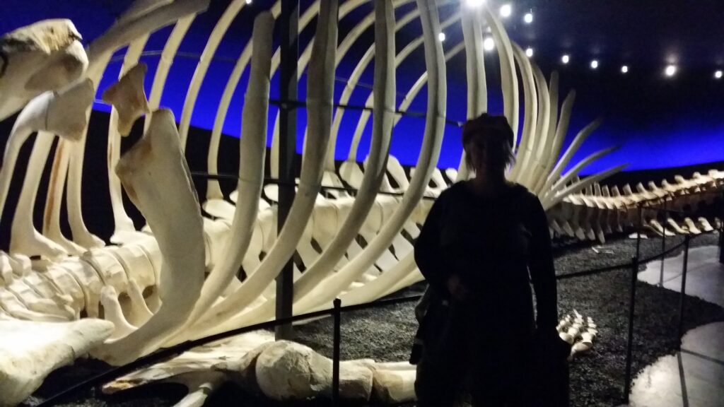
Check out the blue whale sceleton in the Húsavík whale museum!
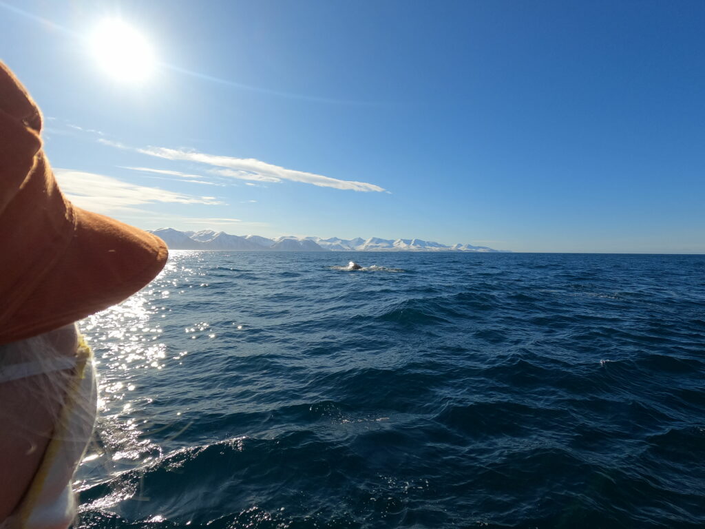
Husavik got it’s income from trade, fishing and whaling for many years. Today (2021), Húsavík has switched from whaling to whale watching, and it works very well! There are different whale watching concepts, including by sailboat, where the focus is silence. Before the cruise: Take a trip to the whale museum, where you will find, among other things, an entire skeleton of a blue whale. Yes! That’s impressive stuff! We did a standard whale watching tour, during winter time, although that is not the best time to see whales. The name of the boat? ‘Náttfari‘, of course. Skjálfandi is a large bay, more like a fjord, and we cruised around for over an hour before we saw anything. But finally, a sperm whale (physeter) did appear – to the guide’s great surprise. You don’t come across sperm whales very often, because their dives are deep and long lasting. Our boat crossed behind and to the side of the whale, and we saw it breathe quite closely a few times before it disappeared into the deep. Then we stopped for a while, hoping to see the whale again. And indeed, it did reappear. A great experience!
Sun, mountains and whales – a splendid day!
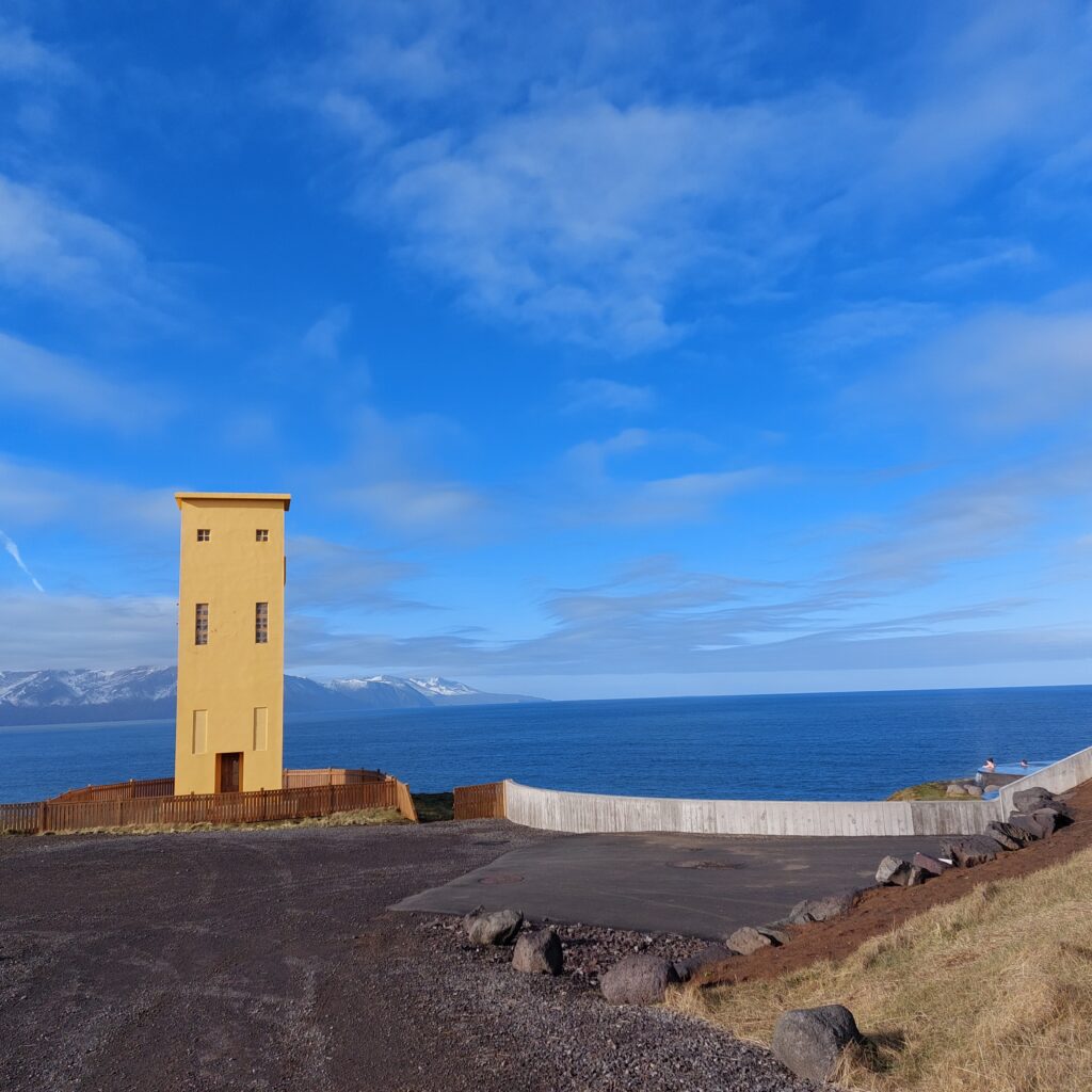
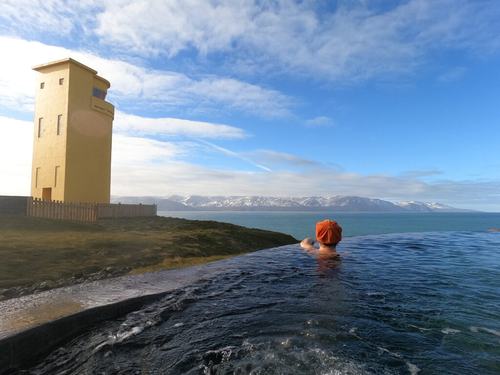
After an ice cold whale watching trip, a warm bath is the perfect thing to do. In Húsavík there is a wonderful spa, GeoSea, located on the cliffs just north of the town.
Close neighbours: Húsavík lighthouse and GeoSea spa.
Here you will find beautiful design both outside and inside. The site is partially submerged in the terrain. When you arrive, you can see straight through the building and out to the sea. An absolutely fantastic view from the spa (when there is no fog). Lovely!