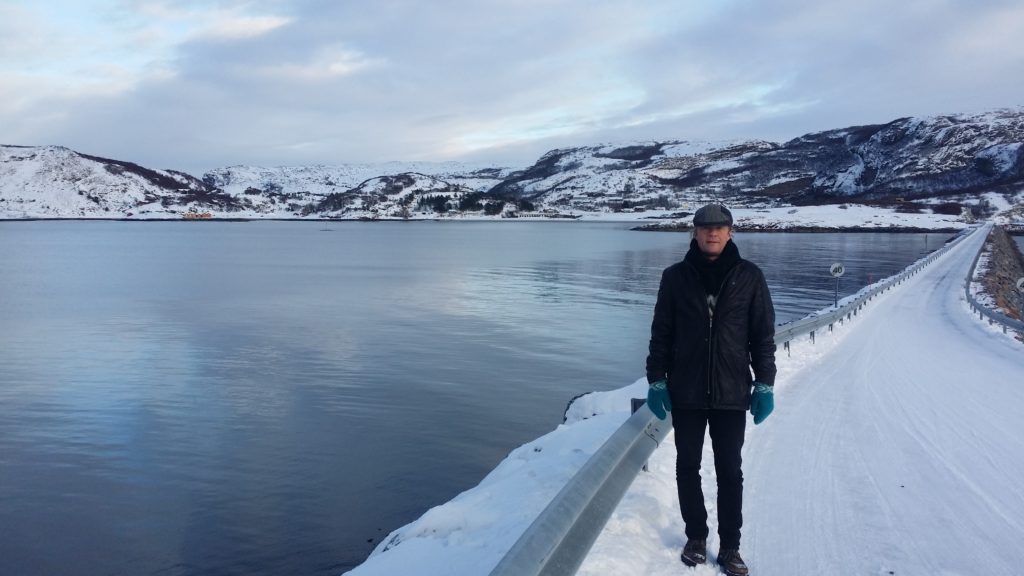
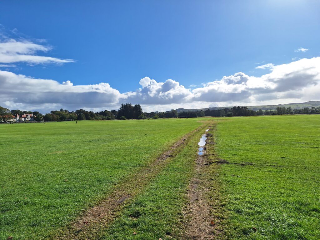
Stokkøya is a 17 km2 island in Åfjord municipality in Trøndelag, with 300 inspired inhabitants. The island was connected to land in the year 2000 via the 525 m long Stokksund bridge over the log-straight Stokksundet (stokk means log). At Stokkøya, facing west, lies the magnificent, 400 m long beach Hosnasand.
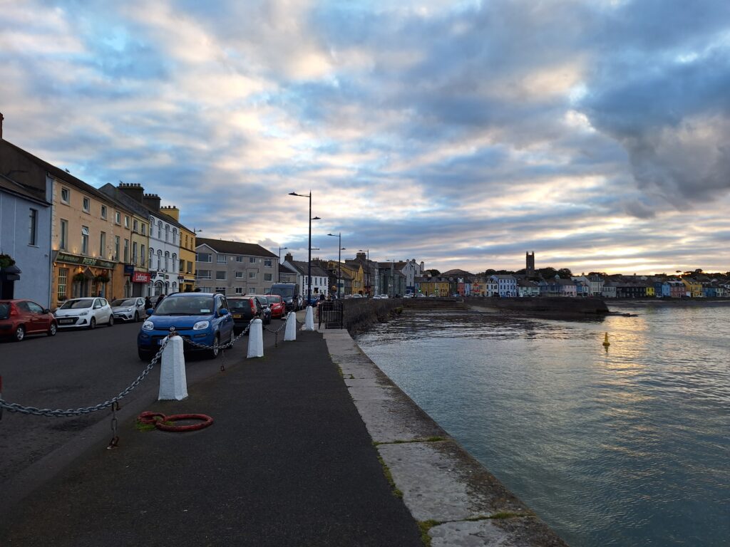
The pier goes west to Linesøya. In the background Hosnavika and Hosnasand beach.
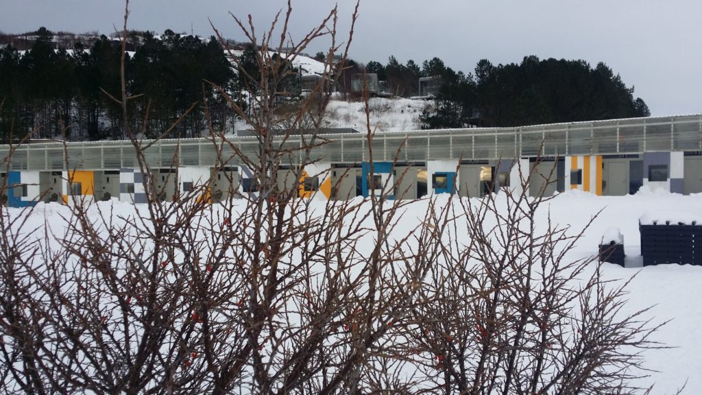
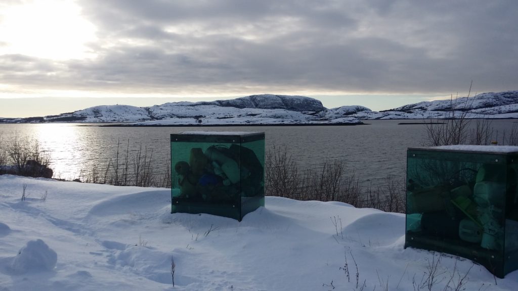
At Hosnasand you will find Stokkøya Sjøsenter with its very special SUB architecture. Partially buried in the sand, with a dedicated use of color. Constructed by so much concrete it might have felt cold and unappealing, but it was surprisingly cozy. Well worth a visit!
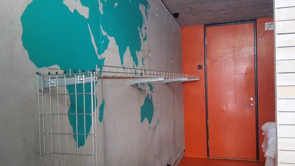
Sea buckthorn (Hippophae) and SUB.
There were also vibrant colors indoors. Orange from hippophae and turquoise color from the sea?
SUB cabin (Sleep-Under-the-Ground) in vibrant colors.
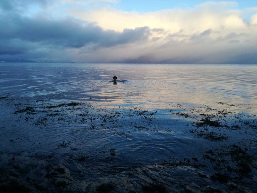
As expected, we went to sea the same evening we arrived. A faboulous bath! The sky was wide, dark and infinitely more stars than we can see in Trondheim. The beach is both long and shallow, so we recommend wet socks to avoid freezing toes.
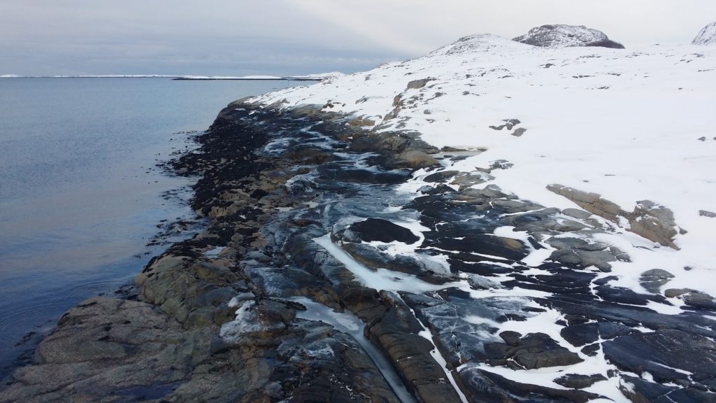
The next day we went out towards the Linesøy pier to find more suitable water depth. However, the coastline had no easy access this winter day.
Not easy to take a bath from here, obviously.
…but finally we found water.
Plenty of sky and sea on Stokkøya.
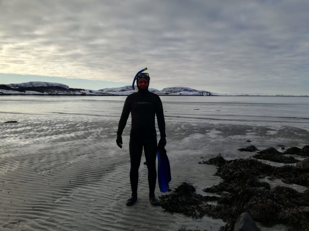
Sunday was snorkeling day.
Idun ready for snorkeling.Knut ready for snorkeling.
It took a while to pass the beach, but the water was fantastic; clear and beautiful.
For lunch it was time for a barbecue (the food at Strandbaren is really good). As you can see, we’re not the only ones who take ease on both barbecue and swimming seasons! We think both are equally naturally all year round.
Classic barbecue season at Stokkøya Strandbar.
The “aliens” in the water are just reflections from the window. The lazy photographer stood inside and took a picture of the other photographer…
Before returning home on sunday we took the obligatory little walk via Hosnastrand to Stokkøya Bakeri. On the way we found this special art, sadly enough made by trash from the sea:
Trash art.
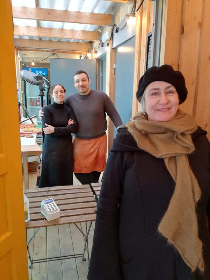
And Stokkøya Bakeri? It’s run by a couple of very nice Italians!
Gli italiani si trovano a Stokkøya Bakeri.
At Stokkøya time is always right for cookies and wheat buns! And a bath…
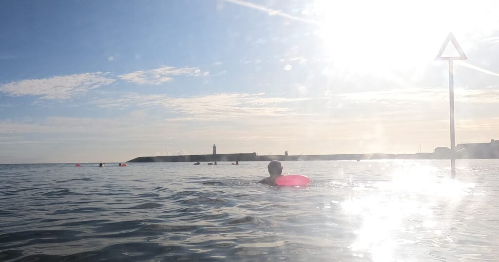
… is a group that swims in Donaghadee Harbour on the east coast of Northern Ireland every day of the year, no matter how cold it is.
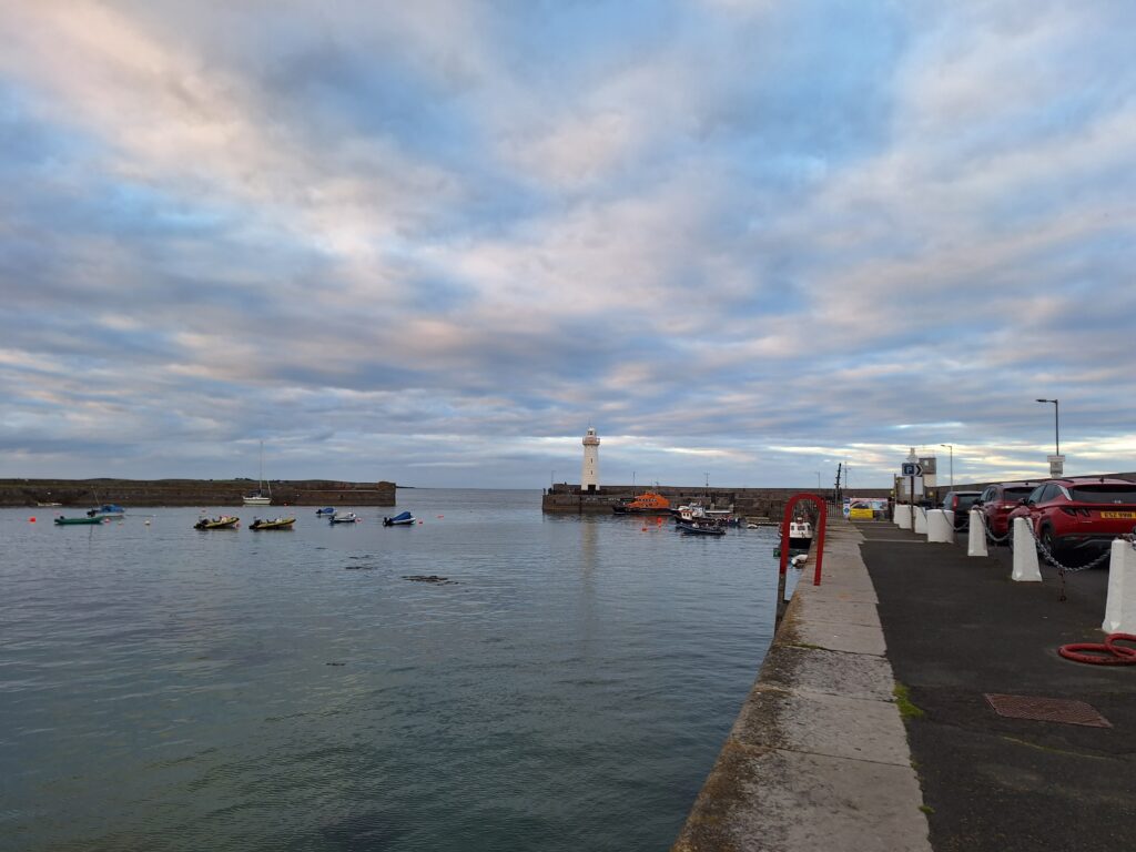
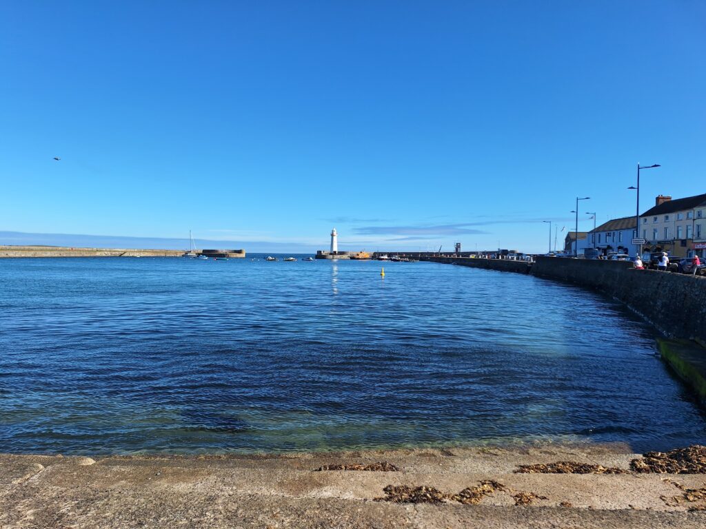
The harbour of Donaghadee with the characteristic lighthouse.
It all started with a family that swam daily from 2012, but dozens have since joined in. For the daily swims, 20-30 people can show up, with very different ambitions and – according to their own statement – ‘all possible sizes and shapes‘. As in most cold water societies we know of, women 50+ are the majority. Some take a fairly short dip, others swim calmly breaststroke for 5-15 minutes, while some crawl away over longer distances. But good temper – they all have that! Cold water swimming is said to alleviate depression, and most people are in a very good mood afterwards, you get a hormone and energy boost from it.
Chunky Dunkers has no changing rooms, the boat slip has to do.
‘We wish we had that!’, they said, when we tould them about ‘Sjøbadet‘ in Trondheim and the (cold but good) changing rooms we have there.
There is a big difference between the tides in the Irish Sea, and the swimming times (full tide) are published on Facebook a couple of times a week. After swimming, some ‘Dunkers‘ meet at a café, and the group has become a social meeting place with various parties and gatherings in addition to swimming – and not least a large social commitment in the form of charity. Various challenges and events are constantly being arranged, often with an element of fundraising.
Idun is swimming off at the ‘1K Summer Challenge 2024‘.
When Tobatheornottobathe visited Northern Ireland in 2024, we had the opportunity to join the ‘1K Summer Challenge’. In short, the challenge consisted of swimming 1000 meters continuously in Donaghadee harbour. So simple, so easy. However, Knut was worried that Idun would swim too slowly, so Idun started 10 minutes earlier. With the result that she finished long before him, and no one swam together. The prize for this great achievement was being allowed to buy an overpriced T-shirt with the first names of everyone who had participated during the summer. The money? – for charity, of course.
Over the years, Donaghadee Chunky Dunkers (DCD) has raised several tens of thousands of pounds. The triangle represents a stick where the Dunkers start their swim, seen in the previous picture.
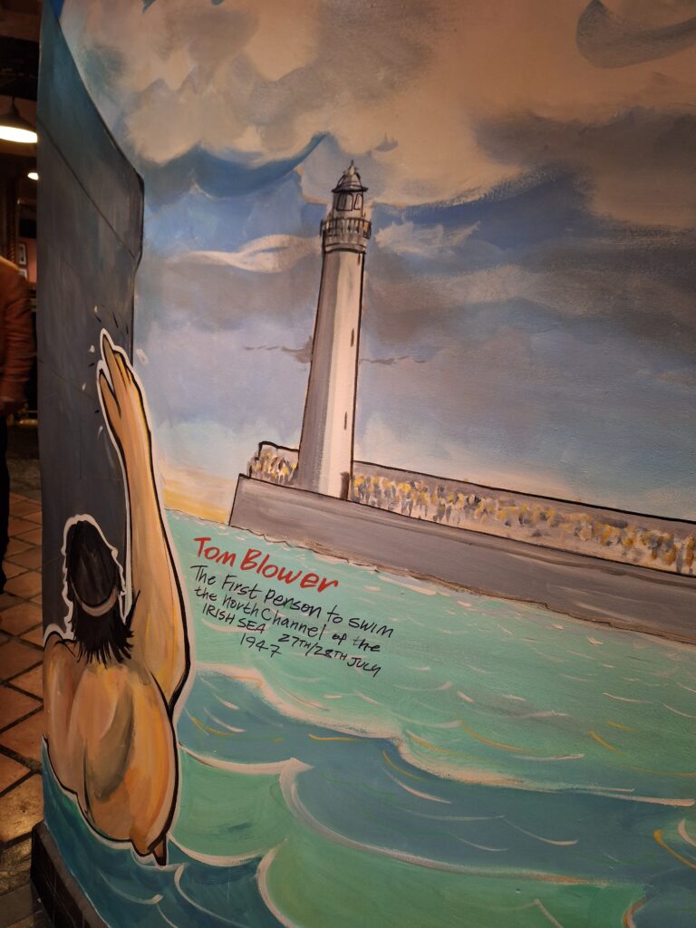
The Donaghadee Chunky Dunkers Facebook group has over 2,600 members, far more than the daily swim group would normally be able to recruit. Why? Britain has a long tradition of channel swimming, with the Dover-Calais crossing being the most famous. However, in 1947, Tom Blower became the first person ever to swim across ‘The North Channel’, i.e. between Ireland and Scotland, a distance of 35 km.
Tom Blower spent 15 hours and 26 minutes to cross ‘The North Channel’ between Ireland and Scotland, a record that stood for 23 years. Mural from the ‘Pier 36’ pub in Donaghadee.
Tom Blower was a decorated hero of World War II, and crossed the English Channel several times, with a personal best of 13 hours and 29 minutes (in 1937). When crossing the Channel, strict rules apply: It is not allowed to touch the escort boat or personnel. The swimmer should not wear a wetsuit, gloves or socks, only a swimming cap and swimsuit/pants. The cold is an important factor, and even more so when it comes to crossing the North Channel. And when crossing the Irish Sea, the Donaghadee-Portpatrick route applies. The incredible number of followers on FB can be attributed to Donaghadee as the starting point, and those who attempt it are expected to sign the Northern Ireland flag before setting off. Tobatheornottobathe were not fit to try channel swimming in 2024!
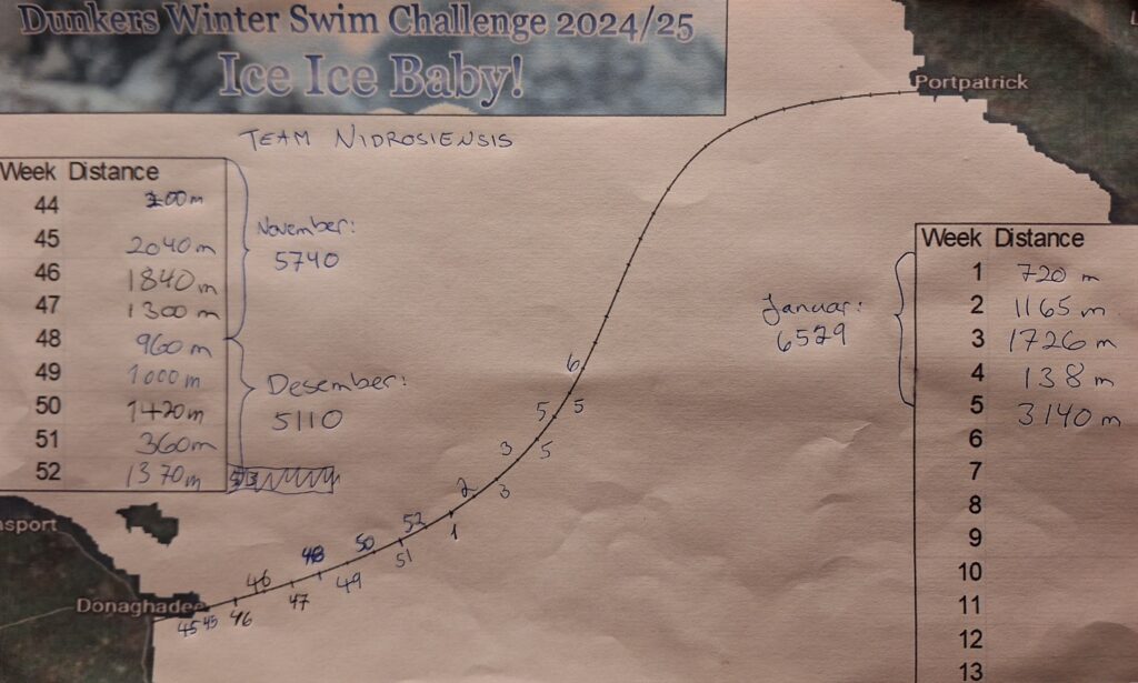
DCD has launched a new challenge: ‘Dunkers Winter Swim Challenge 2024/25. Ice Ice Baby!‘, …and Tobatheornottobathe is participating as ‘Team Nidrosiensis‘.
The challenge this time is: Alone or as a team, to swim a total of 35 km (from Donaghadee to Portpatrick) during the winter, for the simple sum of £10 per person (the money goes to, well you know…). It may sound easy, but when the water temperature is consistently between 0 and 2 degrees, each swim is not many hundreds of meters, even when you add up for two people. After 14 weeks (out of a possible 22), we have just passed 18 km. Halfway there!
And the price? Well, there have some rumours a hand sewn badge. Still, around 140 persons have paid to participate in this!
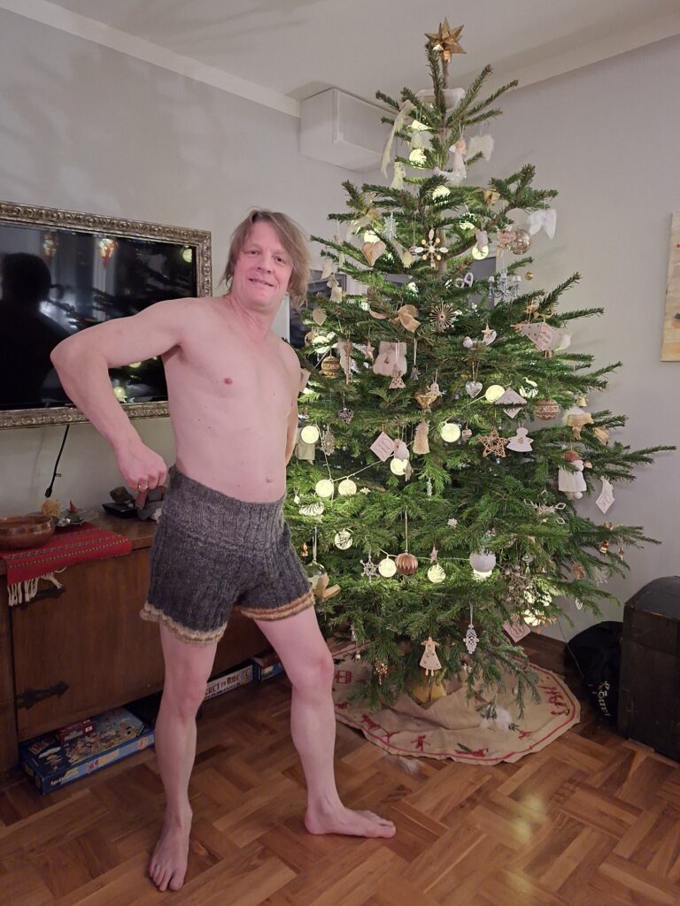
With so much cold-water swimming in sight, Knut got exactly what he wanted for Christmas: A pair of home-knitted woolen panties! Nice?
So, that’s how our days are passing by this winter, with 2-4 swims per week. It’s really easy to find reasons not to swim in 0 degree Celsius water! But on the other hand, every swim is a nature experience, you feel happy and refreshed afterwards, and it’s motivating to see that you’re making progress, even if it’s slow.
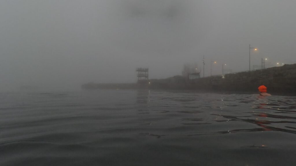
Without DCD’s ‘Winter Challenge‘, we most likely would not have experienced this beautiful foggy atmosphere at Sjøbadet in Trondheim.
NB! When swimming in cold water, you should NOT warm up again in a sauna or a hot bath tub. Rapid, external heating causes the blood vessels in the skin to open, blood from the core of the body will flow there, to be cooled down and later hit the heart, which can lead to cardiac arrest. This was called ‘The second death’ during World War II, when it was discovered by horror that torpedoed sailors who had been picked up from the sea died during warming up. Hot drinks and activities that cause the muscles to produce heat are best, as they raise the temperature from within.
This problem is not valid for short dunks in the water. We still enjoy taking sauna with a short dunk or two in the cold water.
If you drive 30 km eastwards from Belfast, you will come to the peninsula ‘The Ards‘ and a small town with 7000 inhabitants called Donaghadee. That was a strange name you might think, but special names flourish in the region of County Down, since many of them come from Gaelic language. ‘Domhnach Daoi‘ has two possible meanings, either ‘Daoi’s church‘ after a now unknown saint, or ‘The church on the hill‘. The reason for placing a town here is the good harbour.
The long beach of Donaghadee has been a safe landing place for thousands of years.
The distance to Scotland is 35 km from Donaghadee, and the town has been a transit port for Great Britain and Scotland for centuries. In 1606, Hugh Montgomery settled Scottish Protestants here, which was the start of ‘The Plantation of Ulster’, where the plan was to populate Northern Ireland with Lutheran, royalist, English-speaking inhabitants. Montgomery also developed the port and set up a trade route between Donaghadee and Scotland. Donaghadee was Northern Ireland’s most important port until 1850, more important than Belfast.
The Donaghadee lighthouse was completed in the late 1830s.
The inner part of the Donaghadee harbour is completely dry at low tide, so if you are going to swim there, you must follow the tide tables. Here, in the northern part of the Irish Sea, there is fresh and nice Atlantic water, and a swim is highly recommended. However, you should be a little careful with the tidal currents, at least outside the harbour. There is easy access to the sea, with steps down (many people walk on the beach here at low tide, with or without dogs), or you can use the boat ramp a little further north of the pier.
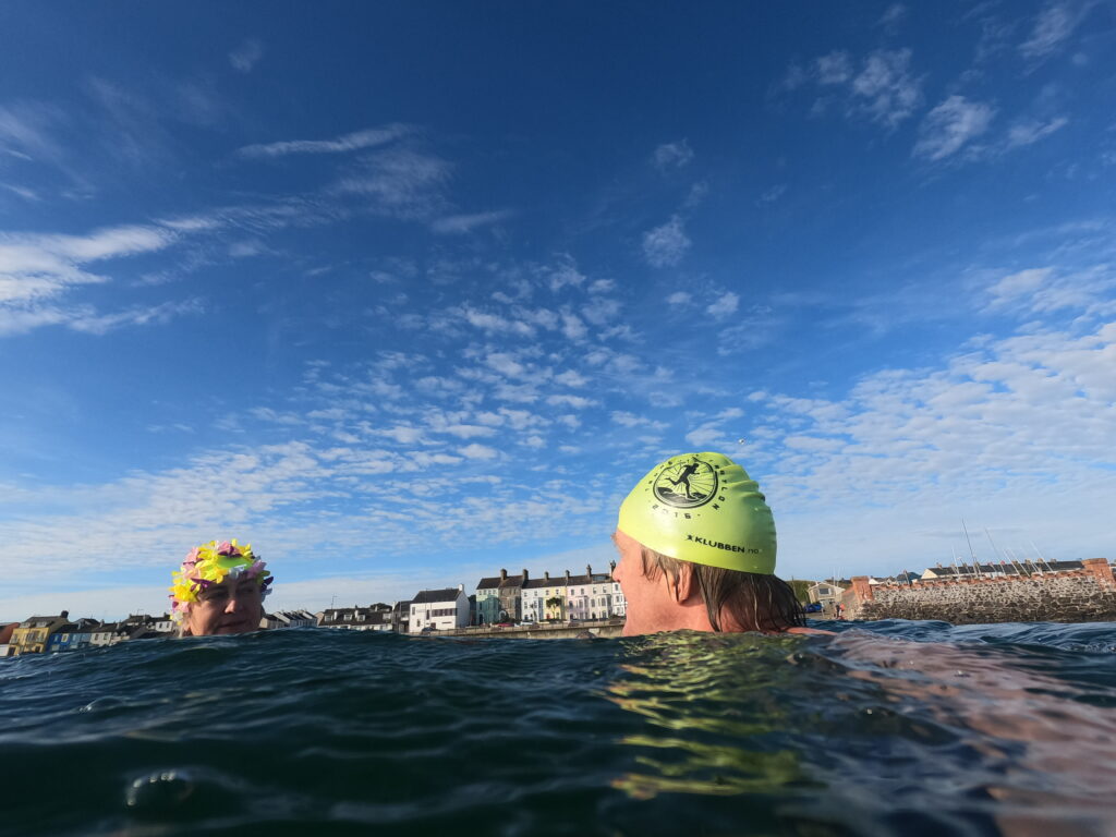
A splendid swim in Donaghadee harbour.
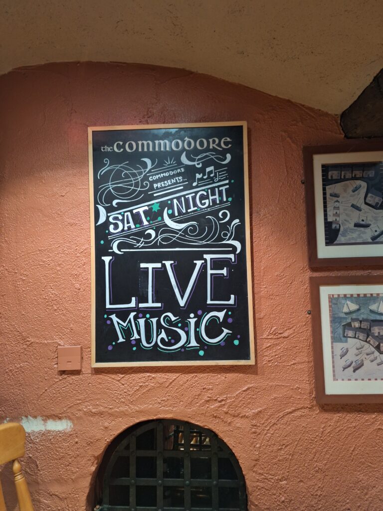
After a swim in Donaghadee Harbour, food and drinks might be a good idea, and we will recomend ‘Pier 36‘ pub, the setting for ‘The Commodore’ pub in the TV series Hope Street. Why did we get fascinated by this TV series? Firstly, we had already booked a Home Exchange there, before we heard about the TV series. And also, the very first episode starts with a swim race in the harbour, with the chief of police taking part in it. Of course we had to see more!
The Donaghadee pier. ‘Pier 36‘ to the left in the picture.
At Pier 36 there is good food and nice people, although a little less drama behind the counter when we were there than in the series. A new season has been shot and will be released in April 2025. We are looking forward to that!
Pier 36 makes no secret of the fact that they are The Commodore.
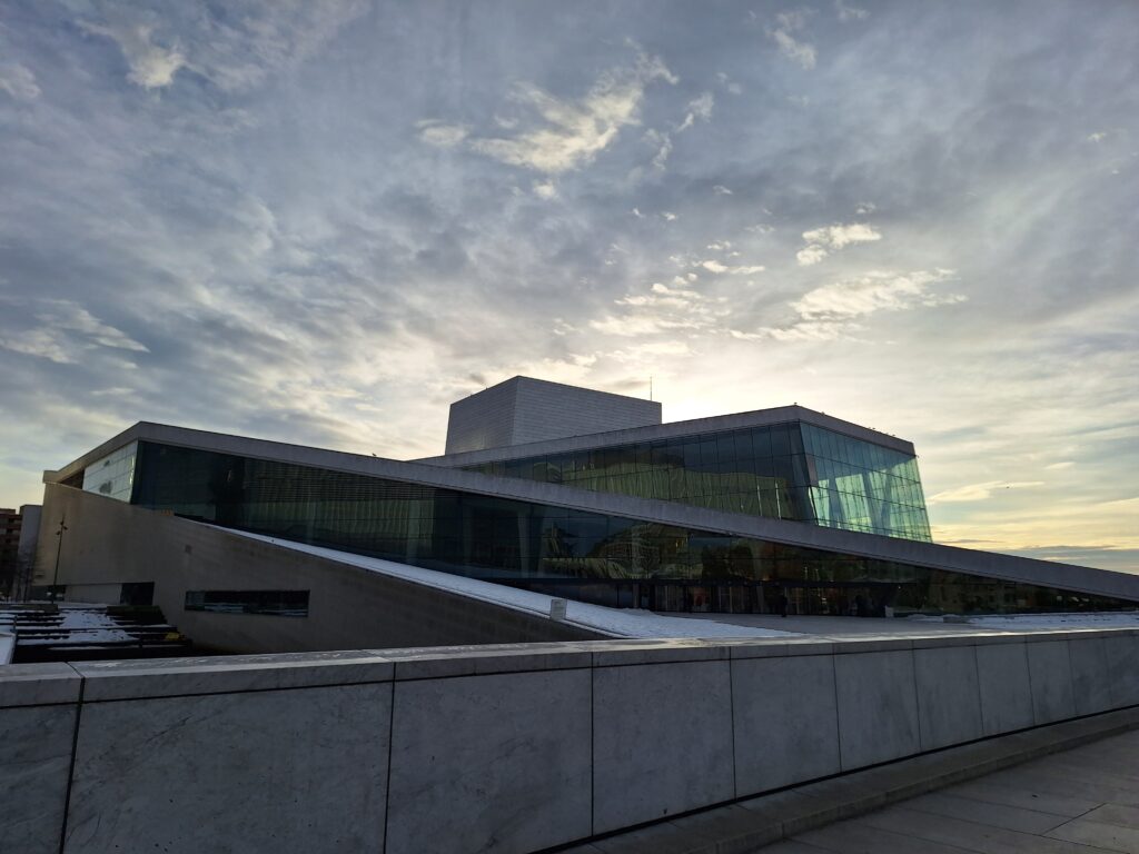
A stone’s throw from Oslo Central Station you’ll find the Norwegian Opera and Ballet. Designed by ‘Snøhetta‘ architects, it has become a landmark and place of pilgrimage for all who visit Oslo.
It was not too popular that Carrera marble was chosen for the facade of the Norwegian Opera House, instead of domestic stone. But it is understandable that pink Fauske marble would not have given the same references to the Arctic Ocean or icebergs.
The decision to build a completely new opera house started a long lasting debate at the time, not least the price tag of over 4 billion NOK. As expected, attendance at the opera has increased significantly since the new building opened in 2008, and all shows are normally sold out before the season starts. When you also consider that the ingenious design, including public access on the roof, makes it accessible to everyone regardless of musical preferences, this project can only be labeled a great success.
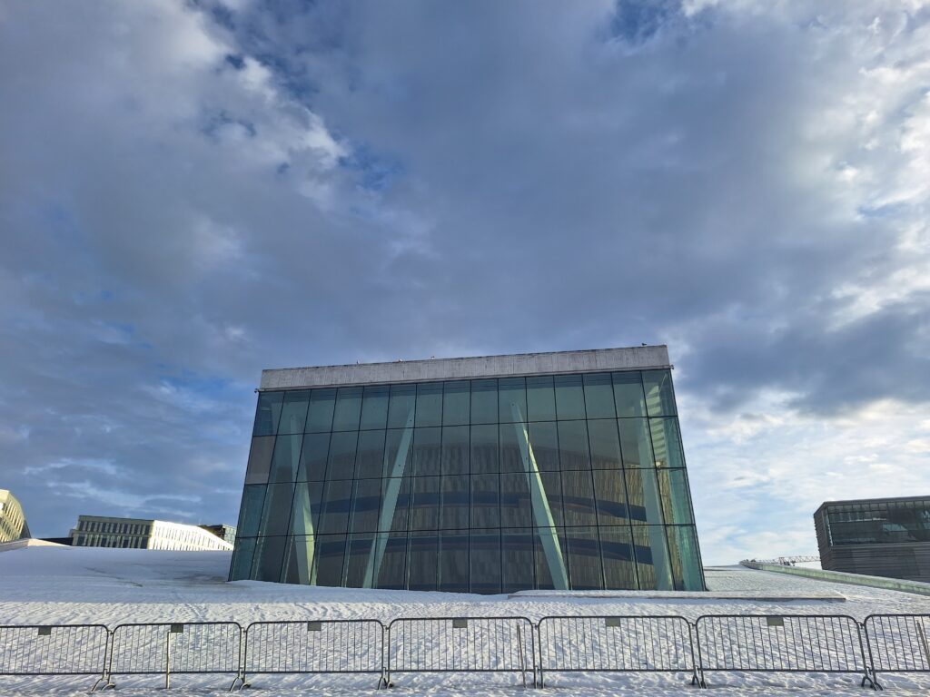
The opera roof is unattainable in winter conditions. The non-integrated fencing solution is not very stylish, though.
For Tobatheornottobathe, the lack of roof summit climbing was not a big disappointment, as we are always on a bathing tour as well. Just outside the Opera House, you can admire the floating sculpture ‘She Lies’. Her design interacts neatly with the Opera House, constantly turning and moving with the current and wind. Awesome! We wanted to swim there!
It’s been called trash, but Tobatheornottobathe thinks Monica Bonvicini’s ‘She Lies’ is just beautiful. And a great goal to swim to.
‘She Lies‘ is a three-dimensional interpretation in steel and glass of Caspar David Friedrich’s painting ‘Das Eismeer‘ (The Ice Sea) from 1823.
Friedrich didn’t visit the Arctic Ocean himself, but the Arctic was getting popular like never before in the 1820’s. Humanity (the wreck) looses aganst nature (God).
Caspar David Friedrich was born German in Greifswald (Swedish Pomerania) in 1774. He is considered one of the most important painters of the Romantic period. Why did he paint the Arctic Ocean? Art patron Johann Gottlob von Quandt wanted polar images in his private collection as a counterpart to motifs from the lush south, so in this sense it may have been a commissioned work. But it has also been interpreted as an elaboration of a childhood trauma from the age of 12, when he and his brother Christoffer went skating and Friedrich fell through the ice into water. The brother, one year younger, managed to save Friedrich, but drowned himself. The brownish color of the ice might come from domestic rather than arctic ice. Friedrich made many sketches while living in Dresden during the winter 1821, when the river Elbe was completely covered in ice.
‘Eisfie‘. For sure, she’s lying in the water crust. But is she lying too?
As a picture of the feeling when you throw yourself into water below 4 degrees Celsius, ‘She Lies’ is an excellent illustration. Tobatheornottobathe do not combine sauna with ice bathing at the moment, so every bath is cold-cold-cold and not warm-cold-warm (the motive is to become even better accustomed to cold water). She Lies’ location might be a lie, since icebergs do not usually drift into the Oslo fjord. But ice on the fjord is not at all unusual, as the day we enjoyed our swim. Bonvicini is an Italian artist based in Berlin, who likes to use humor in her works. Here, the most striking issue is the tension between the romantic style of Das Eismeer and the pointed, modern style of She Lies, which could perhaps be seen as a kind of lie? However, there are other, more extreme variations on Das Eismeer, the scenography at Theater Basel being the most special? The opera ‘Aus Deutchland‘ was performed in and on real pianos stacked like the ice in the painting.
‘Das Pianomeer‘, Basel 1997.
Our swimming was definitely neither lying down nor lying, in winter it’s all about efficiency! It was a rift in the ice from Operastranda (the Opera Beach) to our destination. Luckily! It would have been too much fuzz if we actually did change clothes and jumped into the water directly from the Opera roof. The Opera Beach is constructed by the use of local stone and sand from the Drammen fjord. It’s lovely! While we changed, a couple of Italians were standing just by, talking loudly on their mobile phones. ‘This is Oslo, we can see the Opera, we can see the Munch Museum, etc.‘. ‘Wow! This will turn out loud when we start swimming!‘, we thought. But the narrator continued in exactly the same voice… There’s clearly nothing special about swimming in the innermost part of the Oslofjord in winter, even not for italians.
A sunny swim in front of the Opera House in January is just right. ‘Havnelageret’ (the port storage) in the background. Tobatheornottobathe in place right in front of She Lies.
After an opera bath, what should we do – except visiting the Opera? If all the performances actually are sold out, mulled wine (gløgg), or ‘vin brûlé‘ as they might call it further south, could be an option. To our disappointment, we had to realize that pub owners in The Tiger City make gløgg only in December, and that is very hard to understand. As we see it, gløgg is a part of winter – and winter just doesn’t end in December!
Drunk riding is much more acceptable than drunk driving!
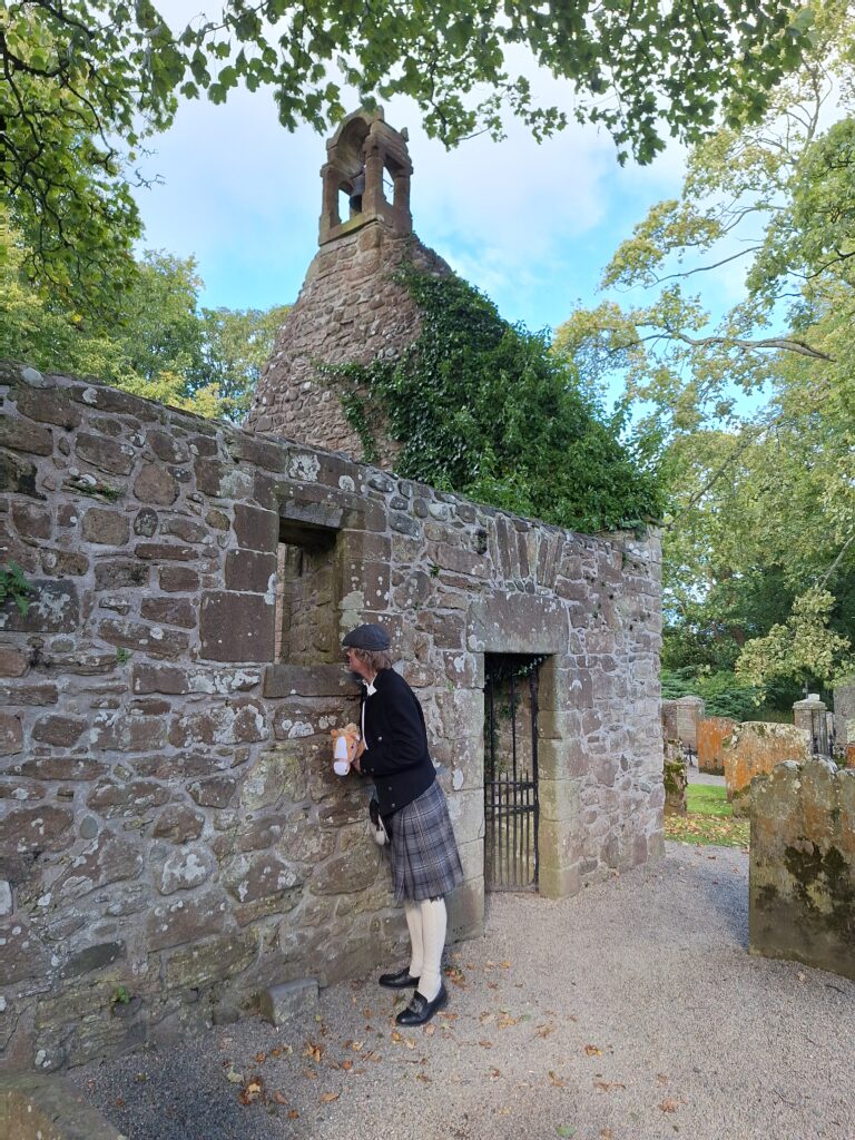
Tobatheornottobathe visited Scotland in 2024, much out of a desire to follow in Burns’ footsteps. Robert Burns (1759 – 1796) is Scotland’s national poet, and his birthday on January 25th is celebrated with Burns Suppers wherever there are Scots. Preferably with haggis and whiskey, poetry readings, folk music (preferably bagpipes) and dancing (preferably folk dance, céilidh).
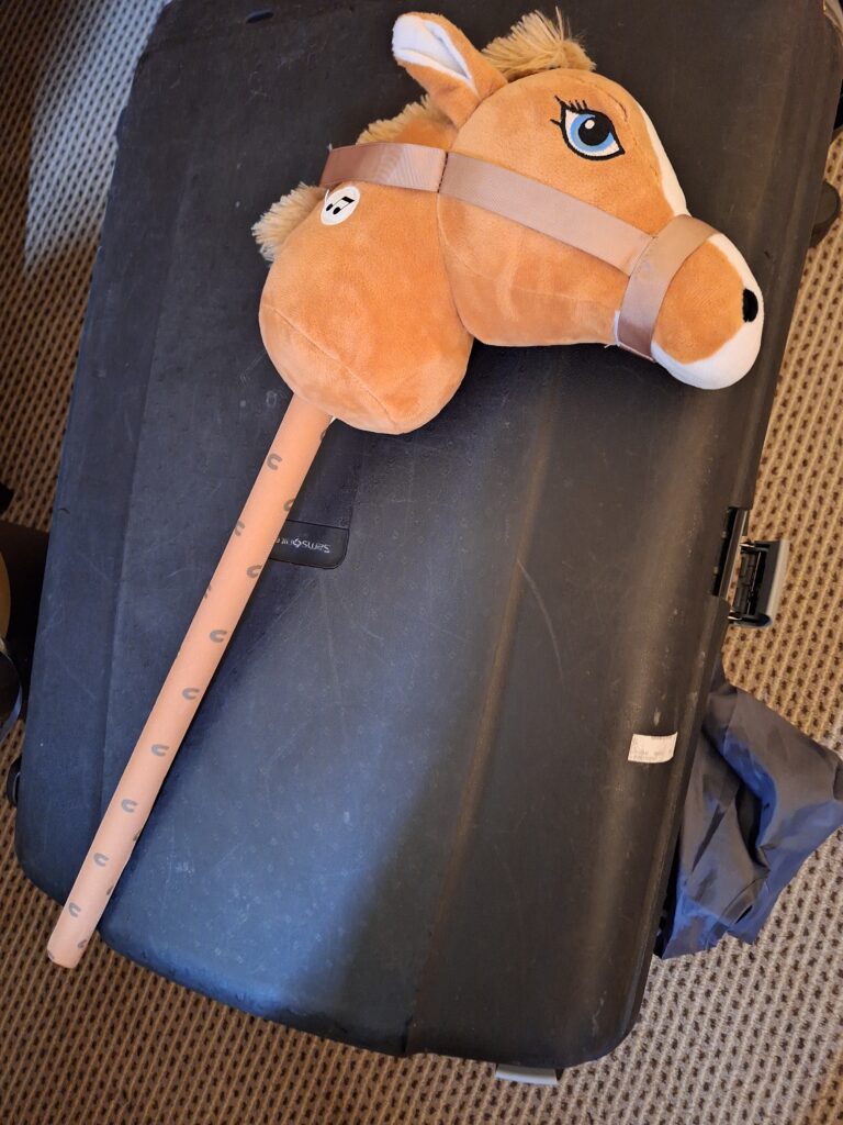
Knut got a horse as a birthday present on the trip. No wonder the suitcase was heavy!
Burns’ poetry ranges from humor and everyday life to beautiful landscapes and love poems. Perhaps the most famous are ‘Auld Lang Syne‘ and ‘A Red, Red Rose‘, which are performed in different versions all over the world. As an example, Evert Taube has a version of ‘My love is like a red, red rose‘, which he translated to ‘Min älskling, du er som en ros‘ (in Swedish). He created a new melody, but the lyrics are directly translated. Tobatheornottobathe’s favorite poem, however, is ‘Tam o’ Shanter‘, a rather long story about Tam, who gets drunk in the pub and has an eventful trip home. If you’re really lucky, maybe you’ll get to hear Knut perform the poem, in Hartvig Kiran’s fantastic New Norwegian translation?
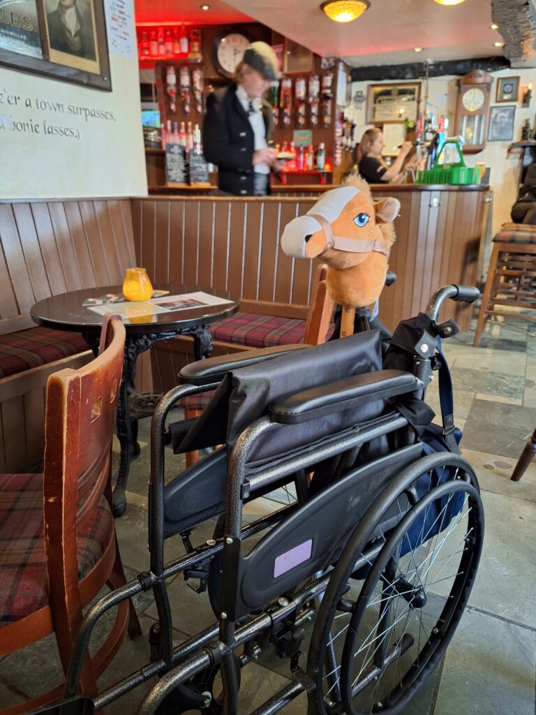
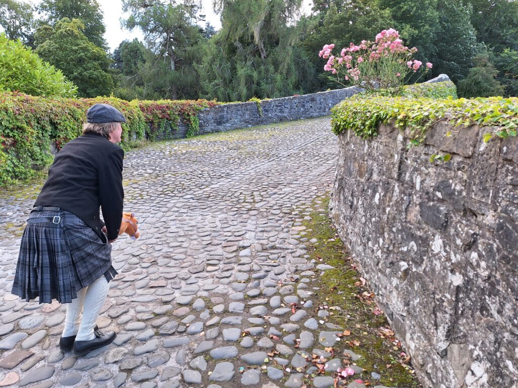
Idun had a sore knee, and alternative transportation was needed. She never got a horse as a birthday present.
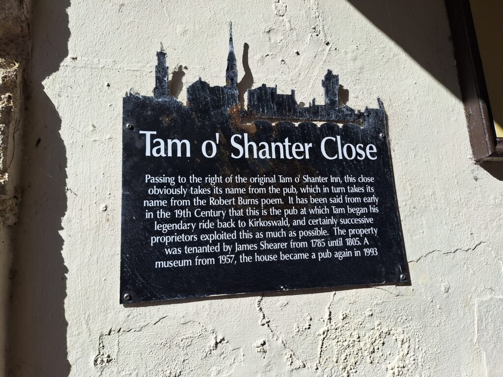
In the poem, Tam starts the evening in the town of Ayr, at the pub which is now, curiously enough, called ‘Tam o’ Shanter’ and which is supposedly the real Tam o’ Shanter pub. From Ayr he rides home to Alloway, the village where Robert Burns himself was born.
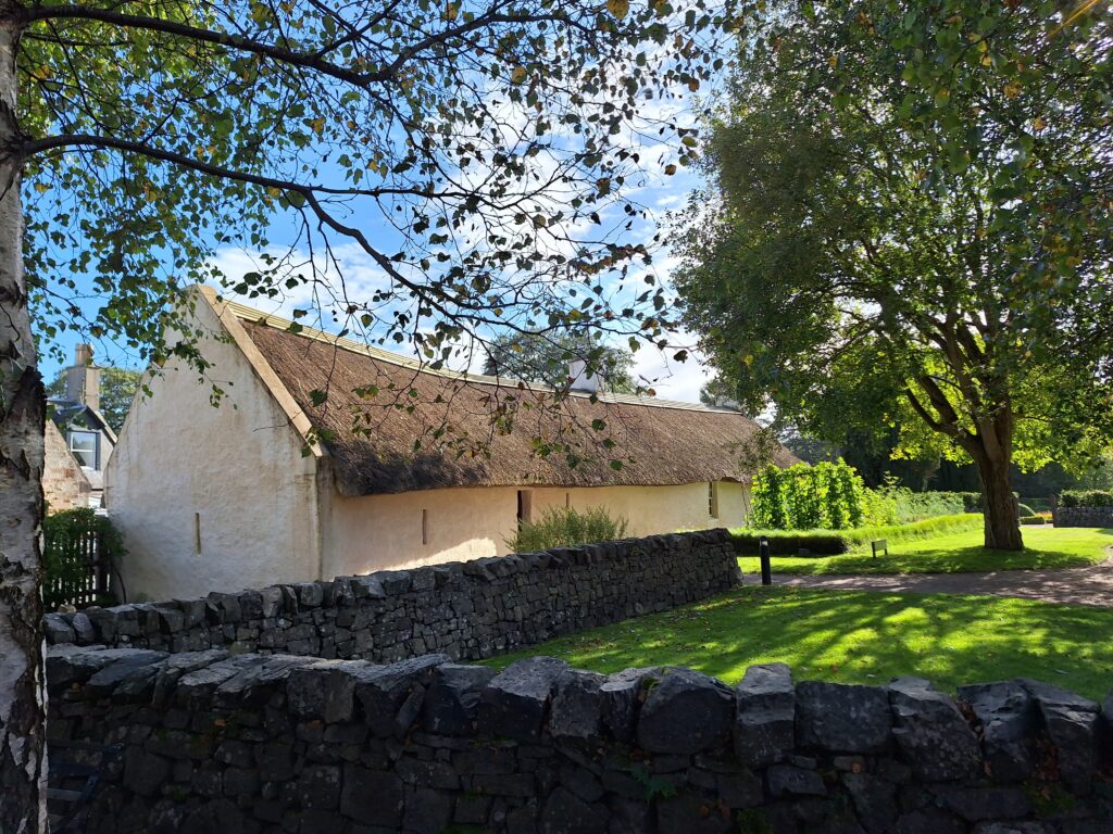
Robert Burns’ birth place and childhood home in Alloway.
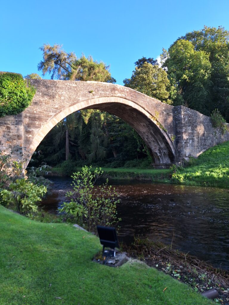
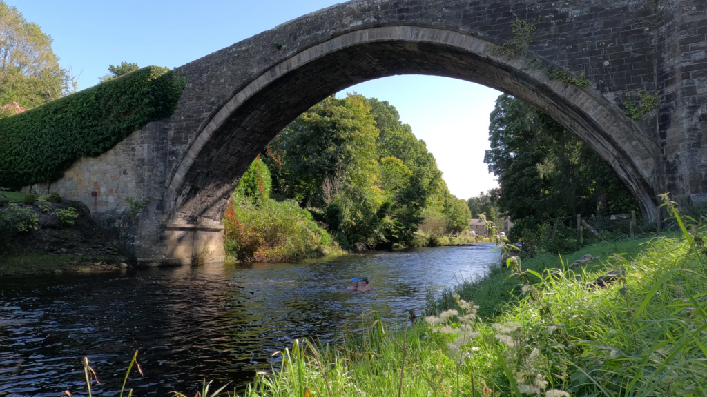
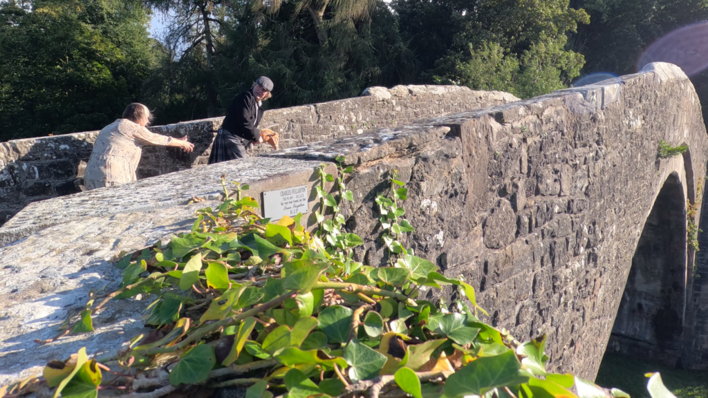
It turned out to be a dramatic journey, ending at Brig o’ Doon, the bridge over the river Doon that Burns’ father crossed every day on his way to work. The bridge has been proposed for demolition several times, but has been saved every time due to the great popularity of both the poet and the poem.
Brig o’ Doon in Alloway.
For Tobatheornottobathe it was natural to think that a bath under Brig o’ Doon would be just great? Well it wasn’t simple, that’s for sure! On the eastern bank you’ll find the Brig o’ Doon House Hotel (where you can have big, fancy parties, maybe even celebrate Burns Supper?), but they had put up prohibition signs on the riverbank. Tobatheornottobathe normally try to avoid ignoring such signs as much as possible. Really! But ‘as much as possible’ doesn’t mean ‘always‘…
Brig o’ Doon House Hotel seen from Brig o’ Doon.
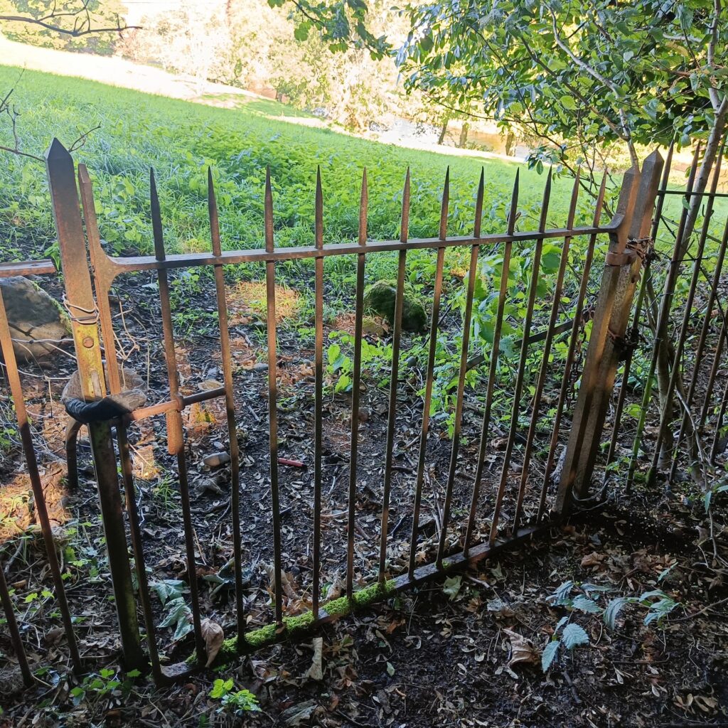
On the western bank, however, there is not much activity , actually it seems well-suited for swimming, the field going all the way down to the river. Then we discovered the fence… The gate was locked with a bicycle combination lock.
To cross the fence here was not right, at least not for Idun, with her bad knee and short legs.
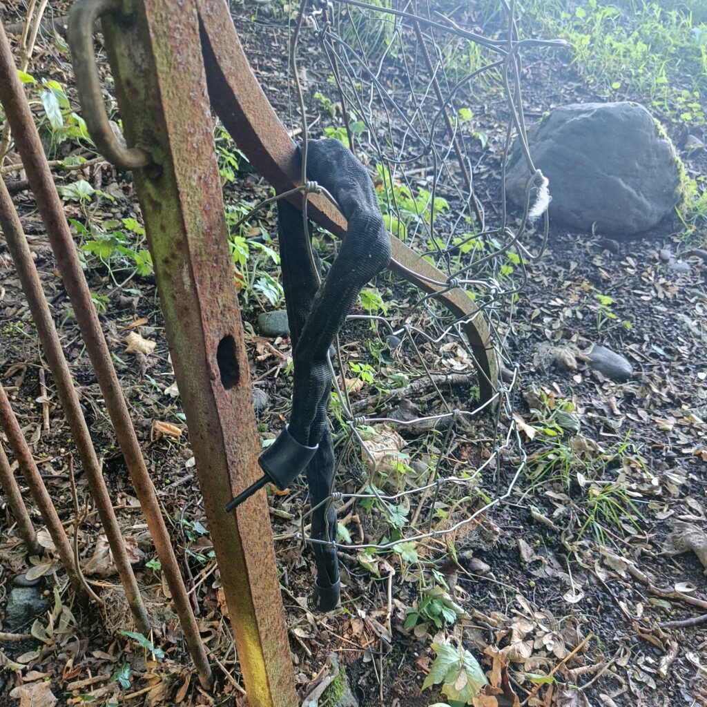
Knut, however, doesn’t give up that easy. He took a stroll up towards the farm, met a random guy and asked how forbidden it really was to cross the meadow to take a bath (fences can be about keeping livestock in and not necessarily people out). Well, it wasn’t sooo forbidden, ‘You won’t get shot!‘, he said. So Knut used the ‘how to unlock a combination lock without knowing the code – trick‘, it took less than half a minute, and Idun was able to hobble through the gate on crutches. We could have a bath!
Knut Lupin strikes again.
Then it was just a matter of strolling down to the riverbank, changing and getting into the water.
The bath was both troublesome and shallow, but otherwise it was just right to have a dip under Brig o’ Doon. The water was clear and without any unpleasant taste.
After the bath, some lively music in the car is a good idea. One possibility is Iron Maiden’s ‘The number of the beast‘, which is supposed to be (very) loosely based on Tam o’ Shanter. But preferably Michael Jackson’s megahit ‘Thriller‘. MJ was a Burns fan, and the music video, where he dances with zombies, is undoubtedly inspired by the poem (Warlocks and witches in a dance…). In fact, Michael Jackson planned an entire musical based on Burns’ poem, accompanied by modern music, but all 3 of the most important people died before it came to fruition.
The phrase ‘Cutty Sark‘ in the poem means a short-cut dress or shirt. The word comes from the Old Norse ‘serkr’, meaning underwear or nightwear. The phrase has later been applied to boats, and every genuine ‘Cutty Sark‘ ship has a figurehead of a lady holding a ponytail in front of her.
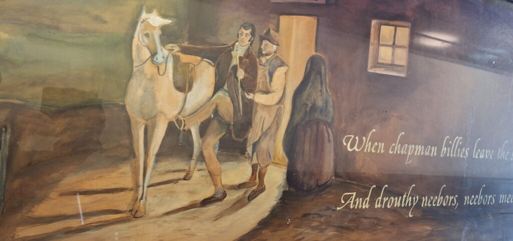
And now time is just right to present the poem itself. In Scots. By twisting the words a little, you should be able to get the essence, even if it’s a little archaic:
Tam o’ Shanter
When chapman billies leave the street, And drouthy neebors neebors meet, As market-days are wearing late, And folk begin to tak the gate; While we sit bousin, at the nappy, And gettin fou and unco happy, We think na on the lang Scots miles, The mosses, waters, slaps, and stiles, That lie between us and our hame, Whare sits our sulky, sullen dame, Gathering her brows like gathering storm, Nursing her wrath to keep it warm.
This truth fand honest Tam o’ Shanter, As he frae Ayr ae night did canter: (Auld Ayr, wham ne’er a town surpasses, For honest men and bonie lasses.)
The Burns Pilgrimage Trail must go via the Tam o’ Shanter Close.
O Tam! had’st thou but been sae wise As taen thy ain wife Kate’s advice! She tauld thee weel thou was a skellum, A bletherin, blusterin, drunken blellum; That frae November till October, Ae market-day thou was na sober; That ilka melder wi’ the miller, Thou sat as lang as thou had siller; That ev’ry naig was ca’d a shoe on, The smith and thee gat roarin fou on; That at the Lord’s house, ev’n on Sunday, Thou drank wi’ Kirkton Jean till Monday. She prophesied, that, late or soon, Thou would be found deep drown’d in Doon; Ot catch’d wi’ warlocks in the mirk, By Alloway’s auld haunted kirk.
On the way into the pub. The horse Meg has to wait outside.
Ah, gentle dames! it gars me greet, To think how mony counsels sweet, How mony lengthen’d sage advices, The husband frae the wife despises!
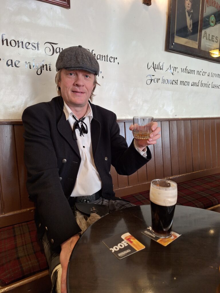
But to our tale:—Ae market night, Tam had got planted unco right, Fast by an ingle, bleezing finely, Wi’ reaming swats that drank divinely; And at his elbow, Souter Johnie, His ancient, trusty, drouthy crony: Tam lo’ed him like a vera brither; They had been fou for weeks thegither. The night drave on wi’ sangs and clatter; And ay the ale was growing better: The landlady and Tam grew gracious Wi’ secret favours, sweet, and precious: The souter tauld his queerest stories; The landlord’s laugh was ready chorus: The storm without might rair and rustle, Tam did na mind the storm a whistle.
Ready for the Knut o’ Shanter night. No Landlady in sight.
Care, mad to see a man sae happy, E’en drown’d himsel amang the nappy: As bees flee hame wi’ lades o’ treasure, The minutes wing’d their way wi’ pleasure; Kings may be blest, but Tam was glorious, O’er a’ the ills o’ life victorious!
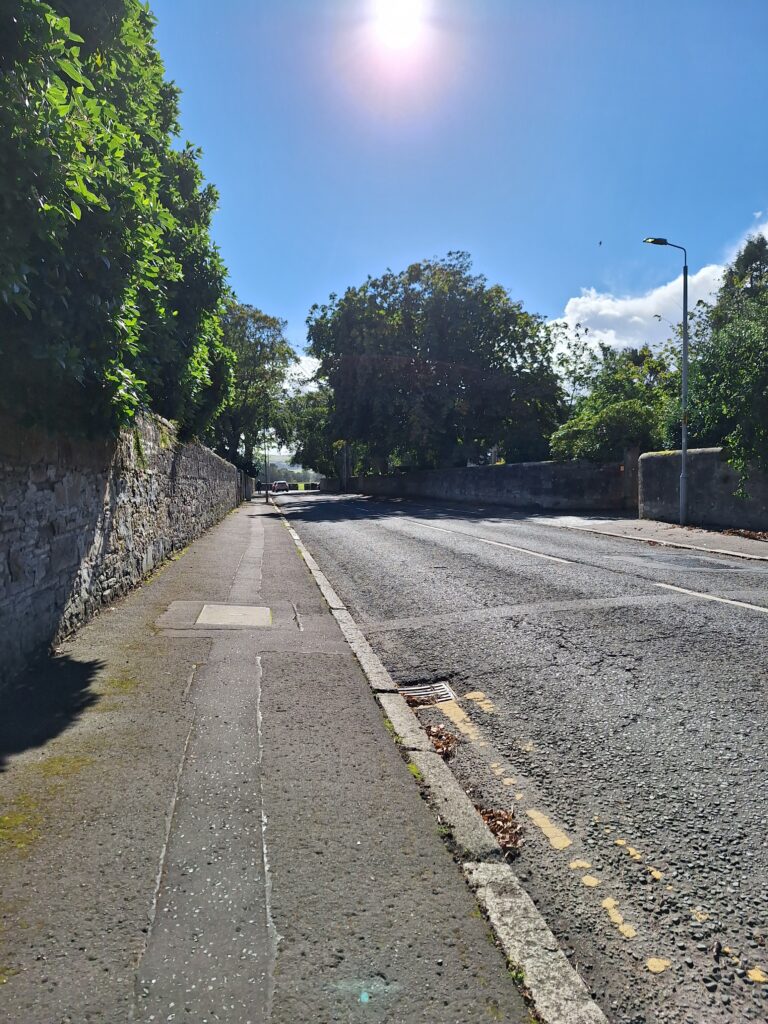
The road to Alloway is not very scary in daylight. The asphalt is not as old as the poem (from 1790).
But pleasures are like poppies spread, You seize the flow’r, its bloom is shed; Or like the snow falls in the river, A moment white—then melts forever; Or like the borealis race, That flit ere you can point their place; Or like the rainbow’s lovely form Evanishing amid the storm. Nae man can tether time or tide: The hour approaches Tam maun ride,— That hour, o’ night’s black arch the key-stane That dreary hour he mounts his beast in; And sic a night he taks the road in, As ne’er poor sinner was abroad in.
The path to the forest was too demanding for us, half of Tobatheornottobathe sitting in a wheelchair. There was no walk in the forest.
The wind blew as ‘twad blawn its last; The rattling show’rs rose on the blast; The speedy gleams the darkness swallow’d; Loud, deep, and lang the thunder bellow’d: That night, a child might understand, The Deil had business on his hand.
Weel mounted on his grey mare, Meg, A better never lifted leg, Tam skelpit on thro’ dub and mire, Despising wind and rain and fire; Whiles holding fast his guid blue bonnet, Whiles crooning o’er some auld Scots sonnet, Whiles glowrin round wi’ prudent cares, Lest bogles catch him unawares. Kirk-Alloway was drawing nigh, Whare ghaists and houlets nightly cry.
The churchyard by Alloway Auld Kirk.
By this time he was cross the ford, Whare in the snaw the chapman smoor’d; And past the birks and meikle stane, Whare drucken Charlie brak’s neckbane: And thro’ the whins, and by the cairn, Whare hunters fand the murder’d bairn; And near the thorn, aboon the well, Whare Mungo’s mither hang’d hersel. Before him Doon pours all his floods; The doubling storm roars thro’ the woods; The lightnings flash from pole to pole, Near and more near the thunders roll; When, glimmering thro’ the groaning trees, Kirk-Alloway seem’d in a bleeze: Thro’ ilka bore the beams were glancing, And loud resounded mirth and dancing.
Alloway Auld Kirk.
Inspiring bold John Barleycorn! What dangers thou can’st make us scorn! Wi’ tippenny we fear nae evil; Wi’ usquebae we’ll face the devil!
The swats sae ream’d in Tammie’s noddle, Fair play, he car’d na deils a boddle. But Maggie stood right sair astonish’d, Till, by the heel and hand admonish’d, She ventur’d forward on the light; And, wow! Tam saw an unco sight!
Most things can happen inside an old church… But early in the day you won’t see the Devil playing the bagpipes in the church.
Warlocks and witches in a dance; Nae cotillion brent-new frae France, But hornpipes, jigs, strathspeys, and reels Put life and mettle in their heels. A winnock bunker in the east, There sat Auld Nick in shape o’ beast: A towzie tyke, black, grim, and large, To gie them music was his charge; He screw’d the pipes and gart them skirl, Till roof and rafters a’ did dirl.— Coffins stood round like open presses, That shaw’d the dead in their last dresses; And by some devilish cantraip sleight Each in its cauld hand held a light, By which heroic Tam was able To note upon the haly table A murderer’s banes in gibbet airns; Twa span-lang, wee, unchristen’d bairns; A thief, new-cutted frae the rape— Wi’ his last gasp his gab did gape; Five tomahawks, wi’ blude red-rusted; Five scimitars, wi’ murder crusted; A garter, which a babe had strangled; A knife, a father’s throat had mangled, Whom his ain son o’ life bereft— The grey hairs yet stack to the heft; Wi’ mair o’ horrible and awfu’, Which ev’n to name wad be unlawfu’.
What’s the buzz?
As Tammie glowr’d, amaz’d and curious, The mirth and fun grew fast and furious: The piper loud and louder blew, The dancers quick and quicker flew; They reel’d, they set, they cross’d, they cleekit Till ilka carlin swat and reekit And coost her duddies to the wark And linket at it in her sark!
Now Tam, O Tam! had thae been queans, A’ plump and strapping in their teens! Their sarks, instead o’ creeshie flannen, Been snaw-white seventeen hunder linen!— Thir breeks o’ mine, my only pair, That ance were plush, o’ gude blue hair, I wad hae gien them aff y hurdies, For ae blink o’ the bonie burdies!
But wither’d beldams, auld and droll, Rigwoodie hags wad spean a foal, Lowping and flinging on a crummock. I wonder didna turn thy stomach.
But Tam ken’d what was what fu’ brawlie; There was ae winsom wench and walie, That night enlisted in the core (Lang after ken’d on Carrick shore. For mony a beast to dead she shot, And perish’d mony a bonie boat, And shook baith meikle corn and bear, And kept the country-side in fear); Her cutty sark o’ Paisley harn, That while a lassie she had worn, In longitude tho’ sorely scanty, It was her best, and she was vauntie. Ah! little ken’d thy reverend grannie, That sark she coft for her wee Nannie, Wi’ twa pund Scots (’twas a’ her riches), Wad ever grac’d a dance of witches!
The road downwards past Brig o’ Doon House Hotel. Brig o’ Doon can be seen in the background.
But here my Muse her wing maun cow’r, Sic flights are far beyond her pow’r; To sing how Nannie lap and flang, (A souple jad she was and strang), And how Tam stood like ane bewitch’d, And thought his very een enrich’d; Even Satan glowr’d and fidg’d fu’ fain, And hotch’d and blew wi’ might and main: Till first ae caper, syne anither, Tam tint his reason a’ thegither, And roars out, “Weel done, Cutty-sark!” And in an instant all was dark: And scarcely had he Maggie rallied, When out the hellish legion sallied.
As bees bizz out wi’ angry fyke, When plundering herds assail their byke; As open pussie’s mortal foes, When, pop! she starts before their nose; As eager runs the market-crowd, When “Catch the thief!” resounds aloud; So Maggie runs, the witches follow, Wi’ mony an eldritch skriech and hollo.
Tam fled over Brig o’ Doon.
Ah, Tam! ah, Tam! thou’ll get thy fairin! In hell they’ll roast thee like a herrin! In vain thy Kate awaits thy comin! Kate soon will be a woefu’ woman! Now, do thy speedy utmost, Meg, And win the key-stane of the brig: There at them thou thy tail may toss, A running stream they dare na cross. But ere the key-stane she could make, The fient a tail she had to shake! For Nannie far before the rest, Hard upon noble Maggie prest, And flew at Tam wi’ furious ettle; But little wist she Maggie’s mettle— Ae spring brought aff her master hale But left behind her ain grey tail: The carlin claught her by the rump, And left poor Maggie scarce a stump.
Maggie got hold of the tail, but Tom was saved on the bridge!
Now, wha this tale o’ truth shall read, Ilk man and mother’s son, take heed, Whene’er to drink you are inclin’d, Or cutty-sarks run in your mind, Think, ye may buy the joys o’er dear, Remember Tam o’ Shanter’s mear.
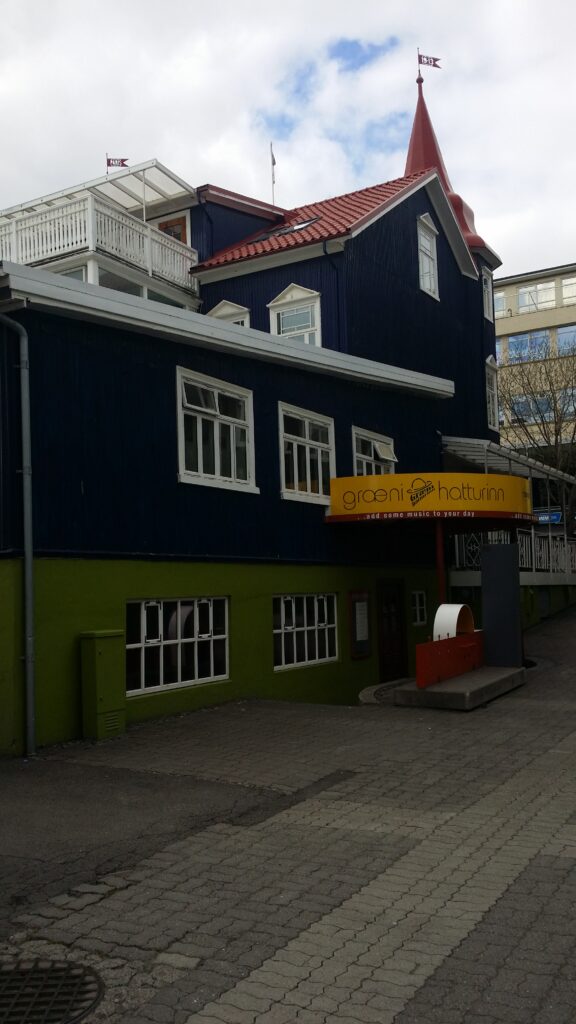
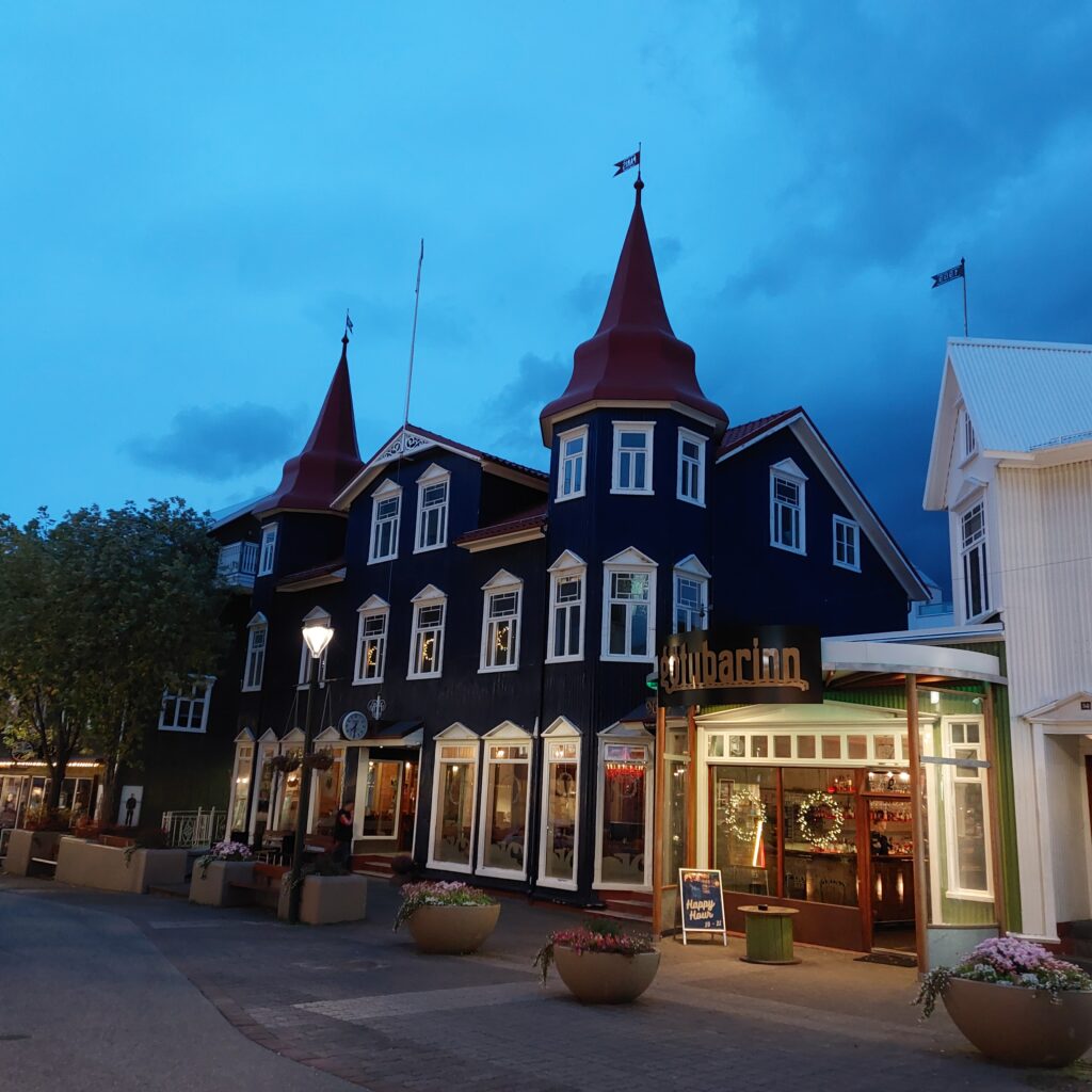
One of the coziest cafes in Akureyri is ‘Bláa Kannan’ (the Blue Tea Pot), with its two frequently photographed towers. Under that Blue Tea Pot there are Green Hats! Græni Hatturinn (the Green Hats) is the concert venue in Akureyri, which actually stayed partially open during the corona period. This is a very nice place, with a good selection of various bjór (pronounced bjaor), i.e. beer, but you probably already knew that.
Græni Hatturinn below the Bláa Kannan Cafe.
Here we can recommend a concert with, for example, the band ‘Hjálmar‘, who plays a nice mix of raggie and folk music (we do often plan the Iceland trip according to the program at Græni Hatturinn). Or maybe you’d rather be amused by the white idiots: ‘Ljótu hárvívitarning‘? In Icelandic! This is reminiscent of Prima Vera, listen to this song as an example: ‘Ég fer á traktornum‘. Or, perhaps, an alternative might be to check out ‘Papar‘, Irish music in Icelandic. However, the titles are somewhat strange: ‘Og þá stundi Mundi‘ = ‘The Wild Rover‘…
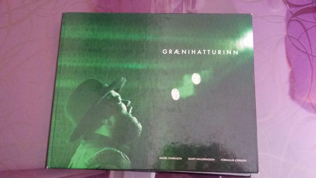
Anniversary book for ‘Græni Hatturinn’.
Before the concert, swimming training is a good idea. Straight up the hill and past Akureyrikirkja, you will find Sundlaug Akureyri, Akureyri’s public pool.
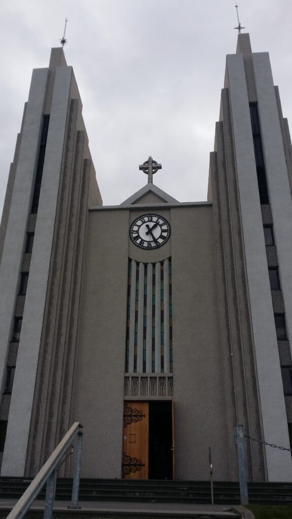
Akureyri church from 1940 was designed by Guðjón Samúelsson. The architecture is inspired by basalt columns. Here you can see a representation of goða Þorgeir Þorkelsson throwing his pagan idols into Goðafoss.
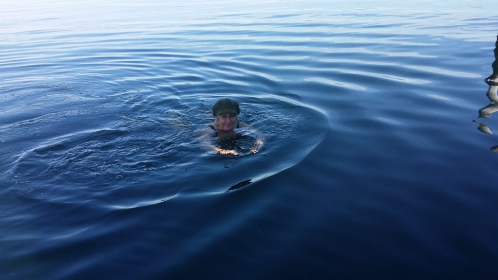
This is a slightly larger swimming facility than usual, with 2 outdoor swimming pools, many different hot tubs and a sauna. Akureyri Sundlaug is a bathing paradise for children with several children’s pools, a long slide and 2 jumping castles. After the swim, when you are clean and ready to party, just put on your green hat and go.
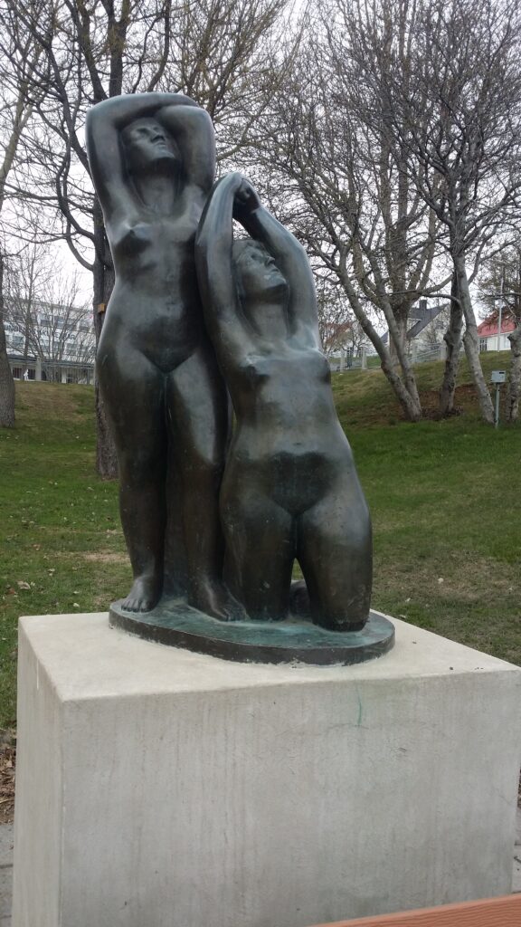
The sculpture ‘Systrurnar’ (The Sisters) below Akureyri Sundlaug is modeled by Ásmund Sveinsson.A bath and a green hat, and Idun is ready for party. Illustration photo (we usually don’t take photos in public swimming pools).
Akureyri was originally two settlements: The houses on the ‘øra’ where Gleráverfi is located today, and in the south, Old Akureyri, where you will find the Minjasafnið á Akureyri (Akureyri Museum). Today’s city center is basically situated between these. From the 17th century, trade was conducted here in the summer months, as there are good harbor conditions. However, the Danes did not stay at winter time until well into the 18th century. At Gleráverfi, in the 20th century, there were a number of ramps out into the sea during the herring fishing, and a lot of activity.
Gleráverfi, with a view towards old Akureyri. Here the herring boats were parked side by side in the 20th century.
Akureyri Museum exhibits a number of old maps and also has a section on the topic Icelandic popular music. The museum is interesting, even if the selected subjects have little to do with each other.
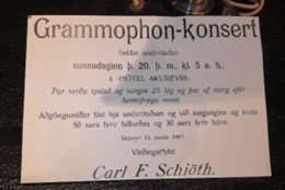
Gramophone concert, announced at Minjasafnið á Akureyri.
There is an exhibition in the basement that emphasizes the Icelanders’ struggle to free themselves from the Danish trade monopoly. Iceland joined Norway into the Kalmar Union in 1397, and the Danes got a monopoly on all trade. The problem was that there were no duties attached to the trade rights. Although the need for imported goods was critical for the population, one could never be sure that Danish ships actually arrived on Iceland every year. At the same time, vessels from other countries, or the Icelanders themselves, risked large fines for trading – regardless of whether Danish ships actually traded or not. In short, a moving story, well told and definitely worth a visit!
Art in old Akureyri.
After a visit to the museum, a swim is a good idea. Take the car and drive further into the fjord ending, to the forest Vaðlaskógur. The forest is named after the mountain Vaðlaheiði on the east side of Eyjafjörður (the fjord with an island). Before 1985, the road from Akureyri to Húsavík was both steep and winding over Vaðlaheiði and through a small canyon called Steinsskarð. Here one might be able to see the remains of a small shed, which some believe inspired the construction of Iceland’s longest word ever:
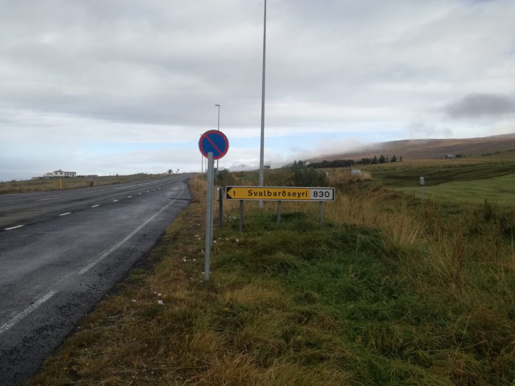
Today there is a tunnel under Vaðlaheiði, called Vaðlaheiðargöng. At Eyafjörður, the tunnel opening is close to the village of Svalbarðseyri, that immediately gave Idun the good, homely feeling, even though it is otherwise not very similar to Longyearbyen, Svalbard, where she grew up.
Vaðlaheiðargöng opened in 2018, which shortened the route between Akureyri and Húsavík by 16 km. NB! You have 48 hours to pay the toll if you haven’t done so in advance. Tobatheornottobathe finds is hard to remember those kinds of deadlines and recommend paying in advance!
Forest Lagoon opened in 2022 and is located – actually! – in a forest.
During the construction of the Vaðlaheiðargöng in 2014, there were problems with water seepage. But the misfortune turned to luck, as the water turned out to be a geothermal source! That, in turn, inspired the couple Sigríður Hammer and Finnur Aðalbjörnsson to build the Forest Lagoon.
Wood is a recurring element in Forest Lagoons interior. Akureyri can be seen in the background.
Eyafarðar skogbruksforening got a contract with the land owner in 1936 to plant a forest on their marshes, at the inner end of Eyafjörður. The tree planting was completed in 1970, and today it is a strange feeling to enter an Icelandic forest here up in the north region, where there are no wild trees at all. The spa is very beautiful and has everything you could ever dream of: hot and cold baths, saunas, a restaurant, all with inspiration from the forest and rocky hill behind. Absolutely recommended!
Akureyri (the acre in the delta) – the capital of Norðurlands Eystri (North Eastern Region), is a university town with all facilities and a bustling public life even though the population is only 20,000.
Not very colorful Akureyri town, seen from the fjord Eyjafjörður’s inner end.
According to Landnámabók (the conquest book), the settlement of Eyjafjörður started with Helgi Magri sometime in the 9th century. His father, Eivind, was originally Swedish, and moved westwards via Norway. Helge was born in Ireland, but left for fostering in the Suðrøyene (Hebrides, west of Scotland) as an infant. When his parents picked him up 2 years later, he had become so thin that they hardly recognized him, hence the nickname ‘magri’ = ‘the skinny one’. Fostering children was a form of alliance building in the Viking Age, and foster children had the same rights as their own children. But one wonders how good the relationships were after this… And let’s hope that the foster family didn’t also have daughters! In the book ‘Auðr’, Kim Hjardar writes that in the Viking Age 7% of men and 37% of women were malnourished as children. Helgi married Torunn, who was the daughter of Kjetil Flatnose and sister of Aud the Deep-Thinking (the same Auðr mentioned above), and they had many children. Their settlement was the largest in Iceland, larger than the settlement of Ingólfur Arnarson. Helgi was a Christian, but when it really came down to life or death (for example in stormy weather at sea), he invoked the thunder god Þor instead.
Akureyri’s most characteristic building, with Bláa Kannan café on the 1st floor.
The first time Akureyri is mentioned by name in written sources is in a judgment from 1562, when a woman was convicted of having slept with a man without being married. But don’t let this put a damper on your mood! Akureyri is a place with a good spirit, several cozy cafes and an abundant number of restaurants and bars.
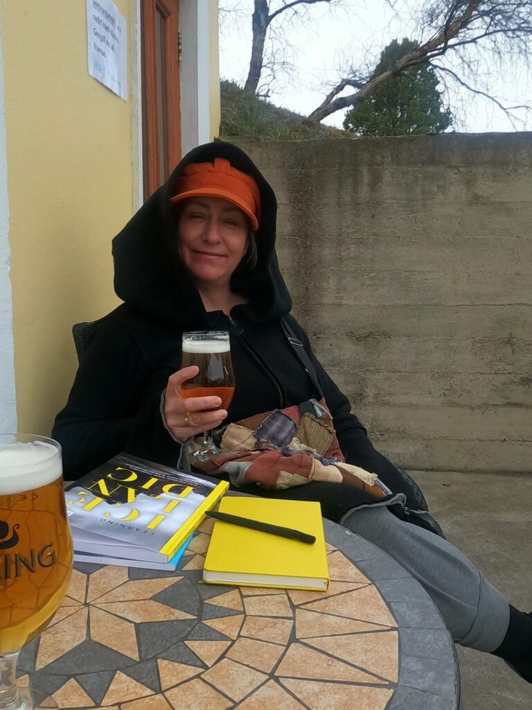
Idun enjoys life at Kafe Limur. Trying to learn Icelandic, but that’s quite a challenge.
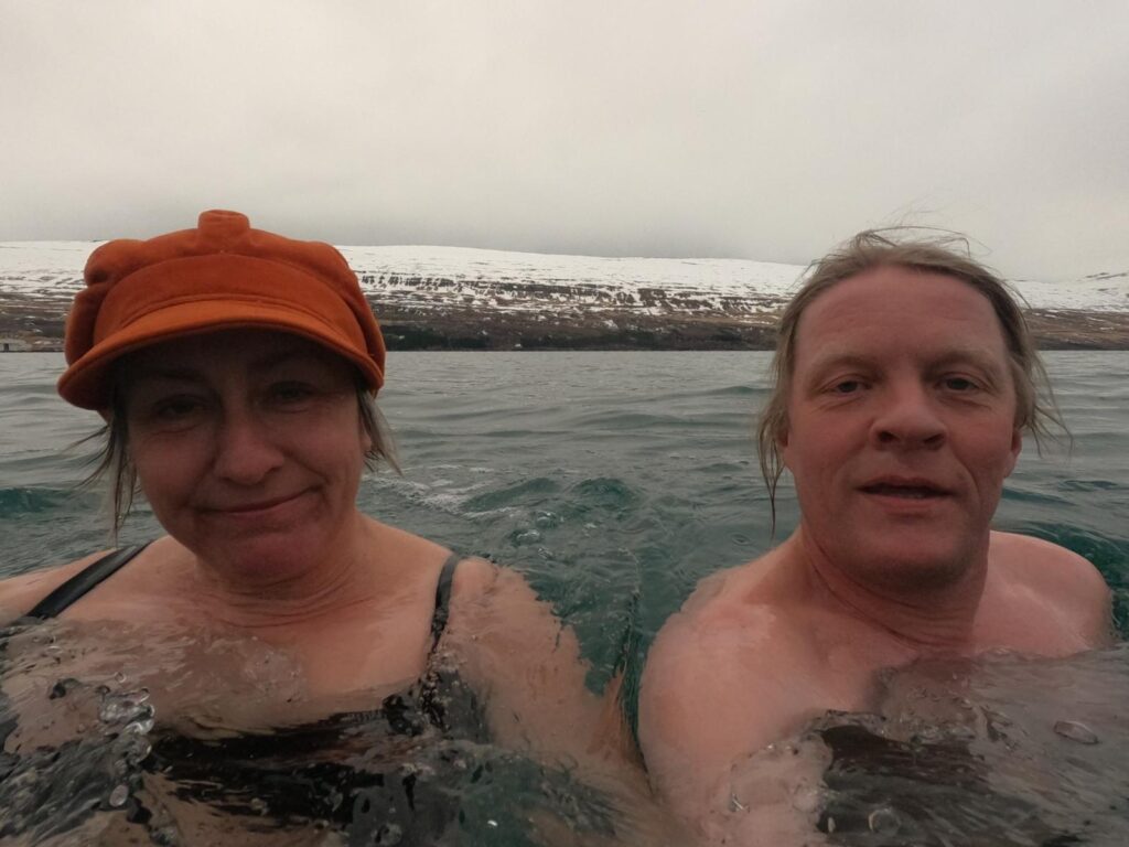
Before you go out to party, taking a bath is just right. This time, we recommend a morning dip! We made it incredibly easy by changing at the hotel, crossing Drotningarbraut (Queen’s Road), climbing over the boulders and swim there. Clear and beautiful water, lots of birds and clean water even though it’s close by an active harbor.
A bath in Eyjafjörður is just right!
Ref: ‘Auðr-Kvinneliv i vikingtid‘, Kim Hjardar, ISBN 978-82-430-1209-7
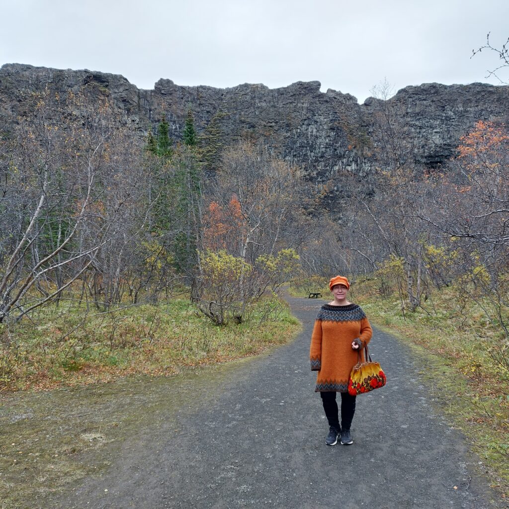
An hour’s drive east of Húsavík is the norse god castle Ásbyrgi. What a place! A field surrounded on three sides by 100 m high cliffs, with a rocky island in between. The rock in the middle is called Eyjan (the Island). Seen from above, it all resembles a giant imprint of a horse’s hoof. Clearly this must be a track made by Odin’s horse Sleipner!
Sleipner’s footprint?
However, science interprets the Ásbyrgi geology somewhat differently. The lava rocks are formed by a volcanic eruption from Stóravíti some 10,000 years ago. The canyon was excavated later. 3,000 years ago, there were 3 active volcanoes under the glacier Vatnajökull, which created dramatic floods of meltwater northwards, and hence the Ásbyrgi cliffs.
At Ásbyrgi you will find nice hiking trails, and in the summer, guided tours are also organized in the area. Spend some time here!
The information sign. Ásbyrgi is 3.5 km long and 1.1 km wide. How big must the horse Sleipner have been to make such an imprint?
Those who can see elves (and in Iceland a lot of people do), have said that inside these cliffs there are many elf homes, public elf houses and even an elf concert hall. There are several elf stories connected to the place, including the impossible love between the poor boy Huginn and Heiðbláina, who was the daughter of the landlord in Ásbyrgi. Because of the difference in status, they were not allowed to marry, and they were very sad. One night an elf came to them in a dream. She was very unhappy, because her beloved had been bewitched into a water monster. Now he lived in lake Botnstjörn, Ásbyrgi, and could only come up when the midnight sun shone on the cliffs. The elf said that Heiðbláina could break the spell if she confronted the Nixie and threw her most valuable things into its gap. So the girl did, the curse was broken and the elf woman paid back by arranging for Huginn and Heiðbláina to get married after all. It always pays back to help an elf!
Idun didn’t hear any elves crying, and was looking forward to a bath in Botnstjörn.
If you hear crying in the elf’s home, it might be the elf Bjartmar mourning for the orphan Una, but that’s a long story that we won’t cover here. None of the Tobatheornottobathers have the ability to see or hear elves, so surely a bath in Botnstjörn could be a good idea? We have been to Ásbyrgi twice. The first time it was winter (April), and what could go wrong?
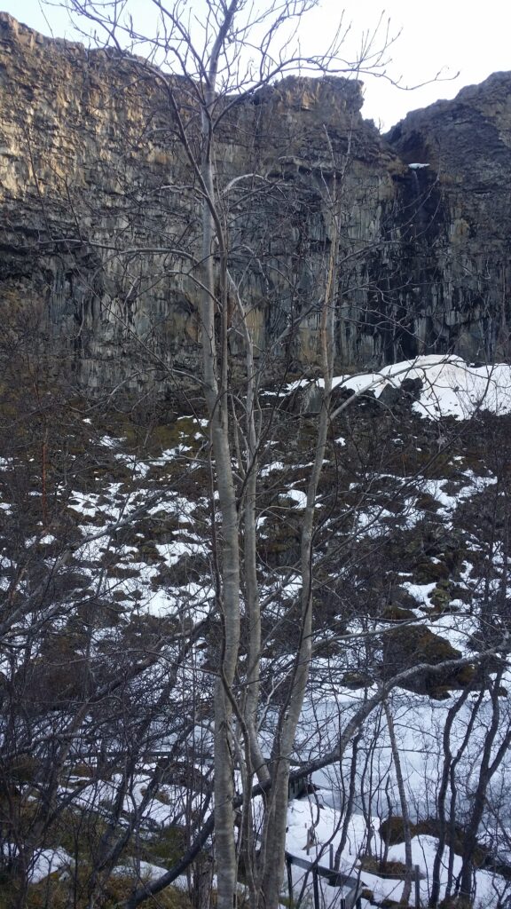
Elf Homes and the lake Botnstjörn in Ásbyrgi, winter.
Well, it was this thing with ice on the water… We couldn’t swim in April. So then we just had to try again, in September. What could possibly go wrong in autumn?
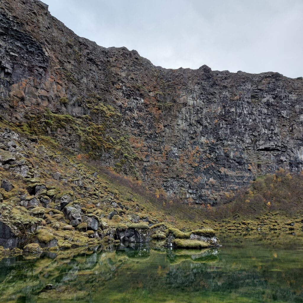
Botnstjörn in September.
When it comes to bathing, there is actually quite a lot that can go wrong. One classic problem: The water isn’t deep enough. Do you really want to have a bath when it will only be a small dip? No, a bath without getting your back wet is too stupid, so this bath became a ‘no‘. AND – by closer inspection: It is not allowed to go outside the path, so we had to conclude that swimming in Botnstjörn is in fact prohibited. Just as well Botnstjörn was too shallow, so we could let go of that temptation.
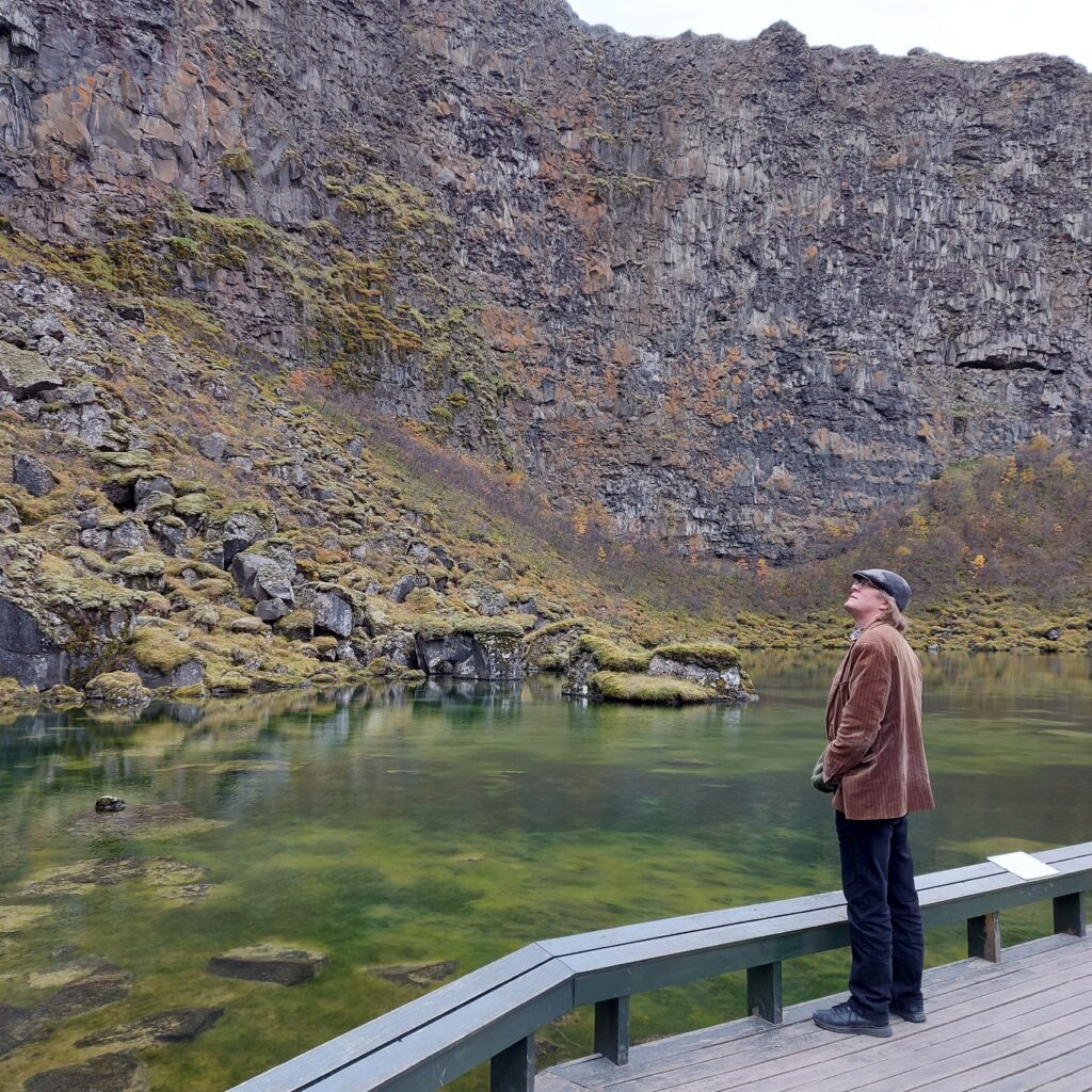
Knut is considering the Botnstjörn bathing area for the second time.
On the road between Húsavík and Ásbyrgi there is a small museum on a farm by the sea: Minjasafnið á Mánárbakka. It is well worth a visit! Here, among other things, they have found a pearl in the soil, a so-called ‘pearl of the eye‘. The pearl was professionally assessed in Norway, and we saw a letter from the Tromsø museum, which says that such eye pearls date from the late Viking Age (9th century), with a place of origin in Turkmenistan (!). In Norway, 55 eye pearls have been found, including Lofoten and in Troms (Kvaløya).
Charming turf houses at Mánárbakka. Please remember to bring some cash for the tickets, as they don’t accept credit cards at Mánárbakka.
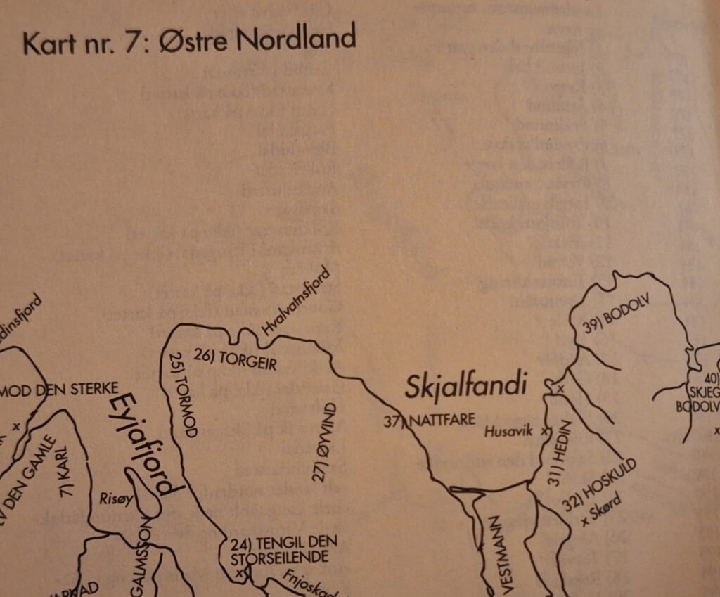
A visit to the Mánárbakka museum is just right on the way to or from Ásbyrgi. Even without cash to pay, we got a tour of the museum. The farm has belonged to the same family in an unbroken line since the Conquest period. As far as we can understand from the ‘Landnåmsboken’, this means that today’s residents are descendants of Bodolv, who emigrated from Agder, Norway, in the 7th century.
Conquest no. 39 in Norðurland Eystra, Tjörnes, was taken by Bodolv. From ‘Landnåmsboken’.
‘A man named Bodolv was the son of Grim Grimolvsson from Agder (Norway) and brother of Bodmond. He was married to Torunn, daughter of Torolv frode, and their son was Skjegge. They all went to Iceland, but their ship was wrecked at Tjörnes, and they were at Audolvsstad the first winter. Bodolv took all of Tjörnes between Tunguá and Os. He was then married to Torbjørg holmesol, daughter of Helgi magri. Their daughter was Torgerd, who was married to Åsmund Ondottsson.‘ Ref Landnåmsboken
Mánárbakka. In the absence of a (Christmas) tree, the solution could be a glittering iron tree.
P.S.: On our next Island trip, we sent cash to Mánárbakka, so we have settled our score!