After a very successful bath in front of Haukafellsjökull, we wanted to repeat the success. So we studied the map again, and found that the glacier in the valley next to it, Hoffellsjökull, (Hof was the Norse temple; i.e the Temple Mountain Glacier) was also marked with a lake at the glacier front. So then it was just a matter of taking another trip the next evening. What could possibly go wrong? We had studied the map, right?
Also at Hoffell, the marked hiking trail goes all the way to the glacier, and again we had a nice evening walk in absolutely brilliant weather, and we envisioned a nice bath at the glacial front.
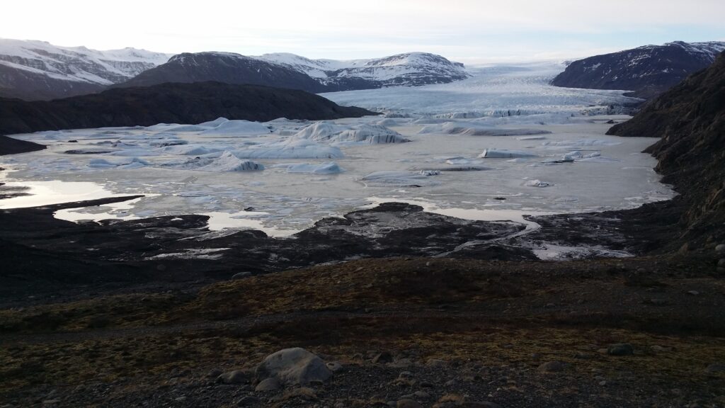
So very shallow indeed, in front of Hoffellsjökull.
Once at the glacier, a bath was a good…no – this time it was actually not right to bathe in the glacier lagoon. Hoffellsjökull has not dug deep enough. Yes, we found water, but it was so very shallow, brown water and mud all the way. How stupid wouldn’t it be to drown in quicksand here?
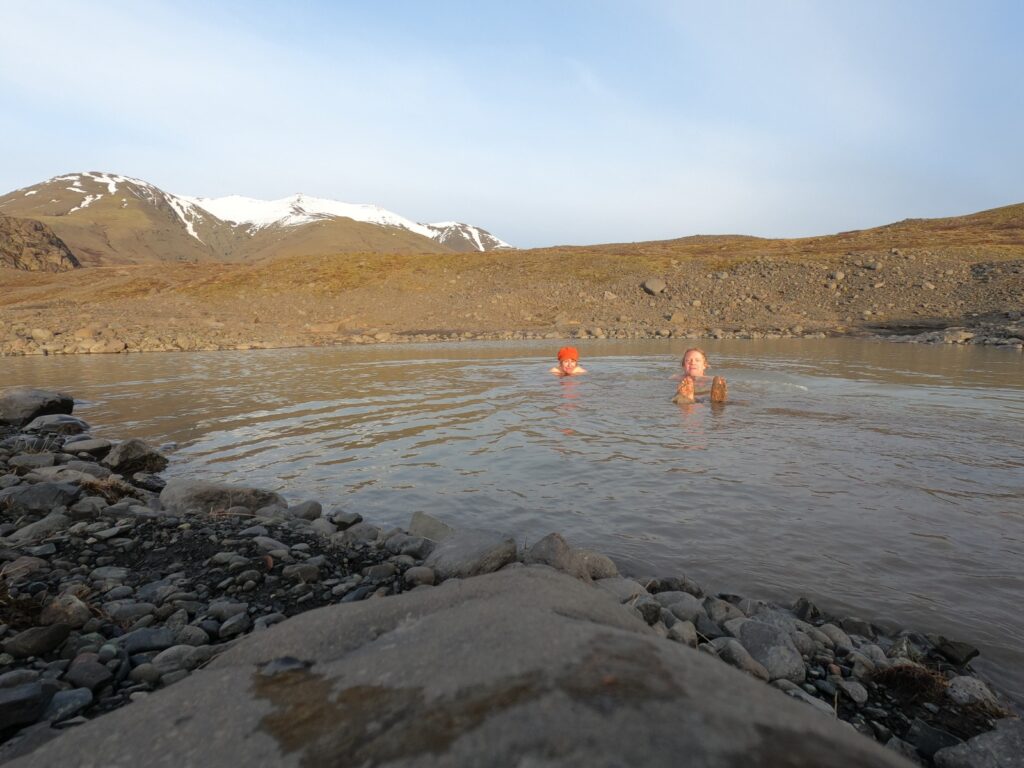
Slightly fun moraine bath.
The solution was a puddle up by the moraine. Mud bath at sunset…
An Old Dane (Eddie) is just right after a mud bath.
Well, well, it was kind of fun, and our bathing friend ‘Eddie’ always helps to lift the spirits. But this bath is simply not recommended.
PS: At Hoffell there are actually a couple of hot tubs to visit. However, those were closed during the corona, and we haven’t tested them. But curious, yes we are! The feedback online ranges from very enthusiastic to completely slaughtering. We will very likely come back with more about this some day.
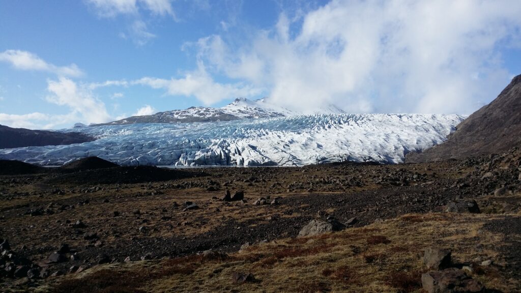
In the spring of 2021, we were in quarantine on the east coast of Iceland, at Rauðaberg, not far from Höfn. This is Vatnajökull’s realm. Vatnajökull (8100 km2) is Europe’s largest glacier after Austfonna at Svalbard/Spitsbergen. The ice thickness is up to 1 km (!), with an average of 400 metres. The glacier outlets from Vatnajökull descend into each valley with its own name, mile after mile. It’s really huge!
Haukafellsjökull is one of many glacier outlets from Vatnajökull.
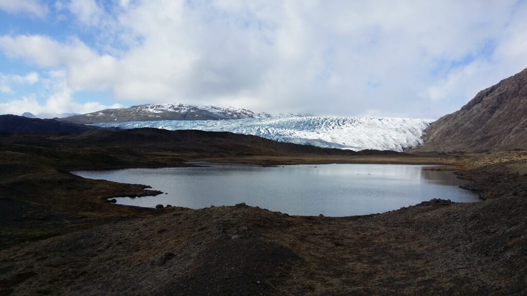
Geologically speaking, fjords are seen as underwater valleys, formed by glacial erosion of the bedrock. The fjords in Norway and Iceland are carved out of glaciers, all the way into the sea. The word fjord comes from Indo-European, the verb ‘fara’, ie where one travels (to the other side). Because of the weight, the glaciers can also dig below sea level. They often have a threshold (ra) at the outlet, where it is much shallower than further into the fjord. The threshold is formed by sediments in front of the ice end. If you imagine a threshold fjord that never reached the sea, then you have the concept of a glacier lagoon. As the glacier retreats, a lake is often formed where the glacier has dug deep – before the end moraine. We wanted to swim in front of a glacier!
The evening sun shines on Haukafellsjökull.
We checked the map and found a potential spot at Haukafell – Haukafellsjökull (the Hawk Mountain Glacier) seemed to have a lake in front of it. Even though we were in quarantine, we felt a tour here would be OK. At least no one could complain about the distance, we didn’t see another soul the whole evening…
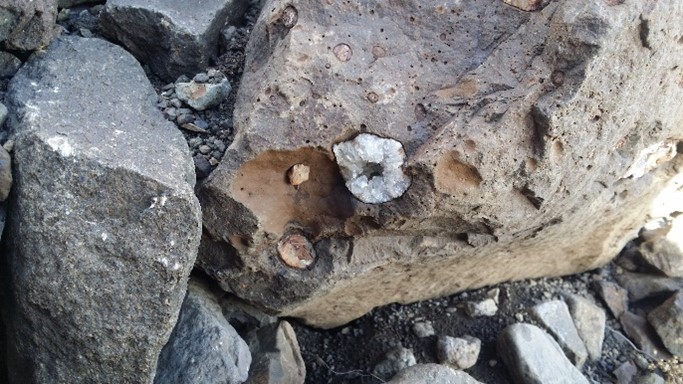
There is a marked hiking trail all the way to the glacier. On the way, we saw many wonderful stones, where beautiful crystals had grown inside the gray or brown rock. You can read more about special Icelandic stones and mineral types at ‘Perlan’ in Reykjavík.
Gray stones aren’t only gray at Haukafell.
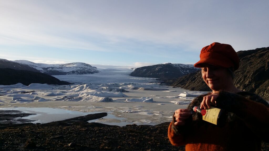
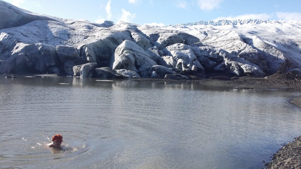
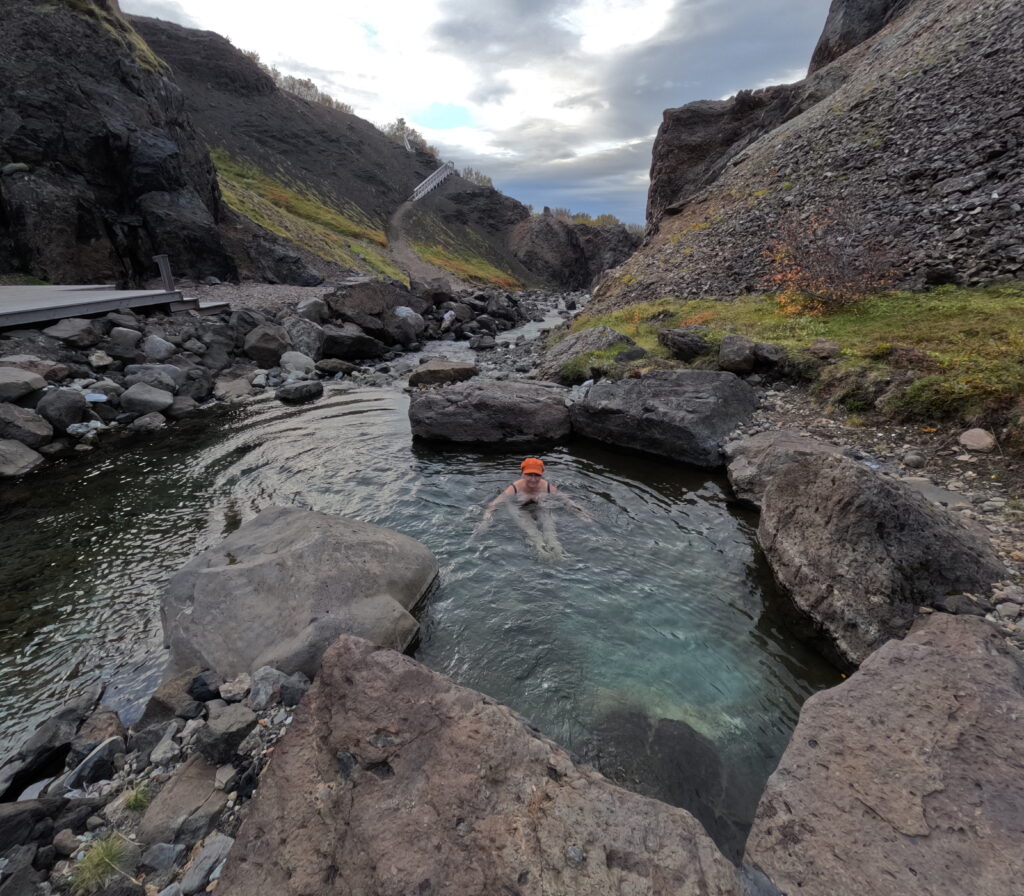
Once at the glacier, a bath was a good idea. Haukafellsjökull is an offspring from Vatnajökull and in decline. We therefore saw little danger in swimming in the glacier lagoon, since the lowermost ice was on dry land.
A fabulous evening bath in front of Haukafellsjökull.
But of course we kept a good distance, and there were no signs of movement in the glacier. A splendid bath in a fantastic landscape, and a beautiful weather!
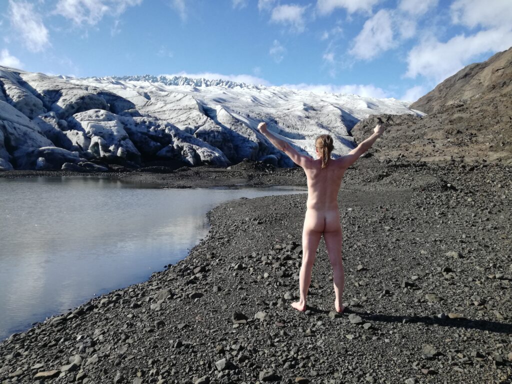
Enjoying the possibilities with no one else around.
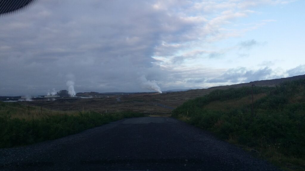
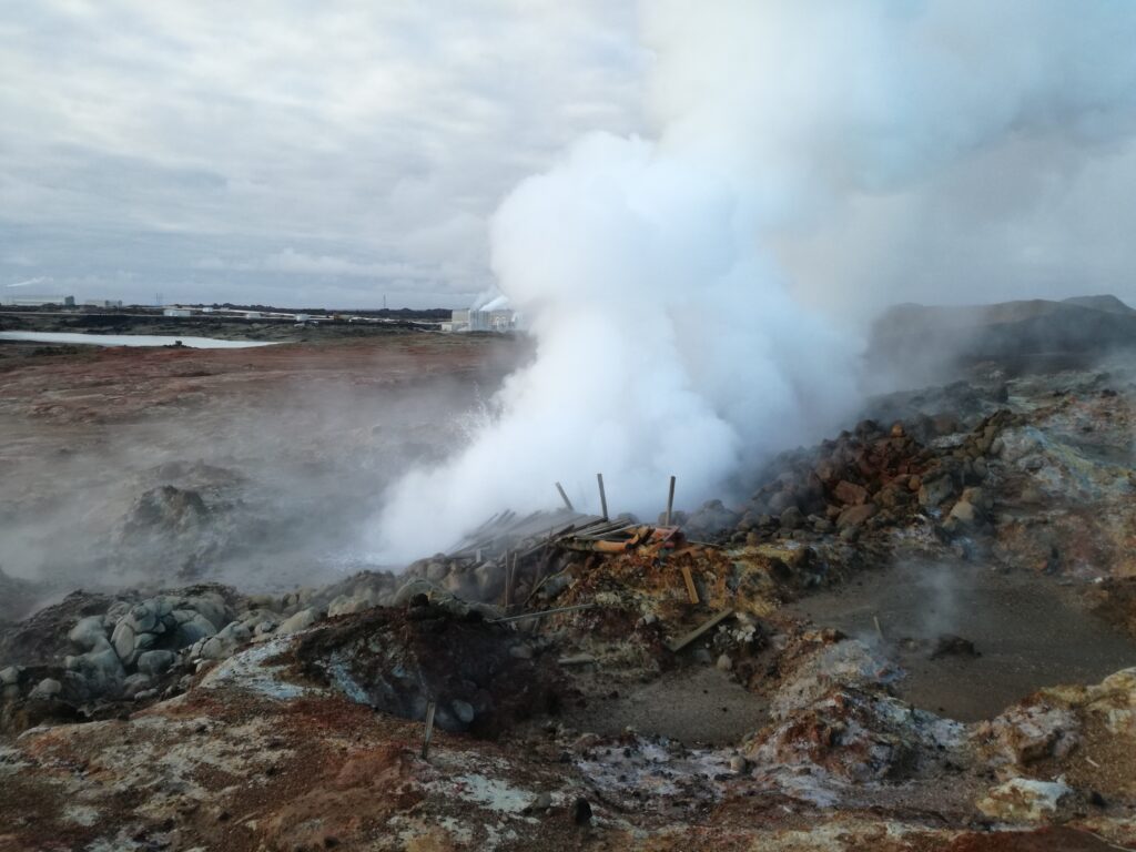
The name itself! Our association flies to warm countries and sandy beaches, and we are already looking forward to it. However, the origin of this very special spa is something as prosaic as wastewater from the large geothermal power plant Svartsengi (the Black Field). It is located in Reykjanes, not far from Grindavík.
Approaching a spa in Iceland…
A reservoir for wastewater was formed in 1976, and the natives discovered in 1981 that it was nice to have a bath there. The temperature was just perfect, including a delicate mud made of blue-green algae and silicon deposits. The warm water is rich in minerals, including silica and sulfur – which have a beneficial effect on the skin.
Jarðhiti (geothermal heat) at Reykjanes.
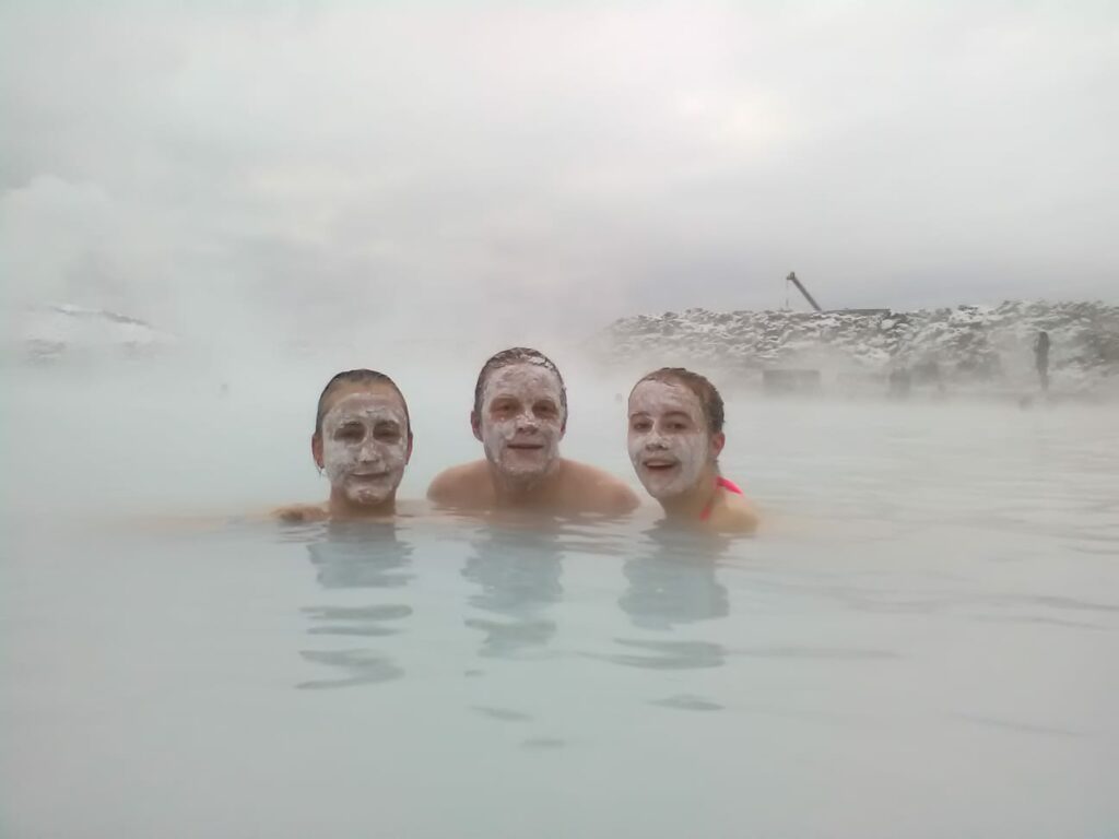
Today, this is one of Iceland’s biggest attractions – but yes! It is a wonderful experience to visit the Blue Lagoon (Bláa Lónið). The facility is large, quite expensive (the locals do not bathe here anymore), but wonderfully constructed. There are beautiful tiles, dark wood and lava stones surrounding the basin, and the nearby industry is almost invisible. The first bathing facility opened in 1987.
The baboon family. Foto: Une Hunstad Løwø.
There are many kinds of offers at Bláa Lónið if you want to buy something special, such as massage in the water, or treatment for skin diseases (psoriasis in particular). Or you can just take a bath and enjoy. Rub your face with light mud and let yourself float away in the warm water – this is delicious.
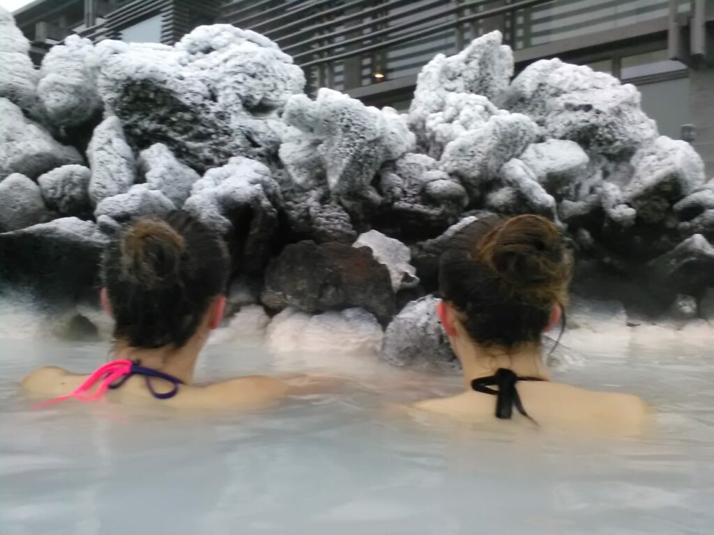
Our daughters Ulvhild and Une are having a christmas bath. Hot water and winther is an unbeatable combination.
A bath in Blue Lagoon is always right! Although we have seen people on Facebook recommending not to go, since you are swimming in wastewater…
Volcanoes are formed when the Earth’s crust cracks open so that magma and gas rise up from the Earth’s interior. From ancient times there has been speculations as to whether volcanoes were the way into hell or to the interior of the earth (ref Jules Verne and Snæfellsjökull).
On the way up to Saxhólar, Snæfellsnes. All bulk.
The word volcano comes from the Roman god of fire; Vulcanus. 25 km north of Sicily is a volcanic island with the same name (Vulcano). The ancient Romans thought this was the chimney of the God of Fire’s forge. When Volcano Island erupted (increased), it was because Vulcanus cleared the forge of various slag and ash. Earthquakes were explained in the same way; they happened because Vulcanus hit his anvil while making weapons for the God of War: Mars.
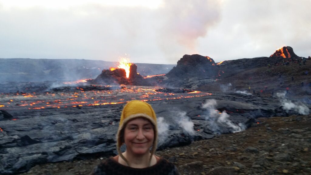
Fagradalsfjall 2021. This is where the God of Fire runs crazy. We saw 7 ongoing fissures at the same time.
Counting volcanoes in Iceland quickly becomes a problem of definition. Where is the border between the one and the other volcano? Some people argue that Iceland has around 130 volcanoes. But scientists usually list only 30 volcanic systems.
The volcanoes at Heimaey, Vestmannaeyar. Eldfell on the left erupted in 1973, while Helgafell has been quiet for 6,000 years.
The shape of the volcano is determined by what comes out of it (thin, viscous, crammed or ash), and how fast it happens. In general, the volcanic eruptions become somewhat less explosive and more fluid in the spreading zones, i.e. where the continental plates move away from each other, such as in Iceland.
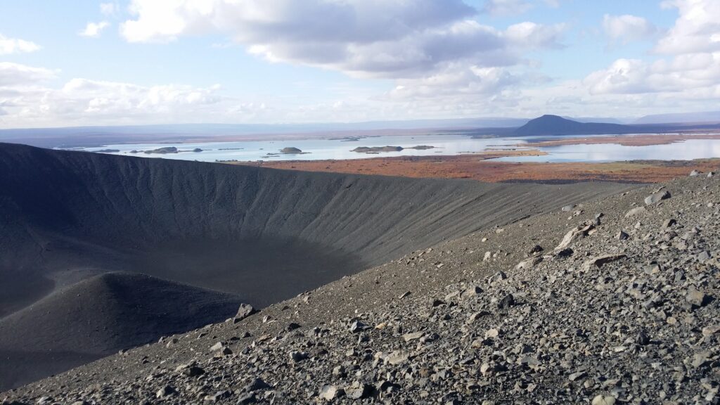
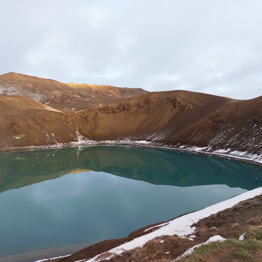
Hverfell, a 2,500-year-old tuff volcano, with Mývatn (Mosquito Lake) in the background.
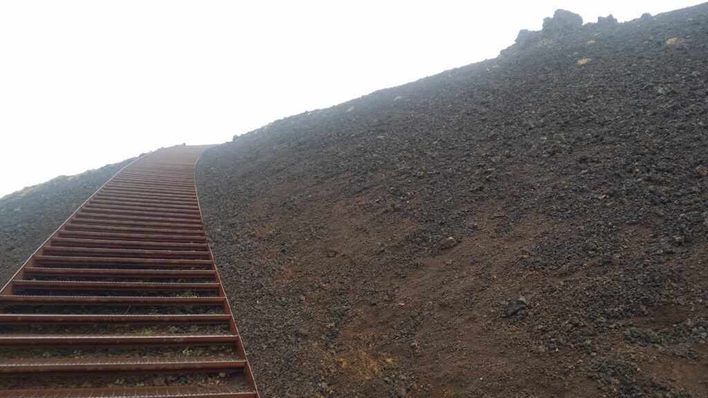
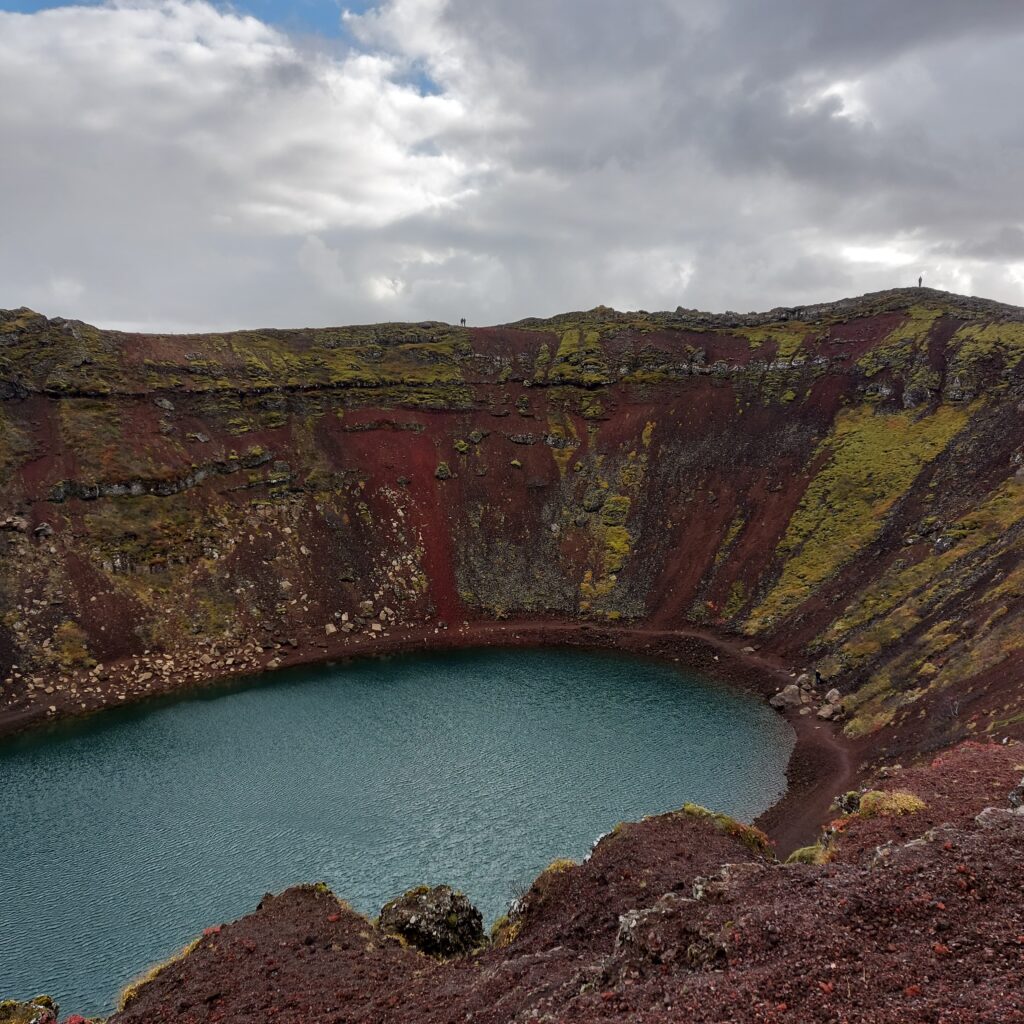
We had made a couple of attempts to Icelandic volcano baths, but it was not easy. First of all, water is needed for bathing, and most craters do not have volcanic lakes. When the volcano is built up of smaller rock particles, tuff and tephra, the water will drain away and the crater will remain dry. The second problem is access, the crater edges are often steep. But finally we found a good candidate – Kerið, which lies in the fissure zone between Reykjanes and Langjökull.
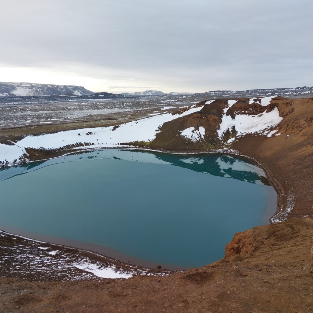
Kerið. The wonderful, red color comes from the fact that the eruption took so long that the iron in the magma had time to oxidize.
Kerið is a caldera crater, formed approximately 6,000 years ago. A caldera is a kind of a sinkhole that forms when the ‘roof’ of the magma chamber collapses after the magma chamber has been emptied. The water depth in Kerið varies between 7 and 14 metres, depending on the groundwater level in the surroundings. Nice place!
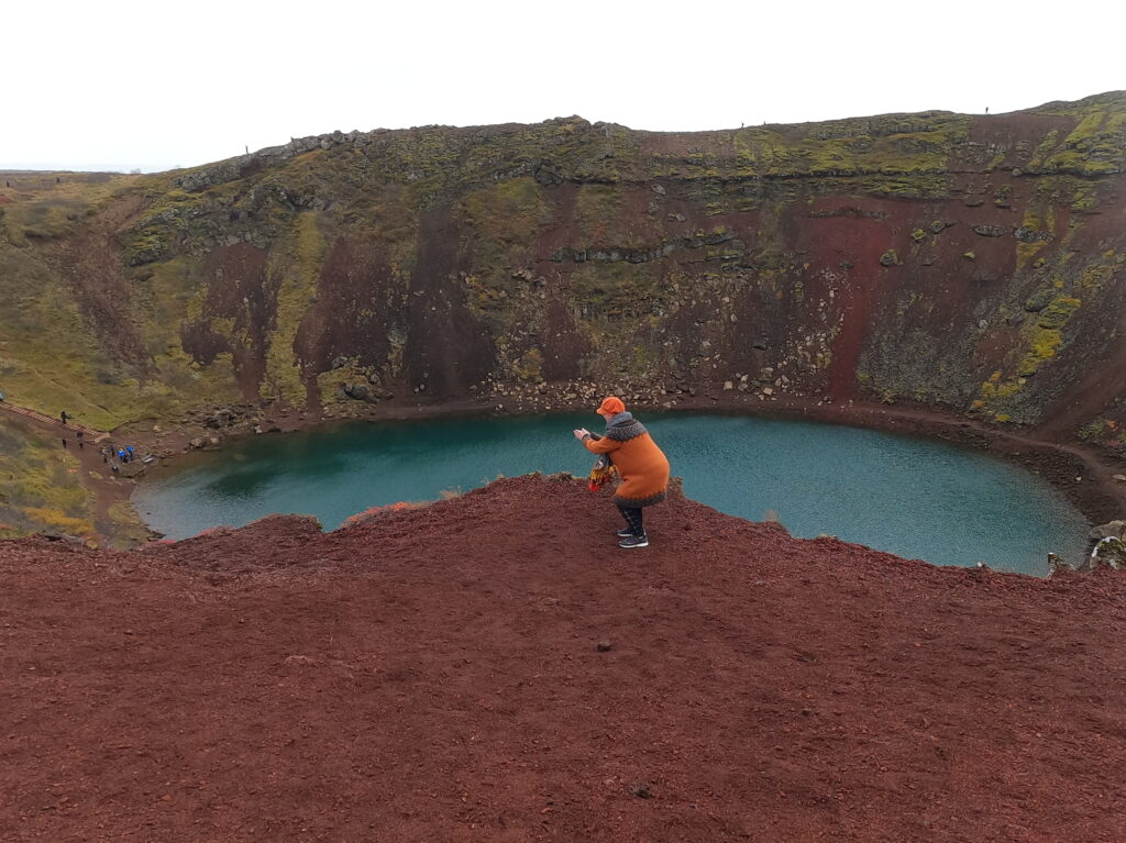
Time to dive in!
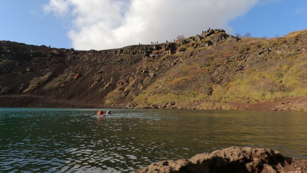
At Kerið, the landowners have made stairs down to the sea (there is a small fee to visit Kerið, but that’s absolutely ok in relation to the effort they have actually put in to facilitate the visit). There is a path along the crater rim, and a path down by the water, too. They have even installed a lifebuoy. So then it’s just a matter of getting started – right? The only small ‘but’ would have to be that at Kerið you can’t expect to be alone. But for us that was not a problem, so then we just jumped in. A splendid vulcano bath!
Even though other people were present, we had the lake for ourselves.
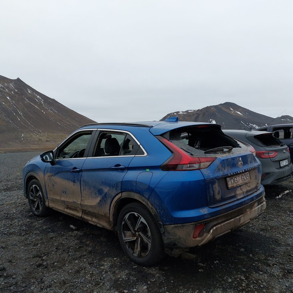
We had read about an absolutely magical, blue volcanic lake called Víti (short form of Helvíti), and there we had to try to get a bath. Helvíti is a combination of the words hel (“realm of the dead”) and víti (“punishment” or “ban”). But things don’t always go as they should. A week ago, Iceland experienced the strongest storm in many, many years. We thought about going up in the mountains, but since there were danger warnings everywhere, we chose a lower route, and spent the night at Mývatn instead. That was a good choice! A lot of tourists chose wrong and became stuck in the storm. The cars were peppered with gravel and pebbles in the strong wind, and more than 70 cars had to be salvaged and/or abandoned at the small cafe Beitarhúsið. What a Hell!
Hard to be a car in an Icelandic stone storm.
How lucky, that they could stay safe in the cafe, you might think, but it wasn’t that easy. We were there a couple of days later, and all of the windows had holes!
Beitarhúsið was open 2 days later. Maybe the plan wasn’t to be quite that open?
A couple of days later, however, it was just fun to drive over the mountain, and we arrived the Krafla area in the afternoon.
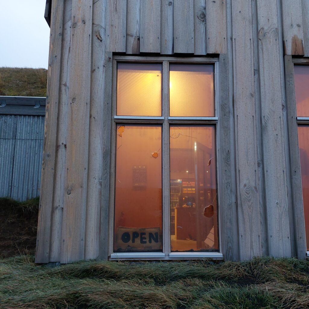
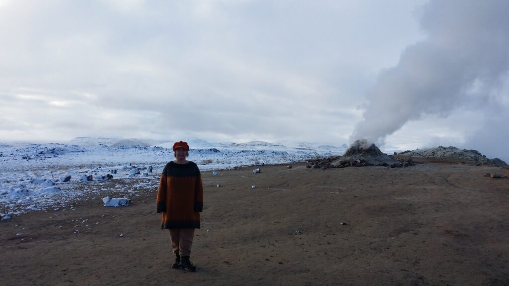
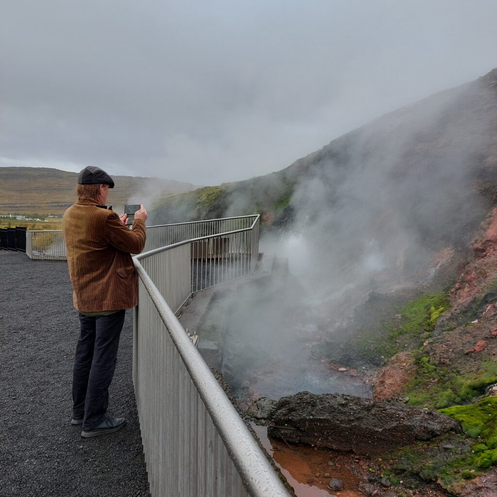
Just off the exit you’ll find Hverir, a sulphur-mud-steam-hell that you won’t forget unless you have a heavy flu (or COVID) upon arrival…
Idun enjoys life in the sulfur vapor at Hverir.
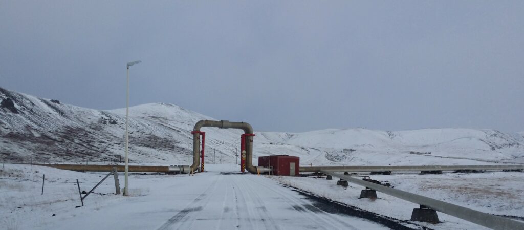
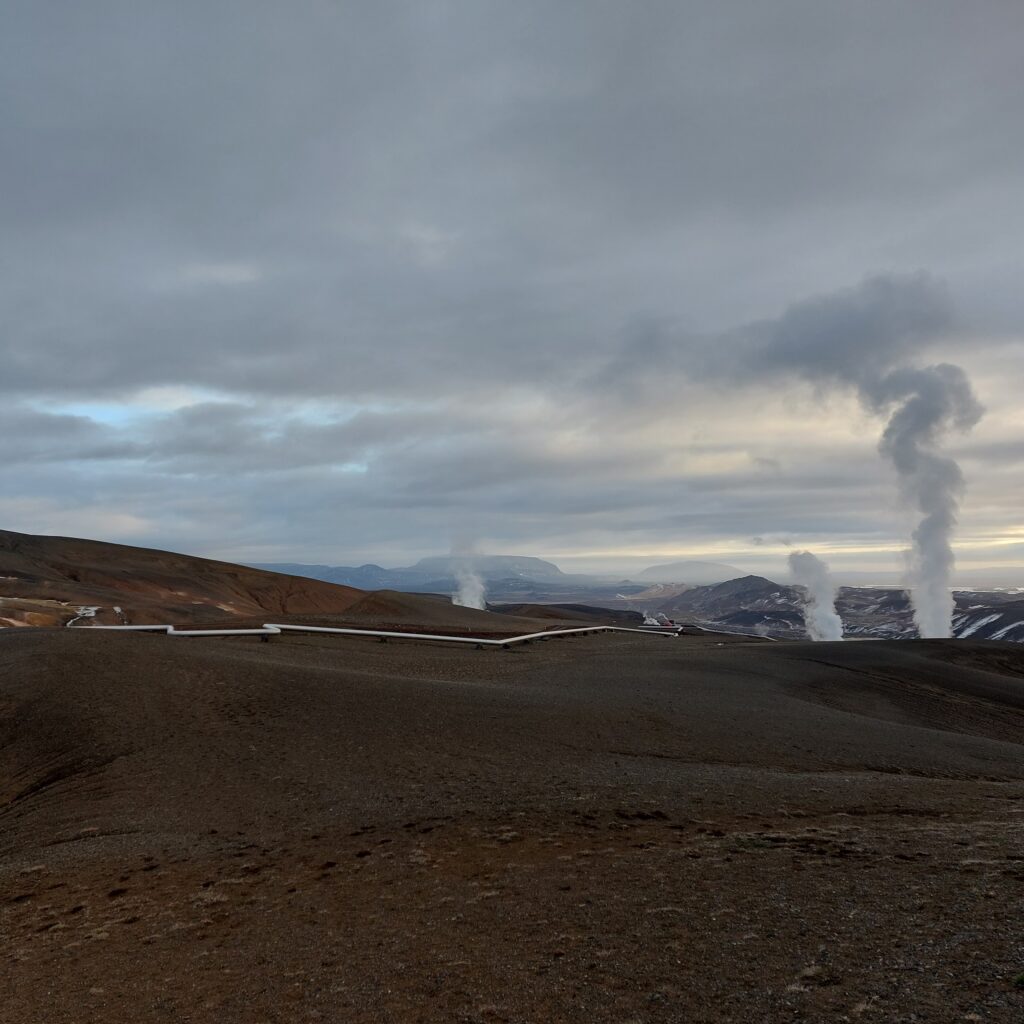
Krafla is the Mývatn area’s main volcano, and the highest peak is 818 m above sea level. The last eruptions were in 1975-1984. The heat at Krafla is used in a 60 MW geothermal power plant, Kröflustöð.
The piping portal at the Kröflustöð power plant.
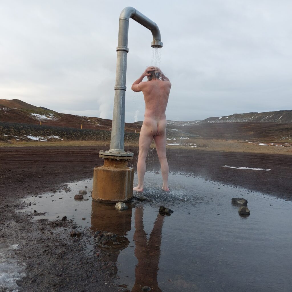
Before you arrive in Krafla, you are met by a hot shower in the middle of nowhere. Knut threw himself into it immediately. When entering any Icelandic bathing resort, you should ALWAYS shower and wash yourself first – without swimwear. So now Knut was ready for a bath in Hell.
Correct showering according to Icelandic bathing rituals.
Then there was only Víti left. We have tried before, but had to drive backwards down again due to snow and summer tyres. This time we basically had no problems. And at least Knut had prepared by having a shower and everything.
Víti. What a water color!
But it wasn’t that simple. Prohibited to go off the path? No path down to the water? It was very steep there. And snow…
Víti. Steep and forbidden and snowy.
Víti became a ‘don’t’ bath. But now a few days have passed and we’ve got time to think it over a bit. And some Googling. It turns out we’ve been on the wrong Víti! The Víti that has 25 degrees Celcius water readily available is Askja-Víti, not Krafla-Víti. Sad to know, but that’s how it is. We won’t be able to visit Askja this year.
View from Krafla-Víti. Wonderful stress loops.
However, for a lady who has been doing piping design for approximately 10 years, it was beautiful to see the pipe stress loops at Krafla…
Húsafell is a so-called ‘populated place’, and former priest’s seat in Borgarfjarðar county, which has fostered several personalities and artists. The farm, approximately 100 km2, was a pioneer for the transition from farming to tourism. And it seems to have been veeeery successful, as the farmer has had enough money to buy his own plane and to make his own airstrip (it is less than 2 hours to go by car to Reykjavík)…
Húsafell, the valley seen from the side.
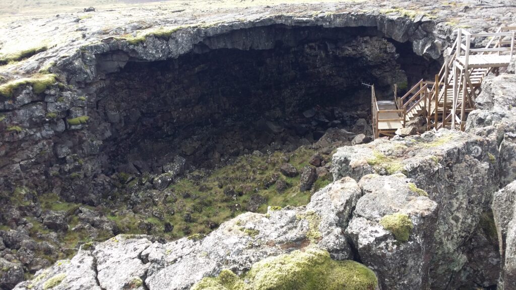
In addition to Langjökull, there are several spectacular tours in the Húsafell area. One opportunity, which we took during the corona, was to visit a lava cave. The longest lava cave in Iceland is Surtshellir (Giant Surtur’s cave) almost 2 km long, while Víðgelmir is the largest (and widest, hence the name). It is still not short, 1.5 km is just fine.
Lava caves are formed when liquid basalt flows out of a volcano and forms a river of molten rock. The sides and top of the river will eventually cool down and solidify, while the river continues to flow in the crust, as inside a pipe. When the volcanic eruption stops, the lava flows out of the ‘pipe’, and what’s left is an empty cave. The volcano that formed Víðgelmir is located 33 km away, and was under Langjökull.
Víðgelmir. The cave roof has collapsed and forms a natural entrance, the only one.
Víðgelmir was formed during a volcanic eruption around 930 AD, i.e. at the end of the Conquest Age. In 1993, bone remains and human belongings were found in the cave, dated 983-986 AD. At that time the cave was still warm, about 20 degrees. No wonder it was nice to live there in the Viking Age. House with central heating fixed and delivered by nature! A (pagan) poem has been written about this volcanic eruption, Hallmundarkviða. Most likely by someone who actually experienced it (!), and Þorvaldur Holbarki (who is mentioned in the Book of Conquest) is a candidate. It is said that he went up to Surtur’s cave and killed the giant that lived there. The trip inside Víðgelmir was both great and interesting. However, our cameras did not cope well with the darkness, so we have very few pictures. The cave was, however, more colorful than expected, and there are both stalagtites and stalagmites, although much has been removed by ravenous visitors. And then there was the fact that the walls looked like melted chocolate…
Unfortunately, there is no water in Víðgelmir, so there was no lava cave bathing. But after a cave trip, time is just right for a bath, and we would suggest a warm bath this time (since the cave is now actually cold). Húsafell Canyon Bad (Giljaböð) from 2019 is a spectacular alternative.
Giljaböð (The Gorge Bath).
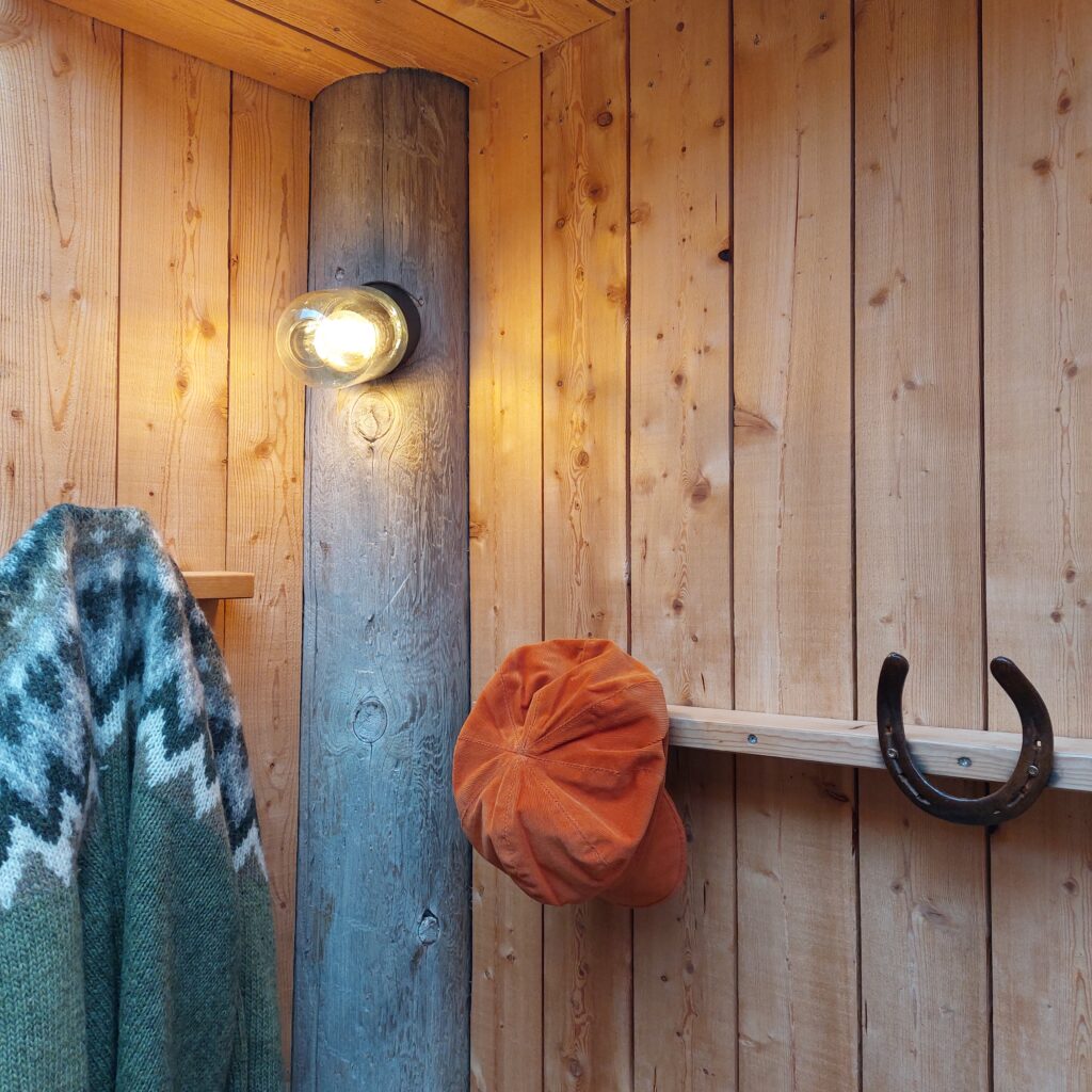
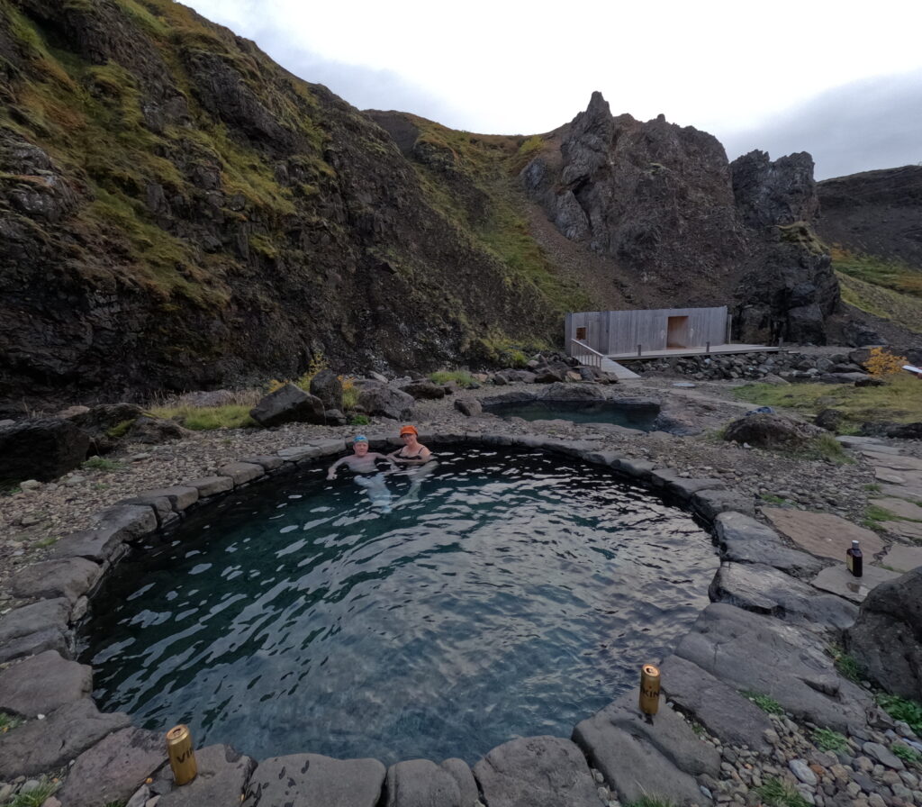
You are transported to the canyon in a minibus, max 20 people (we were 4), and here the farmer Unnar Bergþórsson has really put in a lot of effort to make it all happen. To find hot water, drilling had to be done. And he drilled and drilled, and found heat 8 times, without water. You have to have water in the baths, and luckily he hit the rigth spot on the ninth attempt. Here he found a spring that delivers five liters of 47°C water per second. After 200 m of transport, the water flows into the hot pot at the perfect 39-41 degrees. In Giljaböð there is rough reuse and funny details. We fell for the pegs, made of used horseshoes.
Gentle reuse of horseshoes.
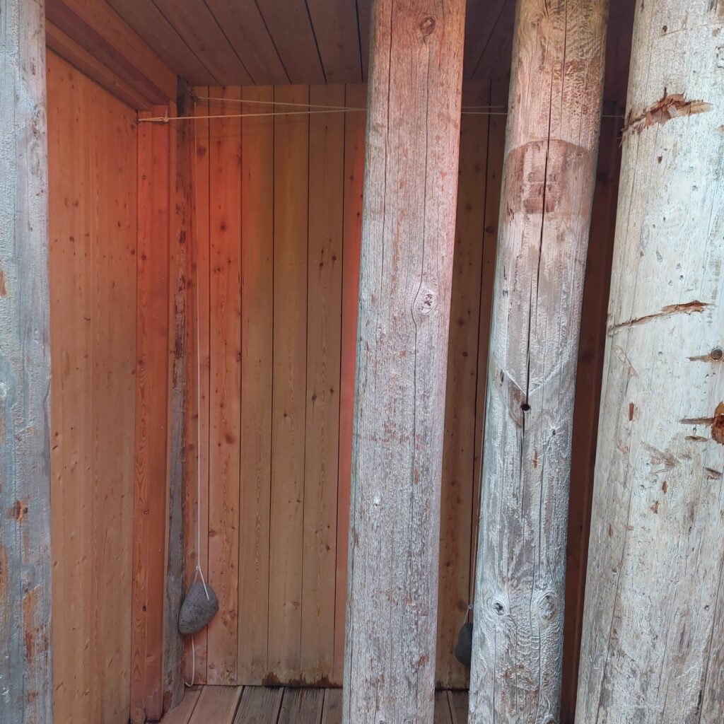
And then there were the closing mechanisms for the doors – a stone and a pulley. Cool!
Door closer with elegant, old technology.
A great bath! Correction, 3 very nice baths. One was down by the river side and had the river temperature (around 10 degrees).
Rather cool
The other was constructed to simulate Snorri Sturluson’s bath at Reykjholt. And it was just right and just a perfect temperature.
Bathing in style, like Snorri himself
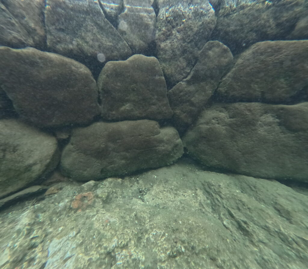
If you want to build a bath like this, you need to know how to put one stone on top of the other. Luckily, they had a local stone stabling expert, as you can see from this underwater picture.
Puzzle without prefactured pieces
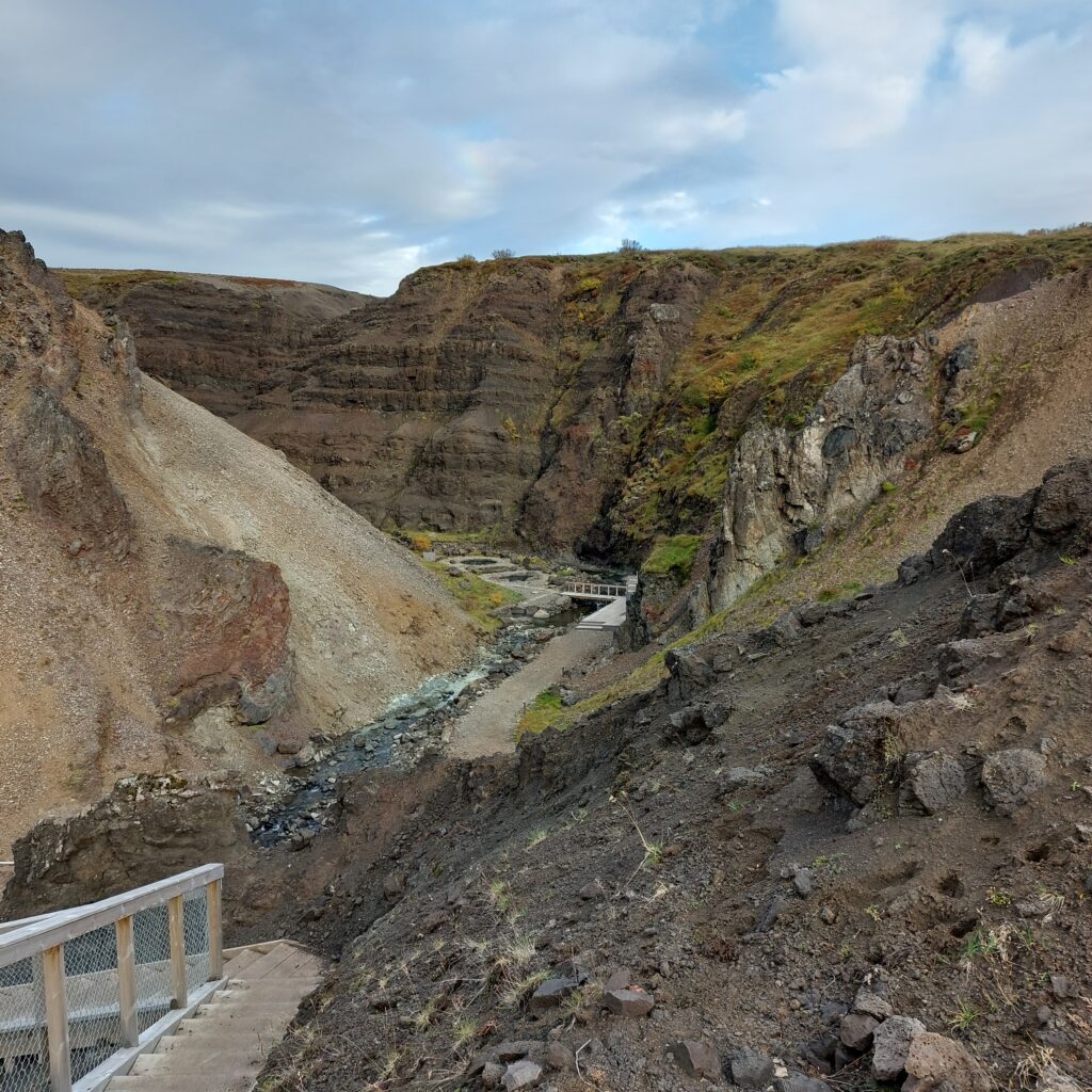
While lying in the bath, you can take a look at the pebbles around you. There are many different stones here. The baths are located in the middle of what was the magma chamber of the 2.5 million-year-old Húsafell Central Vulcano. Small conglomerates are from the magma chamber, but otherwise much of the old volcano has been dislodged into the sea by the ice ages that followed. And then a small river dug and created the beautiful Hringsgil (Ring Gorge), where the baths are located today. Welcome to Giljaböð !
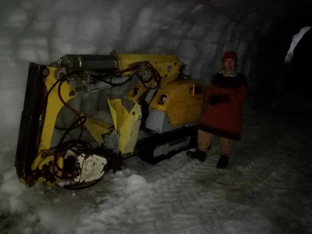
Iceland has more than 400 glaciers. Vatnajökull is the largest one, while Langjökull is number two. In Langjökull, a very special tourist attraction has been created: They have dug tunnels in the glacier, so you actually can walk inside it. Correction: They dig tunnels every night – with a mini excavator, otherwise the tunnels will be flattened in no time.
Mini Ice Excavator.
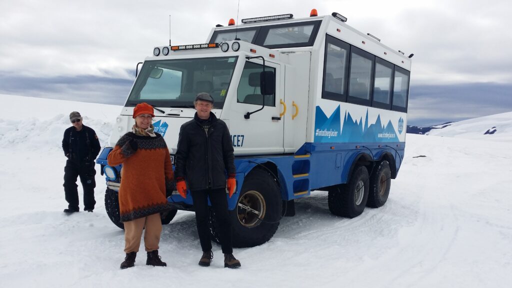
We took the glacial tour in 2020, during the corona, and the number of visitors were very low. The whole trip is spectacular: You are driven in special minibuses, with large tires that can be filled or deflated depending on whether driving on road or on ice. On the glacier, they release air from the tires so that the car can float on snow. Then a bumpy ride starts, on the ice, where next to the ‘road’ you can see crevasses here and there.
A minibus that goes equally well on land and on ice.
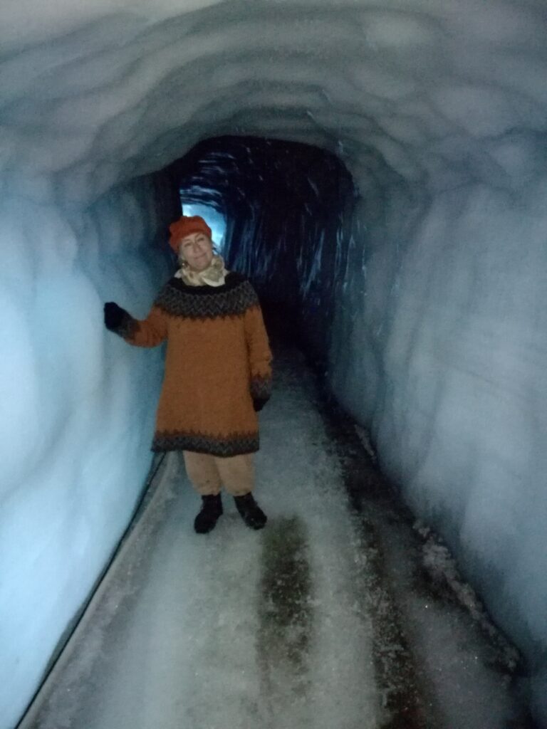
Once inside the glacier, you put on ice crampoons, and then time is just right for enjoying the moment in a completely foreign world.
Strange to be inside a glacier!
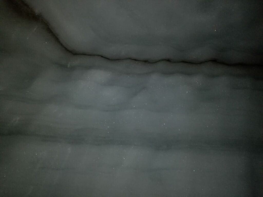
The glaciers are formed from snow that is deposited layer upon layer every winter. They are therefore a chronological journey through time, and studies of glacial ice can tell a lot about the conditions on earth a long time ago. We could see ‘annual rings’ in the ice, and a clear black stripe contained ash from Eyjafjallajökull’s eruption in 2010.
Eyafjallajökull’s eruption is clearly visible inside Langjökull.
The Italian news consequently referred to Eyaflallajökull as ‘Il vulcano con il nome impronunciabile‘ – The vulcano with the impronunciable name.
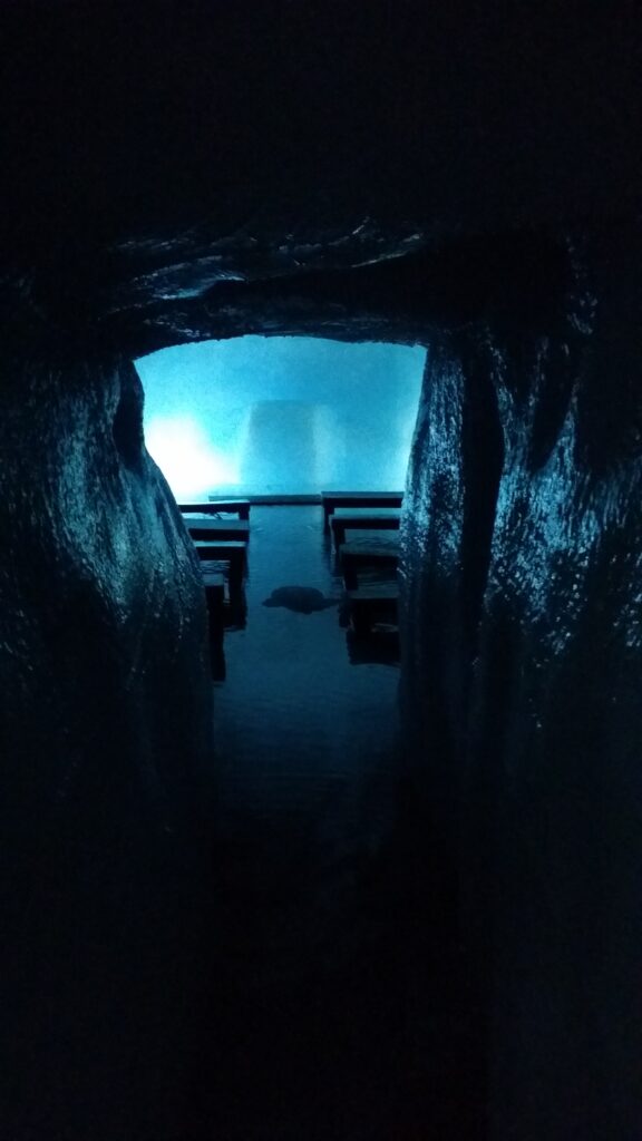
The ice tunnels covers a total of 800 meters, and there are several rooms that have been excavated. You can get married inside Langjökull! Our guide entered the ‘cathedral’ alone and sang for us. The acoustics were incredibly in the ice.
The Langjökull cathedral.
Water is a big problem in Langjökull, it flows everywhere. If it rains outside one day, this is noticed as an increased amount of water inside the glacier 3 days later. Here and there there are crevasses, in one spot they had built a bridge over. Another crack went down from the tunnel wall. They used it as a drainage – and this drain roared like a troll! Because of this, our 3-years old British companion cried of horror all the way out.
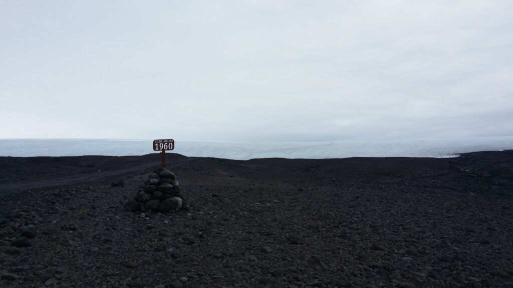
The Icelandic glaciers are in decline. If the trend continues, they will all be gone by the year 2200. This was easy to see near the glacier, where they have put up signs showing the glacier limit in previous years.
It is a while since the glacier reached here.
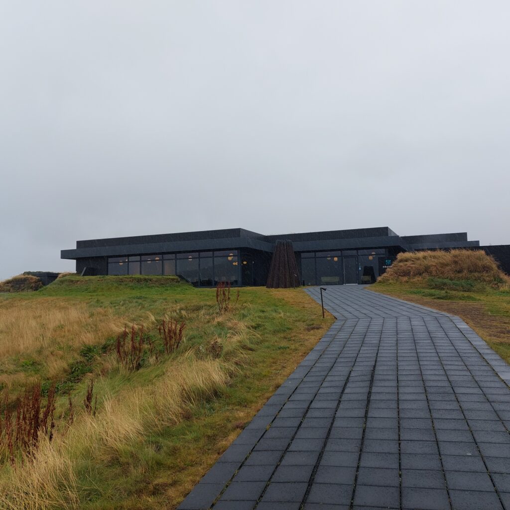
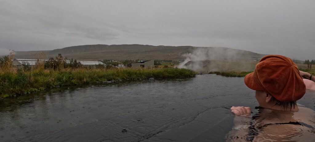
After a glacier expedition, time is just right for a bath, and preferrably a warm one. We went to the Krauma spa. This bath gets its heat from the hot spring Deildartunguhver. Here, 180 liters of boiling water flow per second! The spring heats the villages of Borgarnes and Akranes, which are up to 100 km away. Krauma opened in 2017.
Deildartunguhver.
Krauma is an absolutely beautiful facility, almost entirely black. Wonderful!
Krauma spa.
A bath or three at Krauma is just right. They also have a small ‘cold pot’, for those of us who like to alternate between hot and cold baths.
Nice view of the valley and the steam
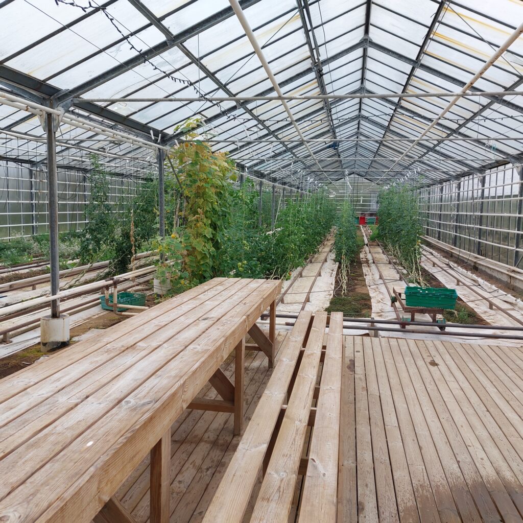
If you need something to eat before driving on, you can buy food at the kiosk by Krauma. The meat soup is very good. But this is not lamb soup, here they probably cook it on the ewe itself. And the soup, it is to be consumed in the greenhouse!
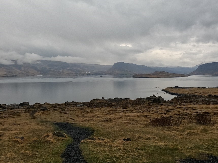
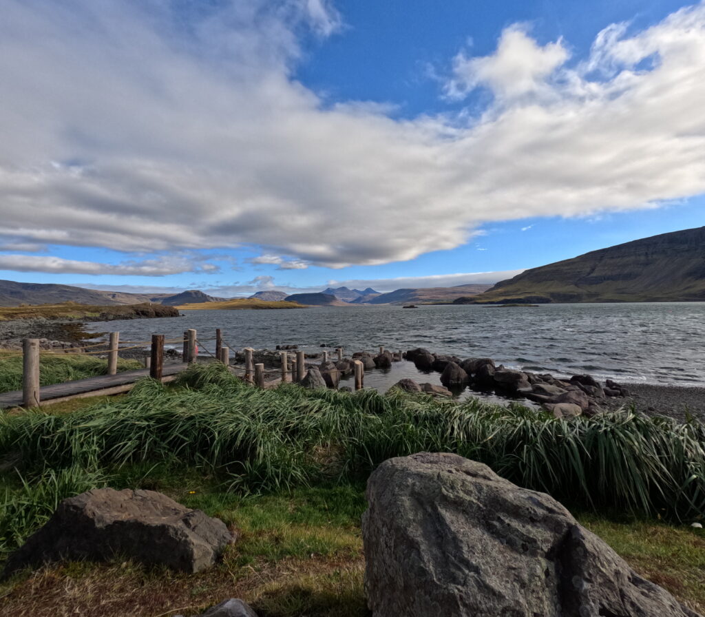
Hvalfjörður has a history dating back to the conquest period, and is mentioned in the ‘Book of Conquest‘ (Landnámabók). The name most likely comes from the fact that there were walruses here when the Vikings arrived.
View from Hvammsvík (in the south) towards Miðsandur (in the north).
The area experienced a tremendous rising during the Second World War, when the Allies stationed 40,000 soldiers here, and up to 200 ships filled the fjord. Code names for Hvammsvík were ‘Falcon Crest’ and ‘Falcon Beach’
WWII architecture at Miðsandur.
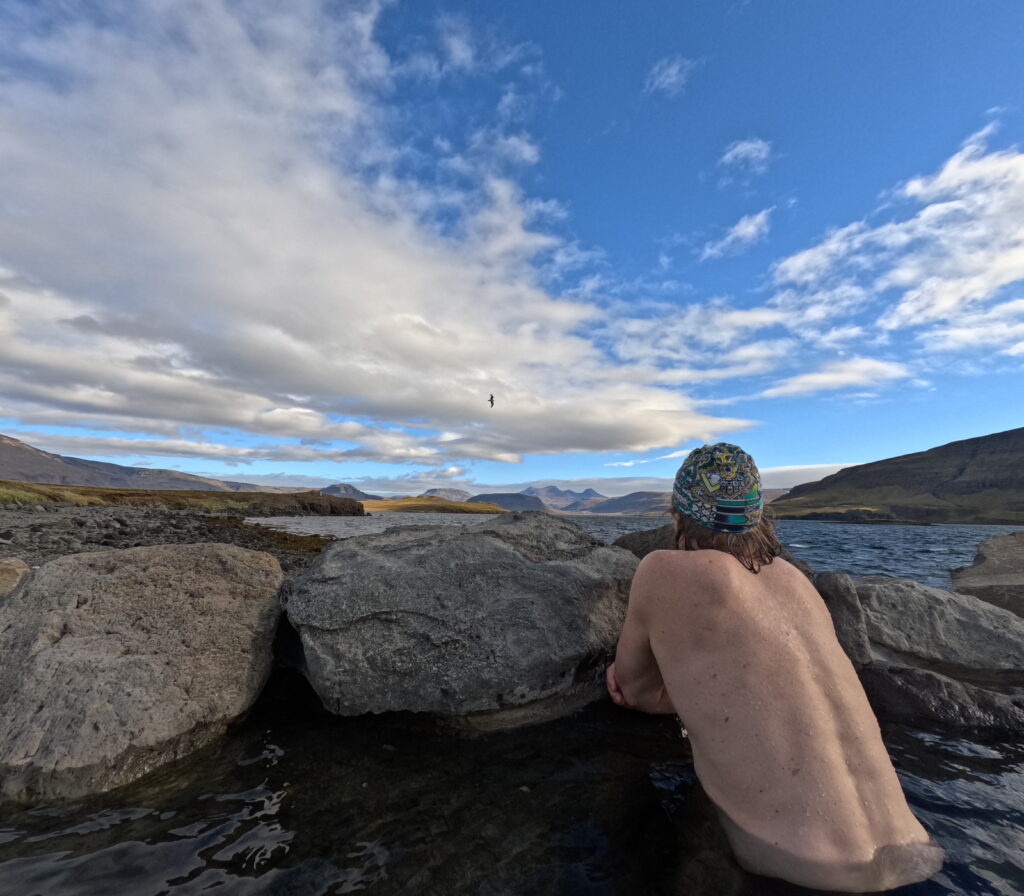
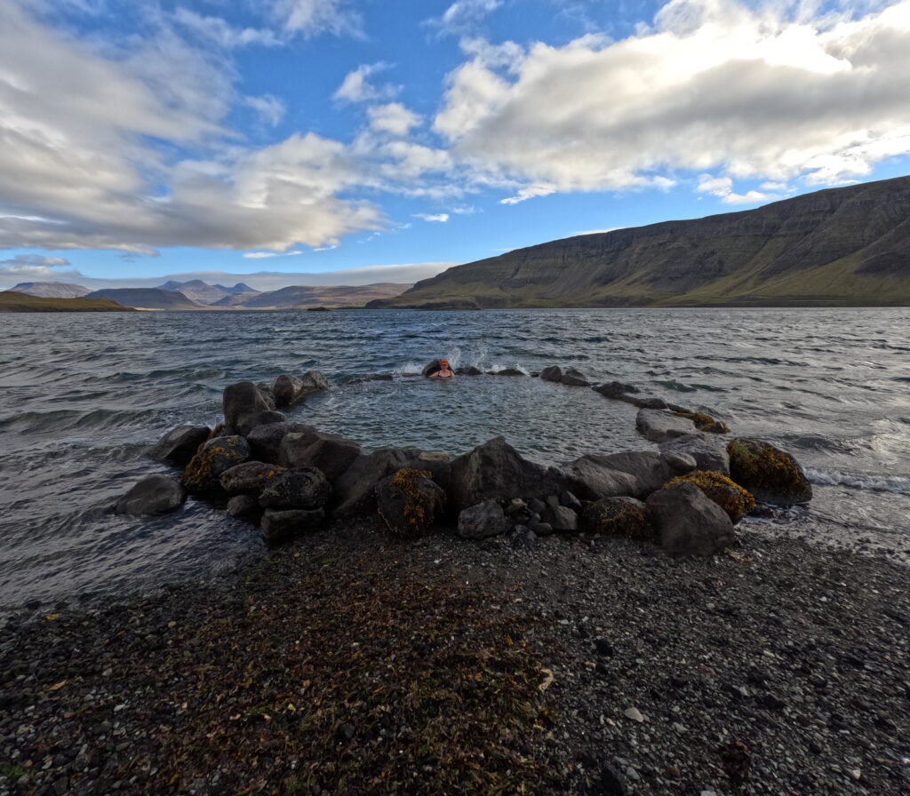
In Hvalfjörður there is smoke everywhere! Hvammsvík was a hidden gem for a long time, a hot spring used only by the locals. A bath in this hot pot could be quite an interesting experience. Firstly, the landowner did not want traffic on his land, and closed off the road, it was private. But it didn’t help much, because the pool was right down on the beach, and the common law accepts walking by the sea. It was therefore ok to park the car by the highway and go down to the beach to bathe. The other exciting part was the hot pot itself. It was built up in the simplest way, and the hot water came unfiltered and unregulated into the tub via a hose. Sometimes in just perfect temperature, sometimes way too hot. Here you just had to be careful! One solution was to take the hose out of the pool during bathing, to avoid scalding.
Bathing in the original pot.
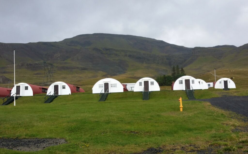
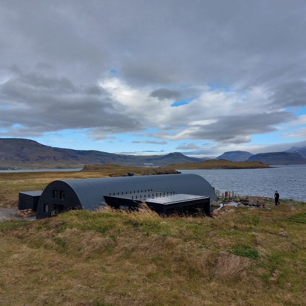
Now everything is different! We were in Hvammsvík at the end of September -22, only two months after opening. This is great! The building is constructed in typical corrugated iron aesthetics a la WWII, but in black. The foundation is reuse of a barracks foundation built by the Allies during the Second World War. It’s rough, it’s tough and very stylish.
Rough corrugated iron architecture in Hvammsvík.
There are a total of 8 warm pools in Hvammsvík, of which one (the furthest one, at the top) is the old, original one. Another pool is situated just above sea and is flooded by waves and tides. It’s not hot there when the high water splashes over, but fun!
Rather splashy at high water.
A bath or nine at Hvammsvík is just right! We assume you can guess where the ninth bath is?
Some baths are colder than others.
After some baths, a gufubað (steam sauna) can be just right. And at Hvammsvík we found the most wonderful steam room we have ever seen. It was big. It was dark (like entering a cave). It was fresh in the air (smell of conifers). It had wooden benches. And it was very, very hot. Recommended!
And if you get hungry after the bath, they have some really good dishes to serve as well. Welcome to Hvammsvík!
A visit in the restaurant is just right after a bath or nine.
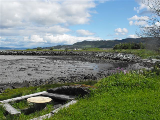
East of central Trondheim, between Nedre Charlottenlund and Ranheim, is Grilstad. Originally this was only a farm belonging to the Archbishop of Nidaros, named after an old river name: Grýtla. The name comes from ‘gruvla’ which means to dig or mess up. A sausage factory, Grilstad factories, was built on the farm in 1957, which is still in full operation. Below Grilstad farm there was a fine shore which has been planned to be developed since the 1960’s. However, the plans were put on hold due to high costs and a lack of filling material.
Grilstadbekken (Grilstad river) has an outlet at Grilstad coast. Photo: WikiStrinda
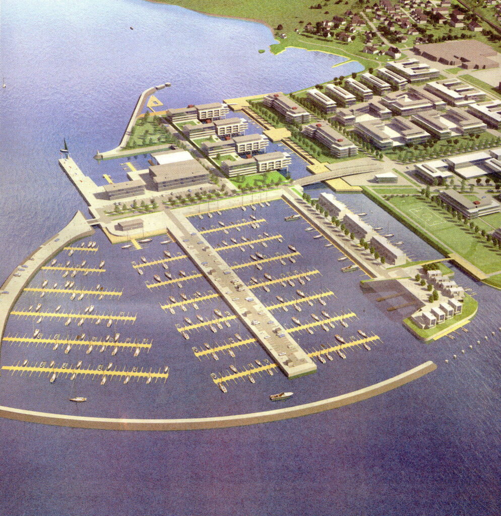
The construction finally started in 2005, with filling material from the Strindheim tunnel project. Grilstad Park is planned with 1,000 residential units, 110,000 m2 commercial buildings, and in addition Grilstad Marina, a harbor/pier with 800 boat berths.
Grilstad Marina, the prospect. Photo: WikiStrinda
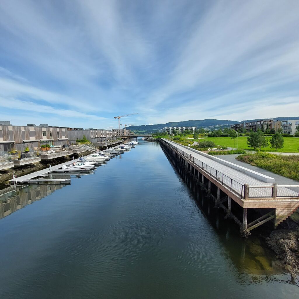
This must be like paradise, you are probably thinking, with a beautiful and peaceful sea panorama. A quay has been built close to the filled-in islands. On the land side there is a sand volleyball court, barbecue grills, benches, lawn and plantings. Great!
Indre Kanal (the Inner Channel) with the quay.
Oh no, it’s not that simple. The bathing area has become too popular. Young people come there to have a bath. They make noise. They jump into the water from the bridge. Ugh! That’s not how we like it!
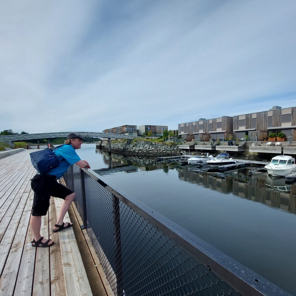
Knut is inspecting a popular, but oh, so noisy, bathing place.
We visited Grilstad in July, and there were no young people there. None! Had they all gone on vacation? Or did it really work to mount a 100 meter long fence along the quayside to prevent bathing in the canal? The matter has, following complaints from the residents, been up for debate in the City Council repeatedly. The argument for a bathing ban has been the safety of bathers. Of course, you have to bring up safety, you can’t argue against that. Or can you? The debate concerns 100-150 meters where there could be a conflict between boats and bathers. There are about 20 boats that have their parking place there. What speed do you need to drive your yacht this distance?
We took a test bath. There was no fuzz, but we didn’t make much noise either. The water was nice and crystal clear, but it was low tide, we couldn’t see the bottom, and we didn’t jump. A great bath!
No, don’t laugh, it’s too noisy!
Swimming in Grilstad Marina is perfect, even though the ladder down from the quay was a little wobbly at the bottom.
Wobble, wobble
After a bath, food is always right. We ate at Flipper Kafe, on Fullriggerøya (Sailboat island). The sandwiches aren’t the cheapest, but that’s no wonder, because the portions are huge. And after the meal, to play shuffle board might be just right. That can be quite fun, at least for some of us.
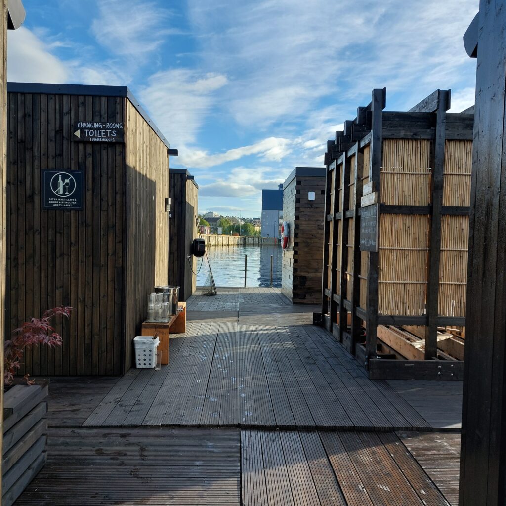
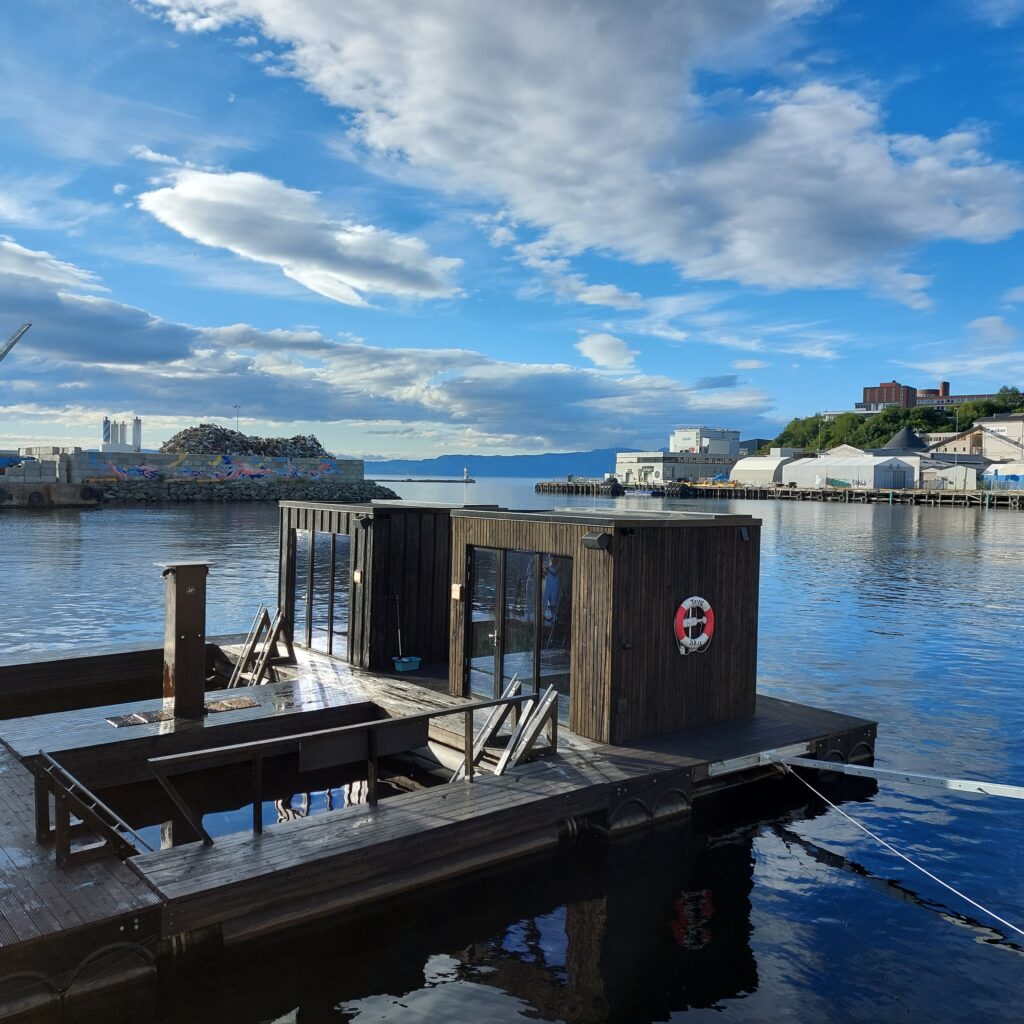
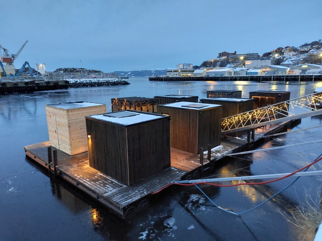
Nyhavna (the new harbour) in Trondheim has for a long time been ready for urban renewal. The industry is retreating, and the municipality wants to make Nyhavna a brand new district. Here, a mixture of offices, apartments, culture and artistic arenas is planned. One of the most positive things that has happened so far in this transformation is ‘Havet’ (The Sea). Just a short cycle ride from the center you have a varied offer for sauna bathing and swimming in the Trondheimsfjord.
There are many saunas at ‘Havet’.
The location is such that you have a varied view:
… towards the industry at Ladehammeren in the east.… towards the scrap dude (metal recycling) in the north.… towards Dora 1 (submarine bunker from WWII) in the west.
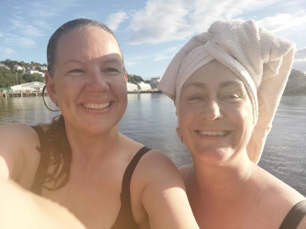
Alternatively, you can of course be the view yourself:
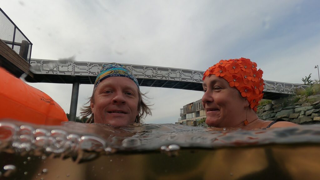
Kjerstin and Idun as ‘Bellaview, bellaview, bella ciao ciao ciao‘. Photo: Kjerstin Moseid Bryhni
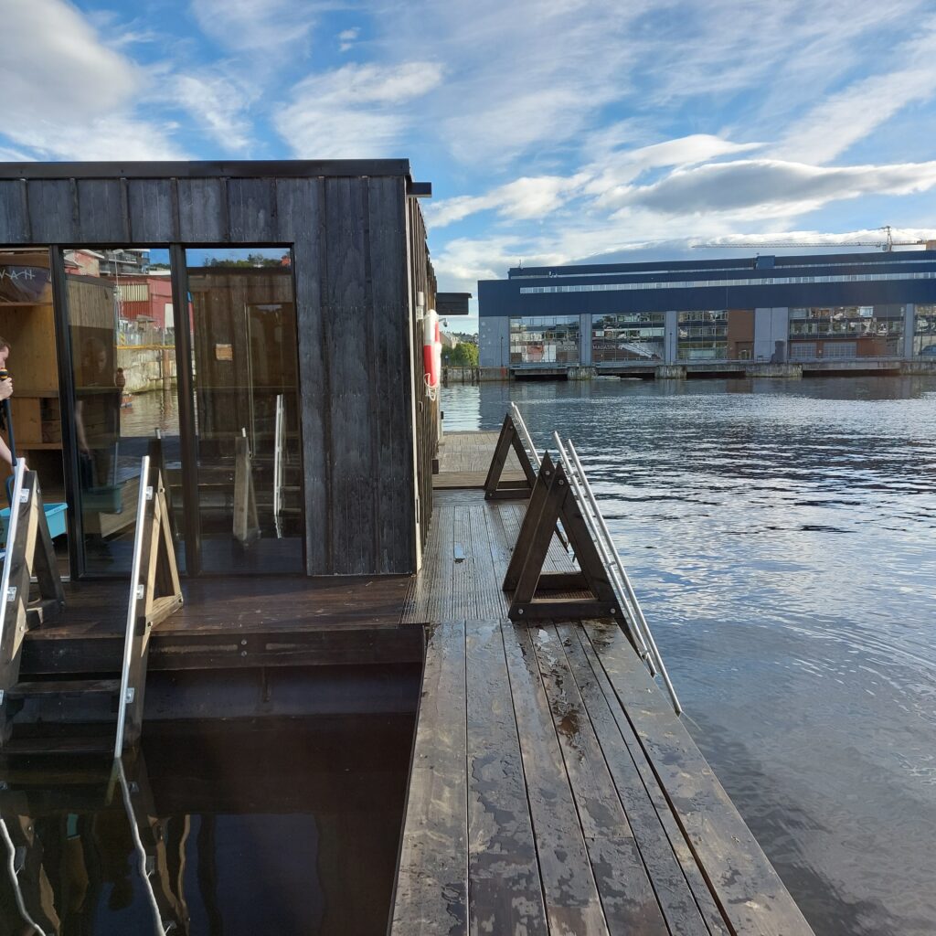
At Havet, you can book single hours or whole saunas for 2 hours. Try it! This is splendid! The furnishings (benches) are spread out in different levels and odd angles, you don’t have to sit in a row if you don’t want to.
Many different angles in the saunas.
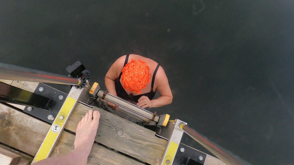
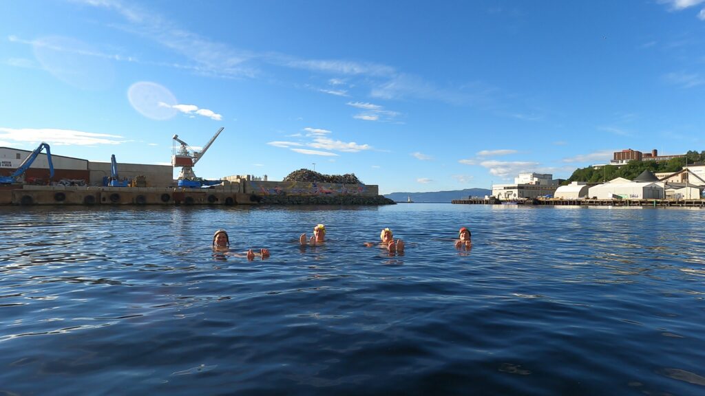
Cold baths are carried out in the openings between the saunas.
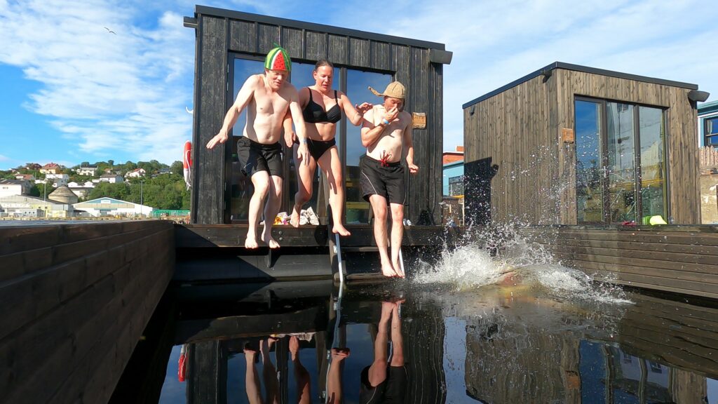
Yes! We are all really looking forward to this!
Some of us where missing some steps up to the roof, to be able to jump from there, as we have seen on other floating saunas.
A couple of hundred meters away, the municipality has built a diving tower in collaboration with Havet. There you can jump and swim for free. But it is just a little too far from the saunas to function as a common facility.
During ‘Kulturnatt Trondheim’ (Cultural Evening Trondheim) in 2017, there was a competition ‘What is your dream for Nyhavna?’ Our bathing friend Taru won, with the answer: Sauna. But she won by a lottery draw, the idea in itself was considered undoable both by the municipality and the consult bureau arranging the contest. But now they are here, a lot of saunas!
Thank you so much, Taru, for an absolutely brilliant idea! For once, it happened in Trondheim that all this came into place quite suddenly, without a long-term localization debate and a lot of back and forth.
Nice to float on the outside too.
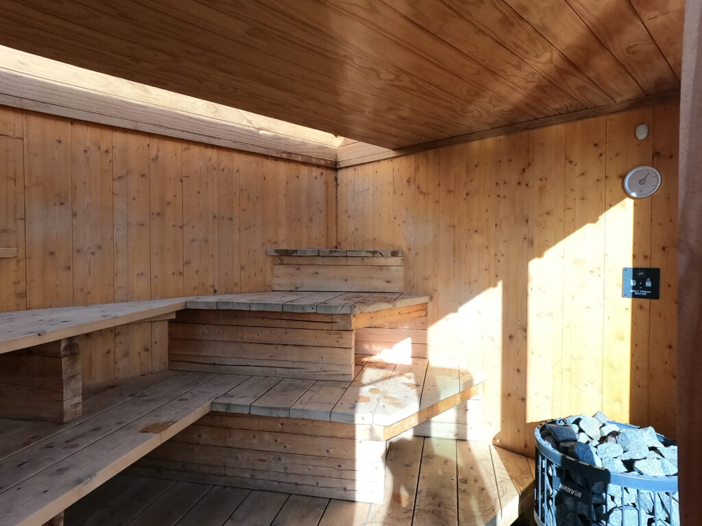
Our sauna had a ceiling partly made of glass. Imagine sitting here and enjoying the stars in the sky and maybe the aurora borealis in winter time?
Havet is nice in winter too.
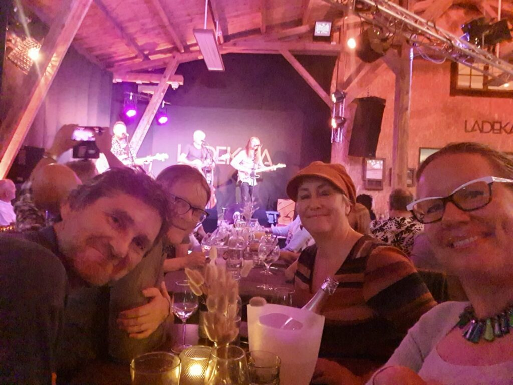
In not too long time, the sauna concert concept at Havet will probably start up again, and then you can experience a sauna and a concert – at the same time! However, we had do to the concert part another place and ended the evening at Ladekaia, watching Vømmøl.
Bathing and a concert the same evening is just right! Photo: Kjerstin Moseid Bryhni