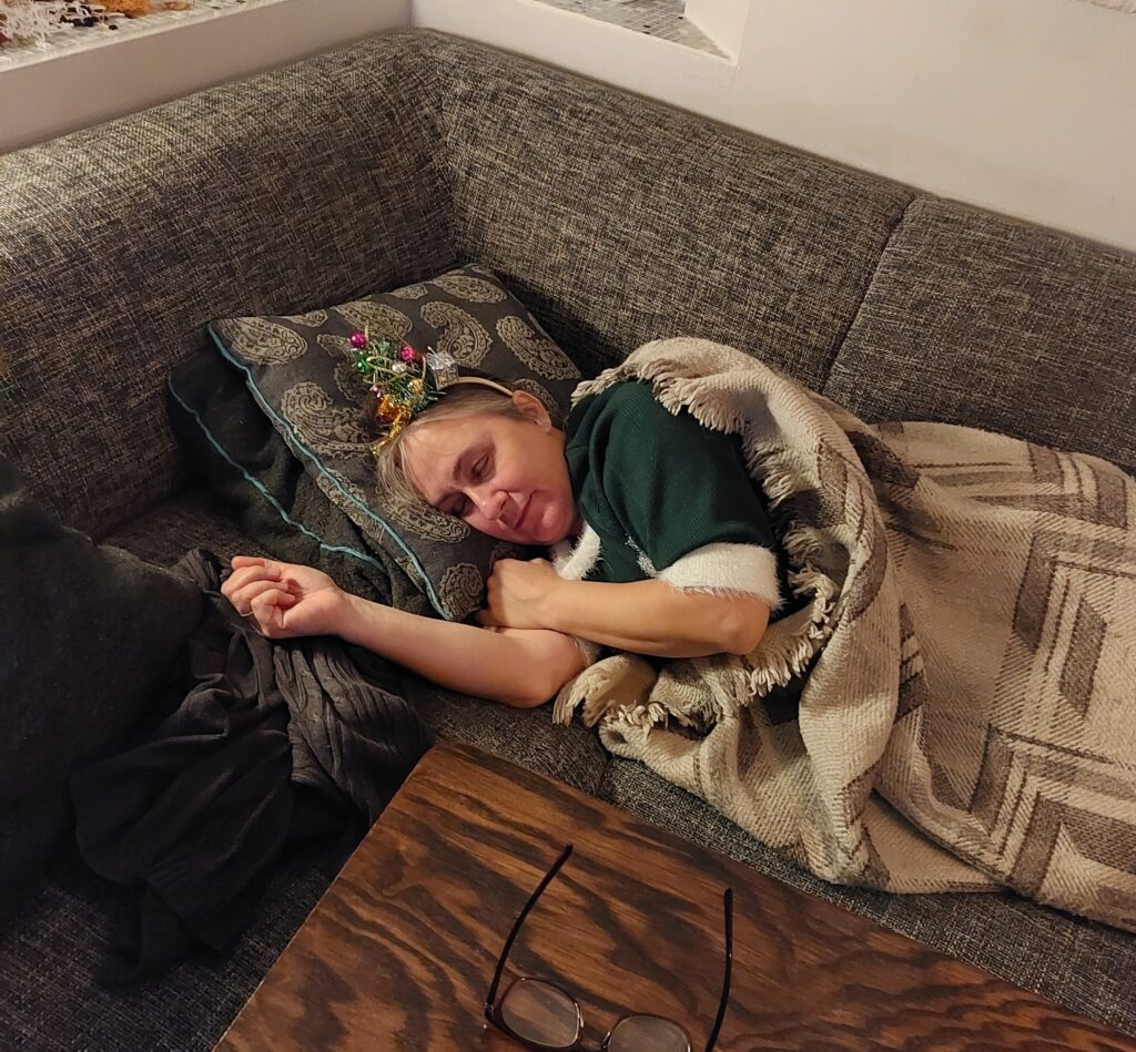
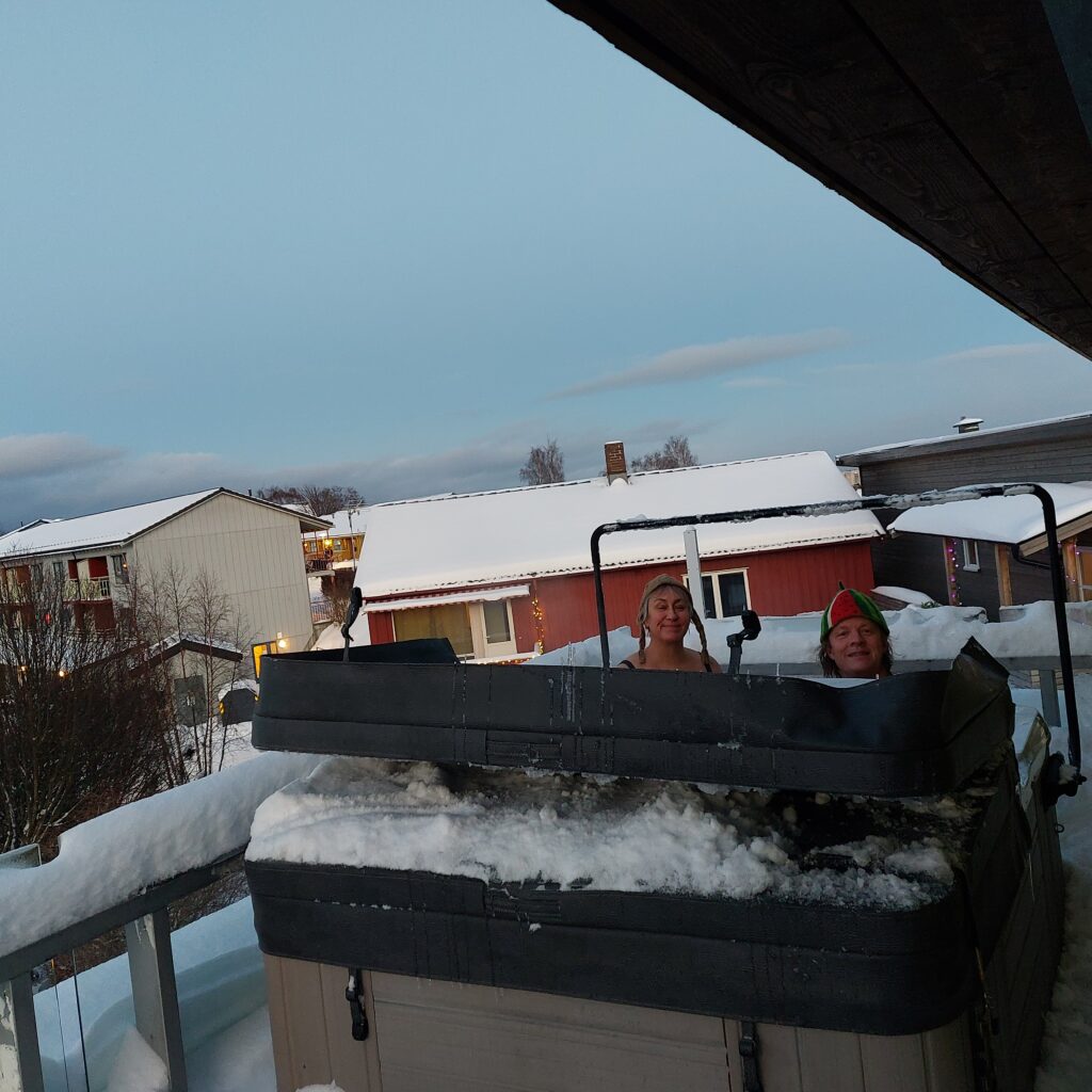
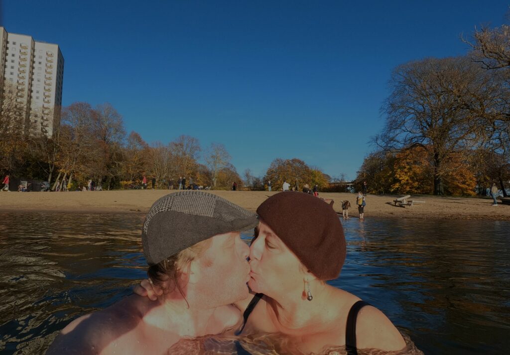
Hurray! Finally Christmas! The children were home again and Christmas holidays had almost started. THEN corona revision 2 struck, and Idun fell to the ground, voiceless. Or, no, it’s not called ‘the ground’ but ‘the sofa’.
Idun tried to lift the mood with an ugly christmas dress, but it didn’t help much. Photo: Une Hunstad Løwø
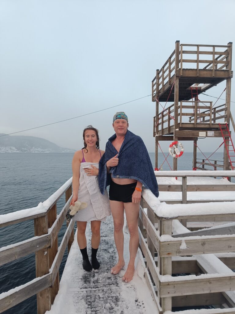
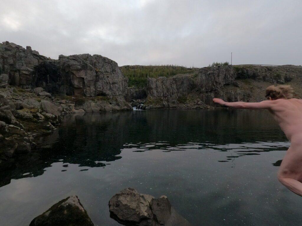
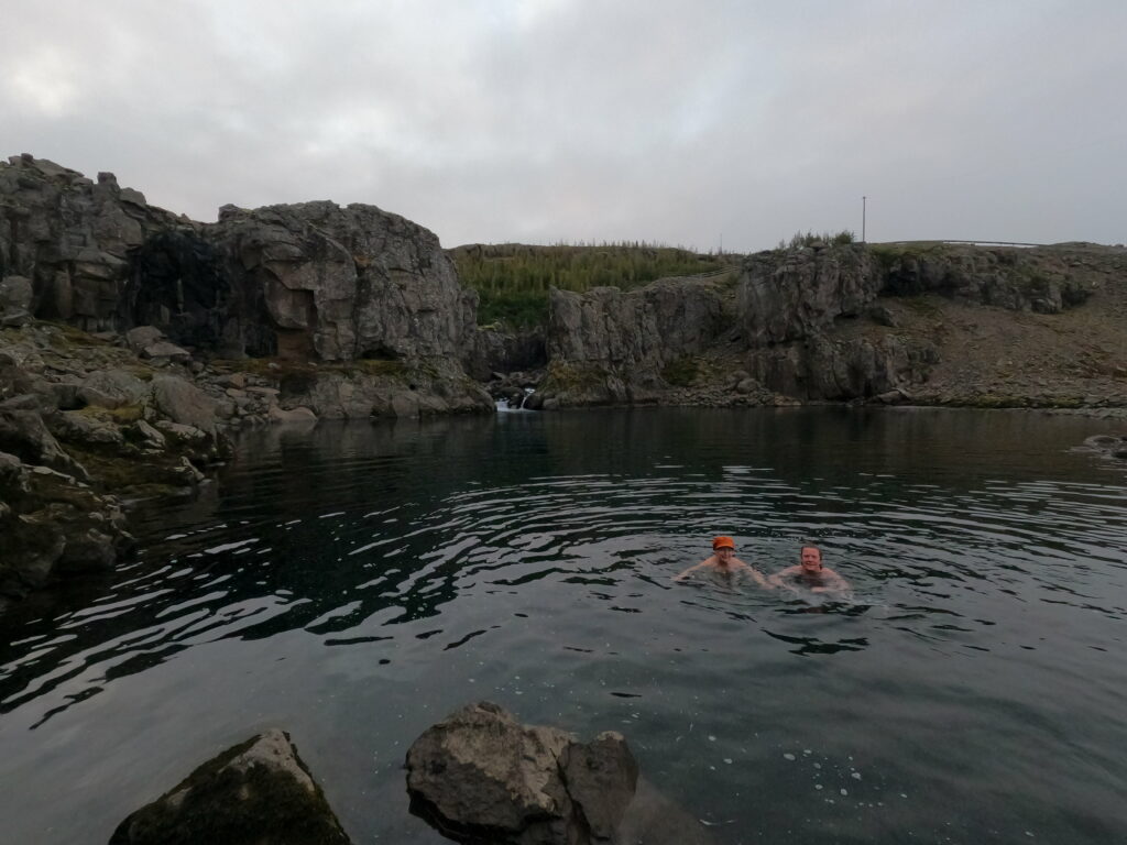
Christmas Bath 2022 became a split session, where the corona patient and the French delegation dropped any cold baths. U1 and Knut, on the other hand, went to Sjøbadet to swim at the great facilities there.
Tobatheornottobathe-standin
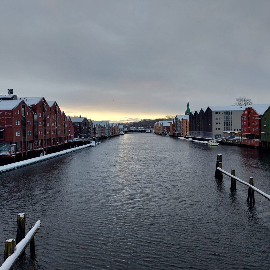
But no sauna, we missed that because of the tradition of Cinderella movie watching. And the 24th of December was a fabulous day to take a walk in Trondheim.
Splendid view in Trondheim.
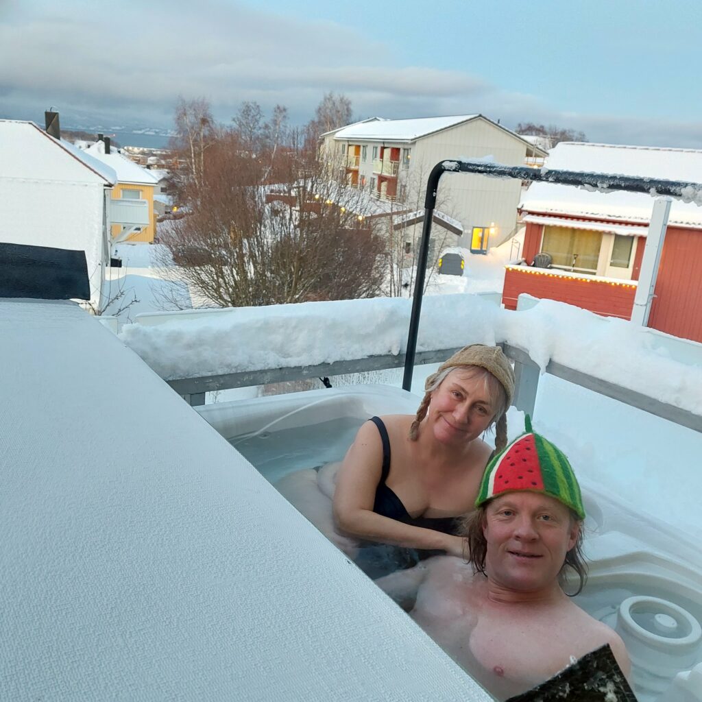
Once at home, Knut just had to get bathing again. CovIdun also wanted a Christmas bath!
Hot Tobatheornottobathe Bath 2022.
Merry Christmas and Happy New Year from Tobatheornottobathe!
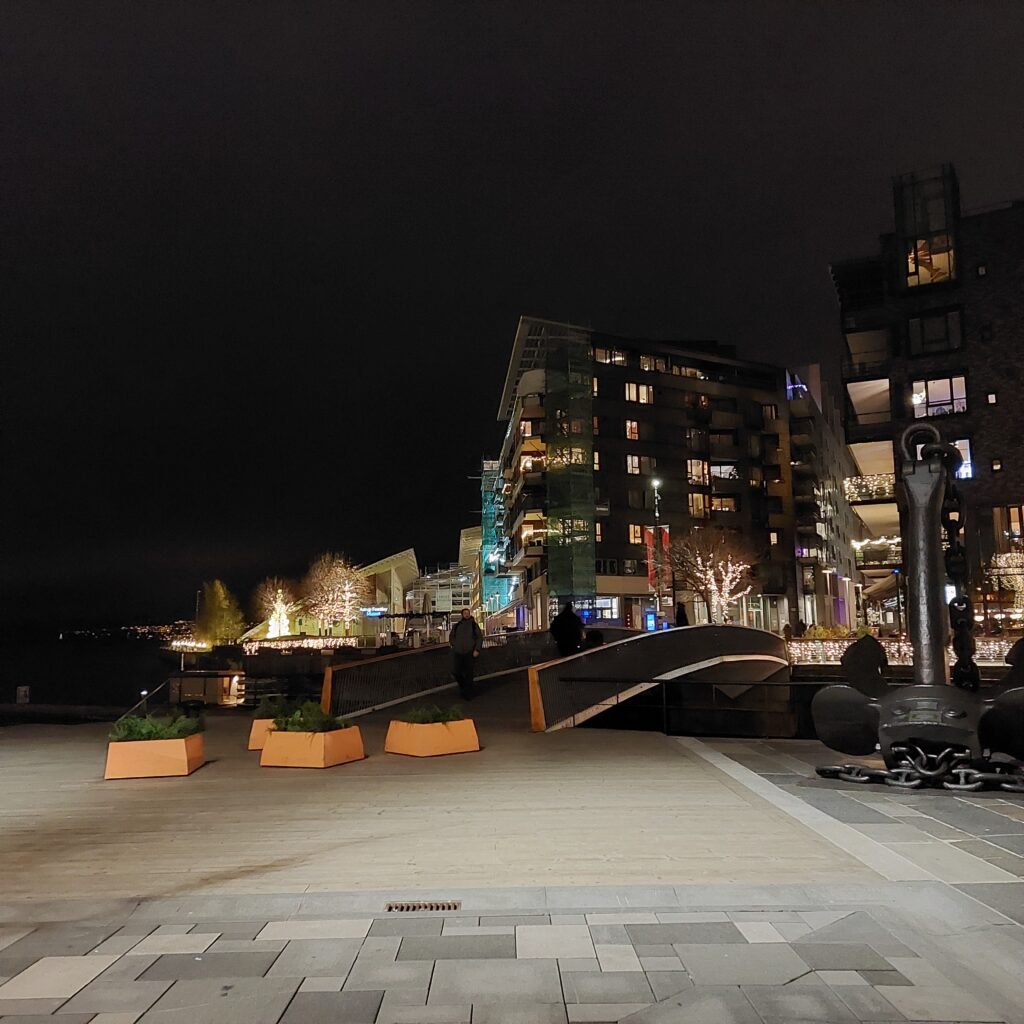
From Aker Brygge you get to Tjuvholmen (the Thief Islet) via a footbridge.
Footbridge to Tjuvholmen. If you are driving, the road goes under ground.
Tjuvholmen was originally a long, narrow headland. Thieves used to be executed here in old times (court documents have been preserved), hence the name. The headland was later converted into a quay, but the really big development took place between 2005 and 2014. Tjuvholmen today consists of 3 parts: Odden (the Headland), which is landlocked, Holmen (the Islet) and Skjæret (the Reef). The area consists of many apartment blocks, offices, a hotel, restaurants, shops, an art museum and several galleries. In total, we are talking about 950 apartments and 1,500 workplaces.
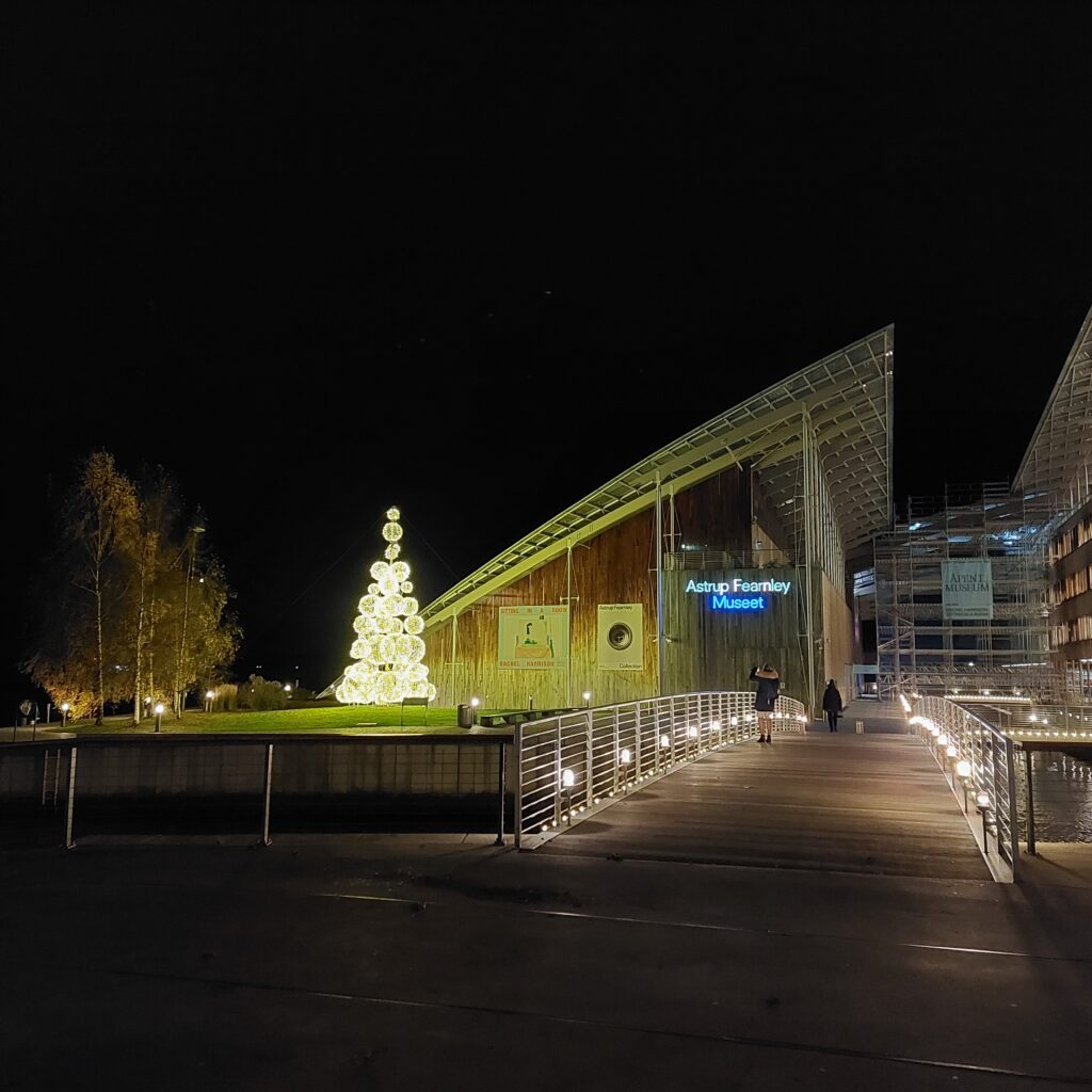
The Astrup Fearnley Museum at Skjæret.
Some upgrading has taken place since the area consisted of warehouses and quays. When the last apartments were sold, it was almost a doubling of the price at Oslo’s otherwise most expensive area, Frogner: NOK 90,000 against NOK 56,000/m2.
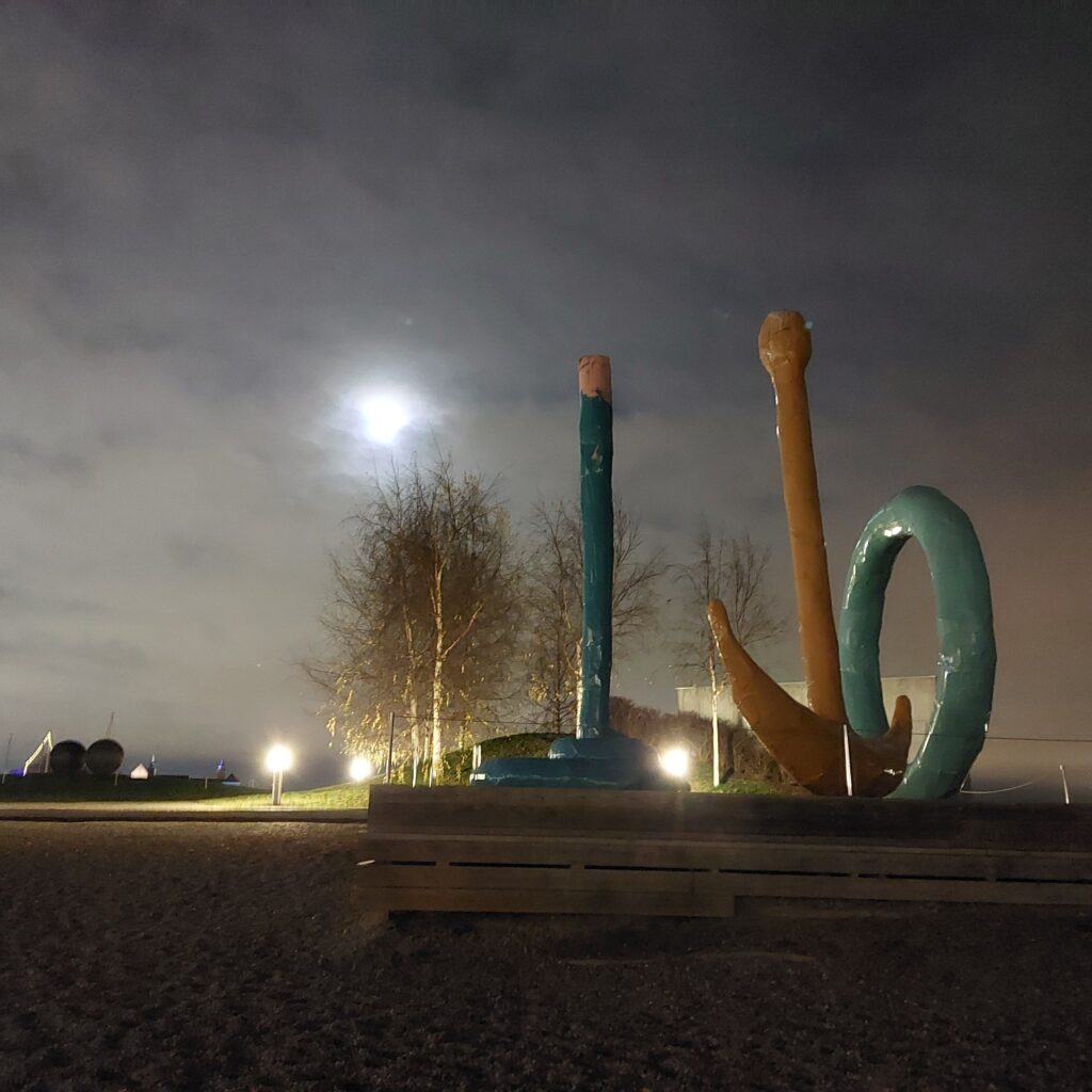
The Sculpture park at Tjuvholmen.
And of course, the same thing has happened here as in Grilstad Marina outside Trondheim: After an excellent, public swimming area is built close to celeber apartment buildings – almost immediately the residents start complaining about noise and garbage, trying to forbid others from using the place. You haven’t bought an expensive apartment to hear other people make noise, have you?
On Tjuvholmen, it went so far that the residents hired security guards, who sent away about 2,000 people during the summer of 2019. In a letter to the municipality, complaints were made about ‘urinating’, ‘fighting with chains’, ‘sex on the lawn’, and the Tjuvholmers referred to the whole situation as an invasion. After this, signs were put up explaining where it is allowed to swim and where it is forbidden (just as at Grilstad, they refer to the bathers’ safety in order to introduce a bathing ban).
The beach at ‘Skjæret’. Swimming allowed!
And the bath itself?
A fabulous bath in the dark, water temperature 5-6 degrees Celsius. Fresh and salt water even though it is in the city center.
We dropped the chains and behaved quite well. No guards in sight.
After a swim at Tjuvholmen, some food is just right.
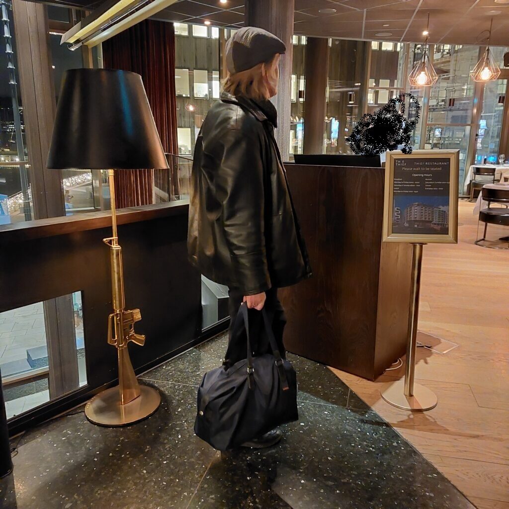
Correct attire to visit ‘The Thief’?
… and if you choose ‘The Thief’ restaurant, you probably understand that the price level reflects the apartment prices in the area. Maybe you even have to beg a little to cover the expenses?
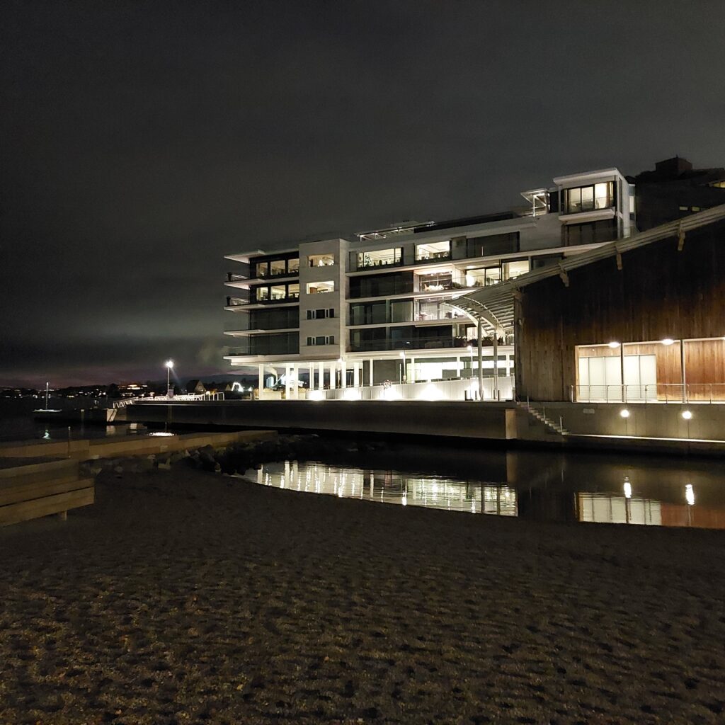
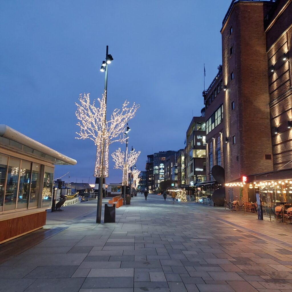
On the west side of Pipervika in the Oslofjord, vis a vis Akershus Fortress, lies Aker Brygge. The area was formerly called Holmen (the Islet), where some industrial companies appeared in the early 19th century. Aker’s mechanical workshop (later also shipyard) was established at Holmen in 1854.
Aker Brygge. Stranden (the Beach) promenade.
When the workshop was closed, in 1982, the development of Aker Brygge began in four stages. Some buildings were demolished, others renovated, and the result is a grandiose meeting place for shopping, dining and entertainment. There are as many as 6,000 employees here and 900 people are residents at Aker Brygge.
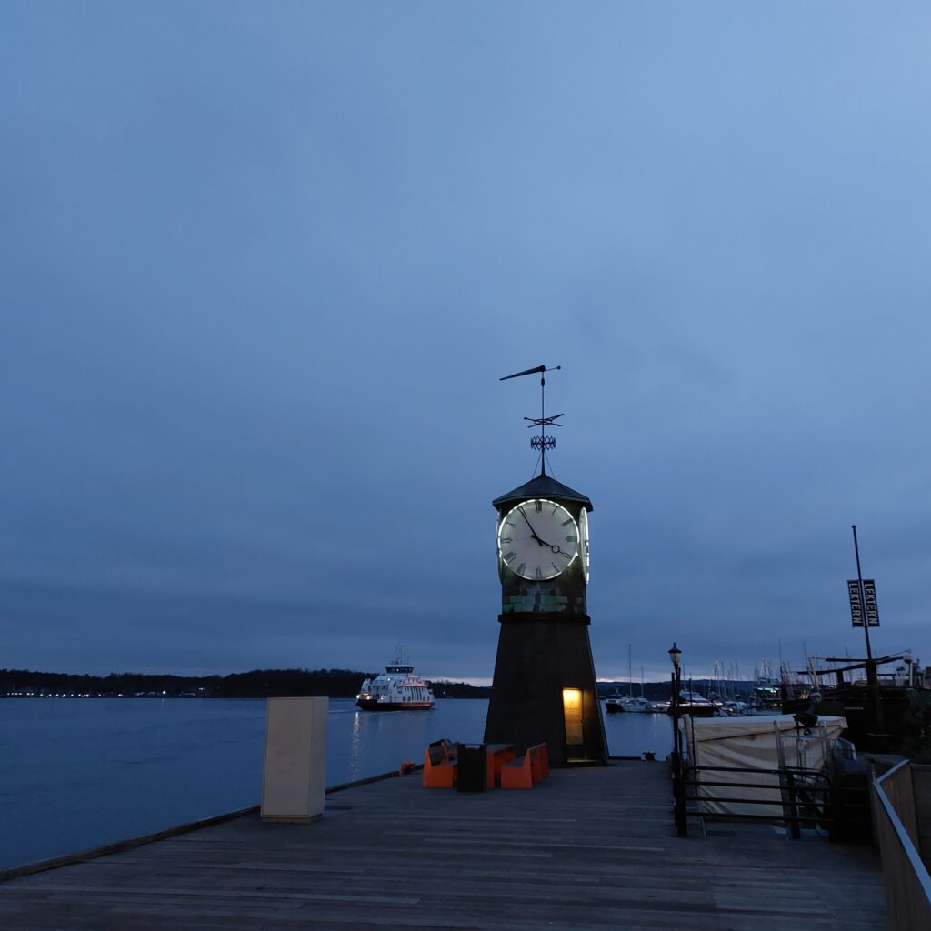
The bell tower, Aker Brygge.
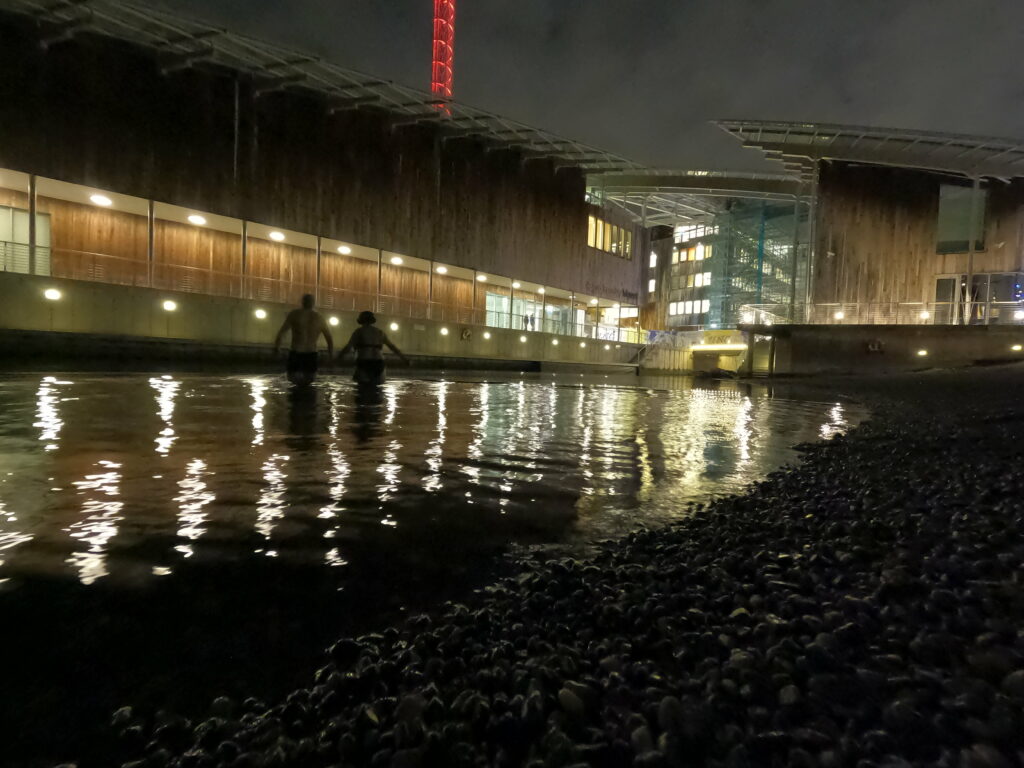
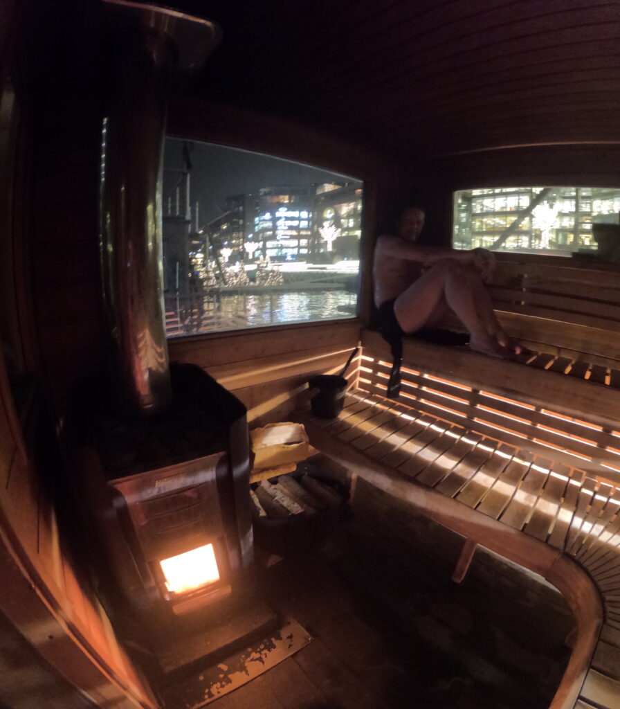
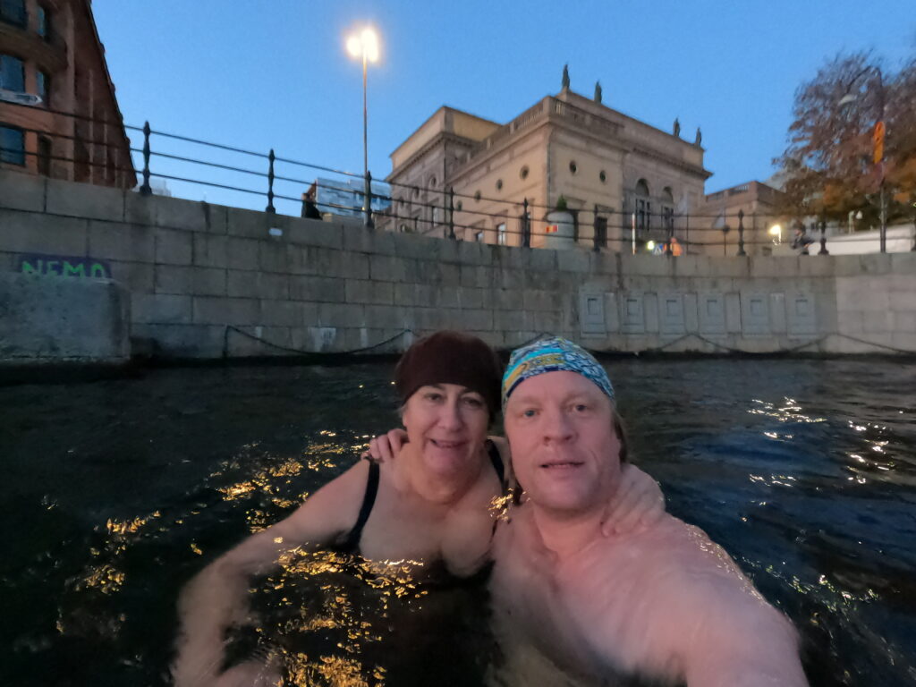
About 12 million people visit the area every year, and the place has become a symbol of the 1980s YAP era. We visited Aker Brygge at the beginning of December, to have a pre-Christmas bath. Here the saunas are lined up, and we ended up at KOK.
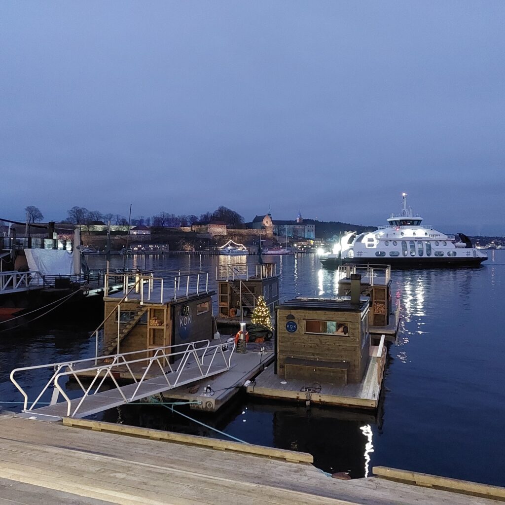
KOK. Akershus fortress in the background.
It wasn’t that simple, though, because when we arrived with our bags full of towels and swimwear, it turned out that “someone” had booked a sauna for the following day. Presumably the booking ended up on the next day because it was full – without Hunstad Booking noticing.
Aker Brygge seen from KOK. The first sauna was launched at Langkaia in 2018.
Then it was just a matter of strolling along (take this day’s bath somewhere else, which comes in an another article soon) and try again the next day. And yes! This was good stuff. We ended up on the fleet ‘Vega’. It was nice winter weather outside, but the sauna heater didn’t quite keep up, and the sauna never got more than 70 degrees Celsius. Or maybe we just didn’t put wood in the oven often enough.
Just medium cooked this time
But we had a splendid experience anyway, including a few baths in the dark – overlooked by Akershus fortress and Nesoddferga.
Most important is catching the mood! But we are considering opening the GoPro user’s manual…
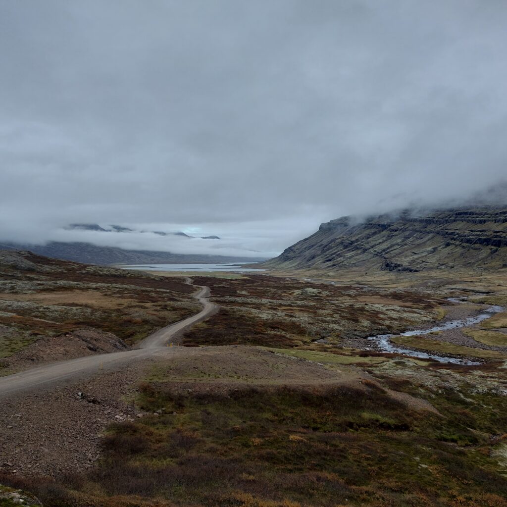
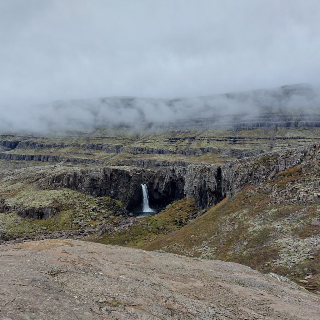
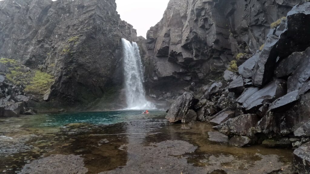
Road no. 939 over Öxi (the Axe) is a 20 km long gravel road that runs between Berufjörður and Skríðdal. This is a splendid shortcut, which shortens the distance between Djúpivogur and Egilsstaðir by 71 km.
Axarvegur and the river Berufjörðurá on the way down towards Berufjörður.
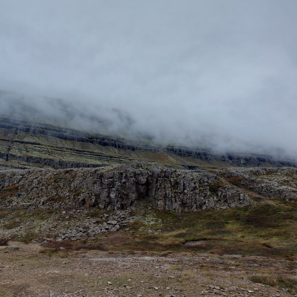
Axarvegur zigzags from the shore over the 532 m high Öxi pass, with a hight gradient of up to 20%, so you should not drive this road unless it is summer and the weather is good.
Mists in the mountains, although the weather was otherwise fine this day.
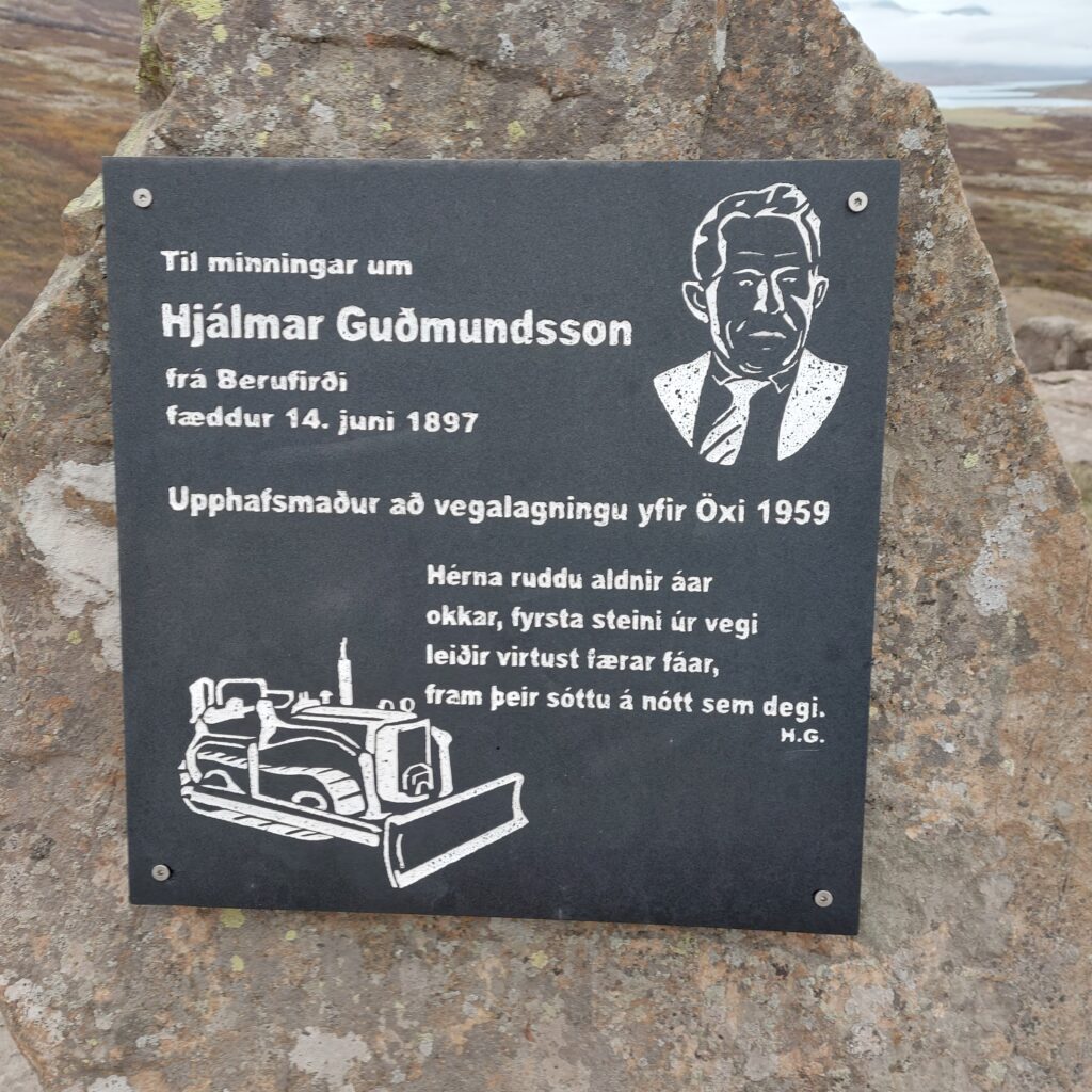
The initiator of this mountain road was Hjálmar Guðmundsson, born in 1897 in Berufjörður. Hjálmar has received a memorial plaque for his efforts.
Hjalmar Guðmundsson. Amazing what a man with an excavator can accomplish.
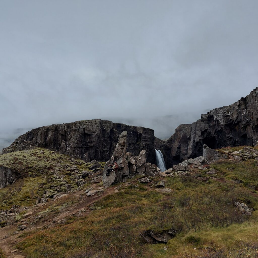
A good reason to choose this route (in good weather) is Folaldafoss (The Foal Waterfall), which is located 4-5 km northwest of the exit from Ringvei 1 at Berufjörður.
Folaldafoss has a nice transverse bend where it is choked in the gil.
Knut found himself a throne and was very pleased with that.
King Canute the Great, almost invisible.
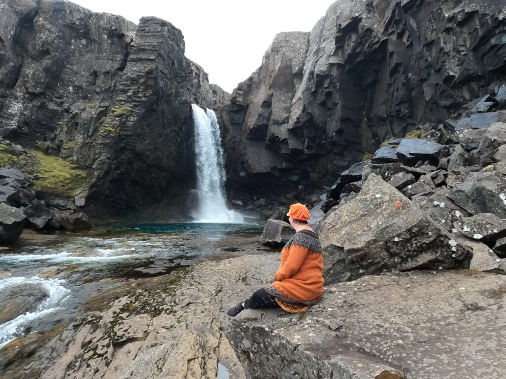
Folalda Waterfall has a fantastic pool beneath it, which just calls all bathing lovers. On road 939, you are slightly off the standard route, and it wasn’t long before we were alone by the pool.
It is important to check the conditions before jumping in (and waiting for the other stupid tourists to go away)
The 3 car loads of Japanese people never left the car park, to our benefit.
Folaldafoss also goes under the label ‘Hidden gem in East Iceland’
A bath in Folaldafoss was absolutely right! But be aware, it was slippery on the bottom, so please take care.
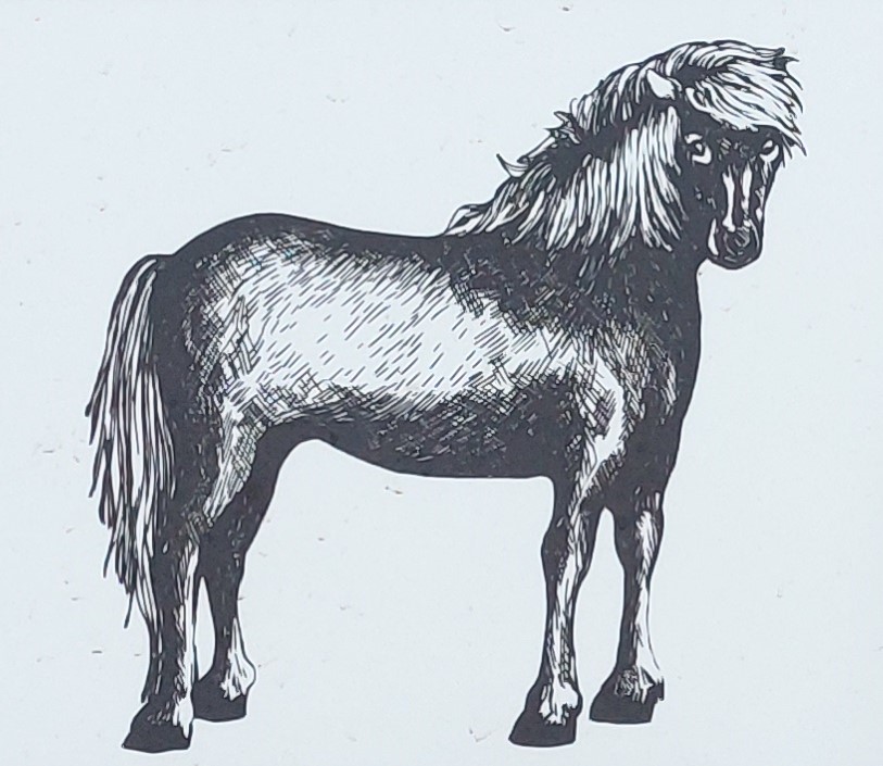
The Nixie (Old English ‘Nicor’) was a water spirit in Germanic mythology and folk tales. The word originates from the Indo-European ‘neig’ = to wash. The Icelandic sagas have little content related to Nixie (Nykr) , but the Icelandic tradition has nevertheless been rich, as the high number of place names including ‘Nykr’ indicate. In Iceland, the Nixie was always a horse – with hooves pointing backwards!
From the information board at Nykurhylsfossen (the Nixie Waterfall).
The dramatic stories about the Nixie were splendid educational tools – to prevent children from going too close to the water and drown. The Nixie was connected to rivers and lakes. If anyone dared to ride the Nixie, they would drown. The sounds that occur in wintertime from the ice on lakes were explained as Nixie’s mournful cries.
Berufjörður at sunset.
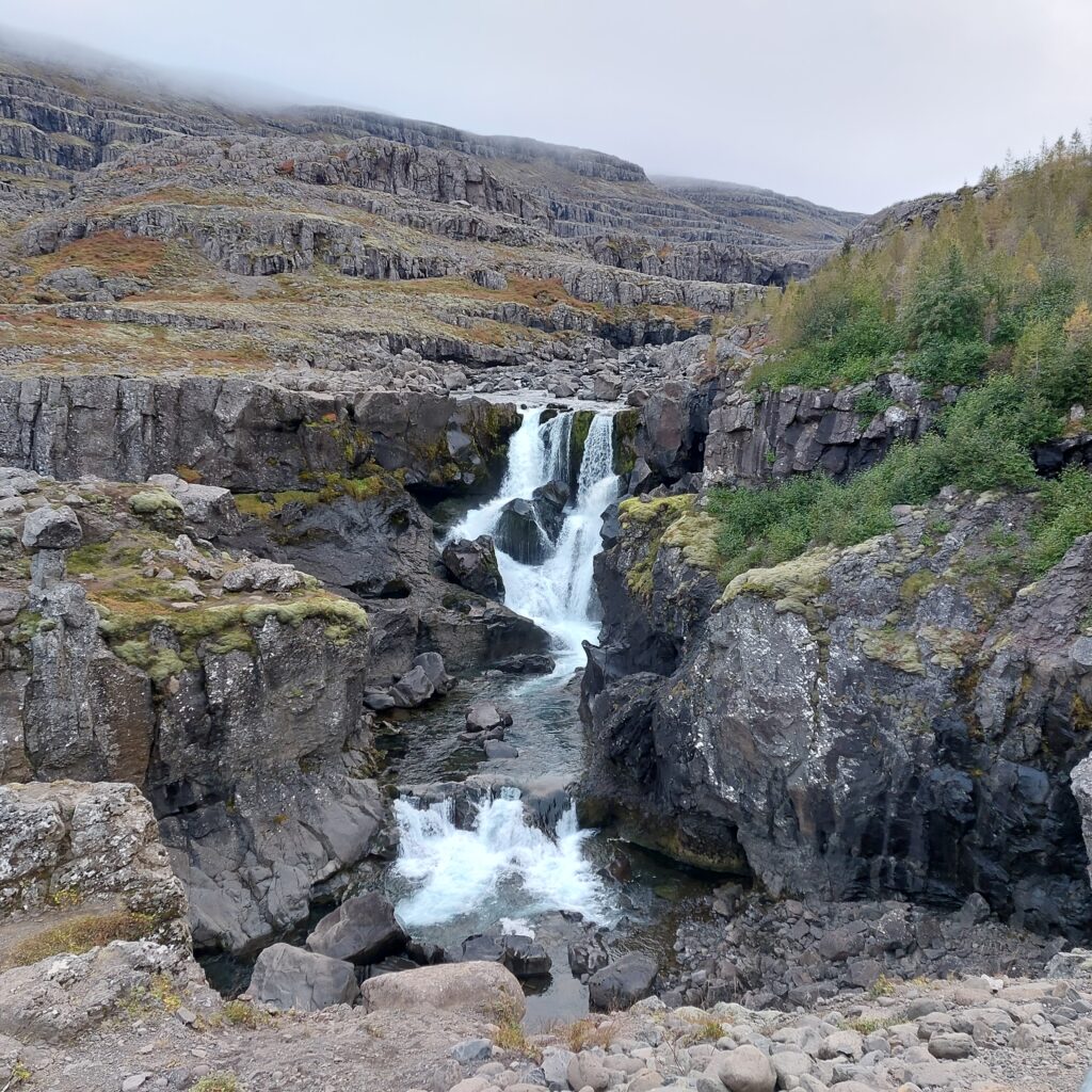
In Fossardalur (the Waterfall Valley) northwest of Djúpivogur (the Deep Inlet) there are vast opportunities for bathing. It is said that you can find 30 waterfalls in the valley! We planned a bath in Nykurhylsfossen, which is the lowest one, but that was easier said than done. The waterfall wasn’t easily accessible.
Nykurhylsfossen. The water flow has varied between 8 and 395 (!) m3/s.
Below Nykurhylsfossen, on the other hand, there is a large and beautiful pool where you can both bathe and swim. The depth is 9 meters. So why not just jump in instead of slowly wading out into it?
Diving in
Unfortunately without a waterfall shower, and without the view of the waterfall.
No Nixie in sight
According to tradition, a Nixie lived in this river. After being frightened and tormented by Nixie for a long time, the village people took action, and the pond under the waterfall was Christianized with holy water. The holy water made the pool uninhabitable for Nixie, and it ran screaming into the fjord and disappeared, never to return again. However, history says nothing about how the fjord Berufjörður turned out after this. Strange.
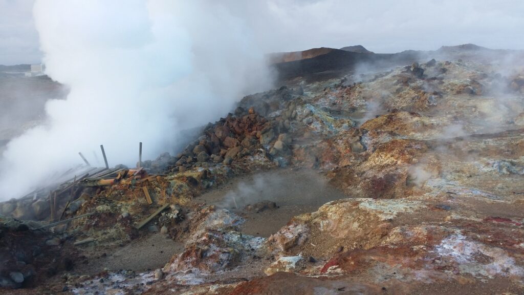
Geothermal energy can be defined as geothermal heat (jarðhiti) that reaches the earth’s surface. Where volcanic activity is high, porous rocks are formed, which allow water to flow in and heat.
‘Stairway to Hell’, Reykjanes.
Geothermal energy can be utilized directly by heating, or for electricity production or both.
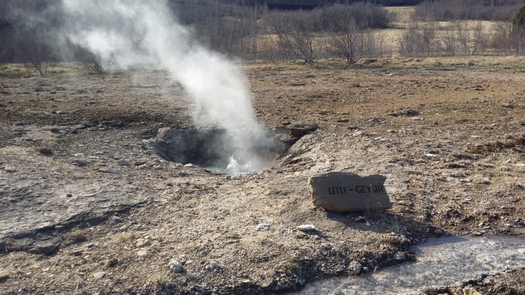
Boiling water in the ‘Geysir Area’.
A distinction is made between hot springs, mud springs and sulfur springs. Iceland has hot springs almost everywhere – the fewest in the east and northwest – the oldest parts of the country. Highest geothermal activity is found between the continental plates, in the fissures that run over Iceland from southwest to northeast.
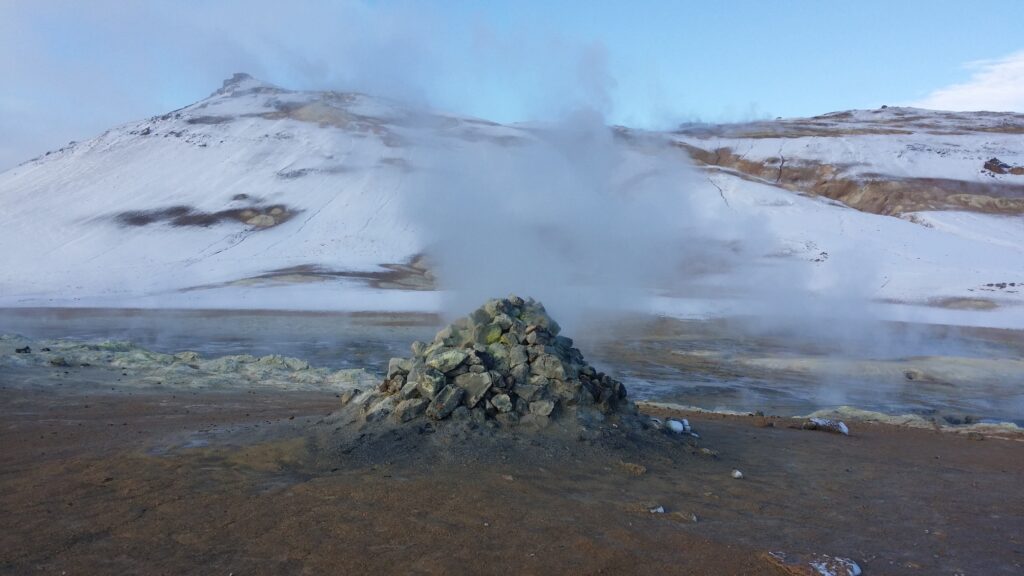
Sulfur vapor by Mývatn.
A Google search shows that Iceland has more than 200 baths. Divided by 350,000 inhabitants, you get the highest density of bathing facilities in the world. This is not only good for hygiene and exercise. For Icelanders, bathing is an essential part of the culture, and the baths are important meeting places.
For the traveling tourist – just let yourself get carried away! You can find hot springs almost anywhere. One hot pot we were really fascinated by was the ‘Sink at Djúpivogur’. Drive south of the city, and just off Highway 1 you will find ‘Djúpavogskörin’, a hot pot that looks like a sink.
A bath in the sink, Djúpivogur.
There is no fancy spa equipment out there, but you can actually find hooks for the clothes. The water is wonderful (quite warm), and the panorama is absolutely fantastic. This is a marvelous experience! NB, there are no signs, look for the steam!
Stockholm lies on both sides of the outlet of Lake Mälaren, as well as 19 islands. Due to its proximity to water and all the bridges, the city is often called the ‘Venice of the North’. The origin of the name Stockholm (Timber Islet) has not been fully agreed upon. It comes either from the collection of timber by the islets between lake Mälaren and the Salt Lake (Baltic Sea), or because the oldest settlement was secured with timber palisades.
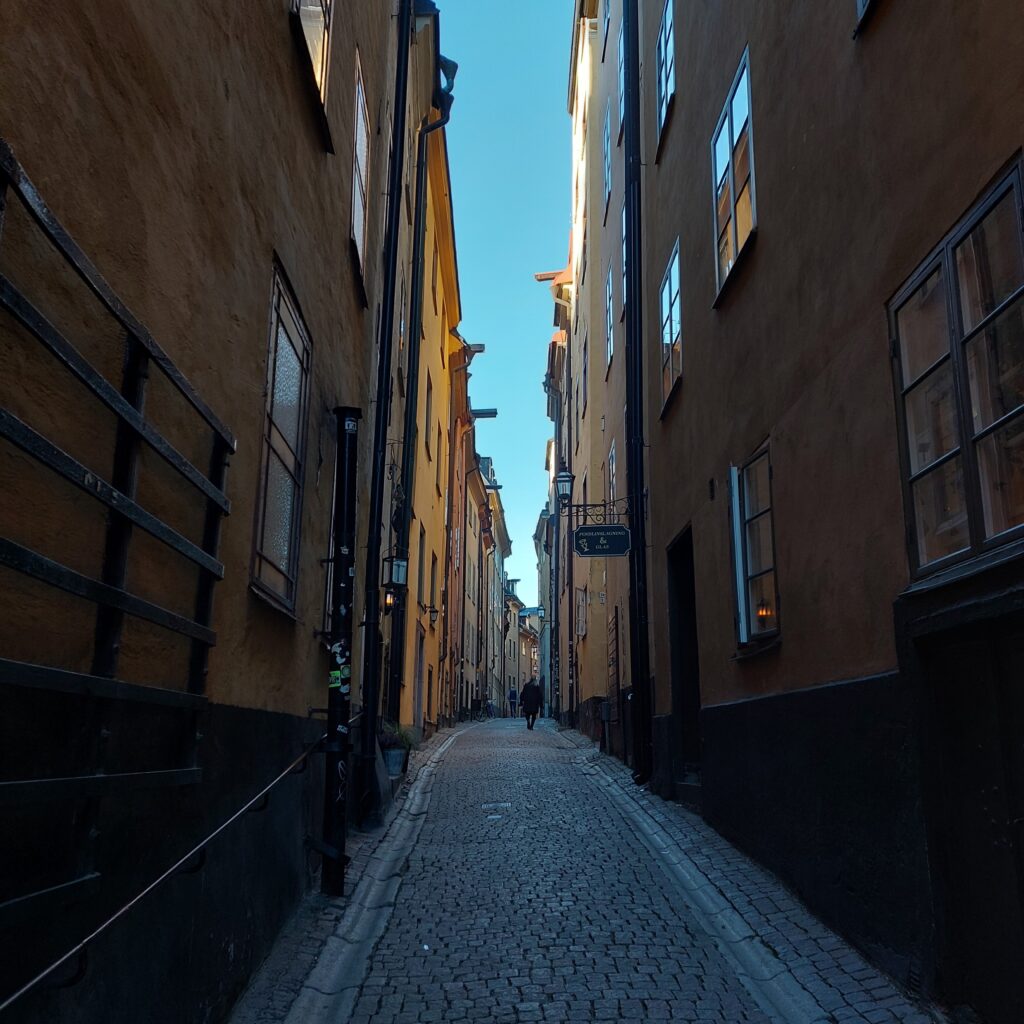
Gamla Stan (the Old Town).
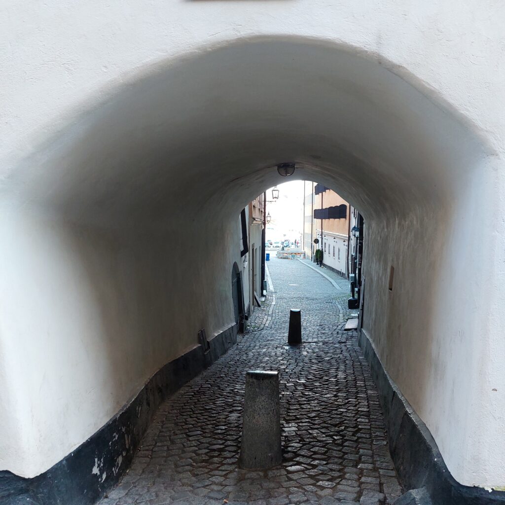
The old town in Stockholm is called Gamla Stan and is located on Stadsholmen (the City Islet). The streets from the Middle Ages are beautifully curved in the terrain, with narrow alleys down towards the sea. It’s beautiful here!
View towards the sea.
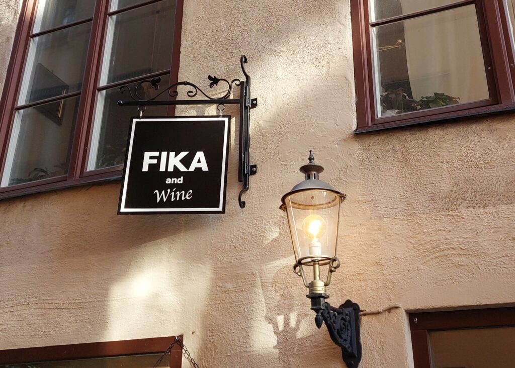
After visiting the many small shops in Gamla Stan, it is a good idea to ‘fika’. The word originated as a backslang of the word ‘kaffi’, i.e. the letters were interchanged. A fika is a pause in work that typically consists of coffee, coffee bread and a relaxing conversation. These breaks are part of the paid working time and were mandatory for factory workers in the old days. The idea was that a break would give the laborers new energy in their work, and that the coffee conversation would ‘force them’ to get to know each other. Surely a very good thought!
Old town. On a daily basis, it might be better ‘to have coffee without wine’?
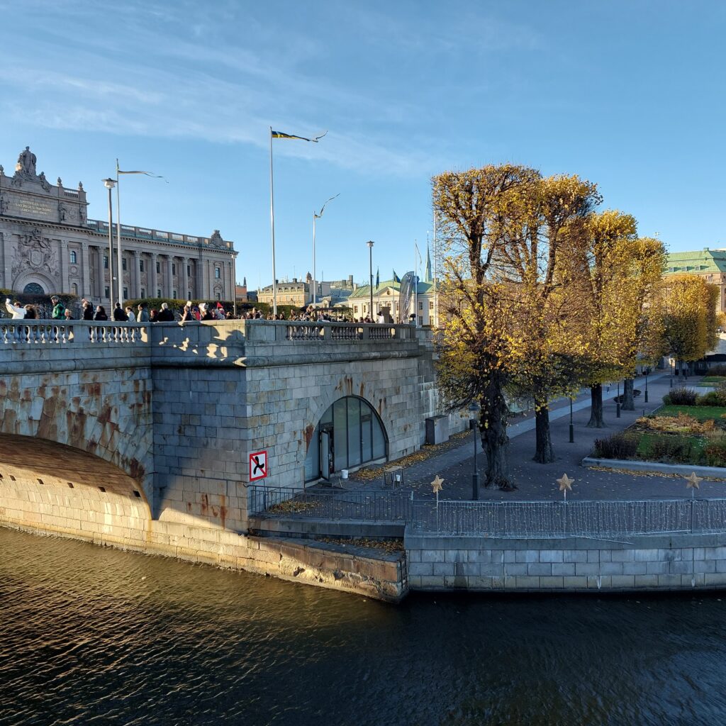
After a fika, a bath is just right. We went northwards from Stadsholmen across Helgeandsholmen (island of the Holy Spirit). The name comes from the Helgeanshuset (the Holy Spirit Hospital) that was located there in the Middle Ages. Helgeandsholmen is 3 hectares in size, of which the Riksdagshuset (the Parliament) covers one hectare.
The propeller ban by the Parliament (Riksdagen) did not bother us.
There is quite a lot of current by the Riksdag. This was too risky for us, so we didn’t swim there.
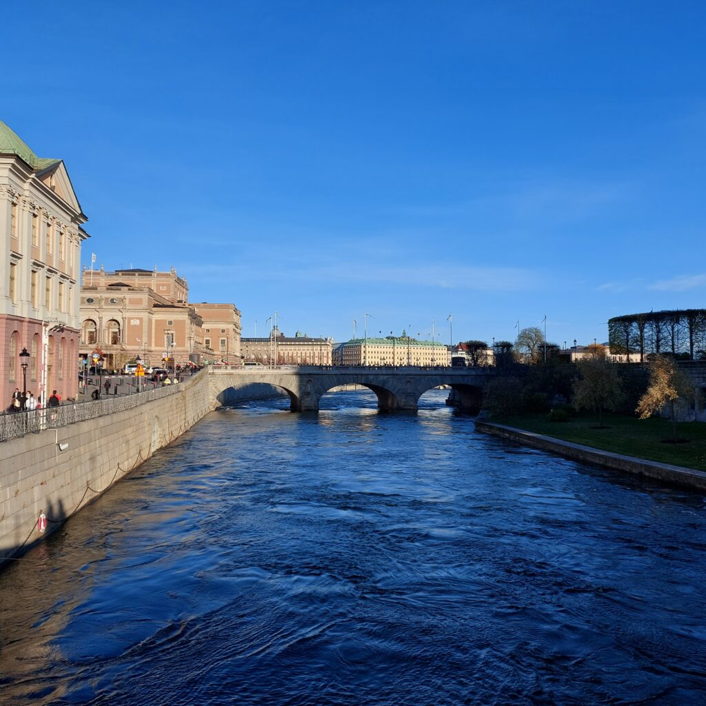
Too much current downstream of Norrbron (the North Bridge).
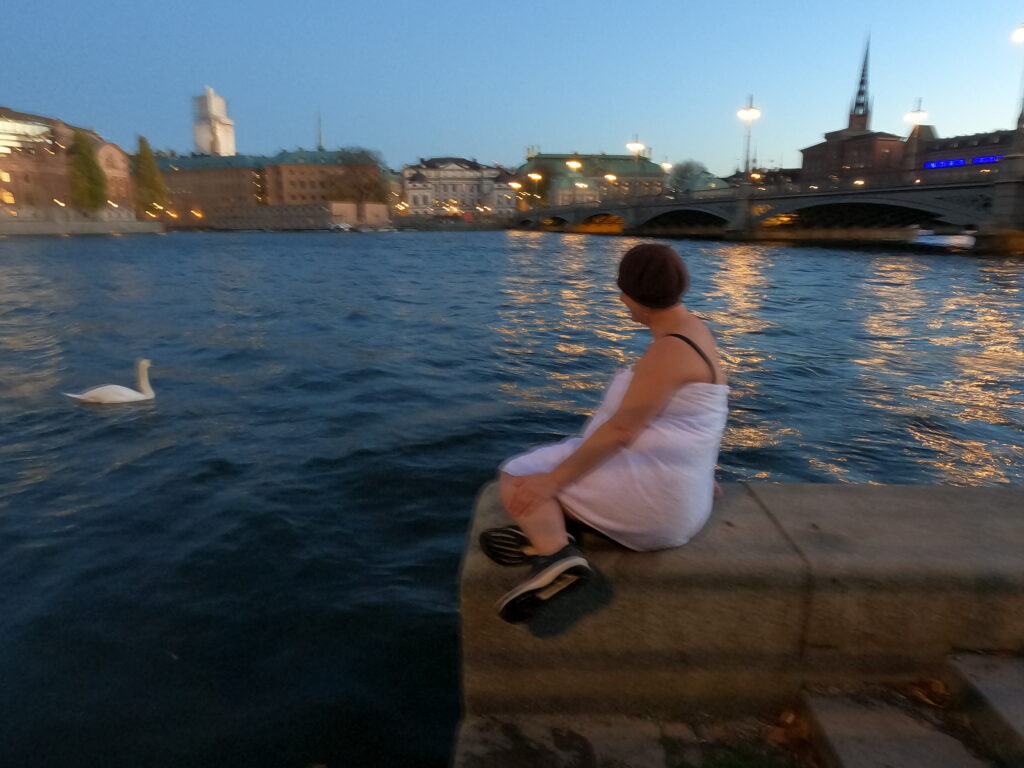
But at Vasabron we found a backwater with no current, perfect for a bath. The water in the canal was not disgusting at all – considering Stockholm’s 1.5 million inhabitants. It was quite shallow and an easy access at our bathing place, and a lot of sea grass. This autumn, Knut has had back problems and basically was happy to avoid extra challenges with climbing out of the water.
Stockholm (almost) by night
And we were not alone! A swan mother came swimming to us just after the bath. Angry or hungry? It is hard to say. Luckily we didn’t have to fight her in the water.
The Mermaid and the Swan
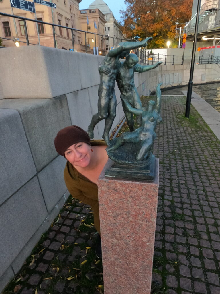
To round this off, we even could check out a little culture in form of a sculpture.
Vinden och Vågen (The Wind and the Wave)…and the photo bomber
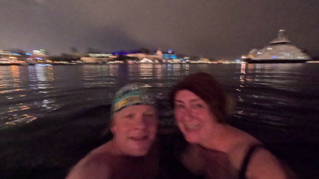
It was a fantastic bath at sunset. As usual, we were very worried about being rescued. But there were no problems. The Stockholmer’s took our bath with stoic calm, and only wondered a little about the temperature. And after the bath – the hotel’s sauna was just perfect.
South of Gamla Stan (the Old Town) in Stockholm is the district of Södermalm. The island, nicknamed Söder (South), has just over 100,000 inhabitants spread over 571 hectares. Until the Viking Age, this was an island, but the postglacial uplift caused it to connect more and more with the surrounding land, before it was again separated as an island when the Hammarby Canal was excavated in the 1930s.
South side of Söder.
From the south side of Södermalm there used to be a winter road across the strait (Årstadviken), on the ice. The road was closed with a toll barrier. This bar is mentioned in Bellmann’s ‘Fredman’s epistle no 53’. These were hard times!
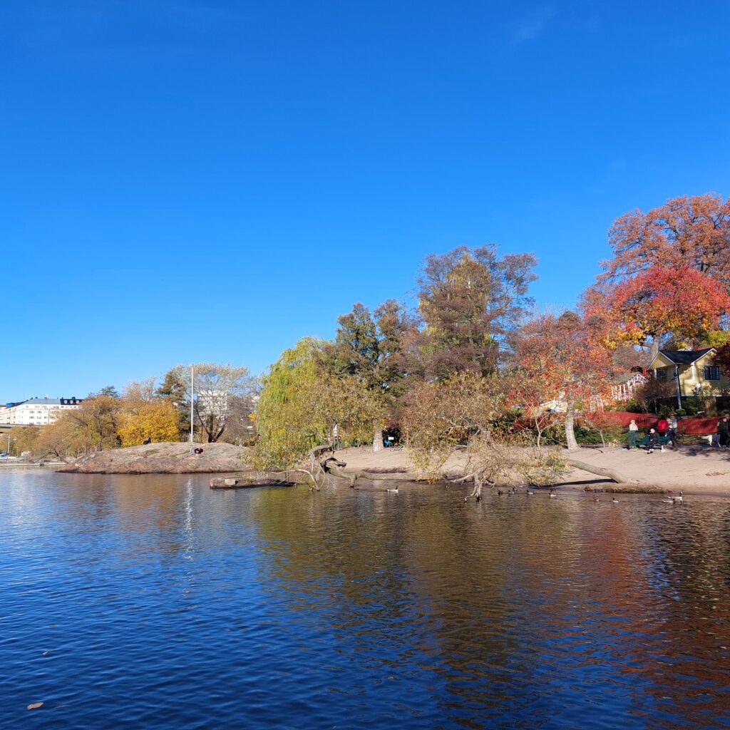
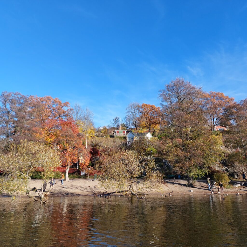
Tantolunden beach, with the allotment gardens above.
We had been recommended Tantolunden by Ulvhild, our eldest daughter. And yes, it’s nice there! Tantolunden is one of the largest park areas in Stockholm. Hans Tanto, mentioned in the census of 1676, was one of the first landowners here. Unfortunately, it was not a ‘strange old aunt (tant)’ who gave rise to the name Tantolunden. Work on the park began in 1885, initiated by Stockholm’s first city gardener, Alfred Medin. The plan for the park was inspired by Romanticism. People were supposed to stroll, wearing the finest clothes, under the most beautiful green trees. Ironically, the upper part of the park was a former waste deposit! The colonial gardens were established around the First World War, to alleviate the famine.
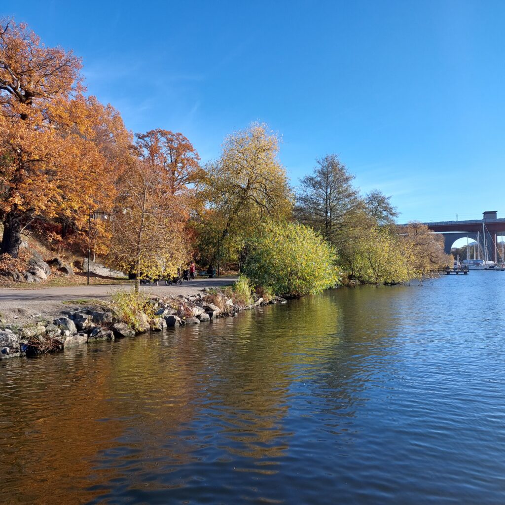
A lovely hiking trail along the water below Tantolunden. Årstabroarna in the background.
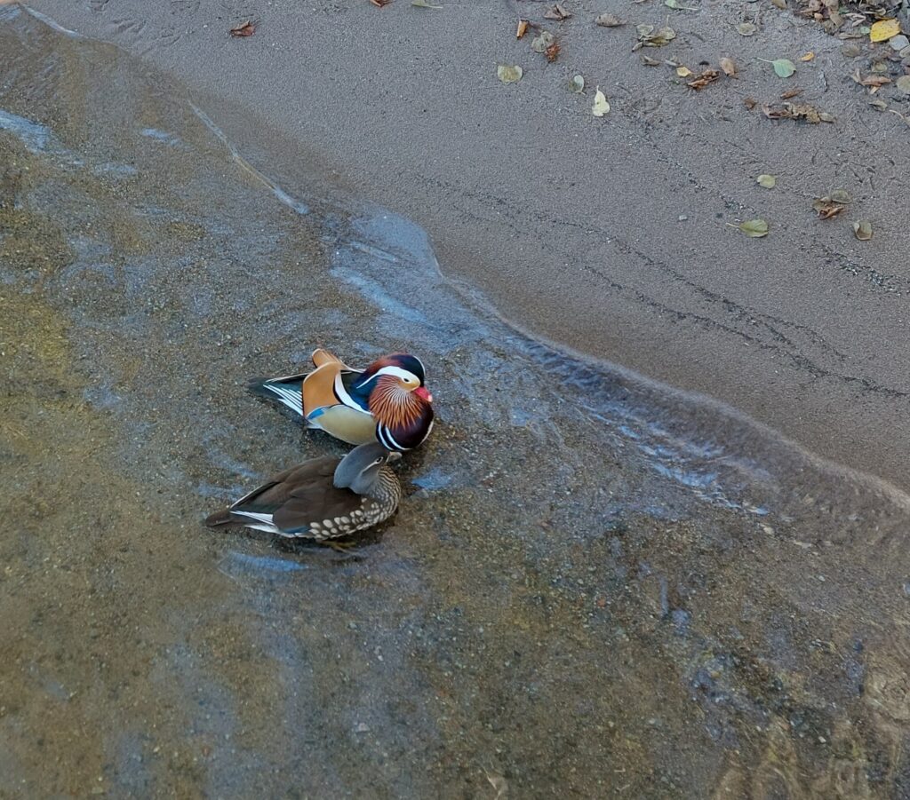
A popular activity at the beach is feeding the ducks, perhaps especially among older and younger bird lovers. But we also enjoyed it very much this Sunday in October, when we caught sight of this beautiful couple:
Mandarin ducks.
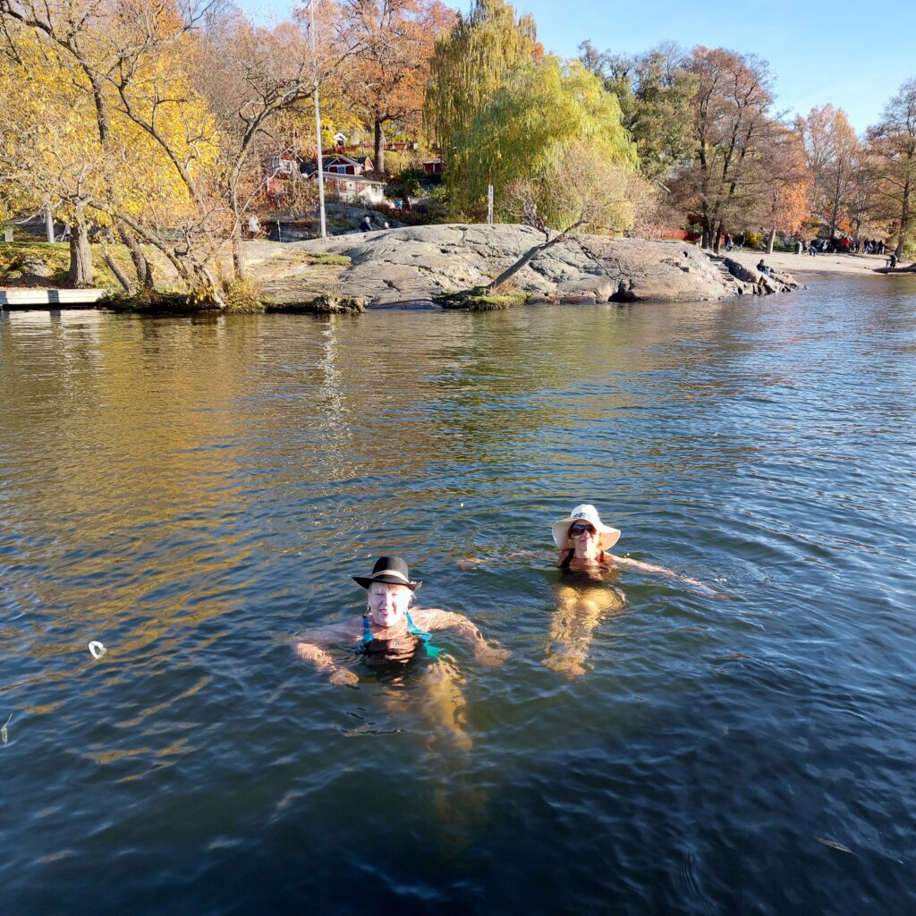
There is a sauna (badstu) at Tanto beach. We haven’t tried it! Tantobadstun was only open to members when we visited. But to the west of Tantobadstun, the floating jetties form a sheltered little bay, where it’s nice to have a bath. And – we were absolutely not the only guests out for the same business this day. Actually we were allowed to take pictures of these aunties (tantor) who bathed with hats:
The Hat Ladies (Hattetantorna) at Tanto.
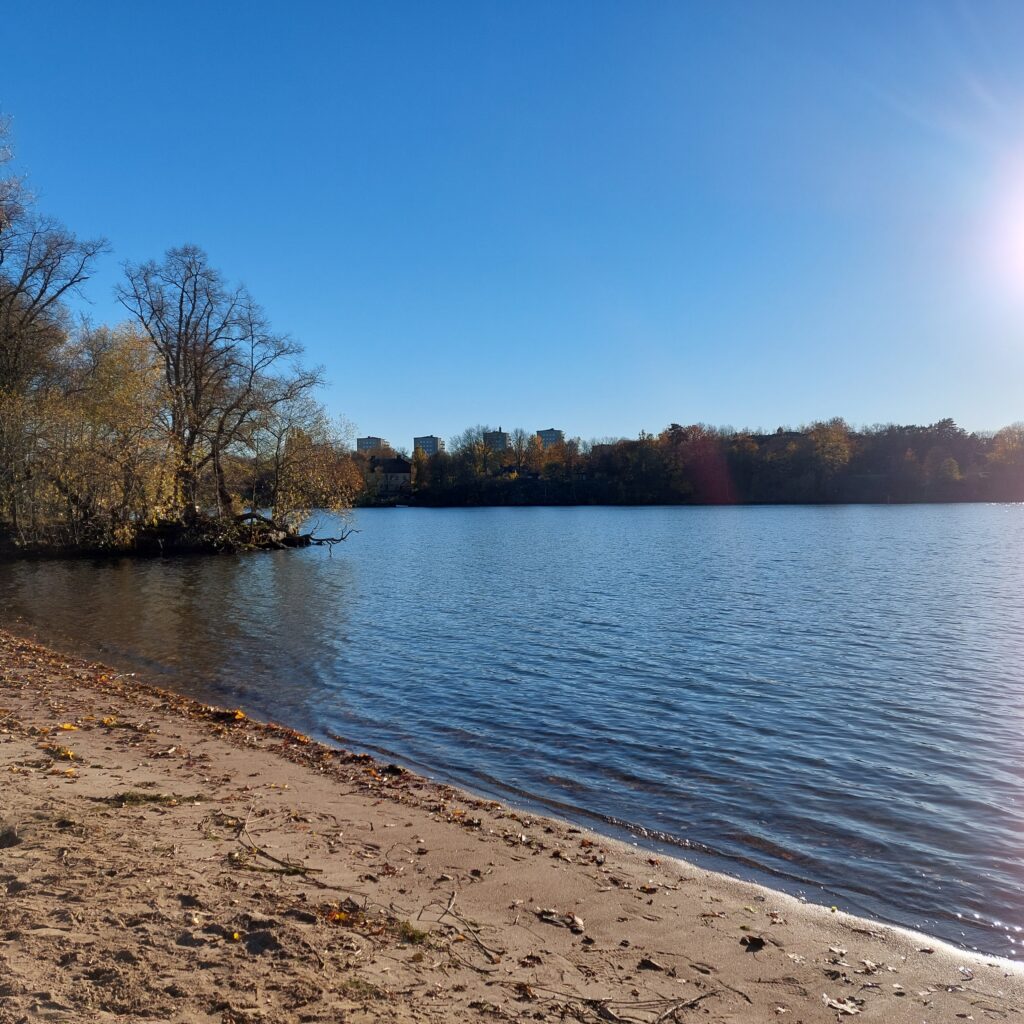
The ladies could tell that this particular day was ‘World Swim Hat Day’ at Smedsudden in Stockholm. We didn’t know that! So then we had to go there, but not before Tobatheornottobathe had tried a sunny October bath at Tantostranden.
Nice spring weather at the end of october!
We had a very nice swim, temperature about 10 degrees. A bath at Tantolunden was just right!
In autumn 2020, Erika Sjöberg and Hanna Prage founded the ‘World Swim Hat Day’. They had been bathing by Stockholm for a long time, regardless of season: ‘The cold water gives me so much pleasure, and it makes me happy. And it doesn’t get worse if you also wear a funny hat‘. While bathing, not much of the outfit is visible, and then it is a good idea to make the most out of the headgear. Check here: World Swim Hat Day!
Since then, in just two years, this has spread to all the Scandinavian countries, Germany, the Netherlands and also has become quite big in Great Britain. As well known, they have a predisposition for extravagant hats…
Tobatheornottobathe was in Stockholm on the occasion of The Dirty Old Band’s annual autumn tour. We had received several tips about bathing spots in Stockholm, our eldest daughter Ulvhild has lived there for 4 years. But the coincidence of our Stockholm trip and the ‘World Swim Hat Day’ – who would have imagined that?
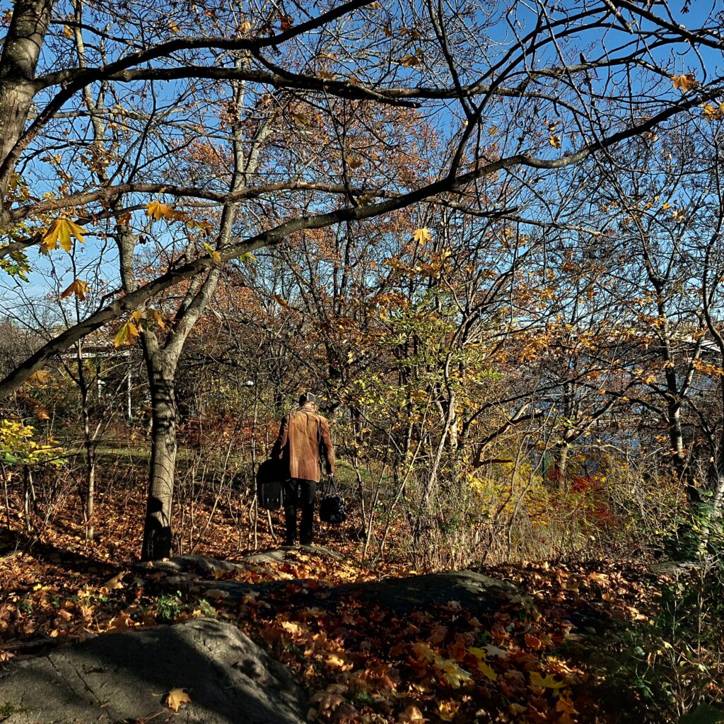
Knut is looking for the hat swim, armed with a suitcase and a bathing bag.
The only problem was that the hat bath tip came to our attention at 11 a.m. on the day of departure, during the planned bath at Tantolunden. And the flight had a departure time of 3:35 p.m. Could we make it? Was there any point in trying? But Tobatheornottobathe just couldn’t let such an opportunity be wasted, so we finished the bathing at Tantolunden, went back to the hotel to check out and then took a taxi to Smedsuddbadet (the Smith’s Cape Bath). Just another ordinary day…
Beautiful as October can be at Smedsuddbadet.
Smedsuddbadet is located close to Västerbron (the West Bridge) on Kungsholmen (the King’s Islet), with easy access 10 minutes from the subway. Originally Smedsudden was an island, called Marieskär (Mary’s Islet) or Smedsholmen (The Smith’s Islet). The name came from ‘glass smith’ Gustaf Hård and A. Röding, who lived here. At the end of the 18th century, the strait was filled in, and the island became a cape. The headland was bought in 1812 by chief inspector Abraham Fineman, who had ‘Sjövillan’ built (The Maison by the Sea). ‘Sjövillan’ burned in 1997, and now only the annex remains.
In the 1960’s, the water quality at Smedsudden was very poor, but sewage treatment from 1970 gave quick results, and on the 21th of June 1973, mayor Thorsten Sundstrøm was able to inaugurate the bath. Here you will find a nice beach, floating jetty, changing rooms and several outdoor showers. Water quality can vary, but water samples are taken regularly.
Nice beach at Smedsudden. However, we couldn’t see the smith anywhere.
Was it worth it? Absolutely! The hat bathing was supposed to take place at 2 p.m, but we couldn’t wait for that. Instead, we took a bath for ourselves, half an hour before.
Hot with hat.
By the time we had finished bathing, a colorful group of hatted bathers was arrived, and we had time for a little chat.
Idun resents her own, all-too-simple hat. Hat trick next year, we hope!
We caught the plane with a good margin of several minutes, so we didn’t have to regret the bath this time, either.
Today’s tip for our readers: the World Swim Hat Day takes place on the last Sunday in October each year. Put on a hat and join us next time too, and follow the hat bath founders’ motto: ‘It must be allowed to have fun even as an adult‘!
Alternatively, you can join the ‘Stockholm Winter Swim Open’ in february/march. There they have a special competition, which consists of swimming wearing the most extravagant or funniest hat.
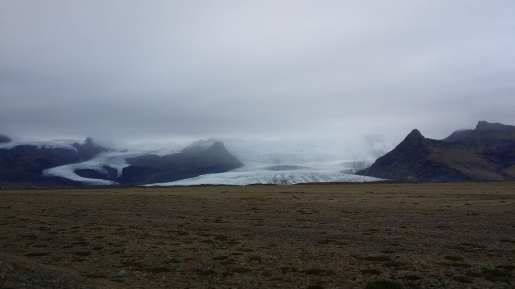
After a not very successful mud bath in front of Hoffellsjökull, it was time to step up the glacier baths a little. If the lake in front of the glacier is deep enough, the probability is high that icebergs will break off from the glacier and start floating in the glacier lagoon. We wanted to swim with icebergs! One possibility is Fjallsárlón. Drive north from Vik i Mýrdal for just over 2 hours (or 15 km southwards from Jökulsárlón).
Love from Vatnajökull.
Fjallsárlón, is named after a glacier from Vatnajökull called Fjallsjökull (the Mountain Glacier). The lake is approximately 4 km2 and 160 meters deep. Above the lake you can see the famous snow-covered volcano Öræfajökull. The name today means wasteland. The volcano has had two eruptions after the settlement of Iceland. The first and largest of these occurred in 1362, when more than 400 people were either killed (by floods) or were forced to move (by ash fall). It took many years before people settled in the area again.
One thing about volcanic eruptions is lava flow or ash rain, and the damage to houses and land because of this. Another issue is when the volcano is under ice, which melts during the eruption. The melt water creates a large flood that washes away everything in its path. In this case, four parishes! Floods from glaciers have been given a specific word in Icelandic: Jökulhlaup (Glacier Run).
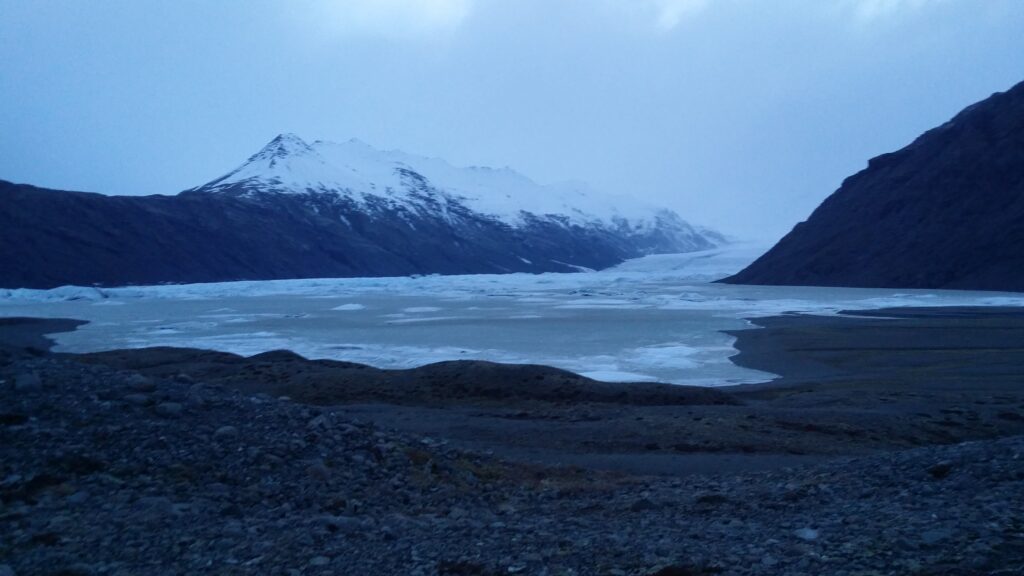
A bath in Fjallsárlón was not right – in March.
Various activities are offered at Fjallsárlón, including kayaking, sailing and boat trips. We haven’t done that! But we have tried swimming in Fjallsárlón twice. Bathing in March was impossible, as the lake was frozen.
Bathing shoes would have been just right.
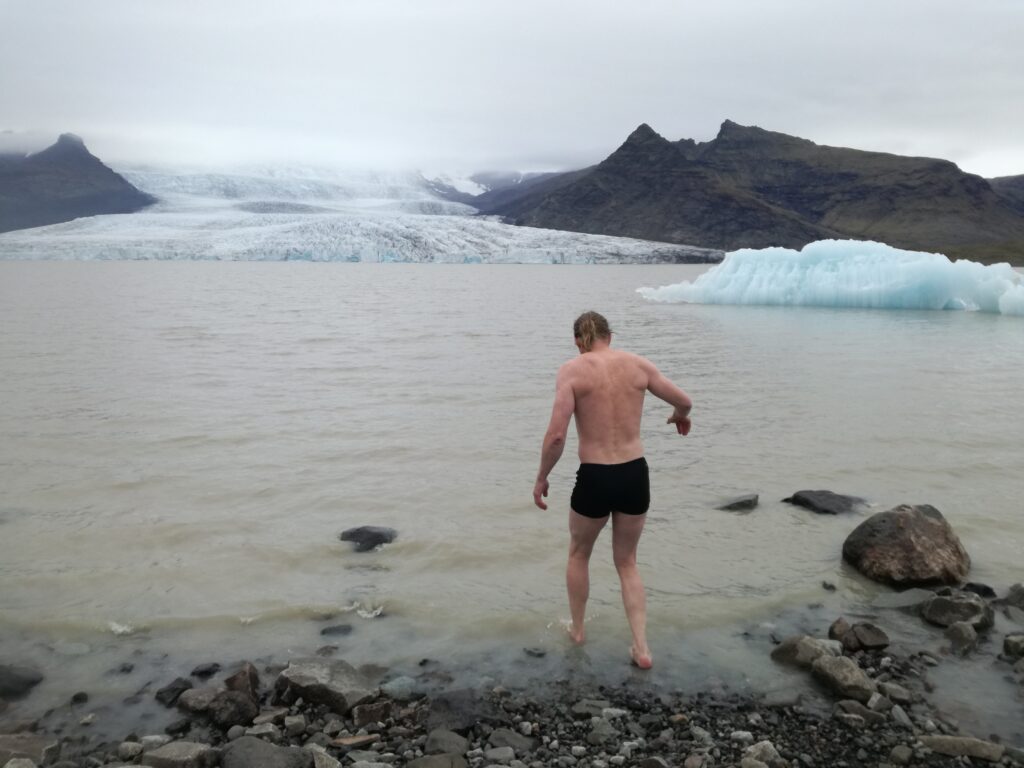
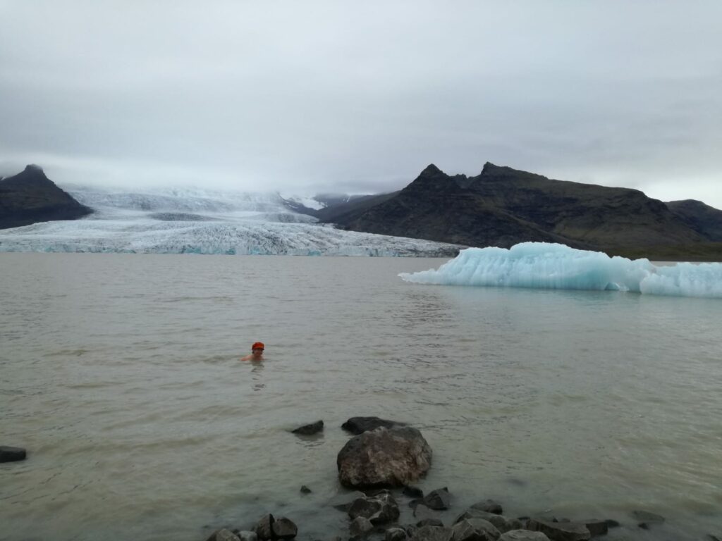
In September, however, we took a bath, all alone (due to covid19). Cold yes, but nice! It was wonderful to see the beautiful blue ice floating in the lake.
Fjallsárlón in September was just fine.
Earthquakes have been recorded below Öræfajökull in both 2017 and 2018, so there may be an eruption here before too long. North of the glacier is Iceland’s highest mountain Hvannadalshnjúkur, 2110 m.