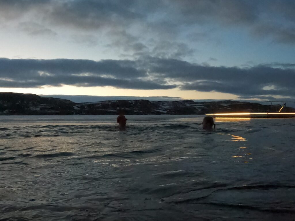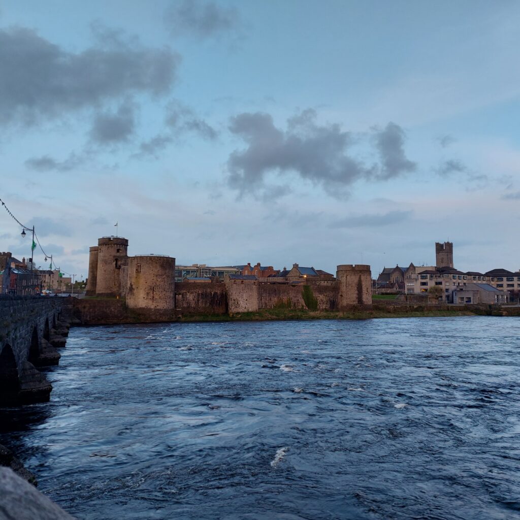
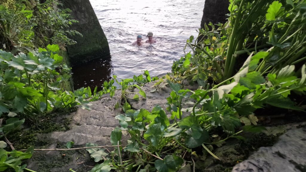
ToBatheOrNotToBathe went to Limerick one day
Musicians’ pubs were not far away.
The Shannon was rough,
But the bathers were tough:
“Time’s always right for a bath!”, as they say!
Right now is always a good time for a bath!
ToBatheOrNotToBathe went to Limerick one day
Musicians’ pubs were not far away.
The Shannon was rough,
But the bathers were tough:
“Time’s always right for a bath!”, as they say!
On an island with almost no soil at all, one might wonder how they found wood in the past, for all possible needs. Some use simply had to be stopped – for example, firewood could be replaced by dried livestock dung. Other needs are more difficult to quit, be it trusses for roof structures, or wood for boat building. One solution could be trading with the ‘mainland‘. But something that always helped was wreck looting, stranded boats were not left untouched – everything that could be used was salvaged. And on the Aran Islands they also built boats almost without the use of wood.
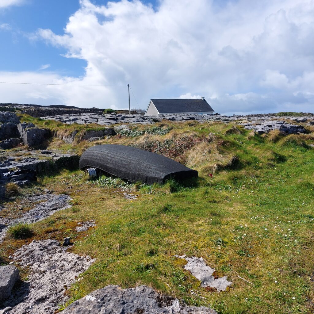
The Aran Currach is a light type of boat, built up of moldings covered with canvas and tarred. It is very well adapted to heavy sea and can withstand quite bad weather. It is said that the fishermen at the Aran Islands did not learn to swim back in the days. The idea was that if the sea was so rough that the currach went down, they wouldn’t survive anyway. Swimming skills would only prolong the agony, which would end in a certain death anyway.
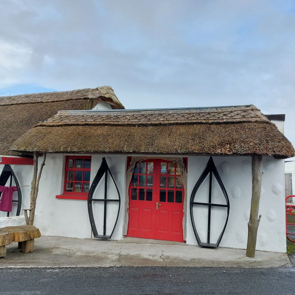
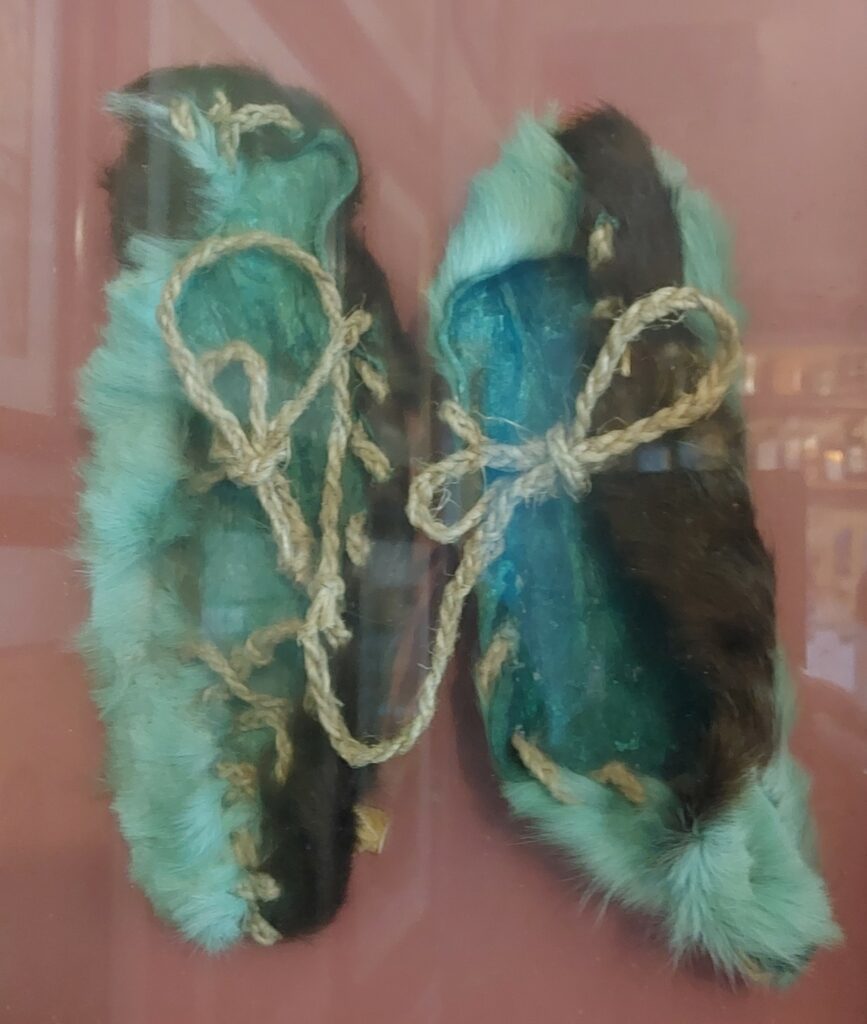
In ancient times, the currachs were covered with cattle hides, and it is considered likely that the first islanders came to Ireland and the Aran Islands in such boats (in the Stone Age). The canvas boats are vulnerable to punctures, and normal shoes cannot be used. Instead, traditional Irish leather moccasins with the hairs out, the so-called pampooties, are worn.
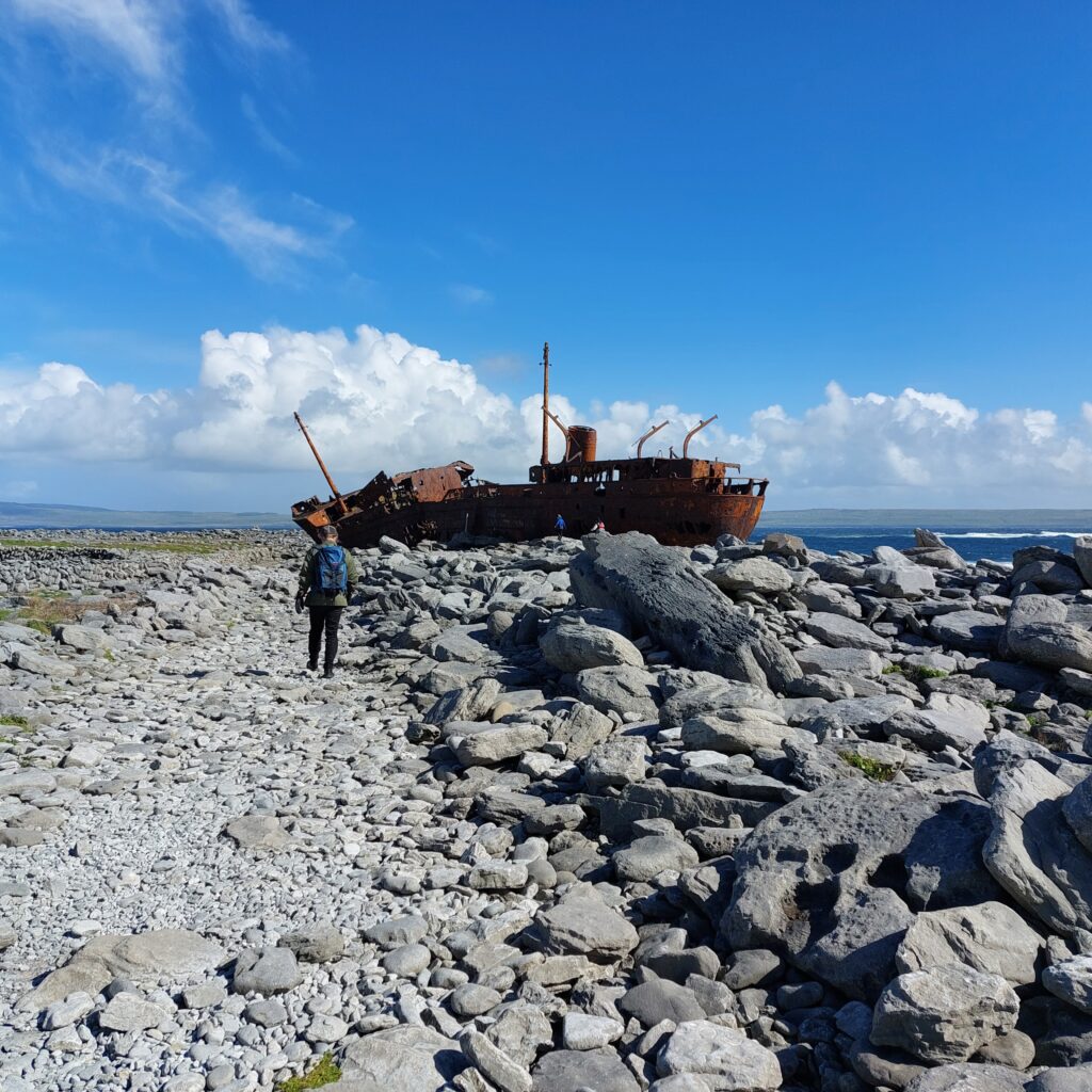
A somewhat more solid boat, Plassy, shipwrecked on a reef outside Inisheer in 1960. HMS Juliet was commissioned by the British Navy at the beginning of WWII, and it served, among other assignments, during the Allied landings in French North Africa. After the war the navy no longer had use for the ship and it was sold as a merchant ship in 1947. In 1951 it was bought by the Limerick Steamship Company, and renamed MV Plassy, after the bank Plassey by the river Shannon, upstream Limerick city. When she sank, Plassy was filled with general cargo consisting of, among other things, whiskey, woolen yarn and shoes.
It was an hazarduous rescue operation by night, March 8th, 1960. The crew of 11 couldn’t get ashore on their own, because the lifeboat had disappeared in the storm. Conditions at Inisheer were even simpler then than now; no cars, electricity, roads – or even toilets (!), as was stated at the 50th anniversary of the incident. The 15 rescuers – also known as ‘The Rocket Men‘ were already struggling to get the equipment cart out (which got stuck 4 times on the way to the sea), but the weather was getting worse and there was almost no visibility due to swirling sand. Once by the shore, they needed 3 attempts to get a line shot over to the ship. Most of the men wore pampooties on their feet, but as they became too slippery on the rocks, some of the rocket men ended up working in their woolen socks.
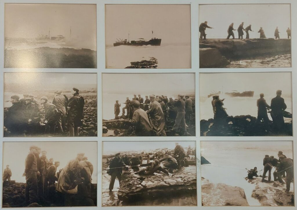
The rescue itself took 4 ½ hours, using a breecher buoy. This is a device where short canvas trousers are attached to a lifebuoy, which is pulled forward using a rope and a pulley (as a zip-line). This way you can save one person at a time, and the operation at Plassy was very successful. The whole crew were rescued, albeit quite chilled, after being pulled ashore through the cold water. This happened during lent, but the islanders immediately broke it by giving the shipwrecked whiskey to warm themselves. The crew had been paid the day before and the money was in their pockets, so they went straight to the pub to dry the money in front of the fire. That was how the money could be spent straight away.
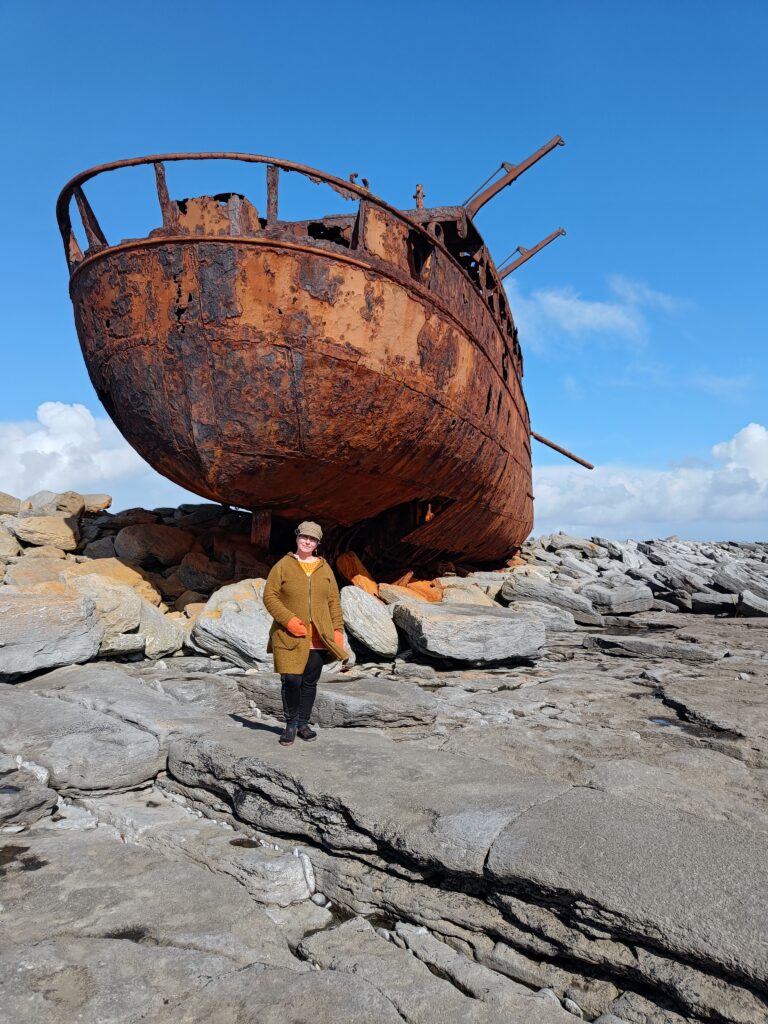
Two weeks passed until the weather became suitable for the ship to be embarked again. The islanders boarded at low tide, and salvaged both wool, shoes and whiskey. They were also able to pick up doors and other wood, which fit well into ongoing construction projects. The priest insisted from the pulpit that robbing the wreck should not happen, but that didn’t help at all, instead that’s when the looting really picked up speed. Bottle after bottle of Scottish ‘Black & White’ was hidden in the potato fields (they wanted to avoid problems with customs), and shoes exchange took place for months afterwards. It took time to get the right and left shoes interchanged so that a suitable pair was obtained. As a well-deserved ‘punishment’, the customs officer had the flu with him when he finally showed up – which put all the islanders to bed.
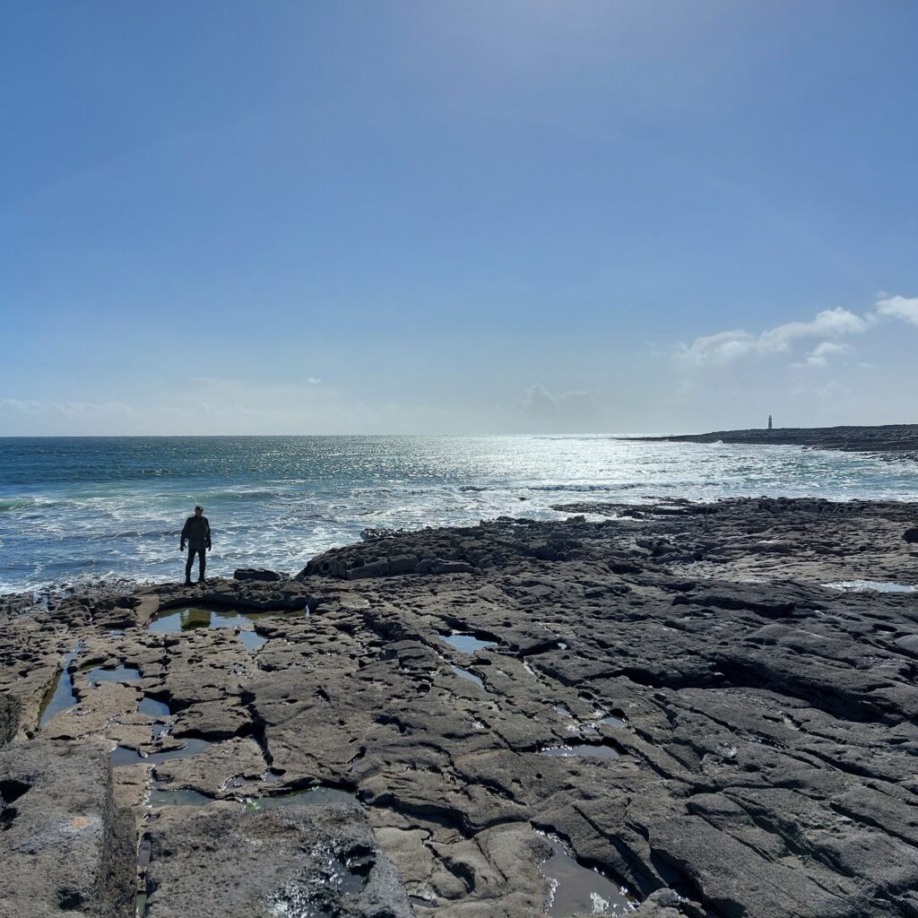
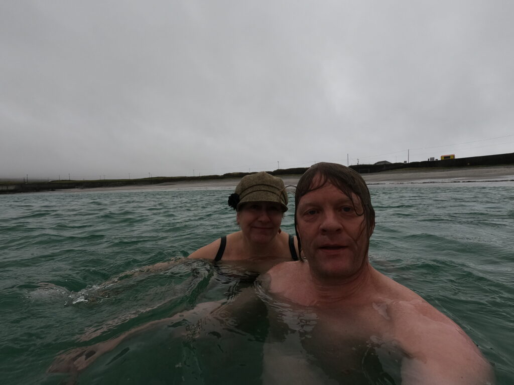
We wanted to swim at Plassy’s! The wreck is now situated on Inisheer itself, this happened in a later storm. Here it is relatively shallow with a continuous train of incoming swells. There were some discussions about the bathing place. Knut wanted to swim as close to the wreck as possible, but Idun was skeptical. After all, we had been warned against swimming on this side of the island, because of the tides. But a short distance away there was a small beach, and there it was possible to have a bath without being knocked unconscious against stones and rocks.
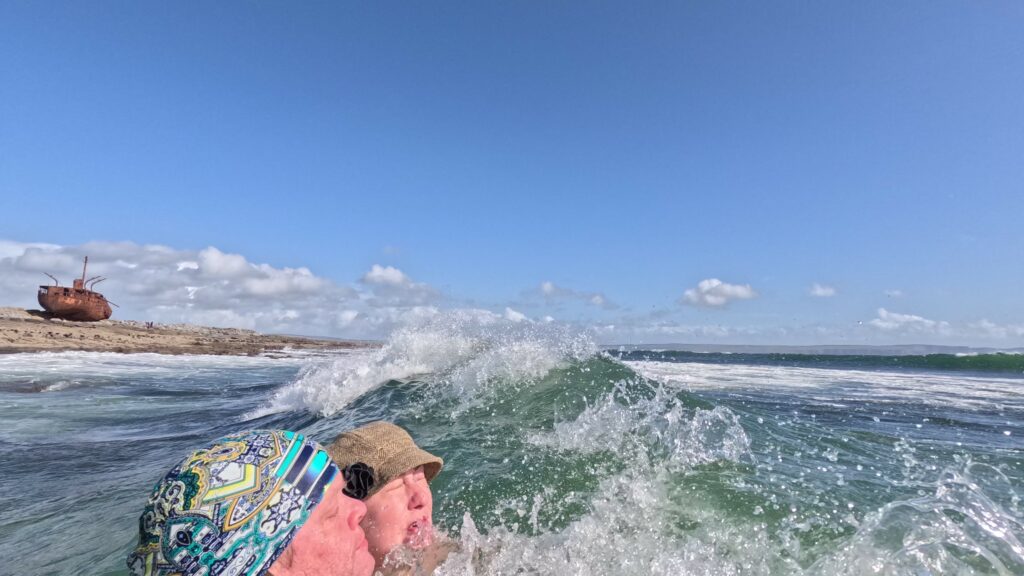
Plassy has become a tourist attraction in itself, and it has been decided to leave the wreck where it is. As part of the opening sequence of the TV series ‘Father Ted’, she has become part of the Irish folk soul. And fine, she is, we think. Rust can be very beautiful!
Sources:
– The article ‘The Plassey Shipwreck‘, Ireland’s Own, on the occasion of the 50th anniversary of the sinking.
– Wikipedia
Inisheer has an airport, but we recommend arriving by boat either from Galway via Inishmore, or from Doolin, County Clare. In the summer season, up to 1,000 day-trippers come ashore here every morning at 11 am.
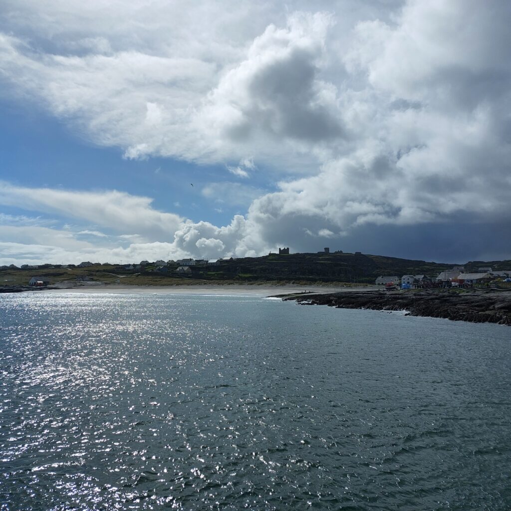
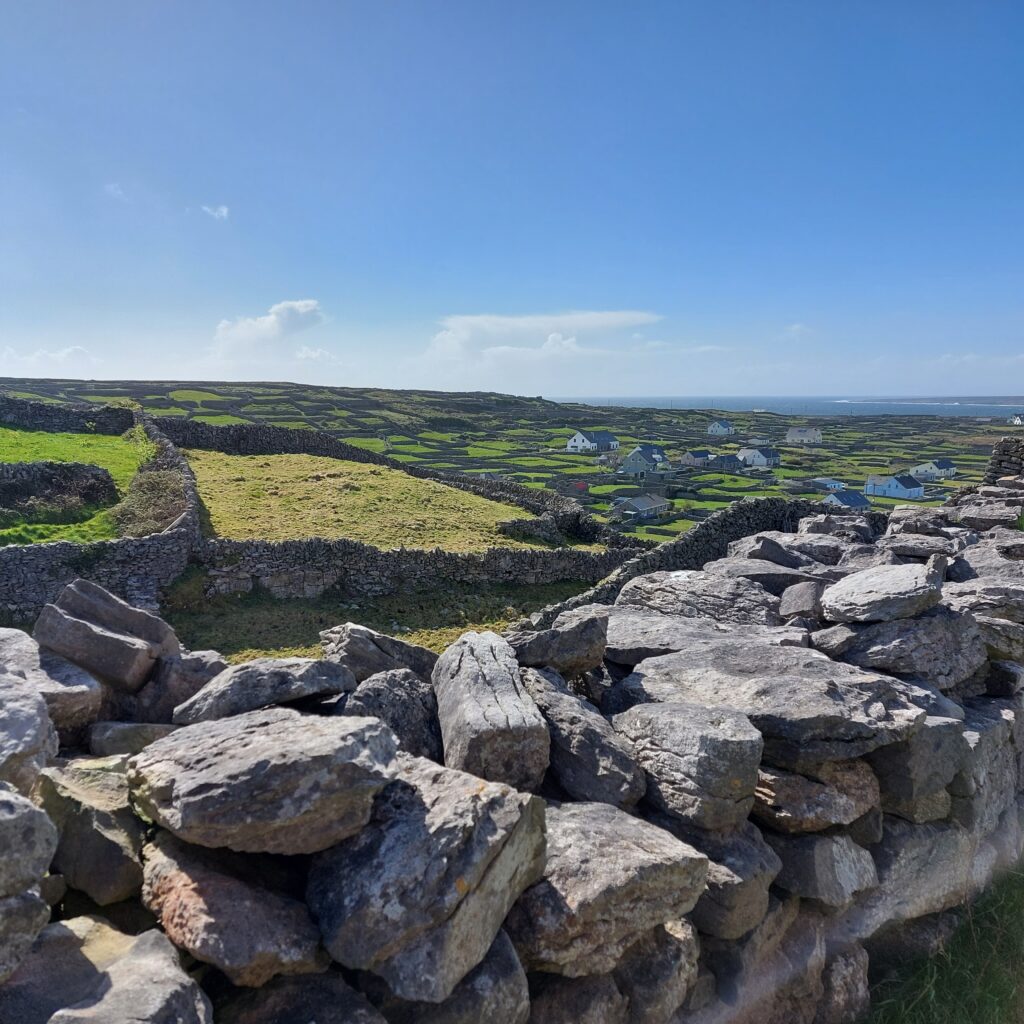
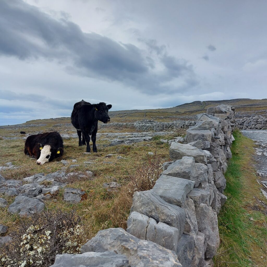
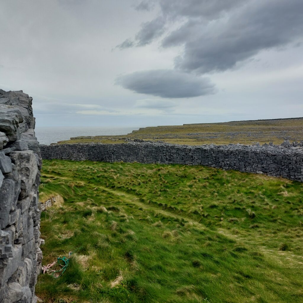
The name Inisheer means ‘The Easternmost Island’, it is also the smallest of the three Aran Islands. Smallest and nicest, we think! The island is approximately circular, with a circumference of 12 km. This is a wonderful place to be! The winds are strong and the weather is steadily unstable, but the village by the harbour is cosy, warm and friendly with myriads of stone fences, green grass and ancient monuments.
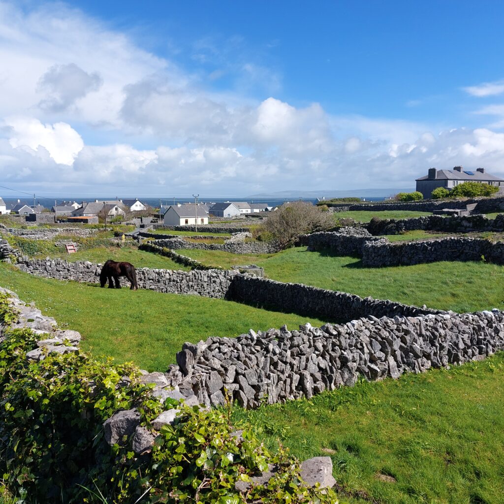
The stone fences date partly from the Bronze Age, when the first soil was made from seaweed, kelp and sand. Further subdivision into very small fields came with population growth and potato cultivation some 3000 years later. Nevertheless, it is the remains of ancient graves, forts and churches that make the biggest impression on this island.
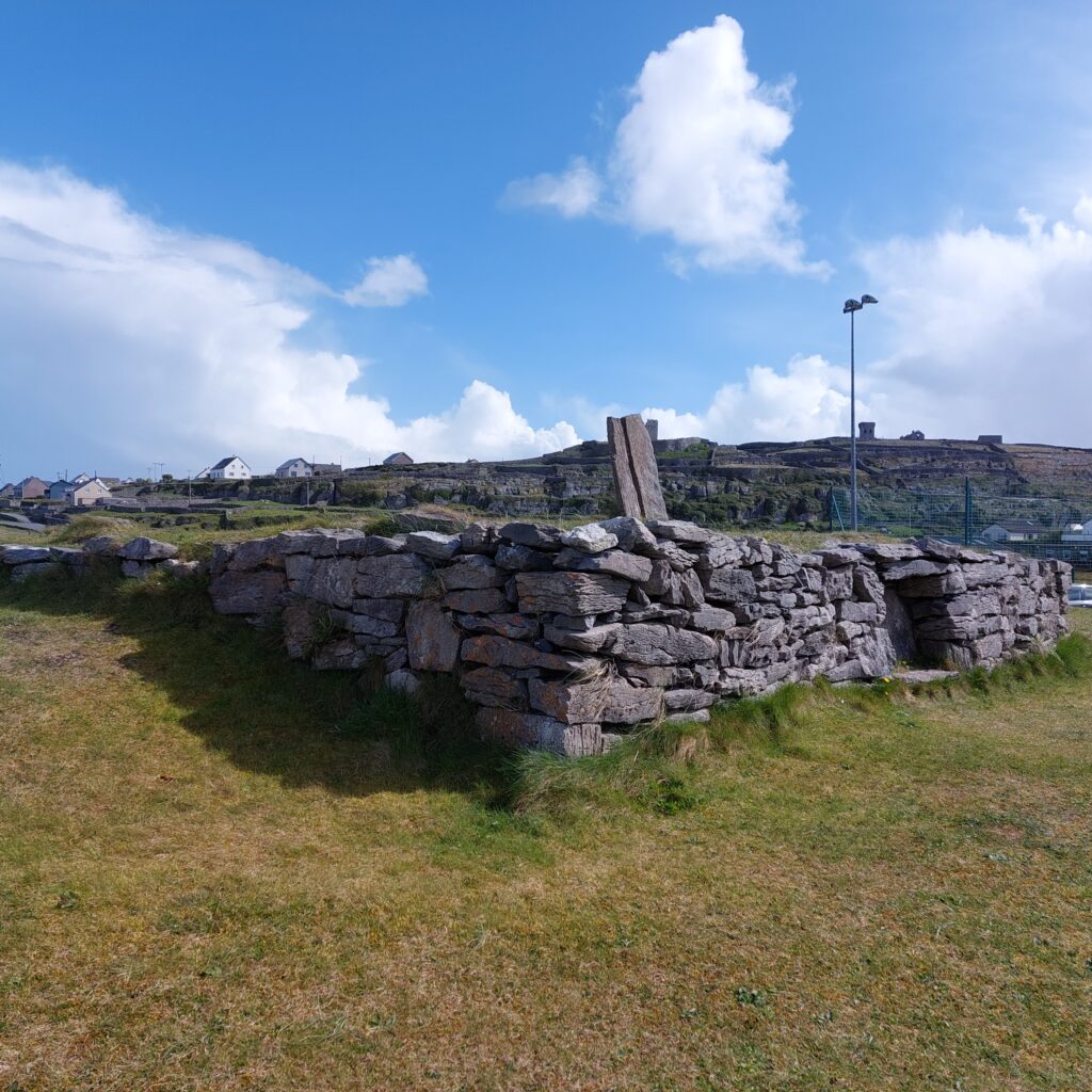
The Bronze Age tomb of Cnoc Raithní was well hidden and forgotten until the sand suddenly blew away during a storm in 1885. Excavations revealed urns with cremated bones and a bronze awl. The upper parts were built by early Christian islanders around 500-800 AD.
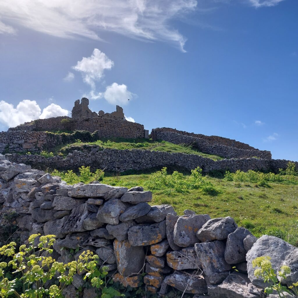
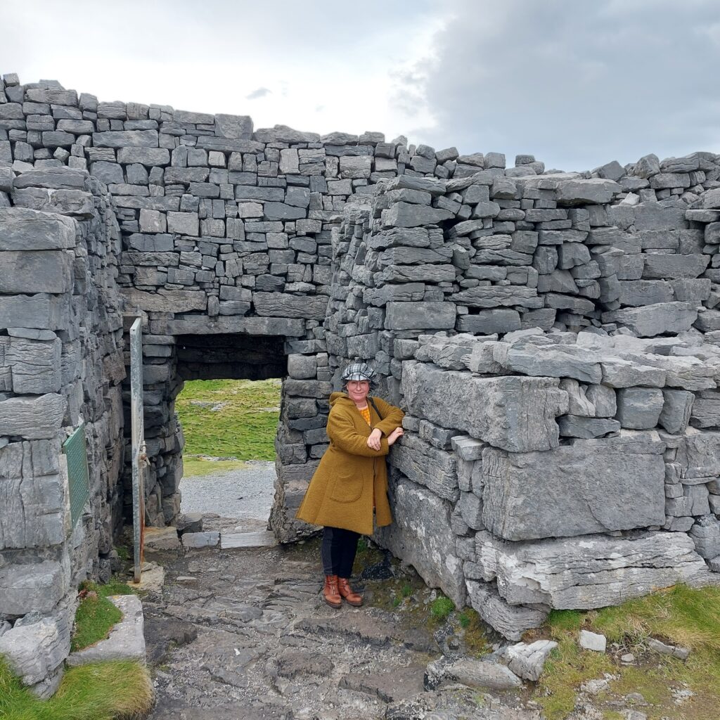
The highest point on Inishmore is dominated by O’Brien’s Castle (Irish: Caisleán Uí Bhriain). Today’s ruins date from the early 15th century, erected by Clann Teiges, from a branch of the O’Brien family. The castle was taken in 1582 by ‘the O’Flahertys of Connemara‘ and again in 1652 by Oliver Cromwell. O’Brien’s Castle has remained in ruins ever since. But it is beautiful, in all its decline!
Today, there are 260 people living at Inisheer, divided into only 6 surnames. As a result, first names and nicknames are often descriptive, so here you should stay average, not to be ‘doomed by the name‘!
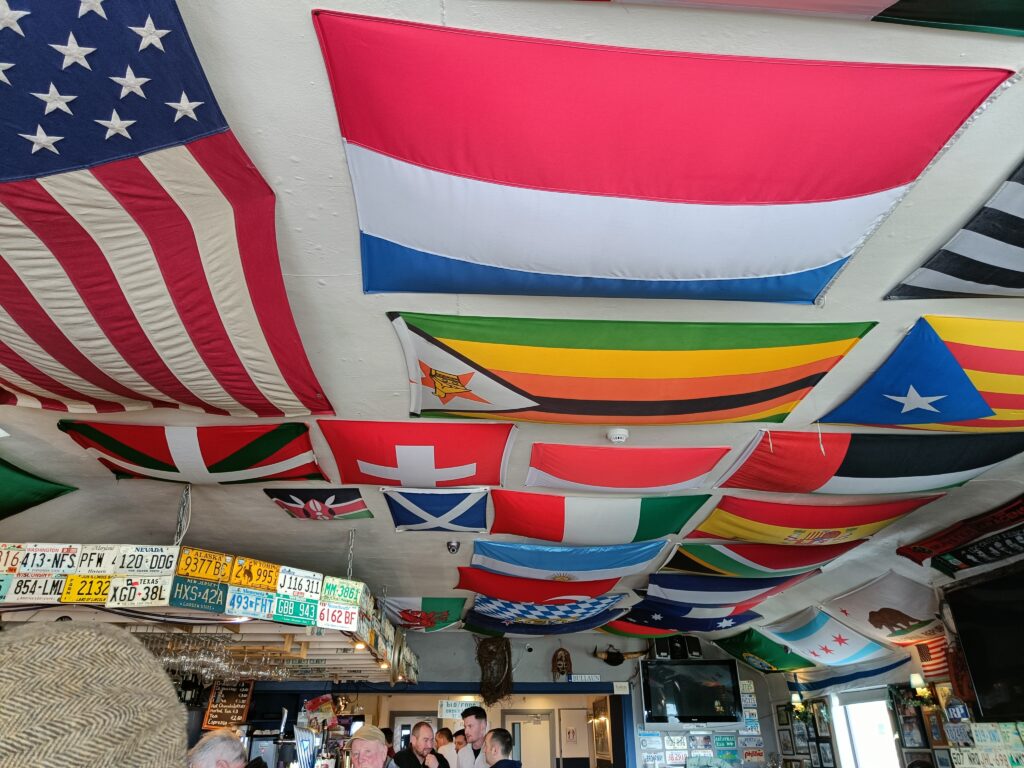
Time moves slowly on Inisheer. Reliable electricity became a fact as late as 1997 (!), and ATMs do not exist (they take credit cards, so there is no crisis without cash). Despite the small population, there are actually several pubs at Inisheer. And Knut was very excited indeed about this one, equipped as it is with a flag quiz in the ceiling:
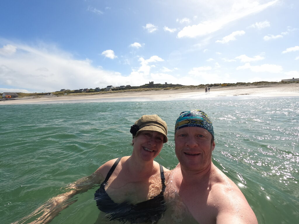
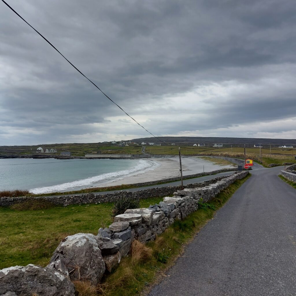
The first thing that greets you when you arrive in Inisheer is the beach (An Trá), which we highly recommend. Here we had a really nice Easter bath, and it is perfect also for swimming. At lunchtime you will even have the beach all to yourself, and that’s fine too.
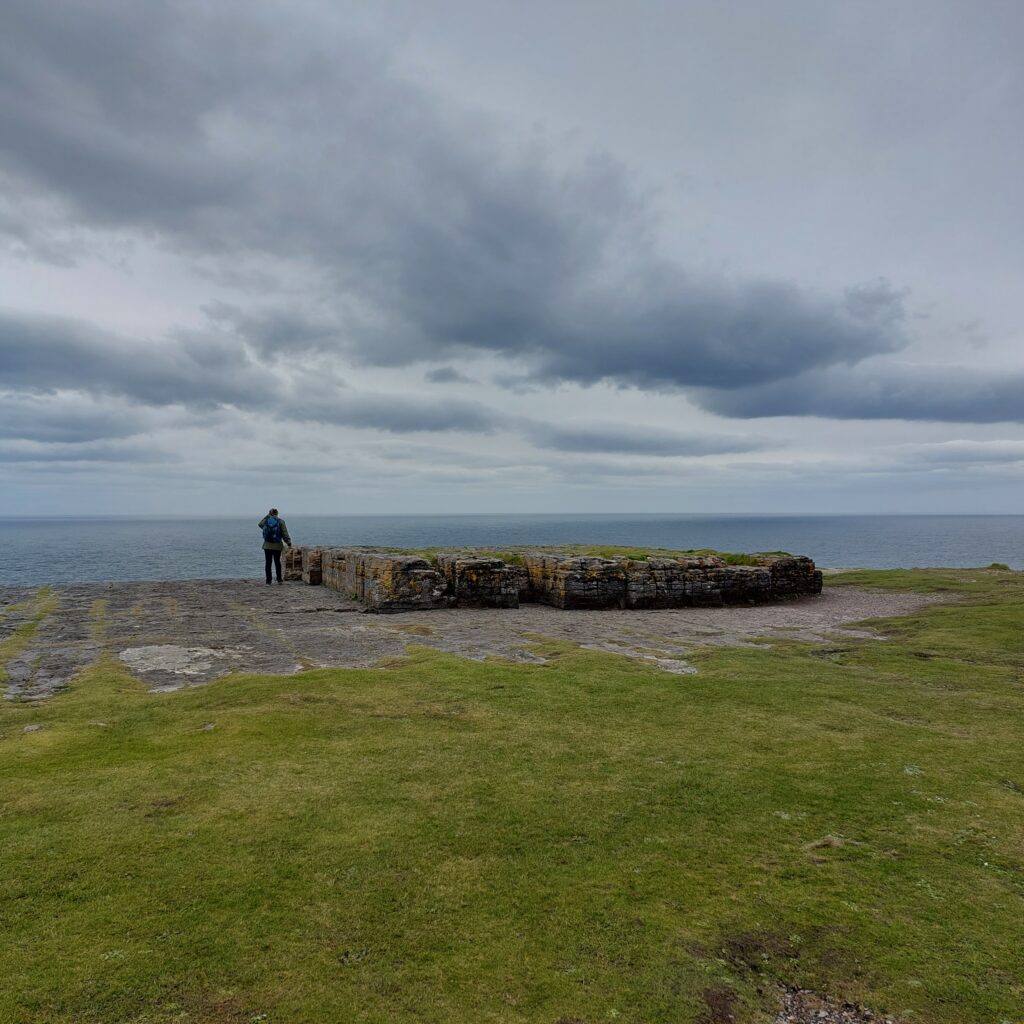
At Inishmore, human remains have been found as far back as the Stone Age, and some of these remains are very easy to spot. The most impressive monument of them all is Dún Aonghasa, a Bronze Age fortress that was constructed around 1100 BC.
There are two explanations for the name. One is that it originates from the God Aengus, who plays a central role in 5 myths in Irish folklore. Aengus was associated with youth, love, summer and poetry. The other explanation is that the fort was built by King Aonghus Mac Úmhór, who led his people to the shores of Galway Bay and onto Inishmore after losing the war against Clann Chuian.
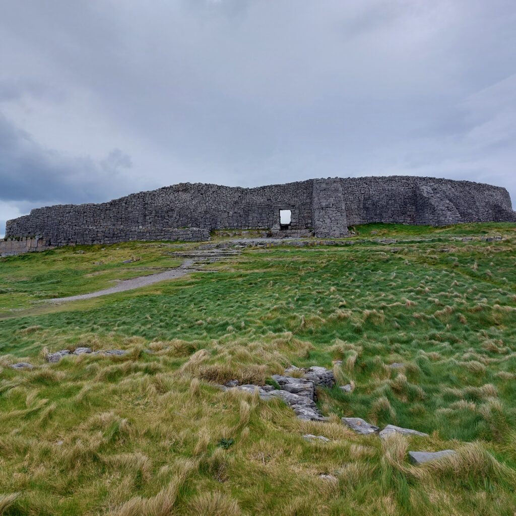
The fort consists of three sets of ring walls. The two outermost walls form a semicircle against the cliffs to the west. Between the two outermost walls a field of upright stones is planted, called ‘Chevaux de frise’, as a protection against invasion. The area is difficult to pass even today.
The innermost (and thickest) wall is believed to have been circular when it was first built, and also when it was restored some 1,500 years later (in the early Middle Ages). After collapsing into the sea, also the inner wall appears semi-circular today.
Dún Aonghasa was investigated archaeologically in 1992-95, and a number of interesting findings were made, including house foundations and Bronze Age graves. These islanders cultivated barley and oats. Compared to other Bronze Age settlements, the Aran population had more sheep and less cattle and pigs. The latter probably because the pig’s tendency to dig in the soil is not sustainable on islands with almost no soil at all. The menu was otherwise based on fish, shellfish and birds, especially guillemot, but great auk bones have also been found (extinct in Ireland some 3,000 years later, in 1835 and in the rest of the world some years later).
After a visit to Dún Aonghasa, time will be just right for both shopping, lunch and bathing.
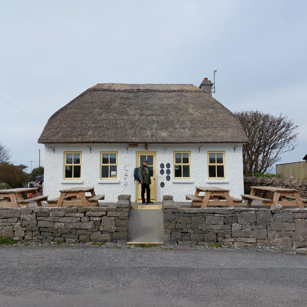
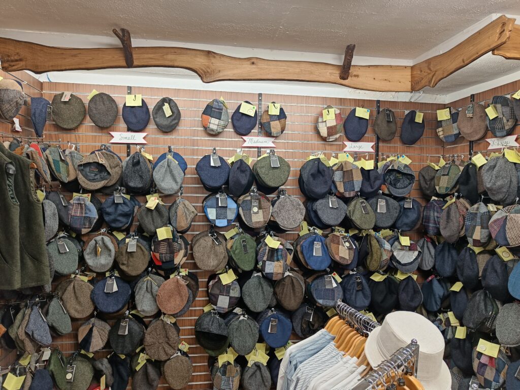
This far into ‘County Wool‘, we were sure to find woolen hats and clothes to buy. But since Idun knits quite a lot herself, it is not interesting to buy knitted sweaters, and it doesn’t help that they are very, very, very beautiful. In these islands, each family has its own patterns, and ‘Aran knitting‘ is popular throughout all of Ireland. The typical ‘Aran Sweather’ dates from around 1900, and it used to be offwhite with textured pattern all over. This time tweed was what tempted us the most, and Idun found herself a nice hat, she thought. Knut, on the other hand – completely overwhelmed by the selection, didn’t find any new sixpence this time.
Finally we were ready for a bath, and Kilmurvey Beach a couple of km below Dún Aonghasa is absolutely perfect, also for swimming.
Here you will find fine, white sand, a bench to put your clothes on, and great swells that are fun to fight with, but not dangerous. A great bath!
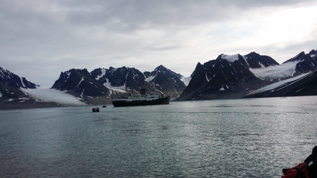
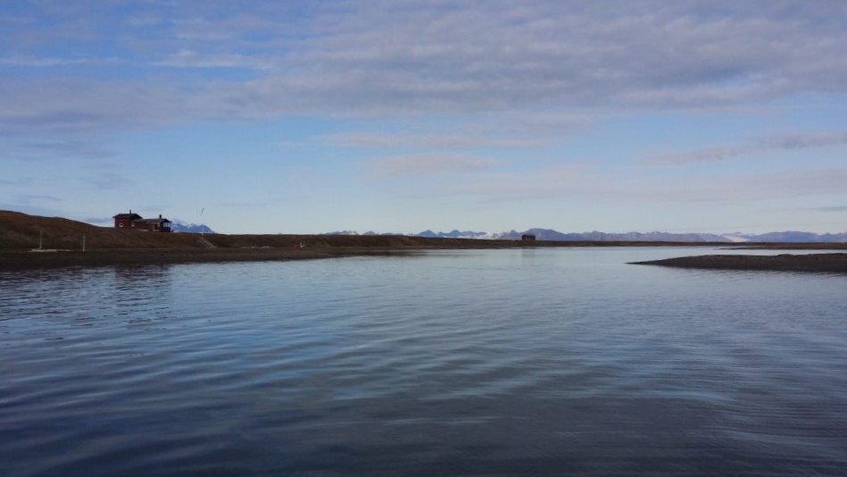
In the summer of 2019, Idun’s older sister Jorunn had another big birthday to celebrate. The celebration was a cruise with ‘Hurtigruten’ from Longyearbyen to the island of Moffen, 80 degrees north.
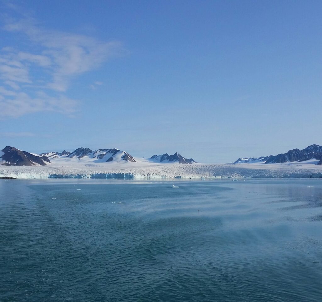
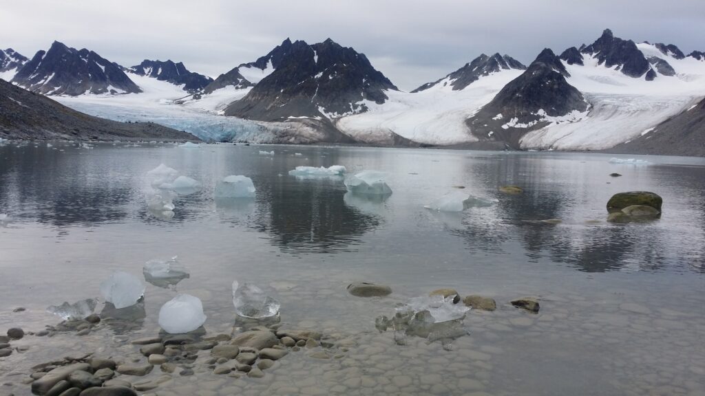
On day 2 of the cruise, we entered the Magdalene fjord north of Ny-Ålesund. Here it is wild and beautiful, and you can admire glaciers surrounded by pointed mountains.
Presumably this is where the name ‘Spitsbergen’ comes from. The fjord’s name is from the 18th century, named after the biblical Mary Magdalene.
On the south side of the Magdalene fjord is a headland with a fine sandy beach, one of the few places in the area where it is possible to a) disembark
b) bury corpses
c) have a bath
An English whaling station was built here in the 17th century.
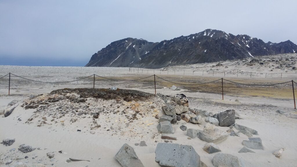
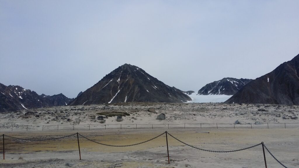
During 200 years of whaling, many people were buried here, and the place is today called Gravneset (the Grave Headland) with Gravnesodden at the end. 130 graves have been found, many of them long after the whale station itself had closed down. The sailors preferred to bury the dead here, where it was possible to dig holes for bodies, instead of throwing the corpses into the sea. The graves are English, Dutch, but also many Basques are buried at Gravneset, they were skilled whalers. In the 1970s, you could still find bone remains in the area, dug up by foxes, polar bears and souvenir-chasing tourists. Today, Gravneset is protected, and large parts are fenced off to avoid wear and tear of the cultural heritage.
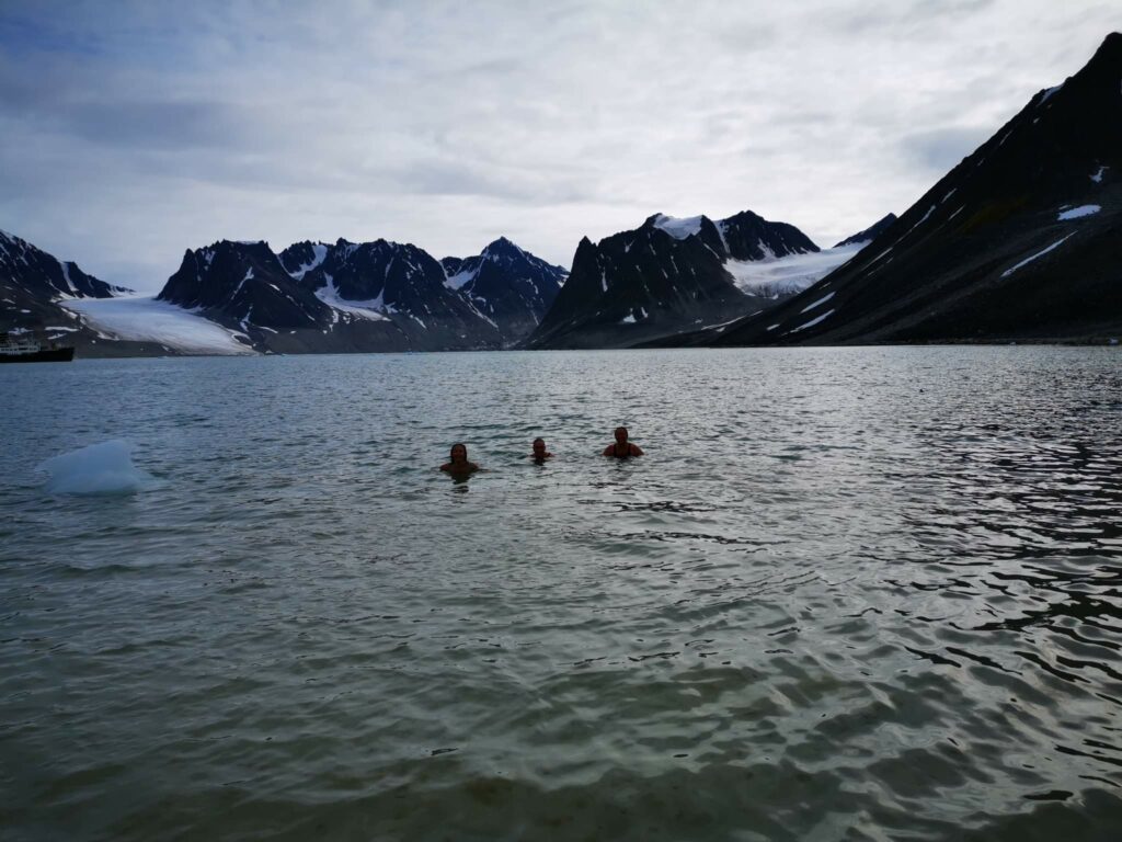
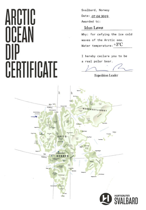
The guides had insisted for two days, that it was compulsory to have a bath at Gravnesodden, imaging that maybe 2-3 people would take the bait and actually have a dip. But that was a severe underestimation of the Løwø family. We ended up with 17 bathers from the ‘Birthday group’ – a new record!
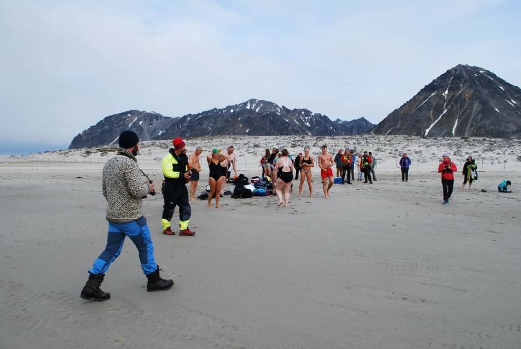
And the bath itself? Absolutely gorgeous! A white sandy beach, crystal clear water decorated by ice cubes – and 3 degrees celsius.
In addition to the buried people, there was also an arctic tern (Sterna paradisaea) who wanted to see us leave Gravneset:
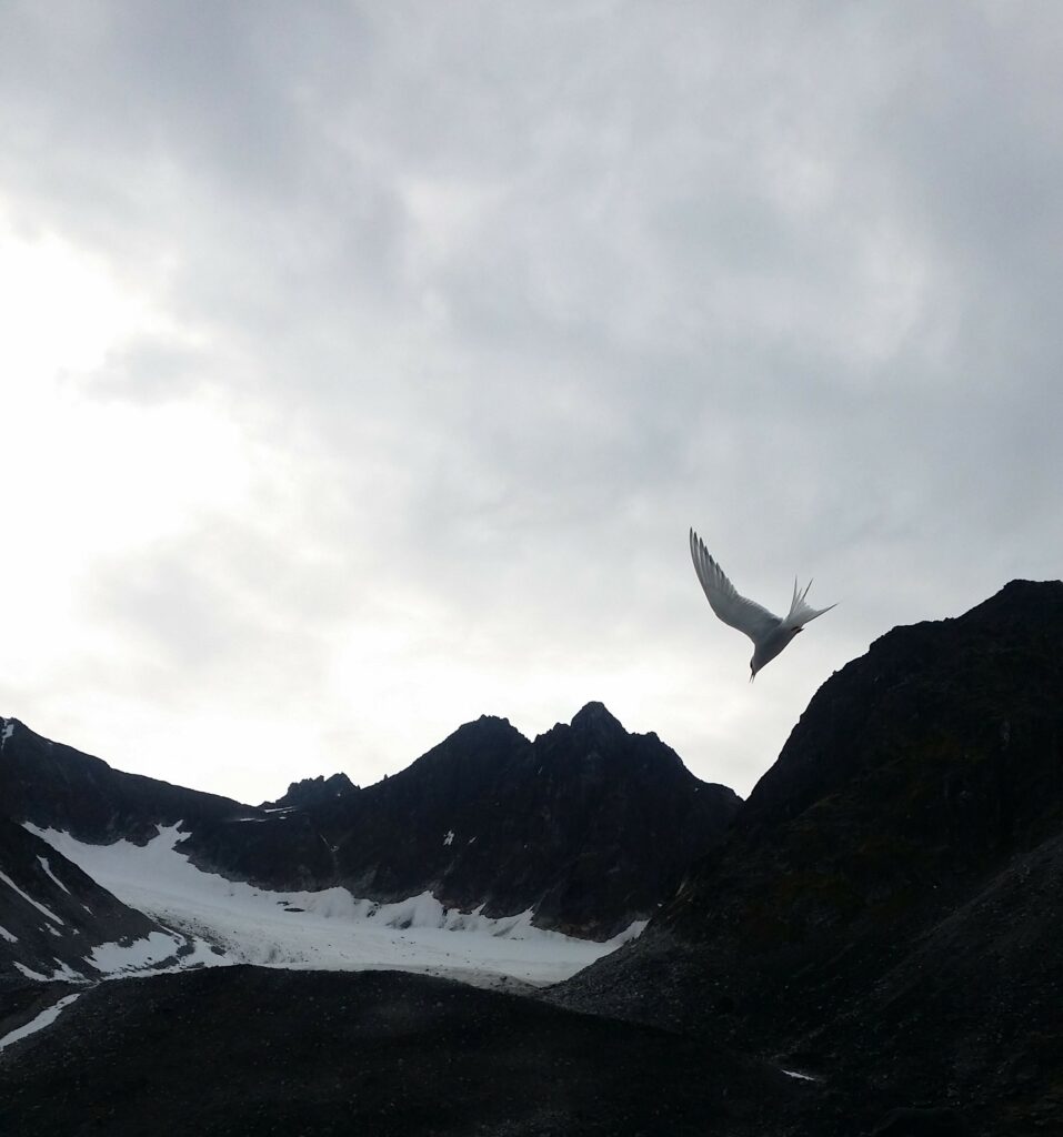
… so then we did. And as ice bathers on a cruise, this time we got physical proof of the bathing madness:
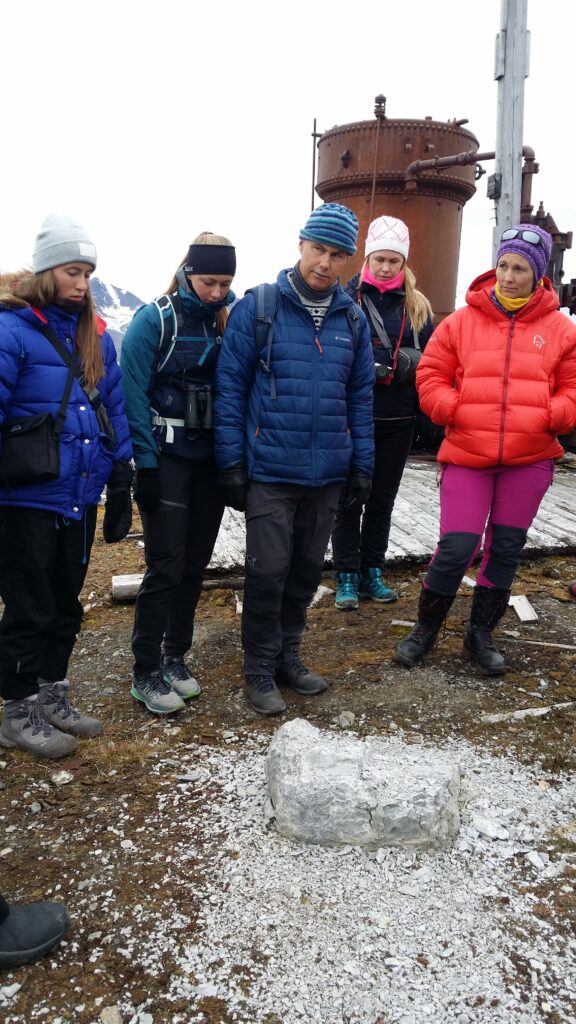
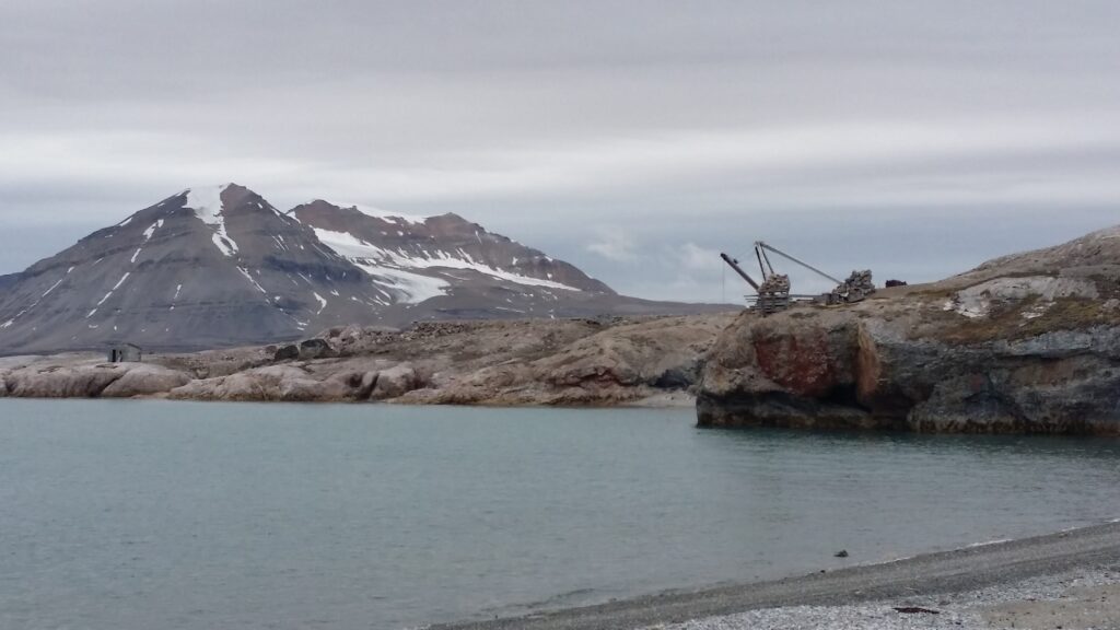
The Kings Bay (Kongsfjord) in the northwestern part of Spitsbergen is one of the most beautiful fjords in Svalbard. On the south side of the fjord you will find the researcher town Ny-Ålesund with the previous coal producing ‘Kings Bay Kull Company’, and on the north side you find ‘Ny-London’, a disused marble mining village.
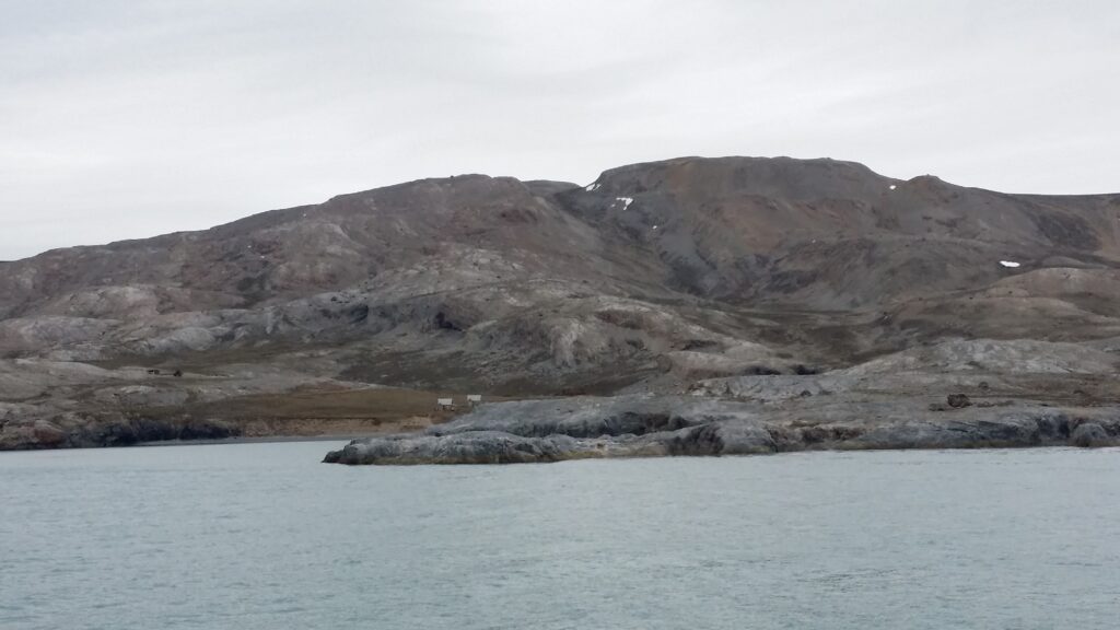
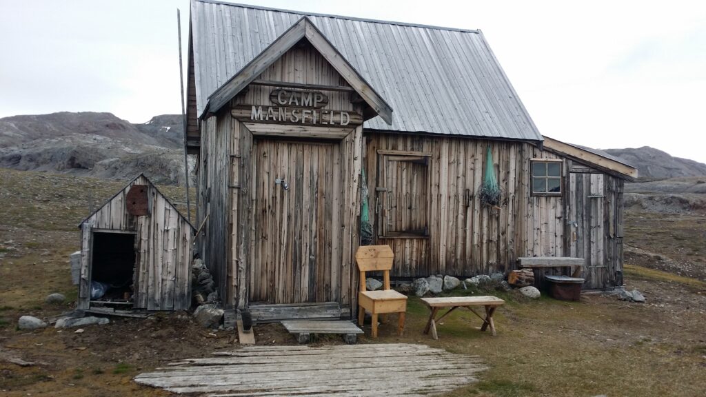
The marble deposits on Blomstrandøya were discovered in 1906. Development of the site began in 1911 and was carried out by the English company ‘Northern Exploration Company Ltd’. The head of the project was Ernest Mansfield. Of the buildings that were erected here (they were supposed to house 70 men), some have been moved to Ny-Ålesund where they are still in use. But some houses remain, partly deserted and partly in use as cabins for the researchers in Ny-Ålesund.
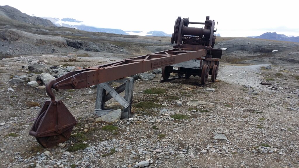
The appetite for investments in the early 20th century was sky high. The best of the technical devices of the time were installed, including railways, steam engines, marble cutting machines and cranes.
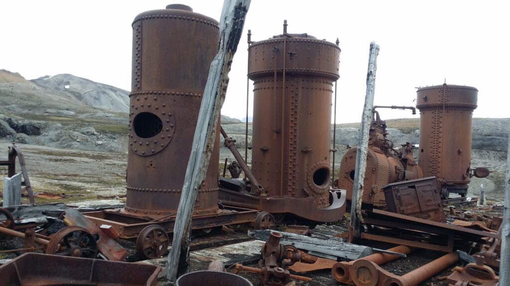
The appetite for investments was continuously increasing throughout the First World War, and the share capital rose to over a million pounds. There were many people who made good money during WWI, and they needed something to spend their money on. The adventure in New London ended in the world’s first stock market bubble, which burst in 1920. Large amounts of money had been invested – without anybody knowing what the marble was actually worth.
When the first small cargo of marble arrived in England, 1912, it turned out that the large, beautiful marble blocks had been transformed into marble gravel due to frost bursting. There was no value whatsoever in the marble from Kongsfjorden. However, this did not stop the investments! Expectations of quick returns overshadowed common sense. Mansfield was fired, and the growth continued. The value was NOK 18 million in 1919. The following year it was 0, and the plant was abandoned.
After so much history teaching, time was just right for a bath, and in New London the bathing conditions are chilly, but excellent!
Here we found just the perfect type of sand, and not too shallow, either.
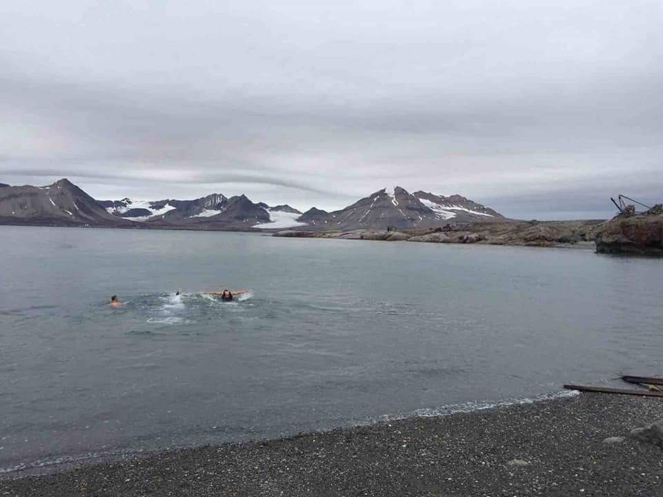
If we swam far? No, we did not swim across Kongsfjorden.
In the summer of 2017, we traveled to Svalbard. The purpose of the trip was for Knut’s mother to experience her daughter-in-law Idun’s place of upbringing.
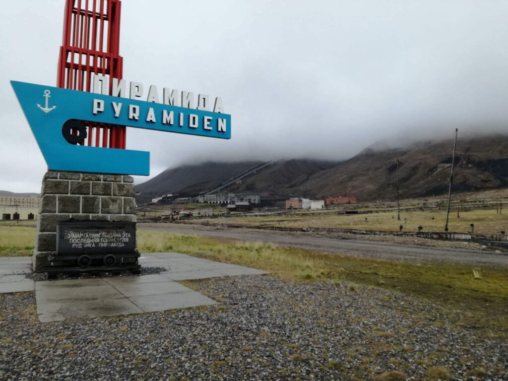
After a few days in Longyearbyen, we booked a boat trip to the Russian ghost town of Pyramiden, which is located by Billefjorden, a fjord branch in the innermost part of the bigger Isfjorden.
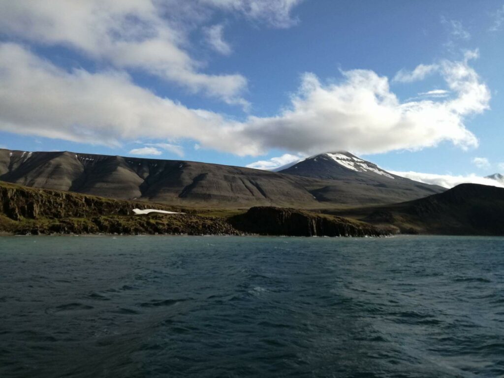
The Pyramid City is named after the pyramid-shaped mountain of the same name. The town was founded by Sweden in 1910. Test drilling revealed coal deposits, but also difficult conditions due to faults in the bedrock. The Swedes therefore chose to concentrate on the Svea mine, and Pyramiden City was sold to the Soviet Union in 1927.
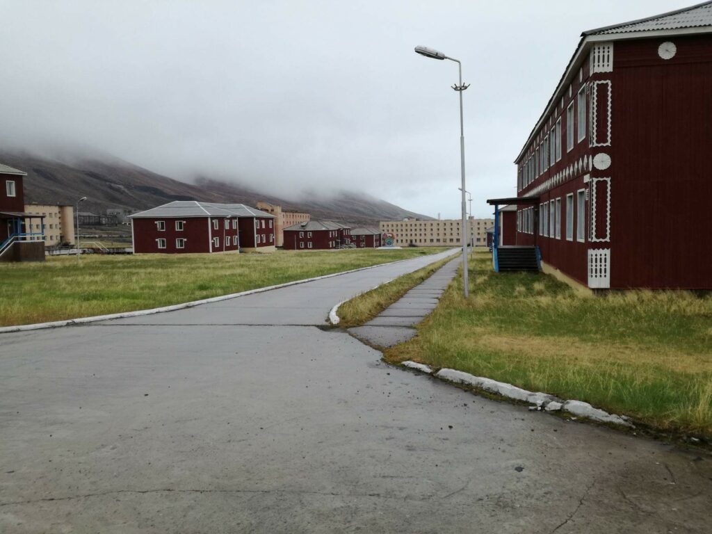
During the Soviet era, the town was developed into a model community with most facilities: Cultural center, swimming pool, library, school, kindergarten and cinema. Pyramiden also had both barns and greenhouses. At the most, some 1,000 people lived here.
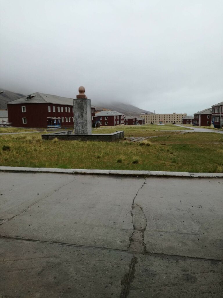
The houses in Pyramiden were built with a desire for good aesthetics. The buildings (both wooden and brick houses) have nice details both outside and inside.
Pyramiden was suddenly abandoned in 1998. This happened during a period of economic downturn in Russia. But it was also connected to the aftermath of the plane crash in Mount Opera near Longyearbyen in 1996, where 141 people died. Many of these were Ukrainian miners working in Pyramiden.
Today, Pyramiden again has a permanent settlement, but the population is slightly reduced – to around 10 people. Hotel Tulipan started up in 2015, and guided tours are organized from Longyearbyen by boat in the summer and snowmobile during winter time.
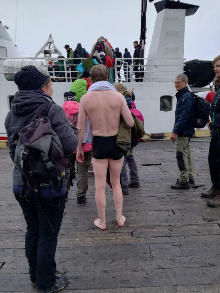
And the bath? Knut grabbed the chance to do his northernmost bath to date: 78°39′ north. In order not to stress the guide unnecessarily, it was a dip in the harbour. When Pyramiden was built, a distinction was made between the technical installations and the housing. The bath in the harbor therefore did not take place in an idyllic Soviet living- and bathing area.
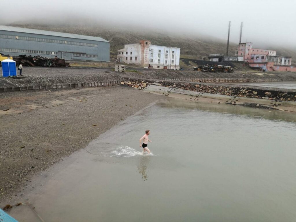
And after the bath? Then it was just a matter of standing in line to enter the gangway.
The highlight of the return trip was the visit in front of the Nordenskiöld glacier, and the many beluga whales that were swimming in the foreground.
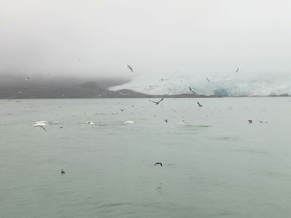
With this sight, it doesn’t matter if the weather is foggy!
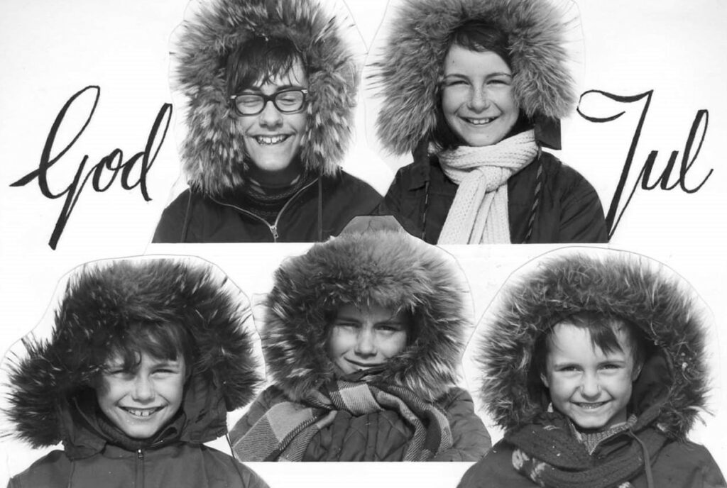
In 1999, Idun’s older sister Jorunn celebrated her birthday at Spitsbergen, where the 5 ‘Løwø Children’ grew up.
The first part of the program was a guided bus tour in Longyearbyen, where the guides were ‘The Løwø children’ themselves.
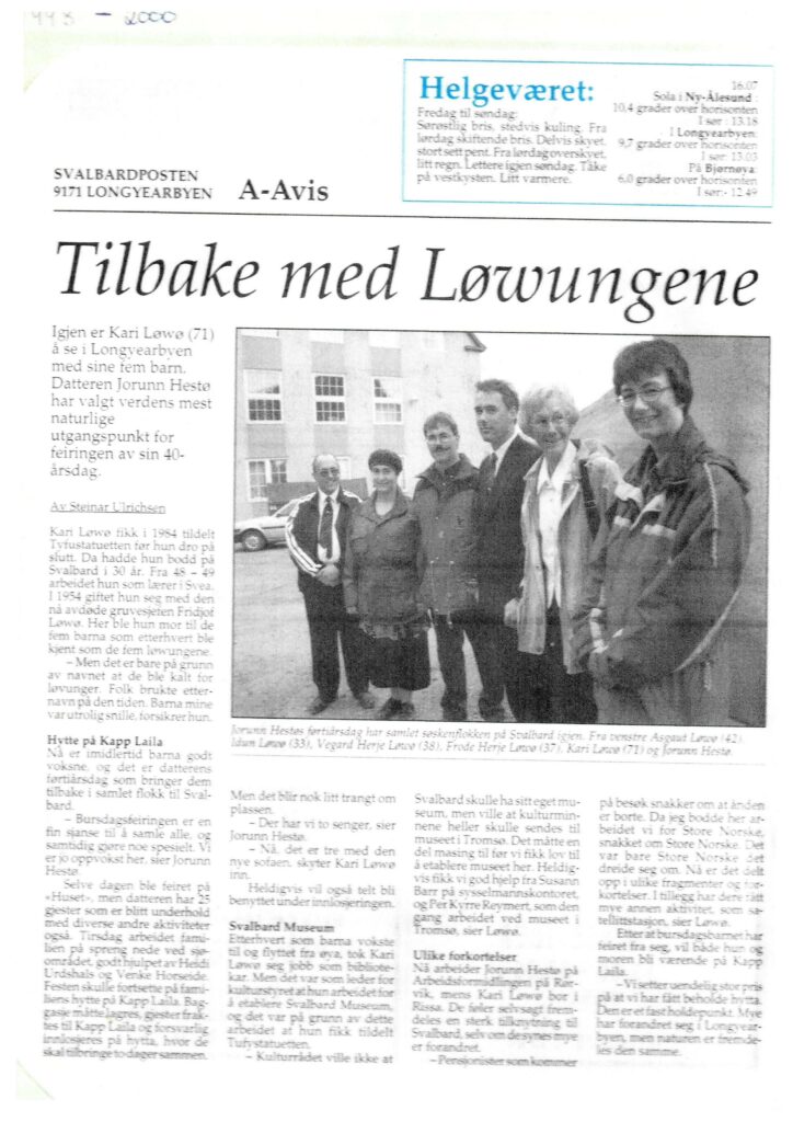
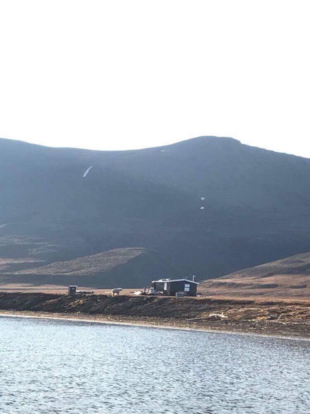
The birthday dinner took place at ‘Huset’, and the following day we went to the cabin at Kapp Laila. For many years our mum Kari and dad Fridtjof had a cabin in Adventdalen (below Operafjellet), but it was inaccessible all summer because of the big rivers. In 1982, they took over a working barrack from Birger Pedersen, and this was to become the new cabin – at Kapp Laila, midway between Longyearbyen and Barentsburg. The cabin was therefore ok. But how to move it from Longyearbyen to Kapp Laila?
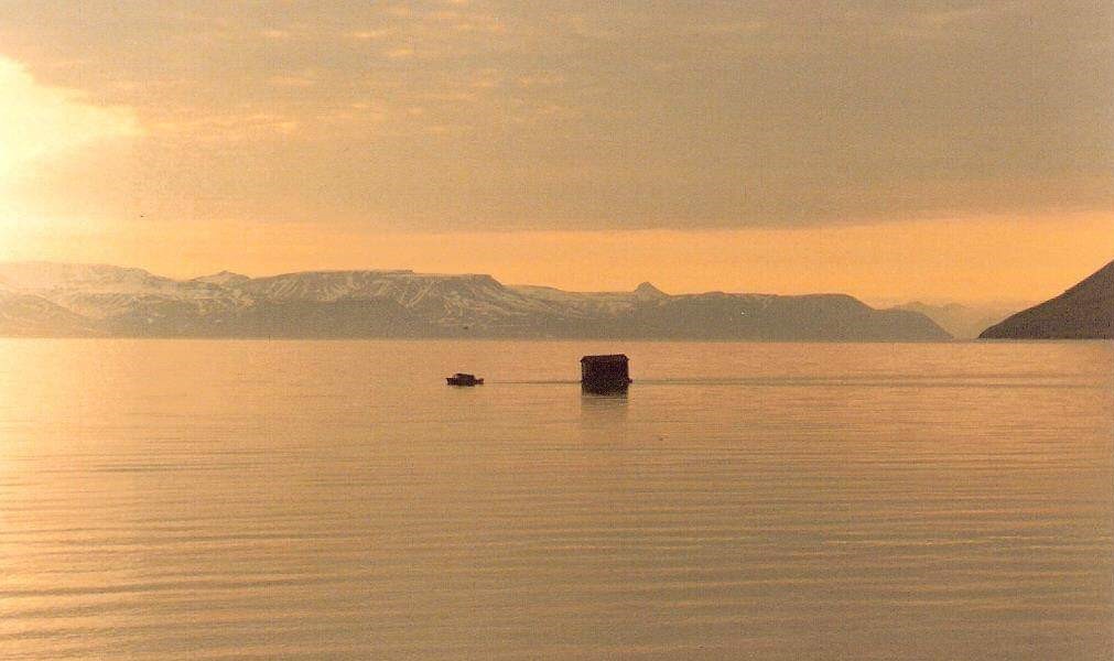
The answer was: On a raft! After all, they had a 16-foot boat called ‘Hårek’ with a 50-horsepower engine in the back. No problem, right? Extra muscle power was hired via their youngest son, Frode. However, he was tired after working double shift in mine 3, and needed rest. And he got that – on the coach in the cabin while it was on tour. The towing took 24 hours. Conveniently enough, there was a wood stove in the cabin, so they could even make coffee on the way.
Kapp Laila is accessible both summer and winter, but there is a ‘but’ during summer season. The cabin is located by a lagoon, which is so shallow that you have to plan arrival and departure times according to the tides.
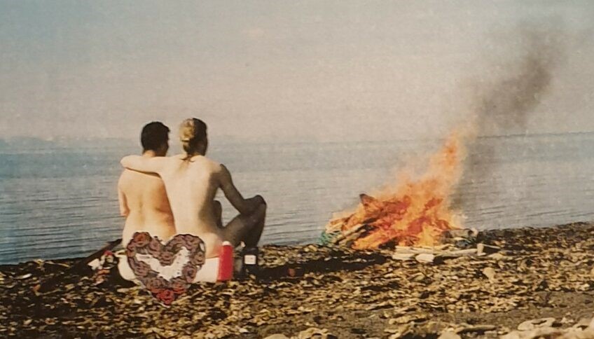
We stayed and celebrated our sister at Kapp Laila for a whole week, and it was splendid weather every single day. So we rigged some driftwood as benches, and barbecued by the sea every afternoon. Fabulous! The first night we were so many guests that there wasn’t room for everyone indoors (Jorunn had also rented two neighboring cabins). Idun and Knut therefore slept in tents outside, as Idun’s eldest brother Asgaut also did. ‘What about the polar bear risk?‘ Knut asked. ‘There’s no risk‘, Idun replied: ‘The Løwø family never sees any polar bear‘. And with some red wine in the body, it was easy to fall asleep in the midnight sun… and just as suddenly wake up the next morning to outside noises. Idun jumped up and picked up the rifle that was hidden under the sleeping bag. Was it actually a polar bear? The zipper in the tent was carefully pulled down, and Idun looked out: ‘What’s going on?‘ It was Asgaut who had crawled out of his tent: ‘I don’t know if I’m most afraid of polar bears or lying on top of a gun – there will be no more sleep anyway!‘ The next night we moved into ‘Bikkjebu’, the dog club’s cabin , and felt safe there.
One night after playing ‘Mattis’ (card game) for hours (in traditional student way, the looser (‘Mattis’) from the previous round had to wear a funny headgear, read: a sleeping bag cover), we found out that time was just right to swim in the lagoon. It was a wonderful midnight sun night. What could go wrong? Well, the tide could obviously be of the wrong type… This night water was definitely low, and we realized that at low tide the lagoon consisted of equal parts (15 cm / 15 cm) water and mud. We had a dip, but this bath is not really recommended by ‘Tobatheornottobathe’. But sunbathing in the midnight sun? Yes, that is something we will recommend! Doesn’t do much for the tan, though…
And the polar bear? A bear mother with two cubs attacked the fridge (= a tub with food under the balcony at the north wall) one week later. Tobatheornottobathe had left Svalbard by then, but those relatives remaining are still talking about the incident.
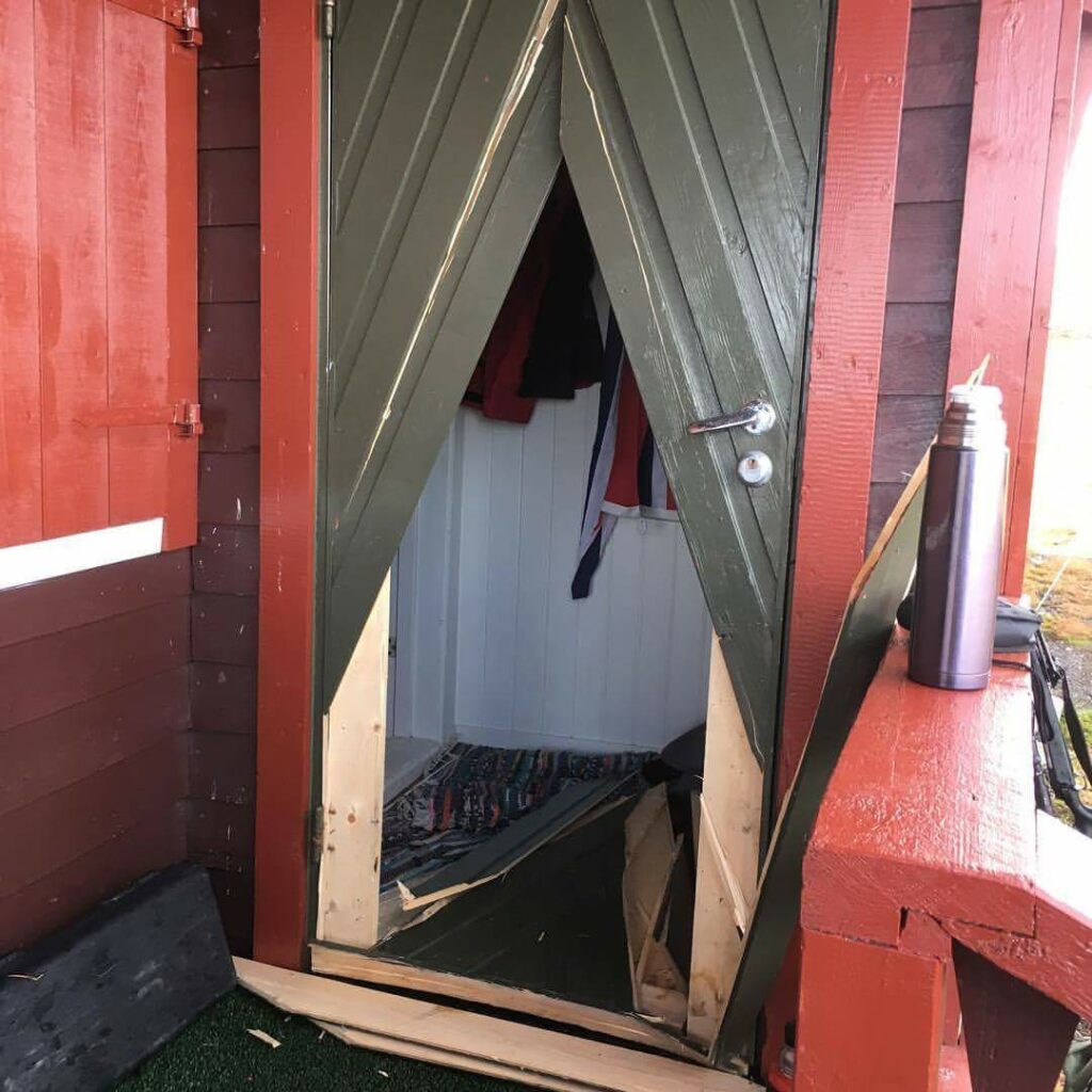
Depending on the mood, it doesn’t need a door either, the polar bear can just as well punch itself through the wall. And why does it do that? In search of food, of course. The polar bears are very fond of chocolate, but not all kinds of food are appreciated, as you can see in the next photo (also from the cabin at Kapp Laila, but not in 1999).
In 1999 the three bears broke into cabin after cabin, but were shot as they arrived Barentsburg. The Russians don’t let the bears rule their lives.
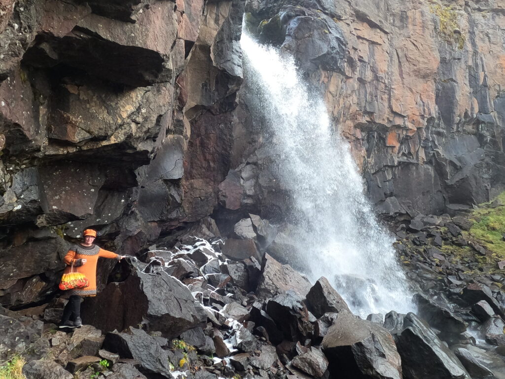
In the Icelandic region of Austurland, the river Miðhúsaá flows west towards Egilsstaðir and then finally ends up in Lagarfljót. Except during the snow melting period, this is not a big river, more like a stream. But in the spring, on the other hand, it is much larger. Miðhúsaá is worth a short detour, because there you can enjoy the view of two different waterfalls: Fardagafoss and Gufufoss.
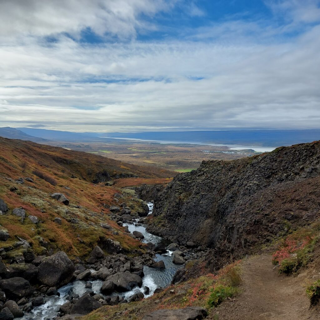
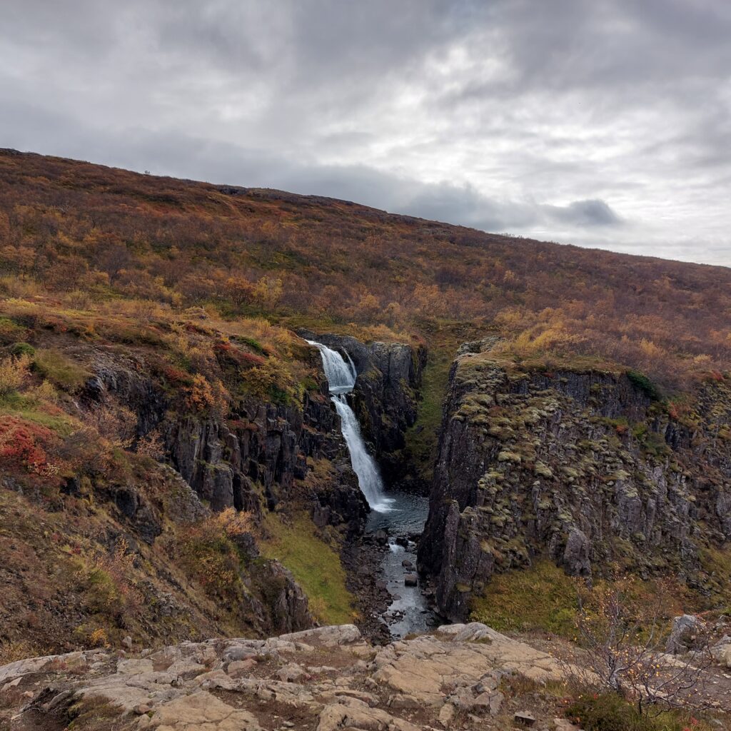
3-400 meters uphill from the car park, the first waterfall appears, the so-called Gufufoss (the Steam Waterfall). According to tradition, a female troll lived in the cave behind Fardagafoss further up. She had a pot of gold hanging in Gufufoss, on the ledge between the two Gufufoss waterfalls. Can you see it? It’s hard to spot, and that’s why no one has ever gotten hold of it.
In ancient times, you were bound for 6 months or a year if you took work on a farm or a house as a servant. It was only allowed to leave during a period of 3-4 specific days in the spring or autumn to take a job elsewhere. These days were called ‘Fardagar’ (travel days). The spring travel days used to be around the 1st of May. Everyone who did not own land had a responsibility to have permanent work and a place to live. Vagrancy was forbidden and could be punished with fines.
In Norway, we used to have similar laws. The 14th of April was travel day, i.e. the day when you could end leases and employment agreements. The term travel day is still used in Norway when it comes to leasing land or farms. Also Scotland did indeed have the same tradition in ancient times. Can ‘làithean siubhail‘ be a tradition from the Viking era?
Well, what does this have to do with the Miðhúsaá waterfall? That’s when Fardaga waterfall is at its most splendid! In the spring, the travel days will coincide with the snow melting and extended rivers.
The cave behind Fardagafoss is reasonably large, but it used to be even larger in earlier times, before the river slowly started to fill it with stones. One day a cat disappeared behind the waterfall. It was later found again in another Gufufoss, at Seyðisfjörður. The conclusion is that there is a tunnel between Fardagafoss and the other Gufufoss (these kind of stories are known from many places). The distance between them is 19 km, so it’s quite a job done by the troll (or the cat), digging that tunnel.
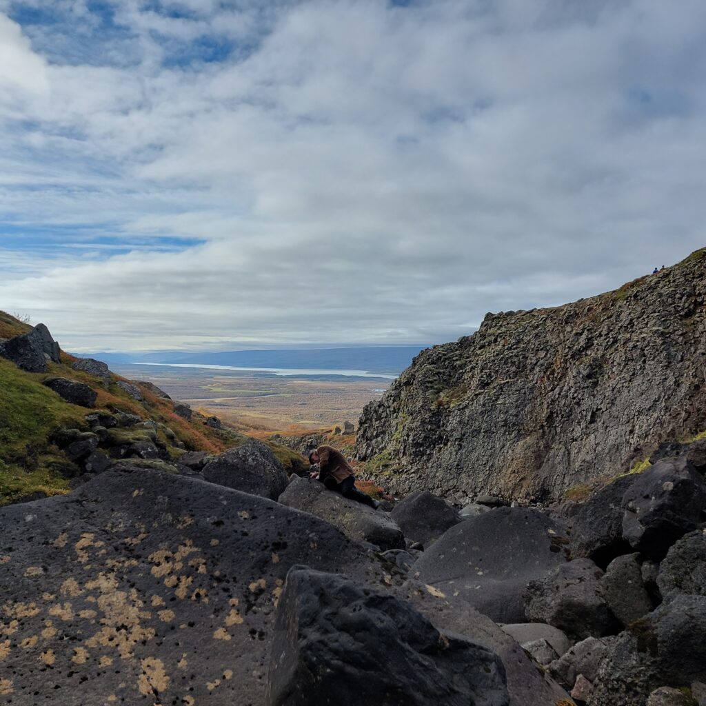
According to Knut, one of his Icelandic colleagues once attended a wedding seremony behind Fardagafoss. That is something! …and this way you avoid interference from the older generation. It is steep down to the waterfall, and most people over 80 would probably let it be.
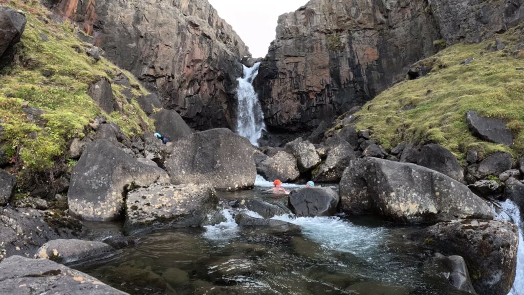
And the bath? Well, we weren’t there during the Fardagar days in the spring, and the river was practically a stream. It was not possible to bathe directly below the waterfall, we had to go further down. But otherwise a nice bath.
… and the two groups of drone pilots on the hill above us were luckily so busy flying that they didn’t even notice us (there were no signs prohibiting drones at Fardagafoss, and we managed – almost – not to get annoyed)…
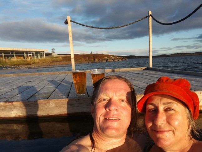
The meaning of the Icelandic word ‘vök‘ is ‘a place with open water in between an otherwise frozen sea or lake‘. In the old days, people used to wash their clothes in Urriðavatn (Lake Trout), because there was always open water, no matter how severe the winter was. The locals thought it was a sea monster, ‘Tuska’, that melted or broke the ice. Tusk means rag, i.e. Tuska was a Nixie with a shabby appearance. The cracks in the ice were called ‘Tuskuvakir’, and Tuska could come up there in winter. However, what kept the water open in winter turned out to be jarðhiti – ground heat. Lake Urriðavatn has its own hot spring inside itself!
The very special bath called Vök is located 6 km from Egilsstaðir and was completed in 2019. Here they have built a beautiful facility based on the hot spring inside Urriðavatn. 76 degree Celsius water from the bottom of the lake is mixed with cold water from the lake to just the right temperature. On shore, there are changing rooms, hot and cold (!) steam baths, two larger pools with warm water and a submerged bar by the pool.
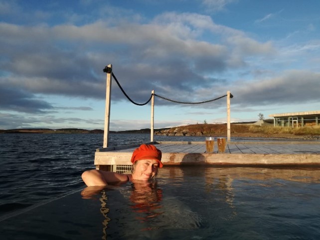
Two hexagonal pools of warm water float (!) in the cold water. The floating pools are made by the Finnish company ‘Bluet Floating Solutions’. If you want, you can enter the lake for a cold scalding, as there are ladders leading to the lake. Hot and cold alternately – that’s the very best. Try it!
We have visited Vök several times, including Easter 2021 – in the middle of the corona. All public baths in Iceland were closed and we really wondered what to do. How could we perform the daily bath when everything was either closed or frozen? It turned out to become a secret bath of the cold type. In Urriðavatn, it’s easy to swim even in the middle of winter – as there is always open water in between the ice! We changed onshore, jumped in for a dip and then returned to the car. As we were leaving the parking lot, a car drove in to check on unauthorized guests. Good then, that we just had a short bath next to the pools and didn’t try to get in for a longer session!