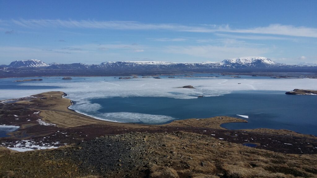
At the southern end of Mývatn lies the small village of Skútustaðir. It is surrounded by pseudocraters, and that is something quite special. Pseudocraters are not volcanic craters. They are formed when lava intrudes into a lake. The water evaporates, and sooner or later the pressure becomes so high that the steam is pushed up through the lava. This is how pseudo craters are formed, rounded and beautiful in shape, but they are not volcanoes, as they never erupted lava themselves.
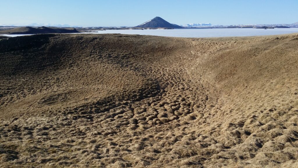
Pseudocrater with the real volcano Vindbelgjarfjall in the background.
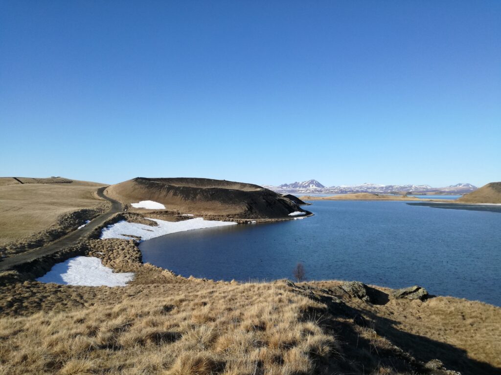
The grassy pseudocraters form an interesting frame around the mini-lake Stakhólstjörn, which is located inside lake Mývatn. The place is well arranged with paths all the way around and up on the crater rim to some of the pseudocraters. Stakhólstjörn is a paradise for birds, you can observe many swans, ducks and geese on the water.
Stakhólstjörn and pseudo craters. Far far away: Lake Mývatn
Stakhólstjörn has an outlet to Mývatn through the little river Skipaskráður, which can be crossed over a small bridge. It is nice to swim here. We were concerned about the amount of bird droppings in Stakhólstjörn, and chosed swimming in Mývatn itself. The water is clear and nice, but terribly shallow. Swim with your hands, otherwise you’ll get scratches on your knees!
The technical section of tobatheornottobathe unfortunately has not been able to find the pictures we both remember to have taken, so this bath will stay undocumented!
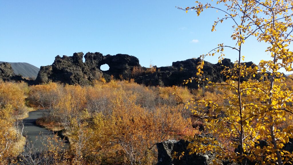
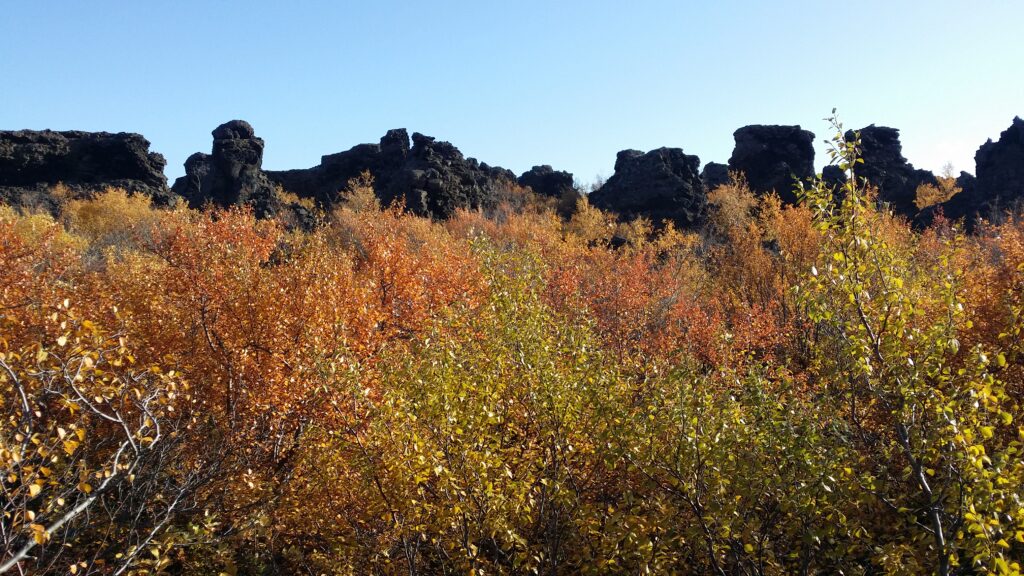
Mývatn in the north of Iceland is located in an active volcanic area. Here you can experience almost everything: New and old volcanoes, hot springs, sulphurous steams, boiling mud baths, narrow gorges and strange geological phenomena such as pseudocraters and Dimmuborgir. Spend some days here!
Dimmuborgir (the Dark Fortress). Hverfjall in the background to the left.
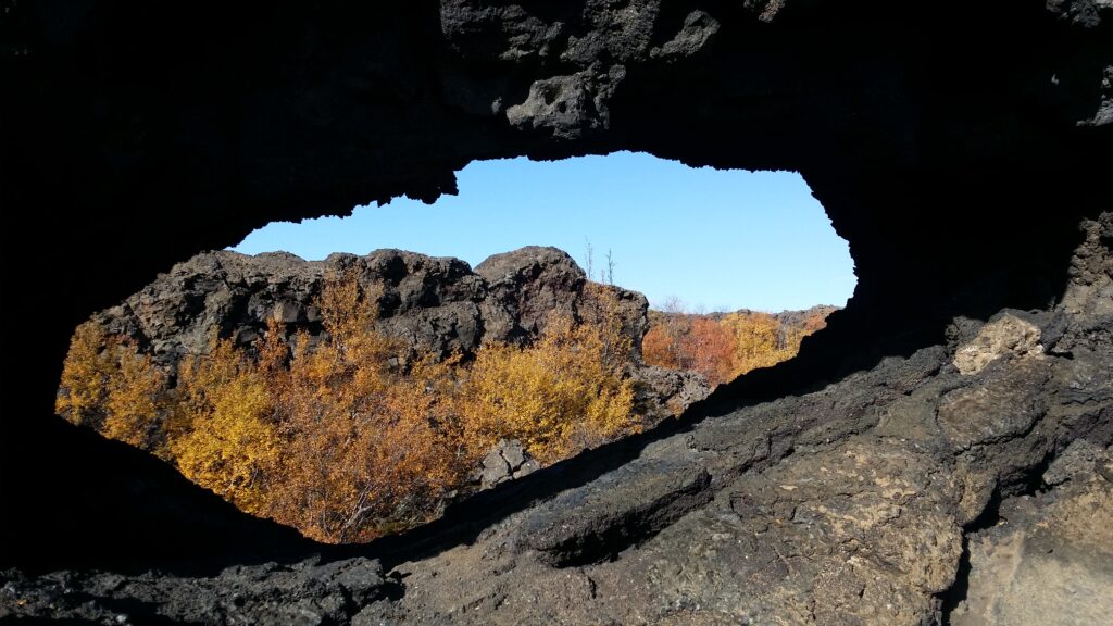
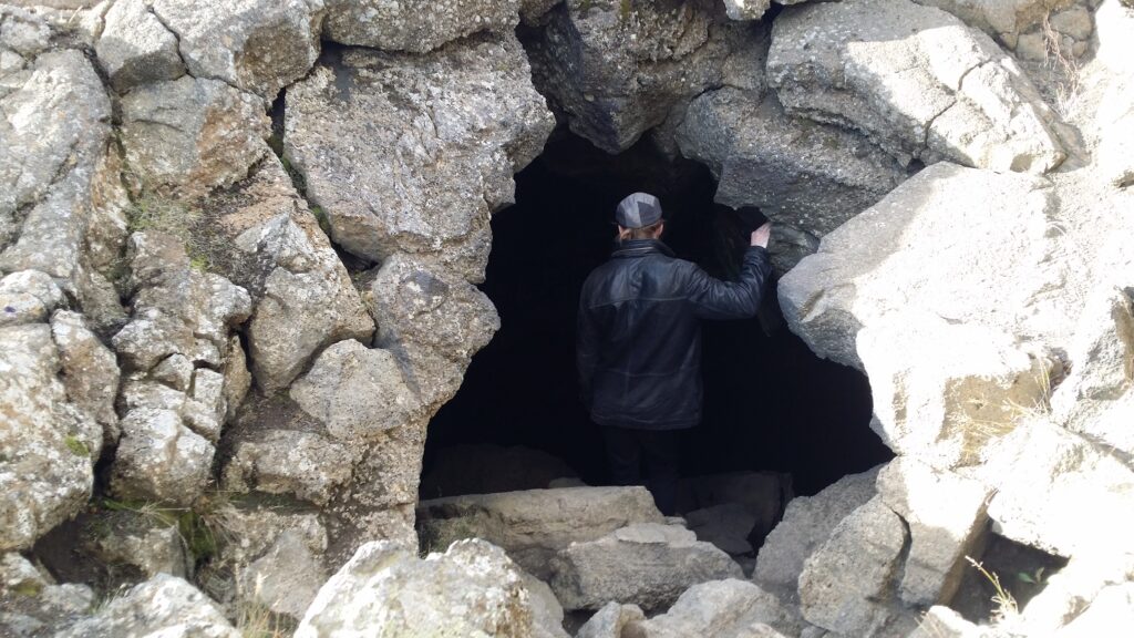
Dimmuborgir was formed by lava from the volcanic eruptions in Lúdentsborgir and Þrengsborgir some 2000 years ago. The place was originally a depression in the landscape, which was filled with lava. The lava solidified from the top, but not all the way to the bottom. Some lava found its way out again, and this led to the ‘roof’ of the lava caves collapsing, creating the impression of a ruined, black fortress. Here you find caves and peculiar rock formations everywhere.
Dimmuborgir was about to be buried by sand dunes, and a lot of resources have been spent on conservation. Now, as the vegetation has finally returned, there is much debate about whether to remove the birch or not – before it hides the whole thing.
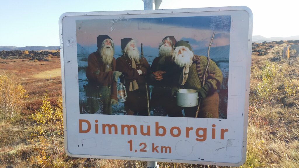
Dimmuborgir has been the location of many fairy tales and myths. In pagan times, as a transition place between the world of elves and humans. With Christianity came the belief that this was Hell, the place where the Devil lived after being thrown out of Heaven. Of more recent myths, we have stories of the Santas (Iceland has 12 of them), that used to live here.
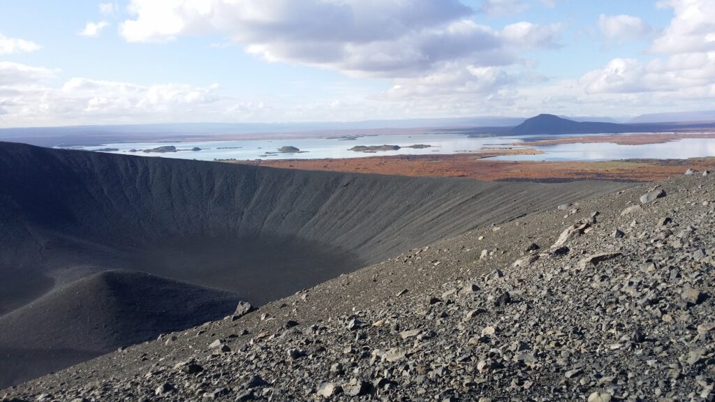
Hverfjall with Mývatn in the background. Hverfjall erupted some 2500 years ago.
One trip we enjoyed a lot was this one: First walk 2-3 of the paths through Dimmuborgir. From there you can follow a path that goes to the volcano Hverfjall. The volcano is not very high, but you can still feel the rise. There are 2 steps forward and one back since the mountain consists of gravel (tuff). Once up, it’s a splendid view! Go around the volcano and down on the other side. From there you can follow the signs to Grótagjá (the Cave Gil). Here you can clearly see how the continental plates are moving away from each other, as there are cracks and crevasses everywhere.
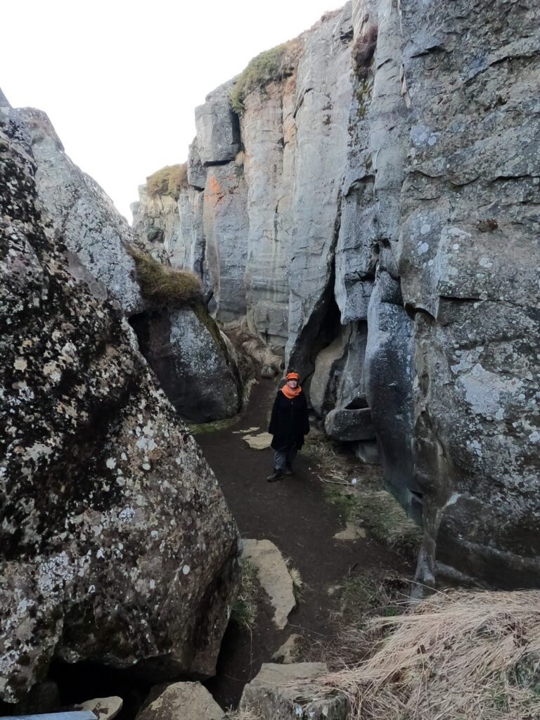
Storagjá (The Big Gill).
The gill Grótagjá is filled with water, and the cave was a highly valued bathing place before 1975. But during the volcanic eruptions between 1975 and 1984, the temperature in the water rose to over 50°C and bathing became impossible. Later, the temperature has dropped again and the place became a popular tourist attraction. However, vandalism led to the cave being closed, people were camping in the cave, washed their shoes and brushed their teeth in the water, etc. Now Grótagjá has had a new renaissance, after the place was the location for a Game of Thrones’ scene in the episode ‘Kissed by Fire‘ in the third season. Although the cave has been reopened, there are still prohibiting signs against bathing (because the temperature might change vey quickly, they claim). It’s not just right to swim in Grótagjá!
Grótagjá unfortunately was a ‘NOT‘ for us. The photographers would have lost their jobs, if they weren’t sort of permanently hired. We don’t have any good pictures from inside, but trust us: it’s very nice!
After a non-cave bath, some tough heavy metal music could have been just right, but Dimmuborgir is not what they used to be…
They look just sweet and nice, the Icelandic group Dimmuborgir. Not at all like the Norwegian symphonical heavy metal band Dimmu Borgir.
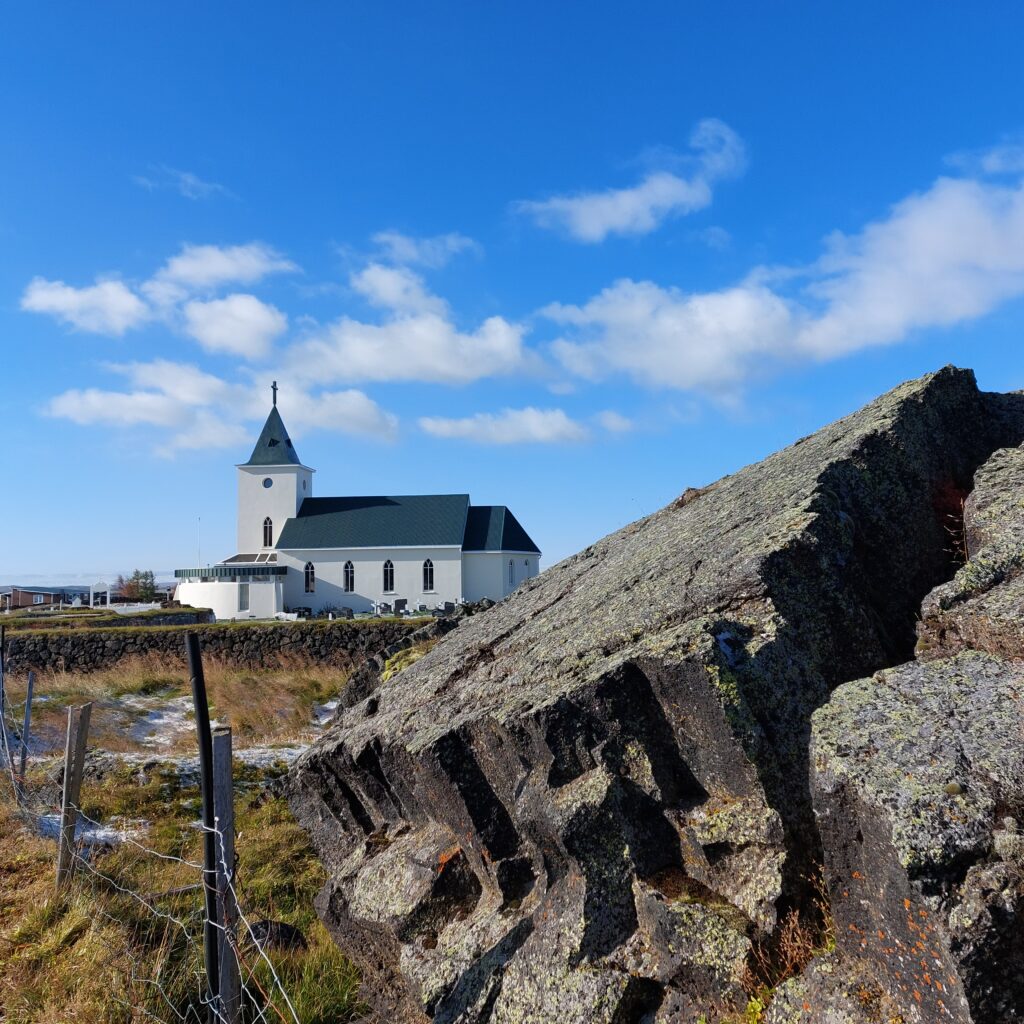
By Mývatn’s northern bank is a village with 300 inhabitants: Reykjahlið (The Smokey Hillside). Here you find cabins and hotels, a gas station and a shop – quite ordinary.
Reykjahlið. ‘Do you want to join a bath? A sunbath only? Well, that’s ok.‘
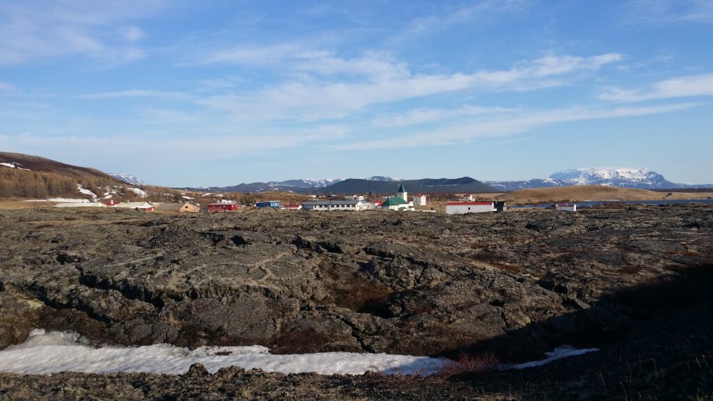
However, the surroundings are spectacular, we are in an active geological area that is subject to ‘Queen Krafla‘. A well-known volcanic eruption was the so-called ‘Mývatn fires‘ in 1724-1729 (actually an outbreak from Krafla, 15 km away). These were dramatic years. The lava came closer and closer, and buried house after house in the village, just like in Grindavík right now (january 2024).
The Reykjahlið lavafield. Far behind: The volcano Hverfjall.
Then – a miracle happened: The lava flow slowed down – at the church stairs! The inhabitants and the church were saved! The intense prayers from the priest (Tobatheornottobathe has not been able to find the name of the priest. Any help will be deeply appreciated!) were given the honor of stopping the lava. Today, the church has been replaced by a new church (from 1962), but the lava still looks quite fresh.
Lava (rhaun) and church in Reykjahlið.
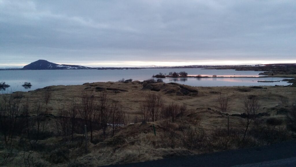
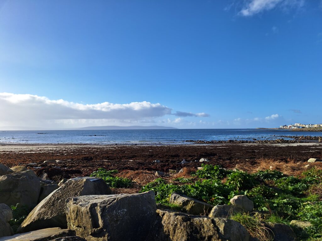
On the opposite side of highway 1, there is a hiking trail down to Mývatn (Lake Mosquito). This unique water is very shallow, the average depth is 5 meters distributed over a 37 km2 area.
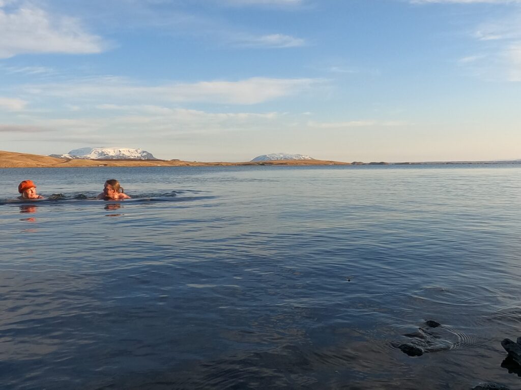
Sunset at Lake Mývatn.
Don’t even try to dive here! But the water is clear and nice – until you swirl up deposits from the bottom. And the water wasn’t very cold, presumable because of shallow ground.
An evening bath in Mývatn was just right, in April 2021.
Galway, on the west coast of Ireland, had close trade relations with France and Spain from the Middle Ages. Today, the city is a center for Irish language, music and culture and hosts several festivals, including food, art and film.
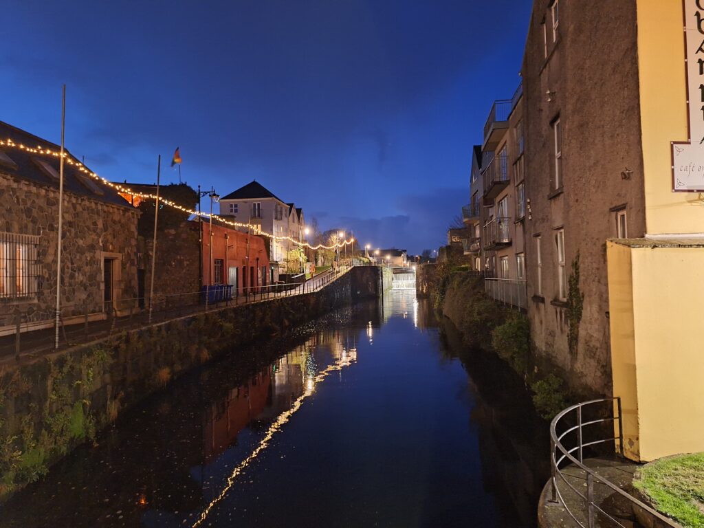
One of Galway’s many canals dressed for Christmas.
Many of the houses in Galway are quite old. As an example, the building that houses the pub ‘The King’s Head’, dates from the 13th century. The name refers to King Charles I, who was convicted of treason and beheaded in 1649. In this pub they sell an excellent red beer called ‘The King’s Blood’. This beer has a thick foam (head of the beer) which is reminiscent of the Guinness’ foam (made by adding nitrogen gas). And as our guide pointed out: This beer holds the ‘head’ better than King Charles I could…
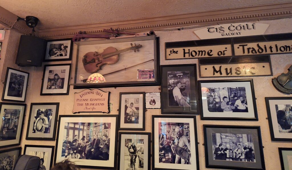
But it’s not just the beer that draws you into the Irish pubs, of course. In Galway you will find live music almost everywhere!
Many pubs have their own areas specifically reserved for musicians, but that means hard-core folk music completely lacking international hits.
But yes, there are some pubs that run a simplified version: 1-2 guitarists with a typical Creedence-Cash-Eagles repertoire. Finding bigger bands at play is not too difficult, either. In that case, you will certainly hear this:
And I ask you friend, what’s a fella to do ‘Cause her hair was black and her eyes were blue So I took her hand, and I gave her a twirl And I lost my heart to a Galway girl
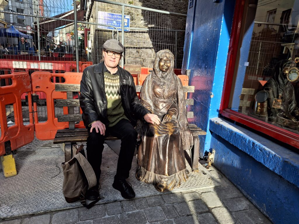
… and actually – we found her! Knut could give a handshake ‘to a Galway Girl’.
Knut on a date with ‘the Galway Girl’. The road work around the bench did not inspire any romance.
In retrospect, it turned out that Knut was not very satisfied with the meeting, so maybe it’s still hope for Idun – even if she doesn’t have blue eyes? The song was first released in the year 2000, but this Galway Girl appeared to be at least 100 years old! And where was the hair? Wrapped in a shawl? No, better to stick to the song and the dream..
‘Galway Girl’ was created by the American musician Steve Earl. He spent a few years in Ireland after a troubled period in the United States. The song is written for/about Joyce Redmond, who played bodhrán on the first release. However, she is not exactly a Galway Girl, as she grew up on the Howth peninsula north of Dublin. On the other side, Joyce Redmond’s mother was from the Aran Islands (Inishmore, where we also have had a bath or two), and that is maybe close enough? Joyce had neither black hair nor blue eyes, and never became Steve Earl’s wife – despite the fact that he was married seven times to six different women. But the mood of the song is perfectly Galway-ish:
I took a stroll down the old Long Walk On the day-I-ay-I-ay I met a little girl and we stopped to talk On a fine soft day-I-ay
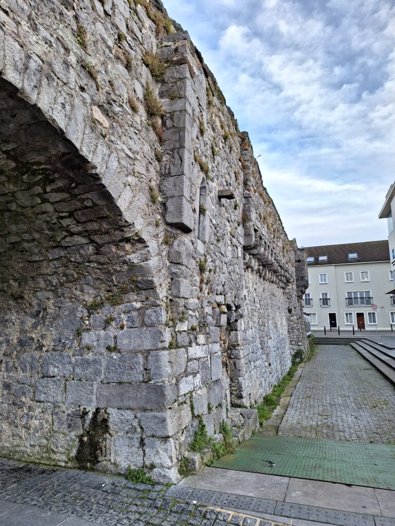
Much of Galway’s city wall on the east side of the River Corrib was destroyed by the tsunami that followed the Great Lisbon Earthquake of 1755. But there is still a part remaining, including the so-called Spanish Arch of 1584.
The Spanish Arch.
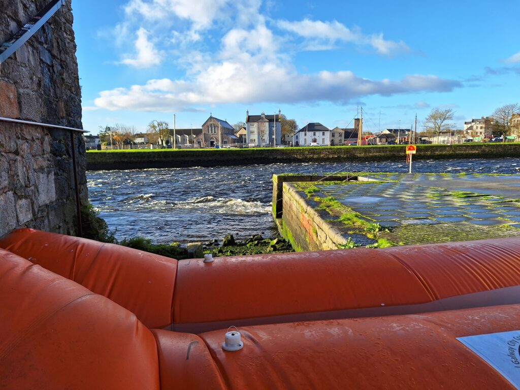
At the Spanish Arch, a major construction project is currently ongoing (2023), to protect the lower part of the city from flooding. During storms and spring floods, basements have repeatedly been filled with water, and they are now trying to do something to stop it. As a temporary measure, two water ‘sausages’ have been laid out as a dam, and on the wall of Nimmo’s restaurant you can see an art installation in the form of a fluorescent tube that shows how high the water will be at spring tide in the year 2150 – if the melting of glaciers continues as today .
Water dam at the Spanish Arch. Horizontally on the wall you can see the assumed sea level in the year 2150.
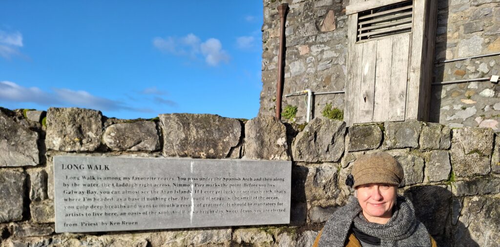
If you walk along the estuary, southwards from the Spanish Arch, you will reach ‘The Long Walk’ mentioned in the song. This is a row of houses protected by masonry, and a nice place to stroll. And it is not unlikely to have a romantic encounter here. Even Ken Bruen writes beautifully about ‘The Long Walk’ in the crime novel ‘Priest’.
Ken Bruen and the Long Walk.
Actually, this trip is not so long that you shouldn’t also stop by the ‘Galway City Museum’, which is next door.
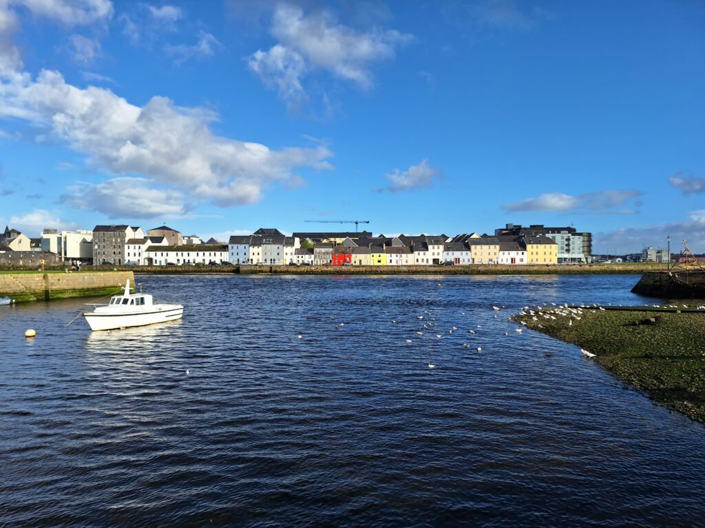
The Long Walk as seen from the Claddagh.
Otherwise, you can walk ‘The Long Walk’ both above and below the wall – as ‘Tobatheornottobathe’ did. On the second morning of the Galway trip, we were well informed about the condition of the river, which is not bad at all. As you know, the Corrib flows very fast, and when you add the information that there are salmons both there and in Lake Corrib above, adding the fact that the river is only 6 km long, then pollution is not a big issue. This left us with only two unsettled questions: 1) Where are the backwaters that prevent us from drifting out to sea? 2) How to get into a bathing position when the river is enclosed by both fences and water ‘sausages’?
Even swift rivers have backwaters.
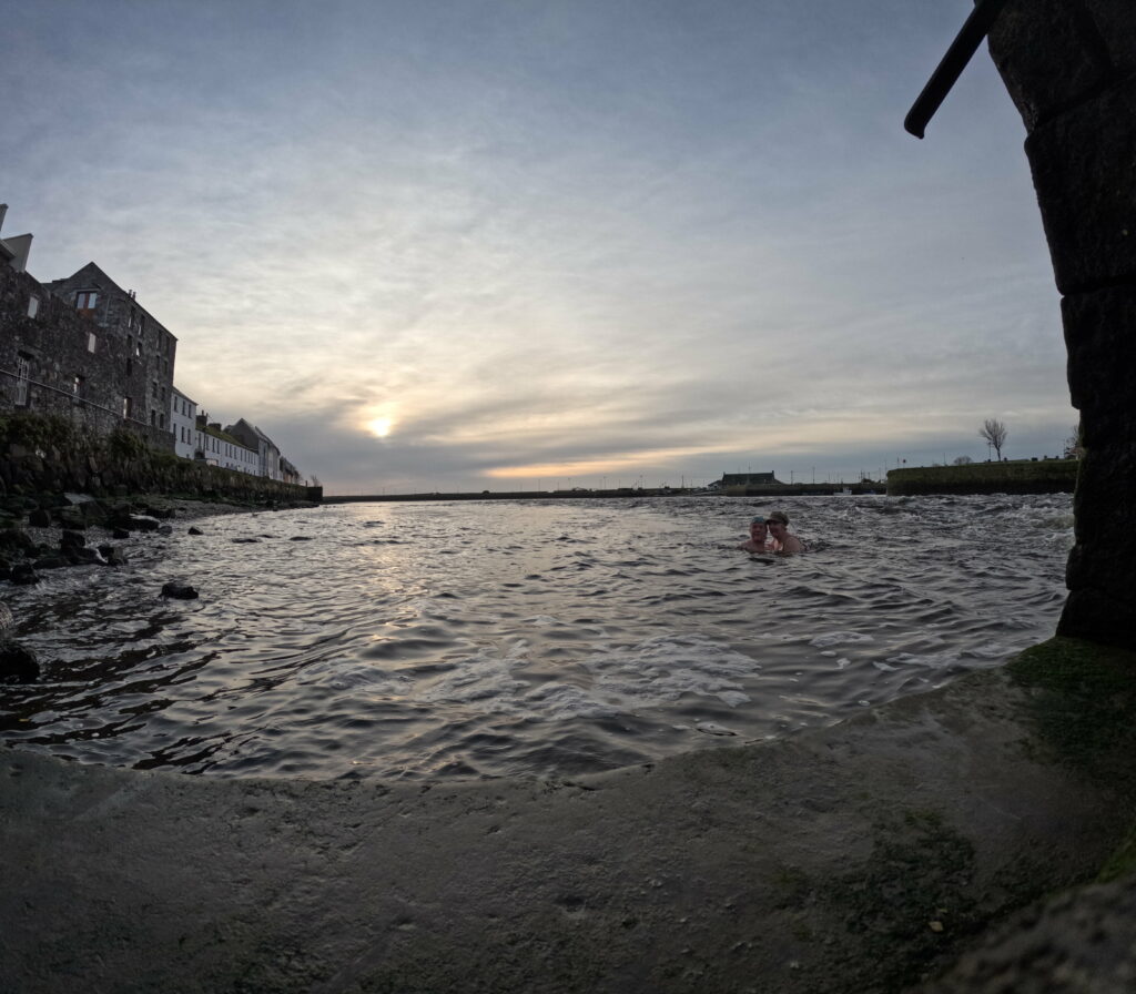
Not far along ‘The Long Walk’ we found – lo and behold – a staircase down to the river bank, which made it easy to go back below the wall to the stairs behind Nimmo’s. We found plenty of broken glass there! It seems to be a favorite pastime to sit and drink on the edge of the wall and throw the bottles into the river. Maybe that’s how romance happens?
It was a splendid bath! The stairs were almost free from glass, and we didn’t hurt ourselves even without swimming shoes. But the current was a bit scary, so we didn’t actually swim, it was just a dip.
A dip in the rocky, swift river turned out to be just right.
All the best wishes from the Long Walk and the Galway Hooker (the typical local boat).
On the west side of Ireland, there is a beautiful coast that calls with a Siren’s (Silkie’s?) song to every bathing enthusiast. But if it’s the Irish folk spirit you want to meet, then you also have to visit the city of Galway on the north side of Galway Bay.
Galway, looking north towards ‘The Latin Quarter’.
Galway, with its population of just over 80,000, is a lively city with a long history. The king of the region of Connacht built a fortification in 1124 by the river Gaillimh, which later became a town. In 1484, a city council was formed with a mayor. The city was ruled by 14 trading families, ‘The Tribes of Galway‘. Of these, 12 were of Norman origin and 2 were Irish.
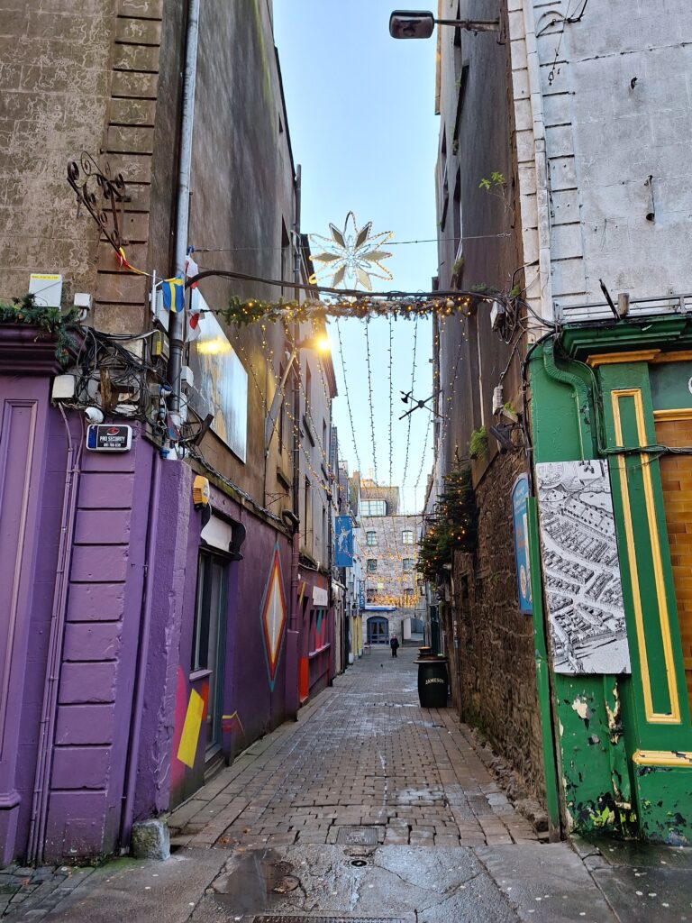
The alley is ready for party, and in 2023 it is also allowed to speak Gaelic here.
People of Irish descent did not have automatic access to the city in the old days, they lived in the Claddagh district at the west side of the river. In a statute in the 16th century the following could be read: ‘Neither O’ nor Mac shall strut or swagger through the streets of Galway without permission‘.
Watch out for green! Ireland’s nickname is ‘The Green Island‘.
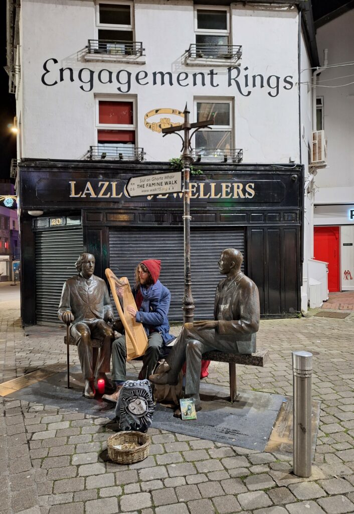
We stayed in ‘The Latin Quarter‘, where there is partytime both day and night. So lively that all the rooms (some of which had been hotel rooms for more than 700 years) were armed with earplugs. Every afternoon, the street players appear everywhere, and they move around the city space following an intricate system of permits and self-justice.
Harp concert in Galway for Oscar Wilde and Estonian Eduard Wilde.
The name of the city of Galway has several erroneous interpretations and myths attached to it, including that it comes from Gailleamh, which was the name of the chieftain Fir Bolg’s daughter. Gailleamh drowned in the river, and her father was so distraught over this that he camped on the spot to mourn her spirit. The town that later grew here is said to have been named Gaillimh in her honour. But – the current opinion is that Galway city got its name from the river, an anglicisation of the Gaelic ‘Gaillimh‘ = ‘The Rocky River‘.
The rocky river flows very fast.
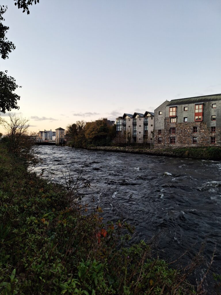
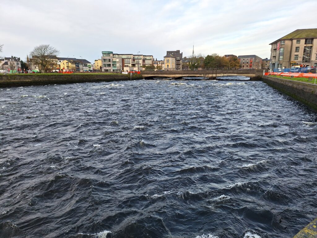
The river is today called the Corrib and is, according to local sources, the fastest flowing urban river in all of Europe. Yes! The Corrib is fast running!
Not all the bridges in Corrib are well maintained.
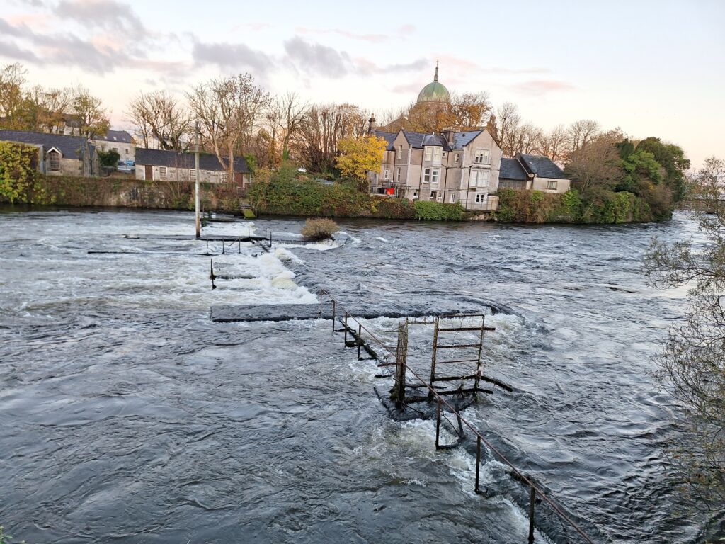
When it came to swimming in Galway, Tobatheornottobathe were in strong doubt. On the one hand – It looks like great fun flowing with the current in Corrib! On the other hand, such a stunt would require an extended HSE focus, for example by use of a wet suit. And we were on a weekend holiday without extra equipment beyond swimwear and a towel.
River Corrib in full speed under the Wolfe Tone Bridge. At weekends, guards make sure that no one jumps in.
Besides, there was the other bathing issue – hygiene. When we were ready for the first morning bath in Galway, we had no idea about the ‘bathability‘ in relation to water quality. Tobatheornottobathe therefore made the simple decision to swim in the sea instead of the river, and headed west from the mouth of the Corrib.
View towards the district of Claddagh on the west side of Corrib.
On the way we came across this sign, which became an excellent starting point for a lively discussion. ‘Oh, funny, a fishing school!‘ Knut said. ‘Nonsense!‘, Idun (and one of our co-travellers, who shall remain anonymous) replied, ‘Episcopal means that this is a church’s school!‘
Claddagh Piscatorial School: School of the Bishop or for the Fishermen?
… but this time Idun actually had to admit that she was wrong. Claddagh Piscatorial School is not Episcopal. It was the Dominicans who wanted to teach the fishermen new ways to fish, and therefore created this school. Not a very popular idea among the local fishermen that someone should come along and teach them how to fish!
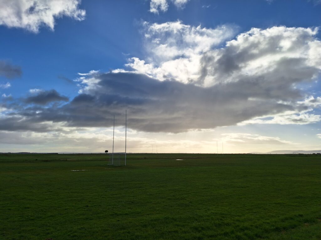
The Galway Tribesmen Rugby League field at South Park, Galway.
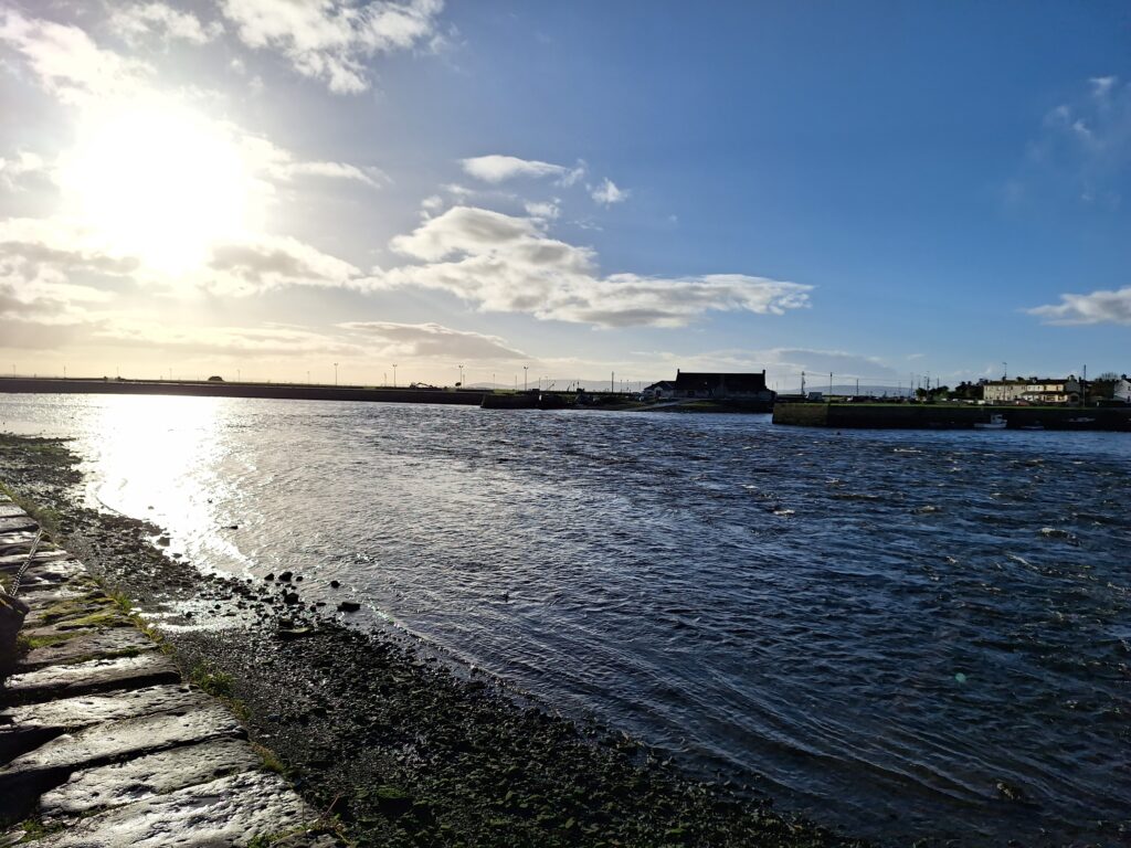
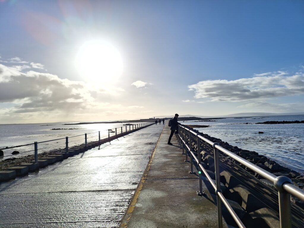
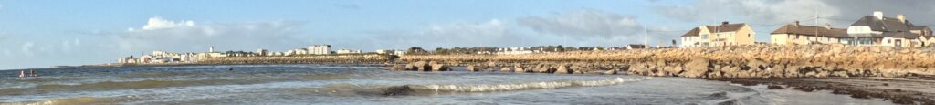
It is nice to walk west from Galway city center and we aimed for Mutton Island. On the map it looks like a paradise for a walk, and also perfect for swimming.
Knut stretches his back on the way out to Mutton Island.
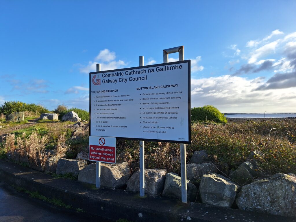
But no. The entire island is closed off, and there are also signs prohibiting swimming from the pier. And when we discovered what the island is used for, all temptations to sneak in a bath disappeared like dew in the cold November sun. Mutton Island is used in its entirety for cleaning the sewage from Galway!
Bathing ban at the walkway to the Waste Water Handling Island.
So then it was just a matter of giving up? No, Tobatheornottobathe doesn’t give in that easy. There was a beautiful sandy beach just inside Mutton Island and the walkway. As long as we entered the beach from the beach promenade, there was no prohibition – according to our interpretation. It turned out to be a really nice bath, and we were almost completely sure that the water quality was good.
Salt Hill Prom, as mentioned in Steve Earl’s lovely song ‘Galway Girl‘. Two tobatheornottobathers seen far left.
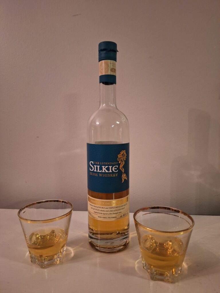
When you (Knut) have a backache, a fresh bath is just perfect. The cold water shocks away pain and stiff muscles, and leaves you in really good shape afterwards. At least with a small taste of Irish whiskey in the body.
If the Scots can make the ‘Water of Life‘, then the Irish must be able to too?
It is believed that Irish monks started distilling and producing whiskey from the 13th century. The drink was popular into the 19th century, but after many years of decline there were only two Irish distilleries left in 1966. This trend has now been completely reversed, with Irish whiskey being the fastest growing spirit in the world every year since 1990.
Behind the headland in the west lie ‘The Aran Islands‘. Salt Hill to the right.
Silkie was, according to the legends, a kind of mermaid. She had a human form but also a seal-figure. In the moonlight she came ashore and danced on the beach. The Silkie was beautiful, with dark hair and deep soulful eyes. A young fisherman saw the seal woman, they fell in love and lived together for a while. But the sea called Silkie, stronger and stronger, until finally she gave in and went back to the sea forever.
Tobatheornottobathe has the general opinion that it’s always a good time for a bath, but this time we feel the fisherman might not quite agree.
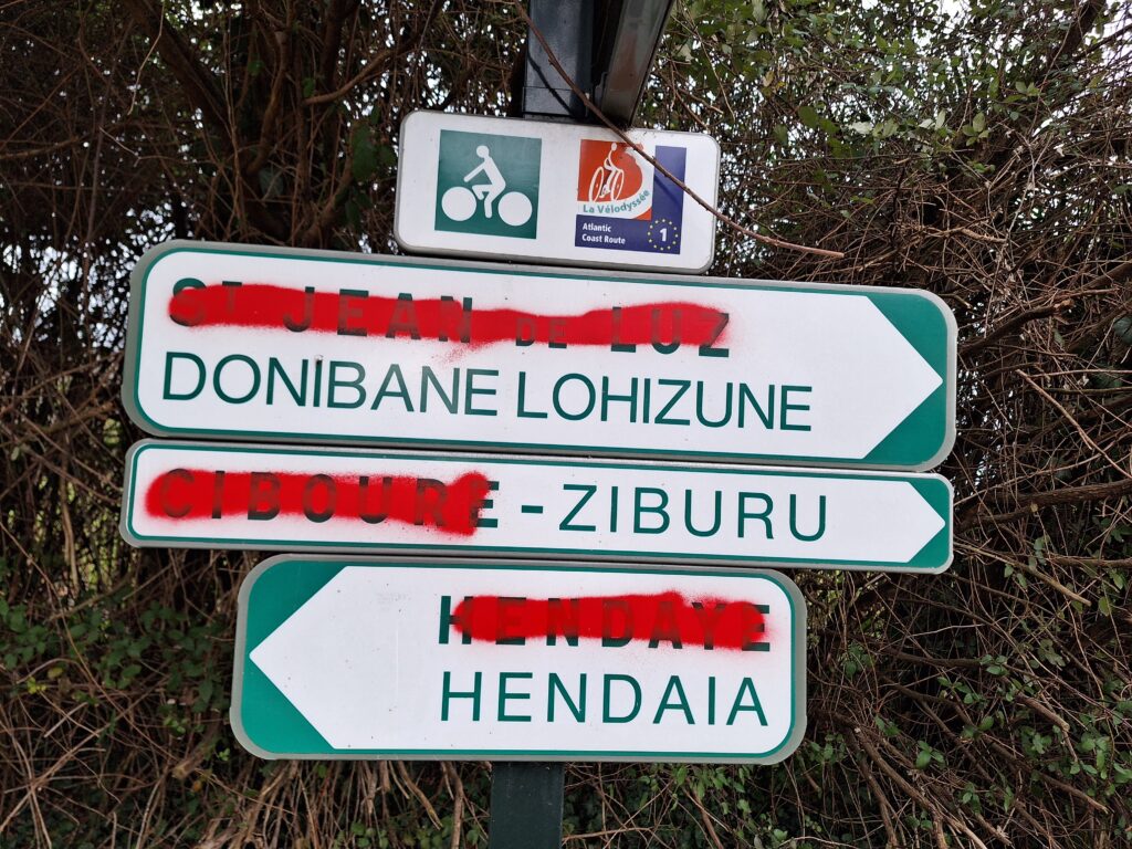
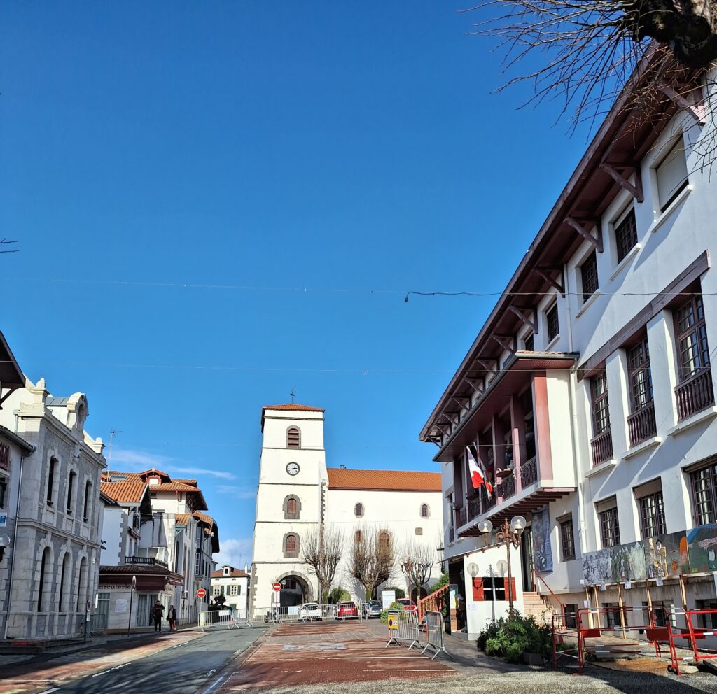
In the inner part of the Bay of Biscay, on the border between France and Spain, lies a sleepy little French-Basque town overlooking the lively Spanish-Basque town of Fuenterrabía/Hondarribia. The city is called Hendaye in French and has just under 20,000 inhabitants. It is located on the right side of the border river Bidassoa.
Hendaye seen from the twin city Hondarribia. The Pyrenees in the background.
Here you are in the Basque core area, and around 50% of the population speak Basque or Euskadi, as they call it themselves). So then it’s just a matter of brushing up what you can find of x’s and z’s, and accept not to understand anything at all. Basque language is not related to any other language in the world! (Yes, they have really tried to find similarities, also against Caucasian languages, but no success yet)
Basque disagreement over French supremacy in Hendaye.
As an example, the 80,000 Euskadi speakers in France can enjoy inflecting nouns in the following cases: Absolutive, ergative, dative, possessive genitive, comitative, benefactive, instrumentalis, inessive, allative, ablative, local genitive and partitive.
Time to start practicing: Zorte on! (Good luck!)
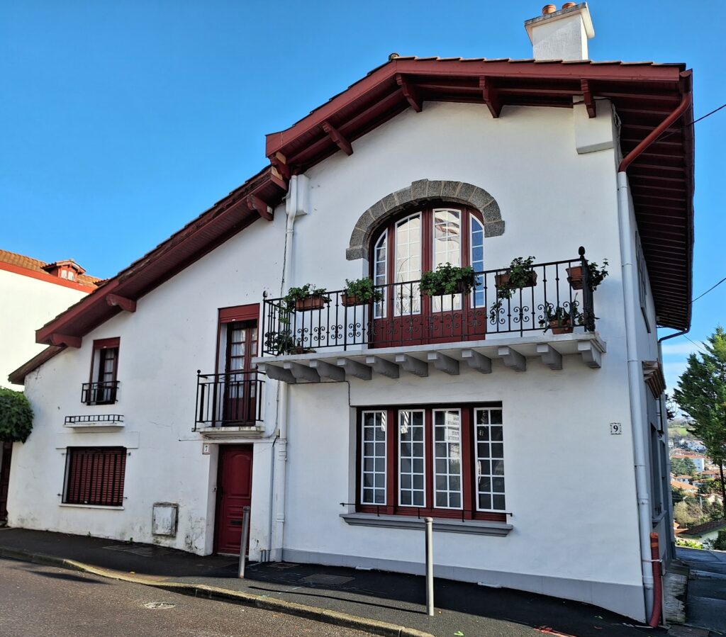
The architecture in Hendaye is kept neo-Basque. White brick walls with wooden details. Preferably dark red, but green, blue and brown are also acceptable colors.
In addition to its role as a border town with alternating French-Spanish affiliation, there was a meeting between Hitler and Franco at the railway station in Hendaye the 23rd of October 1940. Hitler wanted Spain as an Axis contributor, but there was no agreement, and Spain remained out.
Église Saint-Vincent, Hendaye.
Today, tourism is Hendaye’s main industry. There is water! And a splendid beach!
The twin rocks east of Hendaye are visible from both the twin cities of Hendaye and Hondarribia. But they are not identical twins, neither the cliffs nor the cities.
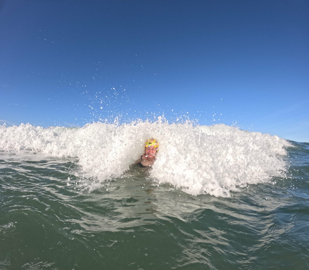
On New Year’s Day 2024, a swim from the large, beautiful beach in Hendaye was just perfect. Here the surfers splash in the water while people go for Sunday walks on the beach – in water and air temperatures like an average Trønder-summer. Adorable!
Hendaye. Surf waves are not just for surfing. Wave bathing is really fun!
Iceland erected between the European and the North American tectonic plates, which drift apart at a speed of 2 cm per year (corresponding to the growth velocity of a fingernail). In addition, they are also parallell displaced. Hence, earthquakes and volcanic eruptions are to be expected on a regular basis. Iceland is also located above a so-called hot spot, where there is a direct link to the interior of the earth (magma). Over the hot spots, volcanic eruptions are evenly distributed during many, many years.
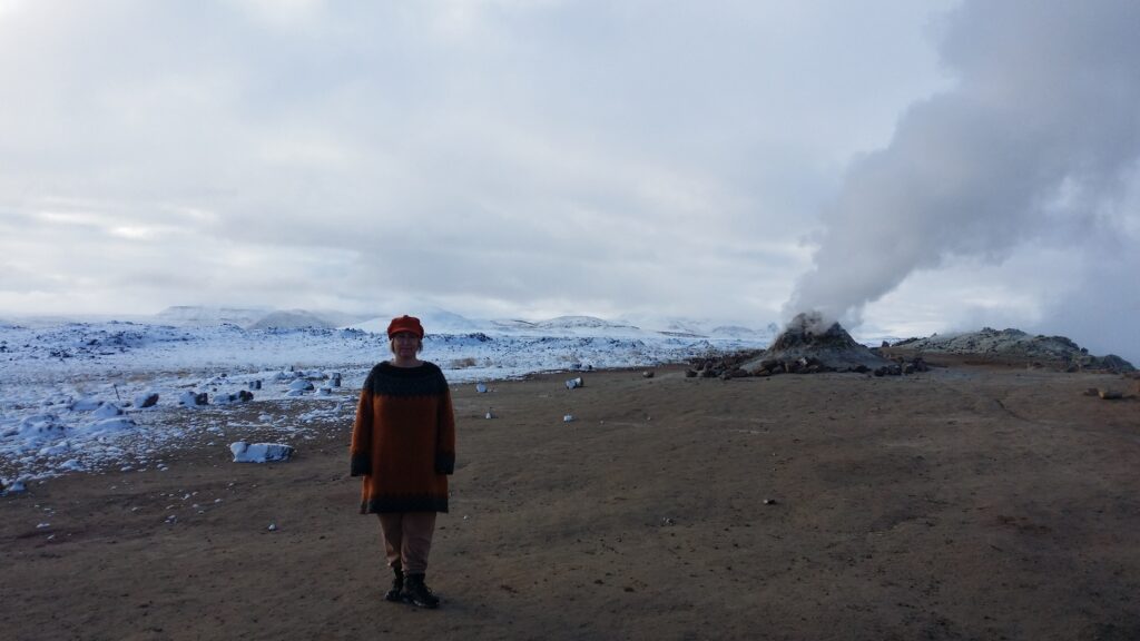
Bad smell of sulfur vapour near Krafla.
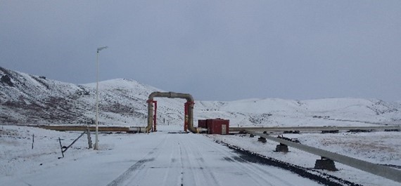
The continental rift in Iceland goes from Reykjanes in the southwest towards the northeast. On the way, it passes Mývatn, an area where the geological activity is intense. Here, the volcano Krafla has had many outbreaks in recent times.
Piping from the geothermal power plant at Krafla.
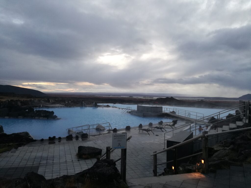
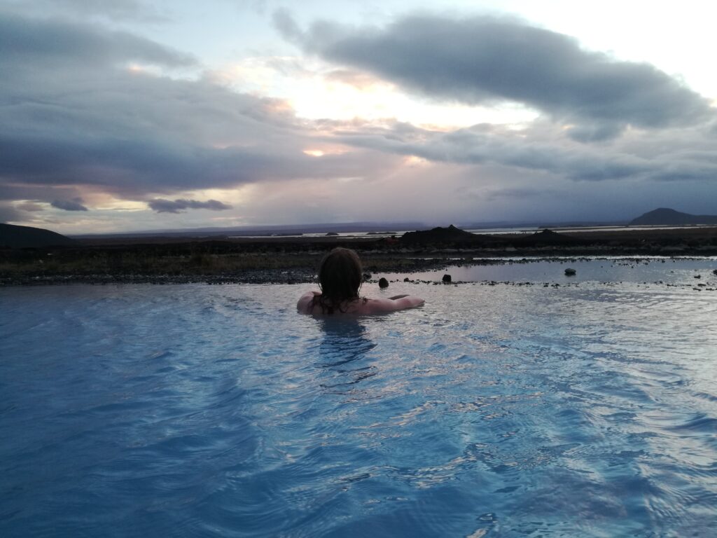
Do you want to have a bath on the continental rift? Then Jarðböðin (the Geo Thermal Baths) is the perfect choice! This is a natural spa in an area with many hot springs. In design, Jarðböðin eccos Blue Lagoon. The spa is beautiful, mostly using dark colors. Large outdoor pools are filled with heavenly, hot water, surrounded by lava rocks. From the pool there is also a splendid view, one thing Blue Lagoon does not have.
Jarðböðin has a view!
BUT – at Jarðböðin you must accept a quite distinct smell of sulfur. Heaven, you said? …no, this smells more like Hell. The saunas are made by piping being stabbed straight down into the ground below the benches. If you don’t like sulfur, don’t go there. But the pools with their corners and showers and views – they are just fabulous!
P.S.: Don’t expect quite as much space as you see in these pictures! We were there during Covid restrictions. They kept it open because the employees preferred working for free in stead of doing nothing. There were less than 20 people there with us, but the place is designed for several hundred!
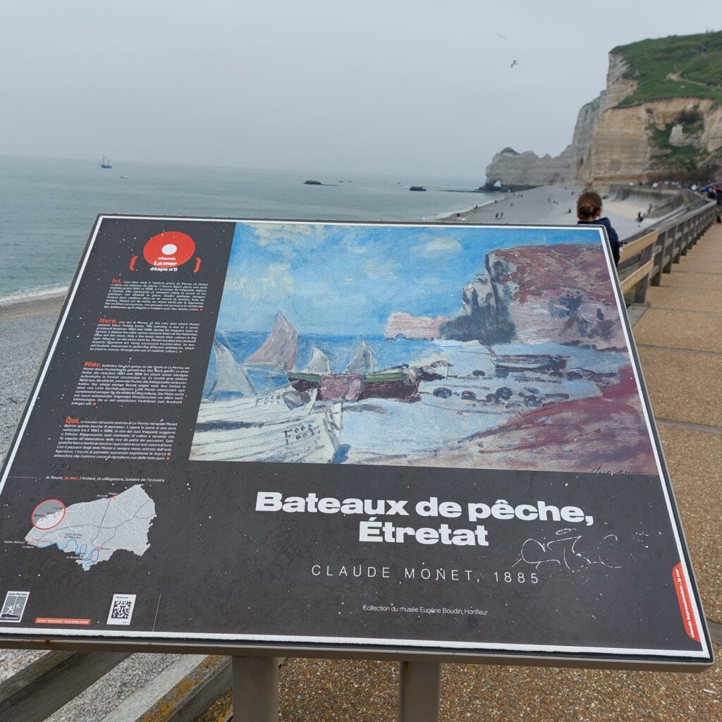
The origin of the name Étretat has been widely studied and debated. From ancient times, people have tried to find explanations from Celtic and Latin/Old French, but without complete success. Later derivations from Norse have emerged as more plausible, including Torstad, Stútrstakkr (upright, high rock) and Styrrstaðr = ‘helmsman’s town’. But one thing is certain, the Vikings were here!
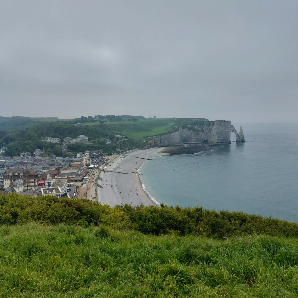
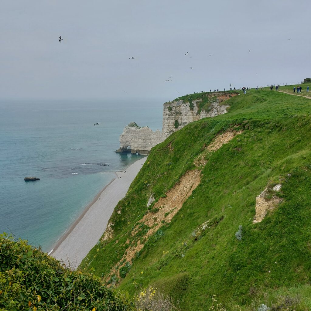
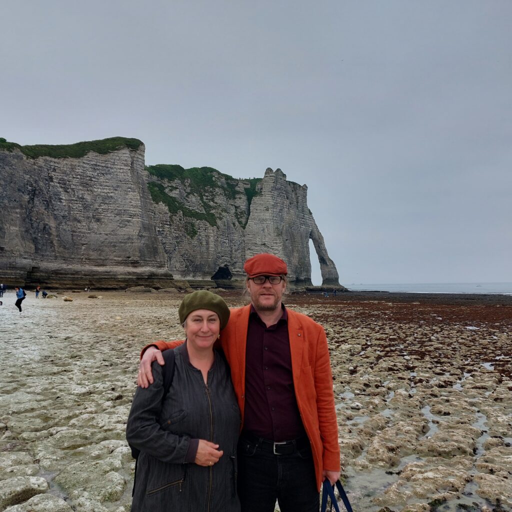
Étretat with Porte d’Aval and l’Aiguille in the background.
This village north of Le Havre is famous for the three arches that lie in a row by the English Channel. Farthest north (to the right when looking towards the sea) is the Porte d’Amont (Upstream Gate).
The Upstream Gate.
To the left of the beach you can see the beautiful Porte d’Aval (Downstream Gate) with a broken arch, l’Aiguille (The Needle) next to it, and further south and invisible from the city: Manneporte (big enough for a sailing ship with all sails up).
The downstream gate. We went to Étretat with the intention of swimming under the arches, but the motivation disappeared when we were greeted by strict prohibition signs. Photo: Une Hunstad Løwø
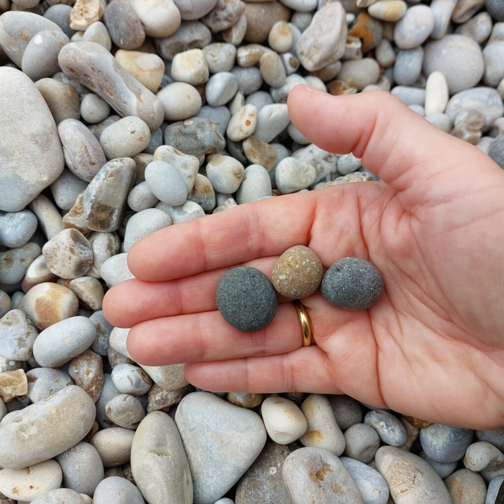
The light color of the cliffs has given the area it’s name ‘The Alabast Coast‘ = ‘The bright coast‘ (ref ‘The White cliffs of Dover‘ on the opposite side of the channel). Parallel to the coast, at Étretat, an underground river flows into the sea, and the arches have been eroded by this river. In older photos, women can be seen washing clothes on the beach at low tide (in fresh water). The beautiful arches are thus created by continental erosion and not by the sea. The limestone contains, among other things, flint, which is left behind as pebbles on the beach when the limestone is dissolved.
The stones have rolled so much in the swells at Étretat that many of them have turned into small, perfectly round spheres. Idun found some that wasn’t flint.
The place’s existence is linked to the sea, and in the 18th century oysters were grown and processed here. Baskets of shells were transported to Versailles overnight so that Marie-Antoinette could enjoy fresh oysters in the morning.
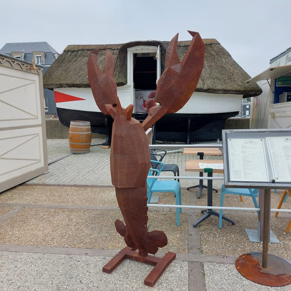
At Étretat, seafood is just right both before and after swimming. Note the old fishing boat. With a thatched roof, it has been transformed into a fridge and freezer storage.
In the 19th century, tourists began to flock the site, and by the end of the 20th century, fishing was completely replaced by tourism as a means of living. No wonder, this place is stunning! So beautiful, that the place is used a lot both in literature and paintings. The creator of Arsène Lupin, Maurice Leblanc, lived in the area and his home is now a museum (Le Clos Arsène Lupin, Maison Maurice Leblanc). The last episode of the Netflix series Lupin was filmed in Étretat. But perhaps most famous are Claude Monet’s paintings of the beach and the arches.
Monet was here! Fishing boats too.
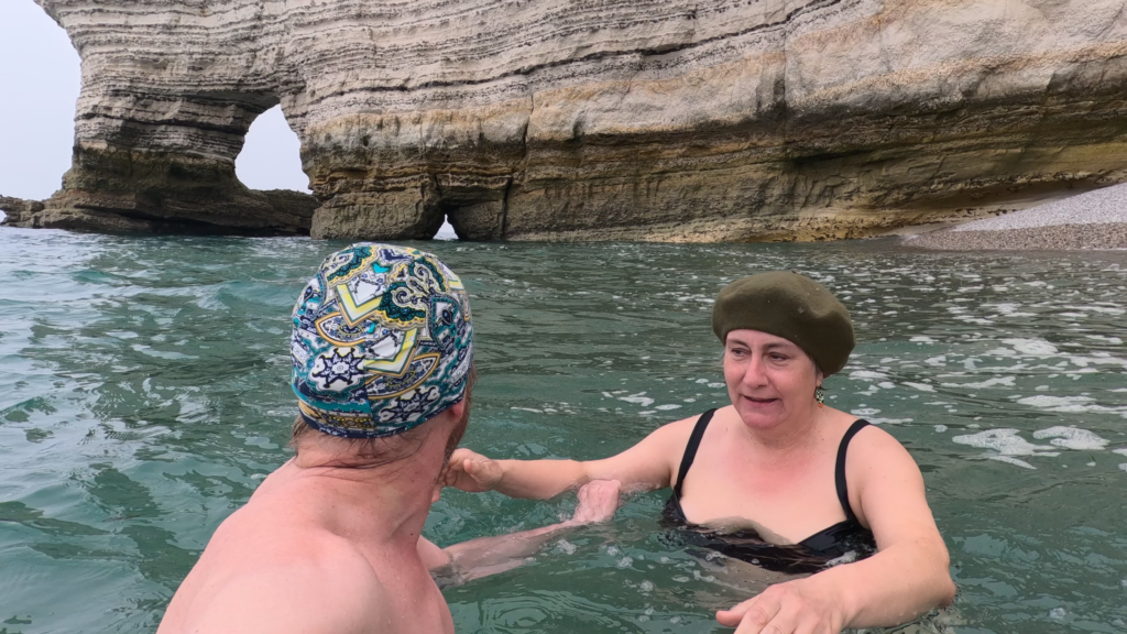
The pebble beach at Étretat is somewhat demanding as a bathing spot. It is actually very good exercise to wade in pebbles on a steep beach. For us, a reminiscent of the movie ‘Rocky‘, who exercised hard by running in the snow. One step forward and half a step back… But it will be good for you (it was for us), and the water is clear and fresh, so beach life by Étretat is highly recommended.
So close, but still so distant (or at least rather unwise to visit)
At Porte d’Amont, there were no prohibiting signs against swimming, only for walking too close to the cliffs. Into the water we went. Currents? Oh yes! The tide was coming in, and when we lifted the legs up from the bottom we were pulled away northwards. The water level here changes 10-15 meter according to the tides… Terrifying, at least without an accompanying boat! Tobatheornottobathe didn’t swim under one single arch, but remained with ground contact…
The estuary of the Seine has at all times been an important hub between the inland and the sea, and this time we mean literally ‘all times’. Human activity goes back a full 400,000 years, to prehistoric times. This was also Asterix-land (Gallic-Roman), with activities linked to the Seine traffic. The city of Francispolis was formally founded in 1517 by King François I (for fear of English invasion), but by then the city was already established. For many years it was called Le Havre-de-Grâce (Harbour of Grace), and after the Revolution just Le Havre (The Harbour).
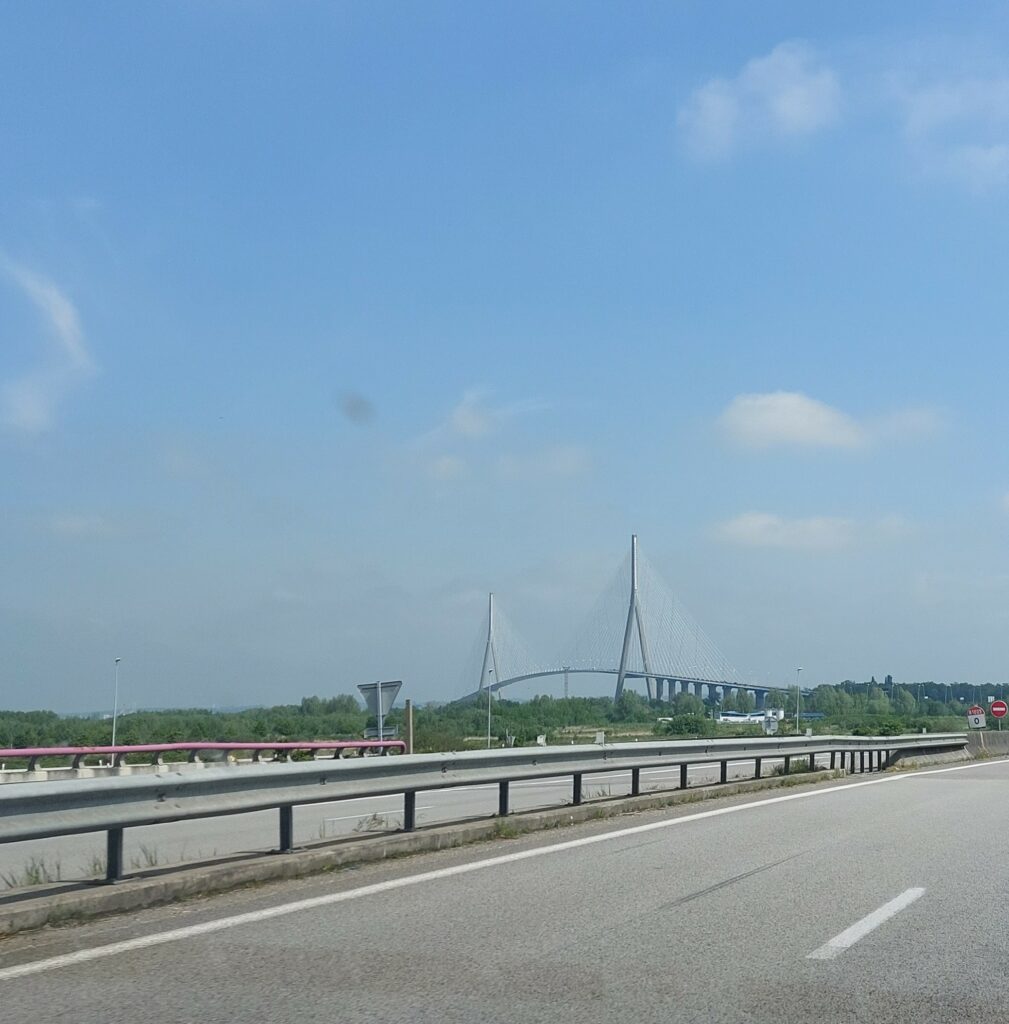
Le pont de Normandie (The Normandie Bridge) was completed on January 20th 1995. The bridge crosses the lower part of the Seine and is 2,141 m long.
In 1914, Le Havre had around 150,000 inhabitants. During the First World War, 7,500 of them died (mostly sailors and soldiers). However, the city escaped the bombardment because the front was much further north. Still, World War II was a disaster for the city. Le Havre was occupied by the Germans, 5,000 people were killed and 12,000 homes destroyed (both devastation by the retreating Nazis, but also by massive Allied bombing). The result was a large exodus, and the population in 1945 was down to around 100,000. Today, Le Havre has again 150,000 inhabitants but this is currently declining.
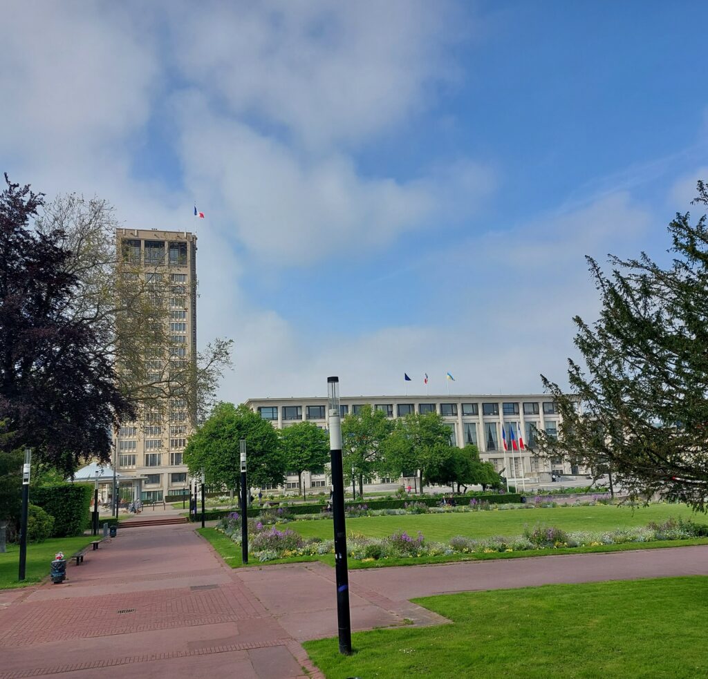
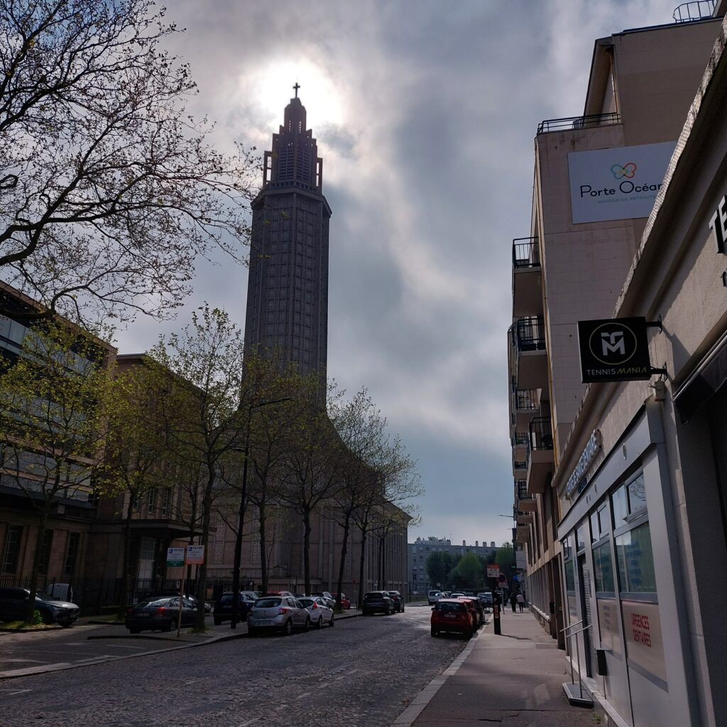
Le Havre. Uniform center in reinforced concrete.
After the war, it was decided to build up the city as quickly as possible, without copying what was there before. The architect Auguste Perret designed a completely new center in reinforced concrete, and this unique city center was placed on the UNESCO World Heritage List in 2005. The construction took place using prefabricated elements, where each module unit was 6.24 m. The restoration was finished with the consecration of the Saint Joseph church in 1964.
Église Saint-Joseph du Havre.
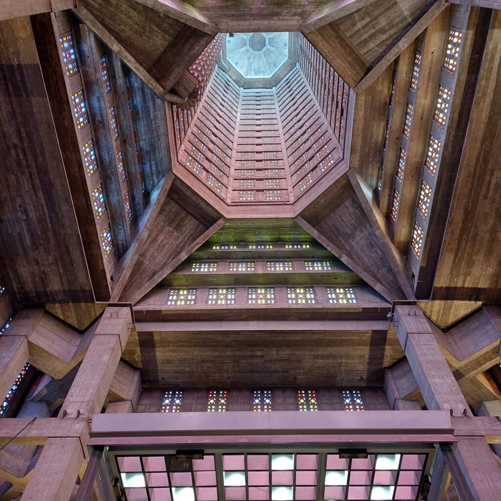
Perret’s use of concrete in a modernist style was not immediately praised, and further development of the style in Eastern Europe has given rise to terms such as ‘Stalin architecture‘ about it. And yes, it does feel overwhelming.
Saint Joseph’s tower. The spiral staircase up to the church bells is visible to the left of the tower. The stained glass windows by Marguerite Huré get brighter and brighter the further up you go.
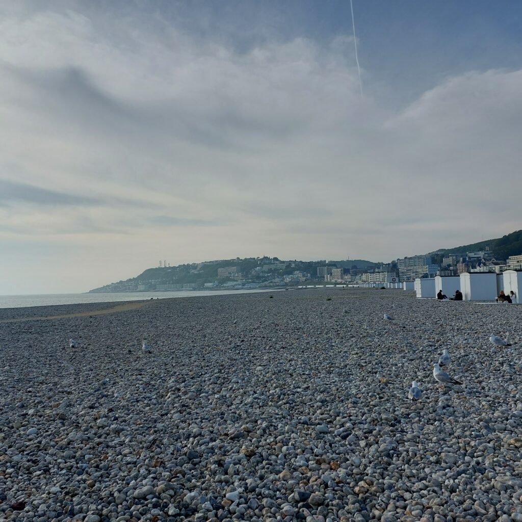
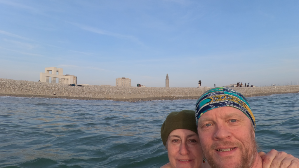
We visited Le Havre on an ordinary Sunday, and the city appeared cold, boring and empty of people. When there’s nothing to do, a bath is just right, you might think, and yes, it was. The area around Le Havre is full of water and swamps (it is, after all, the Seine’s delta), but to the north-west of the city there is a wonderful, long, pebble beach.
The beach at Le Havre.
There were people at the beach! And there were seagulls. And in the north, parts of the old city were also preserved.
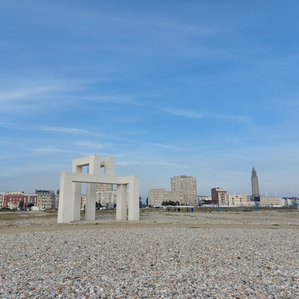
View from the beach to the new Le Havre. At the front, the sculpture ‘UP #3‘. We suppose it looks like Le Havre’s logo, seen from the correct angle (for instance from above?).
In the project ‘Un Eté au Havre‘ (A summer in Le Havre) in 2017, the port and the city’s 500th anniversary were celebrated. Several of the artworks have since become permanent elements in the city, including UP #3 by Sabina Lang and Daniel Baumann.
Le Havre, The logo.
We had a nice swim by the Beach, surrounded by seagulls and sort-of exhausted young people. But we think that massive bombing of ‘The Harbour of Grace‘ was not just right.