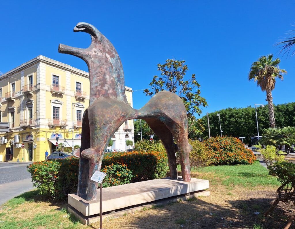
Artwork by Dino Pantano in Syracuse, inspired by a bronze figure dated around 800 BC (before the Greek colonization).
‘The largest Greek city, and the most beautiful of them all!‘ … Cicero wrote around 50 BC. Syracuse was founded by Greeks from Corinth 700 years earlier, when they displaced an Indo-European tribe, the Sicels, from the coast.
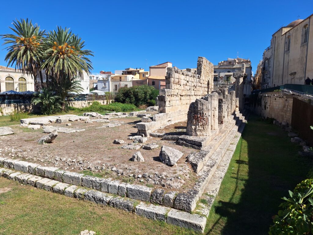
The temple of Apollo in Syracuse.
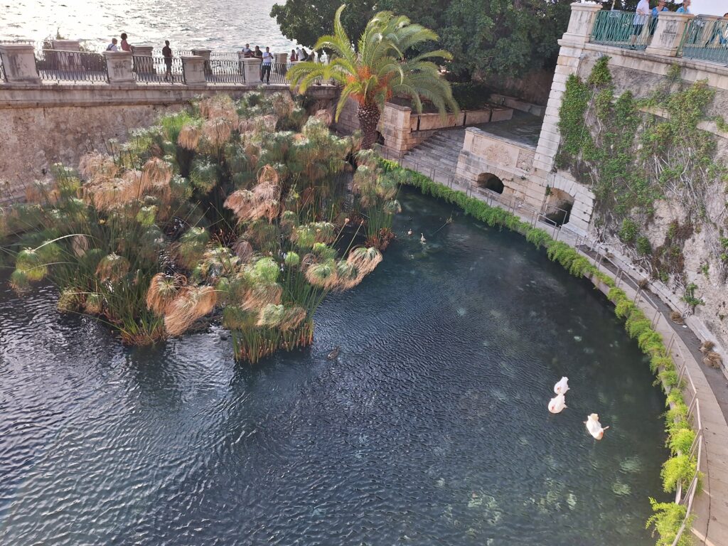
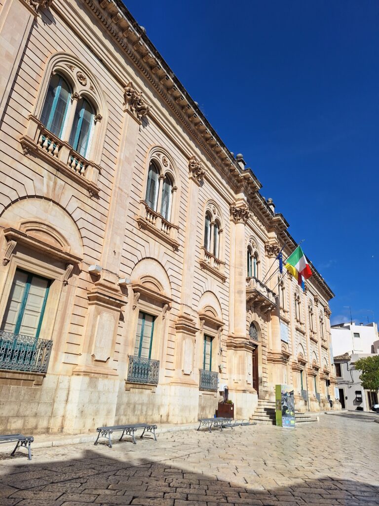
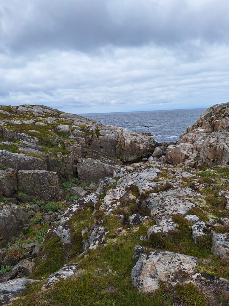
The name of the city of Syracuse means ‘surrounded by water‘, and this actually refers to the marshes in the area. However, the old town is located on an island, Ortigia, so the name fits just as well today even though there is no marshland there anymore.
Ortigia. When Zeus made Leto pregnant, Hera is said to have become so jealous that she condemned her to ‘give birth as painfully as quails do when they lay eggs‘. Ortigia means quail.
Syracuse has a long and uneven history. Greek dominance ended when the Romans captured the city in 212 BC after 3 years of siege. As the last Sicilian city, it became Arab in the year 878.
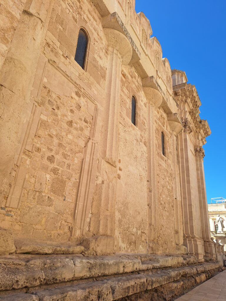
The cathedral is located on Ortigia’s highest point, and here the Greeks built a temple for Athena 580 BC. The temple was later converted into a church, then into a mosque and back to church again. And still you can see the pillars from the temple in the walls. Fascinating!
During two hundred years of Muslim rule, the capital functions were moved to Palermo, and Syracuse was never the most important city again, although trade continued. In this period, most of the churches were converted into mosques, but otherwise it was freedom of religion. The Normans took over in 1038, and from 1298 Sicily came under Spanish control.
Most of Syracuse was totally destroyed during the big earthquake of 1693. Something nice came from the bad, though. The reconstruction in the 18th century gave the city a beautiful, baroque style.
In Syracuse (actually it was Ovid), it is told about one day when the beautiful nymph Arethusa, who was in the retinue of the hunting goddess Artemis, wanted to take a bath after the day’s work. Alpheus, the water God, immediately fell in love and wanted her for himself.
Arethusa Fountain in Syracuse. Here, Arethusa gets an eternal bath.
Arethusa was horrified and asked Artemis for help. She blew her to Ortigia and turned her into a spring. However, Alpheus did not give up, but asked his father, Oceanus, for help. The father believed in his son’s love, and opened the Ionian Sea for him so that he could cross Sicily and meet his beloved girl again. This is how Arethusa and Alpheus were united at Ortigia. How he got her even though she was afraid of him, Tobatheornottobathe has not fully figured out. Possibly, no laws of consent applied in ancient Greece?
The Arethusa spring is the eternal embrace between Arethusa and Alpheus in practice. There is a short distance between the source and the sea, so the water is somewhat salty. Wild papyrus grows here, as one of very few places outside of Egypt and Chad.
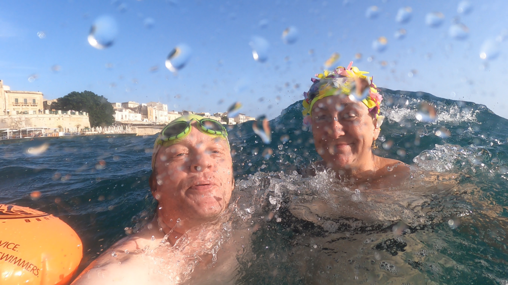
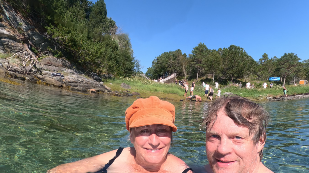
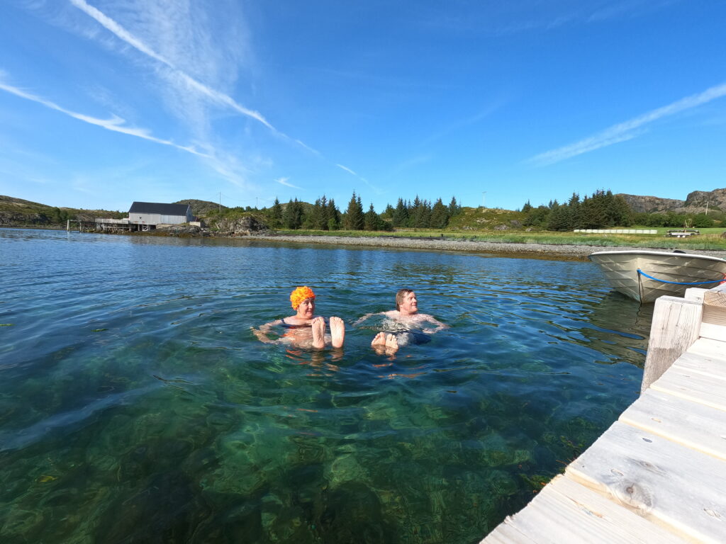
Just north of the spring there is a small, public beach. Tobatheornottobathe is always looking for places to swim, and Syracuse has plenty of them, as there is sea everywhere. This day, however, the wind was quite strong, and we considered bathing from the rocky parts of the coast as risky because of the waves. Beaches, however! The harbor guard has built a long quay here, and we thought it might be a good idea to jump from the quay and swim to the beach. That turned out to be an interesting task! We were thrown around and around, almost like swimming in a washing machine. But fun! And as the Sicilian water is warm, together with a sandy bottom, it wasn’t dangerous in any way.
Bathing in waves is just right in Syracuse. Great fun!
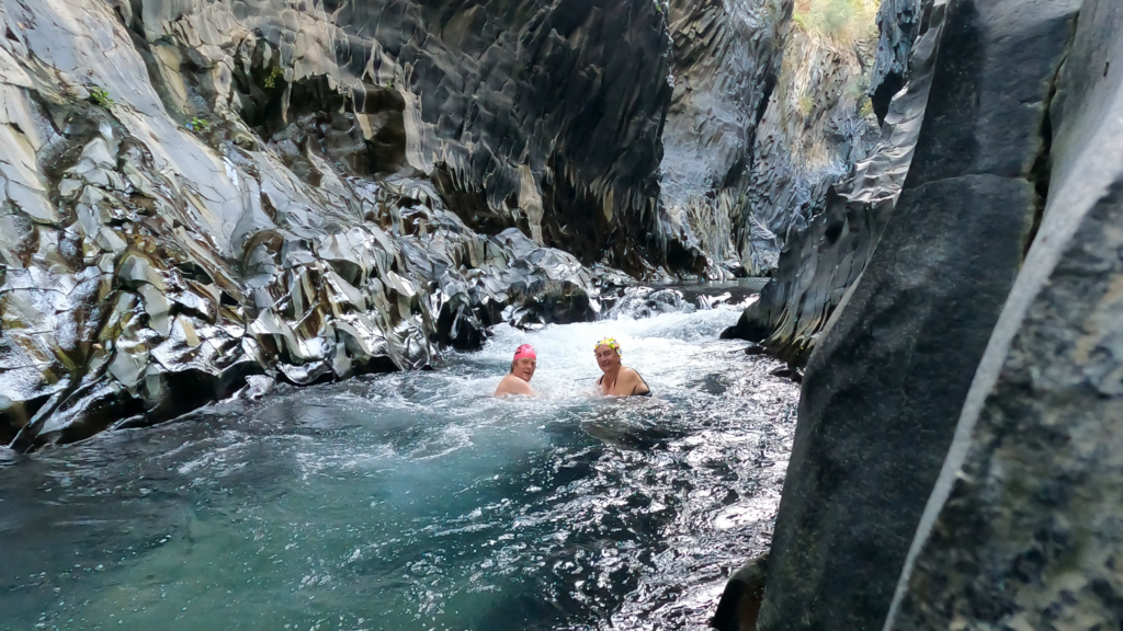
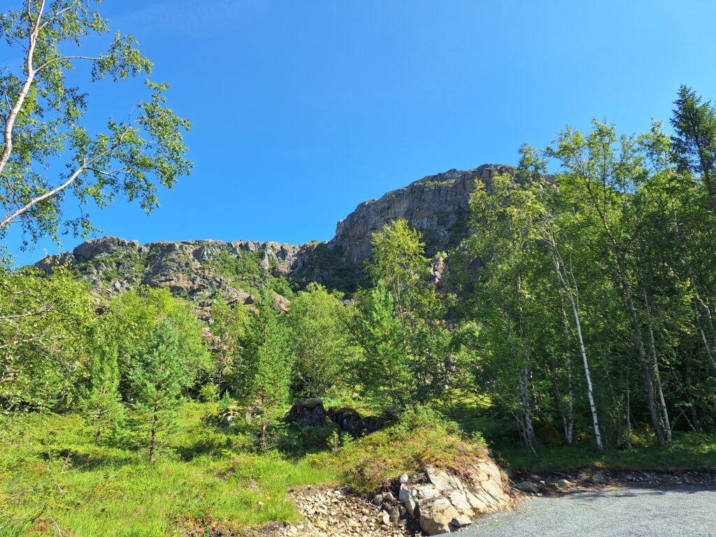
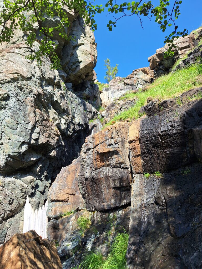
In the east of Sicily, just north of Etna, there is a valley, Alcantara, where a river has been fighting for space against lava since the dawn of time (well, technically it’s about 8000 years). Tobatheornottobathe had come across a picture of a gill with beautiful basalt columns and splendid bathing opportunities. We wanted to go there!
At first glance, the Alcantara valley did not look very promising. The river, like all the Sicilian rivers we had seen until then, was completely dried out. Later it turned out that this was not a river bed, but an irrigation channel…
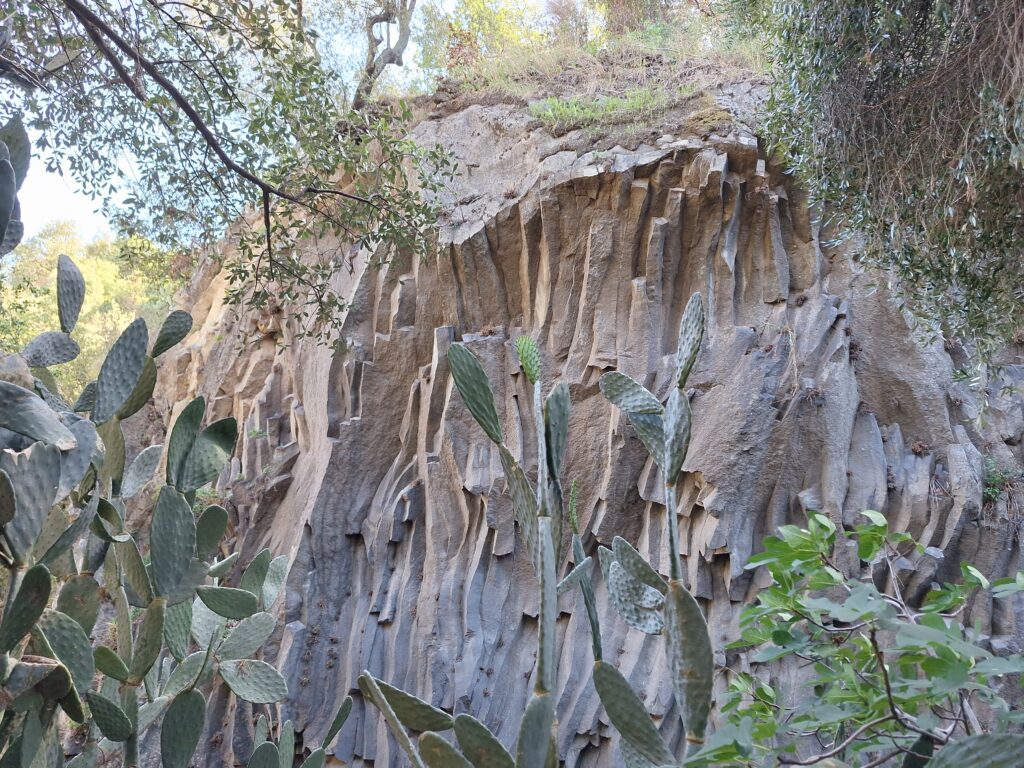
The lava had been flowing down from Etna in three stages, and was cooled down just fast enough for basalt columns to be formed. The basalt beams take their shape after the molecular shape of basalt, and create 5-12 sided beams, usually 6. It’s just marvellous!
The basalt columns in Gole Alcantara.
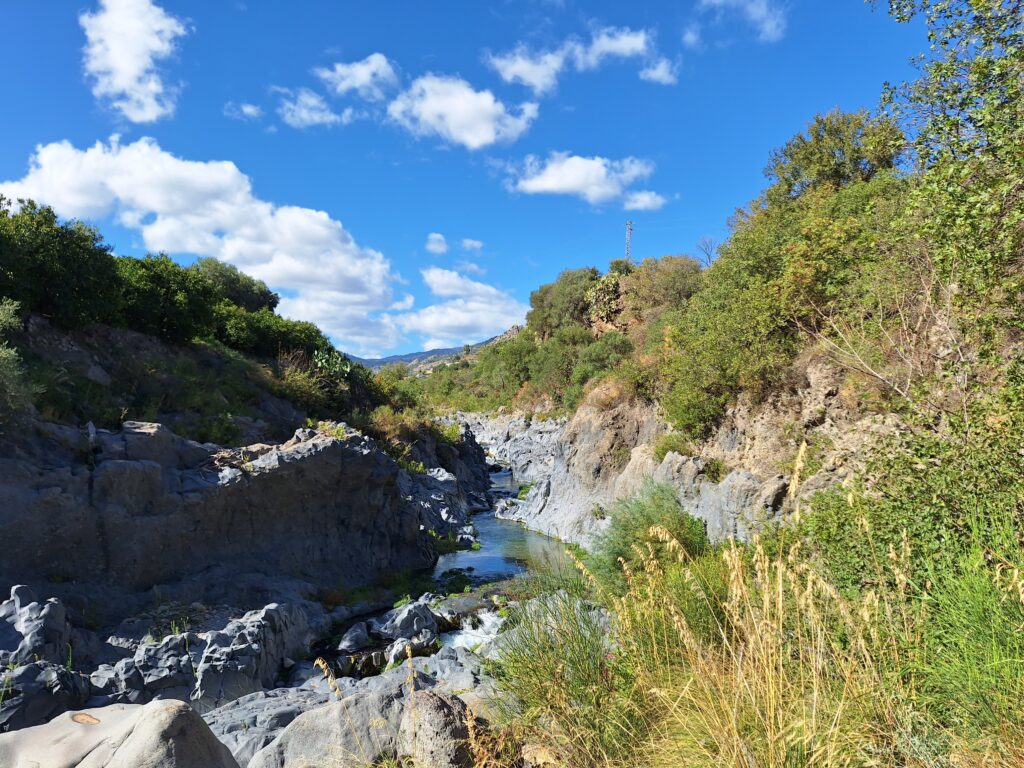
The name Alcantara comes from Arabic ‘The Bridge‘, and in the middle of the valley there is a gorge which in some places is so narrow that you can jump over to the other side (don’t try, please!). The gill that the river has dug is up to 25 meters deep. Apart from the basalt, this looks quite similar to ‘Mågålaupet‘ at Oppdal in Norway. The basalt, on the other hand, is a bit reminiscent of another basalt pillar gill we have visited, namely ‘Stuðlagil‘ in Iceland.
The gorge is 6 km long, but parts of it are difficult to access.
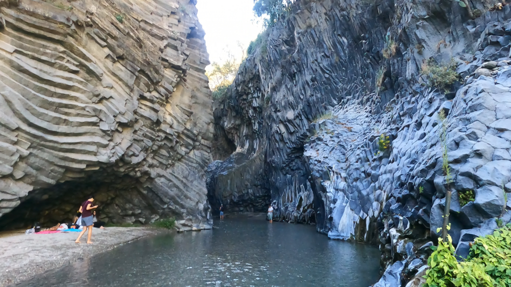
It turned out that the water in the gill is surprisingly fresh and cold. Absolutely wonderful! There will be some wading on sand and gravel (consider swimming shoes or wet socks if you have sensitive feet).
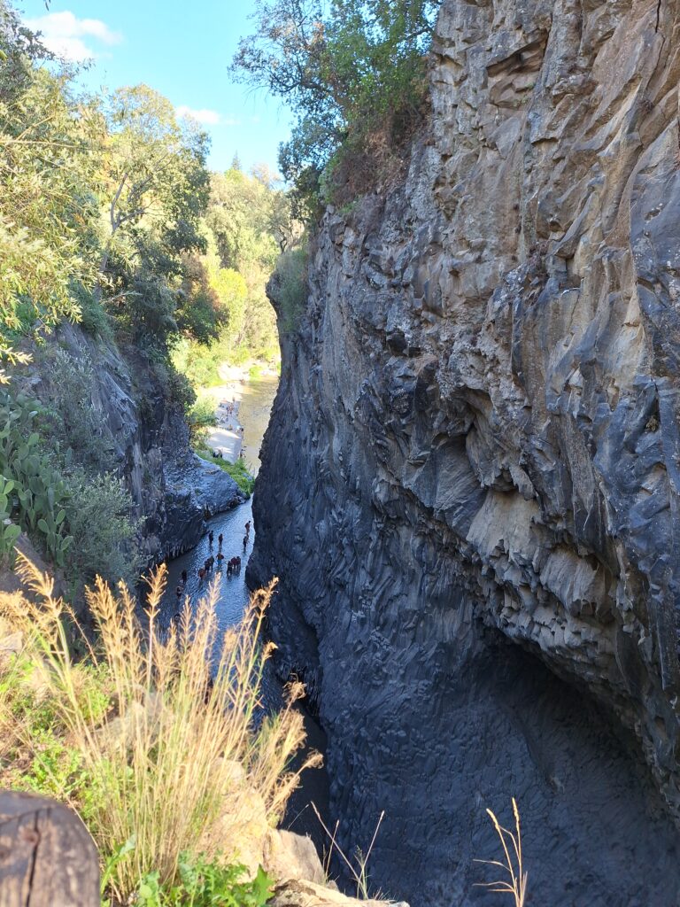
There is water in the river, and Tobatheornottobathe felt cheerful. But what are all the people looking for in the water?
It was probably the stones in the river they were looking at, or maybe fish, we did see some. Tobatheornottobathe visited the place in October and there were a lot of visitors, but not crowded. In August/September it is probably different, but still we would strongly recommend a bath here. If you want, there are organized trips, for example paddling and canyoning. We felt satisfied with just a bath, and purchased tickets including a lift (!) down and up again.
Nice entrance, almost like it was designed by Gaudi.
The area is well developed, with hiking trails and a park on the southern side. Before the refreshing bath we recommend that you walk the entire route. Almost all the stops are linked to stories about Venus and her love life. An old legend says that the god Vulcano and the goddess Venus used to meet here, but Venus dumped Vulcano in favor of the god Mars. It became a mess! Vulcano, who had let the lava flow this way to heat the water in the river to make it comfortable for Venus, made the water cold instead. This is still the case, and according to legend, the icy water is supposed to increase (!) the virility of the men who bathe here, and the virginity of the ladies. Hmm, mysterious!
A bath in Gole Alcantara is absolutely gorgeous! It wasn’t deep (in October), only wading, but that was ok, since the current was so strong that you couldn’t swim against it anyway. And the temperature? Not above 12 degrees Celsius, i.e. freezing cold according to Italian standards (impossible to swim there in winter, they say…).
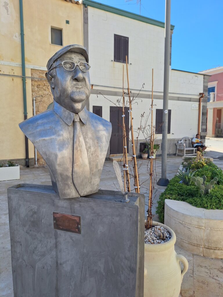
Over many years, we have enjoyed following Andrea Camilleri’s investigator Salvo Montalbano in the TV series of the same name. First with great effort and interpretation problems (many were without subtitles). But even with gaps in understanding, we liked the crime series so much that we watched everything we could find – with or without subtitles.
Camilleri published his first book about Montalbano in 1994, and the last one came out in 2020, the year after the author’s death. Punta Secca has created a small piazza dedicated to him: Piazzetta Andrea Camilleri.
Inspector Montalbano has a big heart for those who are struggling, and little respect for authorities and the mafia. In order to solve the cases, great cleverness and the ability to balance between the necessary investigative steps and the limitations of those in power are needed.
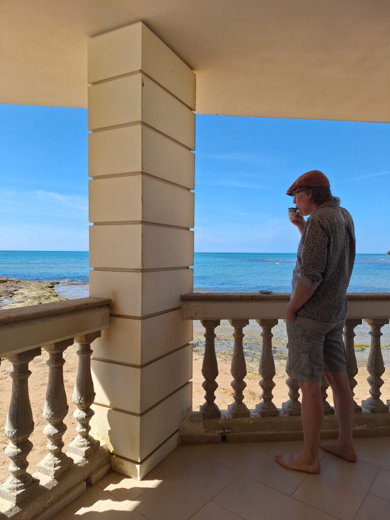
Hunstalbano sono. In almost every episode you can see him taking his morning coffee from exactly this terrasse. And taking a morning swim.
The first episode based on the novels (don’t put too much emphasis on the word episode here, we’re talking about one and a half hour movies…) was broadcasted in 1999 with Luca Zingaretti in the leading role. It was an instant success, and a total of 36 films of varying lengths have been released. We have seen most of them, but we still haven’t been able to get hold of all, so the search continues!
The lighthouse in Punta Secca.
At least one woman tries to seduce Montalbano in every episode, but for the most part he keeps his distance from all beautiful women, including his fiancée Livia, who lives in Genoa, 1,400 km away. Many of the approaches take place in the house (bed), on the terrace or in the bay outside. He lives in an iconic house located in Punta Secca in the south-west of Sicily.
The Montalbano house.
The Montalbano House has now (2024) become somewhat of a pilgrimage destination, and for Badebadebade a natural place to visit – since Montalbano in the TV series swims both often and long.
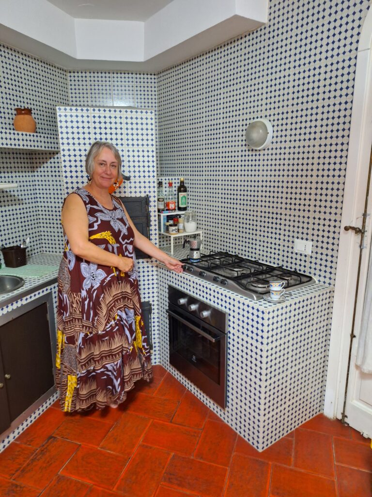
Idulina sono. Idun has neither Ingrid’s car nor Livia’s temperament, so it had to be a tribute to Adelina, his house maid.
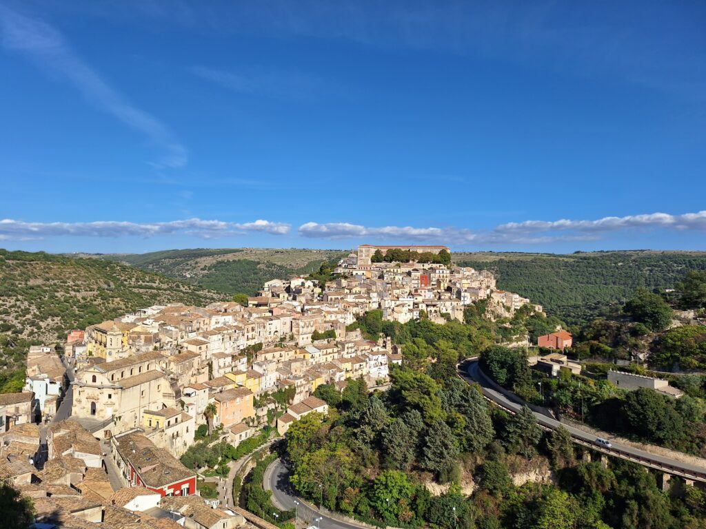
In Camilleri’s books, much of the action takes place in fictional cities in and around his hometown of Agrigento, but in the TV series, many of the recordings are made in and around the cities of Ragusa and Scicli as well as Punta Secca. There are long lists of locations – everyone wants a hand into the tourist industry that has arisen in the series’ wake.
Scicli. The recordings for Montalbano’s police station were made in the town hall.
The scenes in the town hall in Scicli still exist and can be visited for a small fee. The police chief’s office on the floor above is used as a ceremony room, with the same interior as in the films.
Hunstarella struggles with the door, as usual.
Scicli. If you are thinking: Indeed, there are only a few letters that separate the town name Scicli and the island name Sicilia, then you are absolutely right. Both names arrive from the Sicelene, an Indo-European people who lived in Sicily before Greek colonization began around 700 BC. In 1693, the southwestern part of Sicily was hit by a severe earthquake, and many of the towns were completely destroyed. The reconstruction in the 18th century was done in Baroque style, and with building material of light Sicilian sandstone, these UNESCO cities are wonderful places to visit – and also widely used as film sets.
Ragusa Ibla seen from Ragusa Superiore. Follow the Montalbano signs when walking around the city center! It’s no secret that the TV series Montelusa is actually Ragusa.
What was the Montalbano bath like? We had rented the apartment on the ground floor (the first floor is a B&B and was not available to us, nor was the top floor). The house and apartment were nice, some wooden details around the windows and doors are painted white now, not brown as in the series. The access to the sea is as you see in the movies, the lower terrace actually touches the sand. So it was just a matter of strolling down to the sea. The water was a little shallow close to the house, but if you walk a few meters to the side before entering, it’s sand almost all the way. Awesome! We had been strongly warned: The sand is not as nice and golden as in the film, it is too shallow, the water is grey due to sea grass etc. With low expectations, we were happily surprised! We found the beach nice, great for swimming and the water clear.
A bath at the Montalbano beach is wonderful both morning, noon and night. For selfies, you might consider checking where the sun is first.
Living on the ground floor of the Montalbano House is what it is: Living in a pilgrimage destination. There is a steady stream of people coming close up to the terrace taking pictures, they knock on the door and try to look in, absolutely all the time. And by that we mean all the time, now you know.
An offer Knut, having “worked for The Mouse”, could not resist: Contrary to most adaptations of litterature into the Disney Universe, Mickey does not enter the role of Montalbano, he enters the Montalbano universe and helps solving the case. Camilleri himself considered this to be an honor and meaning more to him than a Nobel Prize!
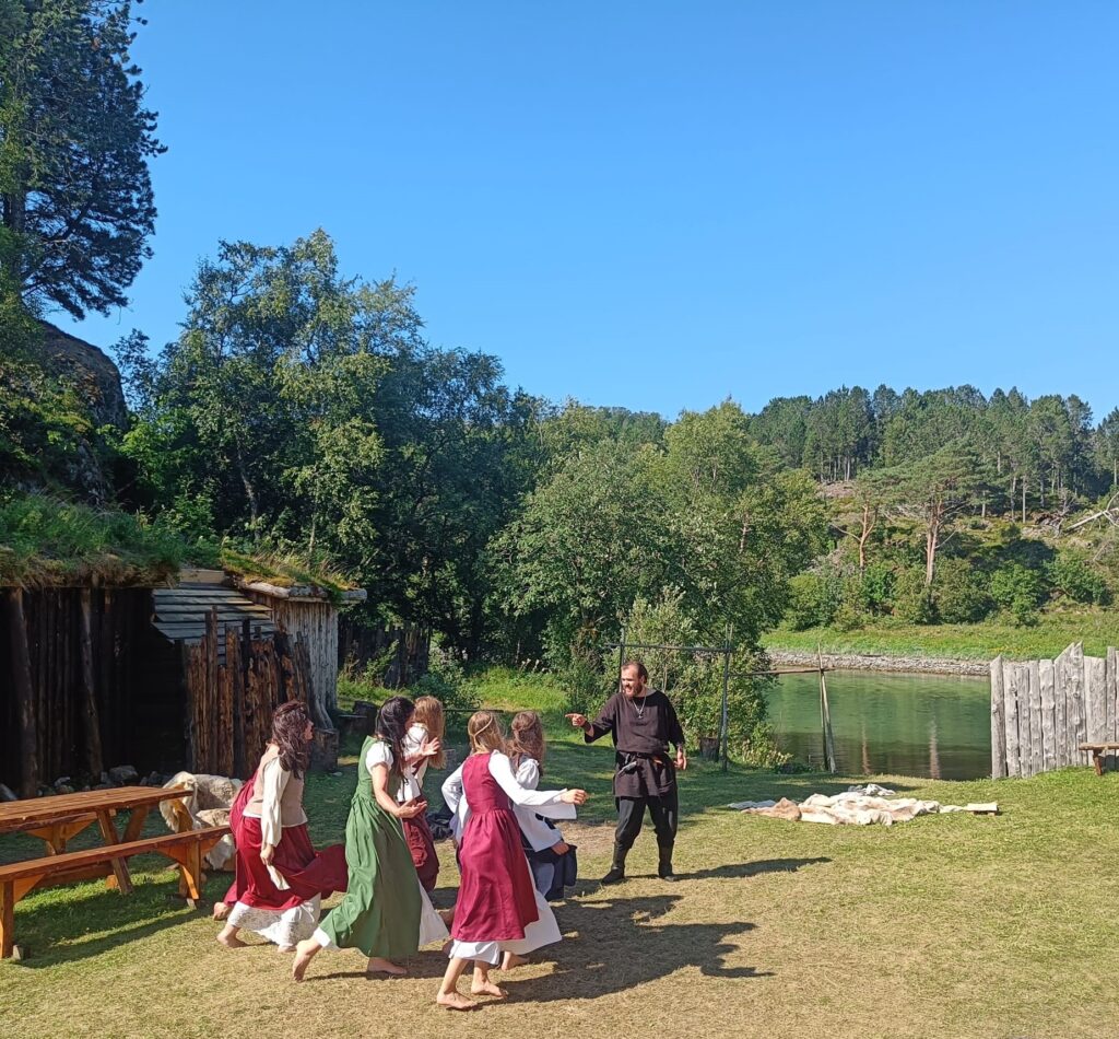
With its 600 inhabitants, Leka is one of Norway’s smallest municipalities, but that does not prevent an immense commitment to theater. Herlaugsgildet theater group was established in 1977, and they have set up the play ‘Herlaugsspelet’ for many years. But in 2024 it was ‘The saga about the Helgeland mountains’ that was the theme. We wanted to see that!
The path to Lekamøya (The Leka Virgin Mountain) starts from Solsem.
Tobatheornottobathe’s short version of the saga goes like this: King Sulis in Sulitjelma and King Vågakallen in Lofoten argued about who had the biggest kingdom. But there was one thing they agreed on, namely that the youths were difficult to manage. Vågakallen had given up his unruly son, Hestmannen (The Horse Man), and King Sulis had sent his 7 daughters to Landegode close to Bodø, so that they would be brought up by the wise and beautiful Lekamøya.
Lekamøya mountain looks like a woman with stretched arms and a shawl. Photo: Ole Hamnes, license: CC BY NC SA 4.0.
It didn’t work out very well, because the seven sisters just wanted to play and bathe, preferably with the Horseman. But his eyes had fallen on Lekamøya, and there was a lot of back and forth before he shot his arrow after her. The arrow went through Trollhatten which still has a hole through it, and at the same time the sun rised and everyone turned to stone. The color on the west side of Leka island is explained by the fact that Lekamøya dropped the bucket of mysost (whey cheese) in the same moment, and the stones were colored red.
On the way to theater in Frøvik. The mysost bucket on this milk ramp won’t blow away anytime soon.
The play ‘Lekamøya and Hestmannen‘ was quite well set up, with several references to Herlaugspelet. The outdoor stage is absolutely beautiful, located on a headland with water visible on both sides. The play had many scenes mentioning bathing, certainly a show to Tobatheornottobathe’s taste!
The seven sisters, here are 5 of them, appreciated bathing and all sorts of fun, especially if the Horseman was around.
This theater day in 2024, the weather was brilliant, almost too much for Tobatheornottobathe. Sunny and 27 degrees celcius… It all went as it had to go – there was a swim in the break!
At Leka, a bath is perfect when the theater has a break.
Just after the ice age, the sea level at the Trøndelag coast was up to 100 meters higher than today. At Leka you can find a cave 78 m above sea level, Solsemgrotta, formed by a fault that was excavated by the sea, while this was the beach zone.
Lekmøyhammaren and the hard choice: Turn left towards Solsemgrotta, or right towards Lekamøya?
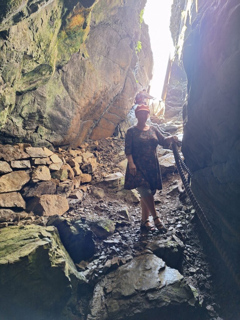
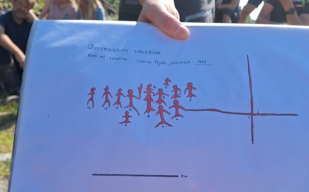
In 1912, the cave was explored for the first time by 3 young men from Solsem. The cave is approximately 40 meters long, 5 meters wide and 8 meters high. Once inside, they discovered cave paintings in the dark part, the first cave art found in Norway until then. The boys behaved well after the discovery, by notifying the Science Museum in Trondheim. Later the cave was examined by archaeologists Theodor Petersen and Claus Hjelte. They made drawings of the cave and the cave paintings, and collected many objects for further investigation.
View northwestwards from the cave.
Remains of many different animals were found, a total of 1,868 bones. From catching and hunting, they found shells from clams and snails as well as bones from seals, cod, flounder, herring, black bream, gray grouse, puffins, vultures, sea eagles, goshawks and rock doves, but also livestock bones from cattle, sheep, goats and horses. The cave has clearly been used for a long time, from the Bronze Age (1800 BD) to the Viking Age (1000 AD).
View westwards from Solsemgrotta, towards today’s farmland.
The use of the cave has been much debated. We have many caves in Norway that have been used as shelters. Solsemgrotta, however, has a difficult access. The path up to the cave is today a rocky trip, but was of course shorter in older times, when the sea level was higher.
The entrance to Solsemgrotta is closed today, to preserve the art. Access only with a guide.
The problem is the slope from the cave entrance. There is a steep drop of 3 meters into the cave before it flattens out, today equipped by stairs and ropes. In older times you must have needed a ladder and/or ropes, which would have been very impractical with children. The conclusion is therefore that the cave must have been used for rituals. The remains of two people are explained by the fact that they were brought there after their death.
The cave entrance is steep, no place for children. The cave cannot have been a residence.
We were at Leka island to see the play ‘Lekamøya og Hestmannen‘, and in that connection guided tours to Solsemgrotta had been set up. It was a great tour, with a good guide. So far, only 10 caves with rock art have been found in Norway, all along the coast between Namdalen and Lofoten. In comparison, thousands of petroglyphs have been found in open air, all over the country.
The cave painting on the east wall. Copy of archaeologist Claus Hjelte’s drawing. It is not allowed to take pictures inside the cave.
The cave painting on the east wall in Solsemgrotta depicts 13 people, one of whom is holding a large solar cross. 9 of the figures are clearly marked as men. Of those who lack male attributes, there are two who have obviously important functions: One holds the solar cross and the other holds a torch. According to our guide, the non-male figures were first categorized as ‘castrated men’, not as women (!). This probably says more about women’s position in the early 20th century than women’s place in the Bronze Age society. Was there an interest in mass castration of men in the Bronze Age? Were the women invisible in the early agricultural society?Tobatheornottobathe is in no doubt, and concludes that the portrayal of women has never been uninteresting, not even in the Bronze Age.
Rullavikstranda at Solsem. Sem comes from Norse ‘Sæeimr’ = Home by the sea.
Unfortunately, Solsemgrotta has no pool, so bathing inside the cave is impossible. At Leka, however, there are bathing places everywhere, and of course we took our cave bath at Solsem. Down by the sea we found a beautiful bay, Rullavikstranda, with fine sand, but decided to jump from the not quite finished floating jetty. It’s wise to look around a bit before swimming, as we discovered a jellyfish where we first wanted to jump in. It is best to swim outside the range of the jellyfish, also at Leka.
You can jump right in if you want to, or wade out from the beach, if that’s your thing
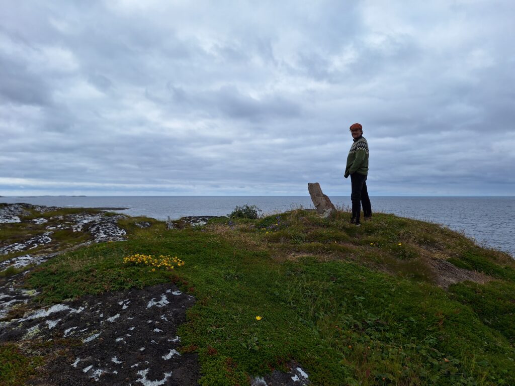
In the far northwest of Trøndelag lies one of Norway’s smallest municipalities: Leka. It is well worth a visit!
From a distance, Leka looks quite ordinary: a few islands scattered across the sea with a modest mountain sticking up. On further investigation, however!
The story of Leka started 500 million years ago, when the American continental plate (Laurentia) and the European one (Baltica) drifted against each other. In the collision, the ocean floor plate Laurentia was pushed under Baltica, but a piece came loose and was turned on its side. This piece is today Leka! 60 million years ago the plates began to drift apart again. A rift arose between what later became the Atlantic Ocean and the Mid-Atlantic ridge. However, the rifting occurred west of Leka, and therefore we have an island in Trøndelag that actually belongs to the American continental plate. Let’s hope they don’t ask to get it back!
Very interesting geology at Leka!
The yellow-red mountains on the west side of Leka were a mystery for a long time, but in the 60’s researchers found the explanation. The island consists of all the layers from the old seabed crust, turned 90 degrees. Here the layers are so thin that by walking for a few hours you should be able to see all the layers from 7 km down into the mantle to the top of the former seabed. The beautiful colors come from serpentinite and olivine. Fascinating! And this natural ‘exhibition’ of all the rocks (a complete ophiolite complex) is the reason why Leka was chosen as ‘Norway’s Geological National Monument‘ in 2010.
The rocks on Leka do not provide much benefit to the vegetation, and the soil is poor. View north towards Vega Island.
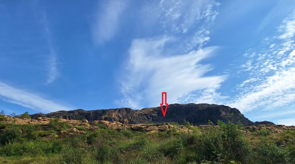
The name Leka is uncertainly explained, but may come from ‘to leak’, i.e. from the streams on the island. The municipal coat of arms pictures an eagle’s claw and refers to a well known eagle catch, which took place in June 1932. Svanhild, aged 3 ½, disappeared while playing, and over a hundred persons were involved searching for her. In the evening, Jentoft Svendsen, Leif Andersen and Karl Haug climbed up to an eagle’s nest, as they had noticed that the eagle was behaving differently than usual. To get up, Jentoft had to stand on the shoulders of the others, and just below the nest he found Svanhild with her dress torn but otherwise in good condition. They were sure that the girl could not possibly have climbed there on her own. On the other hand, ornithologists have claimed that the eagle could not have lifted her, since she weighed 12 kg. And thus the discussions have continued for almost 100 years! Tobatheornottobathe thinks it looks very steep in the mountain, and finds it hard to believe that she could have climbed there by herself. But sure? No.
The eagle’s catch in Hagafjellet. It must be a fit 3-year-old who climbs half the rock face here (to the tip of the arrow)!
Leka municipality consists exclusively of islands, and there are bathing spots almost everywhere. We had hired a van to use as a tent, and stayed at the ‘bobil camp’. There you can book a place based on your desire for either proximity to water or a view. Not hard to guess what Tobatheornottobathe prefers?
Tobatheornottobathe will always choose to sleep by the water if possible. But how come this choice is different from a view? Seriously? Isn’t this what you might call a panorama?
Since parking 5 meters from the sea, there was bathing going on both morning and evening at Leka. A bit tricky to climb down the rocks, but clear water, and the bay was warm and nice to have a swim in. By Sunday morning, however, the weather was windy, and the water suddenly had turned brown. Not disgusting of course, so far out to sea, but not as beautiful as the day before. Things like that happen, but all the baths were nice, because at Leka for sure, a bath is always right!
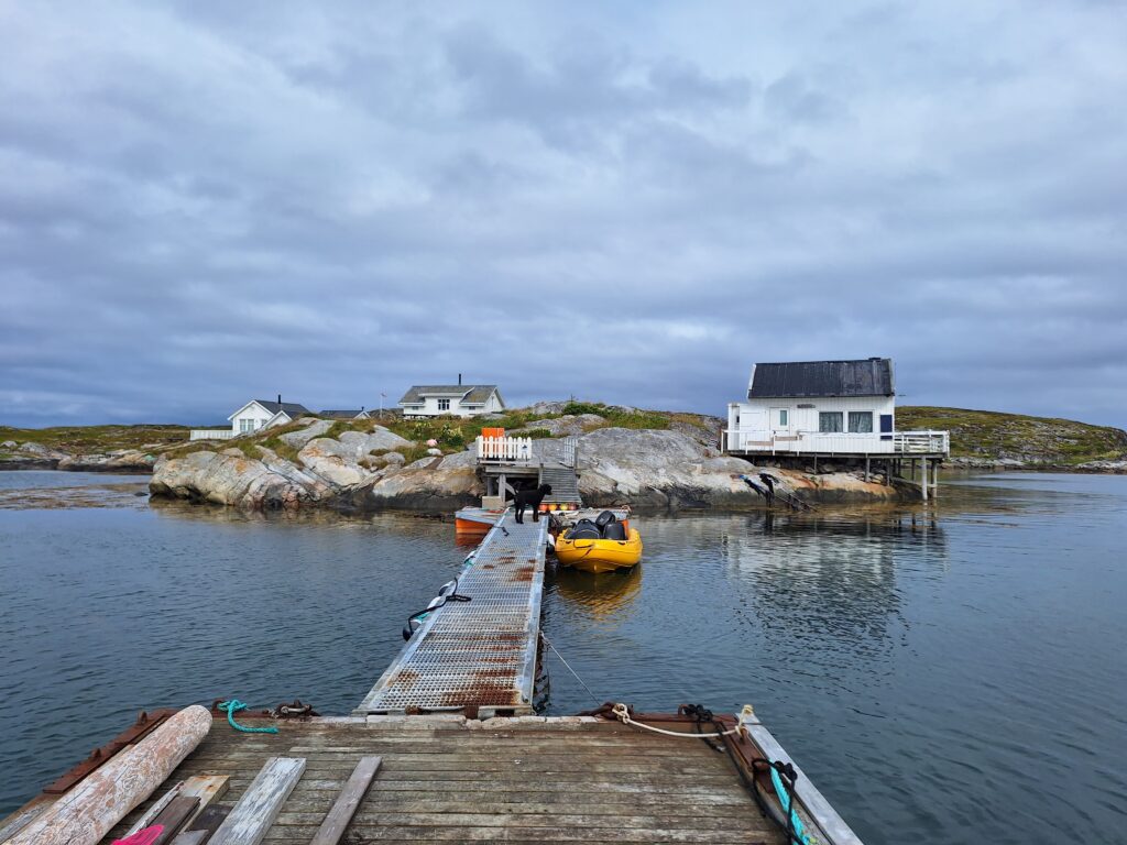
At the far end, north-west of Namdalen lies an eldorado of an archipelago called Vikna. It’s really nice here! The number of islands and islets (6,000) is more than the number of inhabitants (4,500), so there are all possibilities for fishing, boattrips, paddling and swimming.
Vikna, view towards the Dalafjellet wind power plant.
At the far end of Yttervikna lies Frelsøya (Salvation Island), a relatively low island with some marshes, lakes and hills cut by coves. ‘Who was saved here?‘ one might ask, and the answer is quite logical: Anyone who has suffered shipwrecking on the open sea, or perhaps hit the reefs further out, where the waves break all year round. For example, the English cargo ship ‘Zurich’ sank off Frelsøya in 1899, with the captain as the only survivor. He was found on a raft of planks.
Vik in Vikna with a view towards the open sea and ‘fallgarden’, the dangerous reefs that have caused many shipwrecks.
From the wooden material that drifted ashore from Zurich, Peder Kristiansen erected a new house on Nordneset, Frelsøya, in 1906. The house on Nordneset was demolished in 1968, and the wood was later used again – in a new building at Ramstad. Reuse at its best!
Frelsøya; the outermost island with the phallus. Knut was much more excited about the potency here than Kuløyfallosen’s appearance.
There have never been more than 3 farms on Frelsøya: Brusneset (depopulated 1949), Krambuneset (depopulated 1959) and Nordneset (depopulated 1968). All other settlers were fishermen who did not keep animals.
Krambuneset anno 2024. A holiday paradise!
Despite a modest population base, neighbours weren’t always buddys at Frelsøya. Court records from 1593 state that ‘Joen Frelsøen has to pay half a ‘daler’ in fine because he cut his neighbor’s hand.‘ This happened at about the same time that Niels Eriksen Frelsøe was imposed a similar fine ‘because he hit Hågen Frelsøe twice in the head with an ax hammer‘. Exciting neighborhood!
The neighborhood at Krambuneset is a bit better in the 2000s than 400 years earlier. Thanks for the loan of the cabin, Mona Kristin and Svein Gunnar!
We were lucky enough to visit Idun’s sister Jorunn, and her husband Berner, who owns parts of Frelsøya. This implies pleasant time together – and a morning bath every day. Thank you for the trip! A morning bath is just right almost anywhere on Frelsøya.
Ref: ‘Viknaboka Gards- og ættehistorie‘, Bind III av Bjarne Borgan
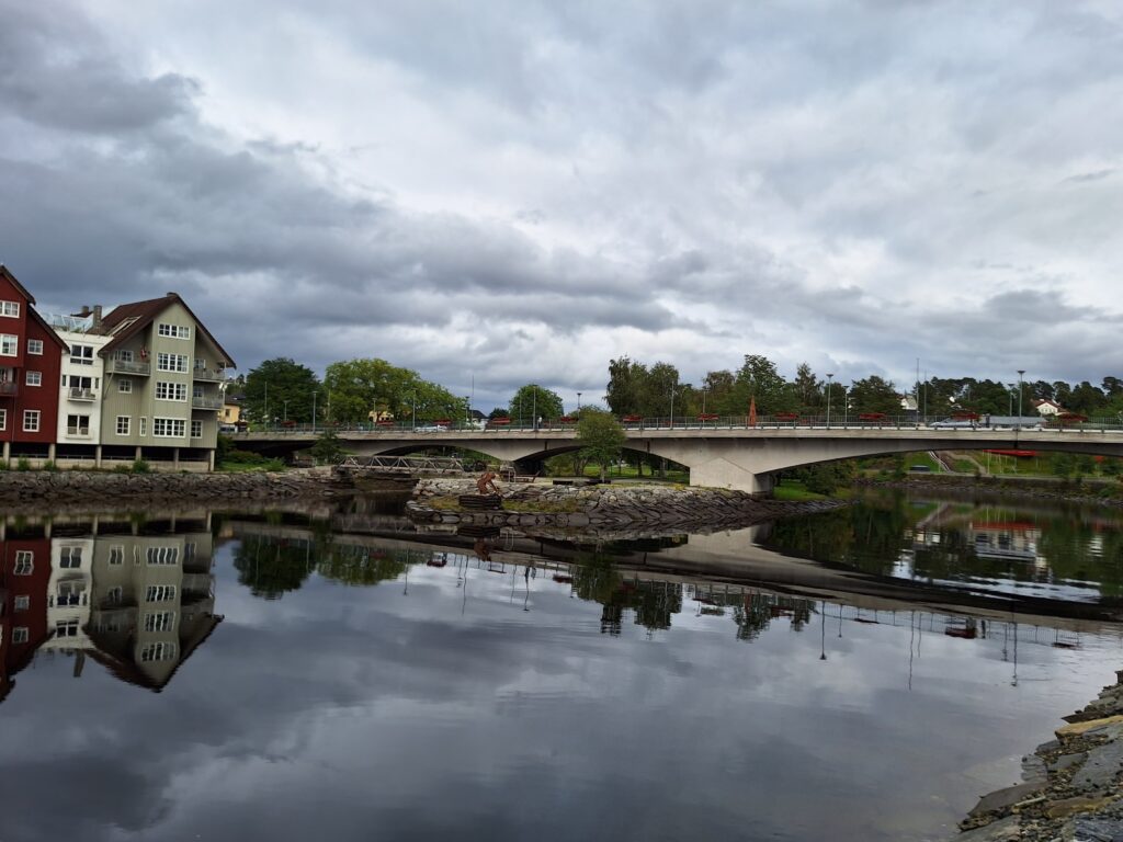
Innermost, in the north-eastern corner of the Trondheim fjord, lies Steinkjer, the county capital of Trøndelag. The name comes from the word ‘stein’ meaning stone plus ‘kjer’, from Norse (bridge) fundament or dam. The town, which has had city status since 1857, has 12,000 inhabitants and is well situated between the outlets of the rivers Steinkjerelva and Figgja. Many of the surrounding villages have fertile soil, on former maritime seabeds, and the town grew up due to trade of forest and agricultural products, hence the nickname ‘City of the Contryside’.
Steinkjerelva river has several opportunities for crossings. We will definitely come back here!
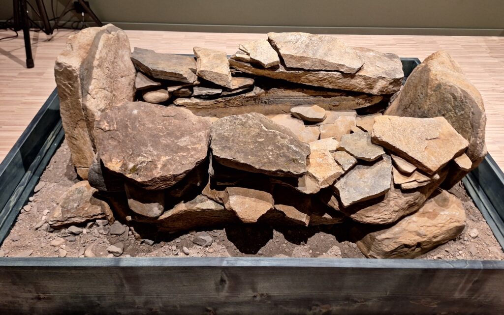
Many ancient monuments have been found in and around Steinkjer, both petroglyphs, burial mounds, stone circles and bauta stones (the stone in the name Steinkjer seems to mark an interest in stone that has lasted thousands of years). When we went swimming on September 2nd 2023, we joined the opening of Steinkjer’s new cultural center, including a special exhibition called ‘Heim’ meaning ‘Home’. The point is to return to the municipality finds that have long been stored elsewhere, including at the Science Museum in Trondheim. One of the ‘objects’ in this first exhibition was a burial site from around 1500 BC (early bronze age). The burial site was inside a circular wall inside a 14 meter high stone pile at Frøset in Steinkjer municipality, which was opened in 2002 in connection with road works. The burial site contained burnt bone remains from animals and a child under the age of 10. The burial site must have been clearly visible from the sea in the Bronze Age (sea level 15 m higher than today), and the location was hardly accidental, especially when you know that sand from the beach was transported to the burial site and placed in the grave.
‘Heim’. Exhibition with the aim of taking the ancient memories home. Illustrated here with a rebuilt children’s grave.
‘Heim’ has since been upgraded, and a new and larger exhibition opened in June 2024. From the cultural center you have a beautiful view of the Steinkjer River. There has been large-scale housing construction here in the 2000’s. Saying that, there are indeed very few old buildings in Steinkjer, after massive German bombings on 21/8-1940, where 80% of the building mass was destroyed.
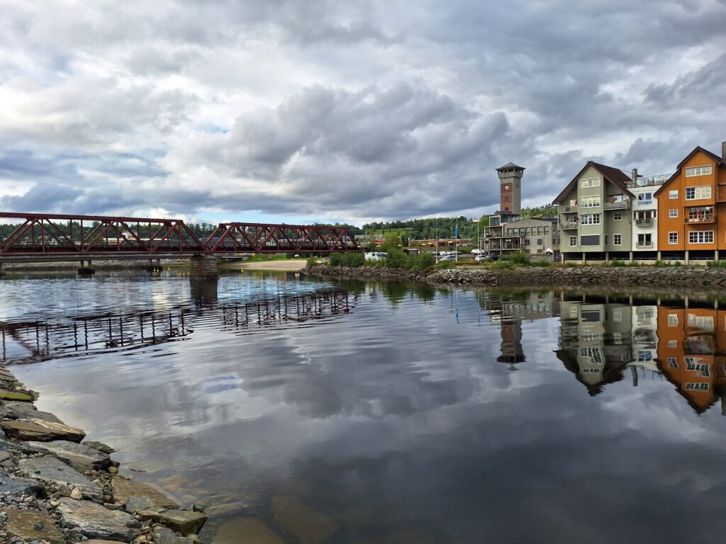
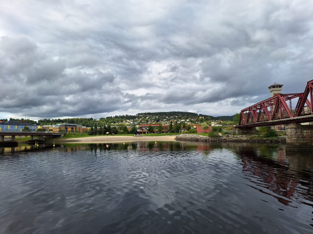
Steinkjerelva with the train bridge and the city beach in the background.
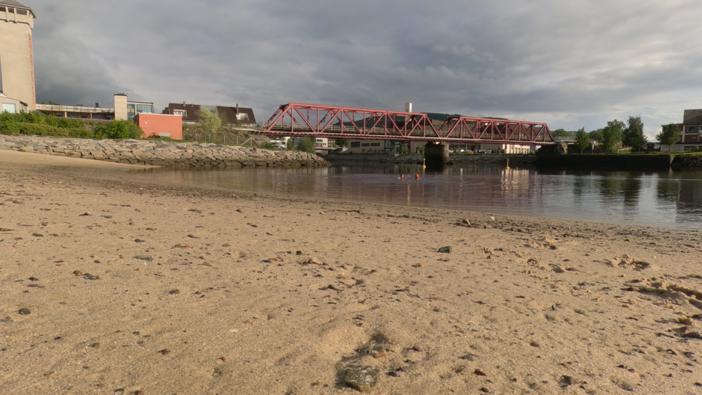
On the north side of the outlet of the Steinkjer River, from the 17th century there were sheds and boathouses for storing agricultural goods awaiting shipment. Timber was also stacked here. The buildings and quay disappeared during WWII, but the area retained the name Naustvollen. In 2014, the river bank was covered with beautiful white shell sand from Ytre Namdal. And sim sala bim, that’s how you get a completely new city beach. This is a really nice place indeed!
Steinkjer city beach.
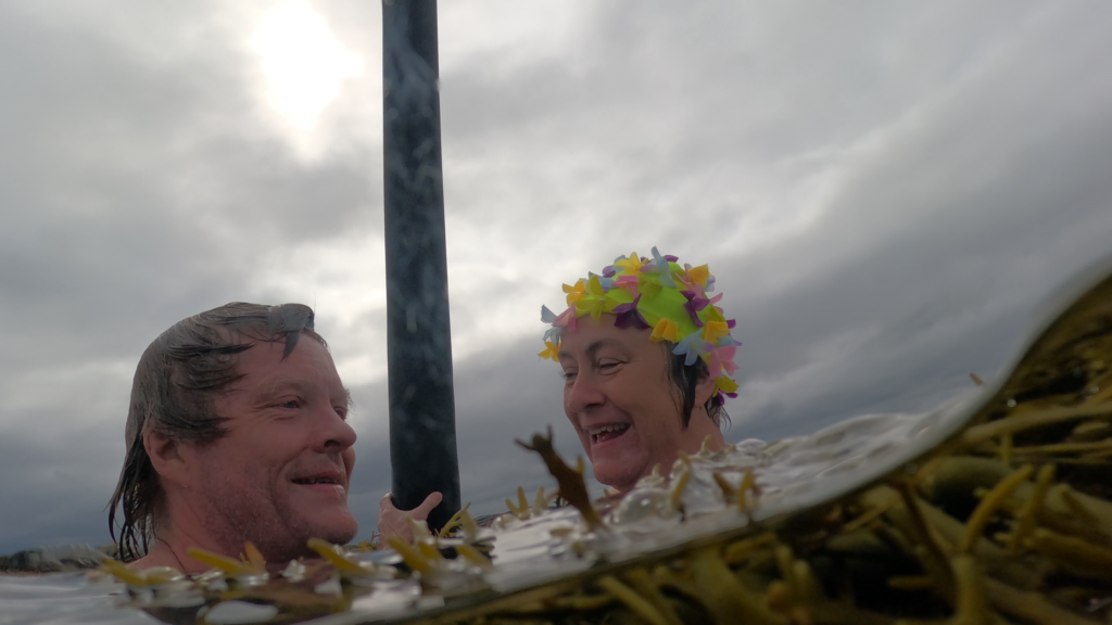
In 2024, new sand will be covering the beach. The city beach has become very popular, and measures to retain the bathing spot have been well received. A bath from the city beach in Steinkjer is perfect, also if you are only passing by.
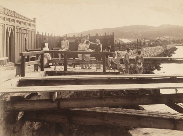
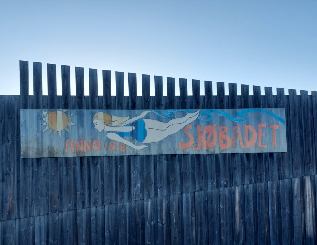
Beautiful winter atmosphere at ‘Sjøbadet’ in Trondheim.
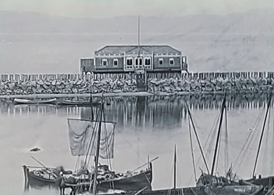
Sjøbadet (The Sea Bathing House) in Trondheim is one of the oldest associations in the city, founded in 1858 with a formal/physical opening on May 1st 1860. The bath was initially a joint-stock company called ‘Søbadedindretningen i Trondhjem’. The first bath was placed in the inner canal (by Ravnkloa).
The ‘sea bath device’ in Trondheim, 1860.
Due to unhealthy water, the bath was moved to St. Olav’s pier in 1880, thanks to the bath’s patron, City Engineer Dahl.
New location at St. Olav’s pier.
At the start, Sjøbadet was for men only. Eventually, the ladies were given access a few hours a day, but it was not until 1927 that a separate women’s department was added. The annual report from 1879 says that the ladies stopped going into the sea because they were disturbed by the dock workers.
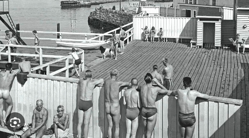
The sea bath has long been a splendid place to hang out.
Tone Hoff became the bath master in 1968, and noticed men standing for a loooong time in the diving tower, staring down into the ladies’ sunbathing area. So she shouted to them: ‘Stop glancing!‘, whereupon some jumped into the water and others climbed ashamed back down the gully.
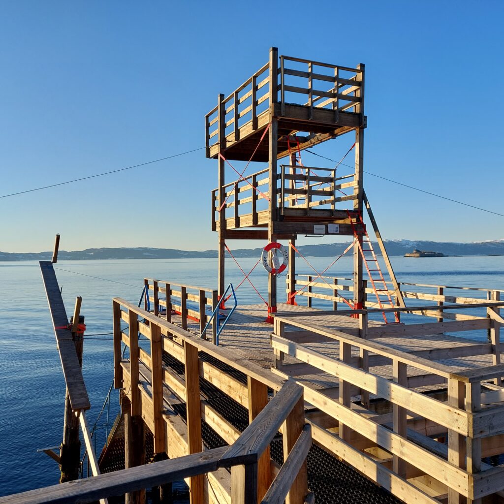
The diving tower, 2023.
Rasmus Rohde has made a nice song about this: ‘Sjøbadet‘. Check it out on YouTube! (However, with a somewhat exaggerated description of the bathing temperature. As you might know, the Trondheimsfjord is very deep, and the water never really gets warm).
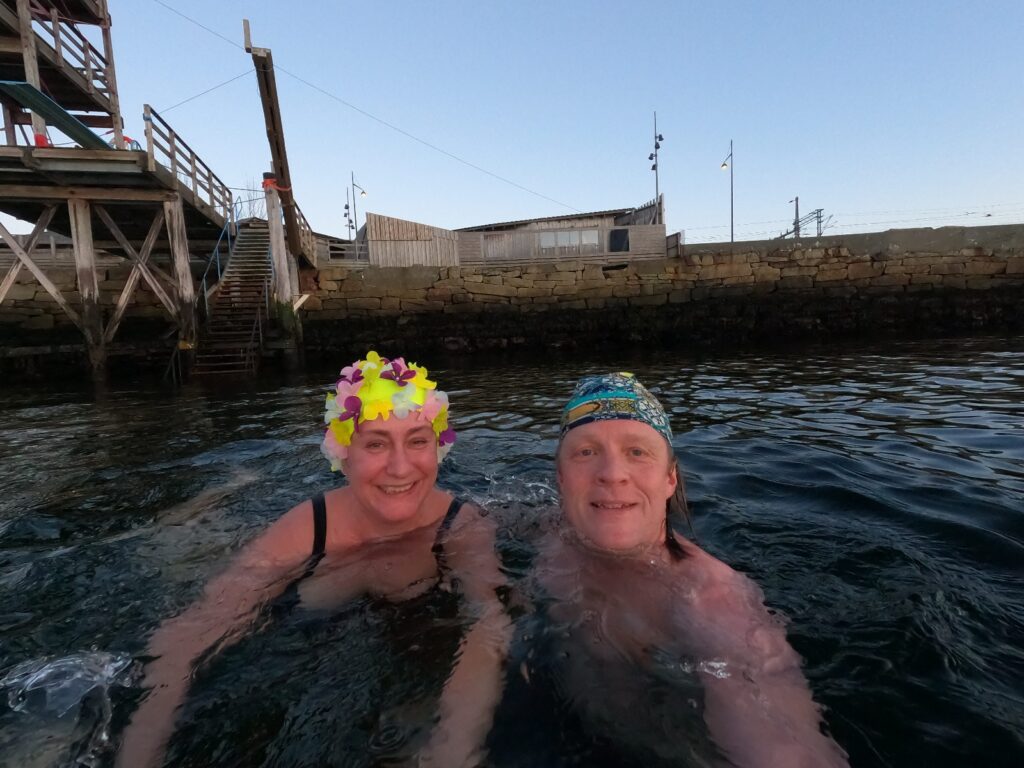
Tobatheornottobathe recommends Sjøbadet at its warmest (and coldest…)!
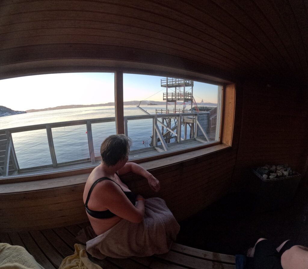
In 2011, the Sjøbadet was moved 1 (!) meter to make room for ‘Nordre Avlastningsvei’, and the bath was rebuilt. For many years, members dreamed of building a sauna. More and more people took into ice bathing in winter, and it was quite certain that a sauna would increase both the use of the bath and the number of members dramatically. Still, there was a lot back and forth, the uncertainty of the finances of the sauna project was big, and the years went by. But finally, on 9/8-2018, after many hours of voluntary work, sauna manager Taru could say ‘Tervetuloa‘ to the first sauna experience at Sjøbadet. The number of members exploded, and for a period a waiting list existed, to get onto the waiting list for membership.
The sauna at Sjøbadet indeed has a panoramic view. Sauna master this winter day in 2023 was Taru Uusinoka.
Tobatheornottobathe highly appreciate both Sjøbadet and its sauna. A better location is hard to find! Various sauna rituals with and without ethereal oils, aufguss, Finnish traditions etc. are carried out here. All members are sent a sauna program every week, so it is easy to choose what suits you the best. If you do not have a membership, it is still possible to visit the Sjøbadet in summertime, for a reasonable amount of money. In summer, there’s a paid lifeguard, who also serves coffee, waffles and sausages between 12 am and 6 pm (2024). When the ‘Trønder summer’ occasionally strikes with wet and cold weather, sometimes the sauna is heated in summer as well. Check FB if this is tempting! In winter, a monthly ‘Folkebadstue‘ (People’s Baths) is organized (2024), where non-members can try both the sauna and ice bathing. Hereby strongly recommended!
Sjøbadet is still going strong. Not bad after 166 years (2024).
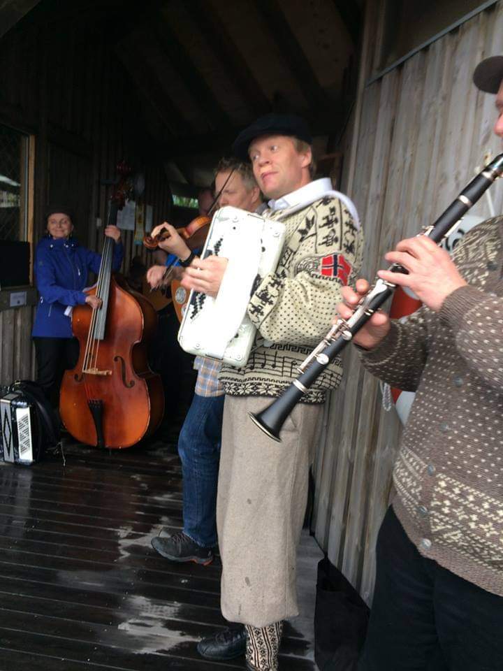
In addition to bathing and sauna rituals, there are also other happenings at Sjøbadet, both in terms of performances and concerts. On Midsummer’s Eve 2017, you could dance norwegian folk dances all the way into the dressing rooms, to music by Gammel-Snaustrinda/The Dirty Old Band.
A cold and wet Midsummer eve in 2017. Gammel-Snaustrinda plays to raise income for the sauna construction. Photo: Berit Rusten
Why do you have to take a several-day safety course to work offshore? Where does that idea come from? Most people probably don’t think much about this, but when it’s your turn to join a course, that’s when you start wondering.
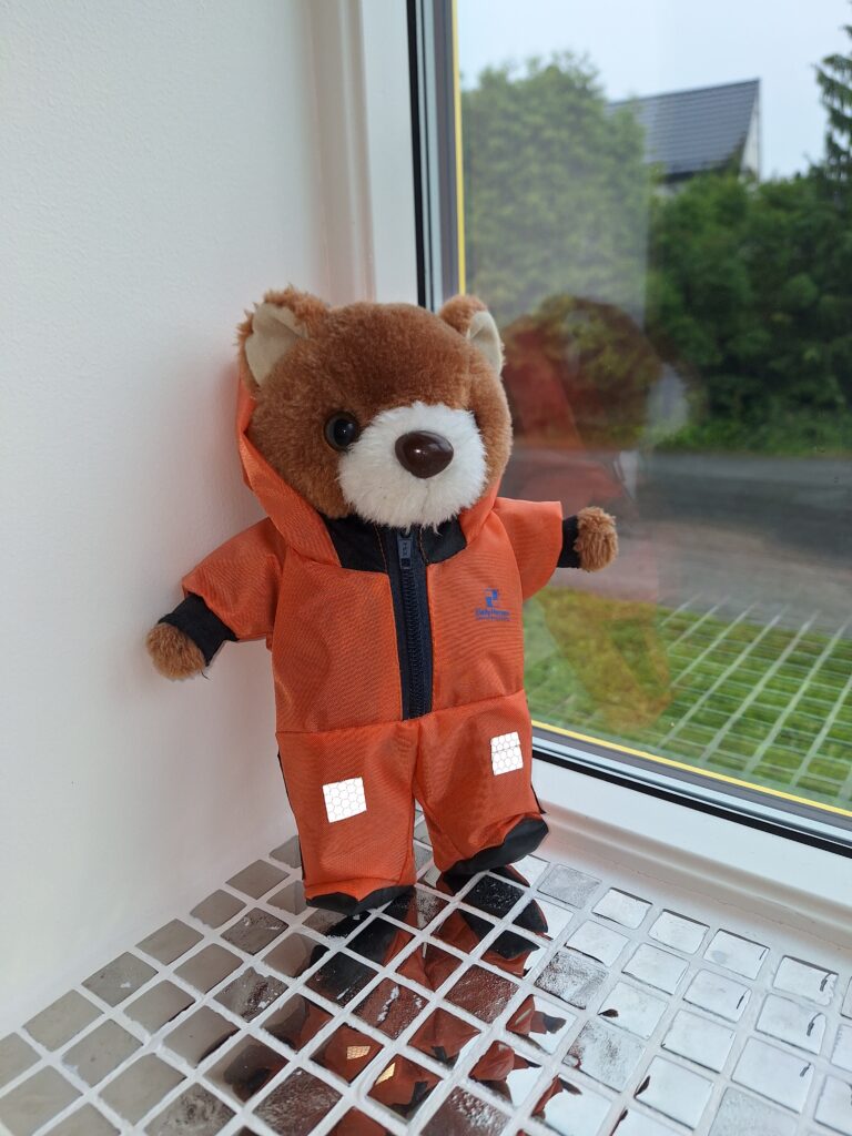
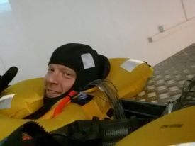
Teddy bear ‘Kristin‘ is ready to go offshore. There has been much debate about the use of hoods in the helicopter. The rescue suit is much more effective with the hood on, but it is not very comfortable in a normal transport situation. The compromise is that everyone must put on the hood before take-off and landing, while during cruising it’s optional. Teddy bear ‘Troll‘ has lost his suit and was not allowed to join the photo.
When drilling off the coast of Norway started in the 1960’s, it was with completely blank sheets. We had many mines in Norway, and we were big in shipping, but no expertise in drilling and producing oil and gas at sea. It was necessary to lean on American companies, which had both expertise and capital. The first drilling on the Norwegian shelf was done by Esso in 1966, they had experience from offshore fields, including in the Gulf of Mexico. In the 1950’s, the personnel were transported out to the rigs by boat – a method that had its drawbacks. One thing was the use of time. The most important argument against was seasickness. There was a risk that the workers were ill and in bad shape when they started work offshore. The very first helicopter to be certified for civil aviation was the Bell 47B in 1946. Throughout the 1950’s, helicopter types with room for more passengers appeared, and it was decided from the beginning to use helicopters for all passenger transport to and from the Norwegian continental shelf. The authorities wanted a Norwegian supplier to handle the helicopter traffic, and the contract went to Helikopter Service A/S. Two Sikorsky S-61 machines were purchased, they made four trips per week. With this activity, the income was far from sufficient, and Esso sponsored Helikopter Service A/S with approximately 60,000 dollars per month at the beginning. It was Phillips who found the first viable (huge) oil discovery ‘Ekofisk‘ on Christmas Eve 1969. The first decades were characterized by a certain ‘Cowboy mentality’. The focus was on efficiency and production, unions were banned, and safety was often so-so. Rescue suits, for example, were not used.
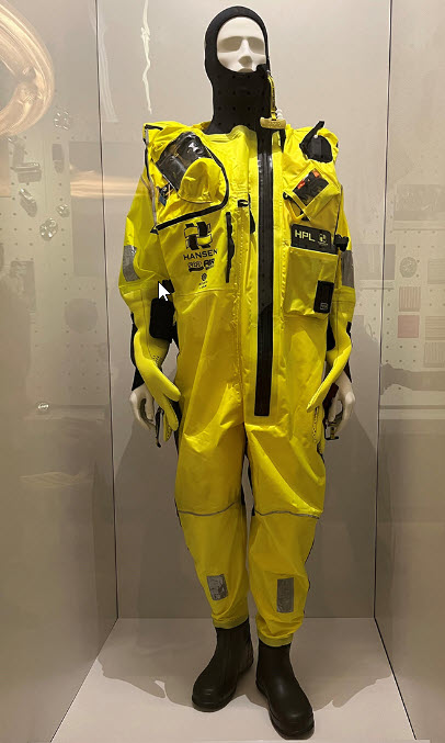
Survival suit with breathing lung (hose and valve can be seen at the doll’s right shoulder). The suit helps you to be rescued, but since survival cannot be guaranteed, it is recommended to use the term rescue suit instead. Photo: The Norwegian Oil Museum in Stavanger
It soon proved impossible for the authorities to have control over everything that happened in the petroleum industry. The development sometimes went so quickly that the regulations were constantly lagging behind, and control offshore was difficult and time-consuming in terms of logistics. The development of safety systems was pushed forward by accidents. If you look at Ekofisk, this development alone resulted in 45 deaths, of which 1/3 were linked to helicopter accidents. The head of the Norwegian Petroleum Directorate’s security department, Arne Flikke, resigned in the summer of 1974 due to a lack of resources to exercise control. The solution was internal control. The Norwegian Petroleum Directorate was supposed to check that the systems were in order, but they were not supposed to go into detailed checks on each individual installation. The companies that did not put in place a functioning internal control risked being ‘punished’ at the next license award. In 1978 there was an investigation (the Leiro committee) which recommended a 3-week safety course for offshore employees. However, this had not been implemented when Aleksander Kielland tipped on the 27th of March 1980. In this disaster, 123 people died. Of the 212 on board, only 76 persons had undergone safety training. The safety courses are therefore a consequence of the Aleksander Kielland accident. Rescue suits were not required by the offshore contractor companies, and almost everyone who died in the Kielland accident were employed by contractors. Therefore, the Norwegian Maritime Directorate decided in the autumn of 1980 that all offshore employees should be equipped with rescue suits.
Knut is testing a rescue suit. The Diving Group at NTNU has for many years sent members to these tests, where you stay in cold water for a couple of hours, with temperature sensors literally everywhere. Photo: Lars Lyse Moen
The most important functions of the suit are insulation (retaining heat) and buoyancy. When evacuating in water, the use of a rescue suit will increase the probability of survival considerably.
An offshore security course (2024) consists of a 4-day basic course, which must be refreshed with a 2-day repetition course every 4 years. One of the main elements is training in the use of rescue suits including breathing lung and helicopter underwater evacuation (HUET). The breathing lung is a waterproof bag that is mounted in the collar of the suit. A hose, valve and a nozzle are fitted to the bag. In an emergency situation, air is blown into the bag and the valve is closed before coming into contact with water. Then you have some air to breathe in until you get up to the water surface. The rescue suit has a lot of buoyancy, so when you first get out of the helicopter, you don’t need to swim to reach the surface. Having said that, this course, or a rescue suit for that matter, will not help the slightest if the gearbox breaks (as in the Turøy 2016 accident).
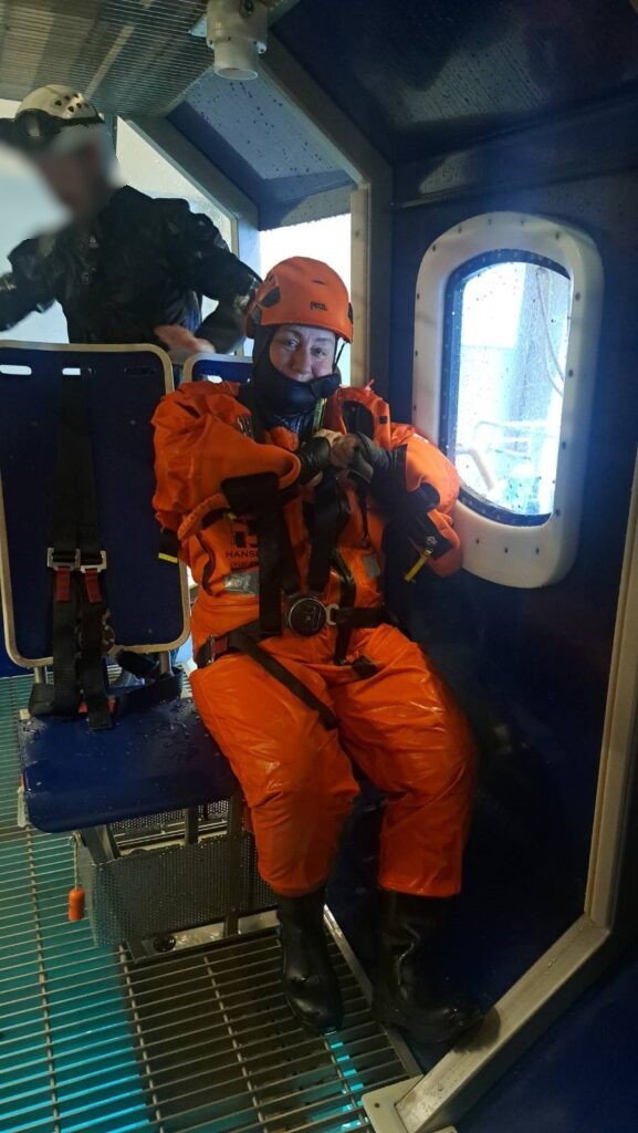
Idun is very ready for HUET (Helicopter Underwater Escape Training) at RelyOnNutec. The center of gravity of a helicopter is high up. In the event of an emergency landing on water, you must be prepared for the helicopter to tip over so that the rotor faces down. Photo: RelyOnNutec
Before you get as far as the helicopter, you have to go through a number of introductory exercises to get used to the breathing lung. Idun was so out of practice that she breathed into the hose without closing the valve first (while we were still on land checking the equipment). It was 3 years since the last offshore trip and 4 years since the last course. Repetition is indeed necessary! The exercises in water went better. First, we had to lay face down in the water and breath into the lungs for 20-50 seconds. Then pull ourself along the edge of the pool by a rope, lying face down. The last exercise before the helicopter was to hang upside down on the edge of the pool, with your foot around the pool ladder and your head down. Not at all complicated for someone who likes to swim. If you are unfamiliar with water, the situation is of course completely different.
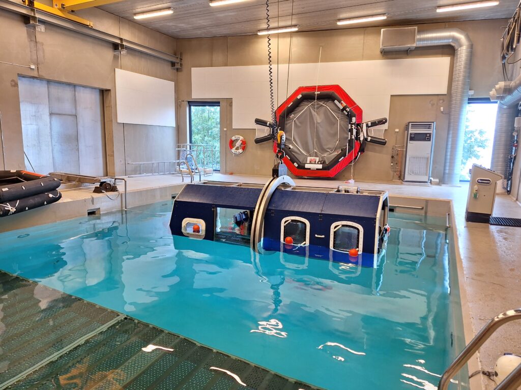
The rotatable helicopter is a piece of pipe with a grating floor, seats with seat belts and windows that can be pushed out.
The heart rate rises considerably entering the helicopter. During the helicopter exercises, everyone has an instructor who only looks after you. Fastening the seat belt (4-point) properly is practiced, which is the first thing to do if you hear the pilot say: ‘Brace, brace‘. There are various stories about things that have gone wrong on the courses, and a classic failure is turning the seat belt knot inwards. The opening mechanism is easy to trigger, but a colleague of Idun had once turned it so that it faced his stomach, with consequent stress, he lost his grip on his reference point (the window), and ended up on the roof (floor) of the helicopter when it turned upside down under water. Then it’s ok to have instructor help!
The instructor’s inquisitive look at Idun turned to laughter when she realized that ‘Wow, you actually like this!‘ After 4 evacuations from helicopter under water, the conclusion is that it’s quite fun when ‘Toworkornottowork‘ turns into ‘Tobatheornottobathe‘!